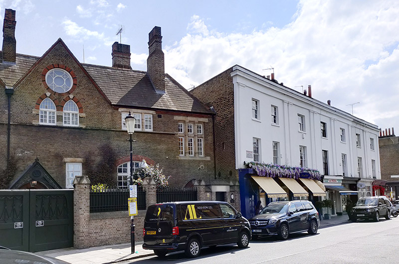
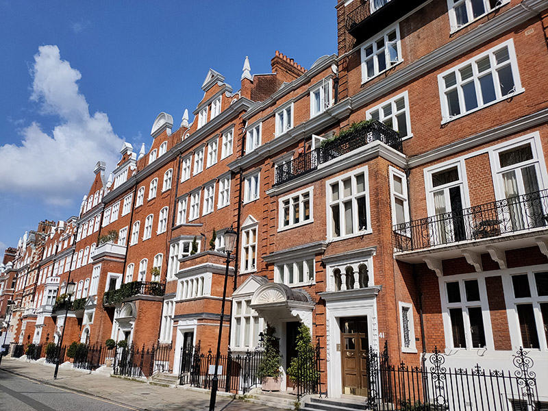
Day 76 – King’s Road – Sydney Street – Sloane Avenue – Cadogan Square

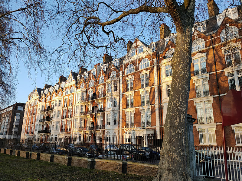
For today’s expedition, just like Real Madrid, we’re getting stuck into Chelsea. Specifically, the area north of the King’s Road bounded by Sydney Street to the west and Sloane Street to the east. Away from the main thoroughfares it’s a relatively quiet mainly residential quarter equally comprised of streets of terraced houses (some of the most expensive in London) and large mansion blocks. There are plenty of high-end stores scattered in between and some impressive churches. Not quite such well-known names as last time as far as former residents go but some interesting characters nonetheless.

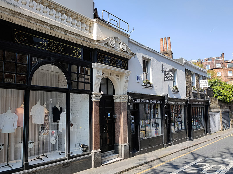
Once again the starting point is Sloane Square and this time we’re leaving via the north west corner, on Symons Street to be precise. This feeds into Culford Gardens continuing westward then we take a left turn down Blacklands Terrace onto the King’s Road. John Sandoe opened his eponymous bookshop here in 1957 with Félicité Gwynne, sister of the cookery writer Elizabeth David (who we shall meet again later).

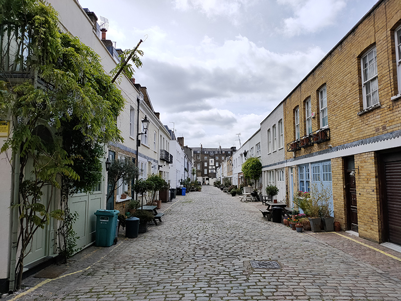
A sequence of Lincoln Street, Coulson Street, Anderson Street and Tryon Street bring us to the eastern end of Elystan Place which on a western trajectory merges into Cale Street. The next run of streets occupy the space between that duality and the King’s Road. After Markham Street we have to backtrack along the King’s Road to visit Bywater Street and Markham Square. The latter is a prime example of the terraced housing in this part of town, immaculately maintained and with brightly painted exteriors.

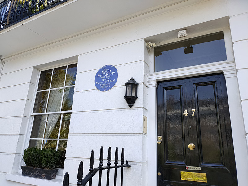
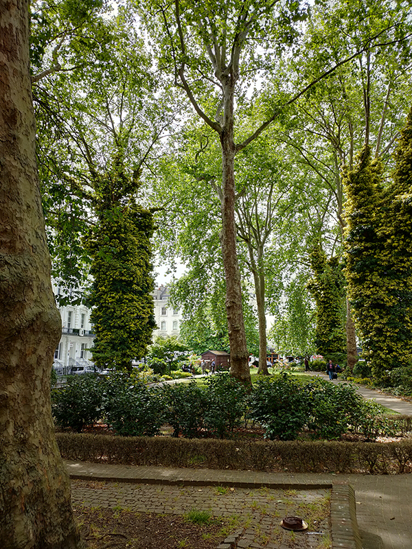
No.47 Markham Square was the one-time residence of Dame Maud McCarthy (1858 – 1949), who was matron-in-chief of the British Expeditionary Force in France and Flanders during WW1. The square, unsurprisingly, also boasts a well-planted private garden.

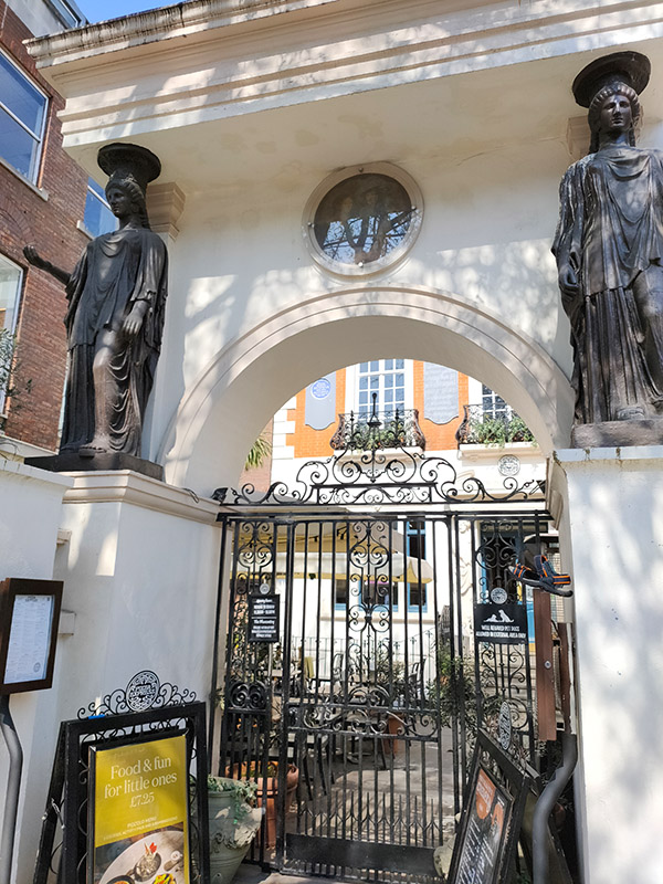
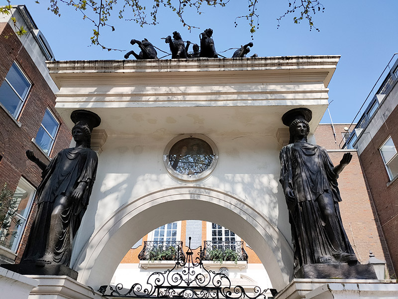
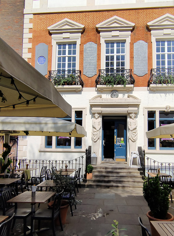
The branch of Pizza Express at 152 King’s Road occupies the building known as The Pheasantry, which got its name from the business of one Samuel Baker who developed new breeds of oriental pheasants here in the mid-19th century. The Grecian-inspired architectural stylings, including caryatids and quadringa, were added in 1881 by the artist and interior decorator Amédée Joubert. From 1916, part of the building was used for a ballet academy run by the dance teacher Serafina Astafieva (1876–1934), great niece of Leo Tolstoy. Then in 1932, the basement became a bohemian restaurant and drinking club patronised by actors and artists such as Augustus John, Dylan Thomas, Humphrey Bogart, and Francis Bacon. The drinking club closed in 1966 after the death of the owner Mario Cazzini, and the building was converted into apartments and the basement into a nightclub. The nightclub went on to host early gigs by Lou Reed, Queen and Hawkwind. The 1972 gig by Queen, which had been intended as a showcase for the band, did not go well. One attendee remembered that the band were “unpolished” and since the venue was mainly a disco, “once the disco had stopped and Queen went on everyone went to the bar.” (Oh, happy days). The Pheasantry name lives on under Pizza Express in the form of a basement jazz and cabaret venue.

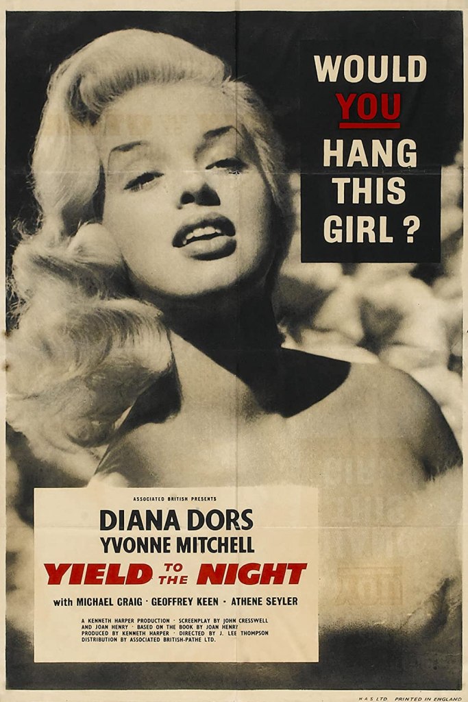
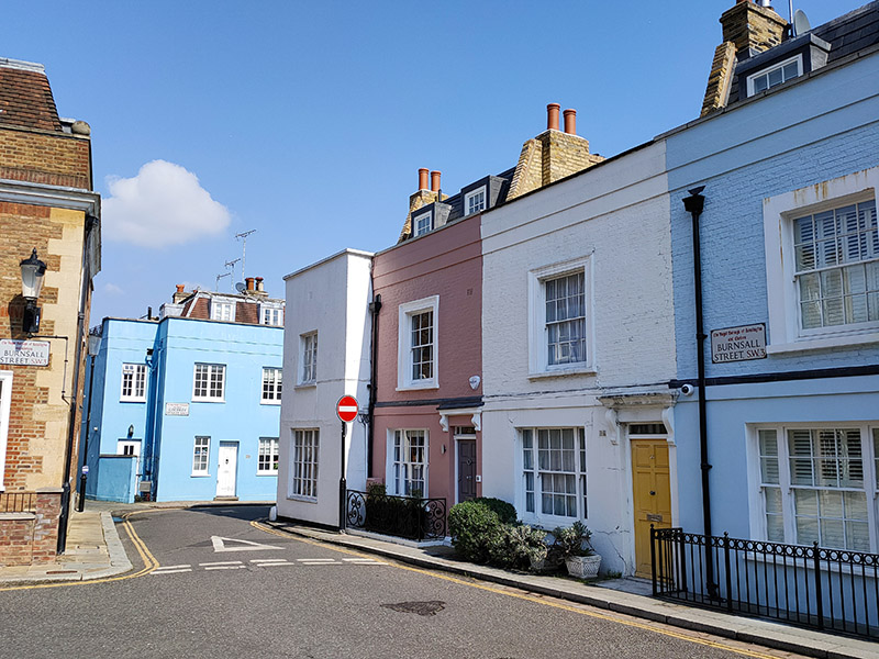
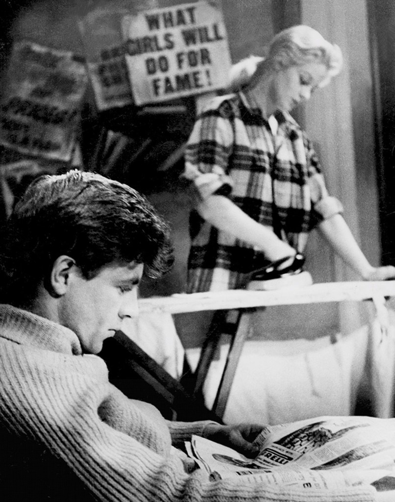
To the west of The Pheasantry we turn north on Jubilee Place then return via Godfrey Street and Burnstall Street. The latter was once home to actress Diana Dors (1931 – 1984). Britain’s answer to the American “blonde bombshells” of the 1950’s was born in Swindon as Diana Mary Fluck. She made her screen debut in the British noir The Shop at Sly Corner (1947) in a walk-on role that developed into a speaking part. During the signing of contracts she changed her contractual surname to Dors, the maiden name of her maternal grandmother, later commenting “They asked me to change my name. I suppose they were afraid that if my real name, Diana Fluck, was in lights and one of the lights blew …”. Diana had an extremely varied career though she was rarely offered quality roles in films and by the 1970’s was restricted to a series of abysmal sex comedies and TV work. Her most acclaimed role was probably playing a Ruth Ellis-style character in 1956’s Yield To The Night. Dors had supposedly been close friends with Ellis, who was the last woman to be hanged in Britain, the year before the film was released. To say that Dors’ personal life was colourful doesn’t come close to covering it. At 10 Burnsall Street in the 1960s’ she hosted lavish “adult” parties that lasted until dawn, with guests including the Kray Twins, press coverage of which provoked the Archbishop of Canterbury Geoffrey Fisher to denounce Dors as a “wayward hussy” and her home as a “den of scandal”.

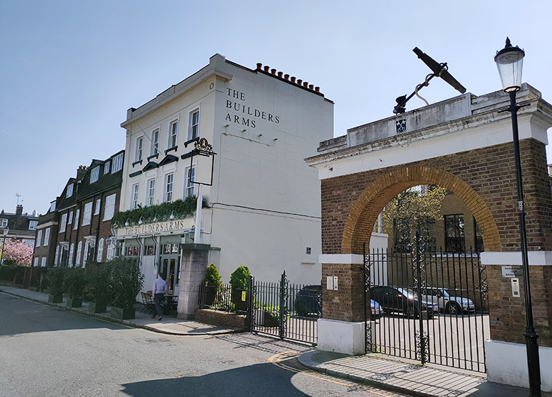
We make our way back up to Cale Street and then down to the King’s Road for the final time today taking in Danube Street, Astell Street, St Luke’s Street, Britten Street and Chelsea Manor Street (with a nod to Hemus Place). Britten Street once hosted the Anchor Brewery, which shut down in 1907, the site is now occupied by an office block called Anchor House but the brewery’s original arch (and anchor) remain in situ.

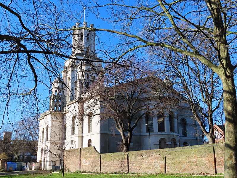
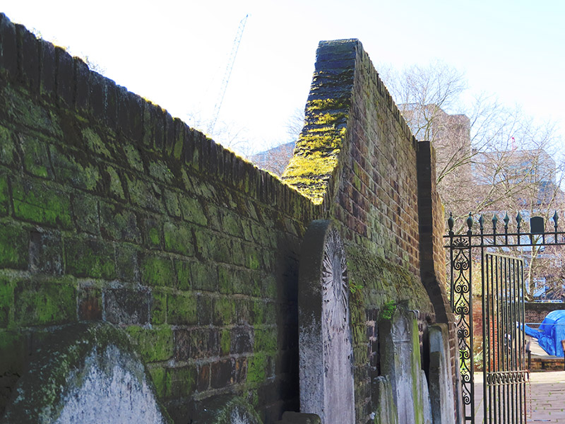
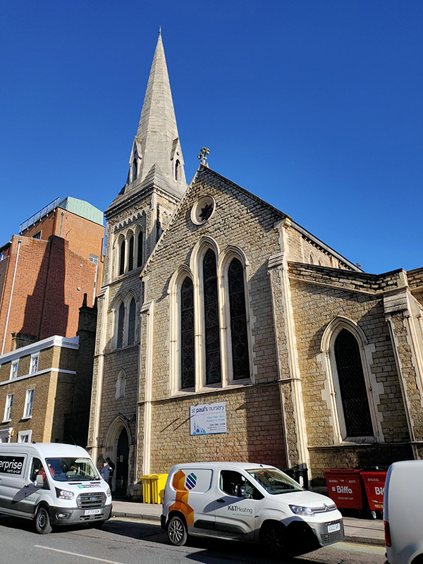
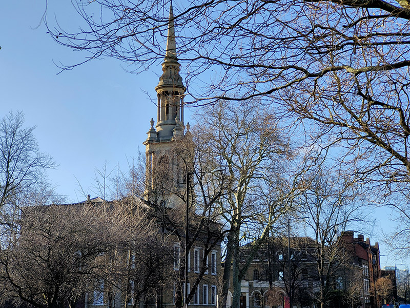
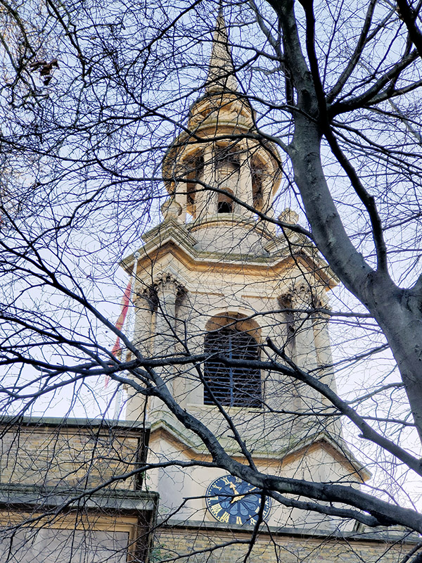
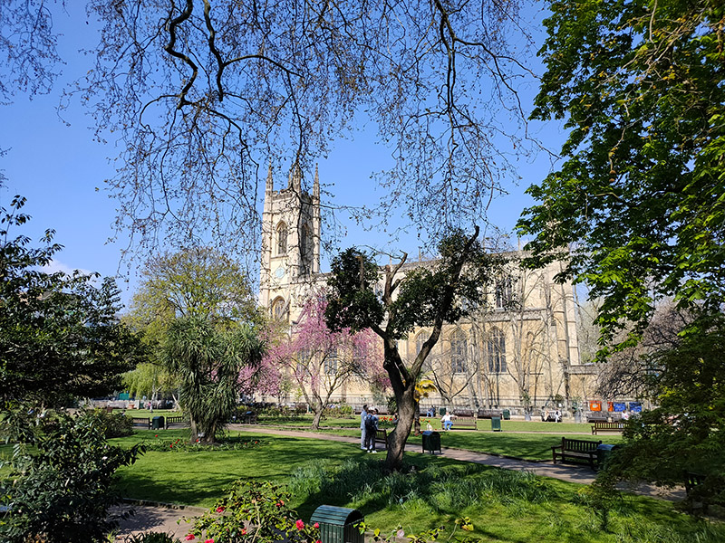
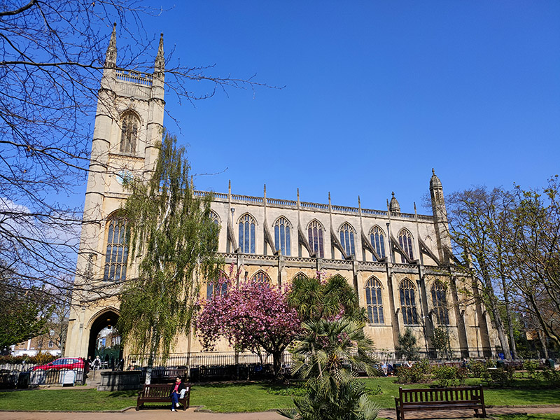
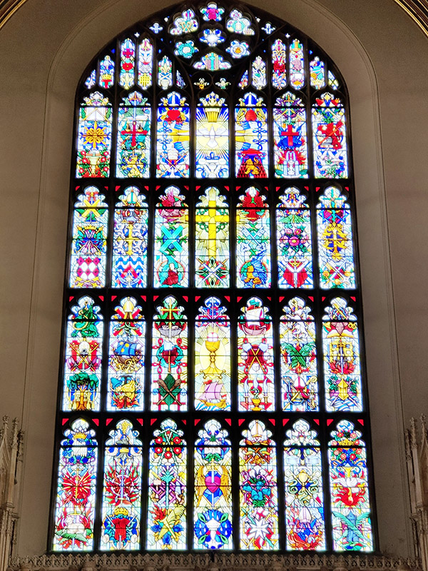
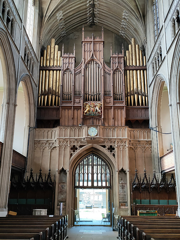
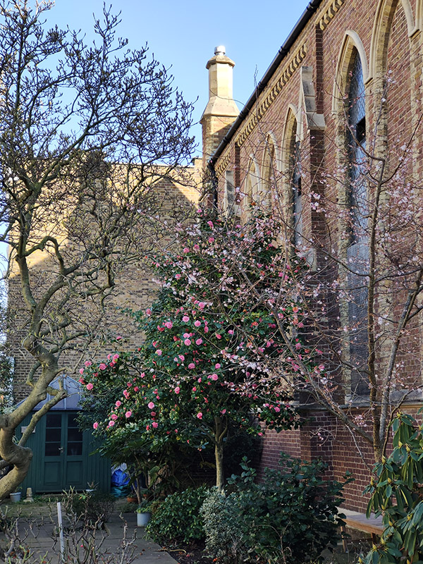
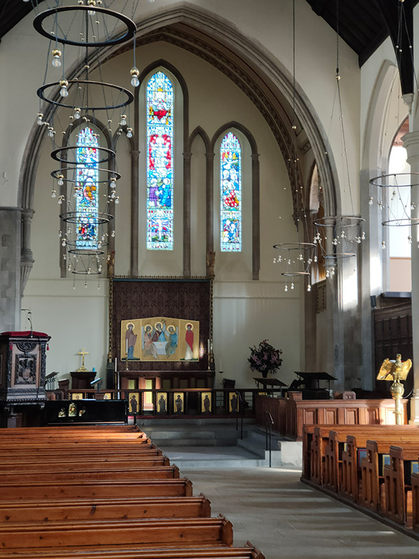
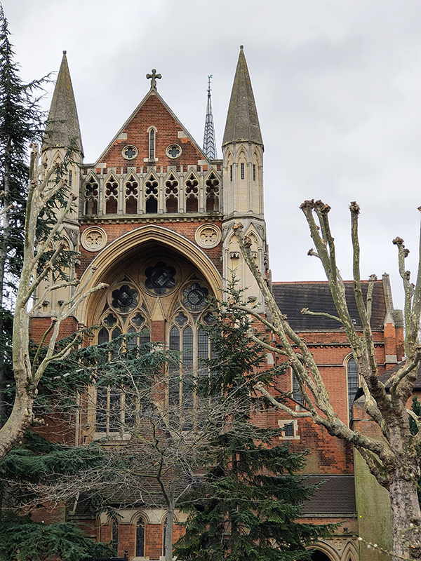
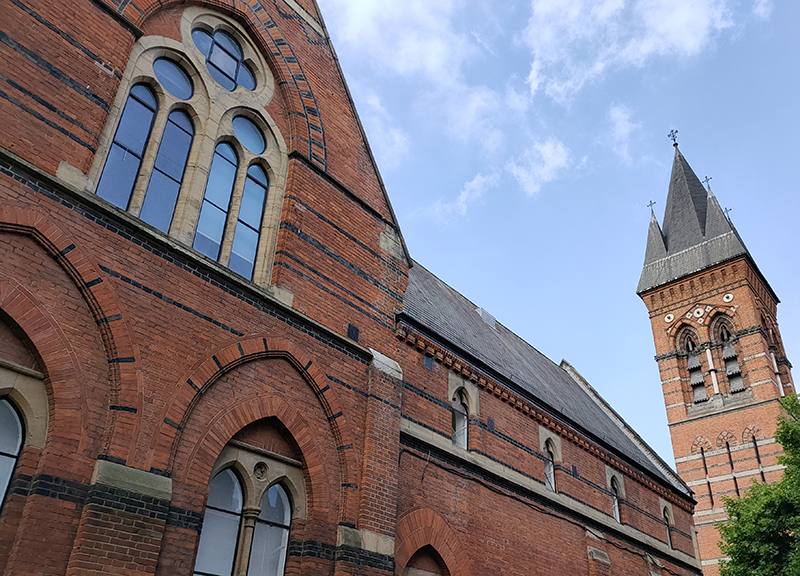
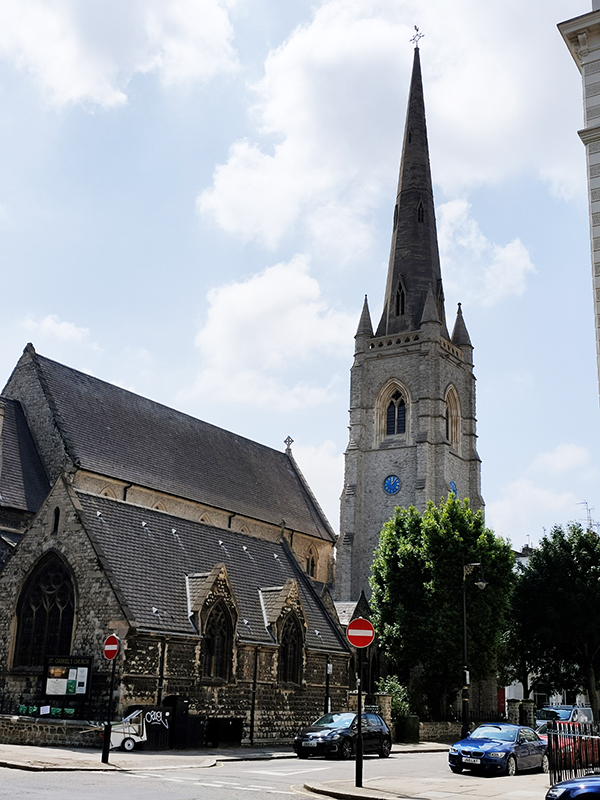
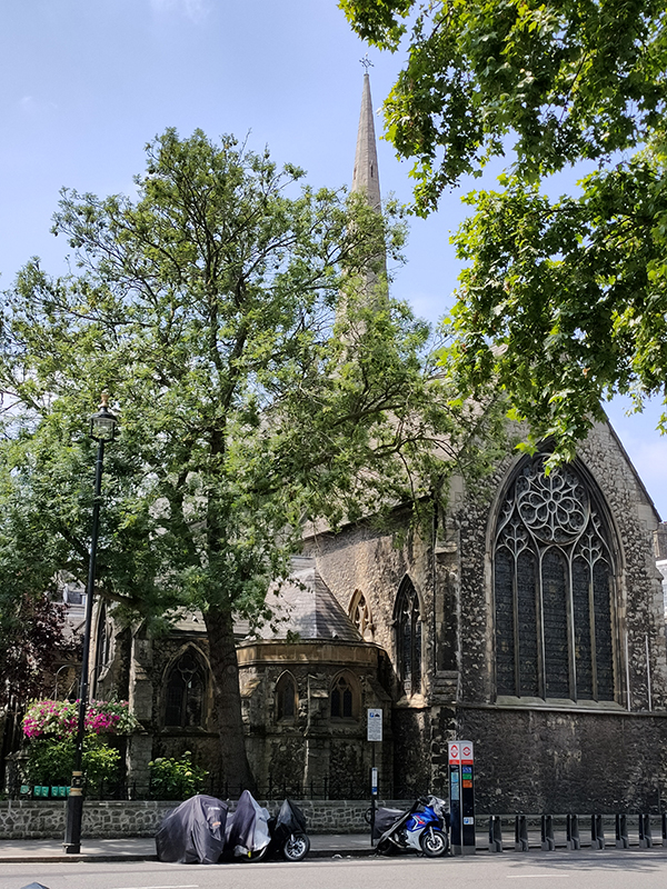
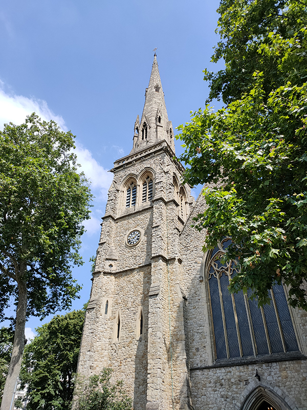
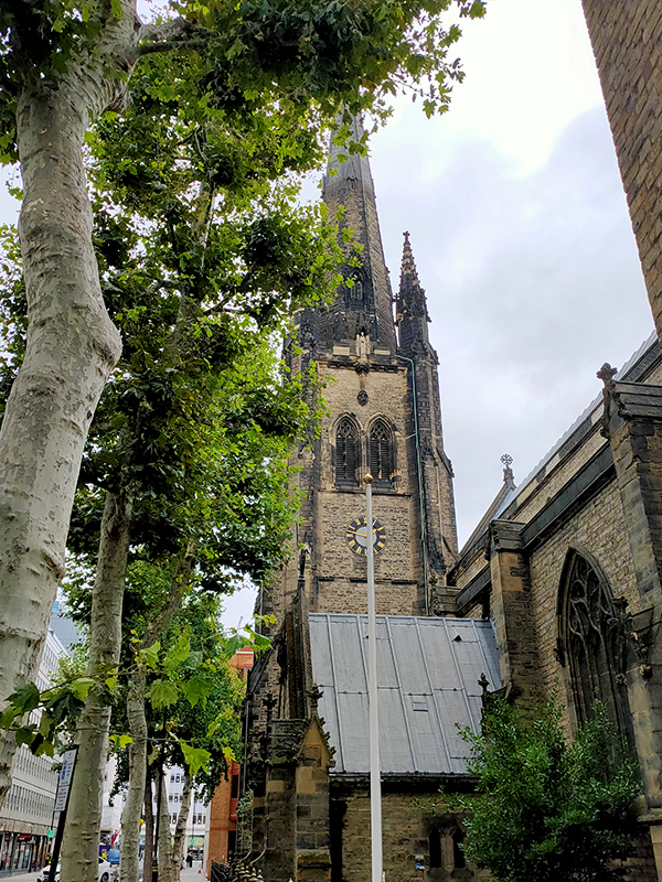
After that final incursion onto King’s Road we head north up Sydney Street and soon find ourselves in the splendid gardens attached to the imposing St Luke’s Church. St Luke’s, which was consecrated in 1824 and bears a striking resemblance to King’s College Chapel in Cambridge, is regarded as one of the first Neo-Gothic churches to be built in London. The nave, at 60ft in height, is the tallest of any parish church in the capital and the tower reaches a height of 142 feet. The architect was James Savage, one of the foremost authorities on medieval architecture of his time. Charles Dickens was married here on 2nd April 1836 to Catherine Hogarth, eldest daughter of George, who was editor of ‘The Evening Chronicle’ in which Dickens’ Sketches by Boz appeared. The large burial ground which surrounded the church was converted into a public garden in 1881, the gravestones being placed to form a boundary wall.

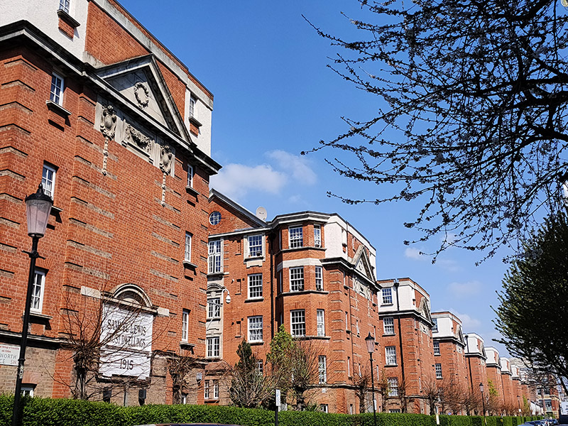
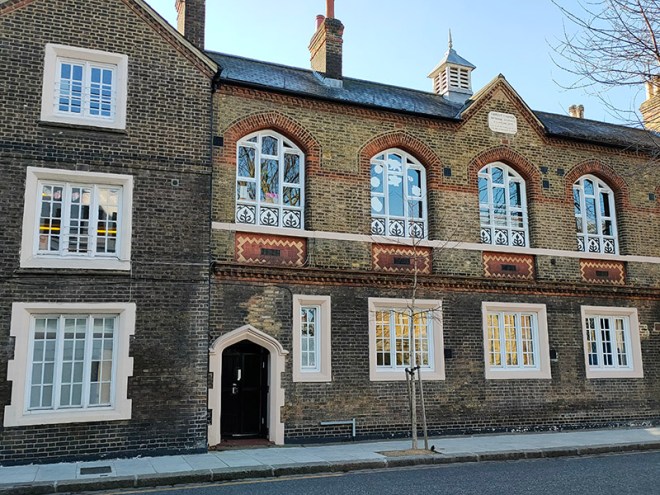
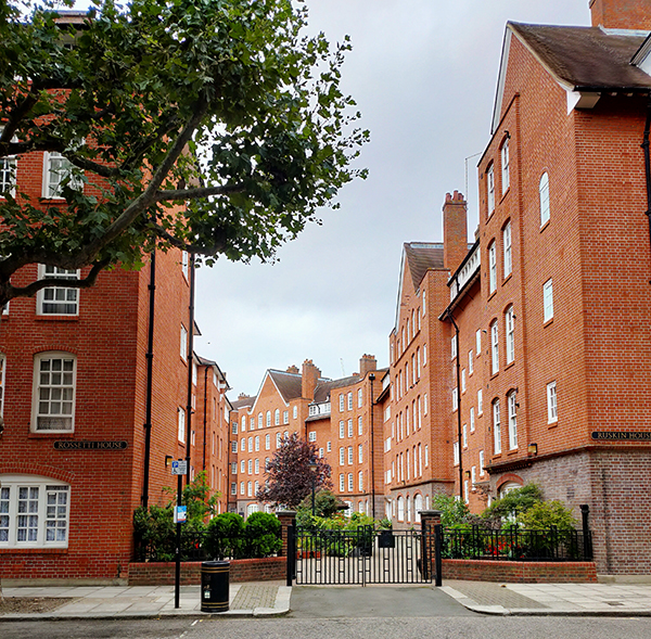
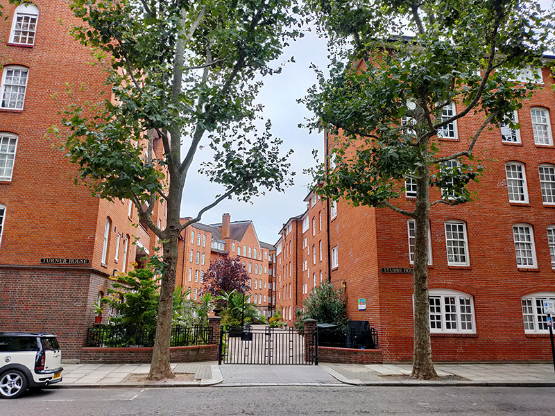
After visiting the church we continue north on Sydney Street up to Fulham Road then immediately make a loop down Bury Walk and up Pond Place. After heading east about a hundred metres on Fulham Road we turn right onto Elystan Street then right onto Ixworth Place to complete a circuit round the Samuel Lewis Trust Dwellings. Samuel Lewis was born in Birmingham in 1837. He began work at 13 and in due course became a salesman of steel pens, then opened a jeweller’s shop, and finally entered the money-lending business, becoming the go-to money-lender for most of Britain’s aristocracy. When he died, in London in 1901, he left an endowment of £670,000 to set up a charitable trust to provide housing for the poor, a huge sum at the time and one that equates to £30 million at today’s values. The estate in Chelsea was the second of eight to be built between 1`910 and the start of WW2.

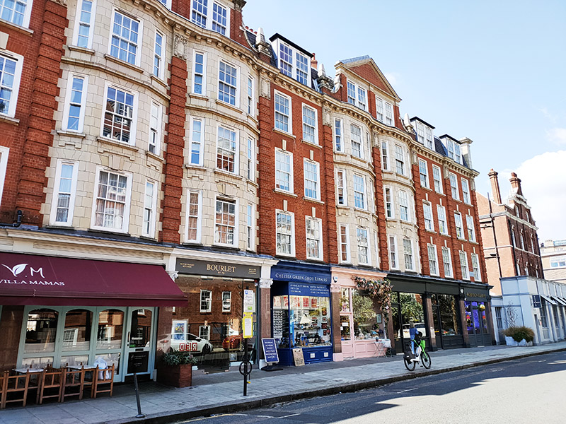
We circle back to Elystan Street via Marlborough Street then turn south past one of many parades of tastefully presented shops.

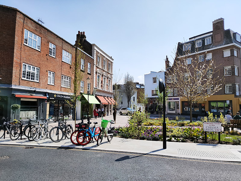
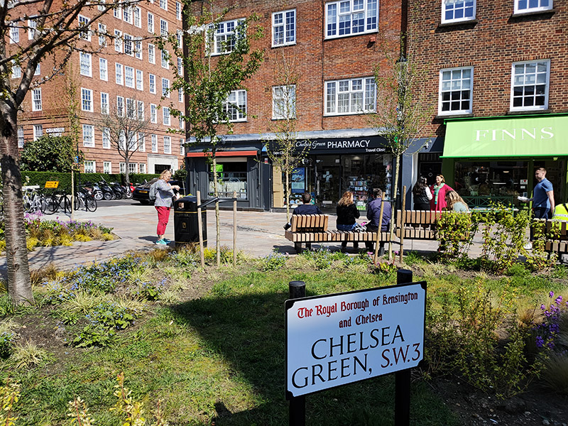
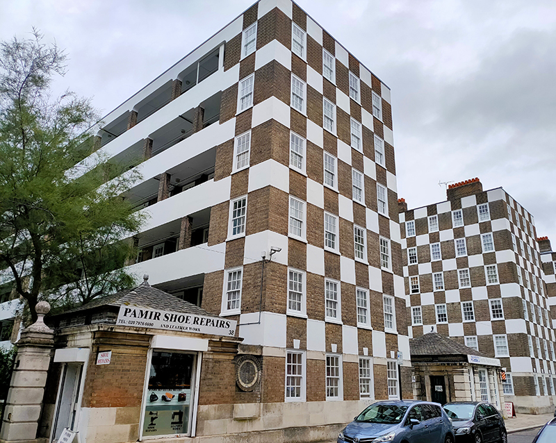
If you look closely you’ll see that the middle emporium is called Chelsea Green Shoe Repairs. In all innocence I initially took this to be a pitch for ecological credibility; however when I reached to the nexus of Cale Street and Elystan Place a short distance further south I realised that there is an actual Chelsea Green. Though, to put it kindly, that nomenclature is somewhat stretching a point; my back garden is bigger (and greener) and that’s not saying much.

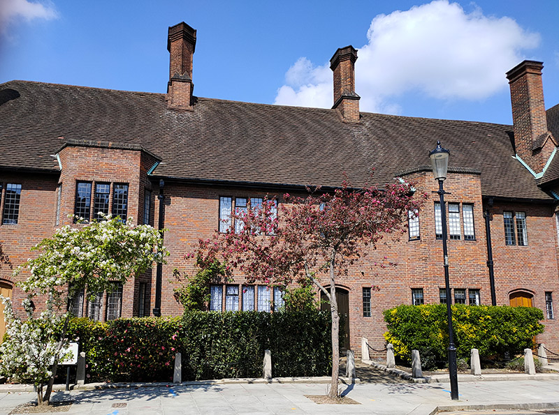
Forking left off of Elystan Place into Sprimont Place there is more distinctive architecture in the form of The Gateways, a 1934 housing development designed by Wills and Kaula that now has a Grade II Listing.

Sprimont Place emerges onto Sloane Avenue, on the east side of which stand two very different high rise residential buildings though both date from the 1930’s and were designed by the same architect, George Kay Green (1877 – 1939). The Art Deco eleven-storey Sloane Avenue Mansions was completed first, in 1933. Neighbouring Nell Gwynn House was finished four years later and has a Cubist design which utilises Egyptian, Aztec, and Mayan patterns and decoration. From the outset, each apartment had built-in central heating and there was a restaurant in the basement, a hairdressing salon, and a bar in the lobby. Above the main entrance, at the level of the 2nd floor, is a statue of Nell Gwynn, with a Cavalier King Charles spaniel at her feet. This is reputedly the only statue of any Royal mistress to be found in London.

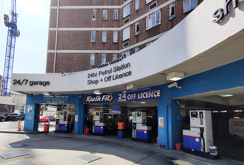
We return to Elystan Street down Whitehead’s Grove then back to Sloane Avenue via Petyward. On the intersection of Makin Street with Sloane Avenue there is a combined Kwik-Fit and 24-hour petrol station which at first sight appears totally incongruous in this context. But then you realise that all those Chelsea tractors have to have somewhere to fuel up.

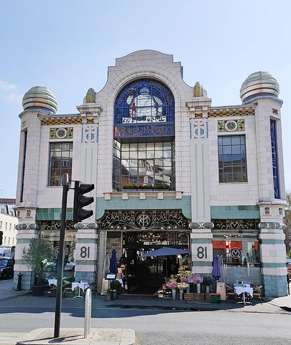
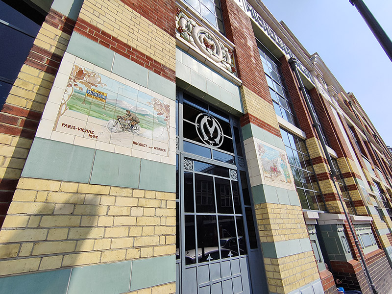
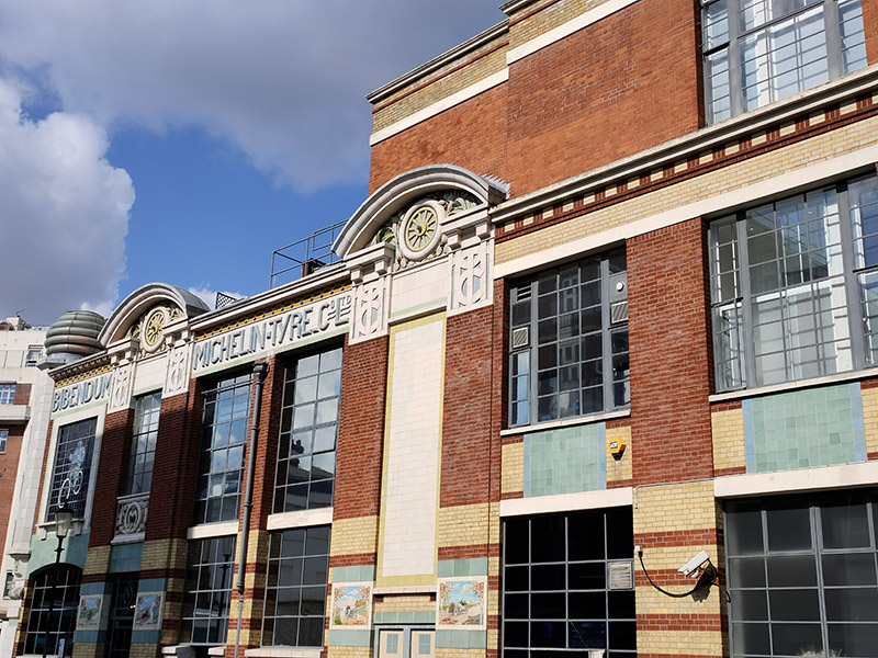
Rounding the garage we proceed north up Lucan Place to the point at which Fulham Road turns into Brompton Road and where stands Michelin House, one of the most distinctive and iconic buildings in the whole of the capital. Michelin House was constructed as the first permanent UK headquarters and tyre depot for the Michelin Tyre Company Ltd, opening for business in January 1911. The building was designed in an Art Nouveau style by one of Michelin’s employees, François Espinasse. It has three large stained-glass windows based on Michelin advertisements of the time, all featuring the Michelin Man aka “Bibendum” and around the front of the original building at street level there are a number of decorative tiles showing famous racing cars of the time that used Michelin tyres. When Michelin moved out of the building in 1985, it was purchased by publisher Paul Hamlyn and the restaurateur/retailer Sir Terence Conran who embarked on a major redevelopment that included the restoration of some of the original features. The new development, which opened in 1987, also featured offices for Hamlyn’s company Octopus Publishing, as well as Conran’s Bibendum Restaurant & Oyster Bar, and a Conran Shop. The dining experience is nowadays run by Chef Claude Bosi and the prices are not for the fainthearted.

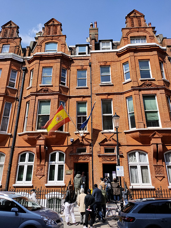
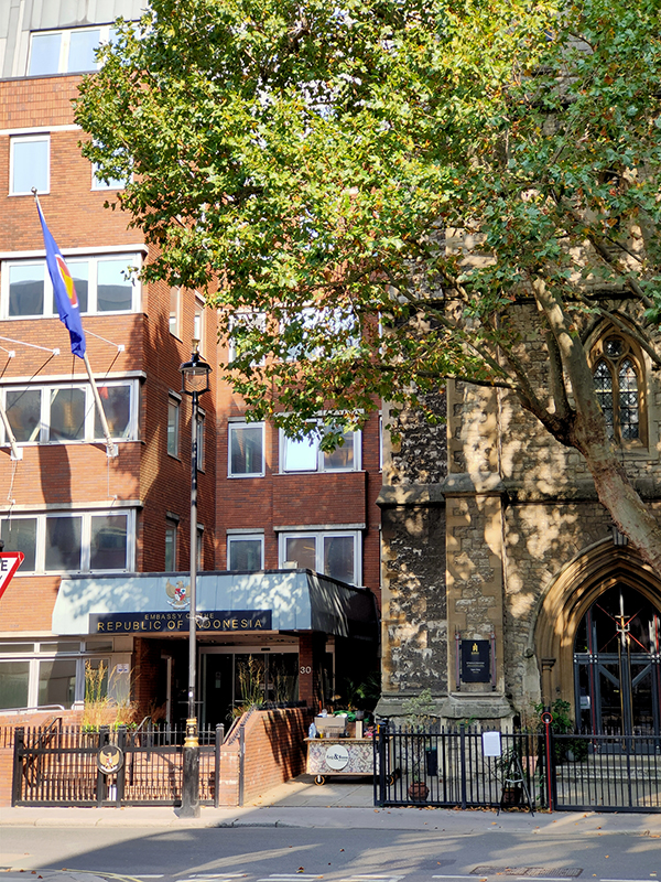
From the east side of Bibendum we follow Sloane Avenue back south almost all the way to the King’s Road. Instead we turn east onto Bray Place then take Blacklands Terrace up to Draycott Place, passing the Spanish Consulate as we resume eastward.

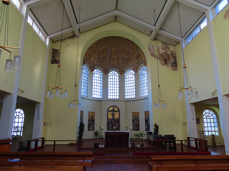
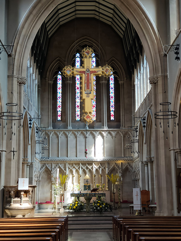
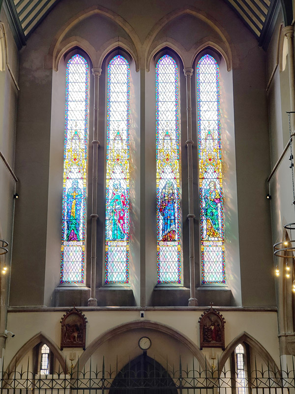
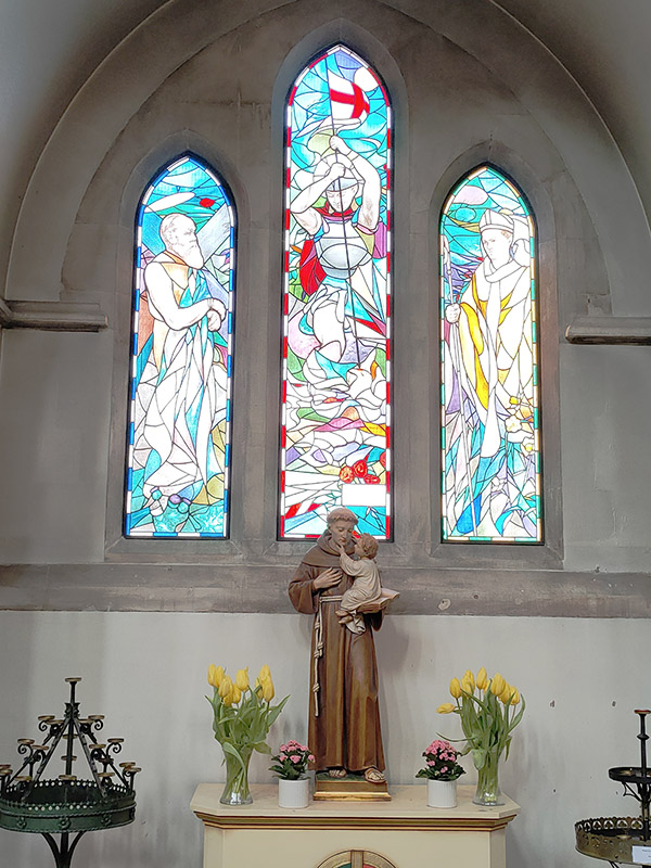
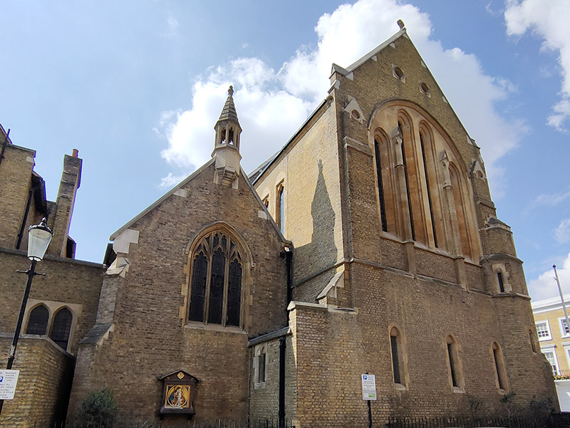
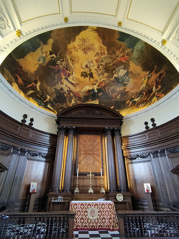
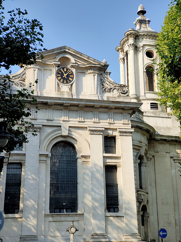
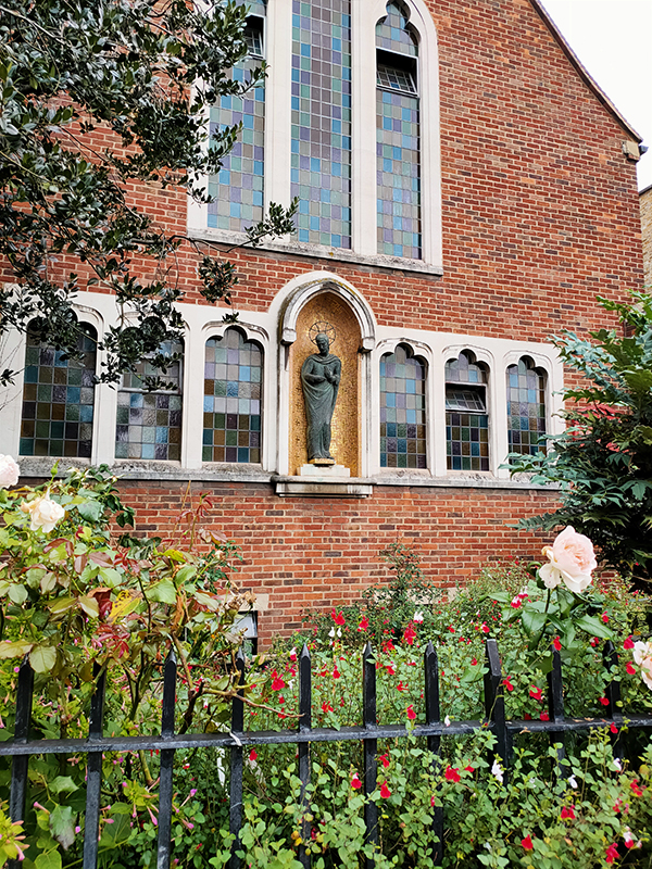
St Mary’s Church on the corner of Drayton Terrace and Cadogan Street looks rather humdrum in comparison with St Luke’s but, as you would expect from a Roman Catholic house of worship, the glories are all interior. The original St Mary’s was built close to the present site in 1812 and was one of the first Catholic chapels in the country since the Reformation. The foundation stone of the present church was laid in 1877. It was designed by John Francis Bentley (1839-1902), an English church architect chiefly known for Westminster Cathedral. For many years the church served the spiritual needs of the Roman Catholic residents of the Royal Chelsea Hospital. One of the special features of the interior is the hanging rood which has a figure of Christ, robed and crowned and the symbols of the four Evangelists.

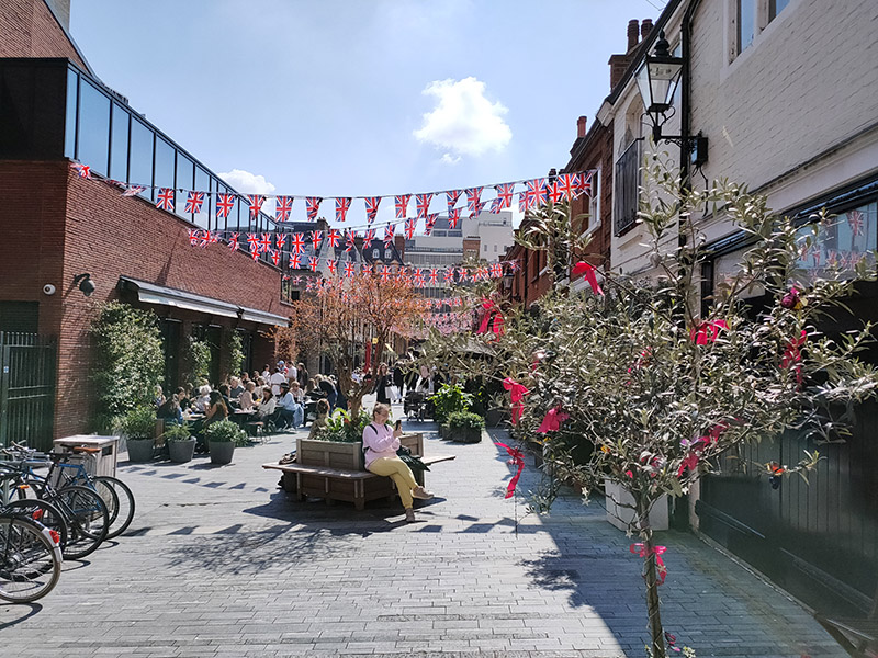
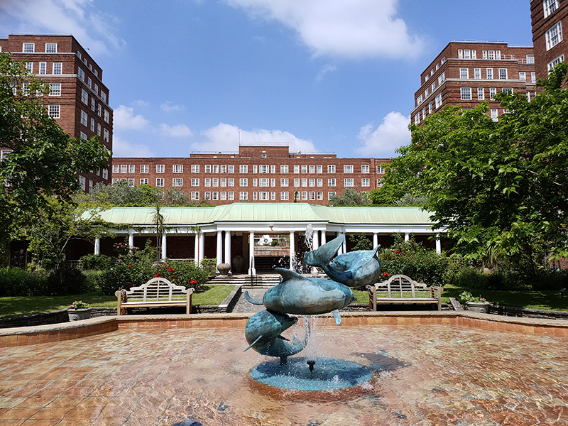
From the church we head east on Cadogan Street into Cadogan Gardens then take a right into the southernmost section of Pavilion Road which is the area’s home of al- fresco dining and is one of the few places I’ve seen so far making any effort to prepare for the forthcoming Coronation.

Having completed the full circuit of Cadogan (private of course) Gardens we return to Draycott Place and proceed west to the southern end of Draycott Avenue.

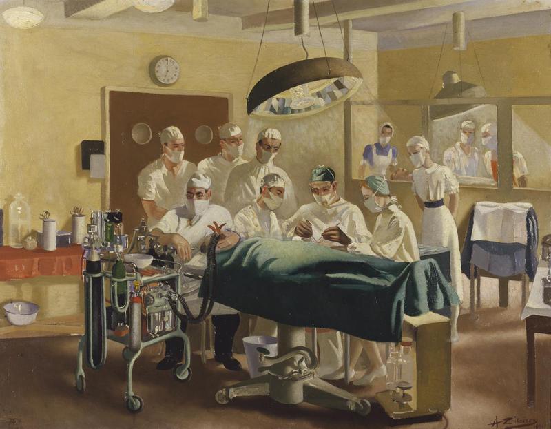
Flat 14, Avenue Court on Draycott Avenue was home between 1949 and 1955 to the New Zealand-born reconstructive surgeon, Sir Archibald McIndoe (1900 – 1960) who is feted for his work with seriously burned aircrew of the RAF during WW2. The painting below was done by artist Anna Zinkeisen in 1944 and depicts McIndoe operating at the Queen Victoria Hospital in East Grinstead.

We wend our way northward to the east of Draycott Avenue taking in Rawlings Street, Rosemoor Street, Denyer Street to reach today’s pub of the day, The Admiral Codrington on Mossop Street. The pub is named after Sir Edward Codrington (1770 – 1851) who served in the Battle of Trafalgar and the Battle of Navarino (Greek war of independence). As a consequence of the ships under his command destroying the Turkish and Egyptian fleets in the latter engagement, Codrington is a popular figure in Greece. His reputation in this country however is tarnished by the fact that he and his siblings inherited a slave plantation in Antigua from their uncle. The other two pubs named after him, in Coventry and south-east London, have both closed and I suspect, if this remains open, it may need to do so under a different name in future. In any event I enjoyed my Chicken Milanese sandwich and half a Madri.

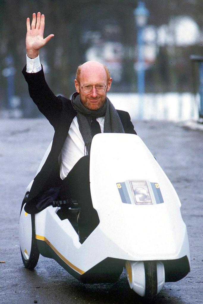
The pub faces onto an empty 4 hectare lot that was formerly the site of the John Lewis Clearing Depot which was built in the 1930’s. John Lewis closed the depot in 2010 and acquired permission to redevelop the site a year later, however, according to the bar staff, the building was only demolished about 18 months ago. It is reported that Mike Ashley (Sports Direct) was behind two companies that acquired the site from John Lewis for £200m in 2015. There is little sign of any construction work going on at the moment. Anyway, after leaving the pub we swing round Ives Street and drop onto Donne Place where maverick inventor Sir Clive Sinclair (1940 – 2021) lived at no.32 from 1982 to 1987, a period that covered both the heyday of the ZX Spectrum home computer and the unfortunate failure of the Sinclair C5 electric vehicle.

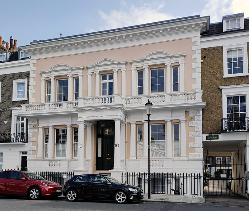
From Donne Place we visit Bulls Gardens and Richard’s Place on the way to Milner Street. We then traverse between Milner Street and Walton Street on First Street, Hasker Street and Ovington Street. No.10 Milner Street, which is also known as Stanley House, was built in 1855 in an Italianate style built by the Chelsea speculator John Todd for his own occupation. From 1945 it was home to the interior designer Michael Inchbald and his wife Jacqueline, who founded the Inchbald School of Design in the basement in 1960. The house was Grade-II listed in 1969, an honour it shares with the other Stanley House in the area, at 550 King’s Road (which is for another day).

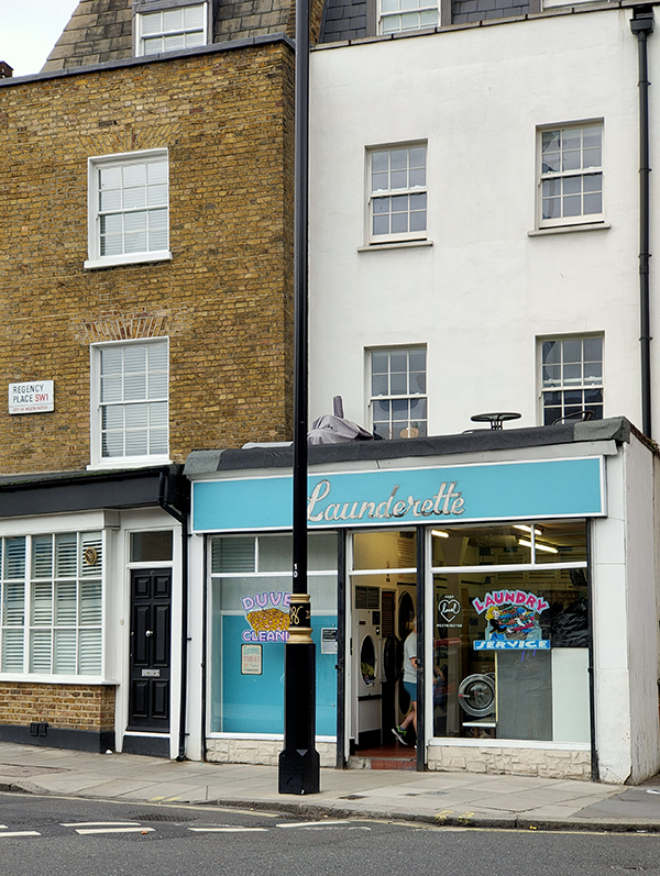
No launderette of the day this time (unsurprisingly) so we’ll have to make to do with the Elite Dry Cleaners at the top of Ovington Street. Come on you Reds !

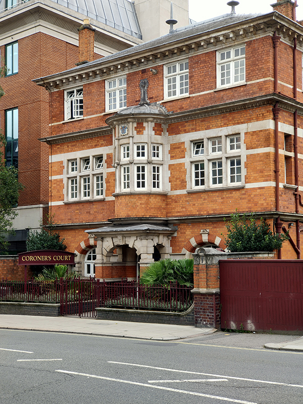
Round the corner on Walton Street, the building at No. 1a started life as a school then became a magistrate’s court and finally a private mansion. In 2018 it was sold for over £50m following the death of the previous owner Canadian cable TV mogul David Graham, who had infuriated neighbours by submitting plans to triple its size by digging down 50ft to create a four-storey basement with 45ft pool, hot tub, sauna, massage room, ballroom, covered courtyards, staff accommodation, parking and car lift. The proposal was thrown out by Kensington and Chelsea council.

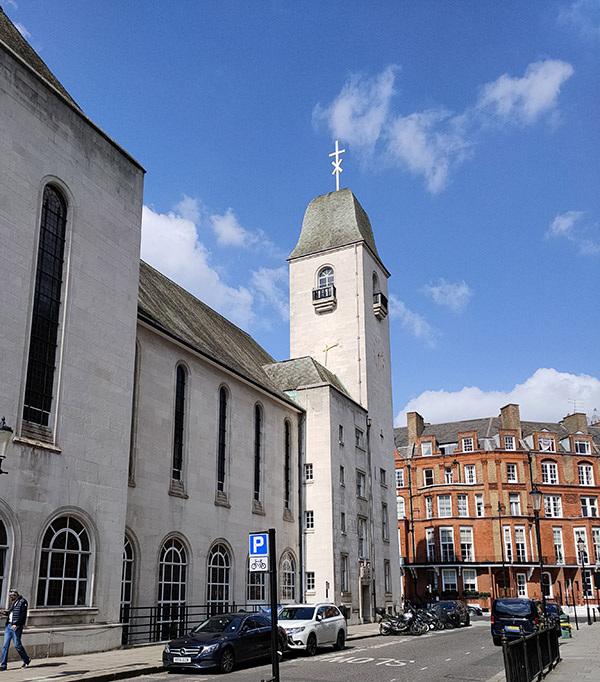
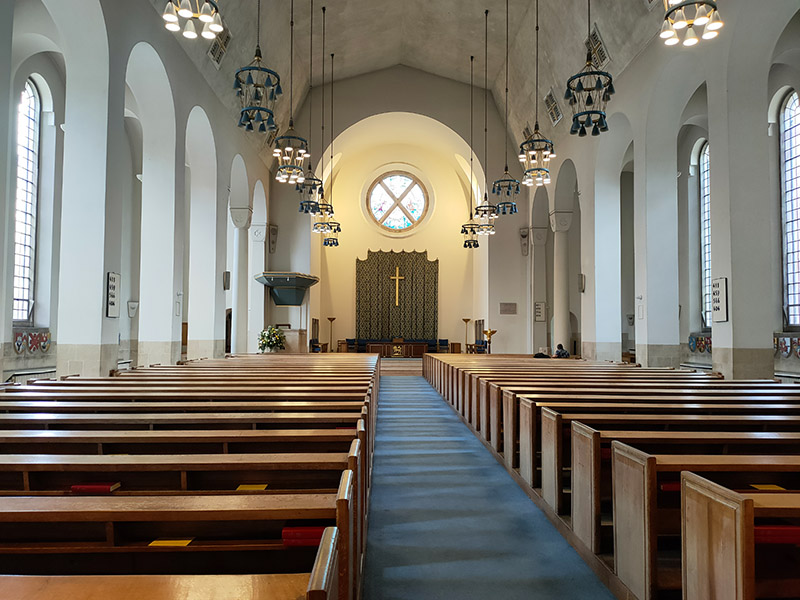
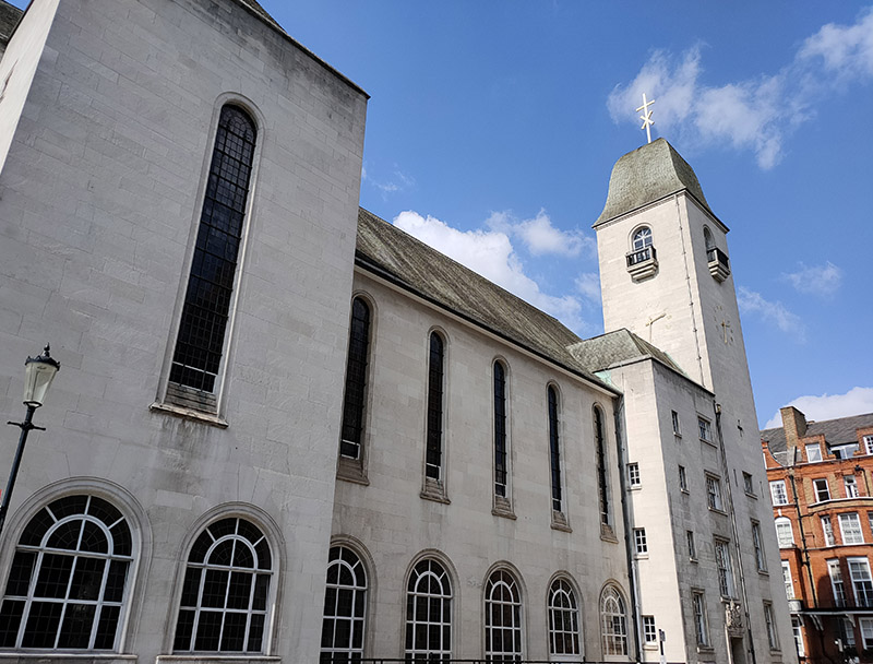
After looking in on Lennox Gardens Mews we navigate the loop that is Lennox Gardens and arrive at St Columba’s Presbyterian Church on Pont Street. The Church of Scotland originally built a kirk here in 1884 but that was hit by a German incendiary bomb in May 1941 and burnt to the ground. It took 14 years before the rebuilt church that we see today was open for worship. As you might expect the interior of the church is even more spartan than that of your typical C&E.

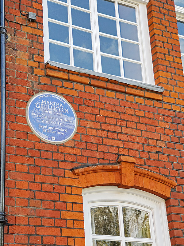
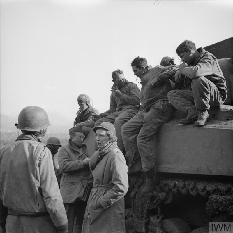
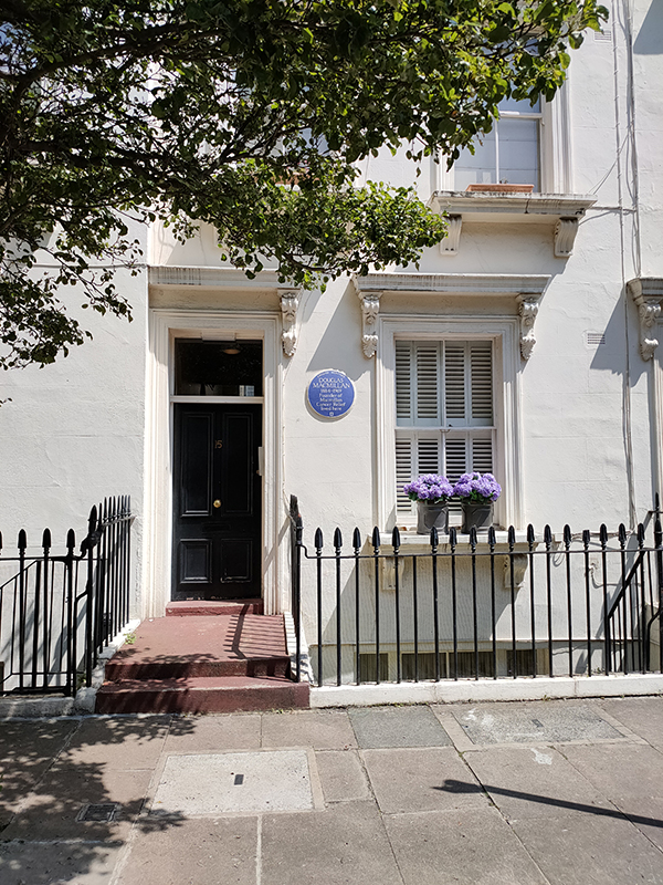
From Pont Street we make a tour of Cadogan Square, Clabon Mews and the northern section of Pavilion Road before returning to Milner Street. At 72 Cadogan Square there is a blue plaque commemorating the war correspondent and writer , Martha Gellhorn (1908 – 1998). Gellhorn met Ernest Hemingway during a 1936 Christmas family trip to Key West, Florida. Gellhorn had been hired to report for Collier’s Weekly magazine on the Spanish Civil War, and the pair decided to travel to Europe together. They celebrated Christmas of 1937 in Barcelona then, moving on to Germany, she reported on the rise of Adolf Hitler. In the spring of 1938, months before the Munich Agreement, she was in Czechoslovakia. After the outbreak of World War II, she described these events in the 1940 novel A Stricken Field. The same year she married Hemingway. Subsequently, Gellhorn reported on the war from Finland, Hong Kong, Burma, Singapore, and England. In June 1944, she applied to the British government for press accreditation to report on the Normandy landings; her application, like those of all female journalists, was denied. So, posing as a nurse she got herself onto a hospital ship where she promptly locked herself in a bathroom. Consequently, she was the only woman to land at Normandy on D-Day, becoming a stretcher-bearer for the wounded. A year later she and Hemingway divorced.

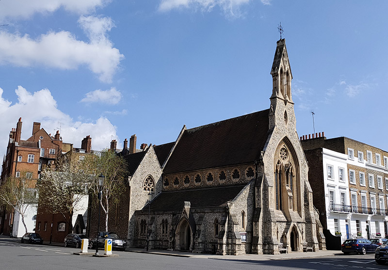
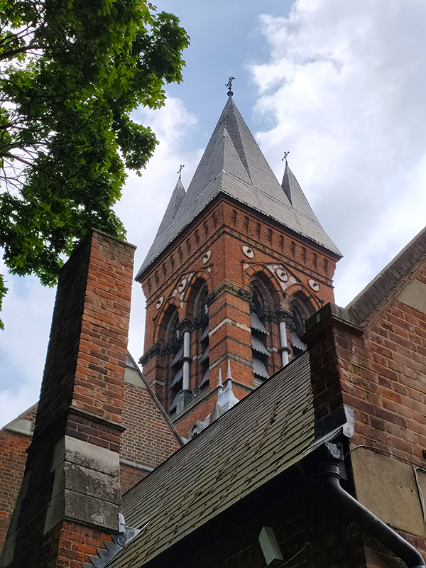
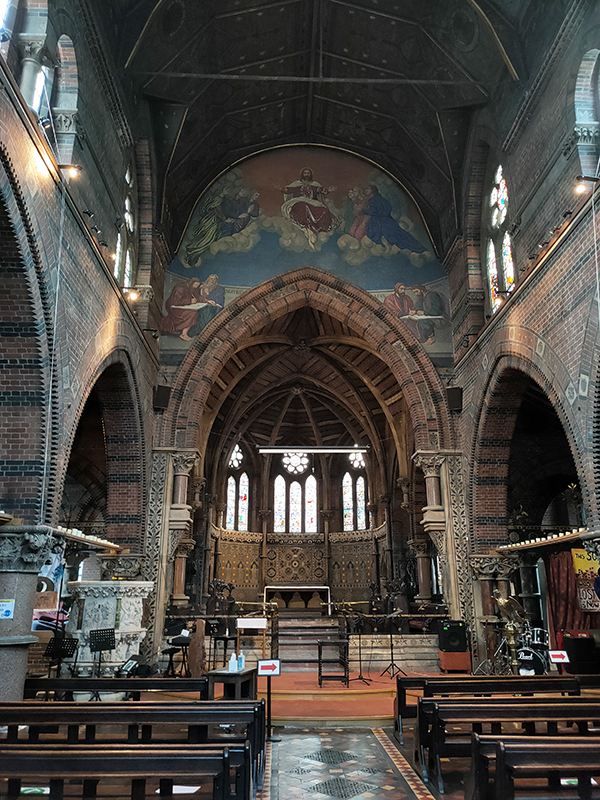
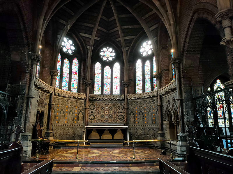
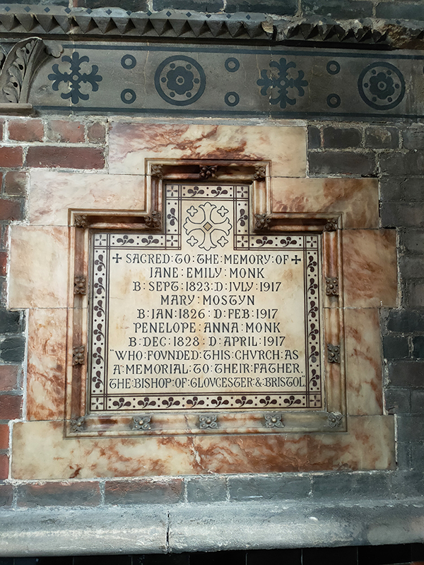
Final church of the day is St Simon Zelotes on the corner of Milner Street and Moore Street. This was designed by Joseph Peacock in the High Victorian tradition and completed in 1851. The church is named for Simon the Zealot, one of the less well-known of Jesus’s apostles. Very little of substance seems to have been recorded about Simon. He is variously reported as having been martyred by either crucifixion or being sawn in half but other accounts have him dying peacefully in his sleep. Despite this obscurity he is regarded as a saint by nearly all the major Christian faiths.

Final street of the day is Halsey Street, which also hosts a final blue plaque. I mentioned Elizabeth David (1913 – 1992) right and the start of this post and mentioned that we’d be returning to her later. Well, here she is at no. 24 where she lived and worked from 1947 until her death. Before she settled down to become one of the most influential cookery writers of the 20th century David had an eventful personal life. In the 1930s she studied art in Paris, became an actress, and ran off with a married man with whom she sailed in a small boat to Italy, where their boat was confiscated. They reached Greece, where they were nearly trapped by the German invasion in 1941, but escaped to Egypt, where they parted. She then worked for the British government, running a library in Cairo. After returning to England, she published her first cookery book, A Book of Mediterranean Food, in 1950 when rationing was still in force and many of the ingredients she championed were unavailable. Nonetheless, the book was a success and she went on to write seven more over the next three and a half decades becoming a major influence on British cooking, both domestic and professional. 

Day 75 – King’s Road – Flood Street – Royal Hospital Chelsea

Continuing where we left off last time, today’s journey takes us west and south from Sloane Square into the area tucked in between the King’s Road and the Chelsea Embankment. A good proportion of this is taken up by the Royal Hospital Chelsea and its grounds, a visit to which concludes this outing. Before then we’ve got plenty else to cover including Chelsea Old Town Hall, Chelsea Physic Garden and a wealth of literary connections.

We start out from Sloane Square tube station again and head westward through the square and onto King’s Road. King’s Road derives its name from its function as a private road used by King Charles II to travel to Kew. It remained a private royal road until 1830. In the 1960’s it became synonymous with Mod culture and Swinging London and although its glory days are behind it now it remains one of the capital’s most fashionable shopping areas.

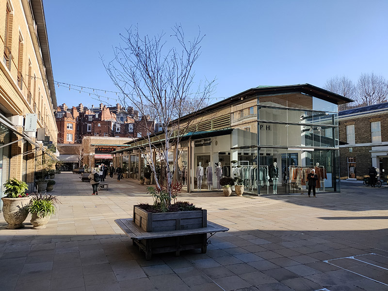
Immediately to the south is Duke of York Square, a retail quarter developed by Cadogan Estates after purchasing the site from the MOD in 1998. It includes one of the largest European stores of fashion retailer, Zara amongst its 33 outlets.

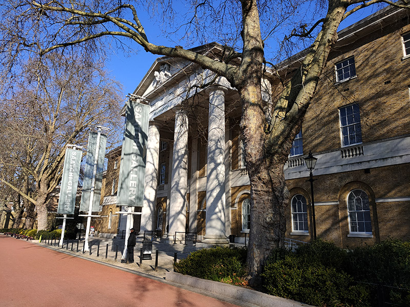
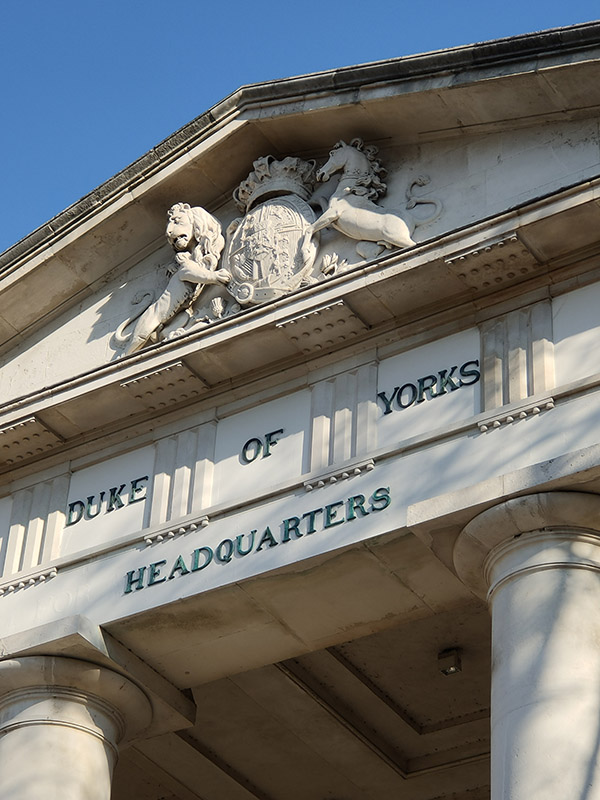
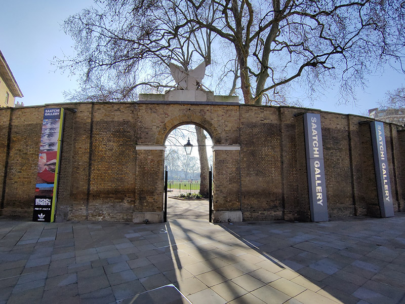
Beyond the square, the building known as the Duke of York’s Headquarters is now home to the Saatchi Gallery. The building was completed in 1801 to the designs of John Sanders, who also designed the Royal Military Academy Sandhurst. It was originally called the Royal Military Asylum and was a school for the children of soldiers’ widows. In 1892 it was renamed the Duke of York’s Royal Military School. In 1909, the school moved to new premises in Dover, and the Asylum building was taken over by the Territorial Army and renamed the Duke of York’s Barracks. The Duke of York in question being Frederick, second son of George III, the so-called “Grand Old Duke of York” and Asylum used in its archaic sense of “sanctuary or refuge”. Saatchi moved his gallery here in 2008 having leased the building from Cadogan Estates. It’s probably the only major Art Gallery in London I’ve never visited, having no wish to patronise a vanity project of Charles Saatchi, a man who will have one or two things to answer for come judgement day. And as it’s currently between exhibitions I have an excuse for not rectifying the omission.

Having returned to King’s Road we take the next left, Cheltenham Terrace which runs down to Leonard’s Terrace and then head back up on Walpole Street. Next up on the south side is the grand and leafy Royal Avenue, an open-ended square with a clear view of Chelsea Hospital in the distance. No.29 was once home to the American theatre and film director Joseph Losey (1909 – 1984) who relocated to the UK in 1953 having been blacklisted by Hollywood. Unlike many of the victims of the McCarthyism, Losey had actually been a member of the American Communist Party. His number was up once RKO pictures, where he has under contract, was bought by Howard Hughes. Once in the UK, Losey worked on everything from crime features to melodrama to horror before achieving major critical and commercial success with a trio of films scripted by Harold Pinter, The Servant (1963), Accident (1967) and The Go-Between (1971). He died here in 1984, four weeks after completing his final film.

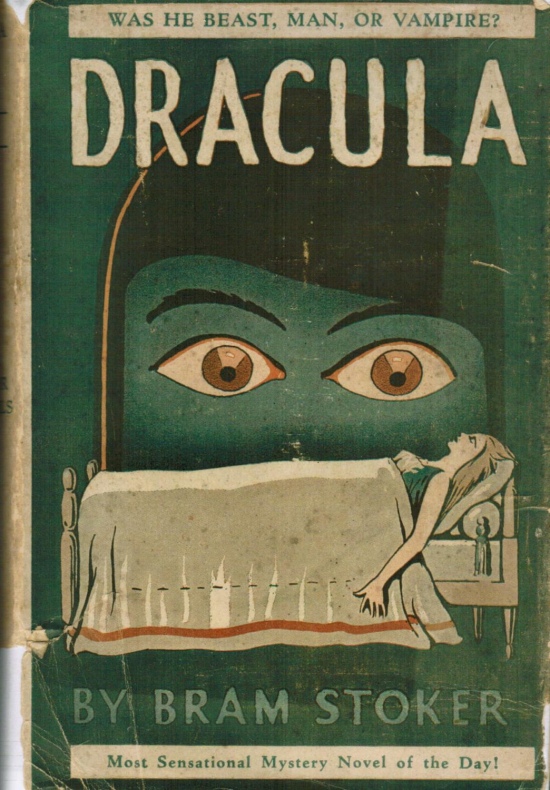
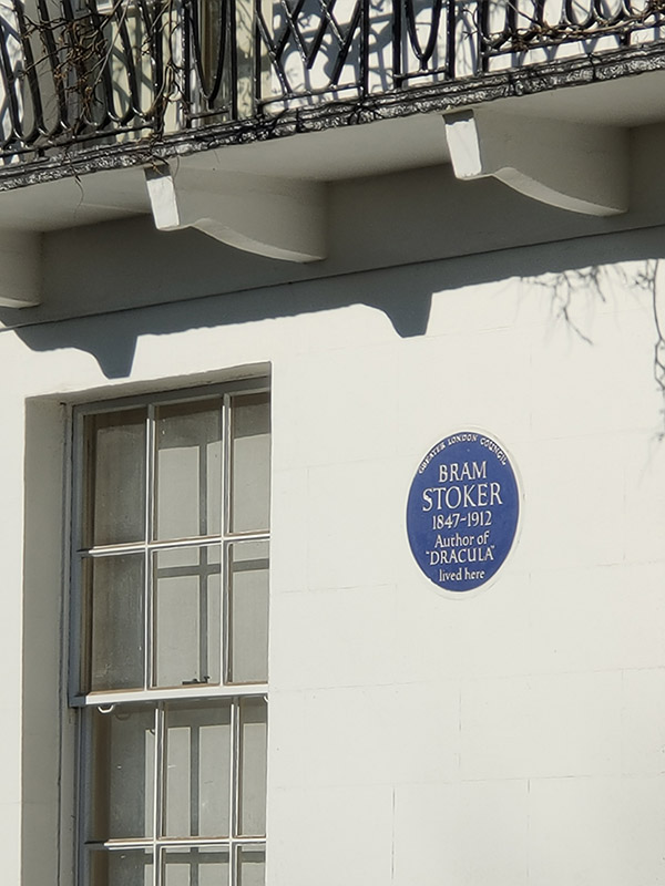
Back on St Leonard’s Terrace at no.18 is a Blue Plaque commemorating the first of the literary icons we’ll be encountering today, Abraham “Bram” Stoker (1847 – 1912). Stoker’s fame largely rests upon his authorship of the classic gothic horror tale Dracula which was published in 1897. I would imagine, like me, you’d be hard pushed to name any of his other novels. Born in Dublin, Stoker moved to London following his marriage in 1878 and for 27 years worked as business manager of the Lyceum Theatre which was in the charge of the most famous actor of the day, Henry Irving. The precise sources of inspiration for Dracula are still subject to debate but prior to writing the novel he had spent several years researching Eastern European folklore and mythology though he never actually visited that part of the world.

Returning to the King’s Road and continuing west we arrive at Wellington Square which despite an absence of plaques also has a number of literary ghosts. A. A. Milne, creator of Winnie-the-Pooh, lived there in the early 1900s as well as the notorious occultist Aleister Crowley in the 1920s. It is also considered to be the location Ian Fleming had in mind when he described his creation, James Bond, as living “in a ground floor flat in a square lined with plane trees in Chelsea off the King’s Road”.

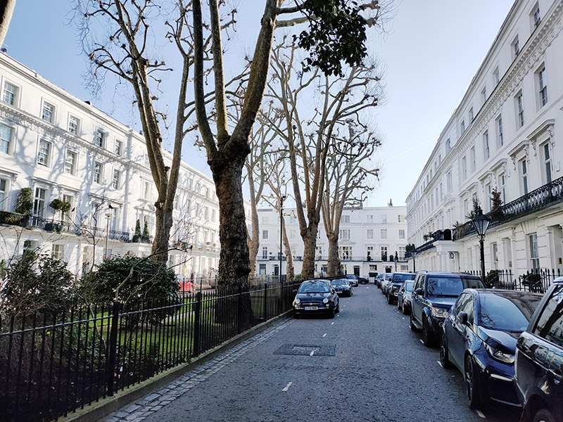
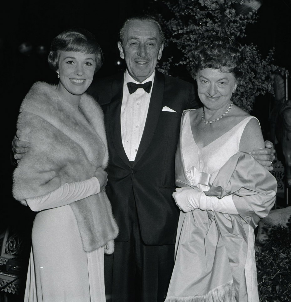
Next southward turning is Smith Street with yet another figure honoured at no.50. P. L. Travers (1899-1996) lived here for seventeen years and the house inspired the depiction of the Banks’s family home in the Disney film of her most famous creation, Mary Poppins. Travers was born as Helen Lyndon Goff in Queensland, Australia. She took the stage name Pamela Travers when she started an acting career in her late teens. After a few years, she gave up acting for journalism and moved to England in 1924. Ten years later she wrote Mary Poppins, the first in a series of eight books featuring the eponymous “supernanny”; the last of which she wrote in 1988 at the age of 1989. Under financial duress, Travers eventually ceded to years of pressure and sold the film rights to Disney. She famously disapproved of the musical which was released in 1964, particularly the animated sequences. The relationship between Travers and Walt Disney was itself given a cinematic treatment in 2013’s Saving Mr Banks.

From Smith Street we cut along Smith Terrace to Radnor Walk and head back to King’s Road again. Just around the corner is the Chelsea Potter Pub which dates from 1842 and was reputedly a regular haunt of Jimi Hendrix and The Rolling Stones in the late sixties. It has added resonance since the appointment of Graham Potter as manager of Chelsea F.C of course, and the beard gives the connection added flavour. Though by the time this is published…

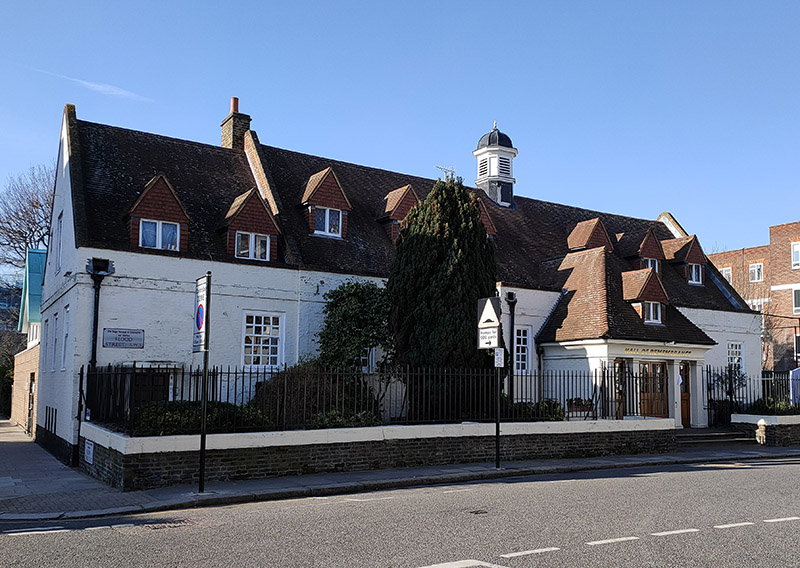
Beyond the pub we turn left again down Shawfield Street then west along Redesdale Street emerging on Flood Street opposite the Hall of Remembrance which is attached to Christ Church (which we will come to in due course).

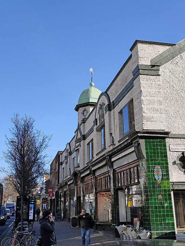
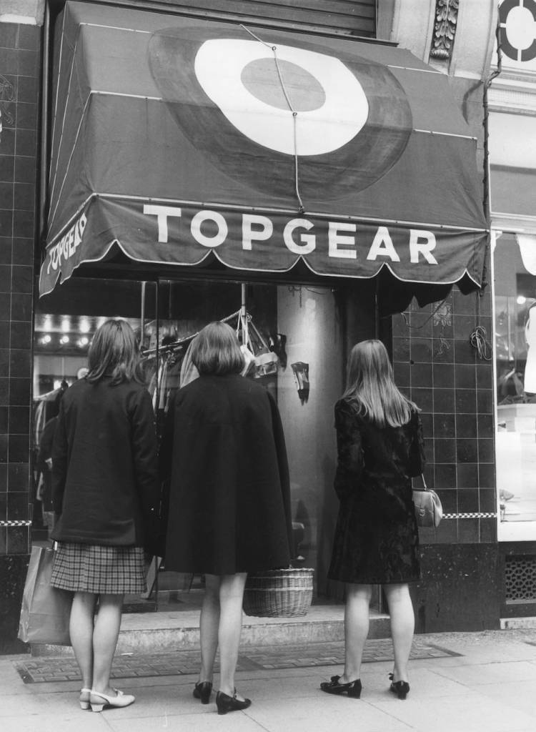
From here we head north back to the King’s Road for just about the final time today. I took the photo below left on account of the splendid tiling. Today this building houses an antique centre but back in the sixties it was home to the Top Gear fashion boutique.

On the other side of the northern end of Flood Street is the Chelsea Methodist Church, the only church with an entrance on King’s Road. The original 1903 building was badly damaged in a 1941 bombing raid; the present church formed part of a 1983 redevelopment and was opened by Cardinal Hume the following year.

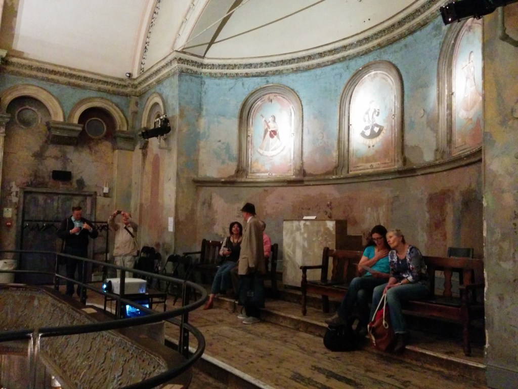
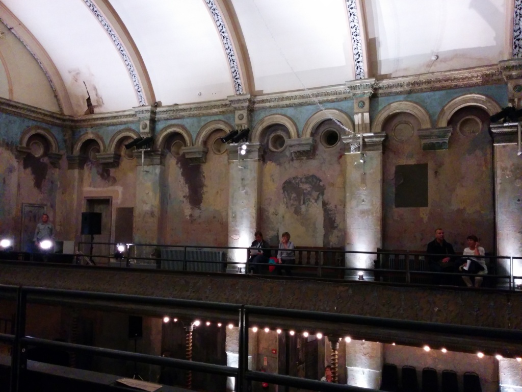
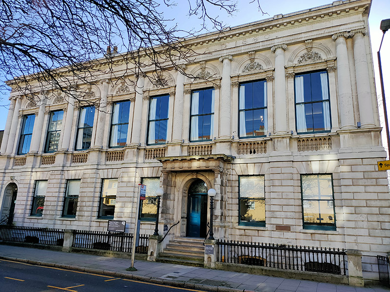
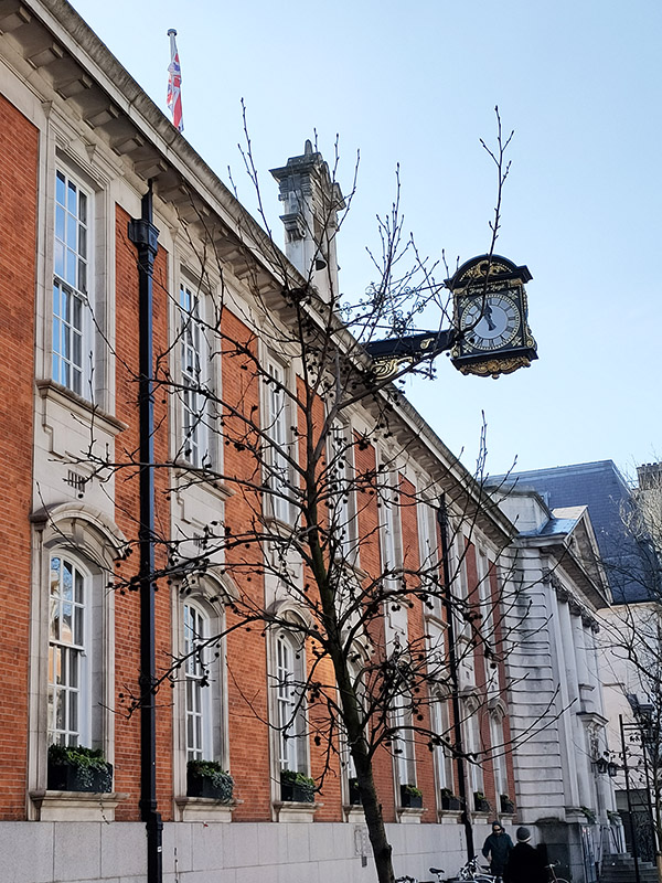
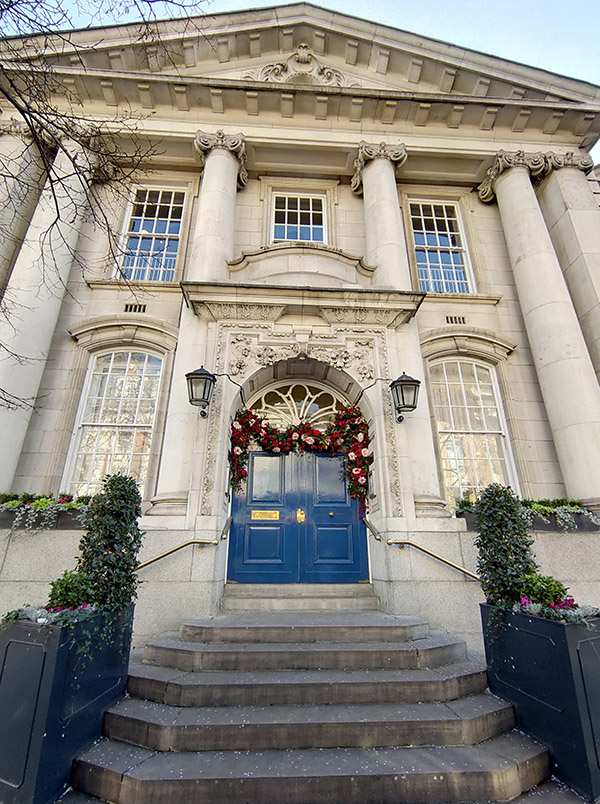
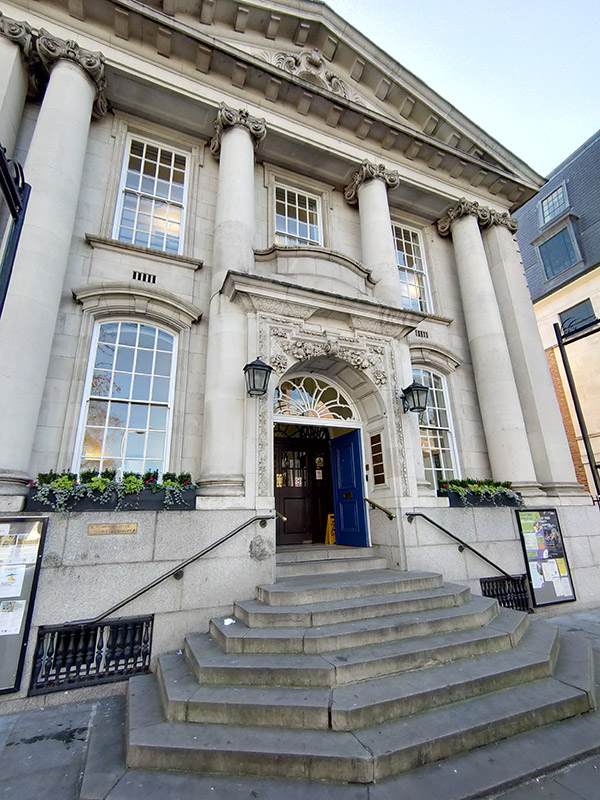
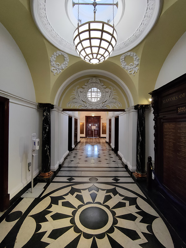
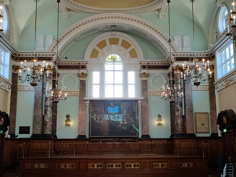
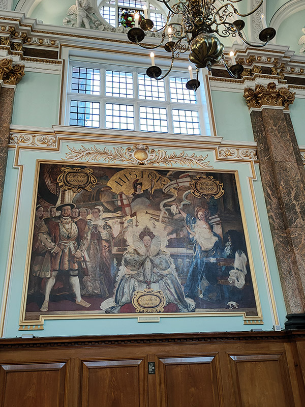
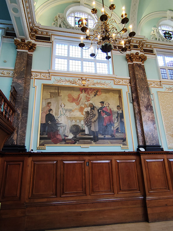
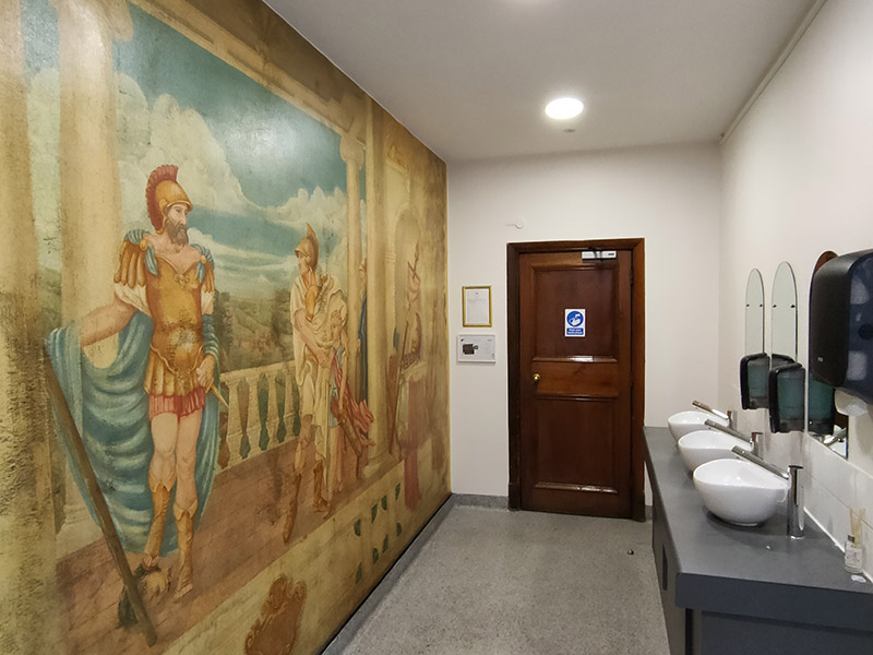
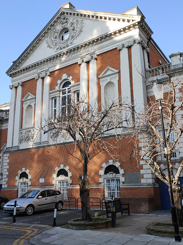
Almost the last stop on King’s Road is Chelsea Old Town Hall which it was a real treat to visit. So many of these old municipal buildings are inaccessible to the public these days. Surprisingly, there seems to be a dearth of information about the buildings despite their Grade II listed status. The oldest part of the complex is the Vestry Hall to the rear which was designed by J.M Brydon in 1886. The north elevations that front onto King’s Road are part of the 1906-08 extension by Leonard Stokes constructed in a neo-classical style. The building ceased to be a seat of local government in 1965 when the boroughs of Chelsea and Kensington merged. The Brydon building houses the Kensington and Chelsea Register Office which has hosted the weddings of, amongst others, Marc Bolan and June Child (1970), Judy Garland and Mickey Deans (1969), Roman Polanski and Sharon Tate (1968) and James Joyce and Nora Barnacle (1933). One section of the Stokes building is taken up by Chelsea Library. Many of the other rooms are hired out for functions and events, including the splendid main hall with its original Victorian wall paintings depicting representations of Art, Science, History and Literature. Unfortunately, I haven’t been able to discover who was responsible for creating these. Even if you don’t need to (and are qualified to do so) it’s also worth visiting the Gents’ toilet (see picture).

Just beyond the Town Hall is a building which dates back to 1722 and was originally the Six Bells pub (as evidenced by the eponymous sign that remains on the outside) which backed on to the bowling green of the local bowls club. Both pub and bowling green have now been consumed by the Ivy Chelsea restaurant which has gotten itself a little too excited about the upcoming Valentine’s Day.

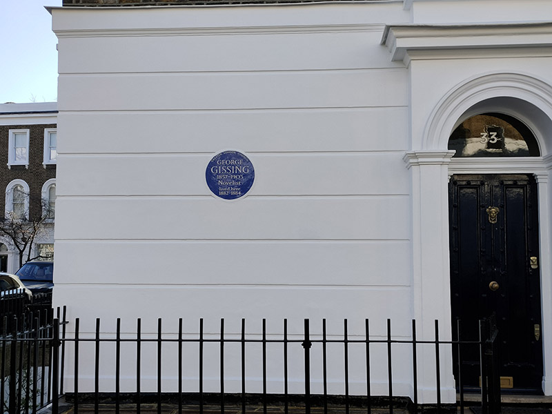
We finally say goodbye (for now) to the King’s Road via Oakley Street then veer left down Margaretta Terrace to reach Phene Street which runs east into Oakley Gardens. At no.33 Oakley Gardens there’s another literary commemoration, somewhat more obscure this time. George Gissing (1857 – 1903) wrote 23 novels in all the most highly regarded of which are Demos, New Grub Street and The Odd Women. Gissing’s relationships with women don’t seem to bear much scrutiny. He parted from his first wife Nell on account of her chronic ill-health then, subsequent to her death in 1888, he married Edith who he also separated from, nine years later, blaming her uncontrolled violent rages. Five years further on, Edith was certified insane and confined to an asylum. Before then, Gissing had met Gabrielle Fleury, a Frenchwoman with whom he lived until his death. Gabrielle eventually outlived him by fifty years.

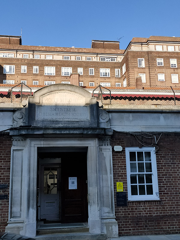
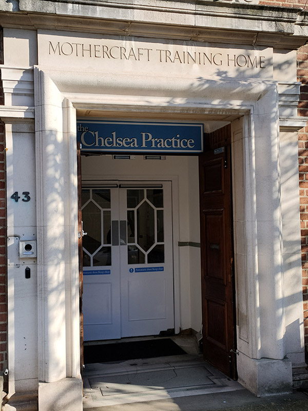
Exiting Oakley Gardens onto Chelsea Manor Street we return northward past the NHS Day Clinic in what was formerly the Violet Melchett Infant Welfare Centre named after Violet Mond, Baroness Melchett (1867 – 1945) and financed by her husband, politician and businessman, Sir Alfred Mond.

Further up the street we make a quick detour onto Chelsea Manor Gardens for a view of the facade of the Vestry Hall before turning back south.

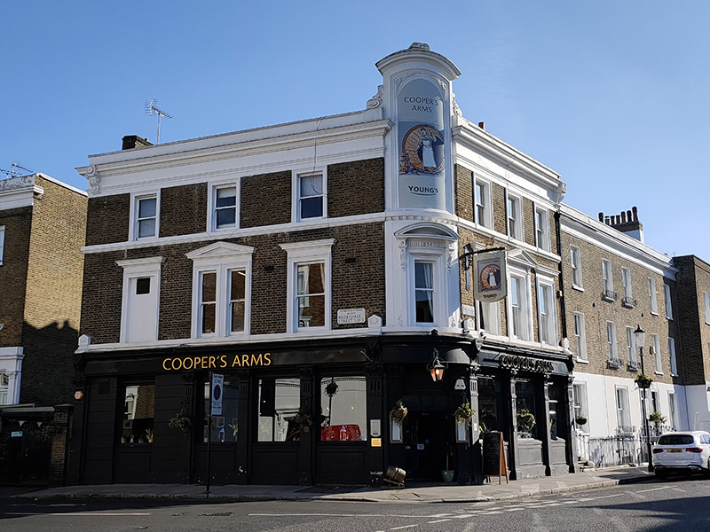
Flood Walk takes us back to Flood Street and after dropping in on Alpha Place we head east on Redburn Street. Unfortunately there’s no time to take in a pub of the day today as there a fair number of fine looking hostelries in the area such as The Cooper’s Arms on the corner of Flood Street and Redburn Street.

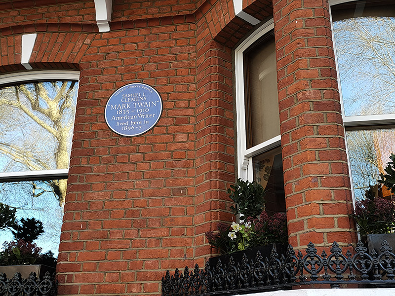
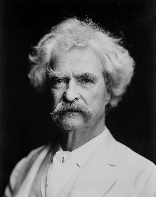
Redburn Street leads into Tedworth Gardens and the adjacent Tedworth Square. Our next literary icon was a one-time resident at no.23 in the latter. Mark Twain (1835 – 1910) was the pen name of Samuel Langhorne Clemens described in his New York Times obituary as “the greatest humorist the United States has produced” and by William Faulkner as “the father of American literature”. Twain is best known, of course, for The Adventures of Tom Sawyer (1876) and The Adventures of Huckleberry Finn (1884) which he wrote at his family home in Hartford, Connecticut. The two years he spent in England came after the conclusion of a year long around-the-world lecture tour which he undertook in 1895 as a means to pay off creditors, having lost most of the money earned through his writing by unsuccessfully investing in new inventions and technology, particularly the Paige typesetting machine

Next we make our way back west to the actual Christ Church following Ralston Street, Tite Street, Christchurch Street, Christchurch Terrace and Caversham Street. The church was consecrated in 1839 having been built to a design by Edward Blore (1789-1879). It was intended as a church for the many servants and tradesmen who worked in and for the grand houses of Belgravia and as such was designed to accommodate the maximum number of people at minimum cost. The construction cost was just over £4,000, paid for by the Hydman Trust, the Hydman family having originally made their money from sugar plantations in the West Indies. Philanthropy really does begin at home.  In 1843, a new school was built on land donated by Lord Cadogan, directly opposite the church. The school still exists as a Church of England Primary School.

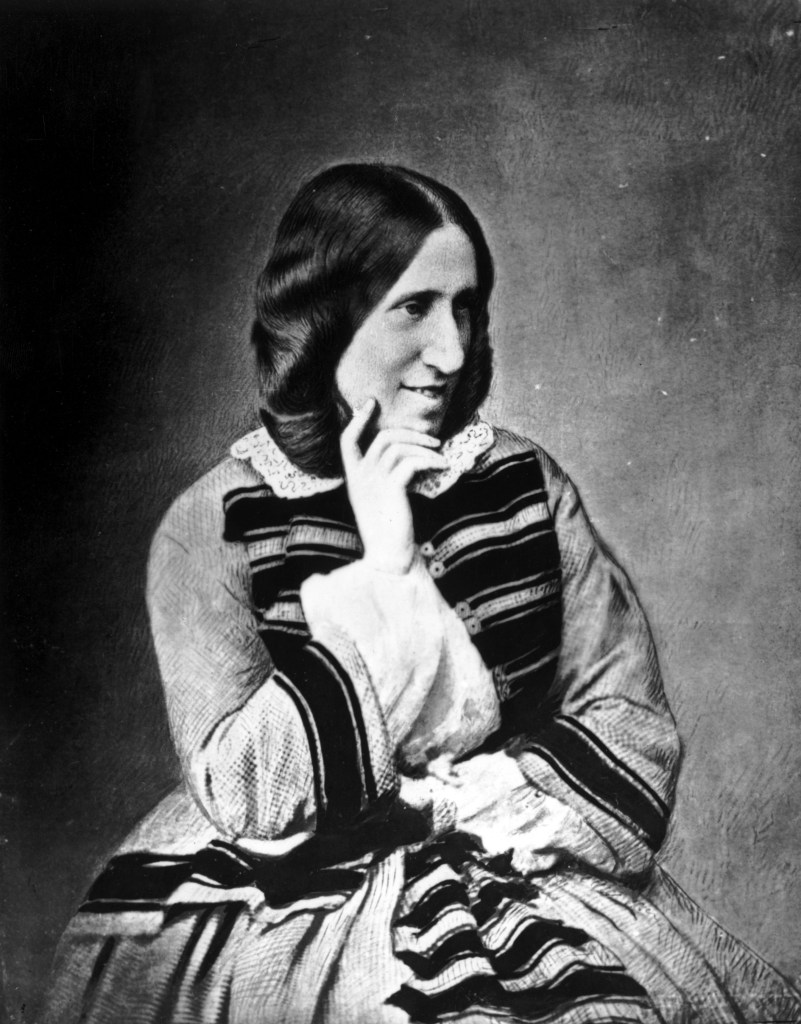
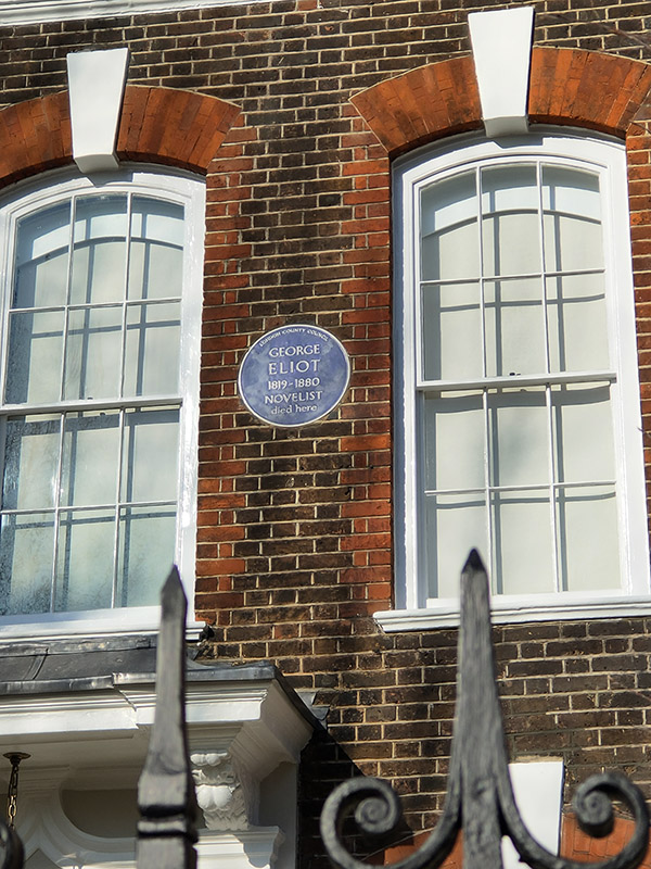
From the church we make a full circuit of St Loo Avenue, Cheyne Gardens, Cheyne Walk and the southernmost section of Flood Street. The literary connections continue unabated with a blue plaque commemoration the death of novelist George Eliot (1819 – 1880) at no.4 Cheyne Walk. George Eliot was the pen name employed by Mary Ann Evans, born the third child of a West Midlands’ mill owner and his wife. Of the seven novels she wrote, The Mill on the Floss (1860), Silas Marner (1861) and Middlemarch (1871–72) are probably the most celebrated (or at least the most studied by English Lit. undergraduates).  Following the success of her first complete novel, Adam Bede, public curiosity as to the author’s identity and the emergence of a pretender to the authorship, one Joseph Liggins, led Mary Ann to acknowledge that she stood behind the pseudonym George Eliot. She continue to publish her novels under the pen name nonetheless. From 1854 to 1878 Mary Ann lived with the philosopher and critic George Henry Lewes (1817–78). Although Mary considered that she and Lewes were effectively husband and wife, he was in fact already married to Agnes Jervis, although in an “open relationship”. In addition to the three children they had together, Agnes also had four children by Thornton Leigh Hunt, the first editor of the Daily Telegraph. It was her association with Lewes, in addition to her denial of the Christian faith, that led to her burial in Highgate Cemetery rather than Westminster Abbey.

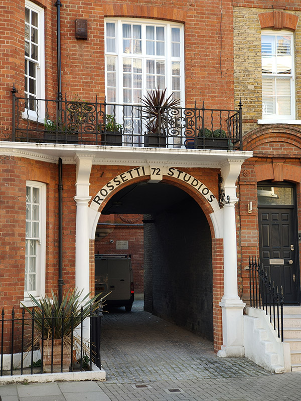
No.72 Flood Street, The Rossetti Studios, is a Grade II listed building containing artist studios which was built in the Queen Anne Revival style in 1894 to a design of Edward Holland. The studios were named after pre-raphaelite artist, Dante Gabriel Rossetti whose own studio was based nearby.

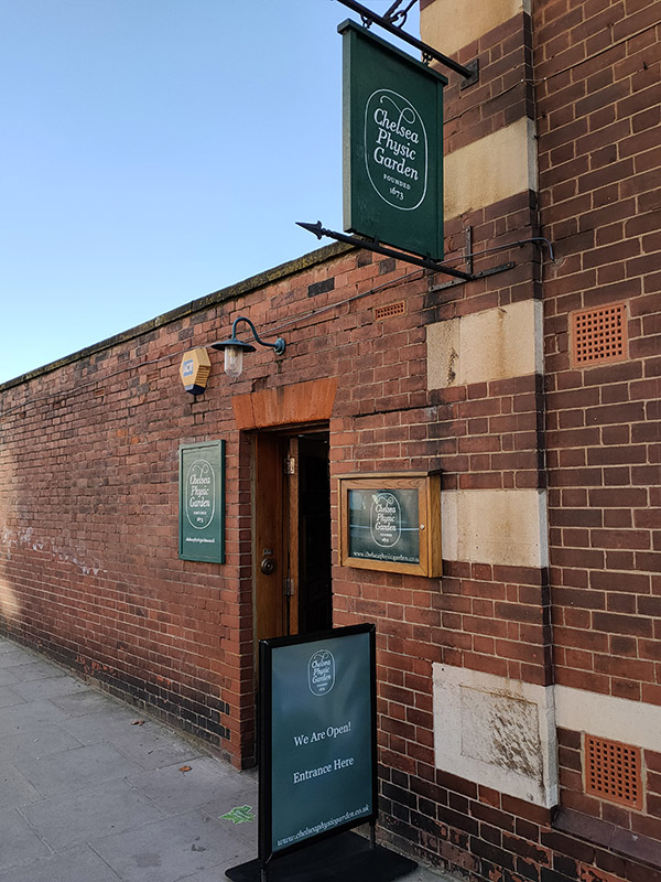
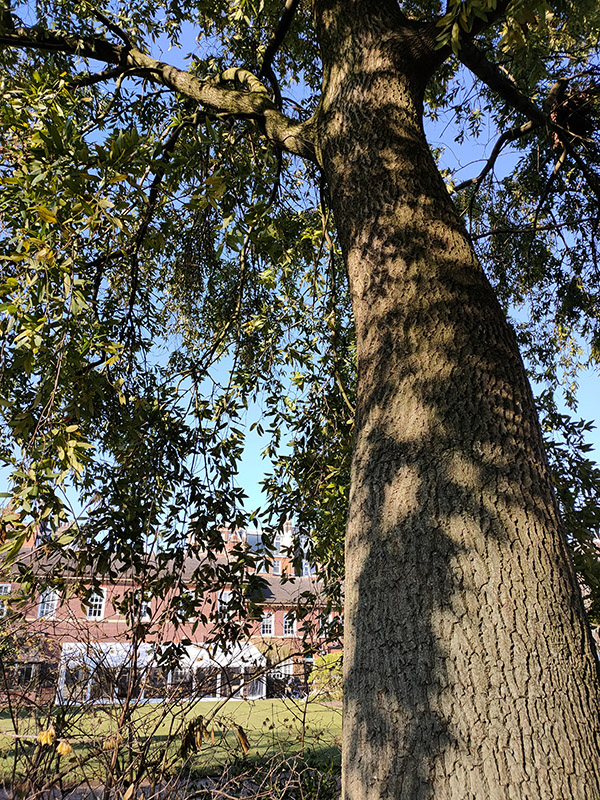
After returning to Christ Church we head down Christchurch Street to Royal Hospital Road for a visit to Chelsea Physic Garden. The garden occupies four acres beside the Thames and was established in 1673 by the Worshipful Society of Apothecaries as a base for conducting plant finding expeditions in surrounding areas and teaching their apprentices to identify plants, both those that might cure and those that might kill. The river access allowed plants arriving from around the world to be introduced to the British Isles via the Garden and its international reputation was quickly established through a global seed exchange scheme, known as Index Seminum, which it initiated in the 1700s and continues to this day. The Garden’s unique microclimate and location has facilitated the cultivation of plants not typically found outside in the UK. Early February is obviously not the best time to visit but there was still plenty of green stuff on show.

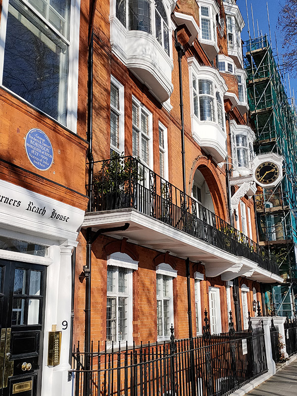
Beyond the garden we turn right onto Swan Walk which runs down to Chelsea Embankment. Round the corner at no.9 Chelsea Embankment is a rare non-literary related blue plaque. This one is for George Robinson, Marquess of Ripon (1827 – 1909), politician and Viceroy of India. Robinson was actually born at 10 Downing Street, the second son of F. J. Robinson, 1st Viscount Goderich who was Prime Minister at the time (though his premiership only lasted 144 days; I studied that period of history at A level and have no recollection of his tenure. Still, compared with Liz Truss it’s quite a stellar effort). Robinson junior’s political career was an extensive one; he served as a member of every Liberal cabinet between 1861 and 1908. In between administrations he managed to fit in a four year stint as Viceroy of India (1880 -84) during which time he did at least attempt to get progressive legislation to improve the rights of native Indians passed.

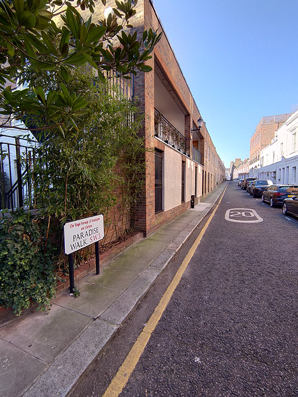
Turning off the Embankment onto Tite Street we immediately double back along Dilke Street for a short glimpse of the ill-named Paradise Walk. My partner, artist Susan Eyre, featured this in an ongoing art project based around unlikely places which include Paradise in their name.

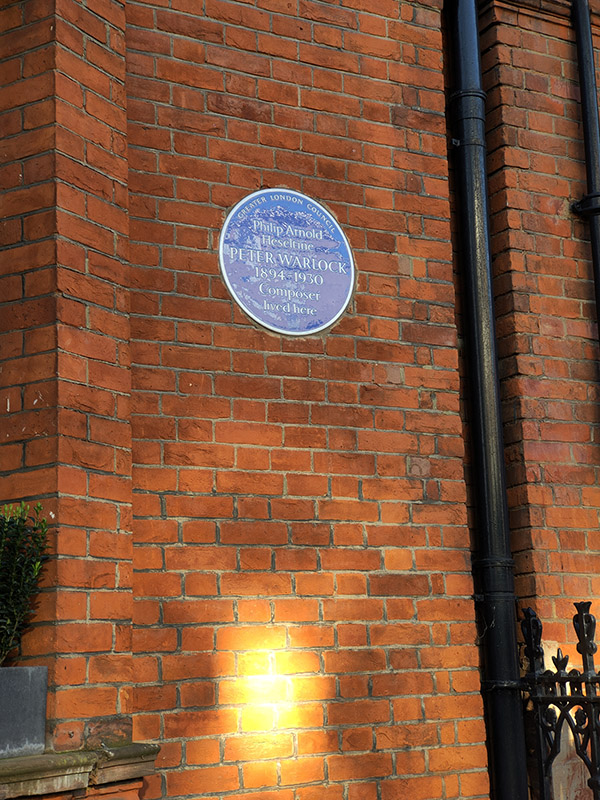
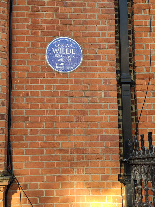
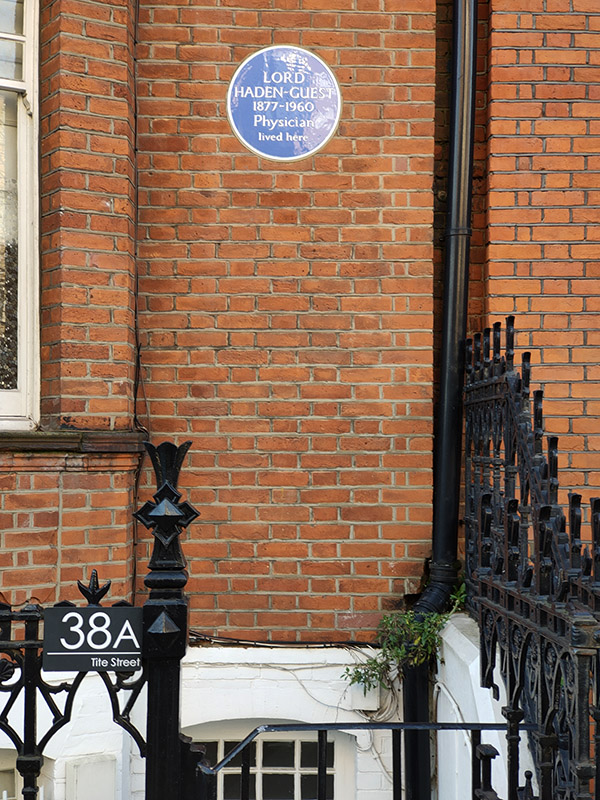
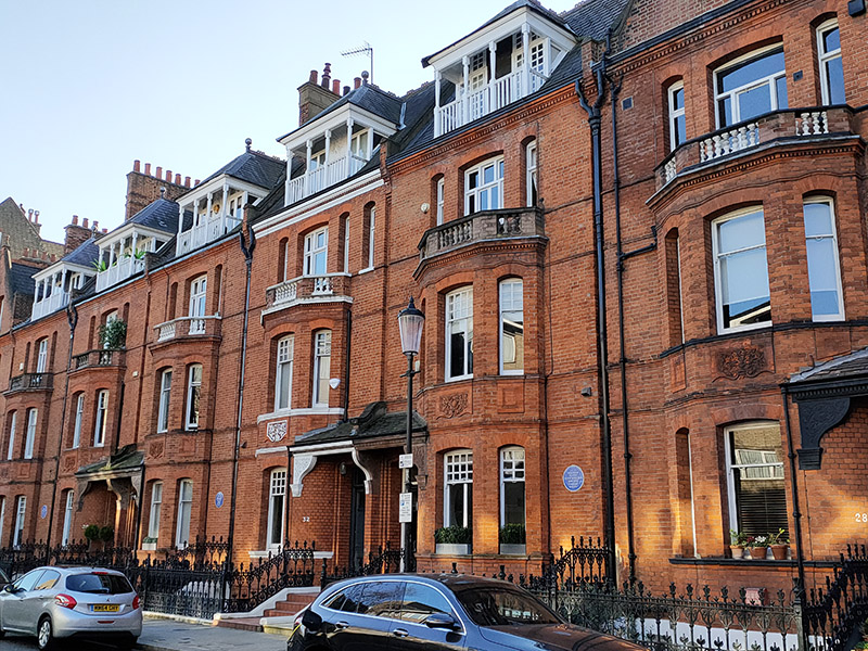
We return to Tite Street to take us back to Royal Hospital Road. The imposing red brick terrace on the west side of the street is home to three more blue plaques more or less adjacent to each other. At no. 38 we have Lord Hayden-Guest (1877 – 1960), author, journalist, Labour politician and physician; at no.34 Oscar Wilde (1854 – 1900) dramatist and celebrated wit; and at no.30 composer, Philip Arnold Heseltine a.k.a Peter Warlock (1894 – 1930). We’ve had an overload of blue plaques today so just a few words about each of these three. Haden-Guest was once described by Bertrand Russell as “a theosophist with a fiery temper and a considerable libido”. Oscar Wilde wrote both The Picture of Dorian Gray and The Importance of Being Earnest while living at no.34 and it was from here he left to serve his jail term for ‘gross indecency’ in 1895. Peter Warlock died here from coal gas poisoning; the inquest returning an open verdict. Previous to this he had penned the following words as his own epitaph :

Here lies Warlock the composer
        Who lived next door to Munn the grocer.
    He died of drink and copulation,
        A sad discredit to the nation.

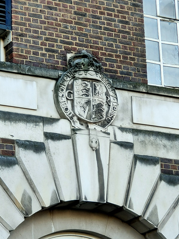
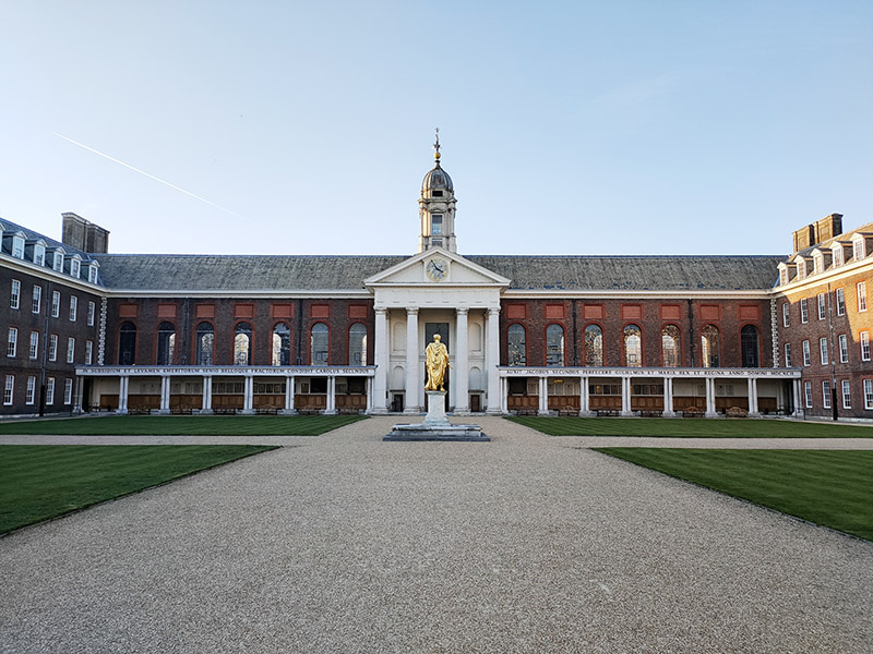
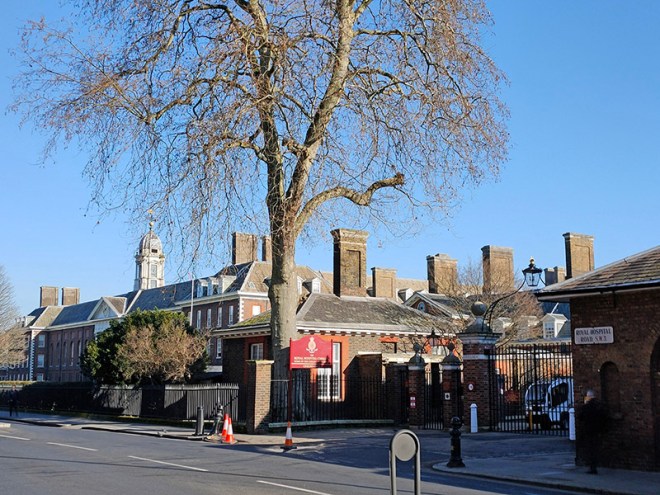
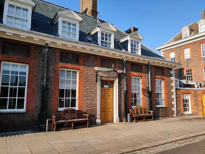
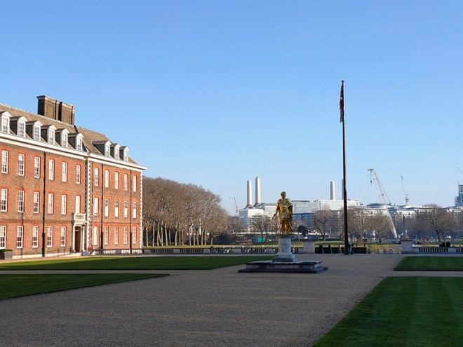
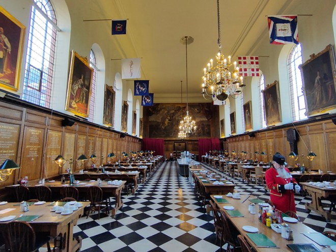
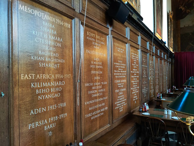
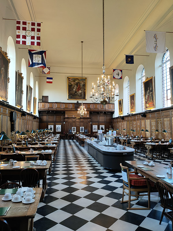
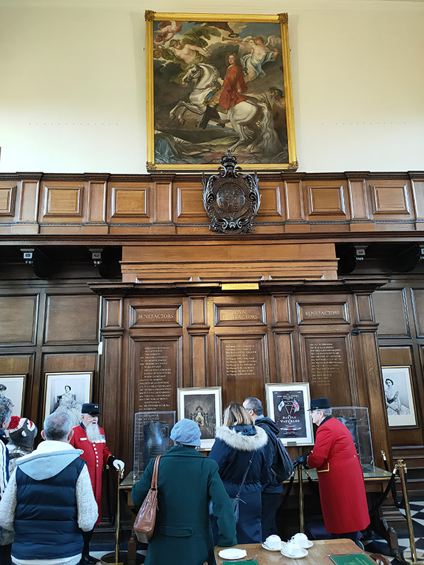
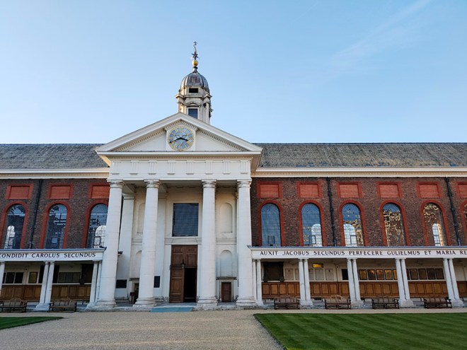
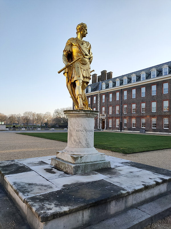
We cross over Royal Hospital Road and loop round the two sections of Ormonde Gate and we arrive at the West Road entrance to Royal Hospital Chelsea ready for our tour conducted by a Chelsea Pensioner. Guide, John, definitely looks the part with his grey whiskers and multi-bemedalled red tunic. He also knows his stuff as he regales us with facts and stories for at least half an hour longer than the scheduled 90 minutes. To deal with the history first: in 1681 Charles II issued a royal warrant for the building of the Hospital to provide for elderly and injured soldiers, Sir Christopher Wren was commissioned to design and erect the building and Sir Stephen Fox was charged with securing the necessary funds.  In 1692 work was finally completed and the first batch of Chelsea Pensioners, 476 in total, were in residence by March of that year. By the time of completion, Charles II had died (in 1685) and his successor James II had been deposed in “the glorious revolution” of 1688. This is why the Latin inscription on the exterior of the main building, composed by Wren himself, translates as ‘For the succour and relief of men broken by age and war, started by Charles II, extended by James II and completed by William and Mary, King and Queen 1692’.

Upgrades to the accommodation, the ‘berths’ – were enlarged in 1954-55 and again in 1991 to resize them from 6ft square to 9ft square, mean that the modern day capacity is only 300 pensioners. Due to an annual death rate of around 10% there are always slightly fewer than that; currently 278 of which 16 are women. To be eligible for admission as a Chelsea Pensioner you must be a former non-commissioned officer or soldier of the British Army who is over 66 years of age, “unencumbered by spouse” and “of good character”.

Since 1913 the Royal Horticultural Society’s Chelsea Flower Show has been held annually on the South Grounds, between Figure Court and the Chelsea Embankment.

Tour over, we leave the RCH via Light Horse Court and the East Road entrance. Crossing Royal Hospital Road, we make a circuit of Franklin’s Row, Turks Row and Sloane Court West emerging back on Royal Hospital Road opposite the Margaret Thatcher Infirmary, a state of the art care home and hospice for Chelsea Pensioners, designed by Sir Quinlan Terry and opened in 2009.

From here it only remains to work our way back to Sloane Square tube station via Sloan Court East, Lower Sloane Street and Sloane Gardens.

Day 74 – Sloane Square – Chelsea Bridge Road – Pimlico Road

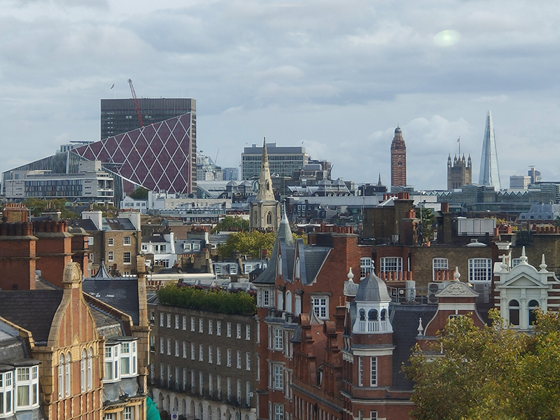
This trip sees us returning to south-west London, specifically the area to the north, south and east of Sloane Square which is a nexus of Chelsea, Belgravia and Pimlico. Basically, about as swanky as it gets. It’s long been a desirable area for the well-off and well-known so there were more blue plaques on this jaunt than you can shake a yappy little handbag dog at. But we’ve also got theatrical history, an iconic department store, a clutch of churches, a few embassies and one of the largest building sites in the capital to offer you. It’s a bit of an epic tbh.

Right next door to today’s starting point, Sloane Square tube station, is the Royal Court Theatre. This red and moulded brick building with a stone facade in free Italianate style was designed by Walter Emden and Bertie Crewe and opened in 1888 as the New Court Theatre. Previously there had been a theatre on the opposite, west side of Sloane Square, a converted non-conformist chapel variously known as the New Chelsea Theatre, the Belgravia Theatre and the Royal Court Theatre between 1870 and 1887. By 1900 the “Royal” monicker had been reapplied to the new theatre and in the following few decades it played host to several of George Bernard Shaw’s plays. It ceased to be used as a theatre in 1932 and became a cinema from 1935 to 1940, until World War II bomb damage closed it. It reopened in 1952 and four years after that was acquired by The English Stage Company whose aim was to produce plays by young and experimental dramatists and “the best contemporary plays from abroad”. This intent was manifested from the outset with the premiere of John Osborne’s “Look Back In Anger” as the third production. Since then, the RCT has “courted” controversy on many occasions and played a key part in bringing about the abolition of theatre censorship laws in the 1960’s. Writers such as Caryl Churchill, Jez Butterworth and Sarah Kane have had multiple works given their first run here and “The Rocky Horror Show” debuted here in 1973. The building was Grade II listed in 1972.

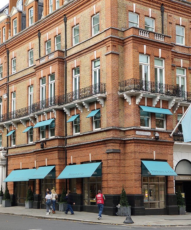
Sloane Square forms a boundary between the two largest aristocratic estates in London, the Grosvenor Estate and the Cadogan. Named after Sir Hans Sloane (1660–1753), an Anglo-Irish doctor who, jointly with his appointed trustees, owned the land at the time the square was laid out in 1771. In the 1980’s, of course, it became synonymous with the rise of yuppiedom and the Peter York-coined “Sloane Rangers”. These days the clientele for the Ralph Lauren and Tiffany stores is somewhat different I would imagine though you still have to watch out for marauding Range Rovers and where you step on the pavements.

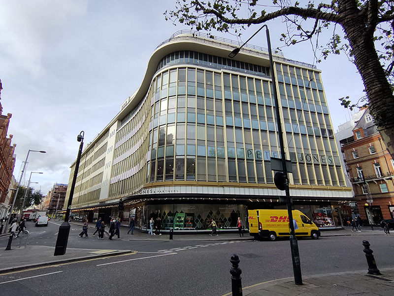
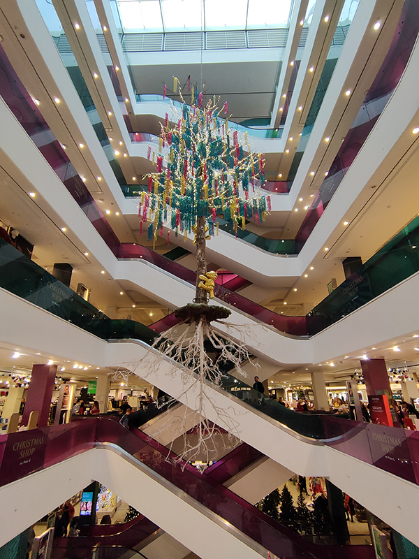
On the west side of the square, the Peter Jones department store still caters to its traditional demographic however. The shop is named after Peter Rees Jones (1842–1905), the son of a Carmarthenshire hat manufacturer, who opened a store here in 1877 on a 999-year lease from the Cadogan estate at £6,000 per year, the terms of which have never been increased (apparently). After Jones’ death in 1905 the store was bought by a certain John Lewis, who already owned a thriving business on Oxford Street. The present building was built between 1932 and 1936 to designs by William Crabtree of the firm of Slater, Crabtree and Moberly and is the first modern-movement use of the glass curtain wall in Britain. It is a Grade II* listed building. Despite being one of the flagship stores of the John Lewis partnership it has always retained the Peter Jones name.

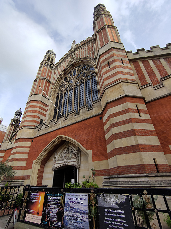
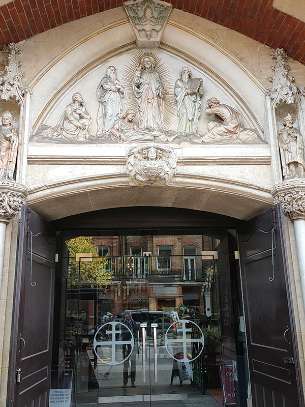
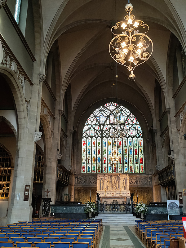
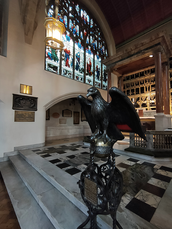
Just off the square, on Sloane Street, stands Holy Trinity Church which, like the theatre, was constructed in 1888. The architect was John Dando Sedding (1838-1891) who was appointed by the 5th Earl Cadogan and his wife Beatrix. The church is notable for its impressive stain glass windows, chief amongst which is the great east window designed by Edward Burne-Jones (1833 – 1898) and installed by Morris and Company (which was founded by William Morris and members of the pre-Raphaelite movement including Burne-Jones). During WW2 the church was hit by several incendiary bombs causing considerable structural damage. Post-war there was considerable pressure to demolish rather than restore the building, and it was only saved from this threat by a campaign mounted by the Victorian Society and Sir John Betjeman who described the church as the Cathedral of the Arts and Crafts Movement. I should also note that at the time of visiting there was an extensive selection of Charity Christmas cards for sale and the two ladies on the till were very amiable.

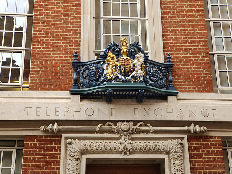
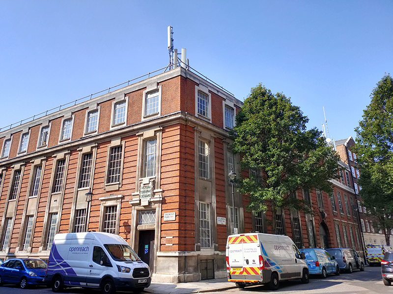
It’s about time we got into some actual streets, so let’s kick that off by exiting the square northwards up Sedding Street. On the left we pass the Grade II listed Neo-Georgian Sloan Telephone Exchange which dates from 1924 and was designed by John H. Markham for HM Office of Works. These days it’s used for offices.

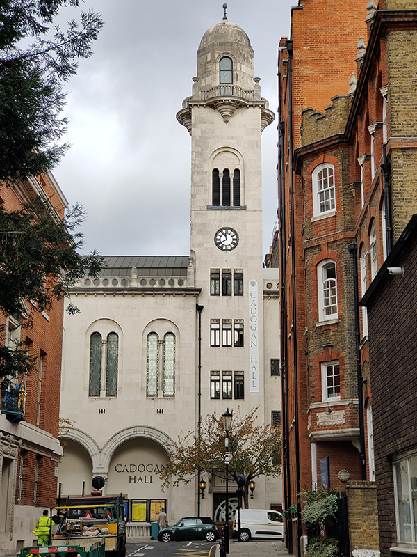
At the apex with Sloane Terrace stands the Cadogan Hall. This started life in 1907 as a new Christian Science Church designed by Robert Fellowes Chisholm, hosting up to 1400 worshippers. However, after planning permission for renovations was refused in 1996, the congregation moved on. The Hall was sold but fell into disuse until it was acquired by the Cadogan Estate in 2000 and four years later opened as a concert hall and the permanent base of the Royal Philharmonic Orchestra. Most of the concerts put on here are classical in nature but they also host (mainly) vintage pop and rock acts and jazz performers. In fact, I was due to attend a concert by the now 85-year old Ron Carter (one time bassist with the Miles Davis Quartet) and his current band in a couple of weeks’ time as part of the London Jazz Festival but sadly it’s been postponed until next year.

We turn left down to Sloane Street then turn briefly north before checking out the rear of the Hall on Wilbraham Place. Not an essential photo this next one but I do like these gates.

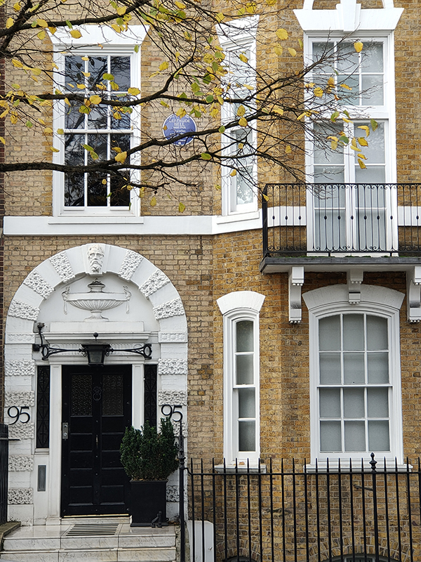
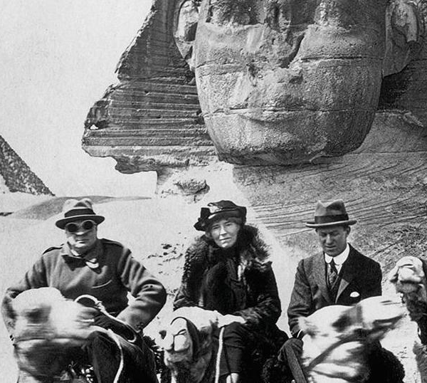
Returning to Sloane Street again via D’Oyley Street and Ellis Street we come across the first of today’s many blue plaques at no. 95, this one commemorating the English writer, traveller, political officer, administrator, and archaeologist, Gertrude Bell (1868 – 1926). Gertrude spent much of her life travelling around and mapping the Middle East and is principally known for her involvement in the establishment of territorial boundaries in the region following the break-up of the Ottoman Empire post-WW1. She was (alongside T.E Lawrence) a strong advocate for independent Arab states and was also opposed to the Balfour Declaration which determined the future of Palestine. Towards the end of her life she settled in her beloved Baghdad where she was President of the National Library and founded the Iraq Museum as a permanent home for the country’s rich collection of antiquities. I can thoroughly recommend the 2016 documentary about Bell’s life, Letters from Baghdad, in which quotations from her letters are read by Tilda Swinton. 

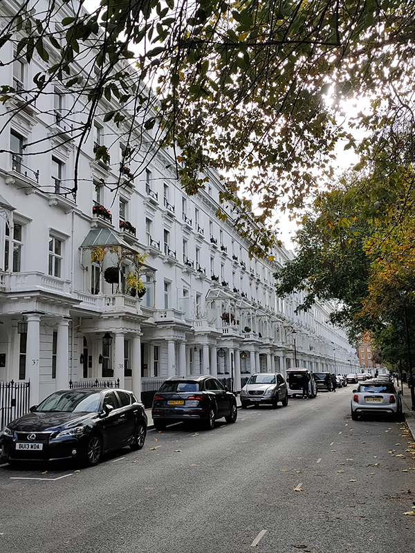
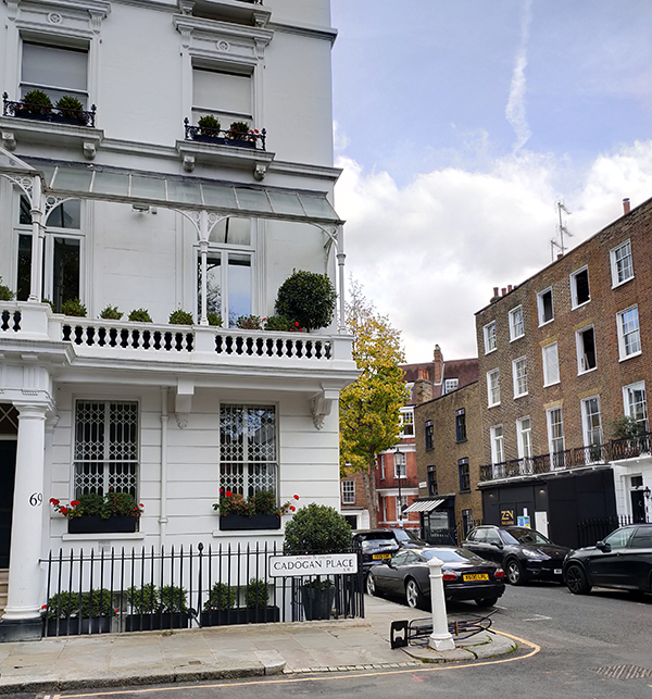
On reaching Pont Street we turn east and then south again down Cadogan Place where the houses, which distinguish themselves from other stuccoed terraces in the area by having mini gazebos on their first floor balconies, face the extensive eponymous private communal gardens. Both flats and terraced houses here are popular with foreign buyers, the average price of the former being upward of £3m and the latter £11m. There were some extremely expensive looking motors parked along the street but as I have little interest in cars you’ll have to use your imagination. The metal ironing board dumped beside the bollard outside no.69 strikes a nicely incongruous note.

The next two blue plaques appear at nos. 30 and 44 Cadogan Place respectively. The former commemorates the actress Dorothy Bland (aka Mrs Jordan) (1762 – 1816) who was at least as famous for her love life as she was for her comic stage performances. In 1790 she became the mistress of the Duke of Clarence, later King William IV and during their a 20-year relationship bore him 10 children, all given the surname FitzClarence. The couple lived together as husband and wife, mainly at Bushy House in Bushy Park, Surrey, of which William was Ranger, until they finally separated in 1811. Dorothy moved to Cadogan Place the following year, living there for three years before retiring to France where she passed away within a year. The anti-slavery campaigner William Wilberforce (1759 – 1833) resided at no.44 but only for the last ten days of his life (it was his cousin’s house). One month after his death, the House of Lords passed the Slavery Abolition Act, which abolished slavery in most of the British Empire from August 1834.

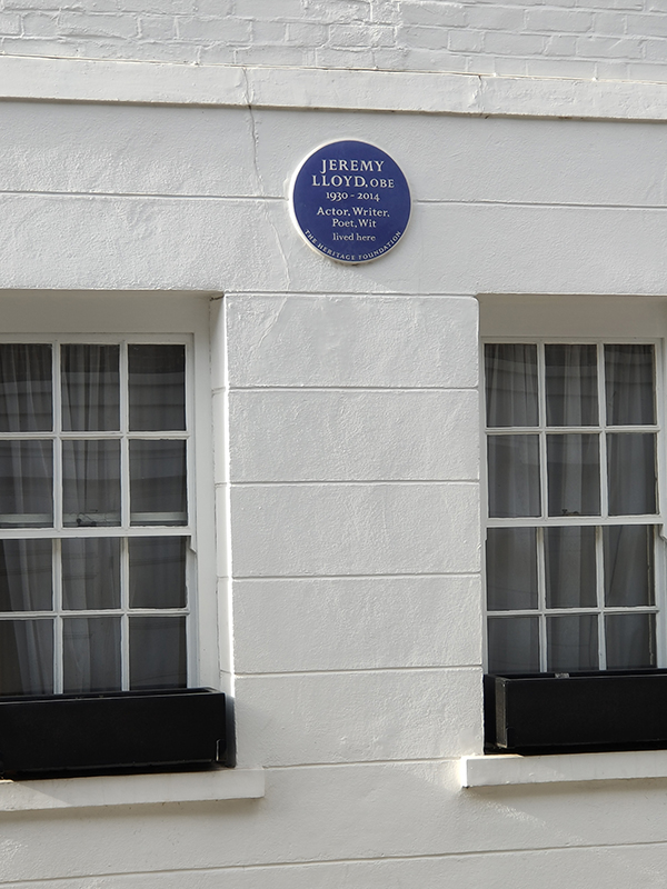
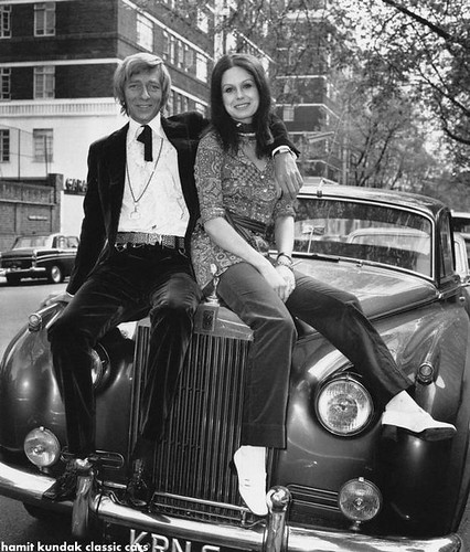
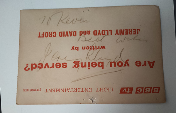
Next street along, moving eastward, is Cadogan Lane which is largely comprised of mews houses which back on to the grand residences of its neighbour to the west. At no. 40 is an English Heritage (as opposed to GLC) blue plaque in honour of the writer and actor, Jeremy Lloyd (1930 – 2014). Lloyd is perhaps best known as the co-writer (with David Croft) of the sitcoms Are You Being Served and ‘Allo ‘Allo. In 1974 (at the age of 14) I went with my grandparents to see the recording of an episode of the former at the BBC’s White City studios. To my embarrassment, my grandma collared Jeremy for his autograph.

To the north Cadogan Place extends across Pont Street and here at no.4 Judy Garland died in June 1969 having accidentally overdosed on barbiturates. That house was eventually demolished in 2019.

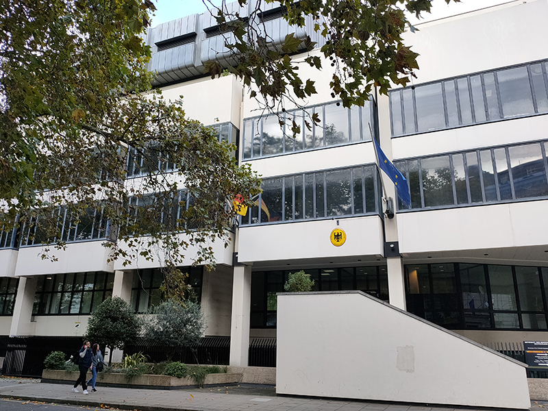
No launderette of the day this time unsurprisingly so you’ll have to make do with London’s finest dry cleaners which we turn right past to get to Chesham Street where we immediately take a left into Chesham Place. It’s here you’ll find the German Embassy, or rather the 1970’s extension thereof. Amazingly, this won the Westminster City Council prize for architecture in 1978.

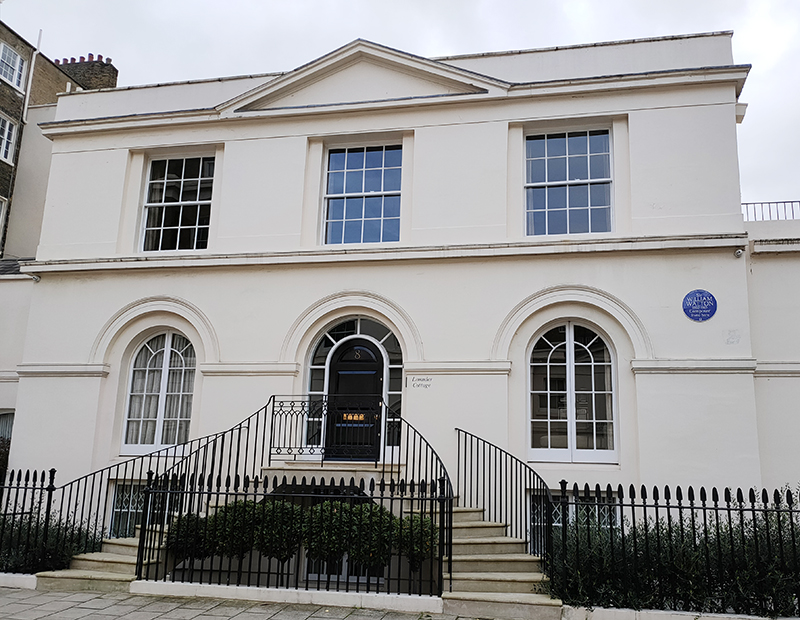
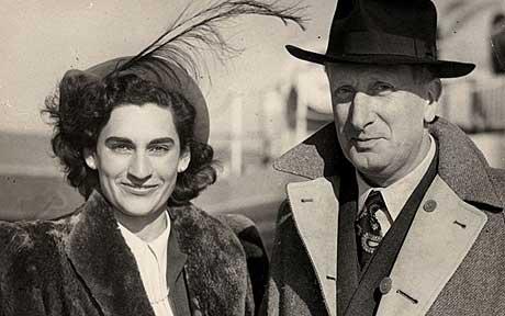
Next up is Lowndes Place where the composer, William Walton (1902 – 1983) lived. Among Walton’s orchestral works were marches he wrote for the Coronations of both King George VI and Queen Elizabeth II, entitled Crown Imperial and Orb and Sceptre respectively. Of the 13 film scores he composed those for the three Laurence Olivier-produced Shakespeare adaptions Hamlet, Henry V and Richard III are probably the best known. In 1934 Walton began an affair with Alice, Viscountess Wimborne, his senior by 22 years, which lasted until her death in 1948. Later that same year he met and married (in Buenos Aires) Susana Gil Passo who was 24 years his junior.

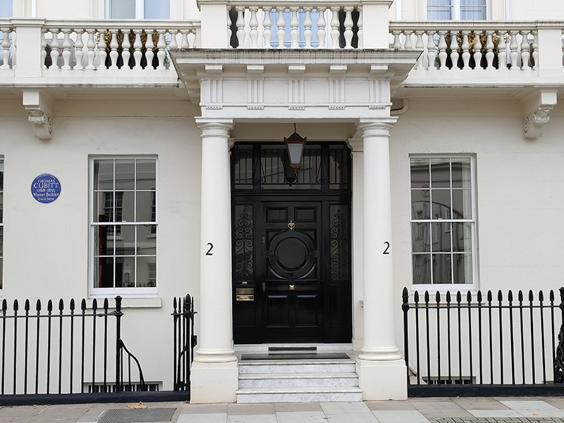
At the end of Lowndes Place we turn right into Eaton Place then right again up Lyall Street which was home to the master builder, Thomas Cubitt (1788 – 1855) who featured prominently in Day 69.

At the top end of Lyall Street we make a sharp left turn back down Chesham Street to the westernmost section of Eaton Place which plays host to the Chilean Embassy.

After turning off onto Lyall Street again we follow Eaton Mews North back to Eaton Place.

This next stretch of Eaton Place, going east, is the site of another embassy, that of Hungary. Though (and I’ll hate myself in the morning for saying this), judging from the number plate, that car would be more at home outside the German embassy.

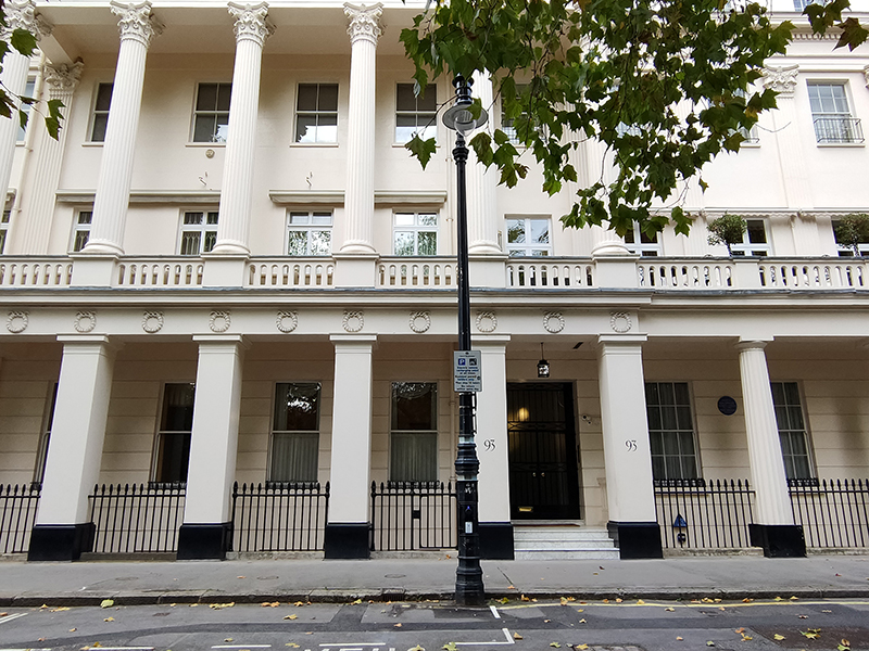
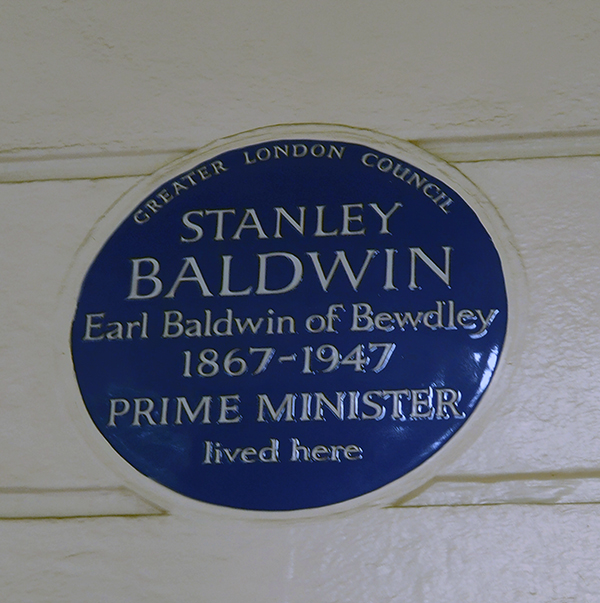
We turn right beyond the embassy down Belgrave Place then switch back westward along a previously unexplored section of Eaton Square. The grandest of the houses along here (no.93), with its double set of columns, was once the residence of Stanley Baldwin (1867 – 1947). Baldwin served as Prime Minister on three separate occasions, May 1923 to January 1924, November 1924 to June 1929, and June 1935 to May 1937. During the last of these stints the country was ruled by three different monarchs, George V, Edward VIII (although he was never crowned) and George VI. These days, of course, it’s hard to imagine a Conservative PM seeing out a full term of office let alone remaining as leader after losing even one election.

Just a few doors away, at no. 86, lived Edward Wood, 1st Earl of Halifax (1881 – 1959). He held various ministerial posts during the first and last of Baldwin’s three terms of office and in between time served as Viceroy of India from 1926 to 1931. Neville Chamberlain appointed him as Foreign Secretary in 1938 and he initially gave his support to the appeasement of Nazi Germany. However, after Hitler’s invasion of Czechoslovakia, he became a proponent of resistance to further German aggression. On Chamberlain’s resignation early in May 1940, Halifax effectively declined the position of Prime Minister as he felt that Winston Churchill would be a more suitable wartime leader. Following the retreat from Dunkirk, Halifax proposed trying to reach peace terms with Hitler using Mussolini as an intermediary. He was overruled by Churchill after a series of stormy meetings of the War Cabinet and was subsequently eased out of the Foreign Office, becoming UK ambassador to the USA from 1941 to 1946.

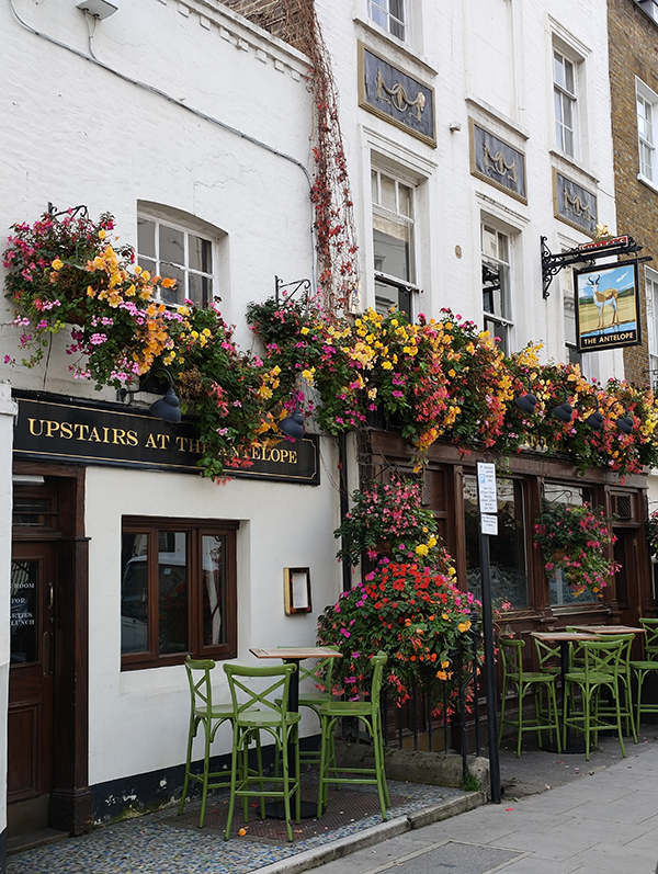
On the corner of Eaton Place and West Eaton Place is the house where Frederick Chopin gave his first London performance in 1848. West Eaton Place runs into Eaton Terrace where the Antelope pub is in full bloom.

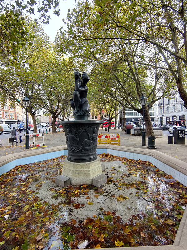
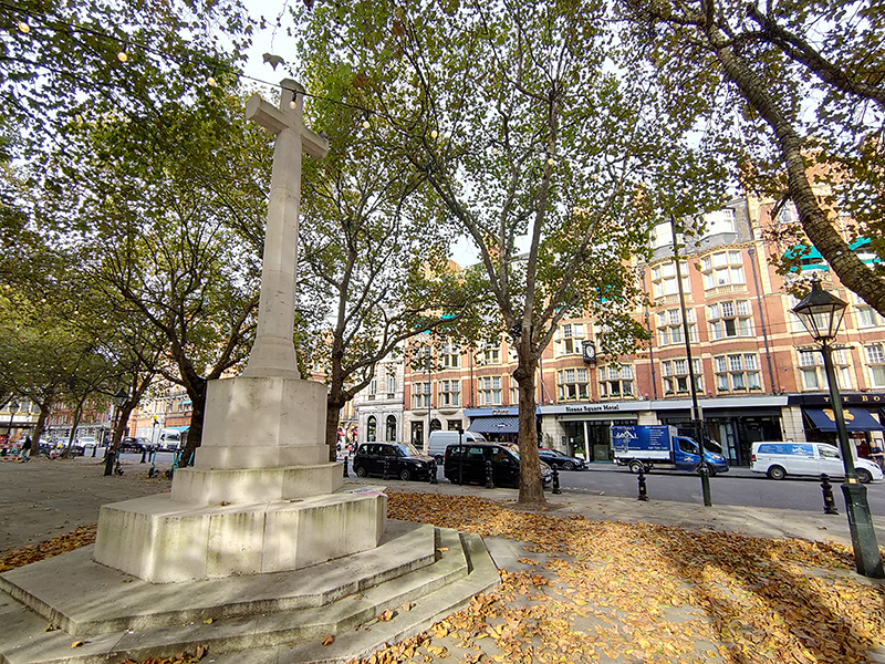
Beyond the pub, Cliveden Place takes us all the way back to Sloane Square. Before we finally leave the square via the southern section of Sloane Street I’ll just quickly mention the two monuments on the island. The Venus Fountain was created in 1953 having been designed by sculptor Gilbert Ledward. The fountain itself depicts the Goddess Venus, and on the basin section is a relief which depicts King Charles II and Nell Gwynn by the Thames. At the other end, the Chelsea War Memorial is a slightly off-centre cross made of Portland Stone with a large bronze sword affixed to its west face.

This section of Sloane Street, which runs down to join Chelsea Bridge Road, is lined on its west side by impressive Dutch style red-brick buildings built in the 19th century at the instigation of Earl Cadogan.

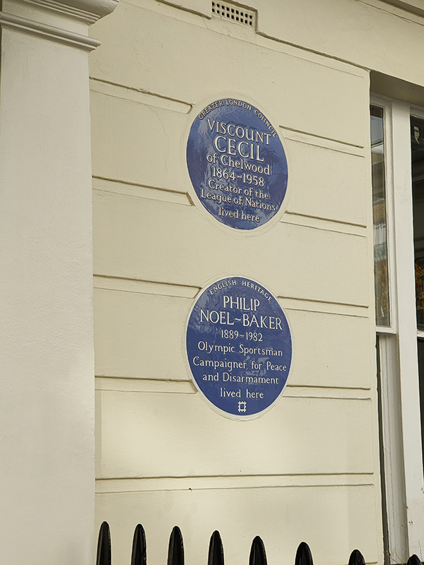
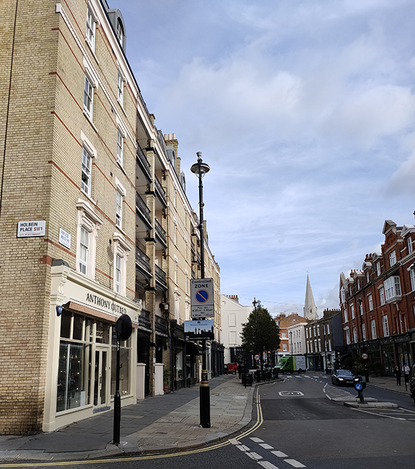
A good run of streets now before we get to the next point of interest (yet more of those blessed blue plaques !). So we’re working our way east to get to South Eaton Place and taking us there are Sloane Gardens, Holbein Place, Whittaker Street, Bourne Street, Caroline Terrace, Eaton Terrace, Eaton Gate, Lyall Street and Eaton Mews West. On reaching no.16 South Eaton Place we are presented with two plaques. The topmost is in honour of Robert Cecil, 1st Viscount Cecil of Chelwood (1864 – 1958) one of the creators of the League of Nations post-WW1 and accordingly winner of the Nobel Peace Prize in 1937 (though I’d rate that as the very definition of a pyrrhic victory given what happened two years later). The one underneath celebrates Philip Noel-Baker (1889 – 1982) the politician, diplomat, academic, athlete, and renowned campaigner for disarmament. He carried the British team flag and won a silver medal for the 1500m at the 1920 Summer Olympics in Antwerp, and (how’s this for coincidence) also received the Nobel Peace Prize (in 1959). So far, he is the only person to have won both an Olympic Medal and a Nobel Prize.

We’re heading back west to the top end of Chelsea Bridge Road next by means of Chester Row, Graham Terrace and Holbein Mews.

Holbein Mews

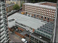
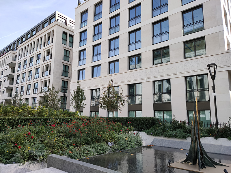
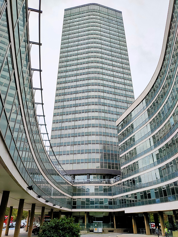
The 12-acre site to the east of Chelsea Bridge Road between Pimlico Road and Ebury Bridge Road was formerly occupied by the Chelsea Barracks. The original barracks, designed to house two battalions of infantry, were completed in 1862 and comprised a long and monotonous brick structure broken by towers in the centre. It also included a chapel which still remains (and which we will come to later). In the late 1950s these original buildings were demolished and in June 1960, construction started on new barracks primarily consisting of two 13-storey concrete tower-blocks which were used to accommodate four companies from the Guards Regiments.

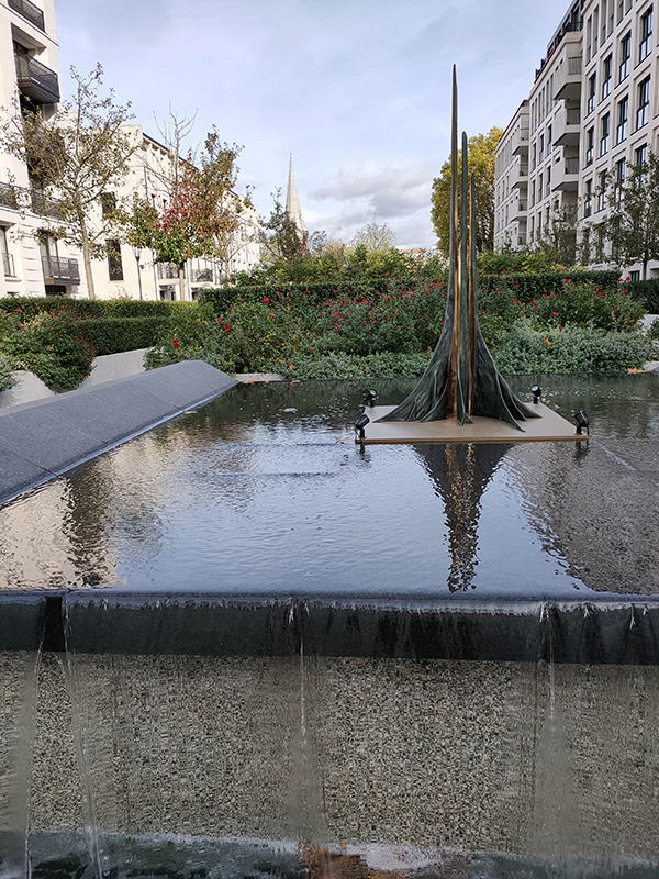
In 2005 the then government announced that Chelsea Barracks would be sold and three years later the site was vacated with the troops transferred to the Royal Artillery Barracks at Woolwich. In the meantime, a sale to the Qatar Investment Authority for £959m had been agreed subject to Westminster Council’s stipulation that 50% of any residential units should be affordable housing. The original development scheme proposed, a contemporary design with a series of copper, glass and concrete pavilions, by Rogers Stirk Harbour + Partners met this requirement but was withdrawn after criticism from Prince Charles. A new masterplan – designed by Squire and Partners – was approved by Westminster Council in 2011. Under this scheme the site would be redeveloped in multiple phases over several years and would incorporate 448 residential units including 123 affordable units (27%), as well as a new leisure centre, NHS medical centre, community centre and local shops. Phases 1 to 3 have now been completed and ground has been broken on phase 4.

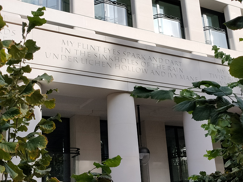
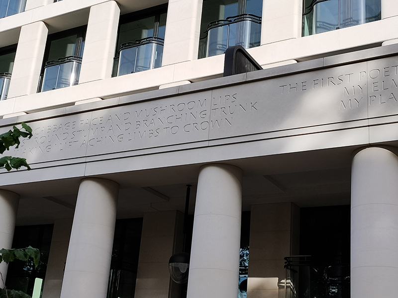
As you can see the results are a long way short of awe-inspiring and, to make matters worse, the buildings facing on to Chelsea Bridge Road have some of the naffest poetry I’ve ever encountered etched in their walls. Cabbage face and mushroom lips my arse ! The Qataris are also noticeably more comfortable advertising their involvement in this project that others around the capital. According to one of the security guards the penthouse apartments have a guide price of around £120m.

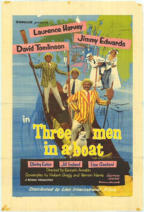
Anyway, moving on, we follow Chelsea Bridge Road down to its eponymous river crossing then backtrack to the start of Ebury Bridge Road. On the corner here is a plaque marking the flat where Jerome K. Jerome (1859 – 1927) wrote his timeless Three Men In A Boat in 1889. This humorous account of a two-week boating trip on the Thames upstream from Kingston to Oxford has been filmed numerous times including the 1956 screen adaptation, with David Tomlinson as J., Jimmy Edwards as Harris and Laurence Harvey as George, as well as German and Russian language versions.

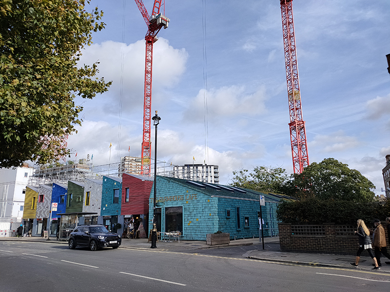
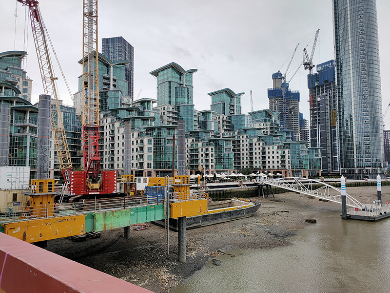
Heading east along Ebury Bridge Road, with a quick detour into Gatcliff Road, yet another massive development on the south side is at least trying something different with these colourful (but temporary) work and community spaces.

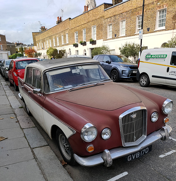
I mentioned earlier that I’m no car buff but who doesn’t love an old Wolseley like this one on St Barnabas Street.

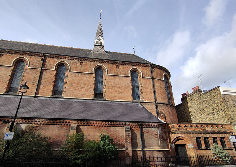
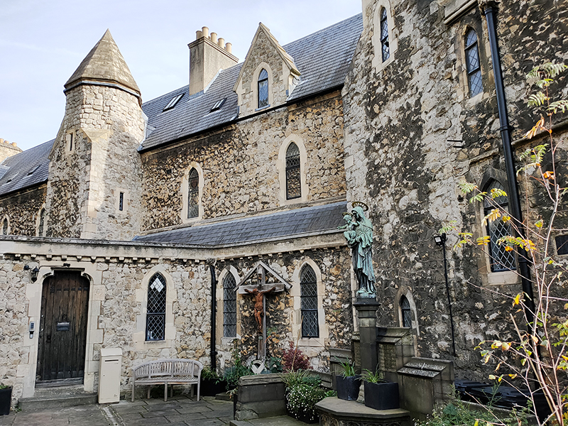
St Barnabas Street intersects Ranelagh Grove where you’ll find that chapel referred to above. As noted, this example of mid 19th Century Romanesque-Byzantine style with Venetian Gothic elements is the only thing that remains of the original barracks. As part of the current development this Grade II listed building was fully restored, including a new bell cast by the world’s largest foundry, John Taylor & Co., and is now home to the Prince’s Foundation (as in Charles of course) – funny that !

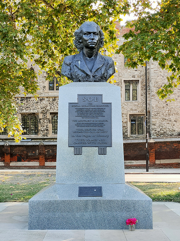
Our route takes us back west briefly next, Bloomfield Terrace leading into Pimlico Road which we follow down past Dove Place and Whistler Square (phase one of the Barracks development) before doubling back as far as Passmore Street. En route we pass the southern end of Holbein Place where there is a memorial to WW2 SOE agent Yvonne Cormeau (1909 -1997). In 1940 her husband, who had enlisted in The Rifle Brigade and been sent back to the UK after being wounded, was killed when their London home was bombed. Yvonne’s life was saved by a bathtub which fell over her head and protected her but not her unborn baby. Shortly thereafter she joined the WAAF (to “take her husband’s place) and in 1943 was recruited by the SOE where she was swiftly promoted to Flight Officer. Later that year she was parachuted into southwestern France to be the wireless operator for the SOE network there; a role she carried out until the liberation of France 13 months afterwards. Before dedicating herself to the SOE she placed her 2-year old daughter with a convent of Ursuline nuns in Oxfordshire.

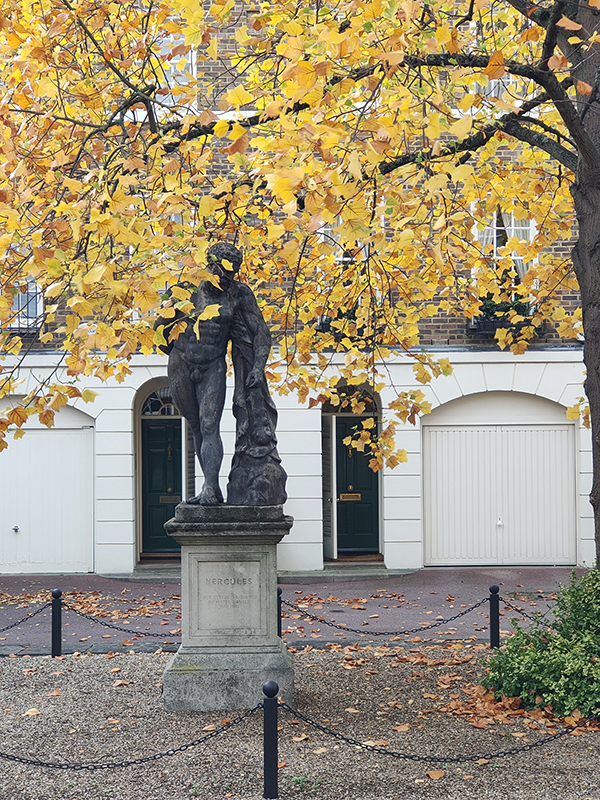
Once on Passmore Street we take an almost immediate right turn into Bunhouse Place which takes us back onto Bourne Street. In Ormonde Place, a discreet a relatively recent private residential development on the west side there is a somewhat incongruous statue of Hercules (about which I can find no further information).

St Mary’s Anglican Church on Bourne Street was built ‘quickly and cheaply’ in 1874, with the intention of providing ministry to the poor living in the nearby slums of Pimlico. Sadly, it appears there is little else of note to be said about it.

We pass the church to the south along Graham Terrace and make our way back to the intersection of Eaton Terrace and Chester Row for today’s pub of the day. The Duke of Wellington is devoid of other clientele when I enter but as I work my way through a (pretty good) fish finger sandwich and glass of Sauvignon there is a flurry of fresh arrivals (mostly tourists).

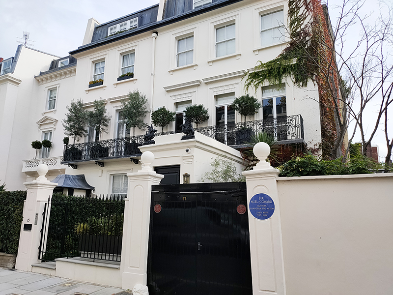
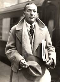
We make our way back along Chester Road then drop down South Eaton Place to Gerald Road to continue east. Here we find the last (blue) plaque for today commemorating the residence at no. 15 between 1930 and 1956 of the playwright, composer, director, actor, singer and noted wit, Sir Noel Coward (1899 – 1973). During this period, he penned two of his most successful stage works, Private Lives and Blithe Spirit and collaborated with David Lean on the patriotic WW2 films In Which We Serve and This Happy Breed. Subsequently, in 1945, he also provided the (uncredited) narration for Lean’s Brief Encounter.

From Gerald Road we turn right onto Elizabeth Street then head back west along Ebury Street. Next left, Semley Place, leads into Ebury Square and off the south-western corner of the square, where the very short Avery Farm Row adjoins with Pimlico Road, stands the Memorial Fountain to Richard Grosvenor, 2nd Marquess of Westminster. Created in an Italian-renaissance style in around 1869 this incorporates four enamel mosaics by the renowned Italian glassmaker and artist, Antonio Salviati.

We make our way back up the west side of the square into Cundy Street. I was shocked to learn (from another security guard) that the splendid 1950’s estate, designed by T.P Bennett with a definite nod to Art Deco, is scheduled for demolition. Grosvenor Estates, which owns the site has received approval from Westminster Council to replace the existing 160 flats (44 of which are leased by the council) with new housing including 88 affordable homes, senior living housing for up to 170 people and 75 open market homes. These will be framed by new and improved green spaces and introduce a community hub, food store and cinema to the area. To my mind (and that of the existing residents who fought unsuccessfully against the plans) this could have been achieved without doing away with the current flats.

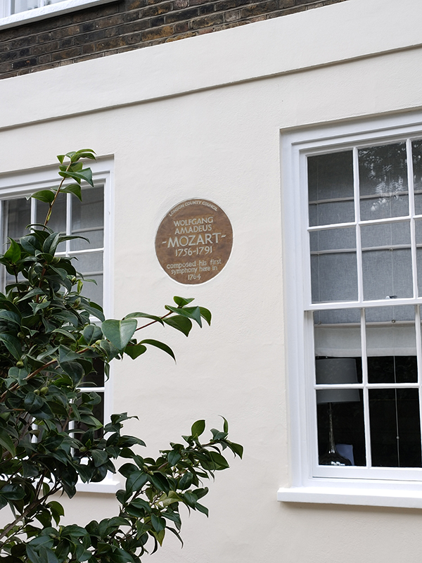
Back on Ebury Street is a today’s very final plaque (honestly). It’s one of the rare sepia brown London County Council ones from pre-WW2 and it commemorates the house in which Wolfgang Amadeus Mozart (1756 – 1791) composed his first symphony in 1764 (at the age of eight !).

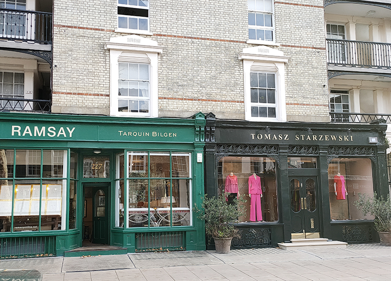
I don’t tend to focus on retail establishments very much but sometimes you just can’t help yourself.

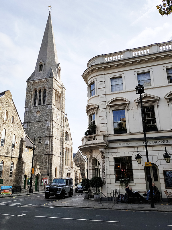
Ebury Street ends at Pimlico Road where we turn east briefly to find ourselves at the top end of St Barnabas Street. On the corner here is the Grade II listed Orange Pub and Hotel (formerly the Orange Brewery) which dates from 1845-6. And across St Barnabas Street is the Church of St Barnabas which is a year younger, having been completed in 1847 to the designs of Thomas Cundy (Junior).  It was one of the earliest Ritualistic churches, and the first in London in which all pews were free (charging for pews was normal practice at the time). The building was listed Grade I in 1958.

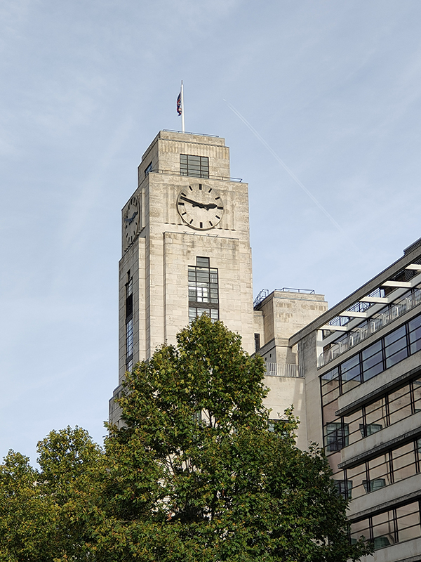
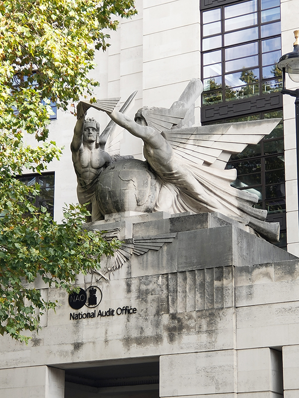
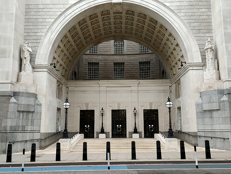
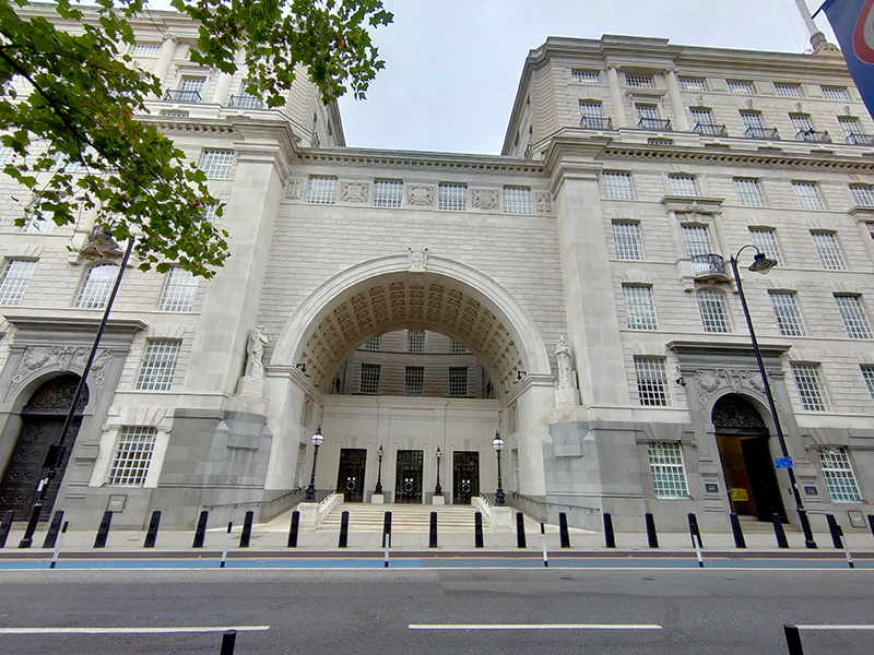
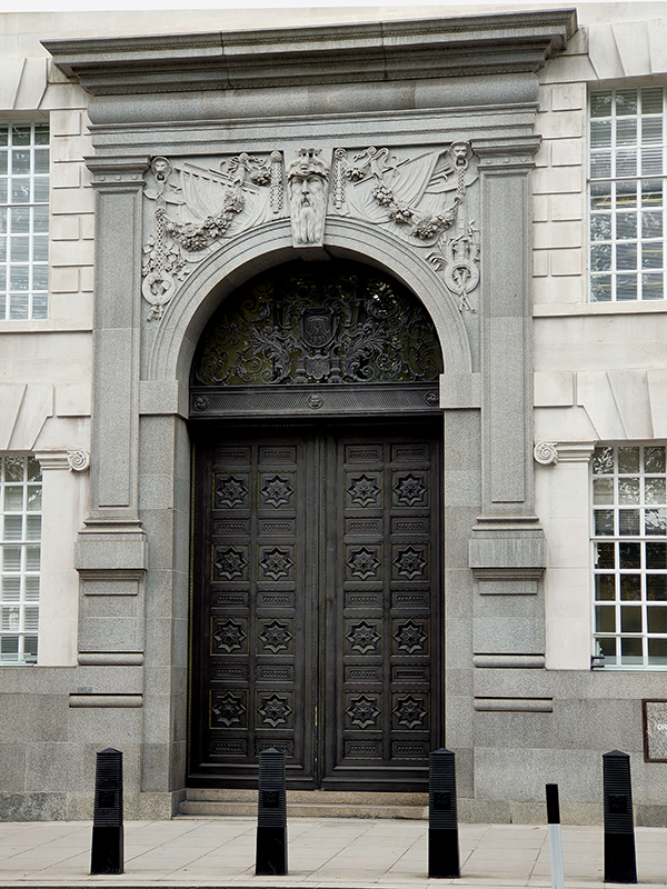
To finish off today (at last) we follow Ranelagh Grove and the last section of Pimlico Road onto Ebury Bridge Road and head up towards Victoria past the National Audit Office. This seminal example of Art Deco architecture was probably the last hurrah for that iconic style of building (at least as far as the UK is concerned). It was constructed as The Imperial Airways Empire Terminal and opened in June 1939 just months before the outbreak of WW2. Designed by the architect Albert Lakeman it has a symmetrical facade with a 10-storey central clock tower and wings curving forward to form a crescent shape. As well as being used by Imperial Airways for ticketing and checking in passengers, it was also used by the airline as a Head Office. The location was chosen because the Air Ministry insisted that Southampton had to be used as base for flying boat services, and this was the only site that backed on to what was then Southern Railway station. Over the years the name of the building changed in synch with changes to the national airline, becoming first the BOAC Terminal and then the British Airways Terminal. The building closed to passenger use in 1980, partly due to pressure on BA to cut costs and also because it became redundant as Heathrow Airport gained direct transport links. It was officially listed a year later and since 1986 has been occupied by the National Audit Office, the independent Parliamentary body with responsibility for auditing central government departments, government agencies and non-departmental public bodies. The sculpture above the entrance, “Wings Over The World” designed by Eric Broadbent, is the only remaining external clue as to the building’s original use.

Day 72 – Sussex Gardens – Praed Street – Paddington Basin

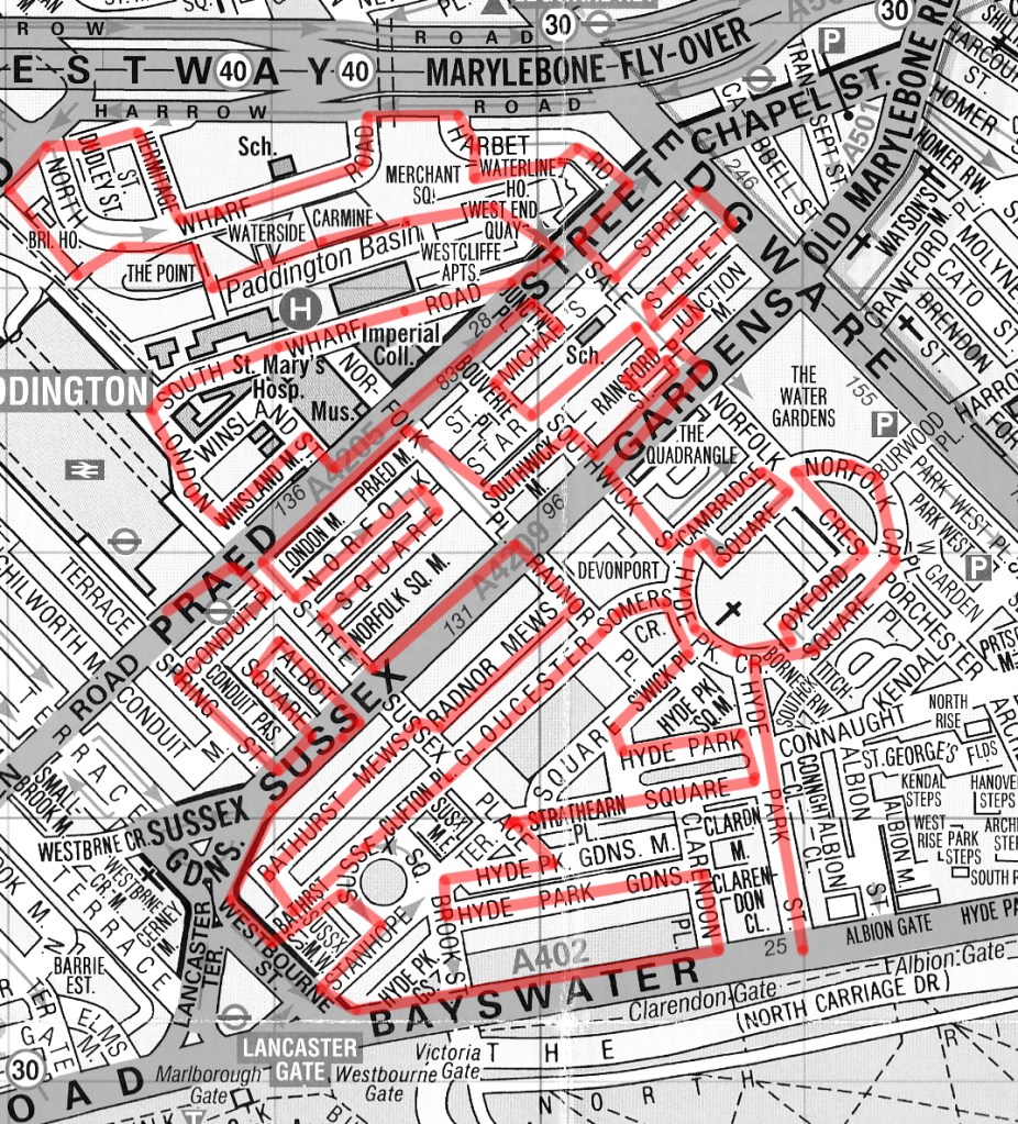
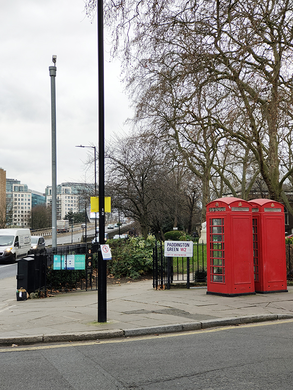
After another lengthy hiatus we’re finally back on the beat and for this trip we’ve moved south from where we finished last time, across the Westway into the area between Paddington Station and the Edgware Road.

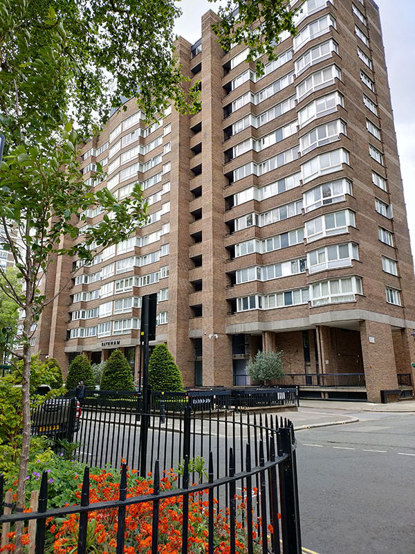
We start out on Bayswater Road and head north up Hyde Park Street into the heart of the Hyde Park Estate. This residential district was originally developed in the early 19th century on land owned by the Bishop of London. In 1836 ownership of the freeholds passed to the Ecclesiastical Commissioners (who became the Church Commissioners in 1948). A series of redevelopments from the 1950’s through to the 1970’s saw a number of high density blocks of flats rise up amongst the remaining Victorian villas.

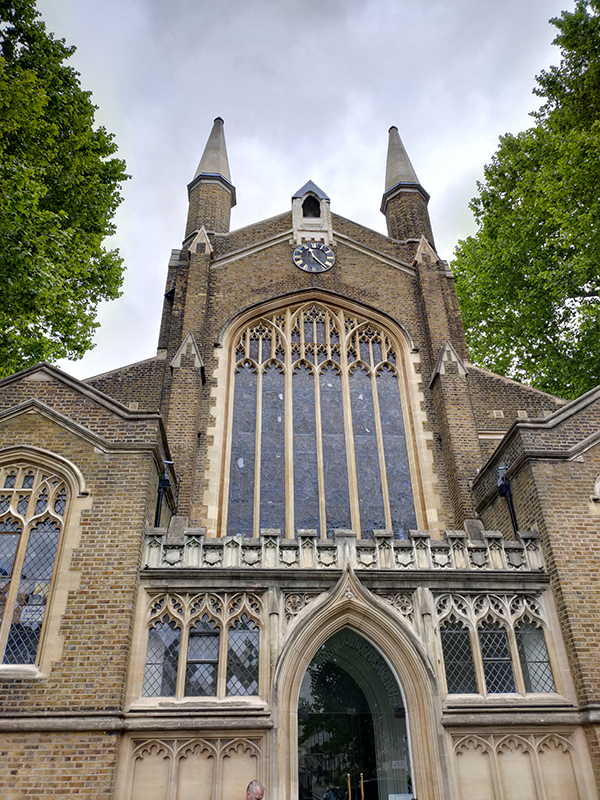
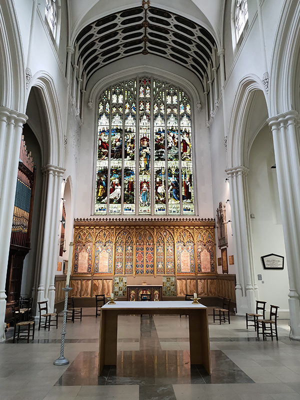
Having circled east on Norfolk Crescent we double back via Oxford Square to reach St John’s Church on Hyde Park Crescent. The church was designed by Charles Fowler (of Covent Garden Market fame) in a 13th century Gothic style and was consecrated in 1832. It has a long history of musical associations and in the 1960’s Beatles’ producer George Martin was invited to sort out the acoustics.

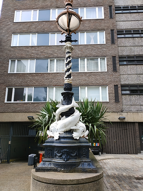
Having circumnavigated Cambridge Square we proceed northward on Southwick Street past a solitary representative of the “Dolphin” lamp posts familiar from the Thames Embankment. Unusually, in this case, the “dolphins” are white rather than black.

Taking a right turn onto Sussex Gardens we pass the Monkey Puzzle Pub. It’s pretty rare to see an example of Araucaria araucana these days so this one was a welcome sight. Also had a sudden memory flash as I recalled meeting an old school friend here for a drink many, many years ago despite this being an area that I have never had any familiarity with.

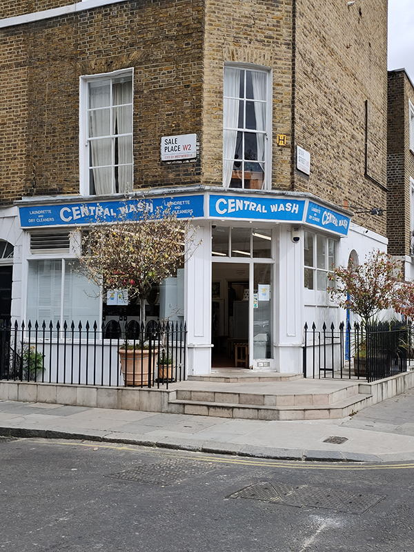
We resume a northward trajectory on Sale Place, passing Junction Mews, on the corner of which stands a house bearing the sign “Boatmen’s Institution”. In 1828, an organisation known as the ‘Paddington Society for Promoting Christian Knowledge among Canal Boatmen and Others’, purchased a stable and coach house with a view to creating a place of worship for the boatmen who transported goods along the Grand Union canal and their families. As Victorian Society generally looked askance at such families, partly because the boatmen worked on the Sabbath, it was difficult for them to gain acceptance in existing church congregations.

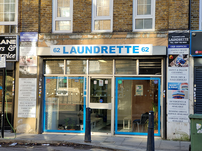
Sale Place is also home to this excursion’s launderette/laundrette of the day. Another example of the latter (mis)spelling.

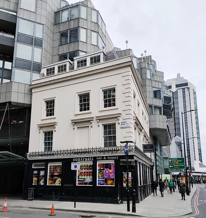
We make a brief visit to the Edgware Road via Star Street before returning to Sale Place along part of St Michael’s Street. Then we continue north up on to Praed Street where we turn right again just as far as Harbet Road. On the corner here is another pub conversion that gives a flavour of the changing tenor of this part of London.

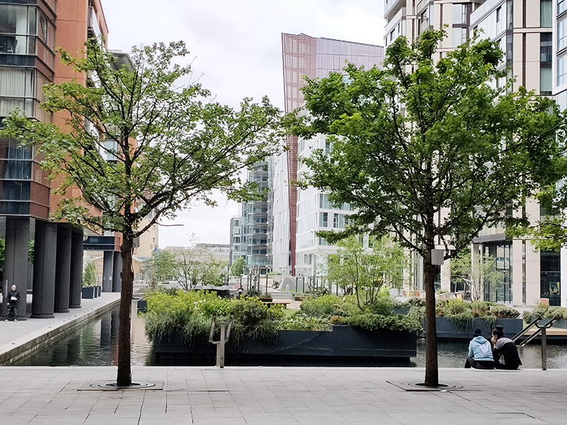
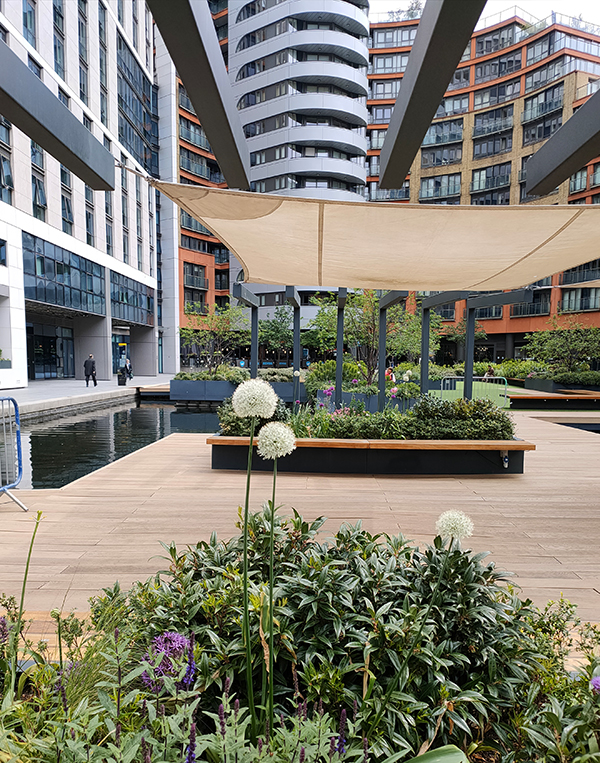
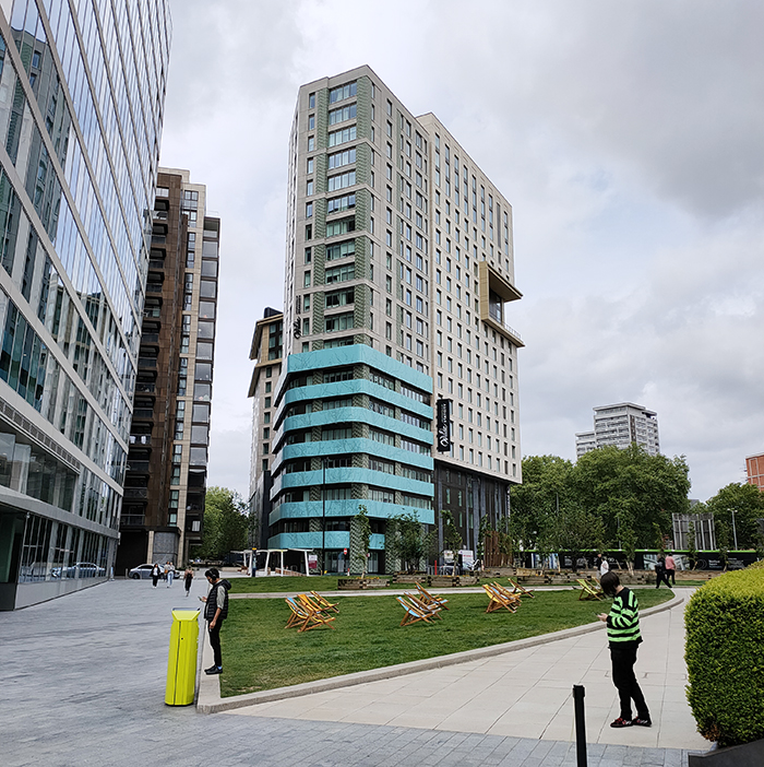
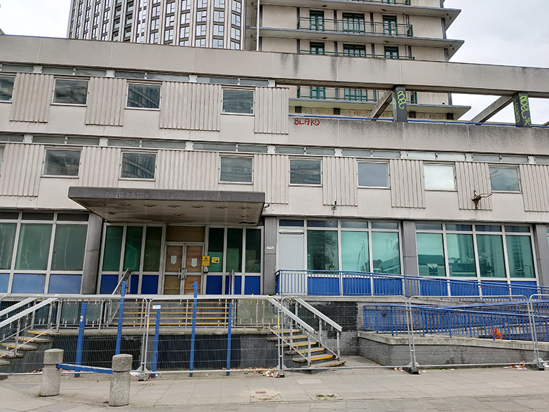
Harbet Road affords access into Merchant Square, a development built around the eastern end of the Paddington Basin. The first of the six buildings for which planning permission was granted was completed in 2013 and three others have been completed since. The remaining two, including 1 Merchant Square which, at 42 storeys, will be the tallest building in the City of Westminster, are still under construction.

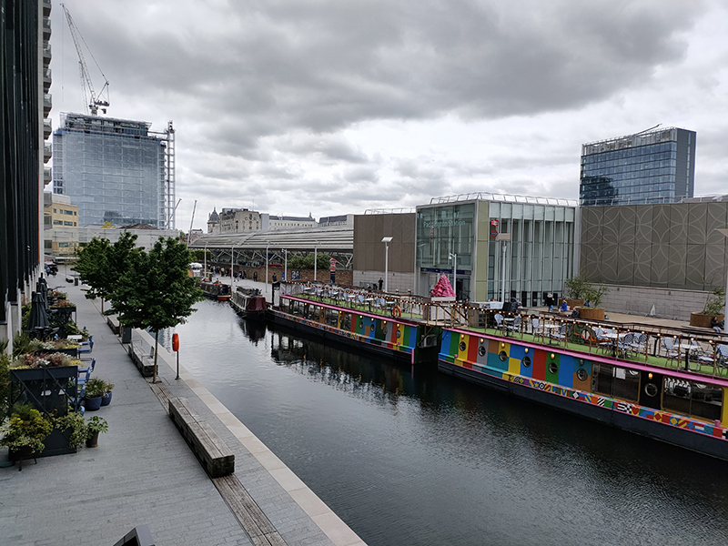
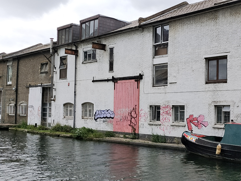
Cutting back on to Harbet Road we swing up to Harrow Road in the shadow of the Marylebone Flyover. We skirt the latter as far as North Wharf Road then follow this as far as Hermitage Street which takes us up to the eastern end of Bishop’s Bridge Road. The bridge itself crosses over the final stretch of the Paddington Arm of the Grand Union Canal which runs from Little Venice down into the Paddington Basin. The Paddington Canal was opened in 1801, with the Basin chosen for its strong onward transportation links. Large furniture depositories arose around the Paddington Basin and its wharves were soon handling huge quantities of building materials, coal, hay, pottery and for the return journey, manure for agriculture and household rubbish to fuel brickyard kilns. However, its heyday was short-lived; within twenty years the Regents Canal had been built allowing goods to be transported from the Grand Union through to the River Thames and the Port of London rendering the Paddington Basin largely redundant.

We drop down from the bridge onto Canalside Walk with its array of modern eateries then nip across into North Wharf Road again following this round to the western end of the Paddington Basin which was redeveloped earlier in the 21st century. On the way back to Merchant Square we pass the Fan Bridge and a statue of Sir Simon Milton, who as Deputy Mayor for Policy and Planning during Boris Johnson’s Mayoral administration, was largely responsible for overseeing the regeneration of the Basin.

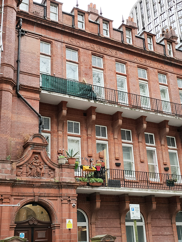
Exiting Merchant Square onto Praed Street we turn back west as far as the junction with South Wharf Road. Here stands the one-time Grand Junction Arms, a splendid representative of the former estate of the Truman, Hanbury, Buxton brewing company (1666-ish to 1988). If you look closely you can just about make out the gargoyles. These days it operates as the Fantasia Grill House.

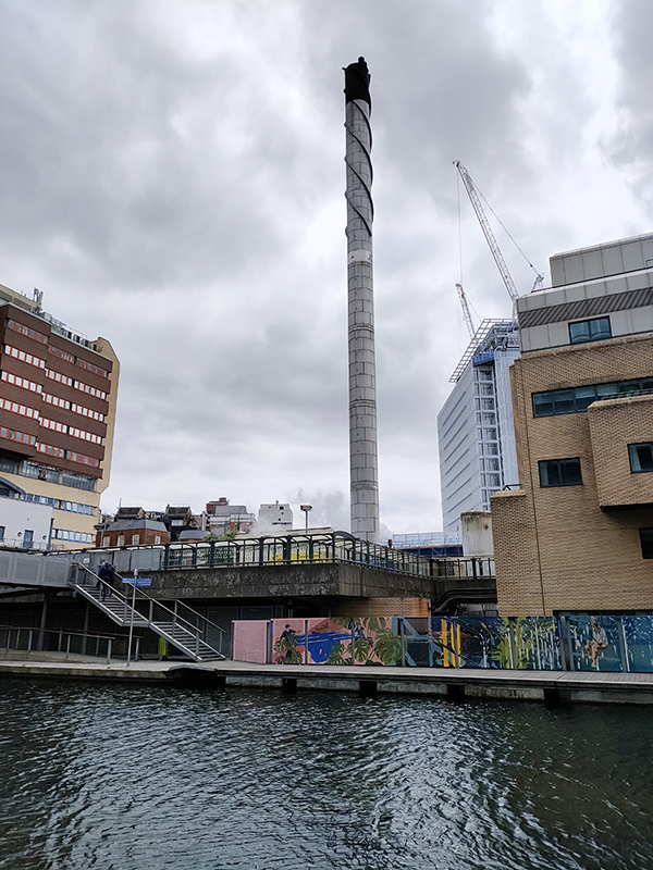
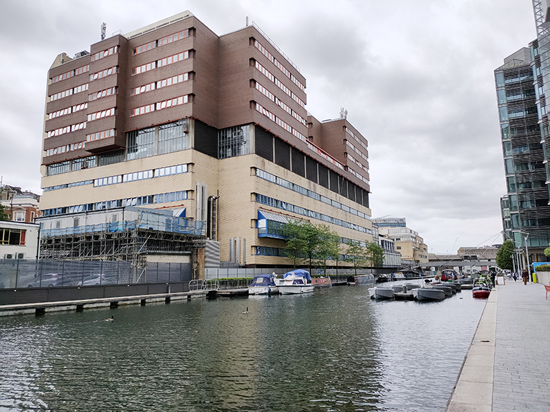
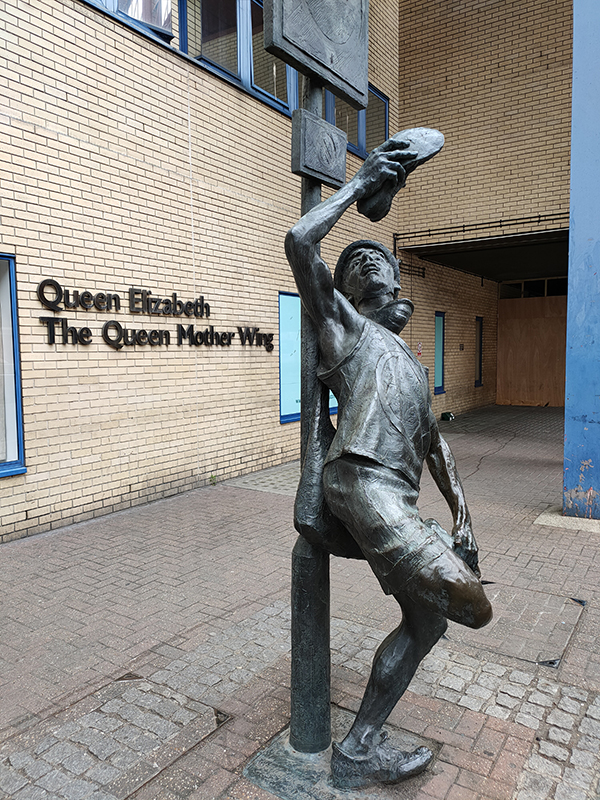
South Wharf Road runs through the middle of St Mary’s Hospital. To the north, abutting the Paddington Basin stands the modern Queen Mother Wing which was opened in 1987 and subsumed the services of Paddington General Hospital.

The Messenger, by Allan Sly

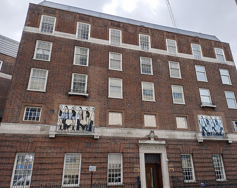
Across the road is the private Lindo Wing which opened in November 1937, having been financed by businessman and hospital board member Frank Charles Lindo, and has witnessed numerous royal and celebrity births. Amongst these being Princes William and Harry, musicians Elvis Costello and Seal and actor Kiefer Sutherland. The artworks on the windows were created as part of a 2012 exhibition by Julian Opie, perhaps best known for the cover of Blur’s “Best of” compilation in 2000.

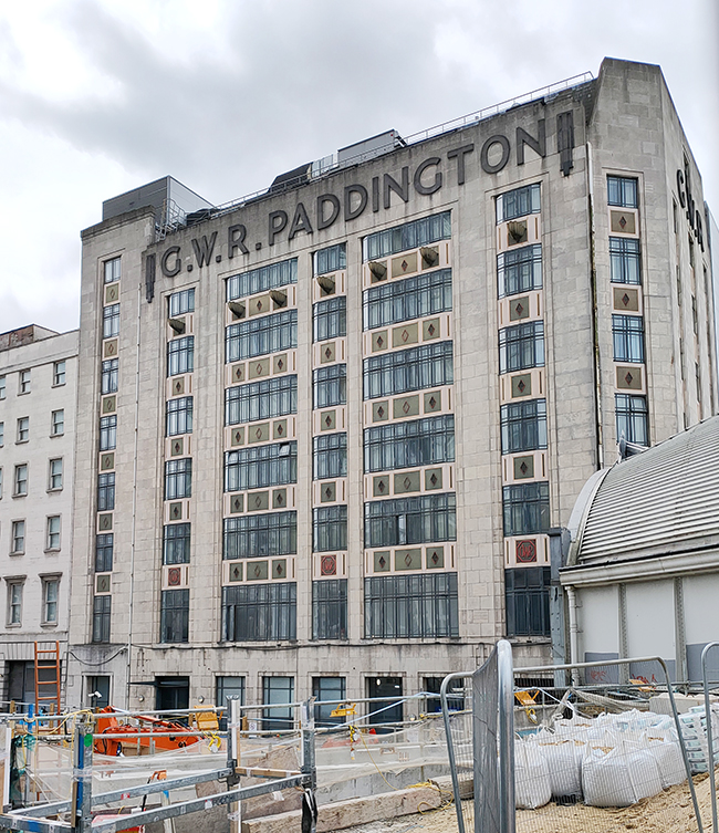
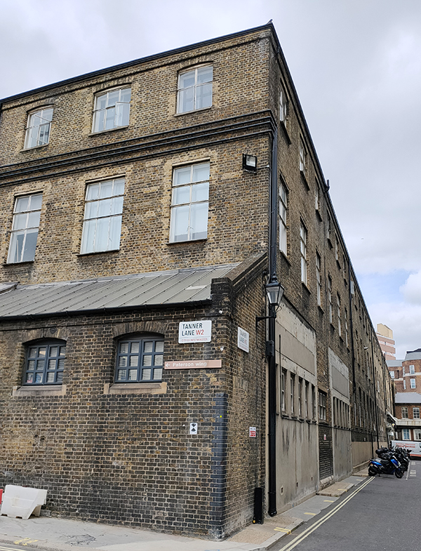
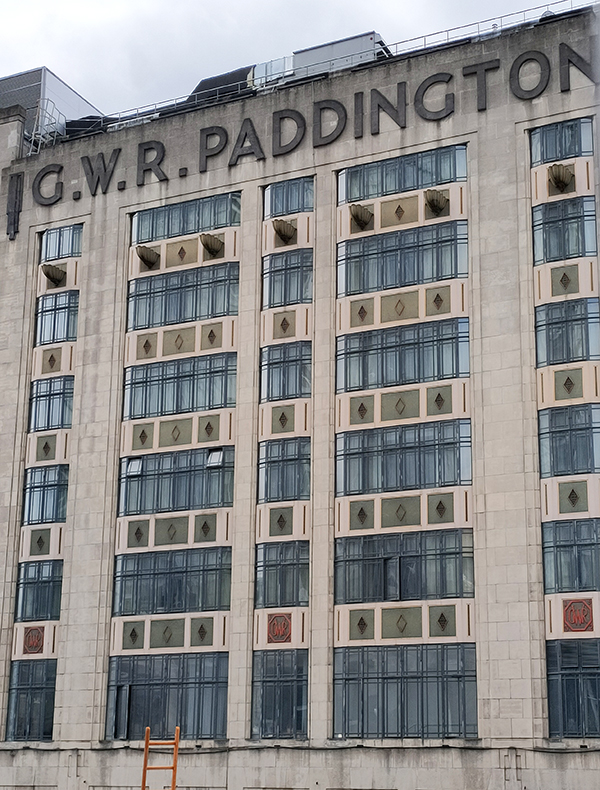
At the western end of South Wharf Road we turn left, where, because of the Paddington Square redevelopment on the east side of Paddington Station, the street configuration is different from that shown on either my printed map or Google maps. Since July 2020 a new road called Tanner Lane has fomed the connection with Praed Street and Winsland Street. It’s named after Sir Henry Tanner (1849–1935) the architect who designed the former Royal Mail sorting office on London Street which was demolished in 2018 to accommodate the Renzo Piano designed new development. During its period of vacancy from 2010 the Sorting Office moonlighted as a culture venue, hosting Punchdrunk’s 2013, A Drowned Man, and acting as a staging post for the 2012 Olympic Games. One small silver lining to its destruction is the view temporarily afforded of Paddington Station’s majestic Tournament House (1935).

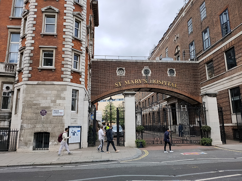
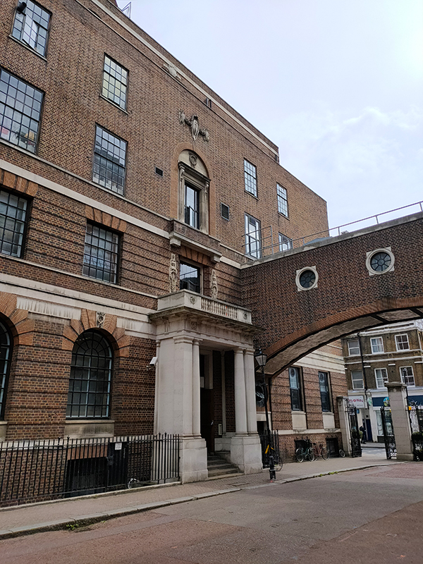
Moving back east along Praed Street we approach the The Clarence Memorial Wing, of St Mary’s Hospital which was designed by Sir William Emerson and opened in 1904.

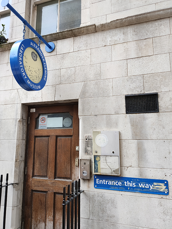
It was here that Alexander Fleming (1881 – 1955) discovered penicillin by happy accident in 1928. On 3 September that year he returned to his laboratory having spent a holiday with his family at Suffolk. Before leaving for his holiday, he had inoculated staphylococci on culture plates and left them on a bench in a corner of his laboratory. On his return, he noticed that one culture was contaminated with a fungus, and that the colonies of staphylococci immediately surrounding the fungus had been destroyed, whereas other staphylococci colonies farther away were normal, famously remarking “That’s funny”. He was able to identify the mould as belonging to the genus Penicillium. Fleming’s laboratory has been restored and incorporated into a museum about the discovery and his life and work, however the museum has not as yet re-opened post-pandemic.

On the other side of Norfolk Mews is the original incarnation of St Mary’s Hospital in Norfolk Place which was designed by Thomas Hopper in a classical style. It first opened its doors to patients in 1851, the last of the great voluntary hospitals to be founded. Among St Mary’s founders was the surgeon Isaac Baker Brown, a controversial figure who performed numerous clitoridectomies at the London Surgical Home, his hospital for women. Since 2008, St Mary’s has been operated by Imperial College Healthcare NHS Trust and the Norfolk Place site now forms one of the campuses of Imperial College’s Faculty of Medicine.

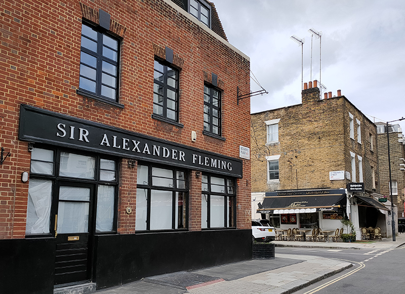
Beyond St Mary’s we turn south off Praed Street into Junction Place then swiftly make a right into another section of St Michaels Street. At the junction with Bouverie Place the pub named after Alexander Fleming sits as inactive as the museum. The Iraqi restaurant opposite appears to be flourishing on the other hand.

A combination of Star Street, Rainsford Street, Southwick Mews and Norfolk Place return us to Praed Street where we head west as far as Paddington Station before turning south again on London Street and almost immediately veering off into Norfolk Square. This is one of the few squares in the vicinity accessible to the public, which might be connected to the fact that the majority of the mid nineteenth century stuccoed terrace houses that surround it are now mid-range hotels (though that might be a slightly generous description). In any event nos. 2 to 22 have a Grade II listing.

After a circuit of the square, London Street drops us down onto Sussex Gardens. The section from here east as far as Radnor Place is equally well endowed with, well let’s call them budget plus, hotels.

Just off Radnor Place, Radnor Mews is a rare example of a mews with vehicle access at either end. There was a certain amount of rebuilding following WWII bomb damage but a number of original buildings survive nearer to the Sussex Place entrance.

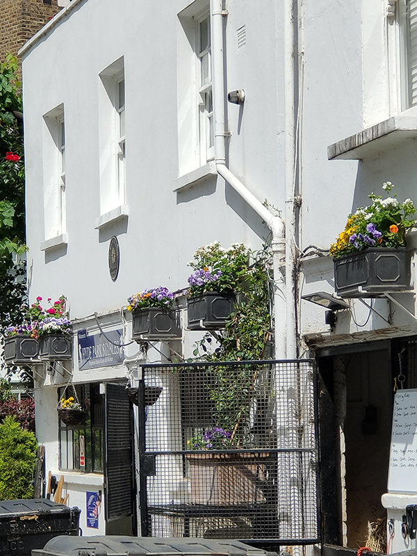
On the other side of Sussex Place is Bathurst Mews which like Radnor Mews originally provided stables for the larger properties in Gloucester Square and Sussex Gardens. However, unlike Radnor and, indeed, any other mews in London, Bathurst is still home to working stables. Hyde Park Stables and Ross Nye Stables are both at the western end of the Mews from where they offer horseback excursions into Hyde Park. As you can see below left, some of the residents at the eastern end have excelled themselves on the horticultural front.

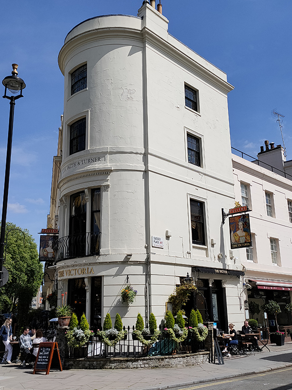
We exit Bathurst Mews onto Bathurst Street the proceed east through Sussex Square, Clifton Place, Gloucester Square and Somerset Crescent all the way back to Hyde Park Crescent and St John’s Church. Then we wend our way back west via Southwick Place, Hyde Park Square and Strathearn Place to arrive at today’s pub of the day, The Victoria on the corner with Sussex Place. A beautiful Victorian pub, dating from around 1864, The Victoria is a Grade II listed building with an interior than retains its original counter with panelled bays divided by fluted pilasters and a regency-style fireplace. The Theatre Bar, upstairs, has ornate fittings imported from the Gaiety Theatre about 1958. It was Fuller’s pub of the year in both 2007 and 2009 and does a mean club sandwich.

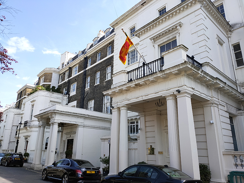
Suitably refreshed, we crack on with the last leg of today’s journey, joining Hyde Park Garden Mews from Sussex Place then swinging round into Hyde Park Gardens via Brook Street. Hyde Park Gardens is home to the Sri Lankan consulate which takes up several buildings.

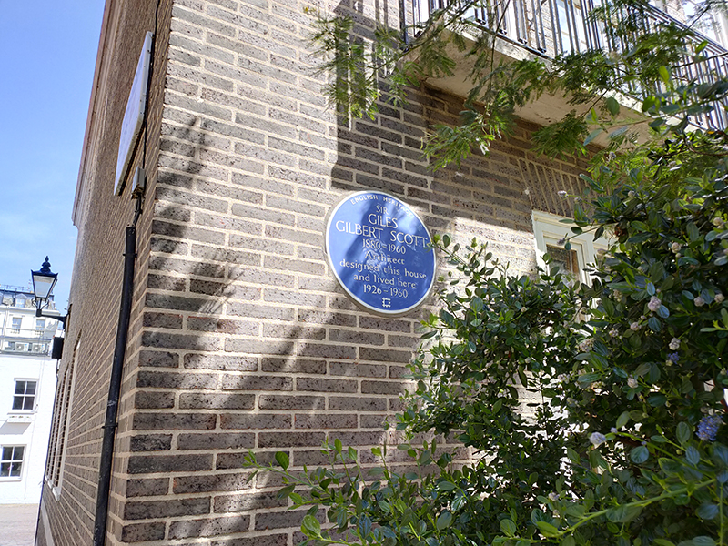
Beyond the consulate we turn right into Clarendon Place which drops us onto the Bayswater Road. On the way we pass Chester House designed and lived in (from 1926 to 1960) by, our old friend, Sir Giles Gilbert Scott (1880 – 1960). GGS is, of course, the man who brought us the red telephone box and both Battersea and Bankside Power Stations (the latter now Tate Modern).

We follow Bayswater Road west as far as Westbourne Street from where detour off to loop round Stanhope Terrace, Sussex Square and Bathurst Street before continuing up to the western end of Sussex Gardens. Turning east we circumnavigate Talbot Square, another one with rare public access to its gardens, before making our way back to Praed Street via Spring Street and Conduit Place.

We end today’s excursion opposite Paddington Station, which has seen enormous changes in recent times due to its participation on the Elizabeth Line. But we’ll delve into that next time.

Day 71 – Maida Vale – Little Venice

Switching our attention back to the north west for this excursion which, roughly speaking, covers the triangular area formed by Maida Vale, Warwick Avenue and Edgware Road tube stations. The name Maida Vale apparently derives from a pub called The Maida which formerly stood on Edgware Road near the Regent’s Canal. The pub was named in recognition of General Sir John Stuart, who was made Count of Maida, a town in Calabria, by King Ferdinand IV of Naples, after victory at the Battle of Maida in 1806. In contrast, the somewhat over-ambitious soubriquet, Little Venice, only became popularised in the latter half of the 20th century.

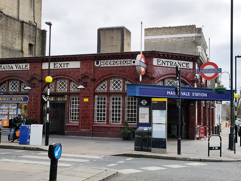
Starting point today is Maida Vale tube station which opened in June 1915 and consequently was the first station to be staffed entirely by women.

We turn right into Elgin Avenue which merges into Abercorn Place and then proceed as far as the junction with Hamilton Terrace. Here stands St Mark’s Church, consecrated in 1847 when this area was on the fringes of urban London. In 1870, Canon Robinson Duckworth became parson. Duckworth’s main claim to fame is that he introduced Alice Liddell, the daughter of his friend, Charles Liddell, to the Reverend Charles Dodgson, aka Lewis Carroll, on a boating trip. Duckworth himself appears in the foreword of an early edition of the Wonderland as ‘The Duck’ and Alice Through the Looking Glass is thought to have been written in the his vicarage.

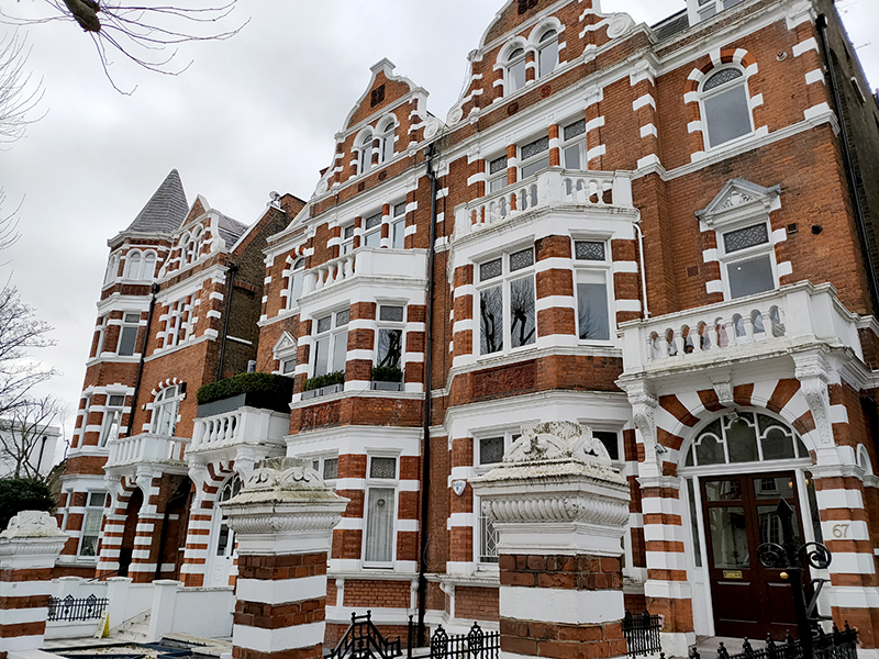
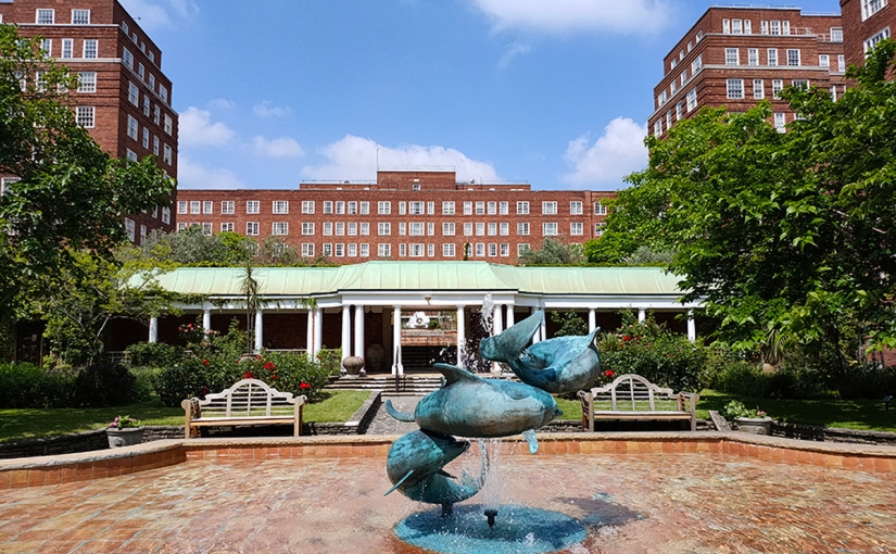
Like neighbouring, and equally affluent, St John’s Wood, Maida Vale is home to an architecturally diverse array of grand residential mansion blocks. The ones here generally predate those in the former, being mainly of late Victorian and Edwardian vintage.

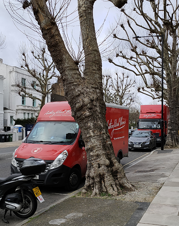
You don’t employ common or garden removal men round here – you need Master Removers.

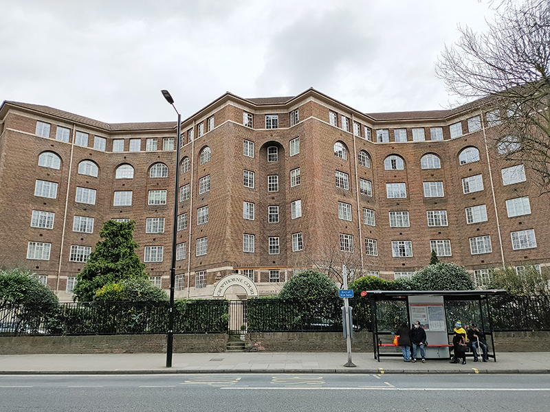
From St Mark’s we head south down Hamilton Terrace as far as Hall Road where we turn back west. On the corner of Hall Road and Maida Vale (A5) is the massive Cropthorne Court apartment block, built 1928-30 (one of the few from that era in this locale) and designed by (our old friend) Sir Giles Gilbert Scott (1880 – 1960). Flats here were originally let out for between £375 and £425 per annum. The building was Grade II listed in 2003 and, fittingly, it has its own telephone box.

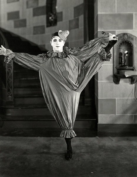
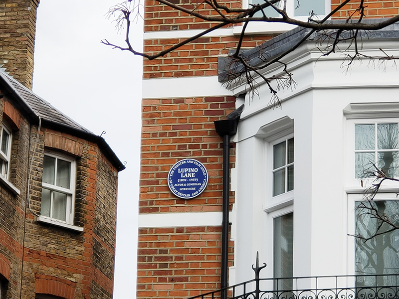
We turn up Maida Vale back towards Elgin Avenue and at no. 32 find a blue plaque commemorating the actor and music hall star, Lupino Lane (1892 – 1959). Born in Hackney, Lane, whose cousin was the screenwriter/director/actress Ida Lupino, started out as a child performer known as ‘Little Nipper’ and went on to make numerous appearances in theatre, film and variety. He moved to America in the 1920’s and forged a successful career in screen comedies before returning to England in 1929. In a rather neat segue from the last post, he is perhaps best known for playing Bill Snibson in the play and film Me and My Girl, which popularized “The Lambeth Walk”.

Also on Maida Vale is the gated Vale Close with its mock tudor pretensions and throwback attempts to keep the riff-raff at bay.

Going back to my point about the diversity of architectural styles there is a distinct Italianate feel to the brick-built parade on Elgin Avenue.

And on Lanark Road, which we follow next there’s another reminder of the social hierarchy that still feels implicit in these parts.

Sutherland Avenue is home to the Maida Vale Everyman Cinema which was purpose built in 2011.

Randolph Avenue takes us back to Maida Vale tube station where we turn left on to Elgin Avenue this time, proceeding as far as Ashworth Avenue which runs down Lauderdale Road. On the corner here sits the Lauderdale Road Synagogue which is one of the main centres for London’s Sephardi Jewish community. The Sephardi Jews first arrived in England in the 18th century fleeing the inquisitions taking place in Spain and Portugal. Originally, they congregated in the East End but by the late 19th century many wealthier members of the community had moved across to the new north-west suburbs. As a consequence, Lauderdale Road Synagogue was opened in 1896, constructed in the Byzantine style by architects Davis & Emanuel.  From 1887 to 1917 the Sephardi community was led from here by Haham Rabbi Moses Gaster who played a major role in the promotion of Zionism in the British Jewish community and at whose home the first meeting to plan the Balfour Declaration was held. As with the synagogue near Lord’s which we encountered a couple of posts back there was security on site to encourage me to move on, though I think my explanation for my interest just about convinced them.

Turning left, we are soon at five-way roundabout from where we take the first exit anti-clockwise and revisit Sutherland Avenue heading west. This is probably a good point to note just how wide some of the streets are round here (compared to nearly everywhere else in London). Many of them have parking on both sides (and sometimes in the middle) and still plenty of space for two-way traffic flow.

We drop south on Castellain Road then cut through Formosa Street to Warrington Crescent. On the way we call in at the Grade II listed Prince Alfred pub which was built in 1856 and is justifiably on the Campaign for Real Ale’s National Inventory of Historic Pub Interiors. Inside it retains its original “snob screens”, a Victorian invention comprised of an etched glass pane in a movable wooden frame which was intended to allow middle class drinkers to see working class drinkers in an adjacent bar but not to be seen in return. The Prince Alfred was also featured in David Bowie’s Grammy Award-winning short film “Jazzin’ for Blue Jean” (1984).

Warrington Crescent adds to the architectural mosaic with its Regency-style white painted stucco terraced town houses reminiscent of those we saw in Belgravia and Pimlico.

At no.75 there’s a blue plaque in honour of David Ben Gurion (1886 – 1973), the first Prime Minister of the state of Israel.  Ben-Gurion rose to become the preeminent leader of the Jewish community in British-ruled Mandatory Palestine from 1935 until the establishment of the State of Israel in 1948. He served as Prime Minister up to 1963 save for a short break in 1954–55. He led military operations during the first Arab-Israeli war which took place almost immediately following the declaration of independence and was instrumental in arranging for the extraction of Adolf Eichmann from Argentina by Mossad in 1960.

Back on the roundabout at the top of Warrington Crescent stands another impressive Grade II listed Victorian pub, the Warrington Hotel, built just a year later than its near neighbour. The Warrington has also retained its colourful original features including mosaic floors, stained glass windows, pillared porticos and art nouveau friezes.

On the other side of the hotel we turn southward again first on Randolph Avenue then on Randolph Crescent. At the end of the latter we turn right on Clifton Gardens and follow this back to the lower end of Warrington Crescent before taking Warrington Gardens to cross behind St Saviour’s church (which we’ll come to in a minute). Now we’re back on Formosa Street which links into Bristol Gardens. The houses on the right side of the latter have a distinctly Moorish feel to them. I came across a picture of these same houses from the early 1970’s that illustrate just how far up in the world this area has come in the last fifty years.

Next we follow Clifton Gardens, Blomfield Street and Warwick Place round to Warwick Avenue and head north up to the eponymous tube station. Also dating from 1915, Warwick Avenue has no surface building, the station being accessed by two sets of steps to a sub-surface ticket hall. It was one of the first London Underground stations built specifically to use escalators rather than lifts. 

As you can see. the Catholic Church of St Saviour stands beyond the station. The current church was built in 1976 replacing a gothic structure dating from 1855 which was demolished in 1972. The original church was deemed too large for its 1960’s congregation and so the site was redeveloped to incorporate a block of flats behind a new brick church building designed by architects Biscoe and Stanton. Local interest groups had lobbied to retain the original tower, as it was felt a vertical feature was desperately needed in the area as Warwick Avenue is one of the broadest streets in London. However, the proposal was ignored in favour of the fiberglass spire we see today.

We retrace our steps eastward on Clifton Gardens then swing round Randolph Road and Clarendon Gardens back onto the southern section of Lanark Road and follow this back up to Sutherland Avenue. Then we return past Cropthorne Court on another stretch of Maida Vale that incorporates two more enormous mansion blocks, Clive Court and Rodney Court, the former dating from 1923 and the latter built in 1915.

Clive Court (1923)
Rodney Court (1915)

We run down as far as Clifton Road which has a suitably upmarket parade of shops including a Village Butcher’s. There’s also yet another red phone box here. This area must have the highest density of them in London.

From Clifton Road we take a peek at Lanark Place and Clarendon Terrace and then work our way down to the Regent’s Canal via Randolph Avenue. Blomfield Road runs along the north side of the Canal through so-called Little Venice. As noted in a previous post the 8.6 mile long Regent’s Canal links the Paddington arm of the Grand Union canal in the west with Limehouse Basin in the east. Construction of the canal formed part of architect John Nash’s grand redevelopment of central north London for George IV (conceived when the latter was still Prince Regent). The first section from Paddington to Camden Town, which includes where we are today, opened in 1816 and included a 274 yard long tunnel under Maida Hill.

We follow Blomfield Road alongside the canal as far as Westbourne Terrace Road just beyond the triangular basin where the Puppet Theatre Barge is moored. The Puppet Theatre Barge began life as a marionette theatre touring company called Movingstage, founded by Juliet Rogers and Gren Middleton in 1978. Several years later, the company acquired a 72ft-long Thames lighter and converted it into a permanent puppet theatre. The stage was specially designed to put on shows using string marionettes, and the seating raked to ensure a good view from every seat. Initially, the Barge was based in Camden Lock and toured the Grand Union Canal in the summer. Then in 1986, it moved its winter base to Little Venice and each summer went up the River Thames, sometimes as far as Oxford.

In the middle of the Basin sits Browning’s Island, named for the poet Robert Browning (1812 – 1889) who lived on Warwick Crescent for most of the latter part of his life. Browning is also credited with being the first person to coin the name Little Venice though there are those who maintain that Lord Byron beat him to it by several years. The island is popular with waterfowl including cormorants, swans, Egyptian Geese and various species of duck.

Westbourne Terrace Road starts with a bridge across the canal which we use to get to Delamere Terrace which runs west parallel to the southern canalside. On the corner here is the Canal Cafe Theatre which holds the dubious privilege of being the only venue to have staged a piece of work written by myself – albeit just a sketch in a 2016 comedy revue. Operating here since the 1970s, the theatre is better known for hosting Newsrevue, the world’s longest running live comedy show (Guinness Book of Records certified) which in March 2020 was forced to close for the first time in over 40 years by the Covid pandemic.

A westward circuit comprised of Chichester Road, Bourne Terrace, Blomfield Villas and Delamere Street takes us through the least salubrious section of today’s walk and deposits us back on Westbourne Terrace Road where we turn back north and then follow Warwick Crescent east beside the south side of the basin. At the end of Warwick Crescent we switch briefly onto the Harrow Road (A404) before turning up Warwick Avenue again. This section of Warwick Avenue skirts Rembrandt Gardens which abut the third side of the basin triangle. A shout out here to Westminster Council for maintaining in the gardens an example of that sorely endangered species, the Public Convenience. Running east from the bridge south of the canal is Maida Avenue which at no. 30 boasts a blue plaque in commemoration of the one-time Poet Laureate, John Masefield (1878 – 1967). Masefield lived here from 1907 to 1912 during which time his wife Constance, who was his senior by 12 years, gave birth to their second child and he wrote his first narrative poem, Everlasting Mercy.

Also on Maida Avenue is the imposing Victorian Gothic-styled Catholic Apostilic Church. This was built in 1891-93 to a design of architect John Loughborough Pearson (1817 – 1897) who worked on around 200 ecclesiastical buildings during a fifty plus year career. The Catholic Apostilic Church, confusingly, was actually a Protestant Christian sect which originated in Scotland around 1831 and later spread to Germany and the United States. Its founder, Edward Irving, was still a minister of the Church of Scotland at the time but was subsequently expelled. Despite his death within four years of its establishment the CAC continued as a going concern until the early part of the 20th century with 200,000 members at its peak. Since then it has been in gradual decline. According to sources, this building, which was Grade I listed in 1970 was home to the last active British congregation as of 2014; though on the day I visited it was completely locked-up with no signs of life.

Maida Avenue runs right up to the Edgware Road (and the canal tunnel I mentioned earlier). We don’t spend long on Edgware Road, turning right almost immediately into Compton Street then following Hall Place, Cuthbert Street and Adpar Street south to Paddington Green. Here we head west past City of Westminster College (originally founded as Paddington Technical Institute in 1904) and St Mary’s Church. The college building was designed by Danish architects, Schmidt Hammer Lassen. The church, the third on this site, was built in 1791 by John Plaw and sits within its own extensive graveyard which contains fine monuments (by renowned sculptors such as Physick, Derby and Blore) to local luminaries including Peter Mark Roget (the Thesaurus man) and Sarah Siddons, actress.

From St Mary’s Square we turn north and make a loop of St Mary’s Terrace, Park Place Villas, Howley Place and Venice Walk before returning past the church on the Harrow Road, in the shadow of the Westway.

Paddington Green is home to a statue of the aforementioned Sarah Siddons (1755 -1831) who was acclaimed for her many performances in the role of Lady Macbeth and who, reputedly, fainted at the sight of the Elgin Marbles. She also played Hamlet on several occasions, illustrating that gender-blind casting is far from a purely 21st century phenomenon.

On the east side of the Green stands the Grade II Listed former Paddington Green Children’s Hospital which is now a residential apartment block. And in its south-east corner, reached via a circuit of Church Street, Edgware Road and Newcastle Place, two more red phone boxes make it at least ten in total for today.

Just behind where that right hand photo was taken lies Paddington Green Police Station, as was. Built in 1971 it became infamous as a location where high-profile terrorist suspects were brought for interrogation. In 1992 a phone box outside the station was blown up by the IRA (not one of the ones above obviously). In 2007, a joint parliamentary human rights committee stated that the station was “plainly inadequate” to hold such high-risk prisoners and despite subsequent major refurbishment its days were numbered. It closed permanently in 2018 and then in February 2020 was occupied by anarchist group the Green Anti-Capitalist Front, who said they intended to turn the space into a community centre. They also discovered that since its closure the station had been used for firearms training for police and special forces.

From here it’s just a few steps to Edgware Road tube station and we’re done for this time.

Day 69 – Pimlico

As some of you may recall from the Ealing comedy “Passport to Pimlico” this part of London likes to consider itself as something of a self-contained unit. There is some justification for this in that, not only are, its boundaries clearly delineated by Vauxhall Bridge Road, the mainline out of Victoria Station and the River Thames but it was first fully developed as part of the Grosvenor Estate after 1825. To partly reiterate what we covered last time out, Robert Grosvenor, First Marquess of Westminster, appointed Thomas Cubitt, master builder, to create a new district on land reclaimed using the soil excavated during the construction of St Katharine’s dock. Like Belgravia this was based on a grid of attractive terraces built in the Regency style but unlike its more fashionable neighbour to the north Pimlico largely drew its residents from the middle classes. From the end of the 19th century onwards the demographic profile of the two areas moved farther apart and parts of Pimlico came close to being designated as slums though this was mitigated by a number of new public housing projects. The 20th century then saw the creation of two large but contrasting developments facing the river, Dolphin Square and the Churchill Gardens Estate. The white stucco terraces are still around today of course, street after street of them (sigh). Some of them are still single occupancy townhouses, many others have been converted into flats and a number are now used as budget hotels. What is striking about the area (even though this is far from unique in London) is the cheek-by-jowl existence of multi-million pound private properties and social housing units.

Apologies for the lengthy preamble but it will, hopefully, save time later on.

Fittingly, Pimlico tube station is our starting point for today. We kick off by heading, via Drummond Gate, down to Bessborough Gardens a garden square developed in the 1980s in a pastiche of the Cubitt-style. The Queen Mother’s fountain in the gardens has a supposed dolphin motif though it’s actually a pair of entwined sturgeon (no relation).

To the west of Bessborough Gardens, reinforcing the point I made earlier, an upscale mid-1990’s development and the Peabody Trust’s Tachbrook estate sit side by side. Navigating around and between these involves Bessborough Place, Balvaird Place, Lindsay Square and Balniel Gate. After this circuit we return to the tube station and take Rampayne Street into Vauxhall Bridge Road. North for a bit then turn left into Moreton Street where we discover the Gothic revival marvel that is the Church of St James the Less. This now grade I listed C of E church was built in 1858–61 by George Edmund Street who was commissioned by the three daughters of the recently deceased Bishop of Gloucester, James Henry Monk. Constructed predominately in brick, its most prominent external feature is its free-standing Italian-style tower, while its interior incorporates design themes which Street observed in medieval Gothic buildings in continental Europe. When I arrived the building was closed but I rang the buzzer on the off-chance and a very simpatico lady allowed me to pop in for a look at the moody interior.

After visiting the church we turn north again up Tachbrook Street alongside the Lillington Gardens Estate to the east. On the other side are those familiar townhouses so the next shot is an attempt to illustrate the dichotomous nature of the area’s housing that I’ll keep harping on about (probably).

Beyond the estate we take Charlwood Street back onto VBR then resume northward as far as Warwick Way before rejoining Tachbrook Street for the section that contains the eponymous market.

A sequence of Charlwood Place, Churton Street, Churton Place and Denbigh Street help us back on to Warwick Way from where we make our way west to St George’s Drive and then Eccleston Square. Warwick Way is particularly blessed with those budget hotels I mentioned earlier.

Eccleston Square, like its counterparts in Belgravia was built by Thomas Cubitt in the 1830’s. Its communal private gardens have been grade II listed since 1987 and since Wimbledon was on the tennis courts were actually being used. Winston Churchill lived at no.33 (the St George’s Drive end) from 1909 – 1913. He moved there with Clementine a year after they married and their first two children were born there.

North of Eccleston Square, Hugh Street runs parallel and crosses over St George’s Drive to get to Cambridge Street and Alderney Street which offer more of the same. (See below but you’ve probably got the idea by now)

Heading west again, the last stretch of Warwick Way ends at the junction of Ebury Bridge and Sutherland Street. We turn left onto the latter then left again into Sutherland Row and work our way back to St George’s Drive via Cumberland Street, Cumberland Court, Winchester Street and Clarendon Street. Warwick Square is the final garden square in the parallel running sequence that began with Eaton Square. Like the others its gardens are private and Grade II listed along with the buildings. Many of the latter are now commercial rather than residential premises. Cubitt himself lived at no.66 while the square was being developed in the 1860’s. After a circuit of the square we travel via Gloucester Street and Moreton Place to the southern section of Moreton Street with its high class boutiques and eateries. Moreton Place and the adjacent Moreton Terrace are lined with these splendid red-flowering trees which I believe (having looked it up) are Crimson Australian Bottle Brush aka Callistemon citrinus splendens. I wonder if Arabella Lennox-Boyd had a hand in that.

After Moreton Terrace we duck in and out of St George’s Drive using stretches of Denbigh Street, Charlwood Street and Denbigh Place. At no.63 St George’s Drive is a blue plaque commemorating the one year (1896) residency of Hindu philosopher Swami Vivekananda ( 1863 – 1902). Vivekananda was a chief disciple of the 19th-century Indian mystic Ramakrishna and was instrumental in the introduction of the Indian philosophies of Vedanta and Yoga to the Western world. He was a major force in the contemporary Hindu reform movements in India, and contributed to the development of nationalism in colonial India. In 1893 he represented India and Hinduism at the World’s Parliament of Religions in Chicago.

At the southern end of Warwick Square, which we return to next, stands St Gabriel’s Church. St Gabriel’s is a middle-pointed building in decorated Gothic style. It was consecrated in 1853 having been funded by public subscription. The 160ft tower was hung with a peal of eight bells two years later.  In 1887 the tower was rebuilt after stonework fell off it, narrowly missing a member of the congregation.

On the other side of the church, on Cambridge Street, is the house (no.114) where the enfant terrible of the Victorian art world, Aubrey Beardsley (1872 – 1898) lived for part of his short life. Beardsley’s six years’ of creative output began at the age of twenty following a stay in Paris. He specialised in black and white illustrations with leanings towards the Art Nouveau style that was in vogue at the time and his work depicted historical events and mythological scenes using grotesque and openly erotic imagery. Probably his most famous drawings were those he produced for Oscar Wilde’s play Salome. With his unusual looks and flamboyant dress sense his public persona did nothing to dampen down the scandalised reaction to his work. In 1966, nearly seventy years after his death from tuberculosis at the age of 25 a private gallery in London was raided by the police for exhibiting copies of his prints and the owner charged under obscenity laws. The originals of those very same prints were contemporaneously being exhibited at the V&A.

From here repeat visits to Charlwood Street, Alderney Street, Winchester Street and Clarendon Street take us to the western limit of today’s journey and a stop for a quick half at the pub of the day, the White Ferry House on Sutherland Street. This dates back to 1856 and doubled as a hotel when first opened. The original Victorian interior panelling is still in situ which has no doubt contributed to the pub’s Grade II listing.

Next door to the pub is another launderette to add to the collection (in the correctly spelt section) and beyond it lies Peabody Avenue which runs through another of the eponymous trust’s estates.

Parallel to Peabody Avenue is Turpentine Lane which, as you can see above, tracks the rear of the Peabody Estate. At the southern end of this we’re in sight of the river on Lupus Street but immediately double back and wend our way around Westmoreland Terrace, Westmoreland Place, Sussex Street, Sutherland Street and Winchester Street. Hopefully by now you’ve got the picture when it comes to the naming of the streets in this part of town. Basically, it’s just Lord Grosvenor namechecking his Ducal chums. Like walking through a cast list of one of Shakespeare’s history plays. Anyway we’re back on Lupus Street now and the area suddenly has quite a different feel – which is actually a refreshing change. Lupus Street is home to the Pimlico Toy Library, a charity set up by Westminster Adult Education services in 1983 to support parents who wanted a safe environment for their children to play. It seems like a good idea so it’s perhaps surprising that other London boroughs don’t appear to have picked up on it.

Lupus Street runs to the north and west of the massive Churchill Gardens Estate which is where we head next. The estate was developed between 1946 and 1962 to a design by the architects Powell and Moya, replacing Victorian terraced houses which had been extensively damaged during the Blitz. Comprising 1,600 homes in 32 blocks, the estate is notable as the only housing project completed under the ambitious Abercrombie Plan to redevelop the capital on more “efficient” lines. A stroll through Glasgow Terrace, Churchill Gardens Road and Paxton Terrace brings us out onto Grosvenor Road and the river. As I enter the Estate an exuberant school jazz-band rendition of “It’s Not Unusual” blasts out from St Gabriel’s Church Hall.

The estate is also notable for its early and rare example of district heating in the UK, the Pimlico District Heating Undertaking. A glass-faced accumulator tower was built to store hot water that would otherwise have been a wasted by-product of Battersea Power Station on the opposite side of the Thames, providing heating and hot water throughout the estate. Churchill Gardens was designated a conservation area in 1990, and in 1998 six blocks (Chaucer House, Coleridge House, Shelley House, Keats House, Gilbert House and Sullivan House) as well as the accumulator tower were Grade II listed. Battersea Power Station is, of course, now in the final stages of a mammoth commercial and residential redevelopment (which no doubt we will get to eventually).

After a jaunt alongside the river we follow Claverton Street and Johnson’s Place back to Lupus Street and find another washeteria to add to the collection (the other section this time). Then a detour into Ranelagh Road uncovers a blue plaque at no.15 in honour of Douglas Macmillan (1884 – 1969). In 1912 Macmillan set up the Society for the Prevention and Relief of Cancer following the death of his father from the disease the year before. It wasn’t until 1930 that the charity, which now bears his name, took on its first full time employee but since then it has grown into one of the largest charities in the UK. Macmillan himself died of cancer at the age of 84.

Crossing over into Chichester Street affords access to the northern end of an estate of an entirely different tenor, Dolphin Square. Built between 1935 and 1937, Dolphin Square consists of 13 blocks (or “houses”), each named after a famous navigator or admiral, that together provide 1,310 high-end private flats. After reclamation of the land it was the site of Thomas Cubitt’s works while Pimlico was being developed. Following Cubitt’s death, The Royal Army Clothing Depot was built on the site and stood until 1933 when the leasehold reverted to the Duke of Westminster. The freehold was soon acquired by an American firm but when they ran into difficulties it was sold on to Richard Costain Ltd who engaged architect, S. Gordon Jeeves to draw up plans for housing development. The buildings he designed are neo-Georgian in style with external facings of brick and stone. The original cost of construction was around £2m with 200,000 tonnes of earth moved and 125,000 tons of concrete and 12 million bricks used on those external walls. The 3.5 acres (1.4 ha) of communal gardens were designed by Richard Sudell, president of the Institute of Landscape Architects, and since 2018 have been Grade II listed (unlike the buildings). When it opened the flats varied in size from one-bedroom suites to apartments with five bedrooms, a maid’s room and three bathrooms. Due to its proximity to the Palace of Westminster (and the HQs of MI5 and MI6) the square has, over the years, provided accommodation for many MPS, peers, civil servants and spooks. Harold Wilson, William Hague and David Steel are among the politicians who have lived here; as did Christine Keeler and Mandy Rice-Davies (though not at the same time). Oswald Mosley and his wife Diana Mitford left their apartment here for internment in 1940 during the Second World War. In 2014, the Met opened an inquiry into allegations that some of the flats had been used by a VIP paedophile ring run by a number of prominent MPs, with the case receiving significant media coverage. Within two years it emerged that the accuser, Carl Beech, had fabricated the story and in 2019 Beech was the one convicted (for false allegations).

Reaching the southern end of Dolphin Square we exit out onto Grosvenor Road again and after a left turn begin a circuit of St George’s Square. This is the southernmost and least grand of the garden squares laid out by Thomas Cubitt and the only one whose gardens are open to the public.

At the north end of the square stands St Saviour’s Anglo-Catholic church which, like St Gabriel’s, was designed by Thomas Cundy. It was consecrated in 1864 and, at the time, its 170ft spire was one of the tallest in London.  The founder of modern lawn tennis, Walter Clopton Wingfield, was a regular worshipper and the writer Sir Compton Mackenzie was married in the church.

Having completed a circuit of the square we cross over Grosvenor Road to the (small) riverside Pimlico Gardens. Here you’ll find a statue of the early nineteenth century politician William Huskisson (1770 – 1830) who, as we first recorded many moons ago, is now best known for being the first person to be killed in a railway accident, having been run over by Stephenson’s Rocket. The statue was created by John Gibson and was moved here in 1915 having originally been designed for the Royal Exchange. It’s not really clear why Huskisson is wearing a toga other than to make a tenuous connection between the House of Commons and the Roman senate.

To conclude we cross Grosvenor Road for a final time and let St George’s Mews and Aylesford Street take us back to Pimlico Tube Station. I’ll leave you with this – the origin of the name Pimlico is not properly known but H.G. Wells, in his novel The Dream, says that there was a wharf here where ships from America docked and that the word Pimlico came with the trade and was the last word left alive of the Algonquin Indian language (Pamlico). That’ll probably do.

Day 67 – Lambeth Bridge -Smith Square – Victoria Station

I know I’ve been guilty of false promises in the past but this genuinely is a short one, essentially just filling in the odd shaped gap between the area we covered last time and the south western limits of our original target zone. We’re starting out across Lambeth Bridge, heading up into the shadow of the Houses of Parliament then winding our way west as far as Victoria Rail Station. However, despite the relative brevity of today’s walk it’s not short on places of interest from the political to religious to theatrical.

To get to Lambeth Bridge we walk from Waterloo Station along the South Bank and the Albert Embankment.

The latter provides evidence that the yoof of London have been resorting to some old skool outdoor pursuits to keep them occupied during lockdown.

Also on the Embankment is a monument to The Special Operations Executive, secretly formed during WW2 to recruit agents to fight for freedom by performing acts of sabotage in countries occupied by the Axis powers. The bus on the plinth depicts Violette Szabo (1921 – 45), who was among the 117 SOE agents who did not survive their missions to France and was posthumously awarded the George Cross and the Croix de Guerre.

Lambeth Bridge is one of the more prosaic of Thames crossings in the capital. The current structure is a five-span steel arch, designed by engineer Sir George Humphreys and architects Sir Reginald Blomfield and G. Topham Forrest which opened in 1932. The only notable features are the pairs of obelisks at either end of the bridge topped with stone pinecones (though there is a popular urban legend that they are pineapples, as a tribute to Lambeth resident John Tradescant the younger, who is said to have grown the first pineapple in Britain).

Having crossed the bridge we make our way north through Victoria Tower Gardens towards the HoP. A short way in we pass the Buxton Memorial Fountain which was commissioned by Charles Buxton MP to commemorate the 1834 act of abolition of slavery in the British Empire. It was originally erected in Parliament Square in 1866 (to coincide with the ending of slavery in the USA) from whence it was removed in 1949 and only reinstated in its current location eight years later. At the outset there were eight bronze decorative figures of British rulers on it, ranging from the Ancient Briton Caractacus to Queen Victoria, but four were stolen in 1960 and four in 1971. They were replaced by fibreglass figures in 1980 but by 2005 these too had gone missing and the fountain was no longer working. Restoration work was carried out and the restored fountain was unveiled on 27 March 2007 to coincide with the 200th anniversary of the abolition of the slave trade in the Empire. Though, as you will note if you were paying attention, colonialist landowners were able to keep the slaves they already had for another 27 years.  

At the northern end of the gardens is a statue by Auguste Rodin (1840 -1917) entitled The Burghers of Calais. This is one of twelve casts of the work and was made in 1908 then installed here in 1914. The first cast. done in 1895, is in Calais itself. The sculpture represents an act of heroic self-sacrifice that was recorded as having taken place during the Hundred Years’ War. In 1346, King Edward III of England, after victory in the Battle of Crécy, laid siege to the port of Calais.  Philip VI of France ordered the city to hold out at all costs but starvation eventually forced the residents to parley for surrender. According to contemporary chronicler Jean Froissart, Edward offered to spare the people of the city if six of its leaders would surrender themselves to him, walking out wearing nooses around their necks, and carrying the keys to the city and castle. One of the wealthiest of the town leaders, Eustache de Saint Pierre, volunteered first, and five other burghers joined with him. They expected to be walking to their deaths, but their lives were spared by the intervention of Edward’s queen, Philippa of Hainault, who persuaded her husband to exercise mercy by claiming that their deaths would be a bad omen for her unborn child.

Leaving the gardens we head west on Great Peter Street and then follow Lord North Street south to Smith Square (which is actually circular). Smith Square has long had an association with government departments and political parties (not really surprising given its location). Nobel House at no.17 was built in 1928, for the newly-formed Imperial Chemical Industries (ICI). ICI leased it to the government in 1987, and it is currently headquarters for the Department for Environment, Food and Rural Affairs. On the south side is Transport House which from 1928 to 1980 was Labour Party HQ before being taken on by the TGWU until the 1990s. It is now the headquarters of the Local Government Association. №s 32-34 served as Conservative Central Office between 1958 and 2003. It stood empty until 2007 when it was sold to developers. Irony of ironies, it’s now called “Europe House” and is home to the UK office of the European Parliament.

In the centre of Smith Square stands the imposing Grade I listed St John’s Church. Designed by Thomas Archer and completed in 1728, as one of the so-called Fifty New Churches, it is regarded as one of the finest works of English Baroque architecture. It is often referred to as ‘Queen Anne’s Footstool’ because legend has it that when Archer was designing the church he asked the Queen what she wanted it to look like. She kicked over her footstool and said ‘Like that!’, giving rise to the building’s four corner towers. In fact the towers were added to stabilise the building against subsidence. The church was hit by an incendiary bomb in 1941 and stood as a ruin for 20 years until a charitable trust took it on and restored it for use as a concert hall.

The eastern, southern and western approaches to the square are named Dean Stanley Street, Dean Bradley Street and Dean Trench Street. Not sure how Lord North Street fits into that sequence (incidentally Harold Wilson was once a resident). Or Gayfere Street which also leads north away from the square.

Resuming in a westward direction, on the corner of Great Peter Street and Tufton Street stands Mary Sumner House. This is the headquarters of the Mothers’ Union which was founded by the eponymous Mrs Sumner in 1876. The MU was, and still is, an Anglican Church-led organisation which aims to bring mothers of all social classes together to provide mutual support and to be trained in motherhood, from a vocationary perspective. Today the vast majority of its 3.6m members are to be found in India and Africa.

Halfway down Tufton Street we cut through Bennett’s Yard to Marsham Street then continue southward to Romney Street which takes us back to Tufton Street from where we drop down onto the Horseferry Road. We turn back up Marsham Street then take a left onto Medway Street and run down the side of the Home Office building to Monck Street. Opposite the northern end of Monk Street, on Great Peter Street, is the Indonesian Embassy.

Continuing west the next turning south off Great Peter Street is Chadwick Street which doglegs west itself past the Channel 4 building. Back on Horseferry Road I double back to loop round another stretch of Medway Street and on the way pass Michael Portillo who’s talking away on his mobile. (I’m almost 100% certain it’s him despite the absence of vivid pastel coloured trousers that would’ve clinched it – to be clear, he is wearing trousers just bog-standard navy blue ones). Return up Horseferry Road to the roundabout junction with Great Peter Street then complete a northerly circuit of Strutton Ground and St Matthew’s Street before resuming a westerly trajectory past The Grey Coat Hospital which confusingly is actually a C of E secondary school. The school was first established back in 1698 and moved into this building on Greycoat Place three years later. It was restored and extended, with the addition of wings in 1955.

Originally it was intended as an educational facility of 40 boys of charitable or orphaned status. Today that same number of boys have places in the sixth form with all other pupils being girls. Apparently, Ho Chi Minh worked as a labourer here in 1913 whilst a student in England

Next up is Greencoat Place home to the GreenCoat Boy pub which dates back to 1851. I called in here for a drink after one of the anti-Brexit demos only to find it occupied by a bunch of geezers in “Free Tommy” t-shirts. One of the quicker pints I’ve drunk.

From here we work our way up to Victoria Street via Greencoat Row, Francis Street and Howick Place round the back of the House of Fraser store, which I’m somewhat surprised to see still operating. Back when I worked in this area (late 1980’s) it was still called the Army & Navy Store. Army & Navy Stores originated as a co-operative society for military officers and their families during the nineteenth century. The society became a limited liability company in the 1930s and purchased a number of independent department stores during the 1950s and 1960s. Although the flagship store on Victoria Street was acquired along with the rest of the estate by HoF in 1973 it wasn’t until 2005 that it was refurbished and re-branded under the House of Fraser nameplate. We bypass the next section of Victoria Street on Wilcox Place and another stretch of Howick Place and on regaining it walk the 100 metres or so to the station.

Just outside the station, at the intersection of Vauxhall Bridge Road and Victoria Street, stands Little Ben, a cast iron miniature replica of Big Ben.This was manufactured by Gillett & Johnston of Croydon, and was erected in 1892. It was removed from the site in 1964, and restored and re-erected in 1981 by Westminster City Council with sponsorship from Elf Aquitaine Ltd “offered as a gesture of Franco-British friendship”.

Turn around 180 degrees and you’re facing the Victoria Palace Theatre which absent the pandemic would be continuing its run of the deservedly successful Hamilton. The theatre was built in 1911 on the site of the former Royal Standard music hall and was designed by the pre-eminent theatre architect of the era, Frank Matcham (1854 – 1920). Up until WW2 the theatre hosted a mix of plays, variety shows and revues, including a record-breaking (at the time) 1,046 performances of Me And My Girl. After the war, in 1947, the theatre became the home of The Crazy Gang (not Wimbledon F.C – the comedy sextet including Flanagan and Allen) for the next 15 years. After that the egregious Black and White Minstrel Show ran until 1970. In more recent times as the focus switched to narrative musicals the biggest hits have been Buddy and Billy Elliot. Most of Matcham’s original theatre remains but when Delfont MacIntosh Theatres added it to their stable in 2014 it underwent a major two year refurbishment which was completed in time for the opening of Hamilton in November 2017.

London Victoria station was originally built as two separate termini to serve mainline routes to Brighton and Chatham. The Brighton station opened in 1860 with the Chatham station following two years later and construction involved building the Grosvenor Bridge over the Thames. It became well known for luxury Pullman train services and continental boat train trips and as a departure point for soldiers heading to the continent during WWI. In 1898 work began to demolish the Brighton line station and replace it with an enlarged red-brick Renaissance-style building, designed by Charles Langbridge Morgan. At the same time the Chatham line station was extensively reconstructed and enlarged. All of this took until 1908 to be fully concluded. In 1923 the two stations came under the ownership of the newly formed Southern Railway and in 1948, following nationalisation, British Rail assumed control. In the 1980’s the station was redeveloped internally, with the addition of shops within the concourse, and above the western platforms (the “Victoria Plaza” shopping centre) and 220,000 square feet of office space. In a previous post I praised the fact that this was the first London mainline station to do away with the 30p entrance charge to its toilets. This time I am happy to report that, following refurbishment and Covid-related alterations, these are some of the finest public washroom facilities in the capital.

So after that masked visit to the station we complete the loop of Terminus Place, where the buses hang out in front of the station, then circumnavigate another temporarily “dark” place of entertainment, The Apollo Victoria Theatre, via Wilton Place and Wilton Road before heading south on Vauxhall Bridge Road. A rather different aesthetic proposition from the Victoria Palace, the Apollo was originally built in 1930 as a Super Cinema, with stage facilities for Provincial Cinematograph Theatres, who were part of Gaumont British. I think it’s fair to say, judging by the exterior, that it’s not that high up in the pantheon of 1930’s Art Deco cinema buildings though it is Grade II listed. However, the interior was described at the time as being like “a fairy palace under the sea” or “a mermaid’s dream of heaven”. After sympathetic restoration in recent years this alone is apparently worth the price of a ticket for Wicked. Despite being named the New Victoria Theatre when it opened it was soon being used exclusively for cinema releases. Saved from demolition in the 1950’s the New Victoria was spruced up in 1958 and began playing host to ballet and live shows, as well as film presentations. It was later operated by the Rank Organisation, who eventually closed it in 1975. After five years it was taken on by the Apollo Leisure Group and reopened as the Apollo Victoria. Initially playing host to a series of concerts by the likes of Shirley Bassey, Cliff Richard and Dean Martin, the Apollo began its successful espousal of full-scale West End musicals with The Sound of Music in 1981. In 1984 Starlight Express began a run that lasted for 18 years and now Wicked has clocked up 13 years and just prior to lockdown reportedly welcomed its 10 millionth visitor. I haven’t seen either of them.

Continue down VBR for about 200 metres then take a left and head back in the opposite direction up Kings Scholars Passage. Do another about face and take Carlisle Place south down to Francis Street before switching direction again to follow Morpeth Terrace and Ashley Place round to the front entrance to Westminster Cathedral. Carlisle Place and Morpeth Terrace are both lined with the style of redbrick mansion blocks that were so prevalent when we visited the Marylebone to St John’s Wood area some months back. This is the first time I’ve come across them this far south.

Westminster Cathedral (not to be confused with the Anglican Westminster Abbey of course) is the largest Roman Catholic church in England and was designed in the Early Christian Byzantine style by the Victorian architect John Francis Bentley. The foundation stone was laid in 1895 and the fabric of the building was completed eight years later, a year after Bentley had died. For reasons of economy, the decoration of the interior had hardly been started by then and much of it remains incomplete to this day though it does contain some fine marble-work and mosaics. The fourteen Stations of the Cross alongside the outer aisles are by the controversial sculptor Eric Gill (though perhaps not so inappropriate given the Catholic Church’s recent travails). The Cathedral is currently only open for Mass (four times daily) and, to a limited extent, for private prayer between 2pm and 4pm. Since I didn’t want to visit under false pretences I decided not to wait around for the next opportunity. (So the interior shots below are again not my own).

On the east side of the Cathedral we head south yet again on Ambrosden Avenue and then go up and down Thirleby Road before crossing over Francis Street into Emery Hill Street. This takes us back down onto Greencoat Place from where we venture west again, calling in at Windsor Place and Coburg Place, before turning north up Stillington Street. Final photo-op of the day here – the Victoria Telephone Exchange building – about which I can tell you precisely nothing. Nice to end on a note of mystery.

Well almost, we just have to negotiate one last street, Willow Place, before we finish today’s excursion back on Vauxhall Bridge Road with a pint and a fish finger sandwich waiting at the White Swan.

Day 66 – Millbank – Vauxhall Bridge Road – Horseferry Road

Well it’s been a while, for obvious reasons, but I’m finally back pounding the pavements of the mighty capital albeit under the constraints of the “new normal”. In order to minimise use of public transport today’s walk isn’t contiguous with the previous outing back in March. Instead we’ve hopped off the train at Vauxhall and crossed the bridge of the same name to explore the area where the southern part of Westminster rubs up against Pimlico, home to Tate Britain, MI5, Channel 4 and the Royal Horticultural Society.

Vauxhall Bridge is looking a bit of a mess at the moment as it’s in the throes of three months’ of “critical maintenance” which will include addressing the corrosion and deterioration of the Edwardian structure’s metalwork and bearings. As such it’s closed to all vehicles other than southbound buses. In addition to this, just upstream from the bridge on the south side is one of the construction sites for the 25km long so-called “Super Sewer” which will finally prevent raw sewage flowing directly into the Thames when the 150 year old existing Victorian sewer system overflows. This is scheduled for completion in 2024. Let’s hope they manage to keep to the timetable better than Crossrail.

The present Vauxhall Bridge was opened in 1906 replacing the first iron bridge to be built across the Thames which was put in place a century earlier. The new bridge was originally intended to be built of concrete faced with granite in a neo-Gothic style. However when it was discovered that the clay of the riverbed at this point wouldn’t be able to support the weight of the concrete it was decided to impose a steel structure on the granite piers which had already been embedded. The bridge was built to a functional design by engineers, Sir Alexander Binnie and Maurice Fitzmaurice (yes I know). After something of an outcry from the architectural community,  Alfred Drury and Frederick Pomeroy were appointed to design four monumental bronze statues each to be sited above the piers. On the upstream piers are Pomeroy’s AgricultureArchitectureEngineering and Pottery, whilst on the downstream piers are Drury’s ScienceFine ArtsLocal Government and Education each of them weighing approximately two tons (just look closely). 
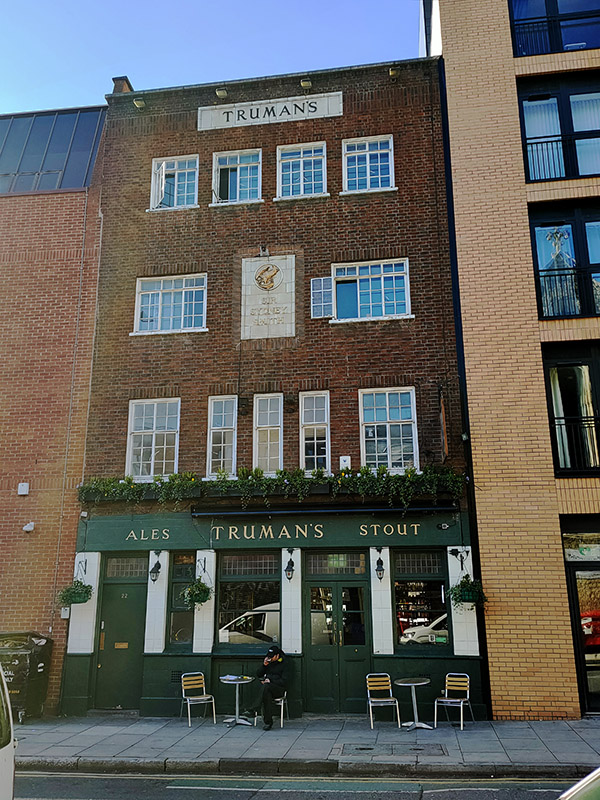
At the north end of the bridge we turn right on Millbank towards Tate Britain but as I’m slightly early for my booked visit we can knock off Ponsonby Terrace and Ponsonby Place on the way.

Jeté, a bronze sculpture of a dancer, cast by Enzo Plazotta in 1975 which stands outside no.48 Millbank.

Standing opposite Tate Britain on the west side of Atterbury Street is Chelsea College of Arts. The college started life in 1895 as one of the schools of South-Western Polytechnic (which actually was in Chelsea). In 1908 this merged with the Hammersmith School of Art to form the Chelsea School of Art.  The school was renamed Chelsea College of Art and Design in 1989 and then acquired its present name in 2013. It only took over the site here on Millbank in 2005, the buildings having originally been built to house the Royal Army Medical College in 1907. Prior to that, Millbank Prison had occupied the site of both the college and Tate Britain for around 80 years. Amongst its alumni Chelsea includes Anish Kapoor, Steve McQueen, Chris Ofili and Mark Wallinger.
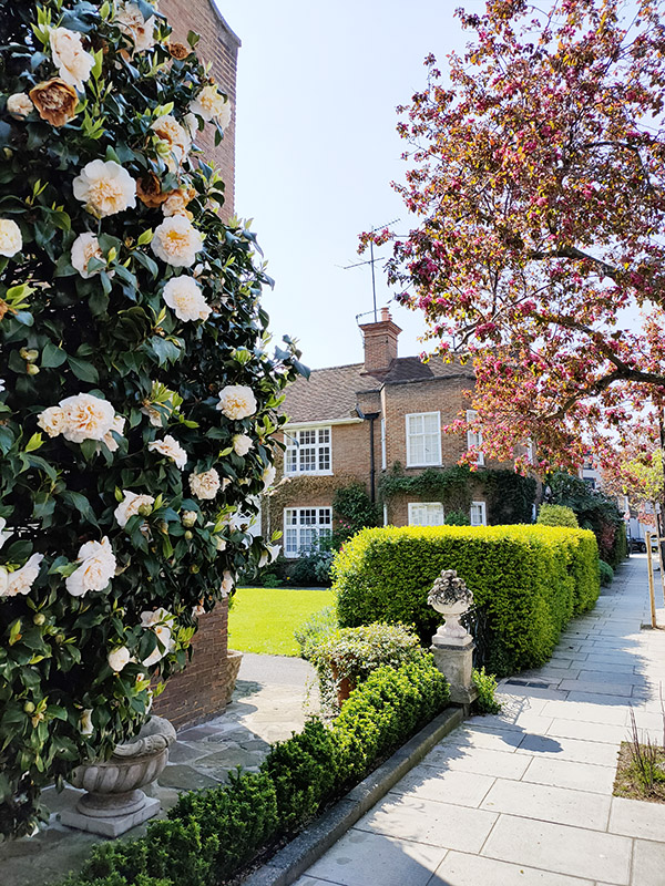
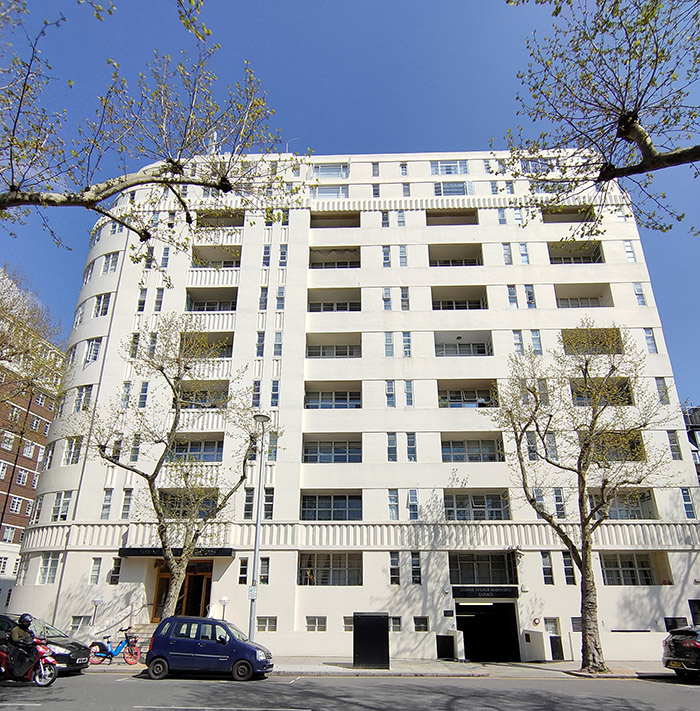
As mentioned, I had pre-booked my visit to Tate Britain in accordance with the current requirements. I had decided to forego the Aubrey Beardsley exhibition and follow the designated route devoted to British Art from 1930 onward despite the fact that there aren’t that many Britons among my favourite artists of the 20th century. The selection of highlights below therefore eschews the obvious Bacon’s and Hockney’s in favour of some lesser-known lights.

Milk and Plain Chocolate (1933) by Ben Nicholson (1894 – 1982). Nicholson’s second wife was the much more widely known sculptor, Barbara Hepworth. The Mondrian influence on his abstract work is clearly apparent here.

Morvah (1958) by Paul Feiler (1918 – 2013). German-born Feiler, he was sent to school in England in the thirties, was a member of the St Ives School of painters. Morvah is a village west of St Ives.

Family Group (1949) and King & Queen (1952-3) by Henry Moore. Immediately recognizable of course. Personally I much prefer Moore’s figurative work to the abstract stuff.

More Moores. Including the posthumous 2020 work “Masked Man” there on the right.

Inversions (1966) by Mary Martin (1907 – 1969). Not just picked in order to provide the reflection of the day.

As noted above, the institution first known as the National Gallery of British Art was built on part of the site of the Millbank Penitentiary, used as the departure point for sending convicts to Australia, which was demolished in 1890.
Sidney R.J. Smith was the chosen architect and his design with its grand porticoed entranceway and central dome resembling a temple remains the core of the building today. The statue of Britannia with a lion and a unicorn on top of the pediment at the Millbank entrance bluntly emphasised its function as a gallery of British art. The gallery opened its doors to the public in 1897, displaying 245 works in eight rooms from British artists dating back to 1790.

Since its original opening, the Millbank site has had seven major building extensions, doubling in size in its first 15 years. And by 1917 it had become responsible for the national collection of British art from 1500. The Tate Gallery name was officially adopted in 1932 and in 1955 it became wholly independent from the National Gallery.  A major extension in the north-east corner, designed by Richard Llewelyn-Davies opened in 1979 and in the same year, the gallery took over the adjacent disused military hospital, enabling the building of the new Clore Gallery, designed by Sir James Stirling and funded by the Clore Foundation. That opened in 1987 and went on to win a Royal Institute of British Architects award the following year.

On the right above is part of Steve McQueen‘s large-scale installation, Year 3. Every Year 3 class in London was invited to have its photograph taken by a team of specially trained Tate photographers. Participants included children from state primaries, independent schools, faith schools, special schools, pupil referral units and home-educated pupils.

Just beyond Tate Britain, heading downstream, is the Millbank Tower, which upon its construction in 1963 as the HQ for the Vickers engineering conglomerate, after which it was originally named, was the tallest building in the UK. It retained that pre-eminence only until the Post Office Tower opened the following year. It was designed by Ronald Ward and Partners and built by John Mowlem & Co. and unlike many of the high-rise buildings of that era has not only survived but attained Grade II listed status. Throughout its history, the Millbank Tower has been home to many high-profile political and other organisations. In the nineties the word Millbank became synonymous with the Labour Party which ran its 1997 General Election campaign from offices here and after the election relocated its HQ to the tower. After five years residence however, the £1 million per annum rent forced another move. The United Nations also had offices in the tower, but moved out in June 2003. Other public bodies such as the Environment Agency and the Audit Commission have continued to occupy the building. I had a brief temporary job here in the mid-1980’s with Whitehall Securities which was the holding company of Pearson plc, then the owner of Penguin Books and the FT.  The floor they leased in the tower basically just comprised the boardroom and the directors’ offices and dining room. My job was to assist the guy who organised the rota for the pool of drivers who ferried those directors to and from their homes and around the city. Different times eh ?           

30 Millbank which is part of the same sixties complex was used as campaign headquarters by the Conservative Party between 2006 and 2014 and more recently the Leave.EU and People’s Vote campaigns have had offices in the tower. In 2016, to the surprise of precisely no-one, a successful application was made to redevelop the complex as a luxury hotel and flats. Post-Covid I can’t but think that the developers might wish to renege on that option. Oh and that sculpture in the top right photo is “Momentum III” by Michael Spiller.

That’s enough of Millbank for now; we’ll make our escape via Thorney Street and then turn onto Page Street which takes us past the back of Burberry HQ to John Islip Street.

John Islip was Abbot of Westminster from 1500 until his death in 1532 and was buried in the chantry chapel he built at Westminster Abbey. We follow the street named after him all the way back to Vauxhall Bridge Road passing en route the rear of Tate Britain and the statue of John Everett Millais (1829 – 96). 

The statue was commissioned shortly after Millais’ death by a committee chaired by Edward, Prince of Wales and was created by Thomas Brock (1847 – 1922) who also designed the Victoria Memorial in front of Buckingham Palace. A leading light of the Pre-Raphaelite movement, Millais is today as well-known for his personal life, rescuing his wife Euphemia “Effie” Gray from her unconsummated first marriage to the critic (and Millais’ patron) John Ruskin, as he is for his art.

Once on Vauxhall Bridge Road (VBR) we swing right past the Embassy of Lithuania and the White Swan Pub (which I visited many times in the late Eighties) and loop round Causton Street and Ponsonby Place back to John Islip Street.

We take the first left, Cureton Street, then continue heading back north-east on Herrick Street, checking out St Oswulf Street and Bulinga Street before arriving at Marsham Street. This area between Tate Britain and Vincent Square is occupied by the Grade II listed red brick buildings of the Millbank Estate built between 1897 and 1902. The bricks were recycled from the demolished prison. The 17 buildings, comprising one of London’s earliest social housing schemes, are all named after painters; below are Rossetti and Ruskin Houses and Turner and Stubbs Houses. The estate has 562 flats and these days roughly half of them are private leases.

Marsham Street takes us back to John Islip Street where we continue on to another stretch of Page Street that links up with Erasmus Street which sends us back south east again. VBR is reached again via Cureton Street, Causton Street and Regency Street. At the junction of the latter two is our sole blue plaque of this outing.

Harry Mallin (1892 -1969) was a middleweight amateur boxer and officer with the Metropolitan Police. He won gold at the 1920 Olympics in Antwerp and successfully defended the title four years later in Paris ( a feat unmatched by a British boxer until Nicola Adams came along). In 1937, he achieved the distinction of being the first British television sports commentator, when he gave commentary on two boxing matches broadcast by the BBC from Alexandra Palace.

Next we work our way north from VBR courtesy of Chapter Street, Douglas Street, Esterbrooke Street and Regency Street as far as Vincent Street. In between Vincent Street and Page Street stands the similarly Grade II Listed Grosvenor Housing Estate  designed by Edwin Lutyens (1869 – 1944) and built between 1929 and 1935.  The estate comprises seven U-shaped blocks faced with grey bricks and white render in a checkerboard pattern. I think influence of that man Mondrian might be in play here as well (Mondrian was an almost exact contemporary of Lutyens – 1872-1944).

Having circumnavigated the estate via Herrick Street, Page Street and Regency Street we wend our way back to VBR by means of Hide Place, Douglas Street and Osbert Street then criss-cross between VBR and Vincent Square along Stanford Street, Bloomburg Street and Udall Street. On the corner of the latter and Vincent Square stands what was the Infants Hospital from 1907 to 1995 but is now of course luxury apartments.

Vincent Square, all 13 acres of it, is owned and principally used as playing fields by Westminster School. The square contains a cricket pavilion, four football pitches (cricket pitches in the summer), about 10 tennis courts, and the groundsman’s house. It was developed in the 18th century on land originally known as Tothill Fields, and was named after William Vincent, a former Dean of Westminster and headmaster of Westminster School. Prior to that its uses had included acting as a burial pit for victims of the Great Plague. In the south and west corners are a couple of concrete-based basketball courts/five-a-side football pitches. The day I passed by coincided with the return to school of the majority of London pupils and so there were about seventy or so year 7s from the local comprehensive crammed into these spaces for their first games lesson. If you’re looking for a visual representation of the British class structure you couldn’t do much better than that.

More upscale accommodation is available at Vincent House on the west side of the square. This elegant 1939 building offers serviced rooms with accompanying facilities including a bar with snooker table and piano.

We detour off to complete a triangle of Fynes Street, Regency Street and Rutherford Street and a loop round Maunsel Street, Horseferry Road and Elverton Street before returning to the north(-ish) side of the square where we find, Lindley Hall, the HQ of the Royal Horticultural Society which also incorporates the Lindley Library which is based upon the book collection of English botanist John Lindley, comprising many rare books dating from 1514. The Hall was built in 1904 to host botanic art exhibitions held by the RHS and nowadays hosts events such as London Fashion Week as well as weddings.

We follow the west side of the square and Hatherley Street  back to VBR for a final time. At the junction of the two is a terracotta plaque to the above-mentioned William Vincent.

Rochester Row lead us back in a north-easterly direction towards Horseferry Road with diversions en route to take in Walcott Street, Vane Street, Rochester Street and Greycoat Street.

On the way we call in at St Stephen’s Church which was built by Angela Burdett-Coutts (1814-1906), grand-daughter and heiress to the banker, Thomas Coutts. She intended it as a memorial to her father, Sir Francis Burdett, a former brilliant and radical Member of Parliament for Westminster. With the encouragement of her close friend, Charles Dickens, she chose to build it in a very poor area on the edge of the notorious Devil’s Acre on land donated by the Dean and Chapter of Westminster Abbey. The chosen architect was Benjamin Ferrey, a pupil of Pugin, and the foundation stone was laid in 1847.

On the building adjacent to the church on Rochester are several signs like the one to the left. “Ancient Lights” refers to the common law right to light which means that the owner of a building with windows that have received natural daylight for 20 years or more is entitled to forbid any construction or other obstruction that would deprive him or her of that illumination. 

Horseferry Road takes its name from the ferry which once used to cross the span of the Thames now occupied by Lambeth Bridge. These days it’s best known for being home to the original (and now London) headquarters of Channel 4 TV. It’s also the site of Westminster Coroner’s Court and the regimental headquarters of the London Scottish Regiment (where the inquiry into the sinking of the Titanic took place). The Channel 4 building was opened on 6 July 1994 and was designed by Richard Rogers and Partners. It was the first major building they had designed since the Lloyd’s building (1978-1986).  The building, which consists of two four-storey office blocks connected to a central entrance block in an L shape, is finished in grey steel cladding, which is perforated by red-ochre steel struts. The precise colour of those struts was reputedly achieved by copying a sample of the paint used for the Golden Gate Bridge and provided by the City of San Francisco.

Having followed Horseferry Road down to the river all that remains is to walk back along Millbank to our starting point. One last important stop before we finish though is Thames House which occupies the block between Millbank and Thorney Street. Originally built in 1929-30 as offices for chemical giant, ICI, Thames House has since 1994 been the home of the UK Internal Security Service, more popularly known as MI5. The building was designed by Sir Frank Baines, of the Government’s Office of Works, in an ‘Imperial Neoclassical’ style.  High up on the frontage are statues of St George and Britannia sculpted by Charles Sargeant JaggerThe building has been Grade II listed since 1981. Reportedly there is an automated miniature monorail within the building which brings files up from the basement for the use of MI5 office staff.

Day 65 – Marylebone Road – Edgware Road – Seymour Place – Hyde Park Place

Today’s excursion is primarily concerned with the triangular area formed drawing a line along the Marylebone Road from Baker Street tube to the junction with the Edgware Road then down the latter to Marble Arch and back across to where you started. After completing that there was just time to hop over to the west side of Edgware Road a do a few streets to the north of Hyde Park. Looking at this map, it just (finally) occurred to me how much easier this same project would be in Manhattan where the streets are all numbered and laid out in a nice symmetrical grid.

Day 65 Route

We start out today on the Marylebone Road again, outside Old Marylebone Town Hall. This was designed by Sir Edwin Cooper (1874 – 1942), who also designed the impressive Port of London Authority building in Trinity Square, and opened in 1920. The building was listed in 1981 and in 2013 it was acquired from Westminster City Council by the London Business School. Following a redevelopment programme that involved the creation of a new glass and steel entrance structure linking the Town Hall building with its annexe, the Sammy Ofer Centre (named after £25m donor Idan Ofer) opened for, well, business in 2018. The main building continues to function as Westminster Registry Office in which capacity it has historically proved very popular with both members of the Beatles and wanna-be members of the Beatles. Paul McCartney has got hitched here twice; to Linda in 1969 and then for the third time, to Nancy Shevell in 2011 (I have to admit that that one passed me by). Ringo and Barbara Bach also tied the knot here as did Liam Gallagher and Patsit Kensit (of course they did) and Antonio Banderas and Melanie Griffiths.

This slideshow requires JavaScript.

Moving past the Town Hall we turn left into Upper Montagu Street then work our way back to the Marylebone Road via Salisbury Place, Thornton Place, York Street and Knox Street. Sandwiched between the latter and Wyndham Street is the suitably low-key London HQ of Philip Green’s Arcadia businesses. I guess these days it’s somewhat stretching a point to call it an empire.

IMG_1373

Down Wyndham Street to York Street again then back up Enford Street which emerges opposite the Landmark Hotel; which we covered last time out but not with an accompanying picture of the whole building so here it is in all its splendour.

IMG_1374

Back on the south side is the Grade II listed but derelict building that started out as the Free Hospital for Women and Children and Samaritan Institution when constructed in 1889. Fifteen years later it was renamed (slightly more snappily) as the  Samaritan Free Hospital for Women. After becoming part of the NHS in 1948 it survived for almost a further 50 years until it closed in 1997.

IMG_1377

Opposite, and somehow I missed this last time, is what remains of St Marylebone Grammar School. The school was founded in 1792 under the name of the Philological Society by Thomas Collingwood, under the patronage of the Prince Frederick, second son of George III, with the aim of helping “the heads of families, who by unexpected misfortune, have been reduced from a station of comfort and respectability.” It moved to Marylebone Road in 1827 and was accepted in trust by the London County Council in 1908 and renamed St Marylebone Grammar School. During the early Seventies SMGS was subject to a tug of war between the Labour controlled ILEA, who wished to merge it with a local secondary modern school, and the Conservatives who ran Westminster Council who didn’t. When Labour took over the Council in 1974 the Parents’ Association continued opposition to the scheme but in the end the ILEA simply refused to continue funding the school beyond 1981 and it was forced to close. Today the listed main original building forms part of the Abercorn independent prep school. Alumni of SMGS include pop star Stuart Goddard (aka Adam Ant), footballer John Barnes and writer Jerome K. Jerome

Continuing west the next left turning off of Marylebone Road is Seymour Place. Just  round the corner the Rwandan High Commission is the first of four HCs we’ll encounter today.

IMG_1379

Returning to York Street we switch eastward and then cut through Wyndham Place to Crawford Street. This is the site of St Mary’s Church which was built as one of the Commissioners’ churches in 1823–1824 and was designed by Robert Smirke (1780 – 1867) who was also responsible for the main block and façade of the British Museum.

IMG_1380

From Crawford Street we loop back up to Harcourt Street which runs on a diagonal north-west to Old Marylebone Road and is home to the Swedish Church (Svenska Kyrkan), otherwise known as Ulrika Eleonora Church, which dates back to 1912.

IMG_1381

For our final visit (for today) to the Marylebone Road we stroll westward in the shadow of the heavenly vision that is the Marylebone Flyover. As the plaque proclaims, the flyover was opened by Mr Desmond Plummer, leader of the Greater London Council, on 12th October 1967. 119m long and 17m wide it is crossed by around 80,000 vehicles each day. It was created as part of a proposed series of 1960s congestion-relieving initiatives forming the eastern end of the Westway elevated dual carriageway, one of the few schemes that actually came to fruition.

IMG_1382

Turning south on the Edgware Road we make an immediate left into Chapel Street where we find the second of the two tube stations named after the Edgware Road. This one serves the Circle, District and Hammersmith & City lines and was opened as part of the Metropolitan Railway between Paddington and Farringdon in 1863.

IMG_1383

At the end of Chapel Street we cross over the Old Marylebone Road and follow Homer Street down to Crawford Street. Running parallel to this, back up to the OMR, is Homer  Row where T.S. Eliot (1888 – 1965) once resided. American born poet and playwright Thomas Stearns Eliot moved into 18 Crawford Mansions with his wife, Vivienne, in 1916, shortly after the publication of The Love Song of J. Alfred Prufrock. At the time, Eliot was working as a teacher at Highgate School where he taught a young John Betjeman. He also wrote book reviews and lectured in the evenings at University College London to earn extra money. By 1920 the couple had managed to find accommodation close to Regent’s Park that was both more capacious and less insalubrious in its surroundings. Today two bedroom apartments in Crawford Mansions sell for more than £1m.

IMG_1387

Transept Street and Cabbell Street which both cross between OMR and Chapel Street are the settings for the impressive crimson-hued Oxford and Cambridge Mansions which date from 1885.

IMG_1385

These buildings seem a world apart from the chaos and exoticism of the Edgware Road with its shisha cafes and mobile phone/money transfer outlets. One of the few relics of bygone days is Robertsons Pawnbrokers at 199 on the west side. Established in 1797, Robertsons specialises in fine, pre-owned, jewellery, gold, diamonds, watches, antiques and silver, and artwork and since the 1960s has been part of Suttons & Robertsons, one of the largest pawnbrokers in the UK.

IMG_1386

Crawford Place takes us east back to Crawford Street which is one side of the square  that surrounds the Seymour Leisure Centre, the others being Seymour Place, Bryanston Place and Shouldham Street. Grade II listed Seymour Leisure Centre was originally built in 1935-37 as a public baths and laundry by architect Kenneth Cross for St Marylebone Borough Council. The building is faced in purple brick with red brick architraves and Portland stone dressings and the gabled roof is clad in Spanish tiles. One of very few public sports facilities in central London, SLC boasts a gym, sports hall, 30m pool and an indoor climbing wall.

IMG_1388

Besides Shouldham Street there are three more streets that bridge across from Crawford Place to Harrowby Street; Molyneux Street, Cato Street and Brendon Street. Opposite the start of Molyneux Street is 45 Crawford Place which is shared by the High Commissions of Belize and of Antigua & Barbuda and the street itself is home to the High Commission of Tonga.

Of much greater interest though is Cato Street, not that you would know it to look at it. For here it was that the perpetrators of the eponymous Cato Street Conspiracy met in 1820 to hatch their plot to assassinate Prime Minister, Lord Liverpool and all the members of his cabinet. The conspirators, enraged by the Peterloo Massacre and the repressive legislation enacted in its wake, styled themselves as the “Spencean Philanthropists” after the radical speaker Thomas Spence (1750 – 1814). They were led by Arthur Thistlewood, who had been involved with the Spa Fields riots of 1816, with George Edwards as his second in command. The conspirators planned to assassinate the cabinet while they were at a dinner hosted by Lord Harrowby. They would then seize key buildings, overthrow the government and establish a “Committee of Public Safety” to oversee a radical revolution. Unfortunately, this supposed dinner was a set-up courtesy of Edwards who, it transpired, was a government spy.

At 7:30 pm on the evening of February 23 the Bow Street Runners stormed the Cato Street hideout. Some conspirators surrendered peacefully, while others resisted forcefully, Thistlewood killing one of the police officers with a sword. He along with three others slipped out through the back window but they were arrested a few days later. During the trial, the defence argued that the statement of Edwards was unreliable and he was therefore never called to testify. Police did however persuade two of the men, Robert Adams and John Monument, to testify against other conspirators in exchange for dropped charges. Accordingly, most of the accused were sentenced to be hanged, drawn and quartered for high treason. All sentences were later commuted to either hanging and beheading or transportation for life.  Thistlewood, Richard Tidd, James Ings, William Davidson and John Brunt were hanged at Newgate Prison on the morning of 1 May 1820.

On the stretch of the Edgware Road between the intersections with Harrowby Street and Nutford Place is a branch of Waitrose which occupies a former Woolworths store that first opened in 1914 but was done up in the modernist style seen below in 1936.

IMG_1392

On the actual junction with Nutford Place this forlorn and faded pub sign presents a telling juxtaposition of the past and present of this area.

IMG_1393

After a quick nod to Forset Street we proceed east on Nutford Place as far as Brown Street where we turn north. Off Brown Street is the pretty nondescript cul-de-sac of Castlereagh Street which, for the sake of symmetry, I am taking to be named after Robert Stewart, Lord Castlereagh (1769 -1822) who was one of the members of the aforementioned Lord Liverpool’s cabinet; Foreign Secretary in fact. Ulster-born Castlereagh was one of the prime movers behind the repressive government legislation that inspired the Cato Street conspirators and was directly named in Shelley’s vitriolic Masque of Anarchy poem written in response to Peterloo. He didn’t long survive his would-be assassins however, taking his own life in 1822 after being threatened with the exposure of his homosexual proclivities.

IMG_1394

Having arrived back on Harrowby Street we turn right and then head south on a further stretch of Seymour Place past the Sylvia Young Theatre School. Sylvia Young first opened her school as a full-time establishment on Drury Lane in 1981. It moved to this current location in a converted church in 2010. The impressive list of alumni features actors such as Keeley Hawes, Lily Cole, Billie Piper and Steven MacKintosh and singers Amy Winehouse, Rita Ora and Dua Lipa.

IMG_1395

From here, starting with George Street we continue dipping in and out of the Edgware Road all the way down to Marble Arch with Stourcliffe Street, Wythburn Place, Great Cumberland Place, Upper Berkeley Street, Hamden Gurney Street, Seymour Street and Bryanston Street providing the route. At 51-53 Edgware Road you can just about make out what remains of the Art Deco Gala Royal cinema. This opened as the Royal Cinema around 1938/9 then was taken over by Jacey Cinemas and Gala Film Distributers in the 1960s. Theirs was the partnership that introduced continental and art house film to London. As time went on the Gala Royal couldn’t compete with the big cinema companies of the West End and towards the end of its life, resorted to screening saucy sex romps before closing in 1979. The building briefly reopened showing Arabic films to cater for the growing Arabic population on Edgware Road but shut for good in 1981. It now houses what I presume to be an Egyptian restaurant, judging by the pictures of Mo Salah outside, called Shishawi.

On Upper Berkeley Street is the West London Synagogue which was consecrated in 1870. The main sanctuary, shown below, was built in the Neo-Byzantine architectural style by Davis & Emmanuel.

IMG_1399

So as noted at the beginning once we arrive at Marble Arch we nip across the Edgware Road and head west along the Bayswater Road. After a hundred metres or so we turn right and move away from Hyde Park up Stanhope Place where we come across the first of a string of Blue Plaques. Lily Elsie (1886 – 1962) was one of the most successful stage actresses of the Edwardian era with a particular forte for musical comedies including the first London production of The Merry Widow. Despite a multitude of male admirers, according the renowned dress designer of that age, Lucile, “She was absolutely indifferent to most men for she once told me she disliked the male character and considered that men only behaved tolerably to a woman who treated them coldly”. Sadly this didn’t prevent her from entering into an unhappy marriage that led to her exile from the stage.

IMG_1400

We turn down Connaught Place and at the end where it meets the Edgware Road is the house where Lord Randolph Churchill (1849 – 95), father of Winston of course, spent nine of the last twelve years of his relatively brief life. From the start of his political career Randolph was a champion of progressive Conservatism also known as “Tory Democracy”. As this philosophy gained ascendancy within the Tory party his star rose culminating in his appointment as Chancellor Of the Exchequer in Lord Salisbury’s second administration which began 1886. Unfortunately he had little talent for building alliances and gathering supporters within the Commons and lasted only a few months in the role before resigning in a row over cuts to the Armed Forces. He never made it back from the political wilderness and suffered from increasingly debilitating illness for the remainder of his life. It is considered a point of fact that he had been undergoing treatment for syphilis since his mid-twenties but it is still open to debate whether it was the mercury poisoning or an unrelated brain tumour that caused his demise at the age of 45.

IMG_1401

Next one is in Connaught Square, reached via Seymour Street, where the ballet dancer Marie Taglioni (1804 – 1884) lived for a couple of years at no.14. Swedish born, but Italian on her father’s side, Ms Taglioni’s main claim to fame is that she is credited with being the first ballerina to truly dance en pointe.

IMG_1402

Connaught Square is bordered to the north by Connaught Street which we cross over into Portsea Place where no.16 was once the home of the South African author, proto-feminist and ant-war campaigner Olive Schreiner (1855 – 1920) once lived. I have to confess to a total lack of familiarity with Ms Schreiner and the work for which she is reportedly best known, The Story of An African Farm, but her advocacy of socialism, pacifism and the rights of non-white races mark her as a woman distinctly ahead of her time.

IMG_1403

At the top of Portsea Place we take Kendal Street back to the Edgware Road for the very final time then make our way back south towards Hyde Park via Park West Place, Porchester Place, and Albion Street. The last of these has commemorations of two former residents, novelist William Makepeace Thackeray (1811 – 1863) at no.20 and Sir Charles Vyner Brooke (1874 – 1963) at no.13. Thackeray is of course best known for his magnum opus Vanity Fair but he also penned The Luck of Barry Lyndon which was adapted for the screen by Stanley Kubrick in 1975. Thackeray was renowned as a man of idleness and gluttony (allegedly including an addiction to spicy peppers) which undoubtedly helped to hasten him into the grave at the age of 52. Vyner Brooke was the third and last White Rajah of the Raj of Sarawak. The Raj was established as an independent state located in the northwestern part of Borneo from a series of land concessions acquired by the English adventurer, James Brooke (Charles’ great uncle), from the Sultanate of Brunei in the mid-nineteenth century. As a major producer of oil, rubber and black pepper, Sarawak prospered for a century until the territory was invaded by the Japanese in WW2. After the war it became a British Crown Colony, the last one, before becoming part of Malaysia when it gained independence.

Last port of call for today is on Hyde Park Place. This part of London, north of Hyde Park was originally the site of the village of Tyburn which was infamous as a place of public hangings from 1196 to 1793. In 1571, the so-called Tyburn Tree was erected near where Marble Arch is currently situated. The “Tree” or “Triple Tree” was a novel form of gallows, consisting of a horizontal wooden triangle supported by three legs which meant that several prisoners could be hanged at once. Among those executed throughout the ages were the 105 martyrs of the Catholic Reformation. It was in commemoration of these martyrs that Mother Marie Adèle Garnier established the Tyburn Convent here in 1903, she and her  community having fled to England from France two years earlier on account of French laws prohibiting religious Orders. In so doing she fulfilled a prophecy of the 16th century Roman Catholic priest Father Gregory Gunne who in 1585, referring the execution four years