Day 77 Part 2 – Pennington Street – Wapping High Street – St Katharine Docks

When you left us last time we’d made our way back north from the river and the Wapping Wharves to The Highway, the main road that stretches from Tower Hill to the entrance to the Limehouse Tunnel. From here we’ll head west for a bit then double back past the former site of the infamous News International Wapping printworks before winding back towards the river and following Wapping High Street west to St Katharine Docks.

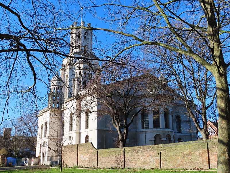
On the north side of the Highway off Cannon Street Road stands the impressive St George In The East Church. The church is one of six in London designed by Nicholas Hawksmoor (1661-1736) built following the passing, in 1711, of an Act for the building of Fifty New Churches in the Cities of London and Westminster or the Suburbs thereof. This was prompted by the accession of Queen Anne to the throne in 1702 under the terms of the Acts of Settlement designed to ensure the Protestant succession. St George’s was built between 1714 and 1729 and gave its name to both the local ecclesiastical parish and its civil counterpart, the third tier of local government, though it was superseded in the latter role when the Metropolitan Borough of Stepney was established in 1927. The church was hit by a bomb during the WWII Blitz on London’s docklands in May 1941. The original interior was destroyed by the fire, but the walls and distinctive “pepper-pot” towers stayed up. In 1964 a modern church interior was constructed inside the existing walls, and a new flat built under each corner tower. The church was Grade I listed in 1950 and in 1980 featured in the film, The Long Good Friday. Not sure which is the greater honour.

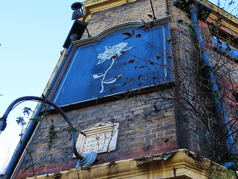
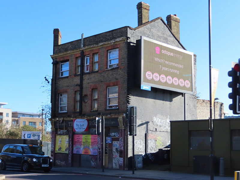
Back on the south side of The Highway, once known as the Ratcliffe Highway incidentally, sits the marooned and very derelict former Old Rose pub. This closed down in 2011 and has been left to rot ever since. The building dates from the early 19th century which means that the mysterious stone plaque embedded in eastern wall, which reads “This is the Corner of Chigwell Streate 1678” must have been salvaged from a different building. Presumably one that stood here, as the Old Rose is at the top of what is now called Chigwell Hill. It was only a few years after the building became licensed premises that the so-called Ratcliffe Highway Murders took place in the very near vicinity. On 8 December 1811 a young draper and ex-sailor Timothy Marr, his wife Celia, their young son Timothy, and their shop boy James Gowan were brutally killed at 29 St George’s Street (now the location of a car showroom adjacent to the Rose) while their maidservant had been sent out to pay a baker’s bill and buy a dozen oysters. Twelve days later the publican of the Kings Arms in New Gravel Lane (now Wapping Lane) John Williamson, his wife Elizabeth and a servant Bridget Harrington were also killed at home. The murders were never satisfactorily solved. A sailor named John Williams was arrested as the prime suspect; it was said that he had a grudge against Marr from their time together at sea, but he was found hanging in his prison cell the night before the trial. This was taken to be proof of his guilt and investigations petered out, even though it had been assumed that there must have been two people involved in each killing. Extraordinarily, to allay public anxiety, the Home Secretary, after consultation with the senior Shadwell magistrate, ordered Williams’ body to be drawn through the streets on a cart, for a suicide’s burial.
After continuing west along The Highway we turn left into Virginia Street which, like Breezer’s Hill, Artichoke Hill and the aforementioned Chigwell Hill, bridges the gap between The Highway and Pennington Street. This western end of Pennington Street was once home to the News International Wapping plant which was at the centre of an industrial dispute that, alongside the Miners’ Strike, defined the conflict between the Trade Unions and Thatcherite laissez-faire capitalism in the 1980’s. The 54 week long strike was sparked by the decision of Rupert Murdoch’s News International group to move print production of their UK newspapers from Fleet Street to the new plant in January 1986. At Wapping new computer facilities would allow journalists to input copy directly, rather than relying on print union workers who used older “hot-metal” Linotype printing methods. As a consequence 90% of those typesetters would lose their jobs. News International’s strategy in Wapping had strong government support, and the company enjoyed almost full production and distribution capabilities and was able to rely on a sufficiently large coterie of journalists (including NUJ members) who defied the picket. NI was therefore content to allow the dispute to run its course and, with thousands of workers having gone for over a year without jobs or pay, the strike eventually collapsed on 5 February 1987. In 2010 News International closed the Wapping plant and moved all the staff to nearby Thomas More Square. Two years later, following the demise of The News of The World, and having rebranded as News UK, the company sold the Wapping site to Berkeley Group for £150m. They left Wapping altogether in 2014, decamping to offices forming part of The Shard development.
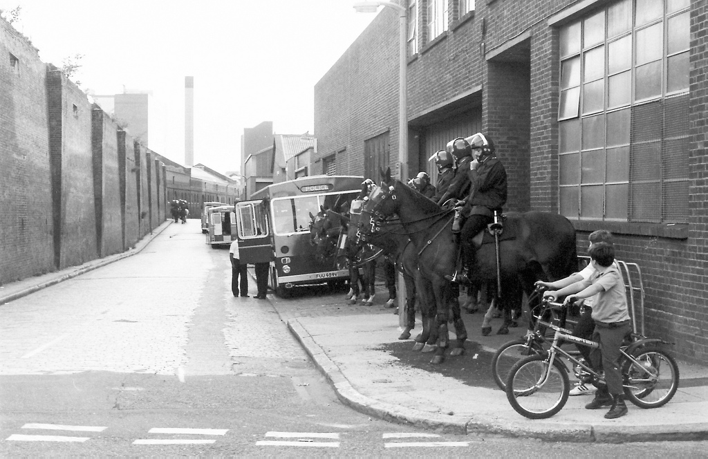
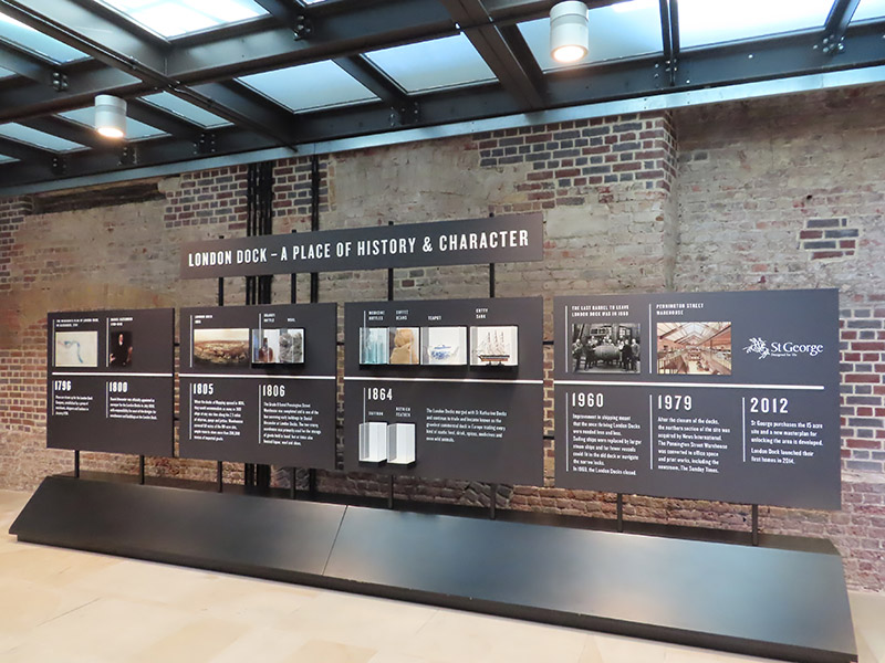
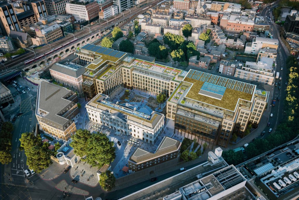
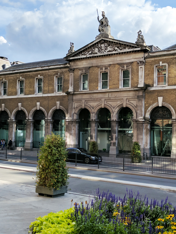
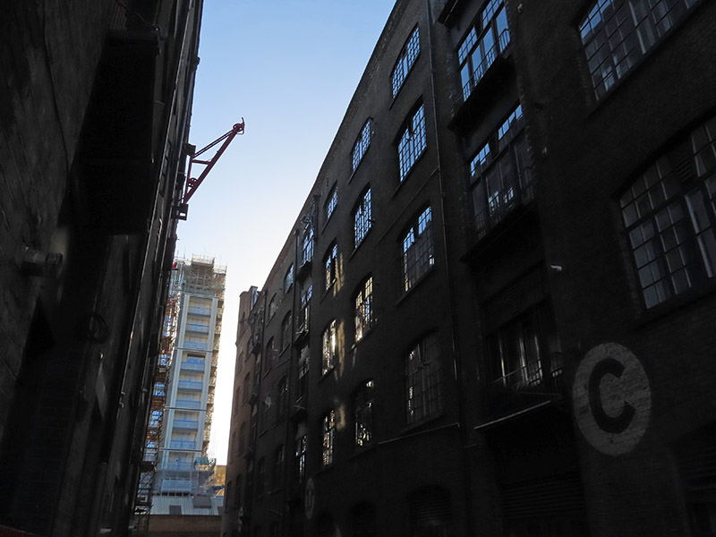
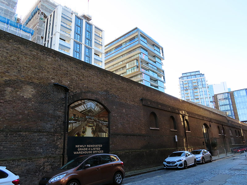
The photo above was taken from the eastern end of Pennington Street. In the distance on the left you can see the Pennington Street Warehouse, a 313 metre long bonded warehouse constructed around 1805 with a semi-basement of brick vaulted cellars. This now Grade II listed (1973) building was originally used to store fortified luxury commodities such as ivory, spices, coffee and cocoa as well as wine, spirits and wool. It is the only substantial building to survive from the former London Dock. Following the departure of News International, as part of the redevelopment of the London Dock site by St George (part of the Berkeley Group) it was converted into new state-of-the-art office and studio spaces which opened in 2018. (The image top left below is of the old wool warehouses on Breezer’s Hill which date from the mid nineteenth century).
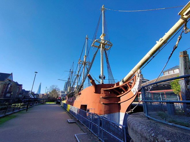
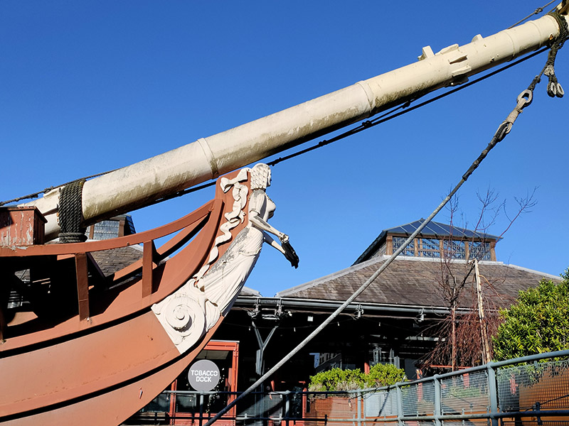
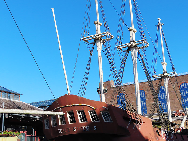
Having traversed the length of Pennington Street we turn south onto Wapping Lane and head down to Tobacco Dock. Tobacco Dock is a Grade I listed warehouse that also formed part of the London Docks.  It was designed by Scottish civil engineer and architect John Rennie and completed in 1812, serving primarily as a store for imported tobacco. At full capacity, the warehouse could accommodate 24,000 hogsheads of tobacco. In 1857 Tobacco Dock was the location of an extraordinary rescue. A colourful local business on the bustling Ratcliff Highway was Charles Jamrach’s Exotic Animal Emporium. This eccentric German businessman had a roaring trade in all manner of unusual animals and birds. One day his Bengal tiger escaped and went wandering down the road. A little boy, who had never before seen such a creature, reached out to stroke the cat. Unsurprisingly the tiger responded by grabbing the boy by his neck and carrying him off into Tobacco Dock. Jamrach gave chase and incredibly managed to fend off the beast with his bare hands. The boy was rescued unharmed and the tiger shipped off to the famous animal collector George Wombwell, earning Jamrach the handsome sum of £300. Unfortunately for him, records show that the boy’s parents sued the animal dealer for the same amount. He wrote bitterly about the incident in his memoirs! After the London Docklands ceased seaborne trade, the warehouse and surrounding areas fell into dereliction until it was turned into a shopping centre which opened in 1989 at a cost of £47 million. It was the intention of the developers to create the “Covent Garden of the East End” but this was never a realistic possibility and it went into administration. By the mid-1990’s only a sandwich shop remained as the sole tenant. In 2003 English Heritage placed Tobacco Dock on its “at risk” register and it stood largely empty until it was used as a barracks for military personnel providing security to the 2012 London Olympics. In the same year the company Tobacco Dock Ltd launched the building as an events and conferencing space for up to 10,000 people. The only event I could find listed for 2024 is something called Meatopia (live-fire chefs ?) happening on the August bank holiday weekend. It’s sold out apparently. Moored in a dry dock in front of Tobacco Dock are two replica ‘pirate ships’ built to entertain the children whose parents were expected to visit the ill-fated shopping centre. The Sea Lark is apparently a copy of a 330 tonne tobacco and spice ship built at Blackwall Yard in 1788 while the Three Sisters is a copy of an 18th century American merchant schooner captured by the Admiralty during the Anglo-American War.
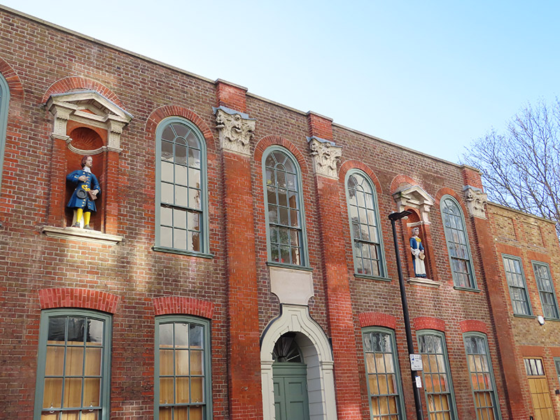
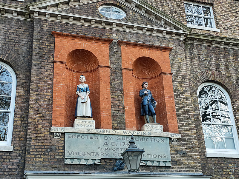
From Tobacco Dock we follow the so-called “ornamental canal” and then work our way back to Wapping Lane, through the new-ish housing developments, via Waterman Way and Reardon Street with nods to the cul-de-sacs of Stevedore Street and President Drive. To the east of Wapping Lane on Raine Street is Raine’s House, named for Henry Raine (1679–1738), a wealthy local brewer and devout churchgoer, who built it in 1719 as a school where poor children could get a free education. The statues in the window niches are replicas, the originals having moved with the school when it relocated to the north of the Highway in 1883.

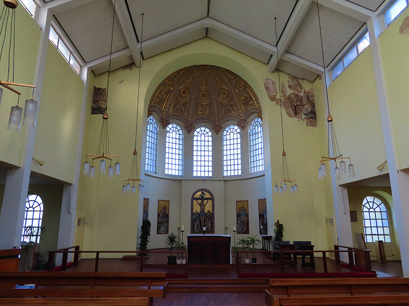
Round the corner is St Peter’s Church designed by F.H Pownall. It was established in 1856 as an Anglo-Catholic mission to the poor of London by Reverend Charles Lowder and a group of fellow priests belonging to the Society of the Holy Cross. The Society had been founded a year earlier with the purpose of providing its members with a rule for living and a vision of a disciplined priestly life.

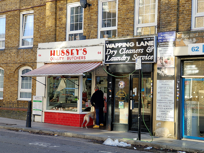
From Raine Street we make our way east on Farthing Fields and Pearl Street then do an about-turn and follow Prussom Street, Penang Street, Clegg Street and Hilliards Court down to Wapping High Street. We switch between the High Street and Cinnamon Street a couple of times using Clave Street and Wapping Dock Street before Cinnamon Street feeds us back onto Wapping Lane. Heading north here takes us past today’s Laund(e)rette of the day and several other refreshingly old- school local businesses.
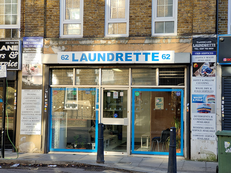
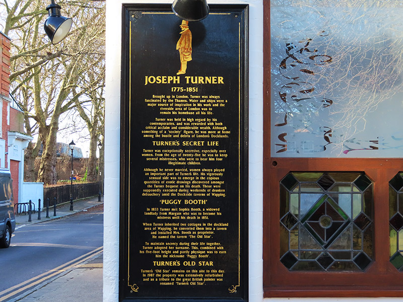
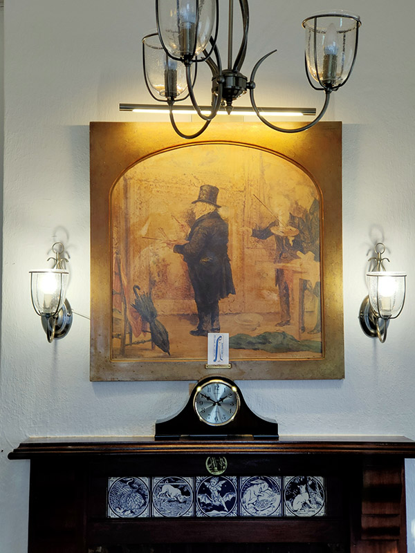
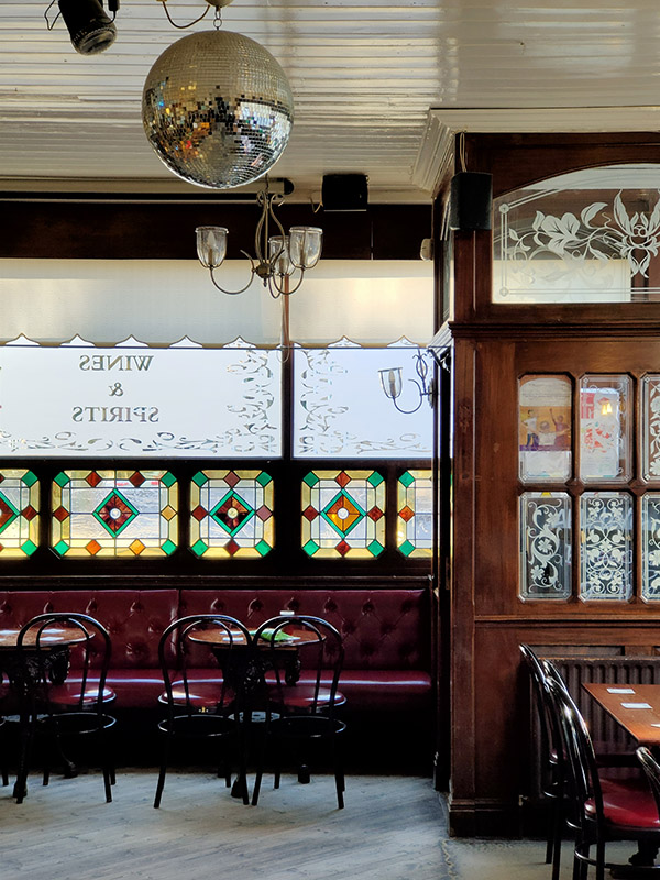
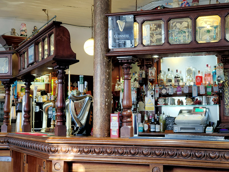
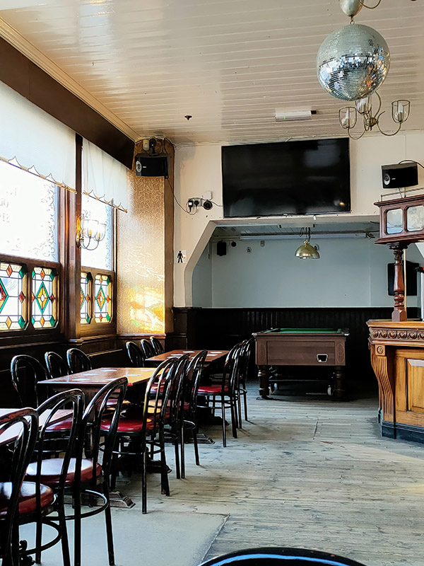
Taking the next turn on the left into Watts Street brings us to today’s pub of the day, Turner’s Old Star. The Star is a real blast from the past. Apparently it was refurbished in 1987 but from the looks of it that was only to update it as far as the Seventies (nowt wrong with that mind). That was also when the pub was renamed in honour of the painter J.M.W Turner who created the pub in the first place. In 1833 Turner met Sophia Booth, a widowed landlady from Margate who was to become his mistress until his death in 1851. When Turner inherited two cottages in the dockland area of Wapping, he converted them into a tavern and installed Mrs. Booth as proprietor. He named the tavern ‘The Old Star’. To maintain his secrecy during their life together Turner adopted her surname. This, combined with his five-foot height and portly physique was to earn him the nickname ‘Puggy Booth’. Refreshments – half of lager and a packet of crisps – not much sustenance for four hours of walking ! Just the two other customers.

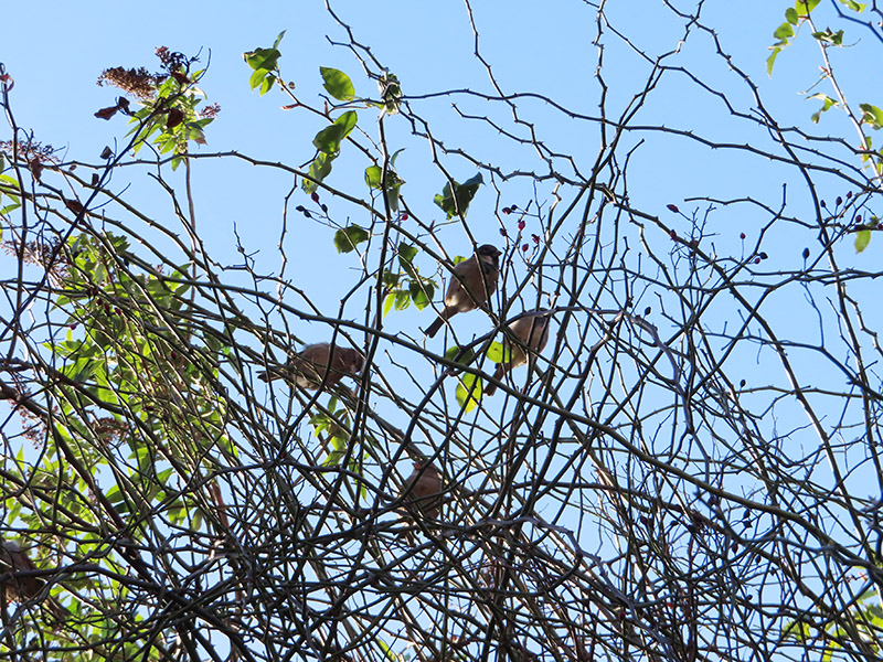
After leaving the pub we continue northward up Meeting House Alley before turning left onto Chandler Street and then heading back south on Reardon Street with a brief detour into Vinegar Street. This walk coincided with the start of the RSPB’s Big Garden Bird Watch weekend so in recognition of that here are some Cockney sparrers spotted at this point.

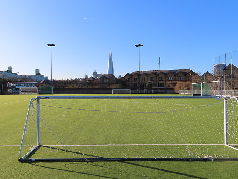
At the bottom of Reardon Street we make a right into Tench Street and loop round past the John Orwell Sports Centre (the eponym of which seems to be unknown to the internet).

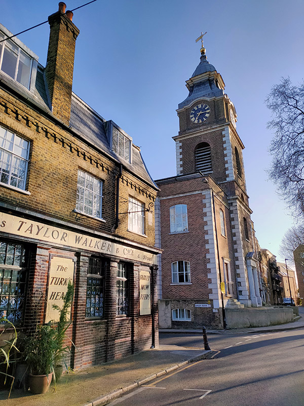
On the corner of Tench Street and Green Bank is the Turk’s Head which closed as a pub in the 1970’s but has retained all of its old signage. Confusingly an Anglo-French restaurant called Bistro Bardot now operates from the premises. A sign outside divulges that “During World War II it was run by its eccentric landlady, Mog Murphy, and stayed open all hours for service personnel seeking news of their loved ones. After a vigorous campaign in the 1980s led by Maureen Davies and the wild women of Wapping, the Turk’s Head Company, a charity they set up to improve local life, bought the derelict building from the Council and restored it.” The adjacent St John’s Church is another Grade II listing in the area. The present building was originally erected in 1756 but suffered extensive damage in WWII, with only a fragmentary rectangular shell remaining. The tower was restored in 1964 by the London County Council and the remainder converted into flats in the 1990’s. The exterior of the church appears briefly in Episode 23 of Season 4 of Friends, “The One With Ross’ Wedding”.

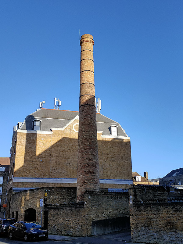
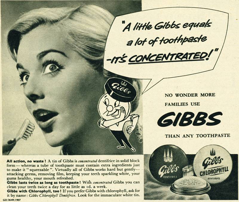
Further along Green Bank, this chimney is all that remains of the old D&W Gibbs factory. Gibbs was a manufacturer of soap, shaving soap and toothpaste founded in 1712. Gibbs SR toothpaste was the very first product advertised on ITV when it started in 1955 though by that time the company was part of the industrial behemoth, Unilever, (The initials ‘SR’ are short for sodium ricinoleate, an ingredient effective in the treatment of gum infections). An earlier brand, French Dentifrice, gained infamy when it was used by British troops in France the First World War – not only to clean their teeth, but also to polish the brass buttons on their tunics and the regimental badges on their caps.
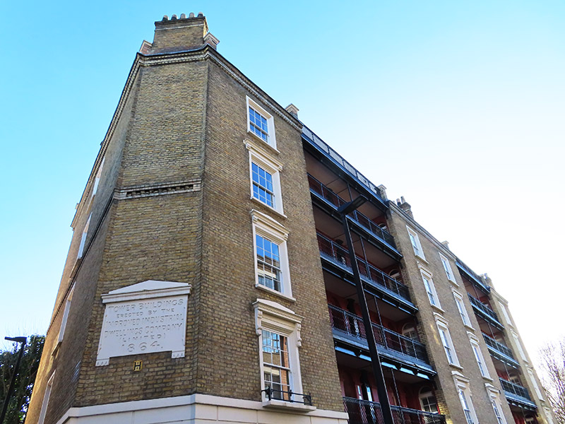
Green Bank returns us once more to Wapping Lane from where we follow Brewhouse Lane down to Wapping High Street, on the way passing Tower Buildings, another Grade II listed edifice, erected in 1864 by the Improved Industrial Dwellings Company. It is a rare surviving example of a Victorian tenement block built to house working class families.

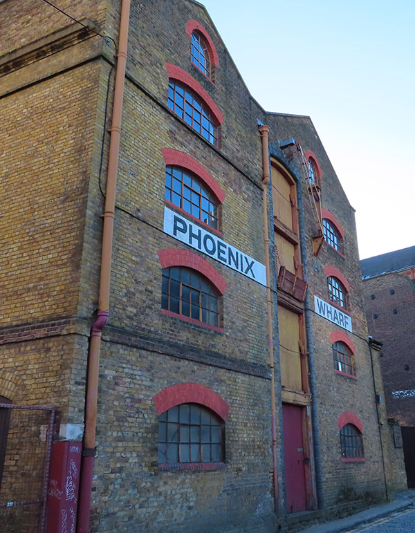
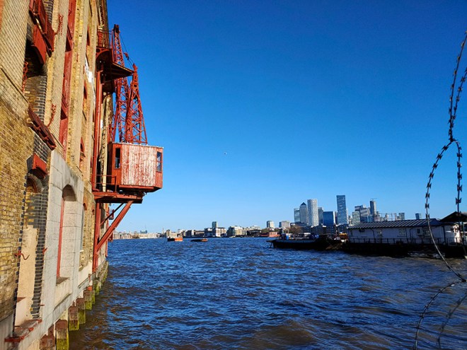
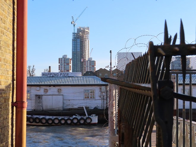
We arrive on Wapping High Street right by Phoenix Wharf, the alleyway beside of which runs down to the river and Wapping Pier. The words delusions of grandeur spring readily to mind here.

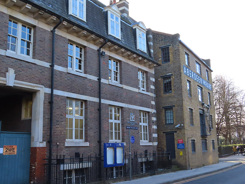
Just west of Phoenix Wharf is Wapping Police Station where The Marine Policing Unit (MPU) is based. There has been a police building for river police at this site since 1798. The MPU is responsible for policing 47 miles of the River Thames in London between Dartford and Hampton Court. It also provides a response to over 250 miles of waterways and other bodies of water across the rest of London, such as lakes, reservoirs and canals. Prior to 1839 the Marine Police Force was an independent operation and up until 1878 it relied on rowing galleys to conduct its patrols. It was only following the loss of over 600 lives when the steam collier Bywell Castle collided with the pleasure steamer Princess Alice in that year that the force acquired its own steam-powered vessels.

Next up are three traverses between Wapping High Street and Green Bank courtesy of Reardon Path, Dundee Street and Scandrett Street. The latter brings us back up to St John’s Church and the “bluecoat” school that was founded by the parish in 1760. As we have seen on previous excursions, bluecoat schools were charitable institutions established between the 16th and late 18th centuries. The first such school was founded by Edward VI at Christ’s Hospital in Newgate Street in 1552. Around 60 similar institutions were set up over the next two hundred years. They were known as “bluecoat schools” because of the distinctive blue uniform originally worn by their pupils which comprised a blue frock coat and yellow stockings with white bands.

Opposite the southern end of Scandrett Street is the final wharf building of the day, Oliver’s Wharf, which was built in 1870 by architects Frederick and Horace Francis to store tea and other cargo. In 1972 it became the first of Wapping’s warehouses to be converted into luxury apartments. Beside the Wharf is another historic riverside pub, the Town of Ramsgate (which also claims to be the oldest Thameside hostelry). It acquired its present name in 1811 in deference to the fishermen of Ramsgate who landed their catches at Wapping Old Stairs. They chose to do so as to avoid the river taxes which had been imposed higher up the river close to Billingsgate Fish Market. At the beginning of the 20th century there were up to 20 pubs on Wapping High Street and now this is the only one remaining. Like seemingly everything else in the area of a certain vintage it has a Grade II listing and, like the Prospect of Whitby, it has a mock gallows.

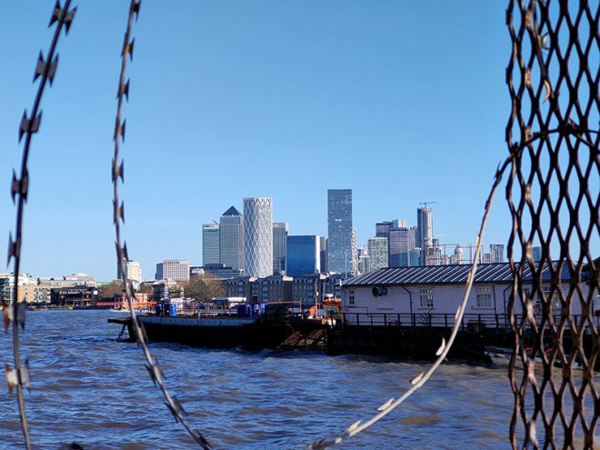
A short way beyond the pub the Thames Path resumes alongside the river with great views of Tower Bridge and the Shard looking west.

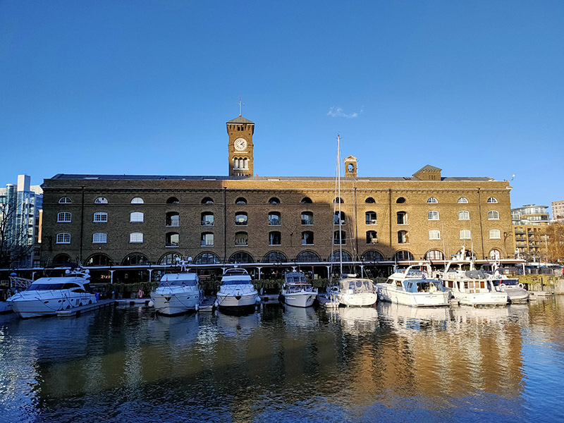
But we’re not following the path eastward we’re taking a more circuitous route to St Katharine’s Dock which involves heading back through the developments in the old London Dock area by way of Knighten Street, Vaughan Way (several times), Sampson Street, Lilley Close, Codling Close, Torrington Place, Smeaton Street, Lime Close, Hermitage Wall and Kennet Street; then working our way back to St Katharine’s Way via Nesham Street, Thomas More Street and Stockholm Way. A hundred metres or so to the west we arrive at St Katharine Docks. These Docks were named after the former hospital of St Katharine’s by the Tower, built in the 12th century, which stood on the site and which was demolished along with 1,250 slum dwellings when construction of the docks began in 1827. The scheme was designed by engineer Thomas Telford (1757 – 1834) and was his only major project in London. To create as much quayside as possible, the docks were designed in the form of two linked basins (East and West), both accessed via an entrance lock from the Thames. Steam engines designed by James Watt and Matthew Boulton kept the water level in the basins about four feet above that of the tidal river. By 1830, the docks had cost over £2 million to build. Although well used, the Docks were not a great commercial success, being unable to accommodate large ships. They were amalgamated with the London Docks in 1864. During WWII all the warehouses around the eastern basin were destroyed by German bombing and the area they had occupied remained derelict until the 1960s. St Katharine Docks completely ceased commercial activity in 1968 and the site was sold to the GLC who leased it to the developers Taylor Woodrow. Most of the original warehouses around the western basin were demolished and replaced by modern commercial buildings in the early 1970s, beginning with the bulky Tower Hotel and followed by the World Trade Centre Building and Commodity Quay. Development around the eastern basin was completed in the 1990s with the docks themselves becoming a marina which is still in regular use today.
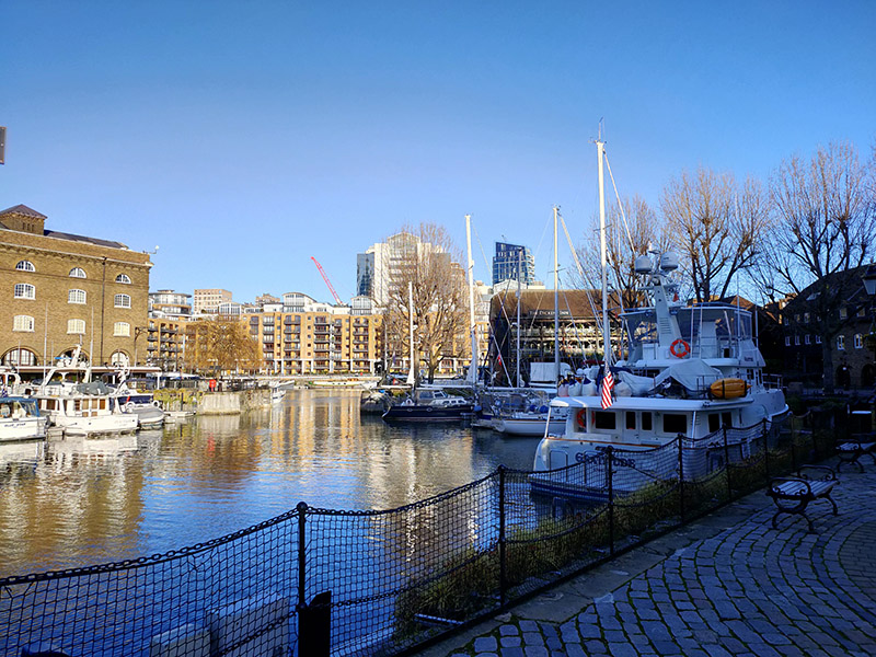
Once beyond the docks we’re out onto the stretch of St Katharine’s Way that runs parallel to the eastern side of the Tower of London and this delivers us back to Royal Mint Court which is more or less where we started the day and which we mentioned briefly at the beginning of the previous post. We noted then that this was the site of the Royal Mint from 1809 to 1967. In actual fact, 1967 only saw the start of the transfer of operations to a new facility in Wales. Minting on some scale continued here until 1975 and the Royal Mint only moved out of the main Johnson-Smirke building (designed by James Johnson and completed by Robert Smirke), in the year 2000. At that time the land was still property of the Crown Estate. The subsequent ownership of the site is somewhat serpentine to say the least; but by 2014 it was effectively in the hands of Delancey (a vehicle owned by BVI incorporated funds controlled by billionaire George Soros) and LRC Group (a property investment company founded by Israeli businessman Yehuda Barashi). Four years later Delancey and LRC sold Royal Mint Court to the People’s Republic of China who envisaged building a new fortified embassy here. You probably won’t be surprised to learn that ground has still to be broken on this project. Concerns and objections were raised by local residents and councillors and Historic England (there are remains of a medieval abbey on the site) and in both the Commons and the Lords. At the same time allegations were raised about possible fraud connected with the sale of the freehold from the Crown Estate to Delancey in 2010 and misinformation supplied to the Treasury Select Committee that reviewed the sale. As of August 2023 the PRC had temporarily shelved its plans having failed to meet the deadline for filing an appeal against Tower Hamlets Council’s original rejection of their plans. The PRC would now have to resubmit its planning application, but the Chinese government is looking for assurances that the UK central government will use its powers to get the application approved. Watch this space (see below).

Day 65 – Marylebone Road – Edgware Road – Seymour Place – Hyde Park Place

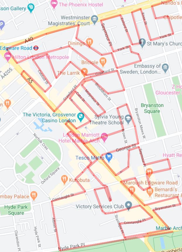
Today’s excursion is primarily concerned with the triangular area formed drawing a line along the Marylebone Road from Baker Street tube to the junction with the Edgware Road then down the latter to Marble Arch and back across to where you started. After completing that there was just time to hop over to the west side of Edgware Road a do a few streets to the north of Hyde Park. Looking at this map, it just (finally) occurred to me how much easier this same project would be in Manhattan where the streets are all numbered and laid out in a nice symmetrical grid.

Day 65 Route

We start out today on the Marylebone Road again, outside Old Marylebone Town Hall. This was designed by Sir Edwin Cooper (1874 – 1942), who also designed the impressive Port of London Authority building in Trinity Square, and opened in 1920. The building was listed in 1981 and in 2013 it was acquired from Westminster City Council by the London Business School. Following a redevelopment programme that involved the creation of a new glass and steel entrance structure linking the Town Hall building with its annexe, the Sammy Ofer Centre (named after £25m donor Idan Ofer) opened for, well, business in 2018. The main building continues to function as Westminster Registry Office in which capacity it has historically proved very popular with both members of the Beatles and wanna-be members of the Beatles. Paul McCartney has got hitched here twice; to Linda in 1969 and then for the third time, to Nancy Shevell in 2011 (I have to admit that that one passed me by). Ringo and Barbara Bach also tied the knot here as did Liam Gallagher and Patsit Kensit (of course they did) and Antonio Banderas and Melanie Griffiths.

This slideshow requires JavaScript.

Moving past the Town Hall we turn left into Upper Montagu Street then work our way back to the Marylebone Road via Salisbury Place, Thornton Place, York Street and Knox Street. Sandwiched between the latter and Wyndham Street is the suitably low-key London HQ of Philip Green’s Arcadia businesses. I guess these days it’s somewhat stretching a point to call it an empire.

IMG_1373

Down Wyndham Street to York Street again then back up Enford Street which emerges opposite the Landmark Hotel; which we covered last time out but not with an accompanying picture of the whole building so here it is in all its splendour.

IMG_1374

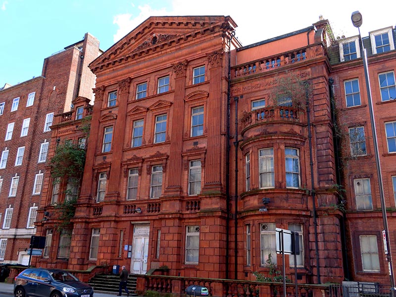
Back on the south side is the Grade II listed but derelict building that started out as the Free Hospital for Women and Children and Samaritan Institution when constructed in 1889. Fifteen years later it was renamed (slightly more snappily) as the  Samaritan Free Hospital for Women. After becoming part of the NHS in 1948 it survived for almost a further 50 years until it closed in 1997.

IMG_1377

Opposite, and somehow I missed this last time, is what remains of St Marylebone Grammar School. The school was founded in 1792 under the name of the Philological Society by Thomas Collingwood, under the patronage of the Prince Frederick, second son of George III, with the aim of helping “the heads of families, who by unexpected misfortune, have been reduced from a station of comfort and respectability.” It moved to Marylebone Road in 1827 and was accepted in trust by the London County Council in 1908 and renamed St Marylebone Grammar School. During the early Seventies SMGS was subject to a tug of war between the Labour controlled ILEA, who wished to merge it with a local secondary modern school, and the Conservatives who ran Westminster Council who didn’t. When Labour took over the Council in 1974 the Parents’ Association continued opposition to the scheme but in the end the ILEA simply refused to continue funding the school beyond 1981 and it was forced to close. Today the listed main original building forms part of the Abercorn independent prep school. Alumni of SMGS include pop star Stuart Goddard (aka Adam Ant), footballer John Barnes and writer Jerome K. Jerome

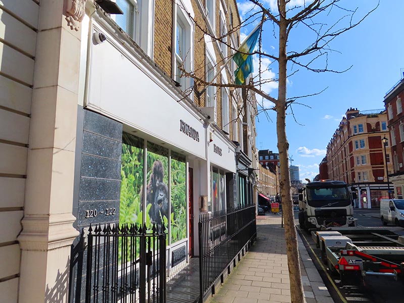
Continuing west the next left turning off of Marylebone Road is Seymour Place. Just  round the corner the Rwandan High Commission is the first of four HCs we’ll encounter today.

IMG_1379

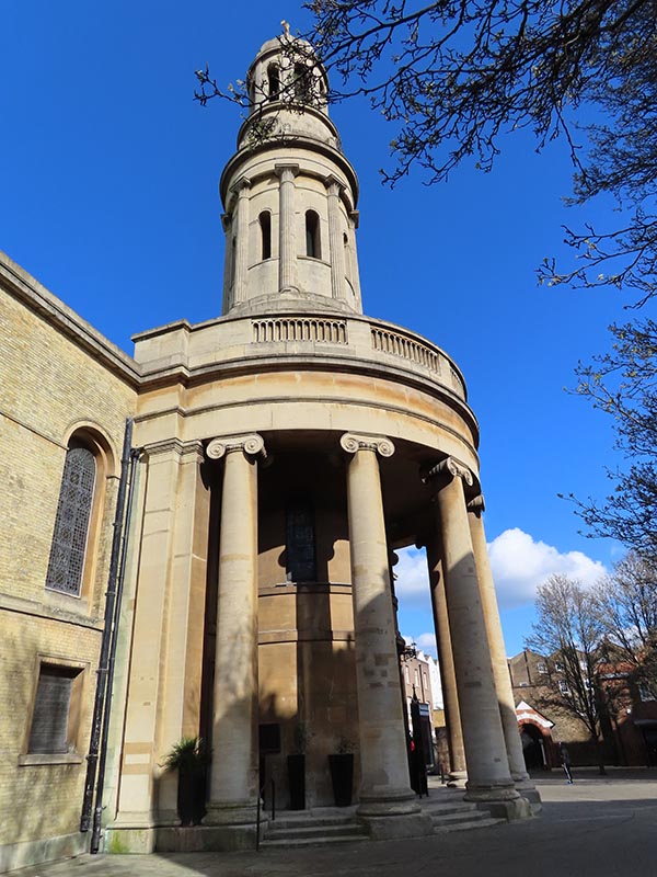
Returning to York Street we switch eastward and then cut through Wyndham Place to Crawford Street. This is the site of St Mary’s Church which was built as one of the Commissioners’ churches in 1823–1824 and was designed by Robert Smirke (1780 – 1867) who was also responsible for the main block and façade of the British Museum.

IMG_1380

From Crawford Street we loop back up to Harcourt Street which runs on a diagonal north-west to Old Marylebone Road and is home to the Swedish Church (Svenska Kyrkan), otherwise known as Ulrika Eleonora Church, which dates back to 1912.

IMG_1381

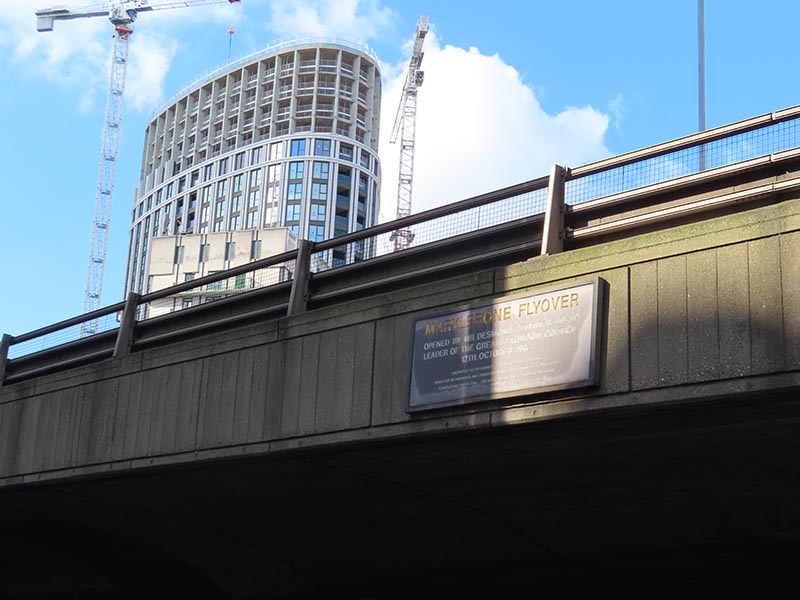
For our final visit (for today) to the Marylebone Road we stroll westward in the shadow of the heavenly vision that is the Marylebone Flyover. As the plaque proclaims, the flyover was opened by Mr Desmond Plummer, leader of the Greater London Council, on 12th October 1967. 119m long and 17m wide it is crossed by around 80,000 vehicles each day. It was created as part of a proposed series of 1960s congestion-relieving initiatives forming the eastern end of the Westway elevated dual carriageway, one of the few schemes that actually came to fruition.

IMG_1382

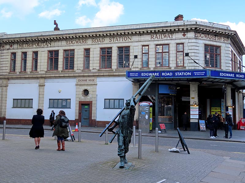
Turning south on the Edgware Road we make an immediate left into Chapel Street where we find the second of the two tube stations named after the Edgware Road. This one serves the Circle, District and Hammersmith & City lines and was opened as part of the Metropolitan Railway between Paddington and Farringdon in 1863.

IMG_1383

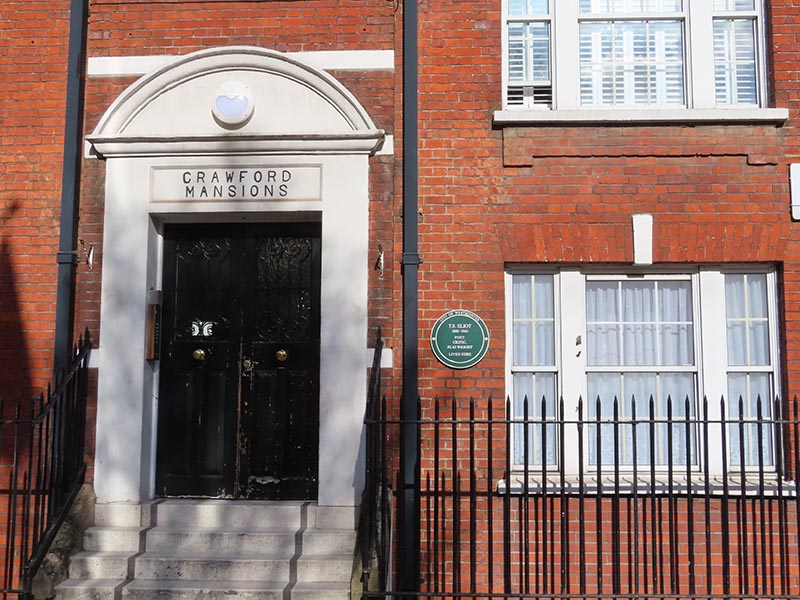
At the end of Chapel Street we cross over the Old Marylebone Road and follow Homer Street down to Crawford Street. Running parallel to this, back up to the OMR, is Homer  Row where T.S. Eliot (1888 – 1965) once resided. American born poet and playwright Thomas Stearns Eliot moved into 18 Crawford Mansions with his wife, Vivienne, in 1916, shortly after the publication of The Love Song of J. Alfred Prufrock. At the time, Eliot was working as a teacher at Highgate School where he taught a young John Betjeman. He also wrote book reviews and lectured in the evenings at University College London to earn extra money. By 1920 the couple had managed to find accommodation close to Regent’s Park that was both more capacious and less insalubrious in its surroundings. Today two bedroom apartments in Crawford Mansions sell for more than £1m.

IMG_1387

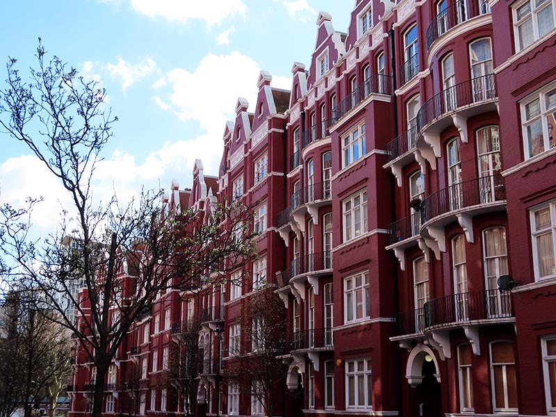
Transept Street and Cabbell Street which both cross between OMR and Chapel Street are the settings for the impressive crimson-hued Oxford and Cambridge Mansions which date from 1885.

IMG_1385

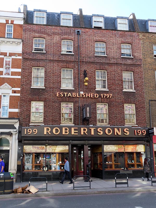
These buildings seem a world apart from the chaos and exoticism of the Edgware Road with its shisha cafes and mobile phone/money transfer outlets. One of the few relics of bygone days is Robertsons Pawnbrokers at 199 on the west side. Established in 1797, Robertsons specialises in fine, pre-owned, jewellery, gold, diamonds, watches, antiques and silver, and artwork and since the 1960s has been part of Suttons & Robertsons, one of the largest pawnbrokers in the UK.

IMG_1386

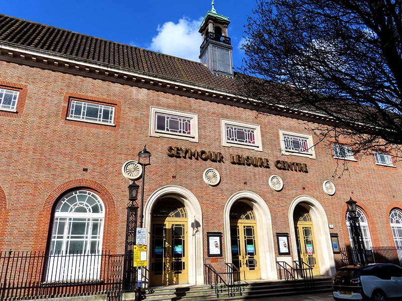
Crawford Place takes us east back to Crawford Street which is one side of the square  that surrounds the Seymour Leisure Centre, the others being Seymour Place, Bryanston Place and Shouldham Street. Grade II listed Seymour Leisure Centre was originally built in 1935-37 as a public baths and laundry by architect Kenneth Cross for St Marylebone Borough Council. The building is faced in purple brick with red brick architraves and Portland stone dressings and the gabled roof is clad in Spanish tiles. One of very few public sports facilities in central London, SLC boasts a gym, sports hall, 30m pool and an indoor climbing wall.

IMG_1388

Besides Shouldham Street there are three more streets that bridge across from Crawford Place to Harrowby Street; Molyneux Street, Cato Street and Brendon Street. Opposite the start of Molyneux Street is 45 Crawford Place which is shared by the High Commissions of Belize and of Antigua & Barbuda and the street itself is home to the High Commission of Tonga.

Of much greater interest though is Cato Street, not that you would know it to look at it. For here it was that the perpetrators of the eponymous Cato Street Conspiracy met in 1820 to hatch their plot to assassinate Prime Minister, Lord Liverpool and all the members of his cabinet. The conspirators, enraged by the Peterloo Massacre and the repressive legislation enacted in its wake, styled themselves as the “Spencean Philanthropists” after the radical speaker Thomas Spence (1750 – 1814). They were led by Arthur Thistlewood, who had been involved with the Spa Fields riots of 1816, with George Edwards as his second in command. The conspirators planned to assassinate the cabinet while they were at a dinner hosted by Lord Harrowby. They would then seize key buildings, overthrow the government and establish a “Committee of Public Safety” to oversee a radical revolution. Unfortunately, this supposed dinner was a set-up courtesy of Edwards who, it transpired, was a government spy.
At 7:30 pm on the evening of February 23 the Bow Street Runners stormed the Cato Street hideout. Some conspirators surrendered peacefully, while others resisted forcefully, Thistlewood killing one of the police officers with a sword. He along with three others slipped out through the back window but they were arrested a few days later. During the trial, the defence argued that the statement of Edwards was unreliable and he was therefore never called to testify. Police did however persuade two of the men, Robert Adams and John Monument, to testify against other conspirators in exchange for dropped charges. Accordingly, most of the accused were sentenced to be hanged, drawn and quartered for high treason. All sentences were later commuted to either hanging and beheading or transportation for life.  Thistlewood, Richard Tidd, James Ings, William Davidson and John Brunt were hanged at Newgate Prison on the morning of 1 May 1820.

On the stretch of the Edgware Road between the intersections with Harrowby Street and Nutford Place is a branch of Waitrose which occupies a former Woolworths store that first opened in 1914 but was done up in the modernist style seen below in 1936.

IMG_1392

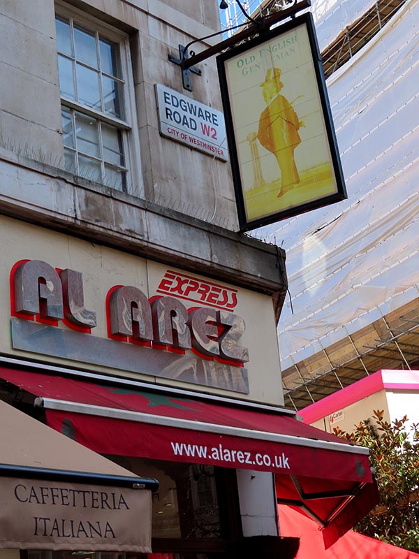
On the actual junction with Nutford Place this forlorn and faded pub sign presents a telling juxtaposition of the past and present of this area.

IMG_1393

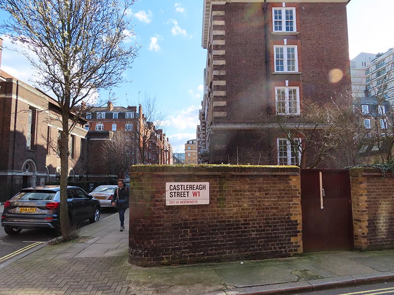
After a quick nod to Forset Street we proceed east on Nutford Place as far as Brown Street where we turn north. Off Brown Street is the pretty nondescript cul-de-sac of Castlereagh Street which, for the sake of symmetry, I am taking to be named after Robert Stewart, Lord Castlereagh (1769 -1822) who was one of the members of the aforementioned Lord Liverpool’s cabinet; Foreign Secretary in fact. Ulster-born Castlereagh was one of the prime movers behind the repressive government legislation that inspired the Cato Street conspirators and was directly named in Shelley’s vitriolic Masque of Anarchy poem written in response to Peterloo. He didn’t long survive his would-be assassins however, taking his own life in 1822 after being threatened with the exposure of his homosexual proclivities.

IMG_1394

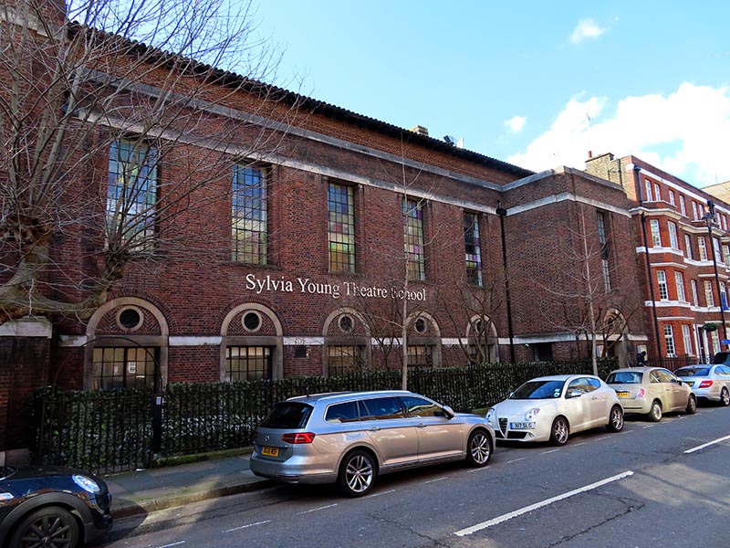
Having arrived back on Harrowby Street we turn right and then head south on a further stretch of Seymour Place past the Sylvia Young Theatre School. Sylvia Young first opened her school as a full-time establishment on Drury Lane in 1981. It moved to this current location in a converted church in 2010. The impressive list of alumni features actors such as Keeley Hawes, Lily Cole, Billie Piper and Steven MacKintosh and singers Amy Winehouse, Rita Ora and Dua Lipa.

IMG_1395

From here, starting with George Street we continue dipping in and out of the Edgware Road all the way down to Marble Arch with Stourcliffe Street, Wythburn Place, Great Cumberland Place, Upper Berkeley Street, Hamden Gurney Street, Seymour Street and Bryanston Street providing the route. At 51-53 Edgware Road you can just about make out what remains of the Art Deco Gala Royal cinema. This opened as the Royal Cinema around 1938/9 then was taken over by Jacey Cinemas and Gala Film Distributers in the 1960s. Theirs was the partnership that introduced continental and art house film to London. As time went on the Gala Royal couldn’t compete with the big cinema companies of the West End and towards the end of its life, resorted to screening saucy sex romps before closing in 1979. The building briefly reopened showing Arabic films to cater for the growing Arabic population on Edgware Road but shut for good in 1981. It now houses what I presume to be an Egyptian restaurant, judging by the pictures of Mo Salah outside, called Shishawi.

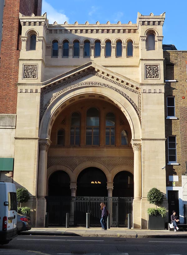
On Upper Berkeley Street is the West London Synagogue which was consecrated in 1870. The main sanctuary, shown below, was built in the Neo-Byzantine architectural style by Davis & Emmanuel.

IMG_1399

So as noted at the beginning once we arrive at Marble Arch we nip across the Edgware Road and head west along the Bayswater Road. After a hundred metres or so we turn right and move away from Hyde Park up Stanhope Place where we come across the first of a string of Blue Plaques. Lily Elsie (1886 – 1962) was one of the most successful stage actresses of the Edwardian era with a particular forte for musical comedies including the first London production of The Merry Widow. Despite a multitude of male admirers, according the renowned dress designer of that age, Lucile, “She was absolutely indifferent to most men for she once told me she disliked the male character and considered that men only behaved tolerably to a woman who treated them coldly”. Sadly this didn’t prevent her from entering into an unhappy marriage that led to her exile from the stage.

IMG_1400

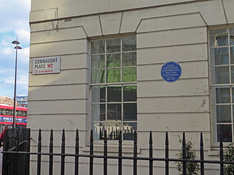
We turn down Connaught Place and at the end where it meets the Edgware Road is the house where Lord Randolph Churchill (1849 – 95), father of Winston of course, spent nine of the last twelve years of his relatively brief life. From the start of his political career Randolph was a champion of progressive Conservatism also known as “Tory Democracy”. As this philosophy gained ascendancy within the Tory party his star rose culminating in his appointment as Chancellor Of the Exchequer in Lord Salisbury’s second administration which began 1886. Unfortunately he had little talent for building alliances and gathering supporters within the Commons and lasted only a few months in the role before resigning in a row over cuts to the Armed Forces. He never made it back from the political wilderness and suffered from increasingly debilitating illness for the remainder of his life. It is considered a point of fact that he had been undergoing treatment for syphilis since his mid-twenties but it is still open to debate whether it was the mercury poisoning or an unrelated brain tumour that caused his demise at the age of 45.

IMG_1401

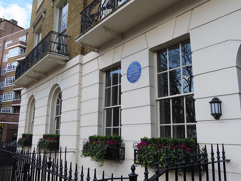
Next one is in Connaught Square, reached via Seymour Street, where the ballet dancer Marie Taglioni (1804 – 1884) lived for a couple of years at no.14. Swedish born, but Italian on her father’s side, Ms Taglioni’s main claim to fame is that she is credited with being the first ballerina to truly dance en pointe.

IMG_1402

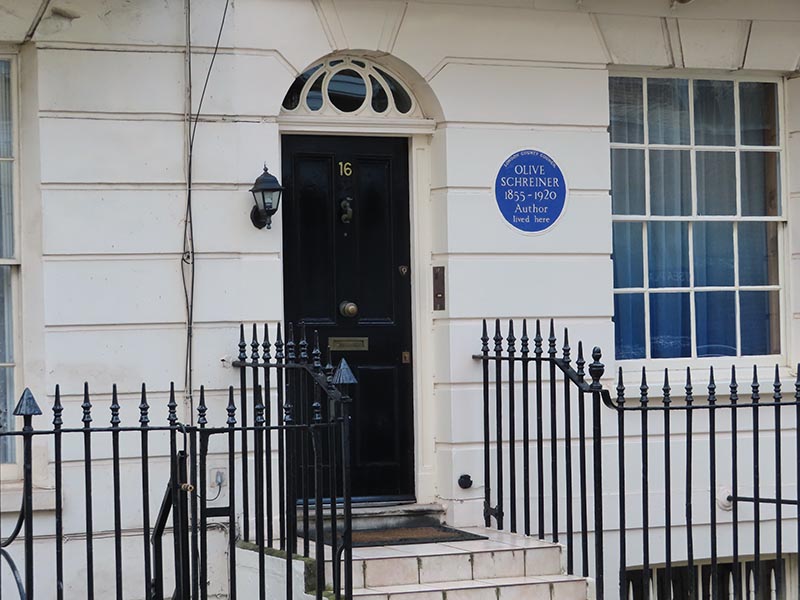
Connaught Square is bordered to the north by Connaught Street which we cross over into Portsea Place where no.16 was once the home of the South African author, proto-feminist and ant-war campaigner Olive Schreiner (1855 – 1920) once lived. I have to confess to a total lack of familiarity with Ms Schreiner and the work for which she is reportedly best known, The Story of An African Farm, but her advocacy of socialism, pacifism and the rights of non-white races mark her as a woman distinctly ahead of her time.

IMG_1403

At the top of Portsea Place we take Kendal Street back to the Edgware Road for the very final time then make our way back south towards Hyde Park via Park West Place, Porchester Place, and Albion Street. The last of these has commemorations of two former residents, novelist William Makepeace Thackeray (1811 – 1863) at no.20 and Sir Charles Vyner Brooke (1874 – 1963) at no.13. Thackeray is of course best known for his magnum opus Vanity Fair but he also penned The Luck of Barry Lyndon which was adapted for the screen by Stanley Kubrick in 1975. Thackeray was renowned as a man of idleness and gluttony (allegedly including an addiction to spicy peppers) which undoubtedly helped to hasten him into the grave at the age of 52. Vyner Brooke was the third and last White Rajah of the Raj of Sarawak. The Raj was established as an independent state located in the northwestern part of Borneo from a series of land concessions acquired by the English adventurer, James Brooke (Charles’ great uncle), from the Sultanate of Brunei in the mid-nineteenth century. As a major producer of oil, rubber and black pepper, Sarawak prospered for a century until the territory was invaded by the Japanese in WW2. After the war it became a British Crown Colony, the last one, before becoming part of Malaysia when it gained independence.

Last port of call for today is on Hyde Park Place. This part of London, north of Hyde Park was originally the site of the village of Tyburn which was infamous as a place of public hangings from 1196 to 1793. In 1571, the so-called Tyburn Tree was erected near where Marble Arch is currently situated. The “Tree” or “Triple Tree” was a novel form of gallows, consisting of a horizontal wooden triangle supported by three legs which meant that several prisoners could be hanged at once. Among those executed throughout the ages were the 105 martyrs of the Catholic Reformation. It was in commemoration of these martyrs that Mother Marie Adèle Garnier established the Tyburn Convent here in 1903, she and her  community having fled to England from France two years earlier on account of French laws prohibiting religious Orders. In so doing she fulfilled a prophecy of the 16th century Roman Catholic priest Father Gregory Gunne who in 1585, referring the execution four years earlier of St Edmund Campion, proclaimed “You have slain the greatest man in England and one day there, where you have put him to death, a religious house will arise, thanks to an important offering.”

This slideshow requires JavaScript.


Day 45 – Bishopsgate – Leadenhall Market – Lime Street – Monument

Today’s journey’s a little bit different from the usual in that it coincided with the Sunday of this year’s Open House Weekend so I was afforded the possibility of seeing inside a few places en route that would normally be off limits. Case in point is the Drapers’ Hall which we encountered towards the end of Day 44 so we’re going to rewind a bit and kick off with that again this time. From there we’re going to head north up to London Wall then drop south on Bishopsgate to Leadenhall Market before wending our way east and south to finish up at the Monument.

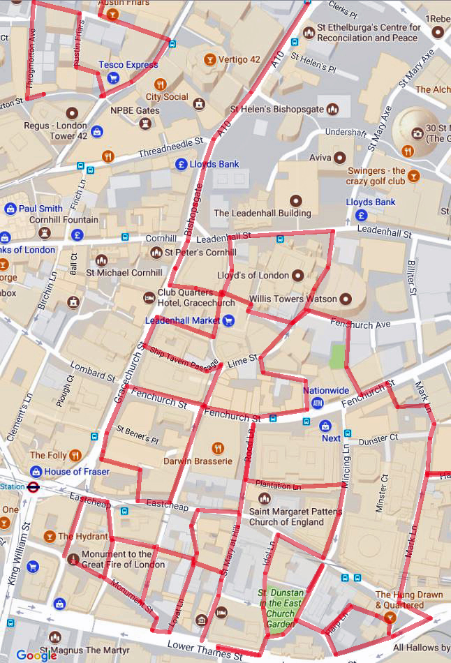
Day 45 Route

As noted, today’s starting point is the Drapers’ Hall on Throgmorton Street. We already covered the history of the Drapers’ Company and the external architectural features last time out so I’m just going to let the images of the interior pretty much speak for themselves (aside from the commentary I’ve added to the individual slides that is). Suffice to say, I had expected something pretty grandiose as befitting third place on the Order of Precedence but I wasn’t prepared for something quite this opulent (and on such a scale).

This slideshow requires JavaScript.

You will have noted that the Victorian artist, Herbert James Draper (1863 – 1920) had quite a prominent role in in the decoration of the Hall. Whether he got the commission on account of his name or because the guiding lights of the company appreciated his somewhat risqué interpretations of mythological and Shakespearean themes is not recorded (so far as I can tell). The thinking behind the tapestries and ceiling painting depicting scenes from the Legend of Jason and the Golden Fleece is rather easier to discern.

After leaving the hall we repeat the walk up Throgmorton Avenue to Austin Friars which leads east to the Dutch Church. Originally this was the site of a 13th century Augustinian priory (Austin Friars) before, in 1550, what is regarded as the oldest Dutch-language Protestant church in the world church was founded here. That first building survived right up until the Blitz destroyed it; the present church was built in the early 1950’s. Perkin Walbeck, the pretender to the English crown (he claimed to be the younger son of Edward IV, one of the Princes in the Tower murdered by Richard III), was buried in the original church following his execution by Henry VII. Today the church still acts as a focal point for the Dutch community in London.

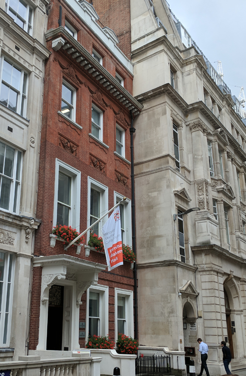
Opposite the church is the Furniture Makers’ Hall – which is the one that I could claim entry to by virtue of ancestry. Typical ! If only my Grand-dads had been drapers instead of chairmakers.

IMG_20170823_163832

Looping round the rest of Austin Friars we emerge onto Old Broad Street opposite the City of London Club, the oldest Gentlemen’s club in, well, the City of London. This was founded in 1832 by a group of prominent bankers, merchants and ship owners and held its first meetings at the George and Vulture pub (see last post). The original membership numbered 600 and included the Duke of Wellington and Sir Robert Peel. If you should want to join then you need to make the acquaintance and get the support of at least six people who are already members (and ladies are equally welcome these days apparently).

IMG_20170823_164020

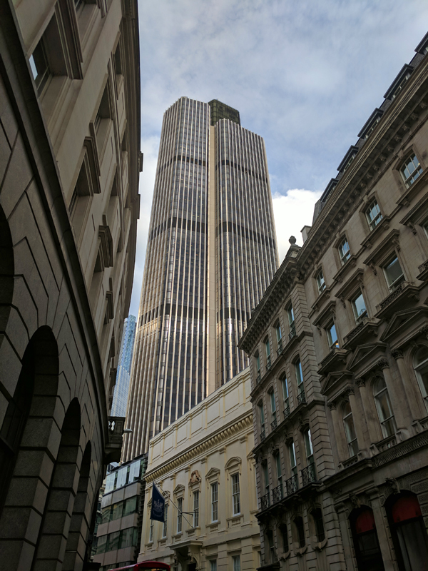
As you can see, these days the City of London Club, sits in the shadow of Tower 42, which until 1990 and the construction of One Canada Square at Canary Wharf was the tallest building in the UK. Nowadays it’s only the third highest skyscraper in the City of London having been eclipsed in recent years by the Heron Tower (we’ll stick with that name thank you) and 122 Leadenhall Street (a.k.a “the Cheesegrater”). Tower 42, of course, started life as the NatWest Tower (seen from above the shape of the building echoes the NatWest logo). It was designed by Richard Seifert (1910 – 20011) and built by John Mowlem & Co between 1971 and 1980 at a cost of £72m. At 183m the tower dwarfed everything around it at the time of construction and was extremely controversial. It was built around a massive central concrete core from which the floors are cantilevered (anchored at just one end) making it exceptionally strong but reducing the amount of office space that could have been available with an alternative structure. On a note with contemporary resonance; at the time of design, fire sprinkler systems were not mandatory in the UK and so weren’t installed. It was this omission, coupled with a fire in the tower during a 1996 refurbishment, that prompted the GLC to amend its fire regulations and require sprinkler installations in all buildings. Today the building is multi-tenanted with a high-end restaurant on the 24th floor and a champagne and seafood bar on the 42nd.

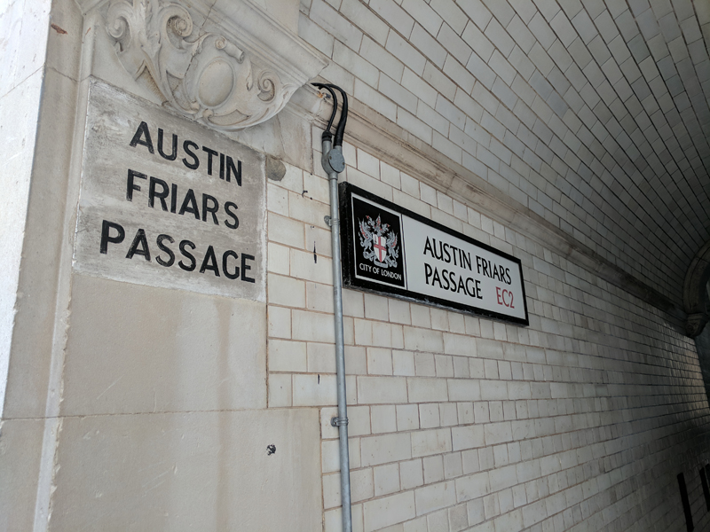
Moving on we duck into Pinners Alley (by the side of Pinners Hall where I worked from 1996 to 2004) heading west briefly before turning north up Austin Friars Passage – which I always though should’ve been the name of a second division 1970’s pro-rock band.

IMG_20170823_164254

At the other end is Great Winchester Street which is home to Deutsche Bank’s London HQ. Among the artworks in their lobby is one of Damien Hirst’s multi-coloured dot efforts (more of him later).

IMG_20170917_115458

Turning left we end up back on London Wall which as we head east morphs into Wormwood Street. At the junction with Bishopsgate (a.k.a the A10) we switch southward and drop all the way down to Leadenhall Market. On the way we pass a NatWest building of a different vintage altogether; this one built in the 1860’s to a design of the architect John Gibson (1817 – 1892) when the bank was known as the National Provincial Bank of England.

At Leadenhall Market I was able to tag along with a tour that had just started (courtesy of Open House again). I wish I had made a note of the guide’s name so I could give a well deserved shout-out as she was excellent. Anyway, Leadenhall Market dates back to the 14th century and stands on a site that was once the heart of Roman London. As early as 1321 it was a meeting place of the Poulterers while the Cheesemongers (I think we must have missed them on our travels) sold their wares here from 1397. In 1411 the Corporation of London acquired the freehold of the site and it became an established market for fish, meat, poultry and corn. The present wrought iron and glass roofed structure was designed by City Architect, Horace Jones (1819 – 1887) and erected in 1881. The Market has been used as a location in a number of films, most notably Harry Potter and the Philosopher’s Stone where it represented Diagon Alley and the Leaky Cauldron pub.

This slideshow requires JavaScript.

We leave the market via Whittington Avenue and, turning right on Leadenhall Street, pass the Lloyds of London building (not to be confused with the Lloyds Register building which we encountered previously). This iconic, Richard Rogers designed edifice, caused even more of a stir when it was put up (between 1978 and 1986) than the NatWest Tower had. In spite of this, 25 years after its completion it became the youngest structure ever to be granted Grade-I listed status. Lloyds is a leading example of what has been dubbed Bowellism, the practice of putting service areas of a building on its exterior so as to maximise space in the interior (c.f. Paris’s Pompidou Centre). The building consists of three main towers and three service towers around a central, rectangular space. Its core is the large Underwriting Room on the ground floor, which houses the Lutine Bell within the Rostrum. (It wasn’t taking part in Open House this year but the queues are normally prohibitive anyway).

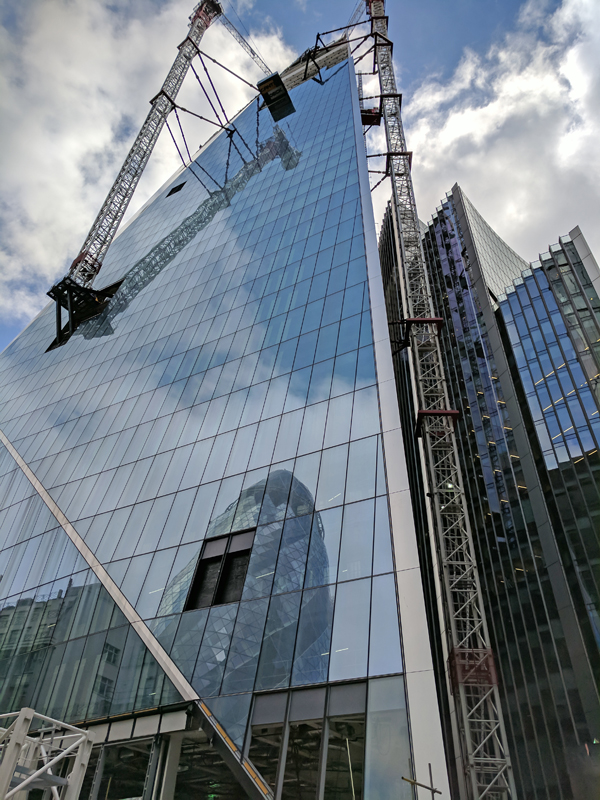
The Lloyd’s building is at no.1 Lime Street; opposite at no.52 construction is underway of yet another skyscraper, The Scalpel. This time that’s an official designation, the developers yielding to the “if you can’t beat ’em join ’em” maxim. This one will top out at 38 storeys and be the new European HQ for insurers W.R Berkley (no me neither).

IMG_20170917_123428

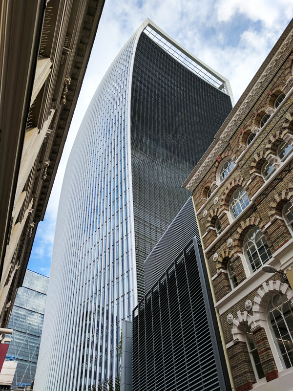
Turn south down Lime Street and then return to the Market along Leadenhall Place. Take a left into Lime Street Passage and then traverse the Market a couple more times via Beehive Passage, Bull’s Head Passage and Ship Tavern Passage. This finds us back on Lime Street which we follow southward to Fenchurch Street. From here we go west back to Gracechurch Street then continue south before cutting round Talbot Court down onto Eastcheap. Turn east as far as Philpot Lane and use this to return northward, poking our noses into Brabant Court on the west side before arriving back on Fenchurch Street. This route takes us around no.20 Fenchurch Street, better known to you, me and everyone else as the “Walkie-Talkie” and the 2015 winner of Building Design Magazine’s Carbuncle Cup for the worst building in the UK. It is notorious of course because its concave shape makes it reflect sunlight into a concentrated beam that on reaching street level has been known to melt the bodywork of parked cars and facilitate the frying of eggs on the pavement. Those incidents took place in 2013, since when the glass exterior has been covered with a non-reflective film. In an interview with The Guardian the building’s architect, Rafael Vinoly, blamed the problem on global warming “When I first came to London years ago, it wasn’t like this … Now you have all these sunny days”.  The ‘sky garden’ at the top of the building was claimed to be London’s highest public park, but since opening there have been debates about whether it can be described as a ‘park’, and whether it is truly ‘public’ given the access restrictions. On the day there was a queue of about eighty or so people waiting to be allowed up.

IMG_20170917_124732

This time we strike eastward until we reach Cullum Street which curves back onto Lime Street. At the junction here that man Damien Hirst makes a second appearance in today’s post, lowering the tone of the neighbourhood with one of his giant anatomical models as part of Sculpture in the City.

IMG_20170917_123920

This time we make an easterly retreat from Lime Street along Fenchurch Avenue and after a short distance cut back to Fenchurch Street via Fen Court. There is a small garden here in what was once the churchyard of St Gabriel Fenchurch, lost in the Great Fire. The sculpture “The Gilt of Cain” by Michael Vissochi was unveiled by Archbishop Desmond Tutu in 2008 and commemorates the 200th anniversary of the abolition of the transatlantic slave trade. It takes its name from a poem of Lemn Sissay which is inscribed on the sculpture and combines Old Testament text with the language of the Stock Exchange.

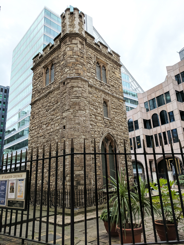
You’re probably wondering by now where all the churches had got to but don’t worry, there are one or two on the menu today – though fewer than you’ve had to put up with in the last few posts. First up is All Hallows Staining which we reach by taking Star Alley south from Fenchurch Street through to Mark Lane. Mind you, all that remains of this one is its tower which was built around 1320 AD. The rest was demolished c.1870 when All Hallows merged with nearby St Olave Hart Street (see Day 40). The latter was badly damaged in WW2 so a prefab church was erected next to the tower and named St Olave Mark Lane (as you see the sign in the photo confusingly still refers to St Olave). The tower is maintained by the Worshipful Company of Clothworkers, whose hall sits in nearby Mincing Lane.

IMG_20170917_132720

Next we follow Mark Lane down to Great Tower Street which at its eastern extremity adjoins with Byward Street which as it heads west turns into Lower Thames Street. At the juncture here sits The Hung Drawn & Quartered pub which acts as a reminder of the public executions which once took place on nearby Tower Hill, including those of Thomases More and Cromwell.

IMG_20170917_133151

We leave Lower Thames Street almost immediately and wend our way through Bakers Hall Court, Harp Lane and Cross Lane to St Dunstan’s Hill where lie the ruins of the church of St Dunstan in the East, now set within a public garden that was laid out in 1967. St Dunstan’s wasn’t completely destroyed in the Great Fire so it was patched up in the immediate aftermath and then a Wren-designed tower and steeple were added at the end of the 17th century. Apart from a couple of walls this tower was all that remained intact after the WW2 bombing and it was decided not to rebuild again. Personally I like it as it is now – as do the birds.

This slideshow requires JavaScript.

Dropping back down onto Lower Thames Street it’s time for another Open House visit – to the Billingsgate Roman House and Baths (or rather the very partial remains thereof) located beneath a drab 1980’s office block. Discovered in 1848 during the construction of the Coal Exchange building (more of that in a while) these are the only remains of a Roman house accessible in London. It is believed that the house was originally built around the late 2nd century AD and the baths added in the following century. The latest theory is that at the time the baths were constructed the building had become a resting-place for travellers, essentially a Roman version of a hotel. I have to again commend the guides who were exceptionally informative and engaging. Visits to the site are restricted but you can book a tour through the Museum of London outside of Open House weekend.

Opposite here, straddling the area between Lower Thames Street and the river is another Open House destination, Custom House. An English Customs service on an ad hoc basis has existed since at least the middle of the 8th century and was formalised by King Edward I in 1275 as a means of beefing up the royal finances. The current Custom House is thought to be the fifth such to have been built on this site, chosen because beyond this point London Bridge has historically prevented ships from going further upriver. The present building was put up between 1813 and 1817 and initially designed by David Laing (1774 – 1856), Surveyor to the Customs. However within a few years of completion the ceiling of the Long Room had partially collapsed and the floor completely given way. The latter event occurred just a day after Sir Robert Smirke (1780 – 1867) had concluded an inspection of the premises and advised staff to evacuate. Smirke was then engaged to oversee the rebuilding and Laing’s career suffered the same fate as the floor. The Custom House now comprises a west wing built by Laing, a central block built by Smirke and an east wing dating from 1962-66. The southern façade, made of Portland stone, is much more aesthetically-pleasing than the northern face of yellow stock brick; this is because the building was designed to be seen from the river and impress shipfarers from overseas.

This slideshow requires JavaScript.

The Great Long Room was an innovation of Christopher Wren (prolific doesn’t even begin to do the man justice) for his version of the Custom House, built in 1671. This was to be the public room where all import and export business was to be transacted. Because of this room, the public rooms in Custom Houses around the world have become known as ‘Long Rooms’ irrespective of their shape or size. The current Long Room is the work of the aforementioned Sir Robert Smirke, it is 190 feet long and 63 feet wide and has one of the largest unsupported wooden ceilings in Europe.

IMG_20170917_151631
The Long Room

The Coal Exchange which I mentioned earlier was one of the glories of Victorian Architecture, built in 1847-49 to the designs of City architect, James Bunstone Bunning (1802 – 1863) and opened to great fanfare by Queen Vic herself. The interior was one of the earliest and most remarkable examples of cast-iron construction in the world, several years before the Crystal Palace. However that didn’t cut any ice with the town planners of the 1960’s who had little regard for Victorian extravagance. Despite the objections of the Victorian Society and Sir John Betjeman (naturally) the building was demolished in 1962 in preparation for a road-widening scheme that didn’t actually take place until the 1980s. Why do I mention this ? Because the alternative would have been to shave off that unlovely north face of the Custom House, an option which from a 21st century perspective appears immeasurably more appealing.

Coal Exchange

James Bunning was also responsible for the original Billingsgate Fish Market built just to west of the Custom House in 1850 but rendered obsolete by increased levels of trade within 25 years. Work on a new market building, designed by Horace Jones in the Italianate style, began in 1874 and was completed three years later. In 1982 the fish market was relocated to the Isle of Dogs and the building on Lower Thames Street was refurbished under the guidance of Richard Rogers (he gets about a bit as well). The Grade II listed building is now used as an events venue.

IMG_20170917_153833

Time we got moving again I think. Head up Idol Lane which runs to the west of St Dunstan’s and turn right on Great Tower Street before proceeding north (with a manly stride) up Mincing Lane. Next move is west along Plantation Lane which leads into Rood Lane. Venture northward first before doubling back towards Eastcheap. On the corner here stands the Guild church of St Margaret Pattens (unlike Parish churches Guild churches hold regular weekday services rather than serving a Sunday congregation). The church’s exterior is notable for its 200-ft high spire, Wren’s third highest and the only one that he designed in a medieval style. The name of the church derives from pattens, wooden-soled overshoes which historically enabled Londoners to walk about the city without sinking too deep into the mud and effluent which covered the streets. The church still has an affiliation with the Worshipful Company of Pattenmakers.

IMG_20170917_153041

Cross over Eastcheap and drop down St Mary at Hill back towards the river. At no.18 we find the Watermen’s Hall, home to the Company of Watermen and Lightermen (in a riverfaring context the Watermen were the equivalent of taxi-drivers and the Lightermen the truckers). The hall was built in 1780 by William Blackburn and is the only remaining Georgian hall in the City of London. The Watermen are not a Livery Company as such, hence no Worshipful before the name. This is because the Waterman are governed by statutes and Royal Charters that extend beyond the boundaries of the City of London. So unlike the Pattenmakers (no.70) they don’t appear in the Order of Precedence.IMG_20170917_153709

So we’re almost at our final stop and to get there we have to negotiate as follows: north up Lovat Lane, left turn into Botolph Alley, north up Botolph Lane, west along Eastcheap, south down Pudding Lane, left along St George’s Lane back to Botolph Lane, south this time and then west into Monument Street. Which, as you might have guessed, brings us to The Monument itself. As I’m sure you’re aware, this was erected in commemoration of the Great Fire of 1666 and the subsequent rebuilding of the City and was completed in 1677. The fire was alleged to have begun in a baker’s shop on Pudding Lane and the height of The Monument is equal to its distance from that starting point, 202 feet. The designers of the memorial were Sir Christopher Wren (goes without saying really) and his friend Dr Robert Hooke (1635 – 1703). They came up with the idea of a classic Doric column with 311 steps up to a viewing platform and a summit topped with a drum and copper urn from which flames emerge. A total of seven people died falling from the viewing gallery (six suicides and one who accidentally fell after leaning over the balcony to look at a live eagle kept in a cage) before it was enclosed in an iron cage in 1842. It costs £5 (cash only) if you want to ascend up to the platform.

Keeping my five pounds in my pocket I walk on by and finish today’s epic with a stroll up and down Fish Street Hill.

And that’s us finally just about done with the City of London. Next time we’ll be heading back west over to Hyde Park for a complete change of scene.