Day 31 (part 2) -Finsbury Square – Golden Lane – Charterhouse Square

Second part of today’s walk is itself split into two. First off we continue west from Liverpool Street Station and make a circuit of Finsbury Square before pausing on the eastern side of the Barbican Centre. Then it’s a return trip through the Beech Street tunnel to get to Golden Lane and its eponymous estate; after which we loop round the extensive site occupied by the Charterhouse and one of the four campuses of Queen Mary University traversing Clerkenwell Road, St John Street and Charterhouse Street to finish in Charterhouse Square.

day-31-route_2

day-31-route_3

Leaving Broadgate Circus we turn right along Eldon Street then turn back north up Finsbury Avenue which leads into Finsbury Avenue Square which contains both table tennis tables and a few pieces of public art including this piece, Rush Hour.

p1050953

Exit the square from the north-east corner into Sun Street first turning left then swiftly right into Crown Place and completing a figure of eight involving those two along with Christopher Street, Earl Street and Wilson Street. Continue south on the latter past the Wilson Street Chapel which is currently besieged by both roadworks and redevelopment of the Flying Horse pub next door. The chapel was built in 1889 which (à propos of nothing) is one of the longest Roman Numeral dates to have yet occurred – MDCCCLXXXIX.


p1050954

At the end of Wilson Street turn right along South Place then right again into Dominion Street facing directly towards the back entrance of City Gate House. This was constructed in the mid 1920’s to the design of Sir Giles Gilbert Scott (1880 – 1960) son of the better known and much more prolific George Gilbert Scott, creator of the Midland Hotel St Pancras (as was recorded many posts ago). Giles’ main claim to fame rests on the design of something on a much smaller scale but that’s one for our next post. City Gate House was originally built as a gentleman’s club but it’s not clear how long it lasted as such. American media giant Bloomberg acquired the building in 1991 though in 2015 they sold it on to developers (leasing it back on a temporary basis).

p1050956

Turn left next along Lackington Street then north up Finsbury Pavement (part of the A501) before turning the corner into Finsbury Square. First building you come to is the Norman Foster designed no.50 which is adjacent to City Gate House and which Bloomberg expanded into in 2000. Two years later they created the Bloomberg Space on the ground floor as a showcase for newly-commissioned contemporary visual art. The exhibitions there are generally worth a visit but the current offering left me distinctly underwhelmed I’m afraid.

p1050957

Continue round the square anti-clockwise passing the front of City Gate House and the drinking fountain that was erected by Tom and Walter Smith as a memorial to their mother Martha who died in 1898. Their father, another Tom, was the man who, in 1847, invented the Christmas Cracker. The business he created on the back of this, Tom Smith & Co., subsequently taken on by his three sons, operated from premises in Finsbury Square up until 1953 (when they moved to Norwich).

p1050959

The north side of the square is dominated by the former Triton Court (now known as the AlphaBeta Building). Triton Court was constructed in 1920, comprising three buildings, Mercury, Jupiter and Neptune Houses, internally arranged around a full height 9 storey central atrium. It underwent a first major refurbishment in 1984 and another, costing £36m, has just been completed following the change of name. On top of the tower stands a statue of the messenger of the Gods; Hermes or Mercury depending on whether you favour the Greeks or the Romans.

This slideshow requires JavaScript.

After completing the circuit of Finsbury Square we head west on Chiswell Street where we pass Longbow House which now houses a branch of Currys PC World. This post-war building incorporates a relief of an archer, referencing back to the days when this area was to archery what St Andrews is to golf. That was before the advent of the musket though and the establishment of the Honourable Artillery Company whose grounds lie just to the north of here (see Day 28).

p1050964

Turn south down Finsbury Street and onto Ropemaker Street then continue west past the Barbican Centre and through the Beech Street tunnel to resume the trail at the southern end of Golden Lane. Take the first left into Brackley Street and when this junctions with Viscount Street head south initially into Bridgewater Street then double back and enter the Golden Lane estate from Fann Street.

The Golden Lane Estate was built in the 1950’s in an area which, as we have seen previously, was effectively razed to the ground by the blitz. A competition for the  design had been launched in 1951 and was won by Geoffrey Powell, a lecturer in architecture at Kingston School of Art. He then formed the partnership of Chamberlain, Powell & Bon with two of his fellow lecturers in order to carry out the project – the three had entered into an agreement that if any one of them won they would share the commission. The first  phase was opened in 1957 and the final block completed five years later. The estate consists of a series of relatively low-level maisonette blocks and the 16-storey centrepiece, Great Arthur House, which was the first residential tower block in London over 50 metres in height. The architectural style takes definite inspiration from the work of Le Corbusier but is softened by the use of primary colours on the facades.

At the time of construction the estate was regarded enthusiastically as a template for integrated social housing and it has indubitably stood test of time better than most of its contemporaries. Unsurprisingly, given the location, slightly over half of the 559 flats have been sold on leasehold since the Thatcher government’s introduction of the right to buy scheme. The attractiveness of taking advantage of such opportunity is enhanced by a level of on-site facilities replicated in scant few other London council estates – including a leisure centre with tennis courts and an indoor pool. Since 1997 the estate buildings have been Grade II listed.

So we exit the estate back out onto Golden Lane itself and continue north before turning west onto Baltic Street East and completing a grid consisting of this, Honduras Street, Timber Street, Domingo Street, Crescent Row, Memel Street, Memel Court, Sycamore Street and Baltic Street West. And the only thing of note to record in this whole area is this doorway of a former school which I can find no information about.

p1050969

Anyway, after all that we find ourselves out on the Goswell Road and then turning the corner into Clerkenwell Road where the mural that we saw back in Day 14 has now been replaced by a giant-sized Jessica Ennis-Hill.

Turn south all the way down St John Street to arrive opposite Smithfield Market then take a left down Charterhouse Street which soon splits in two. Take the left fork which takes us past a couple of pubs of note. First is the Smithfield Tavern which on the website which is still running advertises itself as Smithfields’ only vegetarian and vegan pub. You can see how well that worked from the picture below. Second is the Fox and Anchor which in its current four-storey art-nouveau facaded Grade II-listed incarnation has been around since the tail end of the 19th century (though there has been a pub of some kind here for several centuries).

Continuing on we arrive at Charterhouse Square. On the north side of the square sits the Charterhouse,  a former Carthusian monastery which since Henry VIII’s dissolution of the monasteries in the 16th century the house has served as a private mansion, a boys’ school and an almshouse which it remains to this day. The site was originally set aside in the middle of the 14th century as a burial ground for victims of the Black Death and the monastery was established in 1371 on the unused portion of the land. In 1611, the year of his death, Thomas Sutton (1532 – 1611), businessman, civil servant and philanthropist, founded an almshouse for “80 impoverished gentlemen” and a school for 40 boys. Charterhouse School eventually outgrew its premises and moved to Godalming in Surrey in 1872 selling the site to another school, Merchant Taylor’s, which itself moved on in 1933. Today this part of the site is occupied by one of the four campuses of Queen Mary University London. The almshouse, which remains, is formally known as Sutton’s Hospital in Charterhouse and is a registered charity. For historic reasons the residents are still known as “Brothers”.

p1050974p1050975


The entrance to the University campus is via Rutland Place at the north-east corner of the square. On the east side of this lies Dean Rees House, part of the University now but built in 1894 as the Headmaster’s House and still bearing the motif of the Merchant Taylor’s School.

p1050976

The east side of Charterhouse Square itself is dominated by the Art Deco Florin Court built 1935-37 by Guy Morgan & Partners. When the building was refurbished in 1988 the original roof gardens were reinstated and a basement swimming pool added. Post-refurb and through the nineties it found fame in the guise of Whitehaven Mansions home to the TV version of Agatha Christie’s Poirot.

p1050978

Leaving the square via Carthusian Street (named after those monks of course) we arrive on Aldersgate Street, flanking the west side of the Barbican complex, and the finish of today’s perambulations.


Day 18 – Clerkenwell – Farringdon – Hatton Garden – Holborn

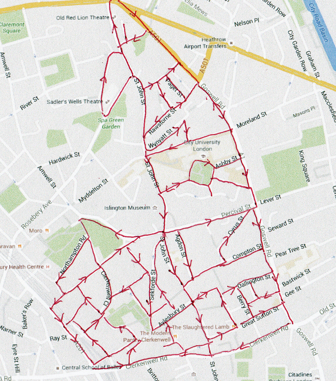
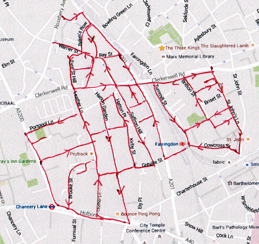
Today’s route is another compact one covering the area bounded by Gray’s Inn Road to the west, St John Street to the east and Holborn to the south. Highlights include a visit to the Museum of the Order of St John (try and contain yourself please) and a stroll around the (in)famous home of the London diamond trade, Hatton Garden.

Day 18 Route

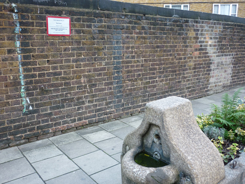
We start in familiar territory and quickly knock off the triangle of streets that are bordered by (and sunken beneath) Rosebery Avenue, Clerkenwell Road and Farringdon Road. Despite some great names: Coldbath Square, Crawford Passage, Bakers Row, Warner Street, Eyre Street Hill, Back Hill, Summers Street, Ray Street and Herbal Hill have only this temporary resident to tempt open the camera lens.

P1050099

Like most things though this is a matter of timing. This area of Clerkenwell (and a bit beyond) was once known as “Little Italy” due to the influx of about 2,000 immigrants from that country in the 1850’s. It remains something of a spiritual home to London’s Italian community due to St Peter’s Church (on Clerkenwell Road) which is the force behind the Procession of Our Lady of Mount Carmel and Sagra which takes place each July and brings this sunken enclave alive. I was fortunate enough to stumble across the procession, and its accompanying food and drink stalls, some years ago and have been trying to schedule a return visit ever since.

St Peter’s Church opened amid great celebration in 1863 and at the time was the only church in Britain designed in the Roman Basilican style. The painting below of the Beheading of John the Baptist is from the 17th century and by the hand of artist, Alessandro Turchi.

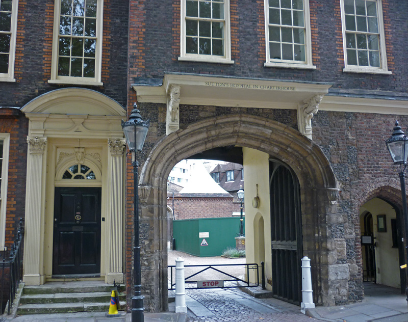
Leaving the church we head east along Clerkenwell Road as far as St John’s Square which  straddles the road. The north side of the square was included in one of our earlier posts. However, unlike on that occasion, St John’s Priory is open to visitors today. I won’t go through all the history again but for Tudor buffs would remind you that the Knights of St John were the last of the monastic orders to be abolished by Henry VIII (in 1540). Consequent upon that Henry took the priory and all its land and wealth which were second only to those of Glastonbury Abbey. Henry gave the priory itself to his daughter Mary to use and as a palace and on her accession to the throne she restored the Order only for Elizabeth to do away with it for good when she became queen.

This slideshow requires JavaScript.

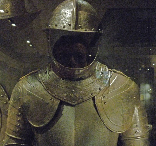
Across the road is St John’s Gate where the main part of the Museum resides. If, like me, you’ve seen anything of the recent TV series on the Crusades this is well worth a visit. There’s no entry fee and the museum does a great job in presenting the remarkable story of the Order and its survival.

This slideshow requires JavaScript.

And it also provides the opportunity for today’s selfie-of-the day. I know what you’re thinking – not everyone can carry off the suit of armour look that well.

P1050119

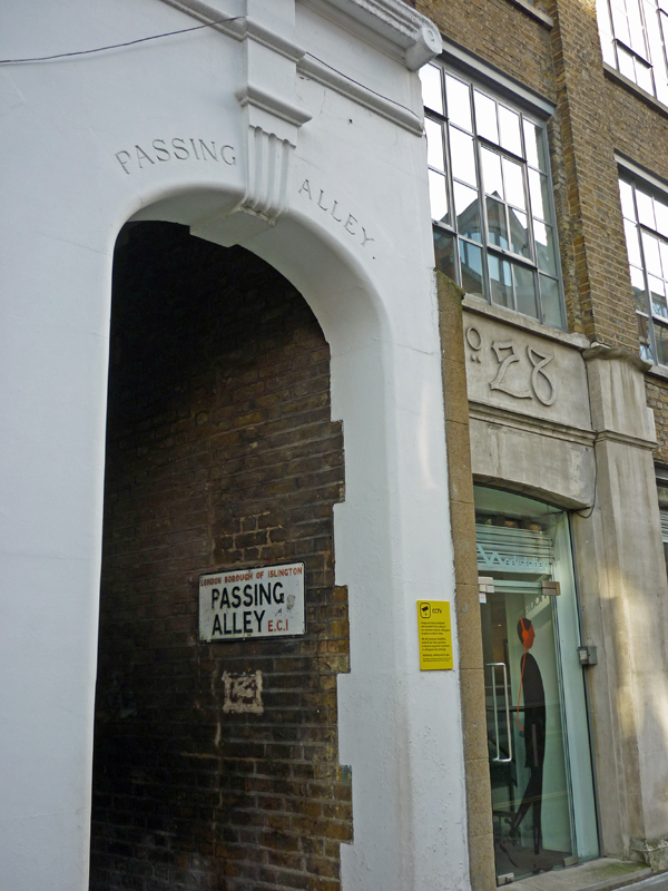
Continuing down St John’s Lane we reach Passing Alley which according to several sources was known as Pissing Alley back in the days when an al-fresco emptying of the bladder was more in tune with public sensitivities.

P1050125

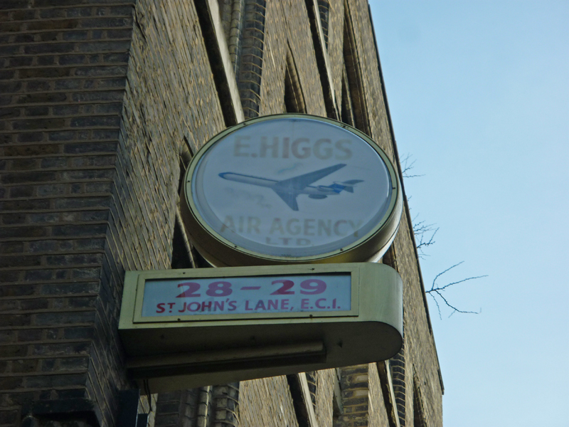
Just a couple of doors further down is this sign for E.Higgs Air Agency which upped and moved away several decades ago and was last heard of trading out of Bracknell under the name of Higgs International.

P1050126

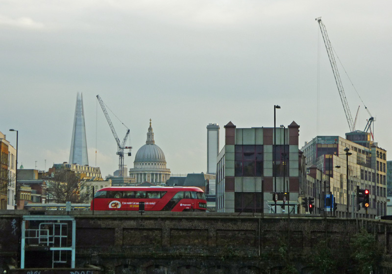
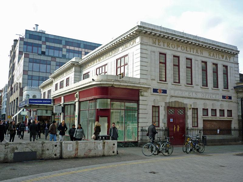
At the end of St John’s Lane we turn right down Peter’s Lane to cut through to Cowcross Street whose name derives from the time (up until the 1850’s) when live animals were herded down here on their way to Smithfield Market. Turning west we arrive at Farringdon station which opened in 1863 as part of the first London underground line, the Metropolitan.  One of the finest looking tube stations in the capital it has fortunately been left unscathed by the developments for, firstly, Thameslink and now Crossrail.

P1050128

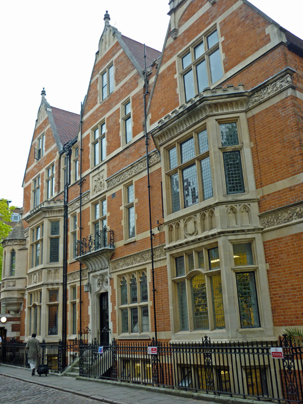
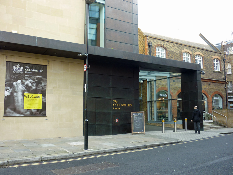
From here we turn briefly up Turnmill Street and then right into Benjamin Street. At the end of this is the Goldsmiths Centre which was opened in 2012 as a new training and education facility supported by the Goldsmiths’ Company (one of the 12 great livery companies of the City of London). The building combines an 1872-built Grade II listed Victorian school with a modern extension.

P1050131

Just round the corner, on another section of Peter’s Lane, the weathervane and bull’s head mouldings on what is now the Rookery Hotel are another reminder of the proximity to Smithfield Market.

P1050132

So next we snake round Eagle Court, Albion Place and Briset Street which brings us out onto Britton Street. Here we find Mountford House, a block of flats built in the 1970’s but which incorporates the 1901-03 façade (by E.W Mountford) from the offices of Booth’s Gin Distillery, demolished as part of the same redevelopment. The preservation of the façade represented a rare victory for the forces of conservation at that time.

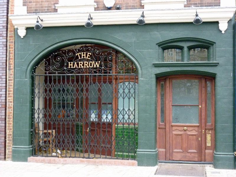
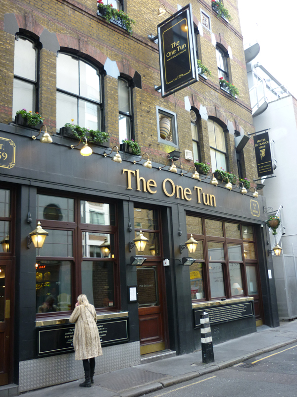
At the top of Britton Street we turn left then head back down Turnmill Street and pass Farringdon station again via another stretch of Cowcross Street. We then head north up Farringdon Road before slipping into Saffron Street and cutting up Onslow Street to return to Clerkenwell Road before heading south again on Saffron Hill. Where this meets Greville Street sits today’s pub of the day, the One Tun, which was established as an alehouse in 1759 and was frequented in his day by our old friend, Charles Dickens. Reputedly this was this inspiration for the Three Cripples pub which appears in Oliver Twist and will be familiar to viewers of the BBC’s “Dickensian” series. Accordingly I should probably have had ‘a little drop of gin’ and a pie instead of a pint of Ubu bitter and a duck fried rice. (Shame that Booth’s Distillery’s no longer around).

P1050137

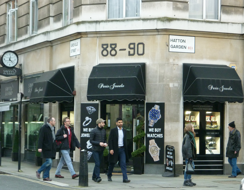
After leaving the pub we move north again up Kirby Street which leads into Hatton Place from where Hatton Wall crosses into Hatton Garden. Hatton Garden and the streets leading off it create the internationally renowned jewellery quarter and hub of the UK diamond trade. Recently of course it has become indelibly linked in the public consciousness with the April 2015 raid on the Hatton Garden Safe Deposit Company which occupies nos 88-90; the so-called “largest burglary in English legal history”.

P1050142

On reflection then I suppose I should have been a bit more circumspect in wielding the camera round these parts. (But I guess no-one would expect lightning to strike twice).

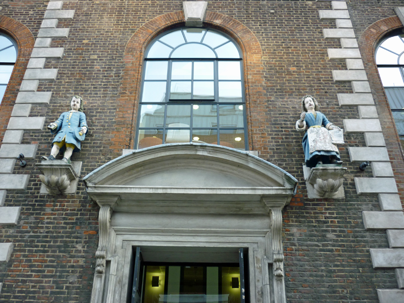
The “bluecoat” statues on the building below are indicative of the site of a charity school. This building was originally a church built after the great fire of London allegedly to a design of Sir Christopher Wren. It was converted to a charity school at the end of the 17th century, suffered serious bomb damage during WWII and upon rebuilding was named Wren House. Fortunately these statues had been sent to a college in Berkshire for safekeeping prior to the start of the Blitz.

P1050139

Treasure House at nos. 19-21 dates from 1907 and is embellished with a fine set of carvings relating to the gold trade.

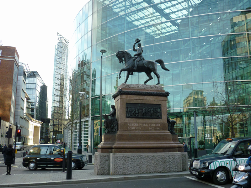
The southern end of Hatton Garden forms one of the spokes of Holborn Circus. Heading west from here along Holborn (A40) we pass this statue of Prince Albert before turning right up Leather Lane.

P1050146

It’s been some years since I last visited Leather Lane market and I have to say it seems to have headed downmarket (so to speak) in the intervening time. Though in fairness the stallholders were packing up as I got there and my memory may be putting a bit of a gloss on its former status.

I did quite like the idea of the pie-minister though.

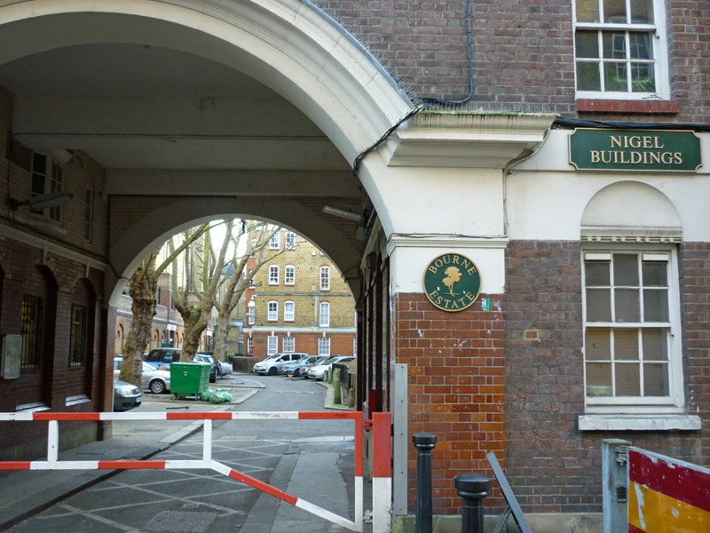
Having dipped in and out of St. Cross Street we exit the north end of Leather line by Portpool Lane and in doing so pass through the middle of the Bourne Estate. Constructed during the Edwardian era between 1905 and 1909 the estate represents one of London’s best examples of tenement housing and a number of the housing blocks have been Grade II listed. The Bourne Estate is the third of the three key estates built by the London County Council in the years of its greatest innovation. In Britain the Bourne Estate is the least known, but it has an international significance as the model for the much admired and highly influential public housing erected in Vienna immediately after the First World War.

P1050156

Portpool Lane terminates on Gray’s Inn Road and taking a left turn southward we call in on Verulam Street before taking the next left which is Baldwin Gardens. This brings us to the massive, and yet extremely well-hidden, Church of St Alban the Martyr. This one was originally built in 1859 to a design of William Butterfield. After being “burnt out” in 1941 it was restored during 1959-61 under the guiding hand of Adrian Gilbert Scott.  The large mural behind the altar, The Trinity in Glory (1966) and the paintings of the stations of the cross down the side are by Hans Feibusch, an artist of German Jewish extraction who after fleeing to Britain in in 1933 produced murals for 28 different Anglican churches. St Alban, incidentally, was beheaded by the Romans in Britain some time in the 3rd or 4th century A.D.

Baldwin Gardens takes us back to Leather Lane and then via Dorrington Street, Beauchamp Street and Brooke Street (with an “e”) we work our way back to Holborn and the site of the building called Holborn Bars but perhaps better known as the Prudential Assurance Building. This impressively monumental terracotta edifice in the Gothic Revival style was built in 1879 to the designs of Alfred Waterhouse (after whom the square which it surrounds came to be named). The Pru still own the building but since 1999 they no longer occupy it. In 1986, when they did, I had a temporary placement here and still remember the woman who sat opposite me and talked incessantly of nothing but her future wedding which was more than a year away. It was one of the longest weeks of my life.

This has been a bit of a marathon posting so well done if you’ve stuck with it right the way through. We’ve reached the final stop, you’ll be relieved to hear, which is Gresham College on the other side of Holborn. Gresham College was founded in 1597 and has been providing free public lectures throughout the more than 400 years since. From 1542 to 1959 the site which it occupies now, Barnards Inn, was home to the independent school operated by the Worshipful Company of Mercers.


Day 14 – Clerkenwell – Finsbury – Farringdon Road

Pretty extensive route today; initially covering the eastern side of the Finsbury district between Goswell Road and St John Street then moving back into Clerkenwell and visiting the area east of Farringdon Road and north of Clerkenwell Road.

Day 14 Route

Before we get into that though here’s a quick update on overall progress so far (including today).

Covered So far copy

So today’s excursion takes Sadler’s Wells as its starting point and begins by heading north on Arlington Way and after a quick diversion along Chadwell Street merges into St John Street up to the apex with Goswell Road. On the way we pass the Old Red Lion Theatre (currently showing a world premiere of Arthur Miller’s first play “No Villain”). Criss-cross between Goswell Road and St John Street using Owen Street and Friend Street. The latter then links via Hermit Street and Paget Street to Rawstorne Street. This is occupied along its southern side by the Brewers Buildings, constructed in the 1870’s in an act of philanthropy by the Brewer’s Company, one of London’s historic livery companies.

Back on Goswell Road nos. 338-346 form the site of Angel House, a former tobacco warehouse with a set of distinctive travel-related plaques on its frontage.

Spencer Street, Earlstoke Street and Wynyatt Street take us back again to St John Street and turning south here takes us to the main building of City University. The University was originally founded in 1894 as the Northampton Institute with the objective of promoting ‘the industrial skill, general knowledge, health and wellbeing of young men and women belonging to the poorer classes’. It achieved university status in 1966 by Royal Charter. At the moment City University is not one of the federal colleges of the University of London but it was announced this year (2105) that it will become so as from August 2016. Alumni include  the likes of Tony Blair and Michael Fish amongst their number.

The University buildings cluster around Northampton Square from which radiate Wyclif Street, Ashby Street and Sebastian Street.

P1040766

Next rung down is Percival Street which links, via Agdon Street and Cyrus Street, to Compton Street. This was the site of the Harrow public house from as far back as the 1760’s up to the late 1980’s. The building below dates from 1904-05, part of the Watney Combe Reid estate.

P1040767

Back on Goswell Road we encounter the design studio of the internationally-renowned architect Zaha Hadid (best known here for the Aquatics Centre for the 2012 Olympics). It’s not one of those places you can just pop into for a browse.

These days Clerkenwell is the main hub for London’s architecture and design studios and this is in full evidence in the cluster of streets around Brewery Square; Brewhouse Yard, Dallington Street, Pardon Street, Northburgh Street, Great Sutton Street and Berry Street.

Once these are out of the way we hit Clerkenwell Road itself

Head west until we reach St John’s Square, home to the Priory of the Order of St John. The origins of the Order and its mission to administer to the sick and injured lie as far back as 11th century Jerusalem. The Priory Church Clerkenwell was occupied by the Order from around 1140 to 1540 when, because of its association with the Catholic Church, the English branch was disbanded during the reign of Elizabeth I. Subsequently the building was put to a number of different uses, coffee house, pub, offices of the Master of the Revels, until the Order of St John in England was resurrected in 1888 by Royal Charter. Although it has other activities it is most prominent today in the guise of the St John’s Ambulance. Unfortunately, today both the museum and garden were closed (despite what is says on the sign).


This slideshow requires JavaScript.

St John’s Square is also home to the rather twee Zetter TownHouse Hotel and this gravity-defying paean to petty crime.

Leave the square via Jerusalem Passage which leads into Aylesbury Street and from here go north along Woodbridge Street as far as Sekforde Street. Here we find the site of the one-time Finsbury Savings Bank and another Dickens connection; apparently he deposited some trust funds here in 1845. The bank was absorbed into the London Trustee Savings Bank around 1928 and this branch closed in 1960.

P1040781

Continue back to St John Street and then sharp right into Skinner Street which skirts Spa Fields Park. At the top end we cut back through the park to reach the apex of the dog-legged Northampton Row which is the location of the London Metropolitan Archives.

P1040782

This free resource is home to an extensive collection of documents, images, maps, books and films covering around 900 years of London’s history. Took the opportunity to apply for a History card and also look around the current (to 27 April 2016) exhibition on War in London. This includes some very sobering photographic archives showing the destruction caused by the bombing raids of both World Wars. As the image below dramatically reminds, St Pauls only survived WWII against some pretty considerable odds.

Blitz_2_53923b

At either end of Northampton Road lies Bowling Green Lane which segues into Corporation Row which runs along the back of the former Hugh Myddleton (that man again) School. There were separate entrance gates here for Boys, Girls and so-called Special Girls. This was not intended in the Jose Mourinho sense of the word I believe but probably alludes to the fact that there was a separate school of deaf and dumb children on the premises at one time.

P1040783

Turning right back into Woodbridge Street and again into Sans Walk brings us round to the front side of the building, now offices and flats (of course).

Head down St James Walk next and cut through St James’s Church Gardens to reach the two limbs of Clerkenwell Close on the eastern side of which sits the Peabody Estate, Pear Tree Court. This was one of six such estates built by the Peabody Trust in the late 1870s and 80s on sites cleared by the Metropolitan Board of Works. The Peabody Trust was one of the original London Housing Associations established in 1862 by the American Banker, George Peabody. It continues to fulfil that charitable mission to the present day.

P1040787

Also on Clerkenwell Close are former warehouses which were built in 1895–7 as the central stores of the London School Board. This is one of the several original entrances still visible today.

P1040786

Pear Tree Court leads out onto Farringdon Lane where we head south alongside the railway and past Vine Street Bridge. The sign in the picture below helpfully provides a number call if your vehicle should crash into the bridge.

P1040788P1040789

P1040790

Ok so we’re on to the final lap of this one, left into Clerkenwell Road then up Clerkenwell Green and back onto Clerkenwell Close to take a closer look at St James’s Church. This has apparently been a religious site since the 12th century though the current church dates from 1792. Unfortunately it wasn’t possible to get a look at the interior of the church, or its much vaunted crypt, on this occasion.

By way of compensation today’s Pub of the Day, the splendid Three Kings, is just across the road. A public house has occupied this spot since at least the 18th century, when it was originally known as the Three Johns. The somewhat unprepossessing exterior (blame a re-tiling job in 1938) is more than made up for by the splendidly idiosyncratic interior styling.

Until next time…