Day 57 – Bankside – Southwark Bridge – Trinity Church Square

This is a bit of a meandering one, starting out on Bankside then crossing the river twice before heading down through Borough to Trinity Square and hallway back again. On the way we’ll cross paths with Shakespeare, Dickens, Alfred the Great and Catherine of Aragon.

Day 57 Route

So we begin where we left off last time, at Tate Modern, exiting from the Blavatnik Building onto Sumner Street. Then we cut down Canvey Street as far as Zoar Street turning east for a short while before nipping between the buildings up onto Southwark Street.

IMG_20181102_124648

On Southwark Street we turn east and when we get to the next left, the by-now familiar Great Guildford Street head back towards the river. Crossing over Sumner Street we reach the western end of the long and winding Park Street. Before we get to Emmerson Street which return us to another section of Sumner Street there’s a nice new demolition site to stop and admire.

IMG_20181102_125143

Sumner Street takes us up onto Southwark Bridge Road where we turn northward briefly before taking some steps which deposit us back on Park Street on the doorstep of the Rose Playhouse. The Rose became the fifth purpose-built theatre in London when it was created in 1587 pre-dating the Globe (of which more later) on Bankside by 14 years. It represented something of a cultural step-up for an area known for its brothels, gaming dens and bear-baiting pits. The Rose’s repertoire included Marlowe’s Doctor Faustus, Jew of Malta and Tamburlaine the Great, Kyd’s Spanish Tragedy and Shakespeare’s Henry VI part I and Titus Andronicus. Its star faded fairly swiftly in the shadow of the success of the Globe however and by the very early years of the 17th century it had fallen out of use. Its archaeological remains were discovered in 1989 during excavations for the re-development of an office block. The Rose Theatre Trust was formed in response to fears that the new building proposed for the site would bring about the destruction of the remains. A campaign to ‘Save The Rose’ was launched with enthusiastic support from the public, scholars and actors, including the dying Lord Olivier who gave his last public speech in May 1989 on behalf of The Rose. The Trust managed to secure government funds to delay construction and to bring about a re-design of the proposed new building so that only a small amount of the fabric of The Rose was lost, and a permanent enclosure of this fragile site was created. If you want to check it out public viewings take place most Saturdays.

IMG_20181102_125906

From Park Street we duck in and out of Rose Alley and Bear Gardens before New Globe Walk takes us up to Bankside and, naturally enough, the new Globe Theatre. The new incarnation of the Globe is located several hundred metres away from where the original was sited so we’ll deal with the latter in a while. The project to rebuild Shakespeare’s Globe was the brainchild of the American actor, director and producer Sam Wanamaker. Twenty one years after his first visit to London, in 1949, he founded what was to become the Shakespeare Globe Trust, dedicated to the reconstruction of the theatre and the creation of an education centre and permanent exhibition. After another 23 years spent tirelessly fundraising and planning the reconstruction with the Trust’s architect Theo Crosby, Sam Wanamaker died in 1993. He lived long enough to see the site secured and a few timber bays of the theatre in place. It was another three and a half years before the theatre was completed. Other than concessions to comply with modern day fire regulations such as additional exits, illuminated signage, fire retardant materials and some modern backstage machinery, the Globe is as accurate a reconstruction of the 1599 Globe as was possible with the available evidence.

This slideshow requires JavaScript.

Sandwiched in between the Globe and Tate Modern is a row of 18th century houses the most striking of which is the three-storey cream coloured building bearing the name Cardinal’s Wharf. Its façade also bears a ceramic plaque engraved with the words Here lived Sir Christopher Wren during the building of St Paul’s Cathedral. Here also, in 1502, Catherine Infanta of Castile and Aragon, afterwards first queen of Henry VIII, took shelter on her first landing in London. Sadly, both of these claims were debunked in a 2006 book by writer and historian Gillian Tindall. Since the house was built in 1710, the year St Paul’s was completed, Wren couldn’t have lived here during its construction. He did however live in a house nearby so it’s probable the plaque was rescued from that property at the time of its demolition and cheekily redisplayed. As for Catherine of Aragon, that’s dismissed as pure fantasy. The adjacent redbrick house is known as the Provost’s Lodging, a name adopted when it was acquired by Southwark Cathedral from Bankside Power Station in 1957. In 2011, following the death of the then Dean of Southwark (the title of provost was done away with in 2000) the property was put on the market for £6m. Which is a lot of money to spend if you’re going to have tens of thousands of people traipsing past each day within spitting distance of your front door.

And so it’s time to head briefly back across the river and tick off a couple more bridges. First up, of course, is the ill-fated (in terms of its name) Millennium Bridge, built to link St Paul’s Cathedral with the new Tate Modern as part of the Millennium celebrations. Unfortunately, as I’m sure we all recall, when it opened in June 2000 it only stayed accessible for two days before being closed for two years to allow for modifications to rectify the swaying motion (or resonant structural response) that led to the nickname “Wobbly Bridge”. The design of the bridge, which was subject to a competition, was a collaboration between Arup Group, Foster and Partners and Sir Anthony Caro.  Due to height restrictions, and to improve the view, the suspension design had the supporting cables below the deck level, giving a very shallow profile. The eight suspension cables are tensioned to pull with a force of 2,000 tons against the piers set into each bank—enough to support a working load of 5,000 people on the bridge at one time. Though not enough to save it from the Death Eaters in Harry Potter and the Half-Blood Prince.

This slideshow requires JavaScript.

Once across the bridge we turn east along the Thames Path though not for very long as you soon have to divert away from the river up Broken Wharf and along High Timber Street (calling in on the dead end Stew Lane if you wish) before rejoining via Queenhithe. Beside and below the street of the same name is the only surviving inlet along the City waterfront which was once a thriving Saxon and Medieval Dock. The harbour is reputed to have been established in AD 899 shortly after King Alfred the Great had turfed the Vikings out of London. Originally named ‘Ethelred’s Hythe’ it became known as ‘Queenhithe’ when Queen Matilda, wife of Henry I, was granted the dues from the dock in the early 12th century (a right inherited by successive English queens). In the 15th century the dock’s fortunes waned as larger vessels struggled to navigate past London Bridge and opted to unload further east at Billingsgate. The dock did however remain in service up to Victorian times and remnants of that period of usage are still visible at low tide.

From Queenhithe it’s just a hop and a skip to Southwark Bridge. Before we get up onto the bridge itself though we can pop through the northside underpass, known as Fruiterers’ Passage after the Worshipful Company of Fruiterers whose warehouses once stood nearby. The passage is tiled on both sides incorporating scanned historic images of the bridge and its immediate surroundings.

IMG_20181102_133357

The bridge itself, something of a Cinderella as far as central London crossings of the Thames are concerned, dates from 1921 in its current form. The bridge was designed and engineered by Ernest George and Basil Mott respectively, the latter also partly responsible for the Mersey Tunnel. And there’s not really much else to say about it to be honest.

IMG_20181102_130219

At the southern end of the bridge sits the current HQ of the Financial Times. I say current because at the time of writing the FT’s owners Nikkei (who acquired from Pearson in 2015) have just announced plans to sell the building ahead of a move back to the FT’s previous offices at Bracken House near St Paul’s in 2019. One Southwark Bridge has been the FT’s home since 1989.
IMG_20181102_125810

We drop down from the bridge onto Bankside and head east as far as the Anchor pub. The pub started life as the ‘brewery tap room’ for the Anchor Brewery which was established in 1616 on land adjacent to the original Globe Theatre and by the early nineteenth century was the largest brewery in the world. After being destroyed in the Great Fire the pub was rebuilt in 1676 and largely reconstructed again in the 19th century. The brewery was taken on by the newly founded Barclay Perkins & Co. in 1781 and Barclays survived as an independent brand (including their famous Russian Imperial Stout) up until 1955 and a merger with Courage. Brewing continued on the site under Courage but last orders were called in the early 1970’s and the buildings were demolished in 1981.

Beyond the pub we turn away from the river up Bank End which soon forms a junction with two more parts of Park Street. We take the section heading back west which runs through where the Anchor Brewery stood (a plaque on the south side commemorates this) and arrive at the site of the original Globe Theatre just to the east of the Southwark Bridge Road flyover and less than a hundred metres from the Rose Theatre. The precise location of the Tudor Globe was only determined in 1989 when part of the foundations were discovered beneath the car park of Anchor Terrace a building of 1834 which originally housed senior employees of the brewery. As this is itself a listed building further excavations have not been possible. The Elizabethan Globe Theatre was built in 1599 on land leased by Richard Burbage and his brother Cuthbert along with Shakespeare and four other members of the Chamberlain’s Men company. It was partially constructed re-using timbers from “The Theatre” in Shoreditch; London’s first theatre which had been built in 1576 by the Burbage brothers’ father, James. As noted above, the theatre was enormously successful in its early years but in 1613, during a performance of Henry VIII, wadding from a stage cannon ignited the thatched roof and the theatre burned to the ground. It was hastily rebuilt, with a tiled roof, and continued as a playhouse until 1642 when the Cromwell’s Puritan administration forced its closure. It was demolished to make way for tenements two years later.

Doubling back along Park Street we turn south next down Porter Street then work our way though Gatehouse Square, Perkins Square and Maiden Lane back to the final, most easterly stretch of Park Street. From here we link back to Southwark Street via Redcross Way where the façade of the old W.H. Willcox & Co. engineering company building still clings on. Lord knows where you have to go these days to get your crank-pin lubricators.

IMG_20181102_135540

We turn west for a bit along Southwark Street then fork right down Thrale Street,  named after Henry Thrale the eighteenth century politician who was a friend of Samuel Johnson and who inherited the Anchor Brewery from his father (it then being sold to Messrs Barclay and Perkins upon his death). His wife, Hester, bore him 12 children and outlived him by forty years. Hester Thrale was a formidable woman; in addition to her procreational achievements she was a noted diarist, author and patron of the arts. She also rescued her husband from probable bankruptcy by raising the money to clear his debts of £130,000 that resulted from a failed scheme to brew beer without malt or hops.

IMG_20181102_153106

At the end of Thrale Street we turn left onto Southwark Bridge Road then right onto Southwark Street again. This takes us past the Menier Chocolate Factory building built by the French company, Chocolat Menier, in the 1870s. Menier eventually became part of the Rowntree Macintosh group which was in turn swallowed up by Nestle. Confectionery production had ceased here by the 1980s and the building was derelict until it was resurrected as an arts and theatre space in 2004. The Menier Chocolate Factory theatre has an impressive list of productions under its belt, including some particularly lauded musical revivals such as A Little Night Music and La Cage Aux Folles which both transferred to Broadway in 2010.

IMG_20181102_135730

Beyond the Chocolate Factory we turn south down Omeara Street where we find the dramatically-named Roman Catholic Church of the Most Precious Blood. The Parish was founded in 1891 and the church was designed by Frederick Arthur Walters who was also the architect for Buckfast Abbey.

At the end of Omeara Street we cross over Union Street and continue south on Ayres Street. The street used to be known as White Cross Street but was renamed in 1936 by the then Labour-led LCC in honour of Alice Ayres, a nursemaid who attained a form of secular canonisation in the Victorian era after she died rescuing the three young children in her care (the daughters of her elder sister, Mary Ann) from a house fire. Such was the public interest in the story that Alice’s funeral was attended by 10,000 mourners and a memorial fund set up raised £100 for the erection of a granite obelisk monument above her grave in Isleworth cemetery.

IMG_20181102_143938

On the corner of Ayres Street and Clennam Street stands the Lord Clyde pub, one of the all-too-few remaining classic style Trumans Beer alehouses. Named after Field Marshal Sir Colin Campbell, 1st Baron Clyde, GCB, KSI, who commanded the Highland Brigade in the Crimean War and led the troops who quelled the Indian Mutiny of 1857, the pub has remained unchanged since it was built in 1913 and has been run by the same family, the Fitzpatricks, for over 60 years.

IMG_20181102_144151

We turn left onto Marshalsea Road then almost immediately left down Quilp Street (the other section of which we visited last time). Off of Quilp Street is Dorrit Street which is basically a twenty-yard cul-de-sac and therefore crying out to be prefaced by the word Little; so one can only assume it was left off out of embarrassed deference towards Dickens’ titular heroine. Quilp Street disgorges into Redcross Way which we hop over into Disney Street then dog-leg round Disney Place back onto Marshalsea Road. Cross over into Sanctuary Street which we follow south as far as Lant Street where we turn left down onto Borough High Street. Continue south down to Trinity Street where we turn east past Trio Place then head south along Swan Street to Harper Road. Turning left onto Harper Road and then left again down Brockham Street brings us into Trinity Church Square, comprised of immaculately maintained Georgian terrace houses such as are the go-to residences for characters of any social station in London-set Hollywood films.

IMG_20181102_145712

The eponymous church in the middle of the square was built in 1824 and designed by architect Francis Bedford. In 1968 it was declared redundant and in the 1970s was converted into an orchestral rehearsal studio for the London Philharmonic and London Symphony Orchestras and named after the conductor, Sir Henry Wood. On the north side of the church there is a statue reputed to be of King Alfred the Great. It’s suggested that it could be one of eight medieval statues from the north end towers of Westminster Hall (c. late 14th century) or, alternatively, one of a pair representing Alfred and Edward, the Black Prince, made for the garden of Carlton House in the 18th century.

IMG_20181102_145909

Having completed a circuit of the square we return up Brockham Street to Harper Road then take the next left into Dickens Square before cutting through Dickens Fields to Falmouth Road. We take Falmouth Road down to Great Dover Street (A2) and turn right briefly for a contractual look at Sturgeon Street before heading back west along Trinity Street. A diversion round Merrick Square gives us a chance to admire some more of those Georgian terraces.

IMG_20181102_151835

On the corner with Globe Street the bloke in the picture below taps me for £2 (to buy food for the dog) after spotting my remembrance poppy by claiming to have spent 6 years in the RAF before being discharged with a fractured skull that still troubles him. He then went on to bemoan the fact that “everyone else round here is foreign and doesn’t speak English”. Unfortunately I’d already parted with the cash by then.


IMG_20181102_151942

So we cut down Globe Street into Cole Street which runs down to Swan Street where we take a right back to Great Dover Street. From here we head down to the four-way junction by Borough Tube Station and take Borough High Street southward for about a hundred metres before turning left into Little Dorrit Court. A little bit more respectful to the fictional Amy and she has a playground named after her too.

IMG_20181102_152634

Little Dorrit Court returns us to Redcross Way across the street from Redcross Garden which along with the six cottages which flank it in one side was created by the social reformer, Octavia Hill (who we covered in detail in the last post).

IMG_20181102_152944

We follow Redcross Way back to the corner with Union Street and the last port of call for today which is the Crossbones Graveyard a disused post-medieval burial ground in which up to 15,000 people are believed to have been buried. Cross Bones is thought to have been established originally as an unconsecrated graveyard for prostitutes, or “single women”, who were known locally as “Winchester Geese” because they were licensed by the Bishop of Winchester to work within the Liberty of the Clink which lay outside the legal scope of the City of London. It was closed in 1853. Today the iron gates surrounding the graveyard are festooned with ribbons, feathers, beads and other tokens commemorating the “Outcast Dead” buried here.  In 2007, Transport for London, which now owns the site, gave playwright John Constable access inside the gates, where he and other volunteers have created a wild garden.  An informal group known as the Friends of Cross Bones is working to ensure that a planned redevelopment of the site preserves the garden as a more permanent place of reflection and remembrance.


Day 56 – Elephant & Castle to Tate Modern

Does what it says on the tin this one, so it’s a long south to north and narrow east to west. So much so that I’ve had to divide the route map in two; starting off with this one which takes us from the Elephant & Castle as far as Mint Street Park which lies about halfway along Southwark Bridge Road.

Day 56 Route 1

Our journey north from the E & C begins along Newington Causeway then takes a right into Rockingham Street before continuing north up Tiverton Street as far as Newington Gardens. This small park sits on the site of the former Horsemonger Lane Gaol which closed in 1878. The poet and reformer, Leigh Hunt, had been one of the “guests” of the gaol, detained for writing disrespectfully of George IV. In 1849, Charles Dickens (of whom much more later), came here to witness a public execution and was so appalled he wrote to The Times in favour of their abolition.

Avonmouth Street takes us away from the park back to Newington Causeway where we turn back southward briefly before cutting sharply north again down Newington Court which runs alongside the railway arches.  On the way we pass the Institute of Optometry which started life in 1922 as the London Refraction Hospital – refraction in this context basically just meaning eye test – the world’s first specialist eye clinic. The current name was only adopted in 1988. On the other side of the road is the Southwark Playhouse which has been one of London’s leading studio theatres for the last 25 years.

Newington Court houses the entrance to the Ministry of Sound nightclub which took over the disused bus garage behind the arches back in 1991. One of the first of the so-called superclubs of the nineties and one of the few remaining, MoS still attracts around 300,000 clubbers a year to its three weekly sessions and has fought off several threats of closure due to the development of the surrounding area.

At the far end of the arches we emerge onto Borough Road and turn east. On our right we pass the home of the London School of Musical Theatre, a faux-Gothic style building dating from 1906. The LSMT moved here in 2000 having previously been at the Old Vic then Her Majesty’s Theatre. Like the MoS they have also had to ride out local redevelopment plans.

IMG_20180927_113538

At the junction of Borough Road and Newington Causeway is a sadly crumbling example of a classic 1960’s petrol station forecourt canopy….

IMG_20180927_113805

… right opposite the Inner London Crown Court located in the Sessions House opened in 1917.
IMG_20180927_113836

Crossing onto the north side of Borough Road we take Stone’s End Street up to Great Suffolk Street then turn west as far as Southwark Bridge Road where we dip back southward in order to check off Collinson Street and Scovell Road. We resume the northward trajectory from Great Suffolk Street up Sudrey Street which is blessed with one of the four rows of cottages in this area built around 1887 at the instigation of social reformer Octavia Hill (1838 – 1912). Octavia, who later went on to co-found the National Trust in 1895, arranged for the cottages to be built on land owned by the Ecclesiastical Commissioners following her appointment to manage their portfolio of inner city properties.

IMG_20180927_115154

At the end of Sudrey Street we turn right onto Lant Street then right again round Bittern Street. A 1904 warehouse on the corner here is now home to the Listening Books charity
IMG_20180927_115410

And round the next corner, heading north again on Touliman Street, stands the Charles Dickens primary school, appropriately bordered on one side by Pickwick Street.

IMG_20180927_115544

Next we turn back along Lant Street before taking the dog-leg Trundle Street round to Weller Street. Then a combination of Mint Street and Caleb Street drops us onto Marshalsea Road. An obvious further Dickens connection here though the debtors’ prison that held his father was actually sited on what is now Borough High Street. Circling round Mint Street Park we arrive at another Dickens’ reminder in the form of Quilp StreetQuilp being the vicious and stunted villain from The Old Curiosity Shop.

IMG_20180927_120408

Before we get to the second leg of today’s journey there’s a previously unvisited stretch of Southwark Bridge Road to go up and down. This includes the old Southwark Fire Station a Grade II listed Gothic Revival building of 1878 (further developed in 1911).

IMG_20180927_120627

And adjacent to the north, Winchester House, originally built as a workhouse in the late 18th century and later converted into a hat factory and private residences. At the same time as the fire station was being built next door this was acquired by the Metropolitan Fire Brigade to serve as its HQ, which it did up until the 1930’s. In 2018 planning approval was granted for a redevelopment to create a new secondary school that would incorporate both the Fire Station and Winchester House buildings.

IMG_20180927_120733


Stage 2 kicks off on the other side of the Borough Welsh Congregational Chapel where Doyce Street makes a short run into Great Guilford Street.

IMG_20180927_120813

Day 56 Route 2

Once on Great Guilford Street you’re greeted with this warning (nicely juxtaposed with the Anarchist symbol I thought) which is supposedly an Edwardian injunction against public urination.

IMG_20180927_120903

We follow Great Guildford Street down to Union Street which then takes us west as far as Pepper Street which runs back south to Copperfield Street (Dickens again of course). On the south side of the street are some more of Octavia Hill’s cottages, Winchester Cottages, with a pleasingly Dickensian aspect to them.

IMG_20180927_121342

And on the north side is All Hallows Church originally erected in 1879-80 in the Victorian Gothic style as interpreted by George Gilbert Scott Junior (1839 – 1897) but almost completely destroyed in the Blitz. Fragments of the building remain, including two stone archways and a chapel, all incorporated into a rebuilding of the north aisle of the church in 1957. This was closed in 1971. The remainder of the bombsite rubble was restored to create an award-winning walled garden with lawns, flower beds and shrubbery.

We take the next turn on the left as you go west which is Sawyer Street. This connects us with Loman Street on which we continue west back to Great Suffolk Street and are pleased to discover en route a Victorian warehouse yet to succumb to demolition or redevelopment. The warehouse is a grade II listed building and dates from the 1850s or 1860s. It has had many occupants over the decades, including Spicer Bros paper merchants in the late 19th century and more recently a group of squatters.

IMG_20180927_122802

From here we loop back to Union Street via the western section of Copperfield Street and Risborough Street. Heading back east we stop off briefly at the Jerwood Space. The Jerwood which opened in 1998 was the first major capital project of the Jerwood Foundation. The Jerwood Foundation was established in 1977 for the international businessman and philanthropist John Jerwood (1918 – 1991). Jerwood moved to Japan after the Second World War and established what became one of the largest cultured pearl dealerships in the world. The Jerwood is an important dance and theatre rehearsal space and includes a gallery which hosts the prestigious annual Jerwood drawing prize. It also has a pretty good café.
IMG_20180927_123136

At the eastern end of Union Street we rejoin Great Guildford Street and resume our northward trajectory. Before reaching Southwark Street we call in on America Street and Wardens Grove. The latter runs along the side of the Metal Box Factory which is a development of office and studio spaces in the building where the tins for Peek Freans biscuits were once made (and was nothing to do with the Metal Box Company as I originally assumed).

From Southwark Street, going west, we branch off down Lavington Street then take a left into Ewer Street which starts out running southward then turns west alongside the railway. The final arch before you get back onto Great Suffolk Street is the current home of The Ring boxing club which as we noted in the last post started life in a twelve-sided  former chapel of prayer that stood on the site now occupied by Southwark tube station.

We continue to the west on another stretch of Union Street then make a circuit of Nelson Square before going north on Gambe Street. Scoresby Street takes us west again onto Blackfriars Road from where we switch back east via Dolben Street, Brinton Walk, Nicholson Street and Chancel Street. At the end of all this we arrive at no.45 Dolben Street which hosts a blue plaque marking this as the site of one of the London homes of Mary Wollstonecraft (1759 – 1797). Wollstonecraft is best known for the proto-feminist treatise A Vindication of the Rights of Woman (1792) but she was author of many other works including a history of the French Revolution. She was born in Spitalfields but led a peripatetic life before returning to London in 1788 to reside here in Southwark. Her other claim to fame is of course as the mother of Mary Godwin, the creator of Frankenstein. It was a fame she was destined never to experience herself as she died of septicaemia just ten days after giving birth to the future wife of the romantic poet, Percy Bysse Shelley.

IMG_20180927_130623

From Dolben Street we take a left into Bear Lane then cut through Treveris Street back to Chancel Street which is where the Philarmonia Orchestra are based. The Philharmonia was founded in 1945 by EMI producer Walter Legge but has been self governing since 1964. Finnish conductor and composer Esa-Pekka Salonen has been Principal Conductor & Artistic Advisor of the Orchestra, which has 80 player-members, since 2008.

IMG_20180927_131212

At the northern end of Chancel Street we initially turn left onto Burrell Street but then double-back under the railway.  At the end of Burrell Street we turn back onto Bear Lane and after a few paces southward switch east down Price’s Street which runs along the rear side of the Kirkaldy Testing Museum. David Kirkaldy (1820 – 1897) set up the Testing Works at 99 Southwark Street in 1874 to house the hydraulic tensile test machine which he had patented ten years earlier and had built at his own expense by the Leeds firm of Greenwood & Batley. The machine is 47 feet 7 inches (14.50 m) long and weighs some 116 tons and could theoretically test the strength of metal parts up to 450 tons in weight. The museum, which was established in 1983, is only open on the first Sunday of each month. The building (including the machine) has a Grade II listing.

IMG_20180927_132231

The eastern end of Price’s Street emerges onto yet another section of Great Suffolk Street. Turning south we call in on Farnham Place before revisiting Lavington Street which deposits us back on Southwark Street. As we head all the way back to Blackfriars Road we pass the Blue Fin building, completed in 2008 and so-named because its façade incorporates 2,000 vertical fins of varying blue colours to provide solar shading for the offices inside. It has been included in a Daily Telegraph list of London’s ugliest buildings but then that’s the Telegraph for you. I have visited the roof terrace in the past but it’s not generally accessible to the public. In any event its views have been largely rendered redundant by the Tate Modern extension (see below).

IMG_20180927_132344

Once on Blackfriars Road we head down to the river and along the Thames Path under Blackfriars Railway Bridge before leaving the riverside to take Hopton Street back to Southwark Street.

Hopton Street is home on its west side to what is genuinely one of London’s ugliest buildings. Sampson House was built in the late Seventies as a processing centre for Lloyds Bank but is currently leased to IBM who use it as a data centre. That lease (rent of £8m a year) has a mutual break clause exercisable in June 2018 and as a result its (no doubt slow) deconstruction to pave the way for new apartment blocks has already begun. Whether those blocks will be less of a blight on the skyline remains to be seen (though Sampson House does actually look quite fetching in this photo).

IMG_20180927_142743

By way of complete contrast, on the other side of Hopton Street are a collection of Grade II listed almshouses built in the 1740’s as homes for poor men of Southwark of good character.

IMG_20180927_142828

So for the final stretch of today’s tour we head back east on Southwark Street then negotiate Sumner Street and Holland Street to takes us to the entrance to Tate Modern. As pretty much everyone knows, Tate Modern was created out of a redevelopment of the Bankside Power Station which was built here across the river from St Paul’s Cathedral in two phases between 1947 and 1963. The power station was designed by, our old friend, Sir Giles Gilbert Scott and consisted of a stunning turbine hall, 35 metres high and 152 metres long, with the boiler house alongside it and a single central chimney. However by 1981 the facility was no longer in service apart from a single London Electricity sub-station and in 1994 the Tate trustees selected this as their preferred site for a separate new gallery focusing on modern and contemporary art. Swiss architects, Herzog and De Meuron were appointed to oversee the conversion of the building.

This slideshow requires JavaScript.

Since it opened in May 2000 Tate Modern has become one of the UK’s top three tourist attractions and welcomed more than 40 million visitors. That electricity substation (now under the control of EDF Energy) continued to occupy the southern third of the building but the western half of this holding was released to the Tate in 2006 and plans were put in place to build a tower extension over the old oil storage tanks. The ten-storey 65m high Switch Tower was opened to the public in June 2016.  The design, again by Herzog & de Meuron, has been controversial. It was originally designed with a glass stepped pyramid, but this was amended to incorporate a sloping façade in brick latticework (to match the original power-station building) despite planning consent to the original design having been previously granted by the supervising authority. In May 2017 the Switch House was formally renamed the Blavatnik Building, after Anglo-Ukrainian billionaire Sir Leonard Blavatnik, in recognition of his “substantial contribution” towards the £260m cost of the extension.

This slideshow requires JavaScript.

For once the timing of my visit was fortuitous as the museum is currently playing host to one of my favourite ever things, Christian Marclay’s epic work The Clock.  24-hours long, the installation is a montage of thousands of film and television images of clocks, edited together so they show the actual time. During several years of rigorous and painstaking research and production, Marclay collected together excerpts from well-known and lesser-known films including thrillers, westerns and science fiction which he then edited so that they flow in real time. If you’ve never seen any of it I would urge you to do so; you have until 20 January 2019.


Day 55 – The Cut – St George’s Circus – London Road – Borough Road – Blackfriars Road

I think it’s fair to say that just about everywhere I’ve visited so far during this project is a places I’ve been to at least once before during the thirty odd years I’ve been resident in the London Metropolitan Area. Today’s foray however took me to some locations that I had genuinely never set eyes on before (and to be honest am unlikely to ever again). We’re taking about the area to the south and east of Waterloo stretching almost as far from the river as the wilds of the Elephant & Castle.

Day 55 Route

For the third and final time we set out from Waterloo Station, taking Sandell Street to the east then hopping over Cornwall Road into Wootton Street. At the end of this we turn right on Greet Street and pay a brief first visit to The Cut before turning left down Hatfields. On reaching the railway track we follow leafy Isabella Street east in front of the parade of restaurants that now occupy the railway arches.

At the far end Joan Street dog legs left past the lumpen monstrosity that is Colombo House, a 1969-built outpost of the BT empire. We follow Joan Street back to Hatfields and then take Meymott Street east onto Blackfriars Road. The building below, 209-215, was refurbished as recently as 2011 but is apparently under threat of demolition as part of Southwark Council’s plans to turn the Blackfriars area into an extension of the City.

IMG_20180830_132047
IMG_20180830_132217
Just before the railway bridge we cut down an alleyway (unofficially known as Falafel Alley due to its being home to a number of Turkish foodstalls) and utilise this and the top section of Joan Street to circumvent Southwark Tube Station in returning to The Cut which we then follow west all the way back to Waterloo Station. First point of interest en route is the Anchor and Hope pub, rebuilt here in 1936. The name, Anchor and Hope, and also its reverse which is more frequently encountered supposedly have a biblical origin, being a reference to a quotation from the Letter to the Hebrews (6: 19), “We have this as a sure and steadfast anchor of the soul, a hope”.

IMG_20180830_132619

A short way further up on the same side of the street is the Young Vic theatre. The Young Vic Theatre Company was formed as an offshoot of the Old Vic (in the days when that was the home of the National Theatre) with a remit to produce classic plays for young audiences and also develop more experimental work. Its first Director, Frank Dunlop, oversaw the construction of the theatre building in 1970, taking over a butcher’s shop and extending onto a bomb-site where 54 people sheltering in a bakery had died in WW2. It was intended to last for five years, but has become a permanent venue.
The Young Vic primarily performs classic plays, but often in innovative productions. Many well-known actors have worked here including Ian Charleson, Vanessa Redgrave, Helen Mirren, Judi Dench, Timothy Dalton, Robert Lindsay, Willard White, John Malkovich, Michael Sheen and Arthur Lowe.
The Who performed free weekly concerts at the Young Vic in early 1971 in order to rehearse their  album, Who’s Next. One of these shows was released on the Deluxe edition of the album. Between 2004 and 2006 the old breeze-block building was rebuilt, though the main auditorium was left intact and the butcher’s shop was retained as the main entrance and the box office.

IMG_20180830_132813

Just before we get to the end of The Cut we take a quick detour off to the right down the southern-most section of Cornwall Road. Down here are the sleeping quarters for the single-decker 521 and 507 buses which link Waterloo Station with its mainline counterparts at London Bridge and Victoria respectively.

IMG_20180830_133134

Back up on The Cut we come to the Old Vic theatre, standing on the corner with Waterloo Road. A theatre was first established here in 1818 and known as the Royal Coburg Theatre. In 1833 it was renamed the Royal Victoria Theatre and in 1871 was rebuilt and reopened as the Royal Victoria Palace. It was then taken over by the philanthropist Emma Cons (1838 – 1912) in 1880 and formally named the Royal Victoria Hall, although by this time it was already known as the “Old Vic”. In 1898, a niece of Cons, Lilian Baylis (1874 – 1937), the force behind Sadler’s Wells, assumed management and began a series of Shakespeare productions from 1914 onward. The building was damaged in 1940 during air raids and it became a Grade II listed building in 1951 after it reopened. As noted in the last post, the Old Vic was the first home of the National Theatre from 1963 up until 1976. In 1982 the theatre was put up for sale through a sealed bid. Canadian entrepreneur Ed Mirvish outbid Andrew Lloyd Webber and spent £2.5 million restoring the building. The facade of the building was based on an 1830 engraving while the auditorium was modelled on the designs of 1871. In 1998 the Mirvish family put the theatre on the market. Suggestions for changing it into a themed pub, a bingo hall or a lap-dancing club provoked widespread outrage and protests, in response to which, it was acquired by The Old Vic Theatre Trust 2000, a registered charity. In 2003 it was announce that the theatre would recommence in-house production (rather than just being a home for visiting productions) with Kevin Spacey appointed as the first Artistic Director of the newly created Old Vic Theatre Company. Spacey’s tenure ended in 2015 and we all know what’s happened subsequently. Following an initial allegation of sexual misconduct against Spacey by actor Anthony Rapp up to 20 employees of the Old Vic have come forward with similar complaints of unwanted advances. To put it mildly, not exactly what the Old Vic would have wanted as it celebrates its 200th anniversary in 2018.

Passing the theatre we cross Waterloo Road into Baylis Road, named after Lilian, and then on the other side of Waterloo Green turn south down Coral Street. At the end we take a right into Pearman Street and, after a quick dip into Frazier Street, follow this down as far as Emery Street which links through to the parallel running Morley Street emerging opposite the former Webber Row School which was built in 1877 at the height of the Victorian era. Grade II listed since 1988 it’s now the Chandlery Business Centre.

IMG_20180830_134329

We follow Morley Street into Westminster Bridge Road and turn east as far as Gerridge Street which reconnects with Morley Street via Dibdin Row. Morley Street then takes us back to Waterloo Road from where we close the loop courtesy of Webber Row and Dodson Street.  Having arrived back on Westminster Bridge Road we strike north until we get to the Perspective Building at no. 100 then double back. In its former guise as Century House this was the home of the Secret Intelligence Service (SIS) aka MI6 from 1964 to 1994.  The Secret Service’s occupation of the building was supposedly classified information but according to the Daily Telegraph it was “London’s worst-kept secret, known only to every taxi driver, tourist guide and KGB agent”. Century House was described as “irredeemably insecure” in a 1985 National Audit Office (NAO) report with security concerns raised in a survey i.e. the building was made largely of glass, and had a petrol station at its base. MI6 moved to Vauxhall Cross in 1994 (if you’ve seen Skyfall you know what an upgrade in security that was).  Century House was refurbished and converted into the residential Perspective Building by Assael Architecture in 2001.

IMG_20180830_135743

Returning southward along Westminster Bridge Road we arrive at Morley College, currently under redevelopment. Morley College is one of the main adult education centres in London; it was founded it the 1880’s and currently serves around 11,000 students. The college’s origins lie in the series of “penny lectures” introduced by the aforementioned Emma Cons as part of the programme of the Royal Victoria Hall when she took that over. The success of these led to the founding of the College thanks to an endowment from the MP, Samuel Morley. The College has been long renowned for its Music Department; Gustav Holst was Music Director from 1907 to 1924 and Michael Tippett held the same post from 1940 to 1951.

IMG_20180830_140003

Turning the corner by the College we head down King Edward Walk until we reach Lambeth Road and turn left here, continuing on the opposite side of the road from the  grounds of the Imperial War Museum. Inset off the road here is Barkham Terrace which is mainly comprised of the building which now houses the Cambian Churchill mental health rehabilitation hospital. You wouldn’t know this from the outside though – I assumed it was just another residential conversion. The building dates from 1940 when it was opened as the Catholic Hospital of Our Lady of Consolation in Southwark. At the time the Catholic Herald described it as “ a splendid six-storey hospital whose creamy facade brightens the drabness of Lambeth Road”.

IMG_20180830_140237

At the junction of Lambeth Road and St George’s Road stands the Roman Catholic St George’s Cathedral, Southwark. St George’s was built in 1848 prompted by the swelling of the local congregation thanks to the influx of Irish immigrants into the area. Four years later it became one of the first four Catholic churches in England and Wales (and the first in London) to be raised to cathedral status since the English Reformation.  It was designed by Augustus Pugin (1812 – 1852), famous for his work with Charles Barry on the design of the rebuilt Houses of Parliament. Pugin was the first person to be married in the church, to his third wife Jane. The Cathedral was extensively damaged by an incendiary bomb during WW2. After the war (the fabulously named) Romilly Craze was commissioned to take charge of the rebuilding and the restored Cathedral was opened in 1958. Since then it has resumed its role as a focal point in the local community and has played host to many notable visitors, including the Dalai Lama (1998) and Pope John Paul II (1982), the latter being depicted in one of the Cathedral’s many fine stained-glass windows.

This slideshow requires JavaScript.

After our visit to the church we head south on St George’s Road towards Elephant & Castle. Having passed Notre Dame High School for Girls, founded by the Sisters of Notre Dame de Namur in 1855, we turn off to the left down Gladstone Street.

Gladstone Street and its offshoot, Colnbrook Street, are the epitome of the gentrification of this part of south London with their smartly done-up early Victorian terrace properties.
IMG_20180830_142543

This is reinforced by today’s pub of the day, the Albert Arms, which sits on the corner of Gladstone Street and Garden Row just across from the converted Ice Cream Factory. The gastro-pub menu isn’t really conducive to light lunchtime eating but it was gone 2.30pm and I was starving so I felt compelled to stump up £6.50 for three very small pulled-pork croquettes. In the Gents they’ve put up a framed poster of that lady tennis player scratching her bare bottom – I assume this is hipster irony.

IMG_20180830_142951

Having finished the aforementioned croquettes (and half a lager) I venture out onto London Road and take a northward turn, past several far more suitable eating spots, up to St George’s Circus. This nexus of five main arterial roads was created in 1771 as the first purpose-built traffic junction in London. Initially the middle of the roundabout was adorned by an obelisk with four oil lamps affixed to it but in 1905 this was relocated to in front of the Imperial War Museum and was replaced by a new clocktower. However by the 1930’s the clocktower was deemed a “nuisance to traffic” and was demolished. It took until the late 1990s before the obelisk was returned to its original location, now without the oil lamps. At the base of the obelisk is the inscription Erected in XI year of the reign of King George MDCCLXXI, with the inscriptions on the other three sides reflecting the obelisk’s one-mile distance from Palace Yard, London Bridge and Fleet Street.

This slideshow requires JavaScript.

Crossing over the Circus we continue north up Blackfriars Road for some distance before turning off west along Webber Street which is on the far side of another of the Peabody Estates we’ve become familiar with.

IMG_20180830_150521

We’re heading back down towards the Old Vic now, criss-crossing between Webber Street and Waterloo Road by way of Webber Row, Baron’s Place and Gray Street. Just before we reach the theatre we take a sharp right onto Mitre Street and then navigate our way back to Blackfriars Road via Short Street and Ufford Street. At no.176 Blackfriars Road is the rather splendid (former) Sons of Temperance Friendly Society Building. The Order of the Sons of Temperance (SOT) was established in New York in 1842 as a teetotalist friendly society, with the dual aim of sustaining its members in a teetotal way of life, and of providing them with a modicum of financial security in case of ill-health, and their families with an insurance payment in the event of their death. The organisation, conceived on Masonic principles with lodges, insignia and rituals, overseen by a Supreme Patriarch, soon spread to other US states and to several Canadian provinces, and had amassed 100,000 members by 1847. The first UK lodges were established in Liverpool and other northern cities in the late 1840s, and in 1853 a National Division of Great Britain was formed. Within this were numerous Grand Divisions, the largest of which, based in London but with branches as far afield as Ipswich and Reading, commissioned the building of 176, Blackfriars Road as its headquarters in 1909-10 with Arthur Charles Russell as architect. The SOT only moved out in 2011 two years after which the building, now occupied by an architect’s practice, was Grade II listed.

IMG_20180830_152502

From here on there’s still a lot of streets to cover though not much to detain us en route so we’ll crack on. First off we work our way back to St George’s Circus passing through Boundary Row, Chaplin Close, Valentine Place and Webber Street then retracing our steps up Blackfriars Road. We then return to London Road and head off to the east side starting with Thomas Doyle Street, named after the founder of St George’s Cathedral (check the earlier slideshow for his memorial). This is the first of the streets that fall within the triangle created by London Road, Southwark Bridge Road and Borough Road, the others being Rotary Street, Keyworth Street, Ontario Street and Kell Street. Once we’ve tramped round that lot we end up on Borough Street by the entrance to London South Bank University, an institution which started life as the Borough Polytechnic Institute in 1892.

IMG_20180830_155227

On the other side of the road is another of the public libraries funded by the Victorian philanthropist (word of the day that) John Passmore Edwards. Most of these were built in the East End (we came across the one in Pitfield Street, Hoxton way back in Day 24). This one dates from 1899 and is currently unoccupied save for the presence of  “guardians” installed by the Camelot vacant property services company so its future is uncertain.

Traversing the area between Borough Road and the eastern stretch of Webber Street to the north takes us, in turn, through Library Street, Milcot Street, King James Street, Lancaster Street, Boyfield Street, Silex Street and Belvedere Buildings. The only thing to draw the eye amongst all that lot is this building, the Peabody Gateway Centre, and even that isn’t interesting enough for anyone to have recorded any information about it.

IMG_20180830_155826

Anyway, after all that we find ourselves back on Southwark Bridge Road from where we’re crossing between Webber Street to the south and Pocock Street to the north taking in Great Suffolk Street, Surge Street, Sawyer Street, Glasshill Street, King’s Bench Street and Rushworth Street. Final picture of the day is of Blackfriars Crown Court on Pocock Street which, earlier this year (2108), the Ministry of Justice announced plans to close and sell off. The site is valued at £32m on the Government’s National Asset Register.

IMG_20180830_161026

And so the very final leg of today’s marathon takes us from Pocock Street back onto Blackfriars Road and up to Southwark Tube Station. The tube station stands on the site of the Blackfriars Ring boxing arena that was bombed out of existence in 1940. The Ring arena was originally called the Surrey Chapel, built in 1783, until the strange shaped building was bought by former British Lightweight champion Dick Burge in 1910. Together with his wife Bella they staged many boxing matches including well known fighters such as Len Johnson, Jack Drummond, Alf Mancini, Jack Hood and the legendary Ted ‘Kid’ Lewis. This is all commemorated by the Ring public house that stands opposite the station on the other corner of The Cut and Blackfriars Road.


Day 54 – South Bank – Waterloo Bridge – Blackfriars Bridge – Stamford Street

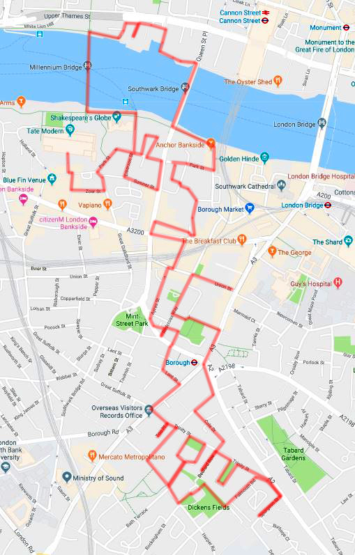
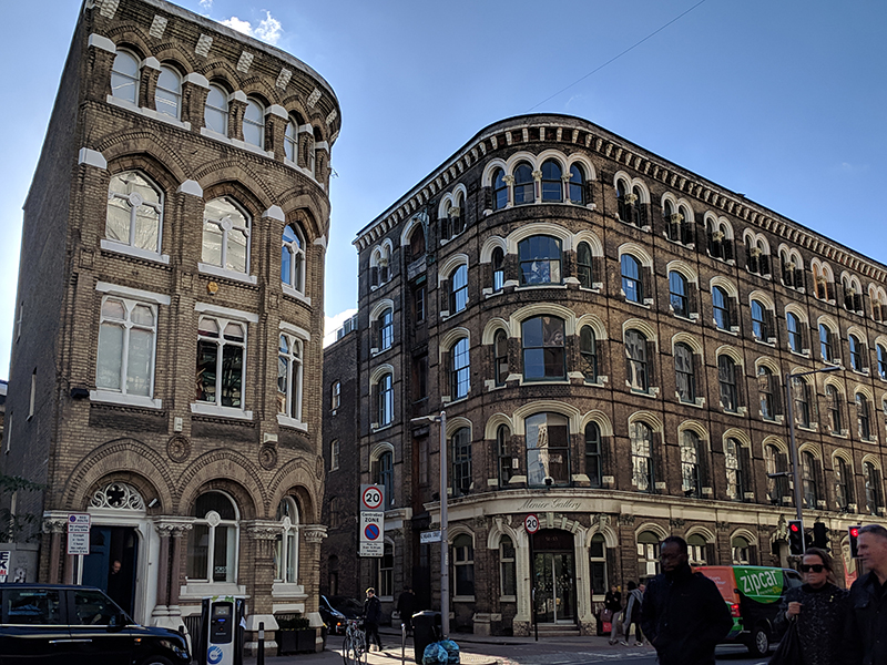
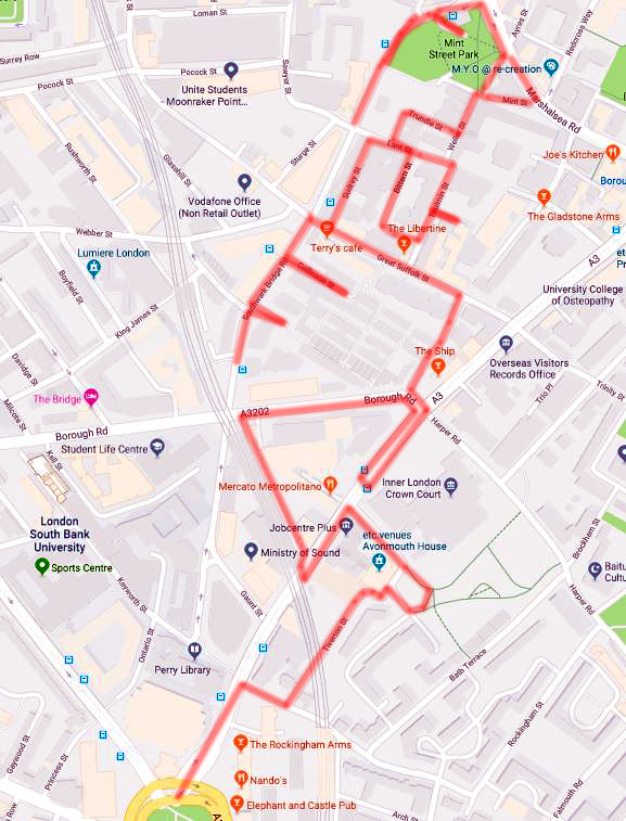
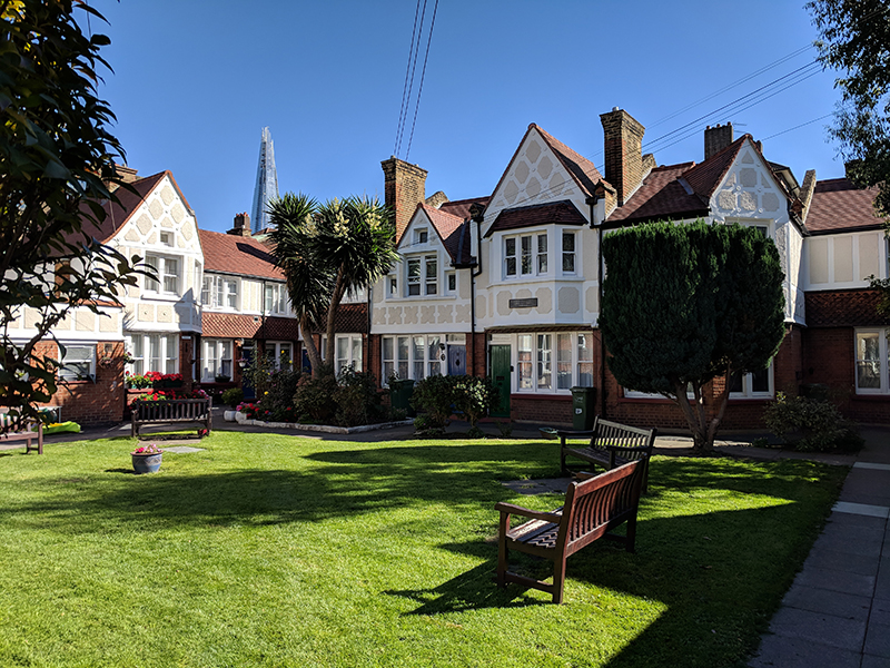
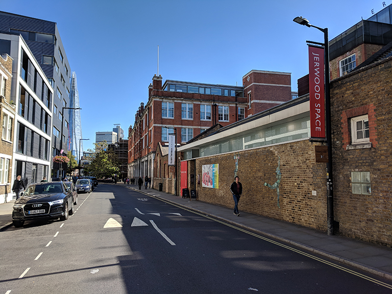
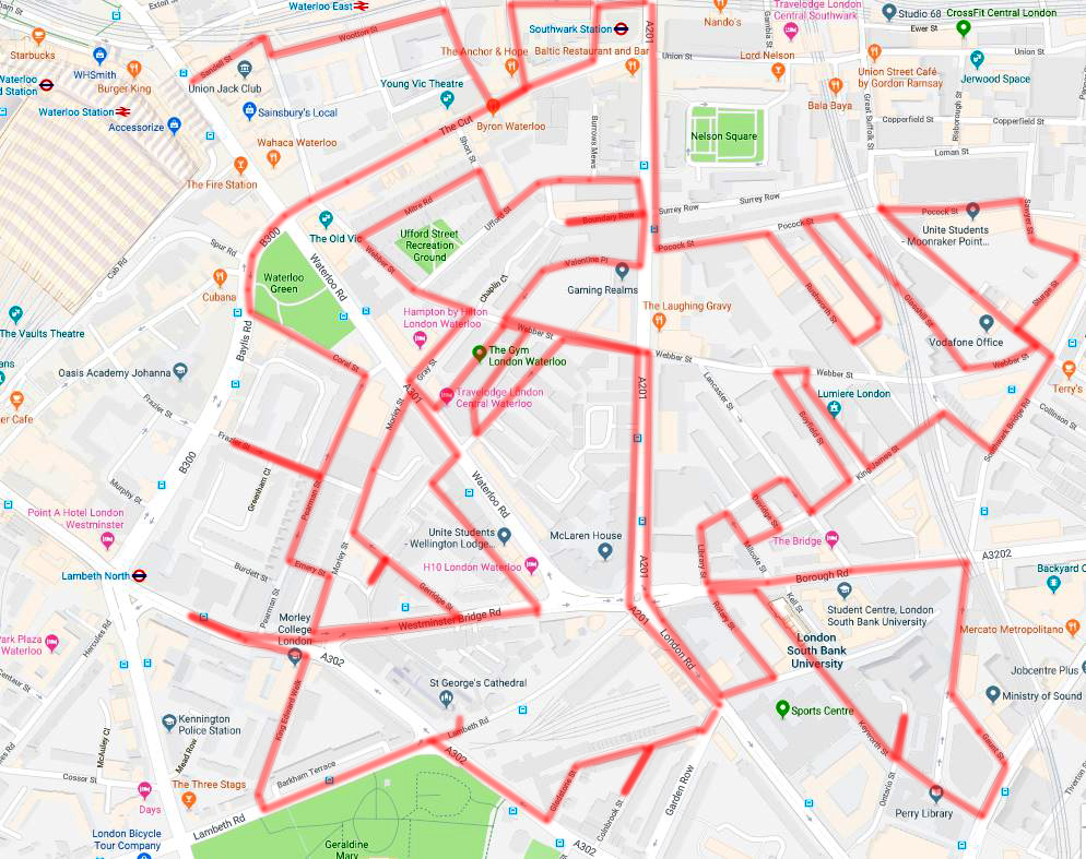
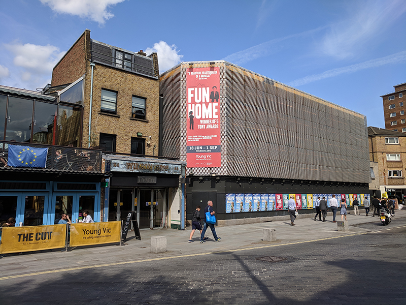
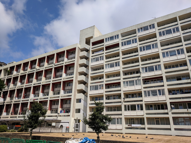
Today’s perambulations are mainly about the riverfronts either side of the Thames between Waterloo Bridge and Blackfriars Bridge with a particular focus on the South Bank though, as you can see, we do venture a bit further south of the river in the latter stages. It’s an area I’m mostly more than familiar with as, when I could be arsed to walk, I passed through here on my way from Waterloo to an office near St Pauls for many years.

Day 54 Route

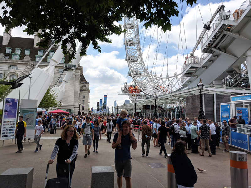
Before we kick off however here’s a bit of bonus material relating to the previous post in which we featured the London Eye. As coincidence would have it, just a couple of weeks after that walk I found myself actually aboard the Eye (for the first time in many years)courtesy of a family visit – and here are the pics from on high.

This slideshow requires JavaScript.

Right, back to the business in hand. We start out this time from Waterloo Station once again and having crossed York Road make our way along Concert Hall Approach towards the Royal Festival Hall. The RFH was built in 1951 as part of that year’s Festival of Britain. As London’s new main concert hall it would be the only permanent structure amongst the temporary pavilions and constructions on the Festival’s south bank site. The architects were Sir Robert Matthew and Dr Leslie Martin and the hall took 18 months to build at a cost of £2 million. Initially it was run by the LCC and then its successor the GLC but on the demise of the latter in 1986 responsibility was devolved to the Arts Council. Two years later the building was granted Grade 1 listed status.

Following a public appeal for assistance with the recovery of lost artworks, Peter Laszlo Peri’s Sunbathers sculpture, which was originally installed outside Waterloo underground station during the Festival, was retrieved from the garden of the Clarendon Hotel in Blackheath, restored and re-hung in the foyer of the RFH. That was in 2017 and it was originally only intended to stay there for one summer – but, as you can see, it’s still in situ. The bust of Nelson Mandela outside the western entrance to the hall was commissioned by Ken Livingstone’s GLC, sculpted by Ian Walters and initially unveiled in 1985 by the then ANC leader Oliver Tambo. Unfortunately, following what was described at the time as “politically-motivated vandalism” the sculpture had to be re-cast and was re-installed in 1988.

This slideshow requires JavaScript.

The “brutalist” Queen Elizabeth Hall and Purcell Room were added to the South Bank site in 1967 adjacent to the RFH. These smaller venues were designed to play host to chamber orchestras and other smaller musical ensembles. Then in 1968 the Hayward Gallery, named after the late Sir Isaac Hayward, the then leader of the London County Council, was opened. The gallery’s first exhibition was a major retrospective of the paintings of Henri Matisse. All three venues were re-opened in 2018 after a two year refurbishment programme. The slideshow below includes shots of the Lee Bul exhibition that was showing at the Hayward when this walk took place.

This slideshow requires JavaScript.

The area beneath the concrete walkway joining the RFH with the QE Hall (known as the Undercroft) has, for decades now, been used as a semi-officially sanctioned skateboard and BMX park. After fending off the latest threat to close and redevelop the site the users of the Undercroft have recently won a £700,000 grant from City Hall to enable the park to be extended and improved.

IMG_20180813_121535

From the Hayward Gallery we ascend the steps up on to Waterloo Bridge. The current bridge, built to a design of Sir Giles Gilbert Scott (the creator of the red telephone box if you remember), was “officially opened” in 1942. Not great timing as you can imagine and somewhat ironically this was the only bridge across the Thames to suffer damage from the German bombing campaign. As a consequence it was only fully completed in 1945. The bridge is sometimes referred to colloquially as the Ladies Bridge due to the fact that when the Irish labourers who had been working on its construction went back to Ireland at the outbreak of WW2 they were largely replaced by women.

IMG_20180813_133738

Having crossed the bridge we head east along the Victoria Embankment towards Blackfriars Bridge. In the previous post we noted that the benches on the Albert Embankment use a swan motif in their metalwork supports while their counterparts on the Victoria Embankment incorporate camels and sphinxes into their design. And here’s the evidence.

About half way along this stretch of the Embankment is HQS (formerly HMS) Wellington which acts as the Livery Hall for the Honourable Company of Master Mariners (Merchant Seamen in other words). The vessel is open for boarding at the moment due to an ongoing exhibition on the role of mercantile shipping in WW1; which was fortunate because as soon as I’d got below decks the heavens opened. HMS Wellington is the last surviving convoy escort ship from the Second World War. She was built at Devonport Dockyard in 1934 and initially served in the Pacific mainly on station in New Zealand and China. When war broke out she was fitted with anti-aircraft guns and loaded with depth charges for use against submarines and went on to conduct convoy escort duties in the North Atlantic. She shared in the destruction of one enemy U boat and was involved in Operation Dynamo, the evacuation of troops from Dunkirk. The Master Mariners, who had been given their Royal Charter in 1926, acquired the Wellington in 1947.

This slideshow requires JavaScript.

A short way further on is the monument erected in 1935 to celebrate King George V’s silver jubilee which I suspect most people walk past without giving a second glance. Much like…

IMG_20180813_140856

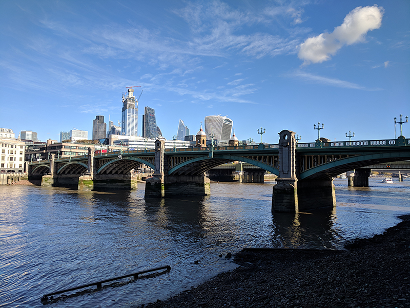
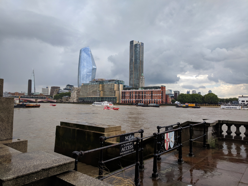
And so on to Blackfriars Bridge which in its present incarnation was opened in November 1869 by Queen Victoria (hence the statue). It was built to a design of Joseph Cubitt and is comprised of five wrought iron arches. On the piers of the bridge are stone carvings of water birds by sculptor John Birnie Philip and the ends of the bridge are shaped like a pulpit in a reference to Black Friars.It is owned and maintained by the Bridge House Estates, a charitable trust overseen by the City of London Corporation. Blackfriars Bridge became internationally notorious in June 1982, when the body of Roberto Calvi, a former chairman of Italy’s largest private bank, was found hanging from one of its arches with five bricks and around $14,000 in three different currencies in his pockets. Calvi’s death was initially treated as suicide, but he was on the run from Italy accused of embezzlement and in 2002 forensic experts concluded that he had been murdered by the Mafia, to whom he was indebted.

IMG_20180813_141841
IMG_20180813_153143

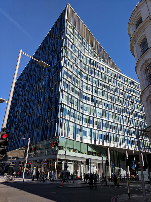
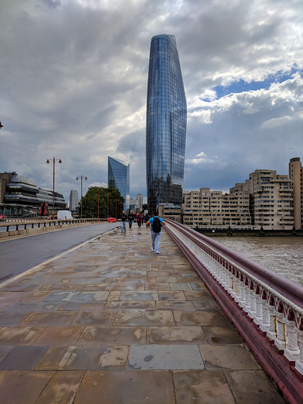
As you walk south across the bridge the view is dominated by No.1 Blackfriars a 52 storey tower comprising 274 private flats that was completed in 2018. The site was formerly occupied by the headquarters of Sainsbury’s but had lain empty at least throughout all those years I walked past it. Then no sooner had I retired than construction started.

IMG_20180813_142021

Having reached the southern end of the bridge we turn right past the Doggett’s Coat and Badge pub. Named after the world’s oldest rowing race, contested between apprentice Thames watermen since 1715, Doggett’s is one of only a handful of riverside hostelries in central London and, as such, does very well for itself.

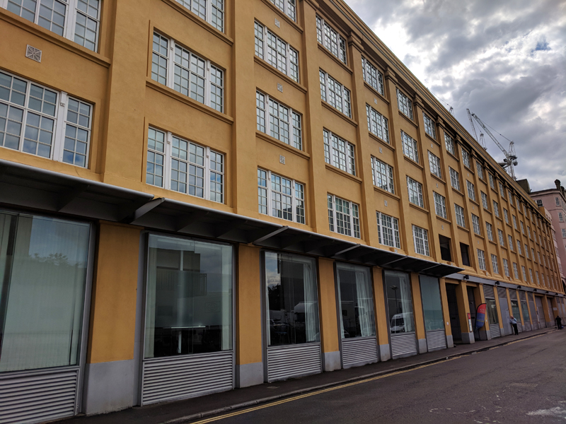
We proceed along the river passing in front of Sea Containers House and the Oxo Tower. The latter was originally constructed as a power station to supply electricity to the Royal Mail post office towards the end of the 19th century. In the 1920’s it was acquired by the Liebig Extract of Meat Company, manufacturers of Oxo cubes, for conversion into a cold store. The building was largely rebuilt to an Art Deco design by company architect Albert Moore between 1928 and 1929. Much of the original power station was demolished, but the river facing facade was retained and extended. Liebig wanted to include a tower featuring illuminated signs advertising the name of their product. When permission for the advertisements was refused, the tower was built with four sets of three vertically-aligned windows, which “coincidentally” happened to be in the sequential shapes of a circle, a cross and another circle.

IMG_20180813_140957

Continuing west we pass by Bernie Spain Gardens (named after Bernadette Spain, a local housing campaigner in the 1980’s), Gabriel’s Wharf and the rear of the IBM and ITV HQ buildings before arriving at the National Theatre. After many years of debate and lobbying the NT was founded in 1963 and was based at the Old Vic until its new purpose-built home was opened in 1976. This latest addition to the South Bank’s modernist skyline, designed by architects Sir Denys Lasdun and Peter Softley and structural engineers Flint & Neill, divided opinion; Sir John Betjeman was an unlikely fan but, less surprisingly, Prince Charles referred to it as “a clever way of building a nuclear power station in the middle of London without anyone objecting”.  That was in 1988, the year that Sir Peter Hall relinquished the post of Artistic Director having succeeded Sir Laurence Olivier in that role in 1973. The building houses three separate theatre spaces, the Olivier Theatre, the Lyttleton Theatre and the Dorfman Theatre (formerly the Cottesloe). It’s been Grade II listed since 1994 and regularly appears simultaneously on publicly-surveyed lists of London most-loved and most-hated buildings.

The sculpture above is London Pride by Frank Dobson (1886 – 1963). This was originally exhibited in plaster cast form at the Festival of Britain but after Dobson’s death was re-cast in bronze and in 1987 donated by his wife Mary to be exhibited in front of the National Theatre. Just to the west of this is the statue of Laurence Olivier (as Hamlet) that was unveiled in 2007.

IMG_20180813_143437

Adjacent to the NT and effectively right underneath Waterloo Bridge is the BFI Southbank (previously known as the National Film Theatre – its cinemas are still called NFT1, 2 & 3). The BFI (British Film Institute) was founded in 1933 and operates as a charity under Royal Charter. The BFI maintains the world’s largest film archive, containing more than 50,000 fiction films, over 100,000 non-fiction titles, and around 625,000 television programmes. In addition to the Southbank site it also runs the nearby London IMAX and the annual London Film Festival each October. The National Film Theatre was initially opened in a temporary building (the Telekinema) at the Festival of Britain and moved to this present location in 1957. In addition to the main three cinemas the building also incorporates the BFI Reuben Library and the Mediatheque which are both free to access. The upper level includes a gallery space which is currently displaying exhibits tying in with the ongoing Working Class Heroes season.

This slideshow requires JavaScript.

Turning away from the river up past the BFI we arrive at Upper Ground and head back eastward passing, in sequence, the home of the Rambert Ballet Company, the front entrance of the IBM HQ and the ITV London Studios and Tower. The latter were constructed in the early 1970’s, when independent television was still provided by a plethora of separate regional operators, as a new studio complex for London Weekend Television (LWT).  It was originally called The South Bank Television Centre (a name that lasted until the early 1990s) and at the time was the most advanced television centre in Europe. LWT was acquired by Granada in 1994 and a decade later Granada was merged into Carlton Communications to form ITV plc. As well as being the main studios for ITV’s entertainment shows the complex has also been used by the BBC and Channel 4 as well as several independent production companies.  Good Morning Britain, The Graham Norton Show, Ant & Dec’s Saturday Night Takeaway and The Jonathan Ross Show are amongst the shows it has to bear some of the responsibility for. In April 2018 ITV closed the site for 5 years of large-scale redevelopment that will result in the loss of most of the studios space.

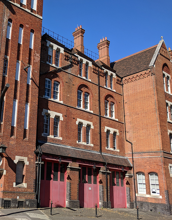
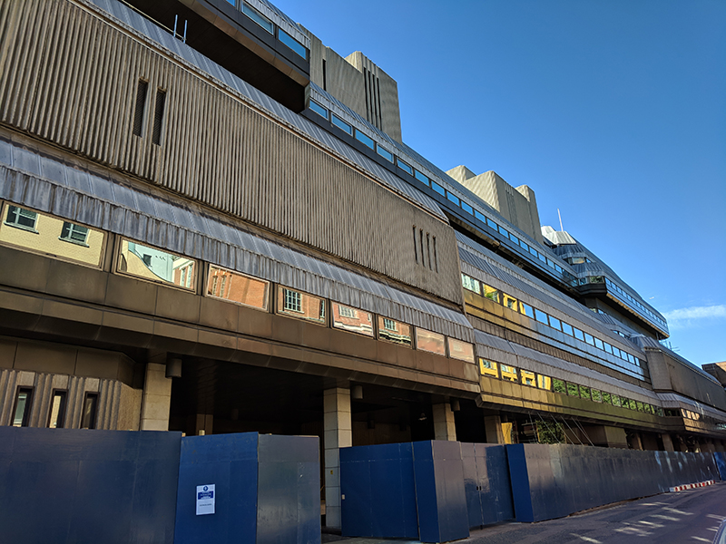
Doubling back a bit we head south next down Cornwall Road then turn right to take a trip up and down Doon Street which runs along the back of the Franklin-Wilkins building (named after Maurice Wilkins and Rosalind Franklin two of the pioneers who contributed to the discovery of the structure of DNA). This is now part of King’s College’s Waterloo Campus but it was built between 1912 and 1915 as a reinforced-concrete headquarters, known as Cornwall House, for Her Majesty’s Stationary Office. However before HMSO could move in the building was requisitioned for use as a military hospital during WW1. As the King George Military Hospital it accommodated, at its height, some 1800 patients on 63 wards.  Cornwall House had been built with underground tunnels connecting it to Waterloo Station and these tunnels were used by the hospital to transfer wounded soldiers arriving by train from the Front.

IMG_20180813_145717

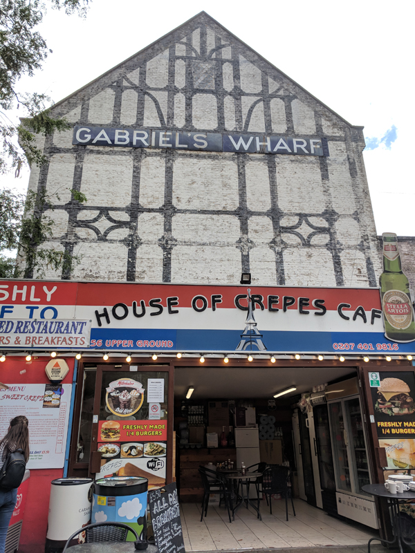
At the junction with Stamford Street we turn left and then take another left up Coin Street back to Upper Ground. Resuming eastward we stop for lunch at the slightly insalubrious but generously-priced House of Crepes at the top of the Gabriel’s Wharf marketplace of “independent eateries and boutiques”.  The actual Gabriel’s Wharf building (in the background below) was formerly used as a scenery store by ITV.

IMG_20180813_150437

We return to Stamford Street via Duchy Street and then take the next left turning, Broadwall, back to Upper Ground. We continue east as far as Bargehouse Street which loops round the back of the actual Bargehouse, a 4-storey former factory building, which is now an exhibition and event space forming part of the OXO Tower Wharf development.

IMG_20180813_152839

After a quick look at the northern section of Hatfields we end up back by the river courtesy of another stretch of Upper Ground and Marigold Alley. Turning right we revisit the steps up to Doggett’s and then it’s a few paces along Blackfriars Road before the final bit of Upper Ground and Rennie Street return us to Stamford Street. We switch westward briefly before turning south down Paris Gardens and then cutting east through the churchyard of Christ Church Southwark. The first church on this site was built in 1670 bit that sank into the Lambeth Marshes after about seventy years and had to be demolished. Its replacement lasted a bit longer but failed to survive the 1941 bombing. The current building dates from 1959 and has an interesting (and secular) selection of stained glass windows depicting local trades and history.

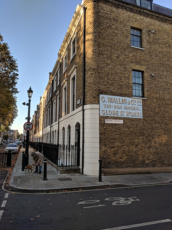
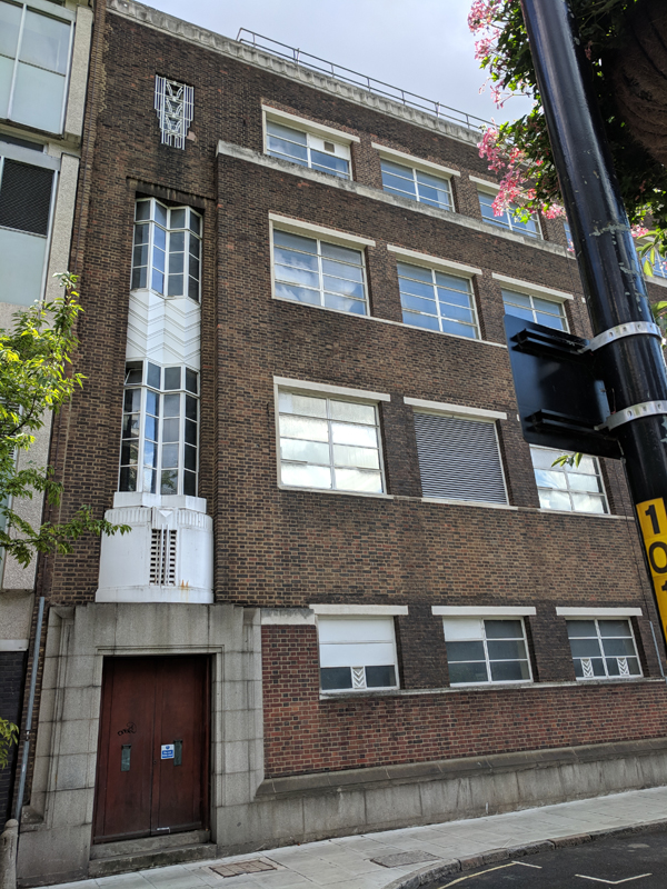
On the other side of the church we revisit Blackfriars Road and drop south as far as Meymott Street where we take a westerly turn and look in on Colombo Street before using the longer stretch of Hatfields to return to Stamford Street. This building on Meymott Street always caught my eye on those journeys to work on account of its modest art deco stylings but I’ve been unable to find anything out about its history or current situation. Incidentally, Hatfields derives its name from the fact that this area was once used for drying animal skins that were made into hats.

IMG_20180813_154842

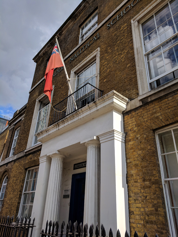
Just around the corner as we turn left onto Stamford Street is the London Nautical School, founded in 1915 as a consequence of the official report into the loss of the Titanic (according to their website though it doesn’t elaborate). Let’s assume it was something to do with the creation of the “nautical ethos” which they still promote to this day.

IMG_20180813_155316

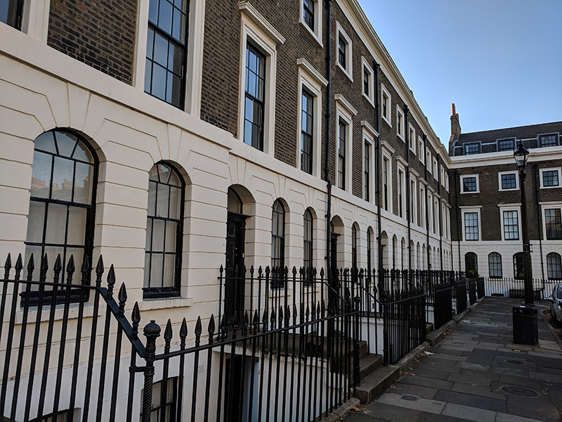
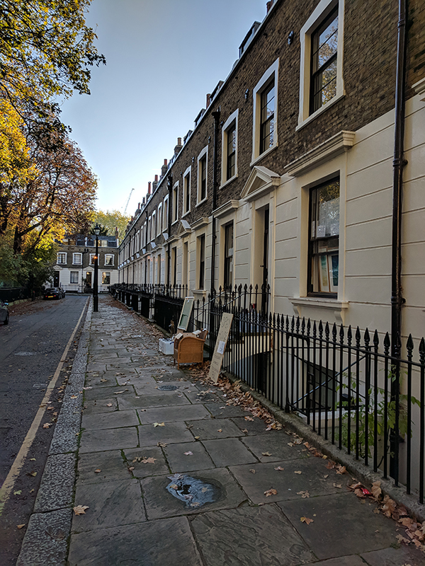
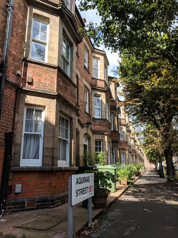
Another section of Duchy Street is the next turning to the south and this is then linked to the southern section of Coin Street by Aquinas Street. The north side of Aquinas Street consists of a very nice three storey Victorian terrace. If you fancied living here though even a one bedroom flat is listed at more than £550k.

IMG_20180813_155637

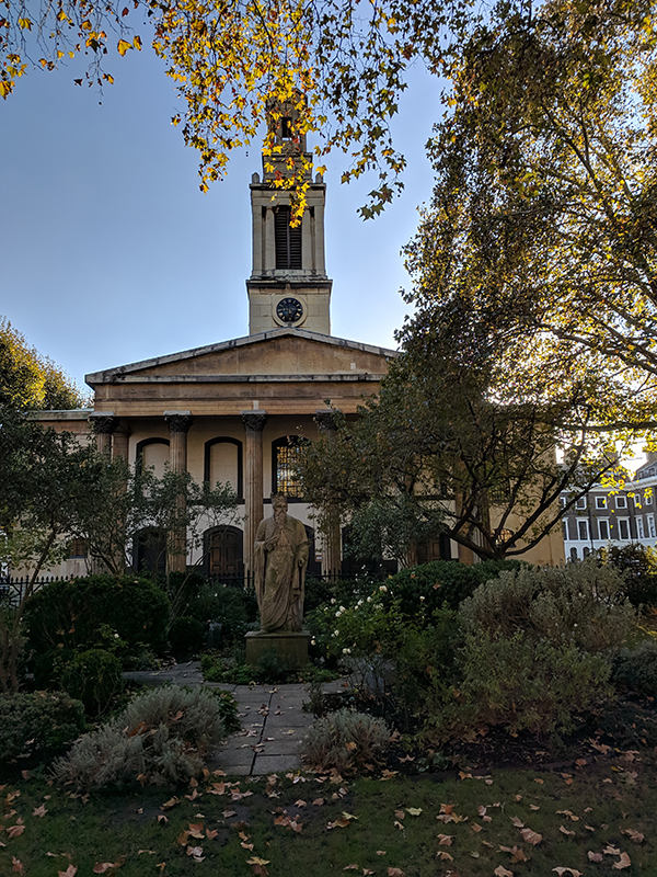
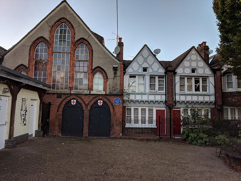
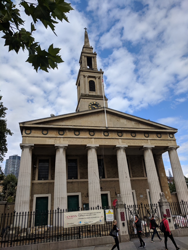
After a final visit to Stamford Street we take the southern section of Cornwall Street down to Theed Street where we make an eastward circuit also involving Whittlesey StreetThen a further block south down Cornwall Street we turn east again along Roupell Street home to today’s pub of the day, the Kings Arms. After a quick pint of cider we carry on down to the end of Roupell Street then double back and cut through Windmill Walk by the side of the pub to reach Brad Street. Turn west here and we’re back to Cornwall Street and duck left through the railway arch to Sandell Street. This is the first of a series of streets that cross between Cornwall Street and Waterloo Road, the others being Alaska Street, Exton Street and Secker Street. The last two of these combine to circle round St John’s Church. The church was originally built to the designs of the architect Francis Octavius Bedford in 1824. It was struck by a bomb in 1940, when the roof and much of the interior was destroyed. The building stood open for ten years until it was restored and remodelled internally by Thomas Ford in 1950. In 1951 the Church was rededicated as the Festival of Britain Church. The interior isn’t much to write home about but the church is imbued with a very strong community spirit and has an extremely cosmopolitan congregation. It’s also home to the Southbank Sinfonia an orchestra formed anew each year through the 33 annual fellowships granted by its charitable foundation. The orchestra performs a series of Free Rush Hour (6pm – 7pm) concerts at St John’s throughout the year and I can testify as to the excellence of these.

IMG_20180813_165131

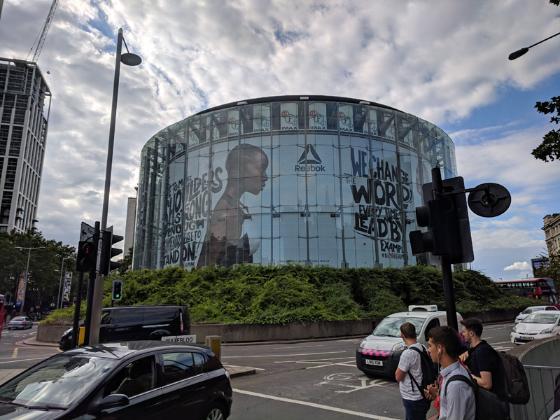
Just across from the church in the roundabout at the nexus of Waterloo Road, Stamford Street, Waterloo Bridge and York Road stands the BFI IMAX (as mentioned earlier).  Built in 1999, this houses the largest cinema screen in Britain (20m high and 26m wide). It has a seating capacity of just under 500 and a 12,000 Watt digital surround sound system. Since 2012 Odeon Cinemas have operated the IMAX under licence.

IMG_20180813_165210

It just remains to cross over at these lights to Tenison Way and from there take the escalator up to Waterloo Station and that’s one more out of the way.


Day 53 – Waterloo Station – Westminster Bridge – Queen’s Walk

Something of a milestone reached today as, for the first time, we’ve ventured south of the river. First time for this blog that is; Waterloo Station, where today’s journey starts, has been my point of entry to central London for the best part of three decades.

We begin our excursion by heading round the southern end of the station and beyond Lambeth North tube station before cutting down towards the river through Archbishop’s Park. Having circumnavigated St Thomas’ Hospital, partly by way of a stroll along the Albert Embankment, we loop back under the railway arches and then cross over Westminster Bridge. Turning east on the other side, Victoria Embankment takes us along the river to Hungerford Bridge where we cross back over and fight our way along Queen’s Walk through the tourist hordes and past the London Eye and County Hall. After that there’s a full circuit of Waterloo Station and we’re done.

I should also mention that this took place on the day of the England v Croatia semi-final so the (very hot) air was filled with expectation and trepidation – though not in the vicinity of those aforementioned hordes.

Day 53 Route

So we start off by exiting the station onto Waterloo Road and turning right, then at the crossroads by the Old Vic we turn right again and follow Baylis Road all the way down to Lambeth North tube. At the top of Kennington Road stands the Lincoln Tower, built in 1876 (the centenary of American independence) in the Gothic revival style as a memorial to Abraham Lincoln. The construction cost of the tower was partly met from funds raised in America by Christopher Newman Hall, the pastor of Surrey Chapel, an independent Methodist and Congregational church based on Blackfriars Road, which had acquired the site in the mid 19th century.

IMG_20180711_105117

We continue south west on Kennington Road as far as Cosser Street which runs alongside the William Blake (public housing) Estate. At the end of Cosser Street we turn right on Hercules Road for just a few yards before continuing north, underneath the rail tracks, on Virgil Street. When Virgil Street ends at Carlisle Lane the entrance to Archbishop’s Park is immediately opposite. This was originally part of the grounds of nearby Lambeth Palace, the official London residence of the Archbishop of Canterbury, but from 1869 onward was set aside as a play area for children and for ball games and in 1900 was turned into a public park. Ownership remains in the hands of the Church Commissioners. Nowadays the park is also home to Zip Now London (allegedly the world’s longest and fastest city centre zip wire). I would guess it doesn’t take much more than 30 seconds to cover the 225m distance which would make the cheapest ticket equivalent to about 67p per second (about 50% more than Ronaldo earns in the same time).

After a circuit of the park, not including a go on the zipline (it wasn’t yet open), we exit onto Lambeth Palace Road opposite the south side of St Thomas’ Hospital, more of which later.

IMG_20180711_111636

We follow Lambeth Palace Road eastward as it converges towards parallel proximity with the river then drop onto the Albert Embankment and head down river towards Westminster Bridge. This is where you’ll get the best views of the Houses of Parliament (see previous post) and it’s also considerably less busy than, say, the South Bank if you’re after a riverside stroll.  Albert Embankment was created by the engineer Sir Joseph Bazalgette for the Metropolitan Board of Works between 1866 and 1869 and included land reclaimed from the river and various small timber and boat-building yards. It was intended to protect low-lying areas of Lambeth from flooding while also providing a new highway to bypass local congested streets. As with its counterpart, the Victoria Embankment, on the north side the street furniture of the Albert Embankment was the creation of George Vulliamy (1817 – 1886). But whereas the sturgeon (or dolphin) lamp posts are common to both sides, the 15 benches on the Albert side have a swan motif in their cast iron arms and panels rather than the sphinxes and camels of the more numerous resting spots on the Victoria side.

This slideshow requires JavaScript.

The river-facing wing of St Thomas’ Hospital,  dates back to 1871 when the hospital moved to this location from Southwark and is now Grade II listed. The hospital, in its original Southwark incarnation, is believed to have been founded towards the end of the 12th century, run by a mixed order of Augustine monks and nuns and dedicated to St Thomas à Becket. When the monastery was dissolved in 1539 during the Reformation the hospital closed but reopened 12 years later when it was rededicated to Thomas the Apostle. In the late 20th century the name was changed from St Thomas’s to St Thomas’ which was undoubtedly due to modern a predilection for simplification but has been  justified on the basis that the hospital is associated with two separate men called Thomas. (Though, as the grammar police and I will tell you, this means it should be known as St Thomases’ Hospital).

Once we reach Westminster Bridge and turn right onto Westminster Bridge Road we find ourselves at the main entrance to the modern building, the North Wing, which was completed in 1975. It met with widespread public disaffection at the time, particularly from MPs who felt it ruined their view from the Palace of Westminster. Between the walkway up to the entrance and the embankment a garden area has been created above the car park.  At the entrance to this garden stands a memorial to Mary Seacole (1805 – 1881), the British-Jamaican businesswoman and nurse who travelled independently to the Crimea and set up the so-called “British Hotel” behind the battle lines in order to treat wounded servicemen. The statue was unveiled, not without controversy, in 2016. (Inside the hospital buildings is a museum dedicated to Florence Nightingale, that much better known Crimean War “angel of mercy”). Despite the question marks about the efficacy of Mary’s treatments and the  claims of her being a medical pioneer she is undoubtedly someone who deserves to be celebrated for what she managed to achieve in the face of twin obstacles of race and gender. The centre of the garden features Naum Gabo’s fountain sculpture Revolving Torsion and just ahead of the main entrance is sculptor Rick Kirby’s work Crossing The Divide from the year 2000. That’s the same year that a statue of Edward VI, originally erected in 1739, was moved to its position directly outside the North Wing. It was Edward VI who granted the hospital a royal charter that facilitated its re-establishment post-Reformation.

This slideshow requires JavaScript.

Following the perimeter of the hospital we return to Lambeth Palace Road and then take a left up Royal Street. This is dominated by the Canterbury House block of social housing flats, built c.1960, which is remarkable in that from the rear it looks like the epitome of a run-down sixties’ estate and yet the front could be mistaken for a 3-star hotel on the Costa Brava.

IMG_20180711_115534

IMG_20180711_120103

Next we weave in and out through the tunnels underneath the railtracks out of Waterloo courtesy of Upper Marsh, Carlisle Lane and Centaur Street before ending up back on Hercules Road.

IMG_20180711_115900

William Blake (1757 – 1827) lived in a building on Hercules Road during the last decade of the 18th century, hence the nearby housing estate named after him and the series of mosaics in the railway tunnels inspired by him. On the way back towards Lambeth North Tube, Newham Terrace offers up one of those historic industrial signage remnants that I’m so fond of.

From the tube station we head back towards the river, starting on Westminster Bridge again and then looping round Addington Street and cutting through (the absurdly named) Forum Magnum Square onto Belvedere Street which runs along the back of the old County Hall.

IMG_20180711_121118

The main central building of County Hall was built between 1911 and 1922 in an Edwardian Baroque style to the design of architect, Ralph Knott, as the new home of the London County Council (LCC). The LCC was created in 1889 as part of the previous year’s Local Government Act, becoming the first elected authority with responsibility for the whole of London. It’s predecessor, the Metropolitan Board of Works, had government appointed leaders and a more limited set of powers. The north and south blocks of County Hall were added between 1936 and 1939. In 1965 the LCC was superseded by the Greater London Council (GLC) on the back of the 1963 Local Government Act which saw the creation of 32 new boroughs comprising the new metropolis of Greater London, extending into areas such as Croydon and West Ham that were formerly part of Surrey and Essex respectively. It also signalled the effective demise of Middlesex as a separate administrative area. The GLC ran London for 21 years until in 1986, under the aegis of Ken Livingstone, its Labour controlled administration became in embroiled in a death-match with the Conservative government and Margaret Thatcher duly abolished it. Parts of County Hall still remain empty to this day but in now houses two hotels (at opposite ends of the spectrum), a Marriott and a Premier Inn and a number of Merlin Entertainments attractions, which we’ll deal with later.

This slideshow requires JavaScript.

Next we finally cross over the river via the packed to the seams Westminster Bridge. At the north end of the bridge stands the statue to Queen Boudicca and her daughters created by Victorian sculptor, Thomas Thornycroft (1815 – 1885). The statue was commissioned in the 1850’s by Prince Albert and was originally intended to sit atop the central arch of the entrance to Hyde Park. Albert died in 1861 before it was completed and the project then ran into all-too familiar funding issues. Thornycroft managed to complete a full-size model of the work before his own death in 1885 but it wasn’t until 1902 that it was installed here by Westminster Pier thanks to the efforts of his son and the support of the LCC. Which makes it all the more shameful that it’s plinth is currently obscured by a stall hawking tourist tat.

IMG_20180711_122305

Moving swiftly on we proceed eastward along the Victoria Embankment passing, firstly, the Battle of Britain Memorial unveiled in 2005 to coincide with the 65th anniversary and then the Royal Air Force Memorial of 1923 with its Golden Eagle sculpted by William Reid Dick. In the background beyond the memorial you can see the PS Tattershall Castle, a floating pub that served as a passenger ferry across the Humber Estuary from 1934 to 1973.

This slideshow requires JavaScript.

We cross back over the river using the western element of the two new footbridges built alongside the Hungerford Railway Bridge in 2002. Officially these are called the Golden Jubilee Bridges in honour of QEII’s fiftieth anniversary on the throne but in reality everyone still refers to them, collectively, as the Hungerford Footbridge. Which is surprising in a way since the original Hungerford Footbridge (on the east side) was notorious for being both unsightly and dangerous and was the scene of horrific murder in 1999 (just a couple of years after the decision to knock down the bridge had already been taken). The railway bridge dates back to 1864 and was designed by Sir John Hawkshaw. It replaced a suspension footbridge of 1845 created by Isambard Kingdom Brunel (the original brick buttresses of which are still in use). The name derives from Hungerford Market, a produce market on the north bank which existed on the site of what is now Charing Cross Station from the late 17th century until, er, they knocked it down to build the station.

IMG_20180711_124013
View west from Hungerford Bridge

On the other side of the bridge we descend the steps down to Queen’s Walk and head back west towards County Hall. En route we pass the site of the Underbelly Festival which runs throughout the summer months beside Jubilee Gardens featuring comedy, circus and cabaret performances in its Spiegeltent and providing al-fresco drinking and dining.

And so we reach the London Eye which is now apparently the most popular paid tourist attraction in the UK with 3.75 million visitors annually. Quite when it took over the top spot from Madame Tussauds I’m not sure but, ironically, the Tussauds Group were one of the original owners along with British Airways and Marks Barfield (the architects who created it) when it opened in 2000 as part of the Millennium celebrations. At the time it was the tallest Ferris wheel in the world at 135m though that record is now held by the High Roller in Las Vegas at 167.6m. It has also lost out on being the highest public viewing point in London since the Shard was built. It is now owned by Merlin Entertainments who took over Tussauds Group in 2007. BA ended its brand association in 2008 and Coca-Cola became sponsors from the start of 2015.

IMG_20180711_124703

Merlin Entertainments run a number of other attractions that are based inside the County Hall building: The London Dungeon (relocated here from its original home near London Bridge); Shrek’s Adventure and Sea Life. On a more edifying note I’ll just make mention here of some of the sculptures that adorn the exterior of County Hall. (I should also belatedly namecheck the Ornamental Passions blog which has been an invaluable source of information on this topic). The sculptures on the Jubilee Gardens façade are the work of Alfred Hardiman and are intended to represent Open Spaces and Child Education. Those on the riverside façade are by Ernest Cole (1890 – 1979), who was only 24 when awarded the commission and whose work on the figures was interrupted by First World War in which he was co-opted into the Intelligence Corps.  Cole was also responsible for the works on the Westminster Bridge Road side including World Beyond which shows the world resting on the shoulders of three grotesque representatives of the human race with two more contorted figures standing astride it. Not surprisingly, Cole’s work caused something of an uproar when it was unveiled and this led to him being replaced by Hardiman for the later commissions. At the outbreak of WWII, Cole and his wife, Laurie Manly, were briefly imprisoned on suspicion of being fascist sympathisers on account of their subscription to Il Popolo d’Italia the newspaper founded by Mussolini.

This slideshow requires JavaScript.

I strongly suspect that Cole and Hardiman’s efforts go completely unnoticed by the crowds thronging round the London Eye and along the rest of Queen’s Walk. Having battled through them twice I make my escape, heading up the side of Jubilee Gardens and down Chicheley Street into York Road. Here I head back to the front entrance to Waterloo Station. The station first opened in 1848 so it’s celebrating its 170th anniversary this year. That original station was built by the London and South Western Railway but wasn’t intended to be a terminus, just a stopping point on the way to the City of London. That further extension never materialised however and by the turn of the 20th century the railway company had accepted the fact and recognized that Waterloo needed to be completely rebuilt to function as a proper terminus for the increasing volume of train traffic from the south west. The rebuilt station was formally opened on 21 March 1922 by Queen Mary. The main pedestrian entrance, the Victory Arch (known as Exit 5), was designed by James Robb Scott and is a memorial to company staff who were killed during WWI. It is flanked by two sculptures featuring Roman goddesses; “1914” with Bellona in armour with a sword and torch, and “1918” showing Pax, the goddess of Peace sitting on Earth. Waterloo is now the busiest railway station in the UK, the largest in terms of floor space and with the greatest number of platforms.

IMG_20180711_130412

Just across from the main entrance, on Mepham Street, is the Hole In The Wall Pub which I visited several times in the late seventies and early eighties. I still recall the horror of using the toilet facilities there so I was more than a little amused to see this recent addition to the local street furniture.

Mepham Street leads out onto Waterloo Road from where we circle past the station for a second time and on this occasion fork right up Spur Road onto Station Approach Road / Cab Road which the taxis use to add an extra few hundred metres to their journeys (just kidding guys). A left turn takes us down to Leake Street which is basically a foot tunnel under the railway. It’s home to The Vaults an immersive theatre and alternative arts venue that occupies a maze of previously disused arches underneath Waterloo Station. From late January to late March for the last few years the Vault Festival has been held here; and with over 350 shows across 16 venues it’s fast becoming a serious rival to the Edinburgh Fringe for showcasing new and experimental comedy and theatre.

The Leake Street tunnel is also an officially sanctioned open canvas for graffiti art. Not sure what the protocol is for how long each work is allowed to stay up before being over-sprayed but I suspect this one has already gone (unfortunately).

IMG_20180711_131603

We retrace our steps up Leake Street and leave via an alternative exit onto Lower Marsh. This always used to be one of my favourite streets in London with a number of idiosyncratic shops selling vintage clothes, jazz books and records, pre-1970’s memorabilia and cut-price designer menswear. Latterly it’s sadly succumbed to the twin curses of redevelopment and rate hikes so almost all of those independent retailers have now gone (apart from the fetish gear suppliers). The shops have of course mostly been replaced by coffee-shops, a couple of which, to their credit, have a decent sense of style. Not quite a pub of the day but I’ll give a shout out to the Scooter Bar where I had a Mexican lager I’ve never heard of before and they let me bring in a take-out of Pad Thai Noodles from one of the several food stalls out on the street.

This slideshow requires JavaScript.

Ok so we just finish things off with the streets running off Lower Marsh to the south namely Grindal Street, Frazier Street, Murphy Street, Joanna Street and Tanswell Street and then return to the station. For once my timing has clicked as the Band of The Royal Coldstream Guards are belting out a few popular tunes on the concourse and just as I decide to hang around for one more they launch into, what else but, Three Lions. Naturally this brings the house down though unfortunately there is no self-fulfilling prophecy here. Nonetheless these boys in red done good as did the ones over in Russia. Bring on Euro 2020 !

IMG_20180711_142706