Day 61 – London Bridge – Hanseatic Walk – Tower of London

I guess I should begin this post with an apology for raising false expectations because this won’t in fact be the last of these as predicted in the previous post. By the time I’d spent several hours at the Tower of London discretion became the better part of valour and I decided to leave the planned home stretch across Tower Bridge and back along the river to London Bridge for another time. Today’s excursion is therefore restricted to a short but interest-packed stroll across London Bridge from south to north, along the Hanseatic Walk to Southwark Bridge and then back east beside the river to the Tower of London.

Day 61 Route

The current, undeniably prosaic, London Bridge is a box girder affair that was completed in 1973, replacing a 19th century stone arch bridge that (as we all know) was dismantled block by block and shipped over Arizona. Though commonly-believed (and repeated by the Yeoman warders at the Tower) the story that the purchaser, Missourian oil millionaire Robert P. McCulloch, thought he was actually buying Tower Bridge is entirely apocryphal. There has been a bridge on this site since Roman times and up until 1729 (when Putney Bridge was constructed) it was the only crossing downstream of Kingston. Several wooden bridges were built and destroyed (either by the elements or enemy forces) during the Anglo-Saxon and Norman periods before Henry II commissioned a new stone bridge on which work began in 1176. It was finally completed 33 years later in the reign of King John. John tried to recoup the cost of building and maintenance by licensing out building plots on the bridge which eventually led to there being around 200 buildings in situ by the time the Tudors came to power. With the buildings came the threat of fire which materialised several times including in 1381 (Peasant’s Revolt), 1450 (Jack Cade’s Rebellion) and 1633 (which was actually fortuitous since it created a natural fire-break at the northern end which halted the spread of the Great Fire three decades later). The southern gatehouse of Henry’s bridge was notoriously used to display the severed heads of deemed traitors such as William Wallace, Jack Cade, Thomas More and Thomas Cromwell. The practice only stopped following the restoration of Charles II. Houses continued to be built on the bridge up until the middle of the 18th century by which time is was finally recognized that the medieval bridge was no longer fit for purpose. It wasn’t until 1831 however that this vision was realised with the opening of the John Rennie designed five stone-arch replacement – and we’ve already revealed the ultimate fate of that one.

IMG_0914
Looking East from London Bridge
IMG_0916
Looking north from London Bridge

At the northern end of London Bridge we drop down onto the riverside to the west and the Hanseatic Walk named after the Hanseatic League, a commercial and defensive confederation of merchant guilds and market towns in Northwestern and Central Europe that dominated maritime trade in the Baltic and North Sea from the 13th to the middle of the 15th century and continued to exist for several centuries after that. The main trading base of the Hanseatic League in London was known as The Steelyard and was situated on the north side of the Thames where one end of the Southwark Railway Bridge now stands. Its remains where uncovered by archaeologists during maintenance work on Cannon Street Station in 1988. In 2005 a Commemorative Plaque was installed at this western end of the Hanseatic Walk by the British- German Association.

Appropriately, Steelyard Passage runs under the rail-line out of Cannon Street and joins the next stretch of the Thames Path that takes us as far as Southwark Bridge. Here we climb up the steps onto Queens Street Place which has a number of richly ornamental facades on its west side. (At this point I should acknowledge again the Ornamental Passions blog which has been an invaluable source of information on architectural sculpture and statuary). First up, on the riverside, is the horrendous neo-neo-classical Vintner’s Place built at the behest of the Vintner’s Company (another of the 12 original Livery Companies). The one saving grace of this building is that it preserved the portico of its predecessor, a 1927 art deco office block called Vintry House. This portico incorporates one of London’s most brazen pieces of sculpture, a full-frontal nude Bacchante (priestess of Bacchus) flanked by a pair of goats and with a cape made from bunches of grapes. The creator of this was one Herbert Palliser and the model was Leopoldine Avico, one of three sisters who posed for numerous sculptors and painters during the early decades of the 20th century.

Next door Thames House was built in 1911 for Liebig’s Extract of Meat Company, which made a Bovril-like goo from boiled up cows at a huge plant in Fray Bentos in Uruguay and later developed the Oxo cube. (Until I looked this up I had no idea there was an actual place called Fray Bentos). The sculptures on the two wings of the façade are the work of Richard Darbe who also dabbled in ivory and ceramic figurines for Royal Doulton.

Finally on the corner with Upper Thames Street is Five Kings House, which was originally the northern end of Thames House but was divided off in 1990. The figures above the entrance were created by George Duncan MacDougald. The male figure appears to represent the god Mercury but it’s not clear who the female figure is meant to be.

IMG_0925

After turning right onto Upper Thames Street we cross between this and the riverfront three times, Bell Wharf Lane, Cousin Lane and All Hallows Lane respectively, to return to the western end of the Hanseatic Walk. As we head back east we pass through Walbrook Wharf which is still an actual operating wharf, acting as a waste transfer station where refuse from central London is loaded onto barges to be shipped downstream to the Belvedere Incinerator which lies halfway between the Woolwich and Dartford crossings. When waste is being transferred onto the barges the riverside walk is closed to pedestrians. This point on the river, known as Dowgate, is also the mouth of the River Walbrook one of London’s lost rivers which now runs completely underground and feeds the sewer system.

There are two more links between Upper Thames Street and the riverside walk before we get back to London Bridge; Angel Lane and Swan Lane. Adjacent to the bridge, still on the west side, is the hall of the Fishmongers’ Company coming in at a mighty 4th place in the Livery Companies’ Order of Precedence which, as we have seen several times before, means that it got its original charter from Edward I (circa 1272). The Company enjoyed a monopoly on the sale of fish in the capital up until the 15th century. The original hall was the first of forty Livery Company halls to be consumed by the Great Fire. However thanks to the Hall’s riverside location, the Company’s most important documents and its iron money chest and silver, were safely transported away by boat. The present hall was the second built after the Great Fire enforced by the start of construction of the “New” London Bridge in 1828. Following substantial destruction during the Blitz the hall underwent major restoration which was completed in 1954. Until 1975 the Company enjoyed the use of a private wharf which excluded the public from access to the riverfront here. The statue in the garden is of “in memory of Mr. James Hulbert late citizen and Fishmonger of London deceased” and was moved here in 1978 having been first erected at St Peter’s Hospital Wandsworth in 1724.

On the east side of the northern end of London Bridge on Lower Thames Street stands the church of St Magnus the Martyr. I’ve visited an awful lot of churches since I started doing this and it’s taken until almost the very end of the mission to discover the two that are probably my favourites, starting with this one. The church was originally established in the early 12th century and it is now accepted that it is dedicated to an earl of Orkney named Magnus who, despite his reputation for piety and gentleness, was killed by one of his cousins in a power struggle around 1116 and was canonised some twenty years later. At various times through the church’s history however it has been contended that the dedication is actually in favour of the St Magnus who was persecuted by the Emperor Aurelian back in the 3rd century AD. The medieval church survived pretty much intact until it was one of the first buildings to be destroyed in the Great Fire, being mere yards from Pudding Lane. Rebuilding after the fire took place (naturally) under the direction of Christopher Wren and was completed in 1676. This new church emerged relatively unscathed from WW2 and what repair work was needed was concluded by 1951, the year after it was designated a Grade I listed building. Though not large, the interior of the church contains a number of interesting artefacts and decorations not least of which is a splendid scale model of Old London Bridge created by David T. Aggett  a liveryman of the Worshipful Company of Plumbers. It also has an historic late 18th century fire engine (well more of a cart really) acquired by the parish in compliance with the Mischiefs by Fire Act of 1708 and the Fires Prevention (Metropolis) Act of 1774. Despite the church’s C of E denomination its interior is very ornate thanks to a neo-baroque style restoration of 1924 which reflected the Anglo-Catholic nature of the congregation at the time. That heritage may also explain why the rector uses the title “Cardinal Rector”, making him the last remaining cleric in the Church of England to use the title Cardinal.

This slideshow requires JavaScript.

On leaving the church we return to the Thames Path and head further east past the riverside facades of Old Billingsgate and Custom House both of which we looked at back in Day 45. The two buildings are separated by Old Billingsgate Walk and beyond the latter Water Lane takes you back up onto Lower Thames Street.

IMG_0931
Old Billingsgate facing the Thames

Looping round Petty Wales and Gloucester Court brings us to the second of those churches – The Church of All Hallows by the Tower. All Hallows (which means “all saints”) was founded by Erkenwald, Bishop of London in 675 AD (as a chapel of the great Abbey of Barking). The original Anglo-Saxon church was built on the site of an earlier Roman dwelling, part of the tessellated floor of which was uncovered during excavations in 1926. The only surviving part of the Anglo-Saxon church, its great arch, re-emerged even later as a consequence of WW2 bomb damage. In 1311 the church was used as the venue for a series of trials of members of the Knights Templar which had become a prescribed organisation across Europe following the issue of a papal bull by Pope Clement. Due to its proximity to the Tower, post-reformation the church found itself the recipient of several bodies which had been deprived of their well-known heads including Thomas More and John Fisher (both executed by Henry VIII) and Archbishop Laud (executed by the Puritan government after the fall of Charles I). In 1650 the ignition of seven barrels of gunpowder in a nearby shop led to an explosion that left the church tower in such a precarious state that it had to be rebuilt in 1659. It was particularly fortunate therefore that the due to the efforts of Admiral General William Penn in ordering the destruction of surrounding houses to create a fire-break the church survived the Great Fire intact. The Admiral’s son, also called William, was baptised in the church and went on to found the American Quaker colony of Pennsylvania. A century later John Quincy Adams, who was to become the 6th President of the USA, was married here. The church’s crypt museum contains as number of Roman and Saxon artefacts as well as the original registers recording the events described above. Bizarrely, it also houses a barrel which was used as the crow’s nest on Sir Ernest Shackleton’s 125-ton Norwegian Steamer “Quest”. Departing England on the 24th September 1921 Quest set sail for Antarctica on what was to be Shackleton’s last expedition. The ship ventured south visiting Rio De Janeiro and then moving onwards to South Georgia where Shackleton died on the 5th January 1922 and is now buried. At this point I should give an honourable mention to the lady on the gift-shop desk who was extremely helpful and friendly.

This slideshow requires JavaScript.

And so finally on to the Tower of London which we reach via a circular route of Byward Street, Lower Thames Street (again) and Three Quays Walk beside the river. Obviously, I could write reams and reams about the Tower if I had the time and inclination but for both our sakes’ I’ll try to keep it short and sweet. The original central fortress, now known as the White Tower, was built after 1070 by William the Conqueror as he sought to protect and consolidate his power. In the 13th century, Henry III and Edward I added a ring of smaller towers, enlarged the moat and created palatial royal lodgings inside these imposing defences.

This slideshow requires JavaScript.

The Tower had a starring role to play in the Wars of The Roses. The Lancastrian King Henry VI was murdered here in 1471 and twelve years later the two young sons of his successor, the Yorkist Edward IV, were reputedly killed on the orders of their uncle Richard Duke of York (subsequently Richard III) who had had them installed in what became known as “the Bloody Tower” for their “safekeeping”. From the Tudor Age onward the Tower of London became the most important state prison in the country. Among those sent here never to return were Anne Boleyn, Lady Jane Grey, Sir Walter Raleigh and Guy Fawkes. The last person to be executed at the Tower was a German WW2 spy, Josef Jacobs, who was on the wrong end of a firing squad in August 1941. Many of those imprisoned, but not always executed, were held in the Beauchamp Tower, named after Thomas Beauchamp, Earl of Warwick, who was imprisoned here at the end of the 14th century for rebelling against Richard II. (Beauchamp is my mother’s maiden name so I’d like to imagine a distant family connection there). Anyway, several of these prisoners whiled away the hours of incarceration by carving graffiti in the form of inscriptions, poems, family crests and mottoes into the walls.

This slideshow requires JavaScript.

Of course what most of the three million visitors a year come for is a gawp at the Crown Jewels. The original 11th century Jewels were destroyed by the victorious Parliamentarians after the Civil War. Precious stones were prised out of the crowns and sold, while the gold frames were sent to the Tower Mint to be melted down and turned into coins stamped ‘Commonwealth of England’. The crowns, orb, sceptre and swords that form the bulk of the collection as seen today were created for the coronation of Charles II following the restoration of the monarchy in 1660. The most famous of the individual jewels were acquired much later however; the two Cullinan diamonds were cut from a stone discovered in South Africa in 1905 and the Koh-I-Nur diamond, which was unearthed in 15th century India, was presented to Queen Victoria in 1849. The Crown Jewels are housed in the Waterloo Barracks on the north side of the Tower complex. Although the queue to get in looks daunting it moves quite quickly; largely because once you get to the heart of the collection a moving walkway whisks you past the cabinets containing the principal regalia. No photos are allowed so you’ll need to click on the link above to see what you’re missing if you’ve never been to see for yourself.

IMG_20190503_134146

The two other things that everyone associates with the Tower are the Yeomen Warders “Beefeaters” and the Ravens. There are currently 37 of the former who all live in accommodation at the Tower (they have their own pub, The Keys, which visitors are excluded from) and have to be ex-forces with at least 22 years service behind them and having attained the rank of warrant officer. So at lot of them are former Sergeant Majors which means they have no trouble herding and making themselves heard by the visitors who join the hourly tours they run. Legend has it that both the Tower of London and the kingdom will fall if the six resident ravens ever leave the fortress. Charles II took this seriously enough to insist that they be protected against the wishes of his astronomer, John Flamsteed, who complained the ravens impeded the business of his observatory in the White Tower. Today there are seven Ravens kept at the Tower; to encourage them to remain they are fed handsomely, including a weekly boiled egg and the occasional rabbit, and their flight feathers are trimmed.

This slideshow requires JavaScript.

And that’ll have to be that for this time. I’ll be back in a few weeks with the final instalment (honestly !).


Day 55 – The Cut – St George’s Circus – London Road – Borough Road – Blackfriars Road

I think it’s fair to say that just about everywhere I’ve visited so far during this project is a places I’ve been to at least once before during the thirty odd years I’ve been resident in the London Metropolitan Area. Today’s foray however took me to some locations that I had genuinely never set eyes on before (and to be honest am unlikely to ever again). We’re taking about the area to the south and east of Waterloo stretching almost as far from the river as the wilds of the Elephant & Castle.

Day 55 Route

For the third and final time we set out from Waterloo Station, taking Sandell Street to the east then hopping over Cornwall Road into Wootton Street. At the end of this we turn right on Greet Street and pay a brief first visit to The Cut before turning left down Hatfields. On reaching the railway track we follow leafy Isabella Street east in front of the parade of restaurants that now occupy the railway arches.

At the far end Joan Street dog legs left past the lumpen monstrosity that is Colombo House, a 1969-built outpost of the BT empire. We follow Joan Street back to Hatfields and then take Meymott Street east onto Blackfriars Road. The building below, 209-215, was refurbished as recently as 2011 but is apparently under threat of demolition as part of Southwark Council’s plans to turn the Blackfriars area into an extension of the City.

IMG_20180830_132047
IMG_20180830_132217
Just before the railway bridge we cut down an alleyway (unofficially known as Falafel Alley due to its being home to a number of Turkish foodstalls) and utilise this and the top section of Joan Street to circumvent Southwark Tube Station in returning to The Cut which we then follow west all the way back to Waterloo Station. First point of interest en route is the Anchor and Hope pub, rebuilt here in 1936. The name, Anchor and Hope, and also its reverse which is more frequently encountered supposedly have a biblical origin, being a reference to a quotation from the Letter to the Hebrews (6: 19), “We have this as a sure and steadfast anchor of the soul, a hope”.

IMG_20180830_132619

A short way further up on the same side of the street is the Young Vic theatre. The Young Vic Theatre Company was formed as an offshoot of the Old Vic (in the days when that was the home of the National Theatre) with a remit to produce classic plays for young audiences and also develop more experimental work. Its first Director, Frank Dunlop, oversaw the construction of the theatre building in 1970, taking over a butcher’s shop and extending onto a bomb-site where 54 people sheltering in a bakery had died in WW2. It was intended to last for five years, but has become a permanent venue.
The Young Vic primarily performs classic plays, but often in innovative productions. Many well-known actors have worked here including Ian Charleson, Vanessa Redgrave, Helen Mirren, Judi Dench, Timothy Dalton, Robert Lindsay, Willard White, John Malkovich, Michael Sheen and Arthur Lowe.
The Who performed free weekly concerts at the Young Vic in early 1971 in order to rehearse their  album, Who’s Next. One of these shows was released on the Deluxe edition of the album. Between 2004 and 2006 the old breeze-block building was rebuilt, though the main auditorium was left intact and the butcher’s shop was retained as the main entrance and the box office.

IMG_20180830_132813

Just before we get to the end of The Cut we take a quick detour off to the right down the southern-most section of Cornwall Road. Down here are the sleeping quarters for the single-decker 521 and 507 buses which link Waterloo Station with its mainline counterparts at London Bridge and Victoria respectively.

IMG_20180830_133134

Back up on The Cut we come to the Old Vic theatre, standing on the corner with Waterloo Road. A theatre was first established here in 1818 and known as the Royal Coburg Theatre. In 1833 it was renamed the Royal Victoria Theatre and in 1871 was rebuilt and reopened as the Royal Victoria Palace. It was then taken over by the philanthropist Emma Cons (1838 – 1912) in 1880 and formally named the Royal Victoria Hall, although by this time it was already known as the “Old Vic”. In 1898, a niece of Cons, Lilian Baylis (1874 – 1937), the force behind Sadler’s Wells, assumed management and began a series of Shakespeare productions from 1914 onward. The building was damaged in 1940 during air raids and it became a Grade II listed building in 1951 after it reopened. As noted in the last post, the Old Vic was the first home of the National Theatre from 1963 up until 1976. In 1982 the theatre was put up for sale through a sealed bid. Canadian entrepreneur Ed Mirvish outbid Andrew Lloyd Webber and spent £2.5 million restoring the building. The facade of the building was based on an 1830 engraving while the auditorium was modelled on the designs of 1871. In 1998 the Mirvish family put the theatre on the market. Suggestions for changing it into a themed pub, a bingo hall or a lap-dancing club provoked widespread outrage and protests, in response to which, it was acquired by The Old Vic Theatre Trust 2000, a registered charity. In 2003 it was announce that the theatre would recommence in-house production (rather than just being a home for visiting productions) with Kevin Spacey appointed as the first Artistic Director of the newly created Old Vic Theatre Company. Spacey’s tenure ended in 2015 and we all know what’s happened subsequently. Following an initial allegation of sexual misconduct against Spacey by actor Anthony Rapp up to 20 employees of the Old Vic have come forward with similar complaints of unwanted advances. To put it mildly, not exactly what the Old Vic would have wanted as it celebrates its 200th anniversary in 2018.

Passing the theatre we cross Waterloo Road into Baylis Road, named after Lilian, and then on the other side of Waterloo Green turn south down Coral Street. At the end we take a right into Pearman Street and, after a quick dip into Frazier Street, follow this down as far as Emery Street which links through to the parallel running Morley Street emerging opposite the former Webber Row School which was built in 1877 at the height of the Victorian era. Grade II listed since 1988 it’s now the Chandlery Business Centre.

IMG_20180830_134329

We follow Morley Street into Westminster Bridge Road and turn east as far as Gerridge Street which reconnects with Morley Street via Dibdin Row. Morley Street then takes us back to Waterloo Road from where we close the loop courtesy of Webber Row and Dodson Street.  Having arrived back on Westminster Bridge Road we strike north until we get to the Perspective Building at no. 100 then double back. In its former guise as Century House this was the home of the Secret Intelligence Service (SIS) aka MI6 from 1964 to 1994.  The Secret Service’s occupation of the building was supposedly classified information but according to the Daily Telegraph it was “London’s worst-kept secret, known only to every taxi driver, tourist guide and KGB agent”. Century House was described as “irredeemably insecure” in a 1985 National Audit Office (NAO) report with security concerns raised in a survey i.e. the building was made largely of glass, and had a petrol station at its base. MI6 moved to Vauxhall Cross in 1994 (if you’ve seen Skyfall you know what an upgrade in security that was).  Century House was refurbished and converted into the residential Perspective Building by Assael Architecture in 2001.

IMG_20180830_135743

Returning southward along Westminster Bridge Road we arrive at Morley College, currently under redevelopment. Morley College is one of the main adult education centres in London; it was founded it the 1880’s and currently serves around 11,000 students. The college’s origins lie in the series of “penny lectures” introduced by the aforementioned Emma Cons as part of the programme of the Royal Victoria Hall when she took that over. The success of these led to the founding of the College thanks to an endowment from the MP, Samuel Morley. The College has been long renowned for its Music Department; Gustav Holst was Music Director from 1907 to 1924 and Michael Tippett held the same post from 1940 to 1951.

IMG_20180830_140003

Turning the corner by the College we head down King Edward Walk until we reach Lambeth Road and turn left here, continuing on the opposite side of the road from the  grounds of the Imperial War Museum. Inset off the road here is Barkham Terrace which is mainly comprised of the building which now houses the Cambian Churchill mental health rehabilitation hospital. You wouldn’t know this from the outside though – I assumed it was just another residential conversion. The building dates from 1940 when it was opened as the Catholic Hospital of Our Lady of Consolation in Southwark. At the time the Catholic Herald described it as “ a splendid six-storey hospital whose creamy facade brightens the drabness of Lambeth Road”.

IMG_20180830_140237

At the junction of Lambeth Road and St George’s Road stands the Roman Catholic St George’s Cathedral, Southwark. St George’s was built in 1848 prompted by the swelling of the local congregation thanks to the influx of Irish immigrants into the area. Four years later it became one of the first four Catholic churches in England and Wales (and the first in London) to be raised to cathedral status since the English Reformation.  It was designed by Augustus Pugin (1812 – 1852), famous for his work with Charles Barry on the design of the rebuilt Houses of Parliament. Pugin was the first person to be married in the church, to his third wife Jane. The Cathedral was extensively damaged by an incendiary bomb during WW2. After the war (the fabulously named) Romilly Craze was commissioned to take charge of the rebuilding and the restored Cathedral was opened in 1958. Since then it has resumed its role as a focal point in the local community and has played host to many notable visitors, including the Dalai Lama (1998) and Pope John Paul II (1982), the latter being depicted in one of the Cathedral’s many fine stained-glass windows.

This slideshow requires JavaScript.

After our visit to the church we head south on St George’s Road towards Elephant & Castle. Having passed Notre Dame High School for Girls, founded by the Sisters of Notre Dame de Namur in 1855, we turn off to the left down Gladstone Street.

Gladstone Street and its offshoot, Colnbrook Street, are the epitome of the gentrification of this part of south London with their smartly done-up early Victorian terrace properties.
IMG_20180830_142543

This is reinforced by today’s pub of the day, the Albert Arms, which sits on the corner of Gladstone Street and Garden Row just across from the converted Ice Cream Factory. The gastro-pub menu isn’t really conducive to light lunchtime eating but it was gone 2.30pm and I was starving so I felt compelled to stump up £6.50 for three very small pulled-pork croquettes. In the Gents they’ve put up a framed poster of that lady tennis player scratching her bare bottom – I assume this is hipster irony.

IMG_20180830_142951

Having finished the aforementioned croquettes (and half a lager) I venture out onto London Road and take a northward turn, past several far more suitable eating spots, up to St George’s Circus. This nexus of five main arterial roads was created in 1771 as the first purpose-built traffic junction in London. Initially the middle of the roundabout was adorned by an obelisk with four oil lamps affixed to it but in 1905 this was relocated to in front of the Imperial War Museum and was replaced by a new clocktower. However by the 1930’s the clocktower was deemed a “nuisance to traffic” and was demolished. It took until the late 1990s before the obelisk was returned to its original location, now without the oil lamps. At the base of the obelisk is the inscription Erected in XI year of the reign of King George MDCCLXXI, with the inscriptions on the other three sides reflecting the obelisk’s one-mile distance from Palace Yard, London Bridge and Fleet Street.

This slideshow requires JavaScript.

Crossing over the Circus we continue north up Blackfriars Road for some distance before turning off west along Webber Street which is on the far side of another of the Peabody Estates we’ve become familiar with.

IMG_20180830_150521

We’re heading back down towards the Old Vic now, criss-crossing between Webber Street and Waterloo Road by way of Webber Row, Baron’s Place and Gray Street. Just before we reach the theatre we take a sharp right onto Mitre Street and then navigate our way back to Blackfriars Road via Short Street and Ufford Street. At no.176 Blackfriars Road is the rather splendid (former) Sons of Temperance Friendly Society Building. The Order of the Sons of Temperance (SOT) was established in New York in 1842 as a teetotalist friendly society, with the dual aim of sustaining its members in a teetotal way of life, and of providing them with a modicum of financial security in case of ill-health, and their families with an insurance payment in the event of their death. The organisation, conceived on Masonic principles with lodges, insignia and rituals, overseen by a Supreme Patriarch, soon spread to other US states and to several Canadian provinces, and had amassed 100,000 members by 1847. The first UK lodges were established in Liverpool and other northern cities in the late 1840s, and in 1853 a National Division of Great Britain was formed. Within this were numerous Grand Divisions, the largest of which, based in London but with branches as far afield as Ipswich and Reading, commissioned the building of 176, Blackfriars Road as its headquarters in 1909-10 with Arthur Charles Russell as architect. The SOT only moved out in 2011 two years after which the building, now occupied by an architect’s practice, was Grade II listed.

IMG_20180830_152502

From here on there’s still a lot of streets to cover though not much to detain us en route so we’ll crack on. First off we work our way back to St George’s Circus passing through Boundary Row, Chaplin Close, Valentine Place and Webber Street then retracing our steps up Blackfriars Road. We then return to London Road and head off to the east side starting with Thomas Doyle Street, named after the founder of St George’s Cathedral (check the earlier slideshow for his memorial). This is the first of the streets that fall within the triangle created by London Road, Southwark Bridge Road and Borough Road, the others being Rotary Street, Keyworth Street, Ontario Street and Kell Street. Once we’ve tramped round that lot we end up on Borough Street by the entrance to London South Bank University, an institution which started life as the Borough Polytechnic Institute in 1892.

IMG_20180830_155227

On the other side of the road is another of the public libraries funded by the Victorian philanthropist (word of the day that) John Passmore Edwards. Most of these were built in the East End (we came across the one in Pitfield Street, Hoxton way back in Day 24). This one dates from 1899 and is currently unoccupied save for the presence of  “guardians” installed by the Camelot vacant property services company so its future is uncertain.

Traversing the area between Borough Road and the eastern stretch of Webber Street to the north takes us, in turn, through Library Street, Milcot Street, King James Street, Lancaster Street, Boyfield Street, Silex Street and Belvedere Buildings. The only thing to draw the eye amongst all that lot is this building, the Peabody Gateway Centre, and even that isn’t interesting enough for anyone to have recorded any information about it.

IMG_20180830_155826

Anyway, after all that we find ourselves back on Southwark Bridge Road from where we’re crossing between Webber Street to the south and Pocock Street to the north taking in Great Suffolk Street, Surge Street, Sawyer Street, Glasshill Street, King’s Bench Street and Rushworth Street. Final picture of the day is of Blackfriars Crown Court on Pocock Street which, earlier this year (2108), the Ministry of Justice announced plans to close and sell off. The site is valued at £32m on the Government’s National Asset Register.

IMG_20180830_161026

And so the very final leg of today’s marathon takes us from Pocock Street back onto Blackfriars Road and up to Southwark Tube Station. The tube station stands on the site of the Blackfriars Ring boxing arena that was bombed out of existence in 1940. The Ring arena was originally called the Surrey Chapel, built in 1783, until the strange shaped building was bought by former British Lightweight champion Dick Burge in 1910. Together with his wife Bella they staged many boxing matches including well known fighters such as Len Johnson, Jack Drummond, Alf Mancini, Jack Hood and the legendary Ted ‘Kid’ Lewis. This is all commemorated by the Ring public house that stands opposite the station on the other corner of The Cut and Blackfriars Road.


Day 45 – Bishopsgate – Leadenhall Market – Lime Street – Monument

Today’s journey’s a little bit different from the usual in that it coincided with the Sunday of this year’s Open House Weekend so I was afforded the possibility of seeing inside a few places en route that would normally be off limits. Case in point is the Drapers’ Hall which we encountered towards the end of Day 44 so we’re going to rewind a bit and kick off with that again this time. From there we’re going to head north up to London Wall then drop south on Bishopsgate to Leadenhall Market before wending our way east and south to finish up at the Monument.

Day 45 Route

As noted, today’s starting point is the Drapers’ Hall on Throgmorton Street. We already covered the history of the Drapers’ Company and the external architectural features last time out so I’m just going to let the images of the interior pretty much speak for themselves (aside from the commentary I’ve added to the individual slides that is). Suffice to say, I had expected something pretty grandiose as befitting third place on the Order of Precedence but I wasn’t prepared for something quite this opulent (and on such a scale).

This slideshow requires JavaScript.

You will have noted that the Victorian artist, Herbert James Draper (1863 – 1920) had quite a prominent role in in the decoration of the Hall. Whether he got the commission on account of his name or because the guiding lights of the company appreciated his somewhat risqué interpretations of mythological and Shakespearean themes is not recorded (so far as I can tell). The thinking behind the tapestries and ceiling painting depicting scenes from the Legend of Jason and the Golden Fleece is rather easier to discern.

After leaving the hall we repeat the walk up Throgmorton Avenue to Austin Friars which leads east to the Dutch Church. Originally this was the site of a 13th century Augustinian priory (Austin Friars) before, in 1550, what is regarded as the oldest Dutch-language Protestant church in the world church was founded here. That first building survived right up until the Blitz destroyed it; the present church was built in the early 1950’s. Perkin Walbeck, the pretender to the English crown (he claimed to be the younger son of Edward IV, one of the Princes in the Tower murdered by Richard III), was buried in the original church following his execution by Henry VII. Today the church still acts as a focal point for the Dutch community in London.

Opposite the church is the Furniture Makers’ Hall – which is the one that I could claim entry to by virtue of ancestry. Typical ! If only my Grand-dads had been drapers instead of chairmakers.

IMG_20170823_163832

Looping round the rest of Austin Friars we emerge onto Old Broad Street opposite the City of London Club, the oldest Gentlemen’s club in, well, the City of London. This was founded in 1832 by a group of prominent bankers, merchants and ship owners and held its first meetings at the George and Vulture pub (see last post). The original membership numbered 600 and included the Duke of Wellington and Sir Robert Peel. If you should want to join then you need to make the acquaintance and get the support of at least six people who are already members (and ladies are equally welcome these days apparently).

IMG_20170823_164020

As you can see, these days the City of London Club, sits in the shadow of Tower 42, which until 1990 and the construction of One Canada Square at Canary Wharf was the tallest building in the UK. Nowadays it’s only the third highest skyscraper in the City of London having been eclipsed in recent years by the Heron Tower (we’ll stick with that name thank you) and 122 Leadenhall Street (a.k.a “the Cheesegrater”). Tower 42, of course, started life as the NatWest Tower (seen from above the shape of the building echoes the NatWest logo). It was designed by Richard Seifert (1910 – 20011) and built by John Mowlem & Co between 1971 and 1980 at a cost of £72m. At 183m the tower dwarfed everything around it at the time of construction and was extremely controversial. It was built around a massive central concrete core from which the floors are cantilevered (anchored at just one end) making it exceptionally strong but reducing the amount of office space that could have been available with an alternative structure. On a note with contemporary resonance; at the time of design, fire sprinkler systems were not mandatory in the UK and so weren’t installed. It was this omission, coupled with a fire in the tower during a 1996 refurbishment, that prompted the GLC to amend its fire regulations and require sprinkler installations in all buildings. Today the building is multi-tenanted with a high-end restaurant on the 24th floor and a champagne and seafood bar on the 42nd.

Moving on we duck into Pinners Alley (by the side of Pinners Hall where I worked from 1996 to 2004) heading west briefly before turning north up Austin Friars Passage – which I always though should’ve been the name of a second division 1970’s pro-rock band.

IMG_20170823_164254

At the other end is Great Winchester Street which is home to Deutsche Bank’s London HQ. Among the artworks in their lobby is one of Damien Hirst’s multi-coloured dot efforts (more of him later).

IMG_20170917_115458

Turning left we end up back on London Wall which as we head east morphs into Wormwood Street. At the junction with Bishopsgate (a.k.a the A10) we switch southward and drop all the way down to Leadenhall Market. On the way we pass a NatWest building of a different vintage altogether; this one built in the 1860’s to a design of the architect John Gibson (1817 – 1892) when the bank was known as the National Provincial Bank of England.

At Leadenhall Market I was able to tag along with a tour that had just started (courtesy of Open House again). I wish I had made a note of the guide’s name so I could give a well deserved shout-out as she was excellent. Anyway, Leadenhall Market dates back to the 14th century and stands on a site that was once the heart of Roman London. As early as 1321 it was a meeting place of the Poulterers while the Cheesemongers (I think we must have missed them on our travels) sold their wares here from 1397. In 1411 the Corporation of London acquired the freehold of the site and it became an established market for fish, meat, poultry and corn. The present wrought iron and glass roofed structure was designed by City Architect, Horace Jones (1819 – 1887) and erected in 1881. The Market has been used as a location in a number of films, most notably Harry Potter and the Philosopher’s Stone where it represented Diagon Alley and the Leaky Cauldron pub.

This slideshow requires JavaScript.

We leave the market via Whittington Avenue and, turning right on Leadenhall Street, pass the Lloyds of London building (not to be confused with the Lloyds Register building which we encountered previously). This iconic, Richard Rogers designed edifice, caused even more of a stir when it was put up (between 1978 and 1986) than the NatWest Tower had. In spite of this, 25 years after its completion it became the youngest structure ever to be granted Grade-I listed status. Lloyds is a leading example of what has been dubbed Bowellism, the practice of putting service areas of a building on its exterior so as to maximise space in the interior (c.f. Paris’s Pompidou Centre). The building consists of three main towers and three service towers around a central, rectangular space. Its core is the large Underwriting Room on the ground floor, which houses the Lutine Bell within the Rostrum. (It wasn’t taking part in Open House this year but the queues are normally prohibitive anyway).

The Lloyd’s building is at no.1 Lime Street; opposite at no.52 construction is underway of yet another skyscraper, The Scalpel. This time that’s an official designation, the developers yielding to the “if you can’t beat ’em join ’em” maxim. This one will top out at 38 storeys and be the new European HQ for insurers W.R Berkley (no me neither).

IMG_20170917_123428

Turn south down Lime Street and then return to the Market along Leadenhall Place. Take a left into Lime Street Passage and then traverse the Market a couple more times via Beehive Passage, Bull’s Head Passage and Ship Tavern Passage. This finds us back on Lime Street which we follow southward to Fenchurch Street. From here we go west back to Gracechurch Street then continue south before cutting round Talbot Court down onto Eastcheap. Turn east as far as Philpot Lane and use this to return northward, poking our noses into Brabant Court on the west side before arriving back on Fenchurch Street. This route takes us around no.20 Fenchurch Street, better known to you, me and everyone else as the “Walkie-Talkie” and the 2015 winner of Building Design Magazine’s Carbuncle Cup for the worst building in the UK. It is notorious of course because its concave shape makes it reflect sunlight into a concentrated beam that on reaching street level has been known to melt the bodywork of parked cars and facilitate the frying of eggs on the pavement. Those incidents took place in 2013, since when the glass exterior has been covered with a non-reflective film. In an interview with The Guardian the building’s architect, Rafael Vinoly, blamed the problem on global warming “When I first came to London years ago, it wasn’t like this … Now you have all these sunny days”.  The ‘sky garden’ at the top of the building was claimed to be London’s highest public park, but since opening there have been debates about whether it can be described as a ‘park’, and whether it is truly ‘public’ given the access restrictions. On the day there was a queue of about eighty or so people waiting to be allowed up.

IMG_20170917_124732

This time we strike eastward until we reach Cullum Street which curves back onto Lime Street. At the junction here that man Damien Hirst makes a second appearance in today’s post, lowering the tone of the neighbourhood with one of his giant anatomical models as part of Sculpture in the City.

IMG_20170917_123920

This time we make an easterly retreat from Lime Street along Fenchurch Avenue and after a short distance cut back to Fenchurch Street via Fen Court. There is a small garden here in what was once the churchyard of St Gabriel Fenchurch, lost in the Great Fire. The sculpture “The Gilt of Cain” by Michael Vissochi was unveiled by Archbishop Desmond Tutu in 2008 and commemorates the 200th anniversary of the abolition of the transatlantic slave trade. It takes its name from a poem of Lemn Sissay which is inscribed on the sculpture and combines Old Testament text with the language of the Stock Exchange.

You’re probably wondering by now where all the churches had got to but don’t worry, there are one or two on the menu today – though fewer than you’ve had to put up with in the last few posts. First up is All Hallows Staining which we reach by taking Star Alley south from Fenchurch Street through to Mark Lane. Mind you, all that remains of this one is its tower which was built around 1320 AD. The rest was demolished c.1870 when All Hallows merged with nearby St Olave Hart Street (see Day 40). The latter was badly damaged in WW2 so a prefab church was erected next to the tower and named St Olave Mark Lane (as you see the sign in the photo confusingly still refers to St Olave). The tower is maintained by the Worshipful Company of Clothworkers, whose hall sits in nearby Mincing Lane.

IMG_20170917_132720

Next we follow Mark Lane down to Great Tower Street which at its eastern extremity adjoins with Byward Street which as it heads west turns into Lower Thames Street. At the juncture here sits The Hung Drawn & Quartered pub which acts as a reminder of the public executions which once took place on nearby Tower Hill, including those of Thomases More and Cromwell.

IMG_20170917_133151

We leave Lower Thames Street almost immediately and wend our way through Bakers Hall Court, Harp Lane and Cross Lane to St Dunstan’s Hill where lie the ruins of the church of St Dunstan in the East, now set within a public garden that was laid out in 1967. St Dunstan’s wasn’t completely destroyed in the Great Fire so it was patched up in the immediate aftermath and then a Wren-designed tower and steeple were added at the end of the 17th century. Apart from a couple of walls this tower was all that remained intact after the WW2 bombing and it was decided not to rebuild again. Personally I like it as it is now – as do the birds.

This slideshow requires JavaScript.

Dropping back down onto Lower Thames Street it’s time for another Open House visit – to the Billingsgate Roman House and Baths (or rather the very partial remains thereof) located beneath a drab 1980’s office block. Discovered in 1848 during the construction of the Coal Exchange building (more of that in a while) these are the only remains of a Roman house accessible in London. It is believed that the house was originally built around the late 2nd century AD and the baths added in the following century. The latest theory is that at the time the baths were constructed the building had become a resting-place for travellers, essentially a Roman version of a hotel. I have to again commend the guides who were exceptionally informative and engaging. Visits to the site are restricted but you can book a tour through the Museum of London outside of Open House weekend.

Opposite here, straddling the area between Lower Thames Street and the river is another Open House destination, Custom House. An English Customs service on an ad hoc basis has existed since at least the middle of the 8th century and was formalised by King Edward I in 1275 as a means of beefing up the royal finances. The current Custom House is thought to be the fifth such to have been built on this site, chosen because beyond this point London Bridge has historically prevented ships from going further upriver. The present building was put up between 1813 and 1817 and initially designed by David Laing (1774 – 1856), Surveyor to the Customs. However within a few years of completion the ceiling of the Long Room had partially collapsed and the floor completely given way. The latter event occurred just a day after Sir Robert Smirke (1780 – 1867) had concluded an inspection of the premises and advised staff to evacuate. Smirke was then engaged to oversee the rebuilding and Laing’s career suffered the same fate as the floor. The Custom House now comprises a west wing built by Laing, a central block built by Smirke and an east wing dating from 1962-66. The southern façade, made of Portland stone, is much more aesthetically-pleasing than the northern face of yellow stock brick; this is because the building was designed to be seen from the river and impress shipfarers from overseas.

This slideshow requires JavaScript.

The Great Long Room was an innovation of Christopher Wren (prolific doesn’t even begin to do the man justice) for his version of the Custom House, built in 1671. This was to be the public room where all import and export business was to be transacted. Because of this room, the public rooms in Custom Houses around the world have become known as ‘Long Rooms’ irrespective of their shape or size. The current Long Room is the work of the aforementioned Sir Robert Smirke, it is 190 feet long and 63 feet wide and has one of the largest unsupported wooden ceilings in Europe.

IMG_20170917_151631
The Long Room

The Coal Exchange which I mentioned earlier was one of the glories of Victorian Architecture, built in 1847-49 to the designs of City architect, James Bunstone Bunning (1802 – 1863) and opened to great fanfare by Queen Vic herself. The interior was one of the earliest and most remarkable examples of cast-iron construction in the world, several years before the Crystal Palace. However that didn’t cut any ice with the town planners of the 1960’s who had little regard for Victorian extravagance. Despite the objections of the Victorian Society and Sir John Betjeman (naturally) the building was demolished in 1962 in preparation for a road-widening scheme that didn’t actually take place until the 1980s. Why do I mention this ? Because the alternative would have been to shave off that unlovely north face of the Custom House, an option which from a 21st century perspective appears immeasurably more appealing.

Coal Exchange

James Bunning was also responsible for the original Billingsgate Fish Market built just to west of the Custom House in 1850 but rendered obsolete by increased levels of trade within 25 years. Work on a new market building, designed by Horace Jones in the Italianate style, began in 1874 and was completed three years later. In 1982 the fish market was relocated to the Isle of Dogs and the building on Lower Thames Street was refurbished under the guidance of Richard Rogers (he gets about a bit as well). The Grade II listed building is now used as an events venue.

IMG_20170917_153833

Time we got moving again I think. Head up Idol Lane which runs to the west of St Dunstan’s and turn right on Great Tower Street before proceeding north (with a manly stride) up Mincing Lane. Next move is west along Plantation Lane which leads into Rood Lane. Venture northward first before doubling back towards Eastcheap. On the corner here stands the Guild church of St Margaret Pattens (unlike Parish churches Guild churches hold regular weekday services rather than serving a Sunday congregation). The church’s exterior is notable for its 200-ft high spire, Wren’s third highest and the only one that he designed in a medieval style. The name of the church derives from pattens, wooden-soled overshoes which historically enabled Londoners to walk about the city without sinking too deep into the mud and effluent which covered the streets. The church still has an affiliation with the Worshipful Company of Pattenmakers.

IMG_20170917_153041

Cross over Eastcheap and drop down St Mary at Hill back towards the river. At no.18 we find the Watermen’s Hall, home to the Company of Watermen and Lightermen (in a riverfaring context the Watermen were the equivalent of taxi-drivers and the Lightermen the truckers). The hall was built in 1780 by William Blackburn and is the only remaining Georgian hall in the City of London. The Watermen are not a Livery Company as such, hence no Worshipful before the name. This is because the Waterman are governed by statutes and Royal Charters that extend beyond the boundaries of the City of London. So unlike the Pattenmakers (no.70) they don’t appear in the Order of Precedence.IMG_20170917_153709

So we’re almost at our final stop and to get there we have to negotiate as follows: north up Lovat Lane, left turn into Botolph Alley, north up Botolph Lane, west along Eastcheap, south down Pudding Lane, left along St George’s Lane back to Botolph Lane, south this time and then west into Monument Street. Which, as you might have guessed, brings us to The Monument itself. As I’m sure you’re aware, this was erected in commemoration of the Great Fire of 1666 and the subsequent rebuilding of the City and was completed in 1677. The fire was alleged to have begun in a baker’s shop on Pudding Lane and the height of The Monument is equal to its distance from that starting point, 202 feet. The designers of the memorial were Sir Christopher Wren (goes without saying really) and his friend Dr Robert Hooke (1635 – 1703). They came up with the idea of a classic Doric column with 311 steps up to a viewing platform and a summit topped with a drum and copper urn from which flames emerge. A total of seven people died falling from the viewing gallery (six suicides and one who accidentally fell after leaning over the balcony to look at a live eagle kept in a cage) before it was enclosed in an iron cage in 1842. It costs £5 (cash only) if you want to ascend up to the platform.

Keeping my five pounds in my pocket I walk on by and finish today’s epic with a stroll up and down Fish Street Hill.

And that’s us finally just about done with the City of London. Next time we’ll be heading back west over to Hyde Park for a complete change of scene.


Day 44 – Bank – Threadneedle Street – Cornhill – Lombard Street

So we’re back after a bit of an extended summer break and we’re still in the City of London. Today’s expedition is all about the streets that radiate eastward from the Bank tube station junction, Threadneedle Street, Cornhill, Lombard Street and King William Street but also extends north up to Moorgate and London Wall. Might not look like a very wide area on paper but on pavement, once you’ve added in all the courts and alleyways, there’s a fair bit of shoe leather laid to rest. Highlights en route today include the Bank of England and the Royal Exchange along with the inevitable Wren churches and a couple more of those Livery Companies.

Day 44 Route

I’ve referenced it fleetingly in previous posts but for this outing I’m going to delve into this a bit more extensively as a source for the commentary (I don’t know the exact year of publication but it was some time in the 1930’s). Direct extracts will appear in italics.

Guide

We begin today from Bank underground station from where exit 1 leads us up to Princes Street heading northward. Set back from the west side of Princes Street is Grocers’ Hall, home to The Grocers’ Company, another of the original Twelve Great Livery Companies and proudly ensconced at no.2 in the Order of Precedence (appropriately in a “Nation of Shopkeepers”). This mob started out as the Ancient Guild of Pepperers as far back as 1100 then in the 14th century founded a new fraternity of spice traders in the City of London which came to be known as the Company of Grossers. It took them three years before they realised that this might cause a few sniggers come the 21st century and changed it to Grocers in 1376. They received their Royal Charter from Henry VI in 1428.  The current hall, the fifth, was built in 1970, its predecessor having survived WW2 only to be burnt down in 1965 reportedly due to a poorly situated lightbulb being left on in a cupboard.

IMG_20170823_135141

At the top of Princes Street we turn right into Lothbury and proceed along the back of the Bank of England where there is a statue of Sir John Soane (whose wonderful museum we visited on a previous excursion), architect and surveyor to the Bank from 1788 to 1833 during which time it doubled in size to 3.5 acres. It first moved to this site between Threadneedle Street and Lothbury in 1734, having previously leased the Grocers’ Hall (see above) from 1695, the year following its foundation. When the Bank was rebuilt between 1925 and 1939 by Sir Herbert Baker, the outer walls erected by Soane in 1828 were retained while all the interior buildings were demolished. Regarding these walls it will be observed that, for the purposes of security, they are completely windowless, all the rooms being lighted from interior courts; but even a Raffles who succeeded in passing this barrier would be baffled at the extraordinary series of defences surrounding the vaults, which include concentric walls of steel and concrete between which armed guards patrol day and night.

On the other side of Lothbury stands St Margaret’s Church, the first of a number of post-Great Fire Christopher Wren rebuilding jobs we’ll encounter today.

Right next door to the church is 7 Lothbury, built in 1868 and designed in a Venetian Gothic style by architect George Somers Clarke (1825 – 1882) as a head office for the General Credit and Discount Company. In the 1960’s it was taken over by the Overseas Bankers’ Club but despite a Grade II listing had fallen into disrepair by the early 21st century. It has now been converted for residential use.

Turn left next up Tokenhouse Yard then left again along King’s Arms Yard to Moorgate. Across the street is another Grade II listed building, Basildon House, which dates from the late 1800s and is in a Baroque style with Grecian details.

IMG_20170823_140756

Head north a short way then look in on Great Bell Alley on the westside before crossing back over and proceeding east down Telegraph Street. Loop round Whalebone Court and Copthall Court into Copthall Avenue and after a few paces north turn west again along Great Swan Alley. This is the site of the headquarters of the Institute of Chartered Accountants, though technically the address is no.1 Moorgate Place which is about half way along the street. Chartered Accountants’ Hall was built between 1890 and 1893 and is another Victorian neo-Baroque job courtesy of architect John Belcher. The façade on Great Swan Alley is part of an extension to the original building completed in 1930-31. In 1964-70 a much more extensive redevelopment was undertaken which included the creation of a Great Hall with five stories of office space above it. The ICAEW was granted a royal charter in 1880 and today has over 147,000 members. Presumably that’s one of them in the photo below (no not the guy the yellow jacket – he looks more like a Certified Accountant).

IMG_20170823_142629

After this it’s back to Moorgate and a continuation northward up to London Wall where we turn east and then head south once more all the way down Copthall Avenue. Swing round to the east and head up and back down the top section of Throgmorton Avenue with just a cursory glance at the Carpenters’ Hall – royal charter granted in 1477 and no.26 in order of precedence. Return along Copthall Avenue and then stroll down Angel Court to Throgmorton Street. Turn right a short distance to arrive at Bartholomew Lane which skirts the east flank of the Bank of England and houses the entrance to the museum. The Bank of England museum has two main things going for it; one it’s free and two it’s not that big. This does mean it can get quite crowded but it’s worth putting up with that.

The Bank was the brainchild of Scottish entrepreneur William Paterson (1658 – 1719). The aim was to provide a secure and continuous loan to the nation (at a healthy profit of course). Public subscriptions raised £1.2 million in a few weeks, which formed the initial capital stock of the Bank of England and was lent to Government in return for a Royal Charter. The Royal Charter was sealed on 27 July 1694, and the Bank started its role as the Government’s banker and debt manager. I’m not going to write at length about the history of the Bank but it does make for interesting reading so it’s worth clicking on the link.

This slideshow requires JavaScript.

Just a bit about the gold held by the Bank to finish off with – as I know that’s what you’re really interested in. The Bank itself only owns two of the gold bars in its vaults (one of which is actually on display in the museum). The rest are stored on behalf of HM Treasury, other central banks and some commercial firms. As of April 2017 the vaults held a total of 164.7 million Fine Troy Ounces of gold (about 5.1m kg or c.400,000 gold bars). Gold is currently trading at around £1,000 an ounce so I guess you can just about do the math as they say.

After leaving the museum we return to Bank station along Threadneedle Street. The Bank has of course long been known colloquially as “the Old Lady of Threadneedle Street”.

IMG_20170823_153417

Across the street from the Bank, in the angle of Threadneedle Street and Cornhill, is the Royal Exchange, founded by Sir Thomas Gresham (1519 – 1579) in 1566 as London’s first purpose built centre for trading stocks and commodities. The first exchange, opened by Queen Elizabeth I in 1871, came to grief in the Great Fire and its successor also burnt down in 1838. The present building, designed by Sir William Tite and inspired by the Pantheon in Rome, was opened by Queen Victoria in 1844. After WW2, during which the building was damaged, the traders moved out and the building fell into disuse until the 1980s’ when it was repaired and taken over by LIFFE (the London International Financial Futures Exchange). By the turn of the millennium LIFFE had also moved on and the building was extensively remodelled to transform it into a luxury shopping and dining destination. In front of the building stands a memorial, designed by Sir Aston Webb, to London troops who fell in the Great War.  Close by is an equestrian statue of the Duke of Wellington (riding without stirrups) by Chantrey cast from bronze from captured enemy cannons in 1844 . Historically the steps of the Royal Exchange have been one of the places from which the accession of a new monarch is proclaimed. It remains to be seen if this tradition is maintained.

This slideshow requires JavaScript.

Walk through the Royal Exchange, without pausing to sample the fine dining though I did have a look in the Paul Smith sample store. Outside the eastern entrance on Royal Exchange Buildings are statues to George Peabody, founder of the Peabody Trust (several of whose housing estates we have encountered on previous journeys – and which look more and more like exemplary models of social housing with the passage of time) and Paul Julius Reuter, founder of the eponymous News Agency which had its first home nearby.

East of the Peabody statue, at the entrance to Royal Exchange Avenue, is a former drinking fountain dating to 1878 adorned by a sculpture entitled La Maternité by Jules Dalou (this was originally in marble but that weathered badly and so was replaced by a bronze copy in 1897). This was partly paid for by the Merchant Taylors’ Company, whose hall is just round the corner but falls into one of today’s blind spots.  So the Livery Company which is either 6th or 7th on the OOP (they alternate each year with the Skinners) miss out on their write up.

IMG_20170823_154145

Walk down Royal Exchange Avenue into Finch Lane, turn south down to Cornhill and then head back towards Bank. In the middle of Cornhill is a statue of James Henry Greathead (1844 – 1896), a Civil Engineer who was instrumental in the creation of the London Underground and patented a number of inventions that facilitated the tunnelling operations. The statue was erected in 1994 and is positioned on a plinth which hides a ventilation shaft for the Underground.

IMG_20170823_153459

Just a little way further back no. 24 Cornhill (now a cocktail bar and restaurant) has a Grade II listed façade designed by that man Sir Aston Webb (1849 – 1930) again. Webb’s most famous works are the façade of Buckingham Palace and the main V&A building.

IMG_20170823_154516

As we approach Bank station once more the Mansion House hoves into view. We pretty much circumvented this last time out so for the sake of completeness here are a few 80 year-old snippets about this official residence of the Lord Mayor of the City of London. It was built between 1739 and 1753, mainly, it is said from fines levied on stalwart Nonconformists. It has a fine Corinthian portico from the platform of which official announcements are often made. The chief room is the Egyptian Hall where the somewhat lavish hospitality expected from London’s chief citizen is exercised. The Lord Mayor receives a salary of £10,000 a year, but if rumour speaks correctly he is generally out of pocket at the end of his year of office.

IMG_20170823_153557

Just before we reach the Bank intersection we cut down Pope’s Head Alley to Lombard Street then turn right to where this apexes with King William Street. Here stands the church of St Mary Woolnoth, which surprise. surprise is not part of the Christopher Wren portfolio but one of the Queen Anne churches designed by that other great ecclesiastical architect, Nicholas Hawksmoor. Today the church is used by London’s German-speaking Swiss community and doubles up as the official London church of the government of British Columbia (why that is even a thing heaven knows).

Next up we switch between Lombard Street and King William Street for a while courtesy of Post Office Court, Abchurch Lane, Nicholas Passage and Nicholas Lane before we find ourselves heading south down Clement’s Lane at the bottom of which is the decidedly underwhelming St Clement’s Church (of “Oranges and Lemons” say fame). Clement was a disciple of Saint Peter and was ordained as Bishop of Rome in AD 93. Legend has it that his was martyred by being tied to an anchor and thrown into the Black Sea, hence his status as patron saint of sailors. The church is currently home to the administrative offices of the human rights’ charity the Amos Trust. So in lieu of shots of the interior here’s a reflection of the day.

IMG_20170823_160548

Back on King William Street we turn east and swing round past House of Fraser into Gracechurch Street. Continue north before turning west down Lombard Court and then cutting up Plough Court to return to Lombard Street. To the left here is the Church of St Edmund King & Martyr, reconstructed to a design of Wren incorporating a tower ornamented at the angles by flaming urns in allusion to the Great Fire that destroyed the medieval church.

IMG_20170823_161239

Across the street the entrance to the Royal Insurance Building is guarded by this bronze sculpture of three “allegorical” female figures – the lady on the left holds an anchor to represent the power of the sea, the one on the right a flaming torch to represent, well, fire and the sphinx in the centre (according to some sources) signifies the uncertainty of the future. The work is by Francis William Doyle Jones (1873 – 1938) and is entitled, with commendable literalness, Chimera with Personifications of Fire and the Sea.

IMG_20170823_161339

We double back a short distance and then proceed north into George Yard as far as the George & Vulture pub. This self-proclaimed Old Pickwickian Hostelrie dates from 1748 and is reputed to have been one of the meeting places of the notorious Hell-Fire Club. Dickens was a regular punter and the inn is mentioned at least 20 times in The Pickwick Papers.IMG_20170823_161505

Just before the pub we turn left down Bengal Court then cross Birchin Lane and follow Cowpers Court back to Cornhill. Turn eastward here as far as Ball Court on the south side which doglegs round to St Michael’s Alley where, opposite the George & Vulture is another legendary City drinking-hall, The Jamaica Wine House. Known locally as “the Jampot” this was originally the first coffee house in London, opening in 1652 and counting Samuel Pepys amongst its clientele.

IMG_20170823_162311

Taking St Michael’s Alley back to Cornhill we reach St Michael’s Church  rebuilt by Wren after the Fire and restored by Sir G.G. Scott. It has a fine Gothic tower, modelled on Magdalen Tower, Oxford and a pulpit carved by Grinling Gibbons. The organ of St Peter’s Church, almost next door, was played several times by Mendelssohn and in the vestry his autograph is treasured. The church was founded, according to an ancient tablet in the vestry, by “Lucius, the first Christian king of this land called Britaine”. Many remains of Roman London have been discovered hereabouts and many authorities place here the site of the Roman forum.

Beginning with St Peter’s Alley we trace a double loop southward additionally involving Corbet Court, St Michael’s Alley again (this is at least three alleys for the price of one) and Bell Inn Yard. That brings us back to Gracechurch Street where we drop further south to Lombard Street and then proceed west to Birchin Lane which takes us north again. After a quick detour exploring the labyrinth that is Change Alley we resume northward, crossing over Cornhill into Finch Lane then over Threadneedle Street into Old Broad Street. Almost immediately veer left down Threadneedle Walk to return to Throgmorton Street generally crowded by bare-headed individuals of varying degrees of frivolity, whose presence betrays the whereabouts of that important institution, the Stock Exchange in Capel Court. The Stock Exchange referred to is the one that was created in 1801 as the first purpose-built and regulated “Subscription Room” for brokers to ply their trade. Prior to that they had gravitated away from the Royal Exchange to conduct their business in the coffee-houses of Change Alley and beyond. Capel Court no longer exists as such; in 1972 a new Stock Exchange Tower was opened on Old Broad Street and the original site redeveloped. However, come the ‘Big Bang’ and the introduction of electronic trading in 1986, the Tower became something of a white elephant and when an IRA bomb blew a whole in the 26-storey building four years later the writing was firmly on the wall. It closed permanently in 1992 and it was another 20 years before this unloved totem of the “Brutalist” era was stripped back to its core and redeveloped as a 21st century glass-clad monolith. In 2004 the London Stock Exchange eventually found a new home in Paternoster Square. Coincidentally the company I worked for made the same journey from Old Broad Street the same year.

Bit of a digression there but back to Throgmorton Street and the Drapers’ Hall. The first hall here was bought from King Henry VIII in 1543 for the sum of 1,800 marks (c.£1,200) and had previously been the home of Thomas Cromwell (up until his execution in 1840). The hall was rebuilt after the Great Fire and again in 1772 after another fire. In the 1860’s the frontage and the interior were redesigned by Herbert Williams. Further changes at the end of the 19th century included the creation of the two Atlantes (male equivalents of Caryatids); turbaned and muscular Djinns that guard either side of the entrance. These are believed to be the work of sculptor H.A Pegram (1862 – 1937).

IMG_20170823_163459

The full title of the Drapers’ Company is “The Master and Wardens and Brethren and Sisters of the Guild or Fraternity of the Blessed Mary the Virgin of the Mystery of Drapers of the City of London”. The word Mystery comes from the Latin “misterium” meaning professional skill. You wouldn’t get away with that if you were much lower than no.3 on the Order of Precedence. We follow Drapers’ Hall and its gardens all the way up  Throgmorton Avenue to where it joins Copthall Avenue.

This slideshow requires JavaScript.

There is a bit more to come  but since we’ve just about breached the 3,000 word barrier we’ll continue from this juncture next time.


Day 43 – Queen Victoria Street – Cannon Street – Cheapside

So what have we got for you today ? Well, we’re still in the City of London but no major landmarks this time so it’s half a dozen more of those Wren churches, a couple more Livery Halls and a lot of building sites. Fear not though, we’ll try and get through this a bit more briskly than of late and see if we can’t extract some reasonable entertainment value out of it.

Day 43 route

We begin at Bank tube station and making our way down the west side of Mansion House arrive at the first of those Wren churches, St Stephen Walbrook. This is considered to be among the very finest of Wren’s work, particularly admired by the great Italian sculptor-architect, Canova. The geometry of the church is perfectly rectangular, unusually for Wren, but it’s the interior that really impresses. In 1953 the rector at the time, Dr Chad Varah (1912 – 2007), founded the Samaritans charity in the church vestry.

This slideshow requires JavaScript.

(Of course the exterior would look a little bit more impressive without another one of those bloody white vans parked in front of it). Head back up to Queen Victoria Street along Bucklersbury and then turn west. To the south, between here and Cannon Street, the massive Bloomberg Place development has been taking shape since 2014 under the combined force of architects, Foster & Partners and constructors, McAlpine. As the name suggests this is intended as Bloomberg’s new European HQ (though I imagine in 2014 they didn’t have much inkling that the UK would be in the process of divorcing itself from Europe come 2017).

Circumnavigate the development via the top section of Queen Street and east on Cannon Street before heading back to the church up Walbrook Street. After a quick peek at Bond Court on the south side of the church we turn eastward in between the north side and the back of Mansion House down St Stephens Row.  This leads into Mansion House Place which in turn emerges on St Swithin’s Lane. At the bottom of this we continue east on Cannon Street before switching northward again up Abchurch Lane. Here we find the second of today’s Wren reconstructions, St Mary Abchurch. The most striking feature of the church is the painted domed ceiling (though there is no exterior dome) believed to be the work of local artist, William Snow, who was paid £170 for his efforts according to the church accounts of the time – 1708.  Painted in oils directly on the plaster, the decorations are divided in two horizontally by a painted Trompe-l’œil cornice. Above this a choir of angels and cherubs in adoration surrounds a golden glow, in the centre of which it the name of God in Hebrew characters.

IMG_20170712_151329

IMG_20170712_151438

Skirt left round the church via Abchurch Yard and follow Sherborne Lane up to King William Street. Turn right for a short distance then go all the way back down Abchurch Lane to Cannon Street again. Keep going east as far as the junction by Monument station where we turn south briefly (still on King William Street) before veering west down an alley that runs into Arthur Street. Next up is Martin Lane which is home to The Olde Wine Shades, one of London’s oldest pubs. Built just three years before the Great Fire as a Merchants house it managed to survive the conflagration and was later, reportedly, used by smugglers who exploited a tunnel running from the cellars to the river. It’s now part of the El Vino chain and currently under refurbishment.

IMG_20170712_152858

Back up to Cannon Street and then down the next turn on the left which is Laurence Pountney Lane. The name is a relic of St Laurence Pountney church which was one that wasn’t rebuilt after its destruction by the Great Fire. Pountney is a corruption of Pultneye, as in Sir John de Pultneye, one time Lord Mayor.

IMG_20170712_153251

With their street cobbles and heritage brickwork Laurence Pountney Lane and the adjoining Laurence Pountney Hill are a brief but welcome antidote to the frenzy and modern bluster of Cannon Street and its construction sites.

IMG_20170712_153436

We’re back on Cannon Street soon enough though having completed a circuit of Laurence Pountney Hill, Suffolk Lane, Gophir Lane and Bush Lane. Cross the road for a quick excursion into Oxford Court where we catch sight of what has to be the most reductive attempt to retain a historic façade yet encountered.

IMG_20170712_154308

Back on the other side we continue west passing the eponymous Cannon Street Station. The original incarnation of this terminus, now serving south east London and Kent, dates back to 1866. That Victorian station was fronted by a five storey hotel in the Italianate style which was converted into offices in the 1930’s. Prior to that though, in 1920, it had hosted the first meetings of the Communist Party of Great Britain. The station was  pretty much wiped out during the Second World War and after a 1960’s redevelopment overseen by the infamous John Poulson (1930 – 1993) all that remained of the original station were its 120ft twin red brick towers (Grade II listed in 1972). In the 1980’s office blocks were constructed above the platforms and Poulson’s main station building was replaced as part of a major regeneration programme by Network Rail starting in 2007.

IMG_20170712_150320

On the other side of the station we head south once more down Dowgate Hill and on the right here we have three Livery Company halls all in a row. First up is the Tallow Chandlers Company, granted its charter by King Edward IV in 1462. The trade in tallow (rendered animal fats) candles had pretty much run its course by the 17th century as tallow was superseded by new materials such as spermaceti (a waxy substance found in the head cavities of the sperm whale) and paraffin wax. This decline was partly offset by the use of tallow in the manufacture of soap in the 19th century (in 1853 Lord Palmerston,  seeking to encourage public cleanliness, removed all duty on tallow). Today like most of the Livery Companies, as we know, the Tallow Chandlers are a purely charitable institution. They do nonetheless sit at a fairly lofty no.21 in the Order of Precedence.

IMG_20170712_155245

Right next door is the Skinners’ Hall, the Grade I listed home of the Skinners’ Company (re)-built in 1670. The Skinners (developed out of the medieval guild of fur traders) are one of the so-called Great Twelve Livery Companies, incorporated by Royal Charter in 1327 and standing firm right up there at no. 6 in the OoP (you have probably twigged by now how much I enjoy a good chart). For a ten year period at the turn of the 18th century the hall was rented by the East India company who, upon departure, left as a gift a mahogany East India table which is still in use today.

IMG_20170712_155407

Final member of this triumvirate is the Worshipful Company of Dyers with their, frankly, quite disturbing coat of arms. The Dyers received their first charter from Henry VI in 1471 and they occupy the 13th position on the OoP. That might have had something to do with the fact that having been rebuilt after the Great Fire the Dyers Hall burned down again just 14 years later.

IMG_20170712_155439

And just round the corner in College Street we have a fourth, the Worshipful Company of Innholders, number 32 on the OoP and receiving its first charter from Henry VIII in 1514.  In a familiar story, the hall was rebuilt after the Great Fire and completed in 1670.

Back then, in the 17th century, there was often a shortage of small denomination coins of the realm and tradesmen found it impossible to give change for small items – in the case of innkeepers for a drink of ale or a bale of hay. They therefore solved their problem by issuing their own tokens which could only be redeemed where they had been issued.

The Innholders’ motto, Hinc Spes Affulget, is Latin for Hence Hope Shines Forth.

Further along College Street we arrive at the Church of Saint Michael Paternoster Royal which is strongly associated with our old mate Richard Whittington, four times Mayor of London. In 1409 good old Dick paid for the rebuilding and extension of the church and in 1422 he was buried here, though the actual tomb has not survived. The three stained glass windows you can see below where designed by John Hayward in 1968. The main window depicts St Michael trampling a red-winged Satan and the windows on either side show, respectively, the Virgin Mary with the infant Jesus and Adam and Eve with St Gabriel and the serpent. There is a separate window depicting Dick Whittington with his cat.

Whittington also founded an almshouse and chantry college adjacent to the church on College Hill which lasted there until the early 1800s when they moved to Highgate. The façades of both institutions from the late 17th century can still be seen on the east side as you go up the hill (one of them with a distinctly Pirates of the Caribbean feel).

Halfway up College Hill we turn right into Cloak Lane then follow a loop of Dowgate Hill, Cannon Street and College Hill again to return to the western section of Cloak Lane and then head south down Queen Street. At the bottom we turn right again into Skinners Lane which leads down to the Church of St James Garlickhythe. Unfortunately (or not depending on your perspective) this one wasn’t open for visits today. The name of the church is derived from the Saxon word ‘hythe’ meaning a landing place.  So this spot, formerly on the river, was where garlic (a vital medicine and preservative in the Middle Ages) was unloaded and probably traded on Garlick Hill at the foot of which the church stands. The forty foot ceiling in the church is the highest in the City apart from St Pauls. In the landscaped area to the west of the church stands a bronze statue of ‘The Barge Master and Swan Marker of the Vintners Company’.

This slideshow requires JavaScript.

We ascend the aforementioned Garlick Hill and two thirds of the way up turn east again along Great St Thomas Apostle (just that, no Street no Lane). At the end we do another loop back round Queen Street, Cannon Street and the top bit of Garlick Hill and this time go west on Great Trinity Lane which is much smaller than Little Trinity Lane which occupies us next. Backtrack up to Queen Victoria Street  take a few steps to the west and then head south again down Huggin Hill (which is only an alleyway) to Upper Thames Street. Continue west alongside the Castle Baynard section of the east -west cycle superhighway before returning to Queen Victoria Street via Lambeth Hill. Turning east then north up Friday Street and Bread Street we reach the One New Change shopping mall. This was created only a few years ago, not without controversy given its proximity to St Pauls. I’ve got a bit of a soft spot for the exterior if not for the range of stores contained within. In my judgement it also hasn’t exactly achieved the desired level of footfall since it opened.

On the edge of the small garden to the south of the mall is a memorial to Admiral Arthur Philip (1738 – 1814) the first Governor of New South Wales and the man who founded the British penal colony that eventually formed the basis of the city of Sydney. His early years were spent in a tenanted family home near Cheapside.

IMG_20170712_163706

And Cheapside is where we head next, cutting through the shopping complex to make this latest visit. Proceeding east we arrive at the church of St Mary-le-Bow, famous of course for its bells which, according to tradition, you have to be born within earshot of to be considered a true Cockney. The bells also feature prominently in the story of how that man Dick Whittington (yes him again) came to be Lord Mayor. Hearing the sound of them supposedly persuaded him to return to London (with his cat) when he was on his way to leaving the capital. As he was reported to have heard the bells in Highgate this would incidentally imply quite a large catchment area for your native Cockneys. During WWII the church was hit by a bomb which brought the bells crashing to the ground. New bells were cast in 1956 and ringing only resumed in 1961. Since the early 1940s, a recording of the Bow Bells made in 1926 has been used by the BBC World Service as an interval signal for its English-language broadcasts.

In Bow courtyard stands a statue of Captain John Smith (1580 – 1631) the soldier and explorer, best known these days (thanks to the Disney film) for the story of his capture by the Powhatan Native American tribe and his release courtesy of the chief’s daughter Pocahontas who, according to Smith, threw herself across his body: “at the minute of my execution, she hazarded the beating out of her own brains to save mine; and not only that, but so prevailed with her father, that I was safely conducted to Jamestown”.

IMG_20170712_164559

Cut through the courtyard and into Bow Lane then turn south down to Watling Street which we complete a quick up and down of before resuming on Bow Lane and taking in our final church of the day, St Mary Aldermary. According to the eminent architectural historian, Nikolaus Pevsner, this is one of the two most important 17th century Gothic churches in England. It was one of the very few churches rebuilt by Wren to employ the Gothic style.

After that it just remains to complete the return to Bank station via a circuit of Queen Street, Pancras Lane and Sise Lane. Thank you and goodnight.


Day 42 – Old Bailey – St Paul’s Cathedral – Queen Victoria Street

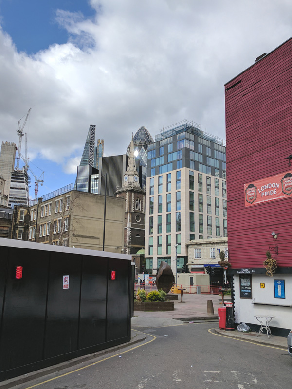
As you can see, we’ve got a couple of big beasts to tackle on today’s expedition; the Central Criminal Court (commonly known as the Old Bailey) and Christopher Wren’s crowning glory and tourist beehive. In between and after these diversions we’re wandering the streets that fill the space bounded by Newgate Street to the north and (just about) the River Thames to the south.

Day 42 Route

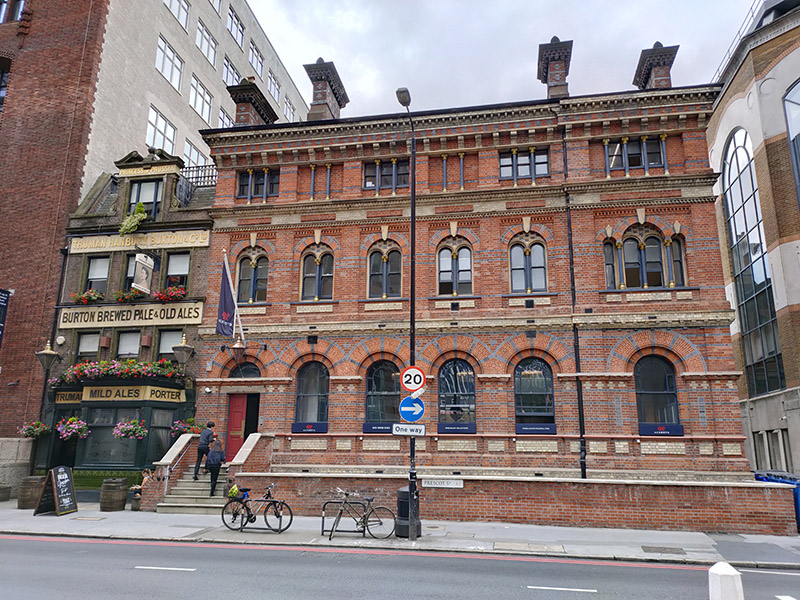
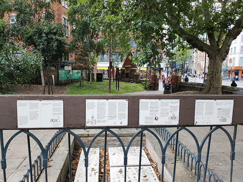
An unusually early start today as I’d booked myself on something called the Old Bailey Insight tour meeting at the Viaduct Tavern, opposite the courts on Newgate Street, at 9.15. The Viaduct Tavern is another of the Gin Palaces that sprang up in Victorian times and dates back to 1869, when Newgate Prison was still standing. It is claimed, though not fully substantiated, that the cellar of the pub contains five cells that are all that remain of Newgate after its demolition in 1902. An alternative explanation posits that these were actually once part of Giltspur Compter, a debtors’ prison that occupied this site between 1791 and 1853. Either way they may make you more appreciative of your next stopover at a Travelodge.

The tour costs £10 and for this you get twenty minutes of facts and anecdotes (mostly about executions) from the guide plus a look at the disputed “cells” in the basement and instructions on how to get into the public galleries at the Old Bailey with a printed list of the day’s trials. Not exactly bargain of the month even with coffee and croissants thrown in. Among the more interesting snippets of information were the facts that trials at the Old Bailey cost an average of around £150 a minute to run and that there is still a shard of glass embedded in one of the internal walls as a memento of the IRA car bomb of 1973 that shattered all the windows.

IMG_20170330_160636

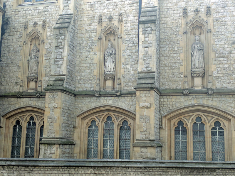
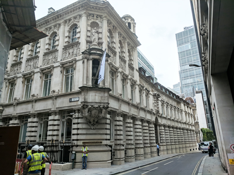
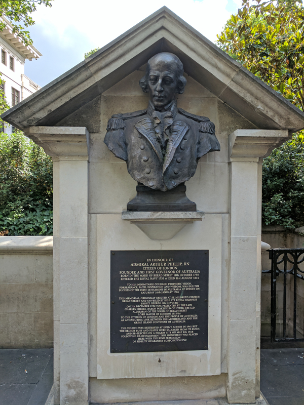
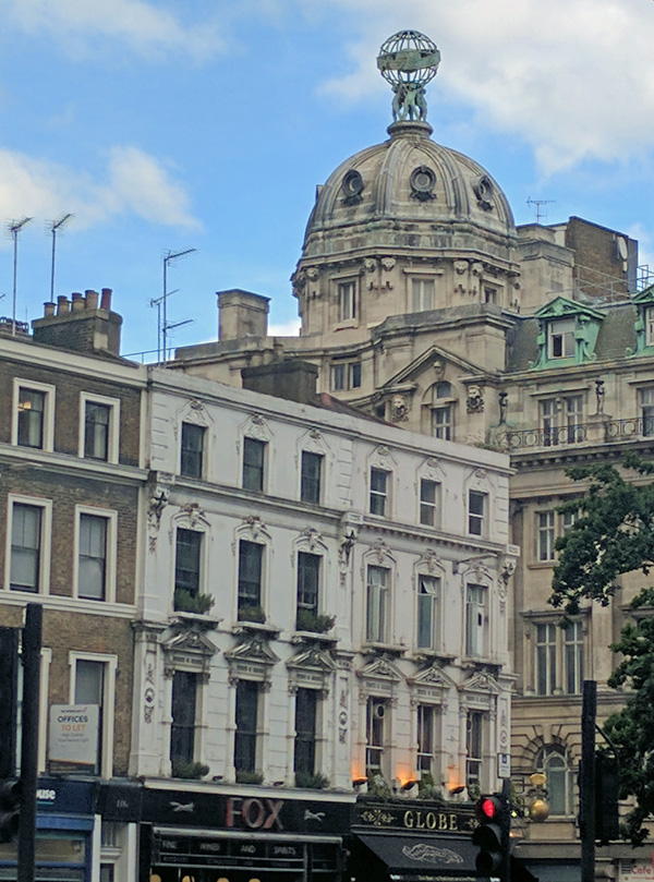
The Old Bailey gets its vernacular name from the street on which it stands, Old Bailey, itself named after the fortified City Wall also known as “bailey”. The court has been around since 1673 when it was sited next to Newgate Prison and has been rebuilt several times. The current building, designed in the neo-Baroque style, by E.W. Mountford, was opened in 1907. The 67 foot high dome is topped with the 12 foot tall gold leaf statue of Lady of Justice”, sword in one hand, scales of justice in the other. However, she is not, as is conventional with such figures, blindfolded. Over the main entrance to the building figures were placed representing fortitude, the recording angel, and truth, along with the carved inscription, “defend the children of the poor and punish the wrongdoer”.  A new extension was added in 1972 (just in time to have all its windows blown out).

This slideshow requires JavaScript.

Strangely enough, the only other time I’ve been to sit in on a trial at the Old Bailey was in 1973 during a school trip up from High Wycombe when I was 14 (the youngest age at which you’re allowed in nowadays). So that must have been just a few months after the IRA bombing yet I don’t have any recollection of particularly stringent security at the time. Now you can only get in if you practically strip down to your underwear. Mobile phones are a definite no-no so that had to be left at the pub. As it transpired I was the only spectator in the gallery for the trial I picked out, a terrorist charge. After about 45 minutes discussing whether or not it’s possible to recover deleted text messages from an I-phone they took a break and I took the opportunity to leave.

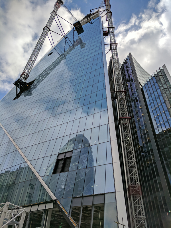
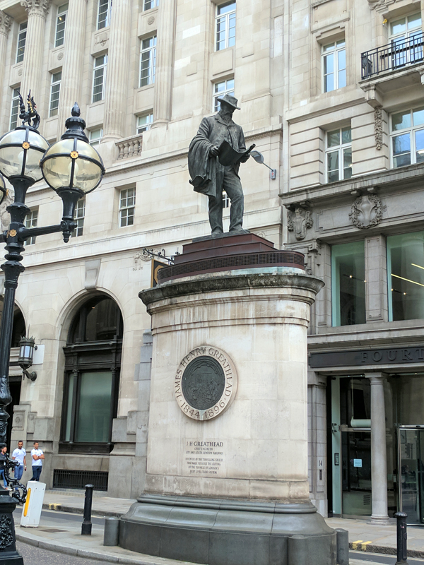
Begin by heading west along Holborn Viaduct to the bridge which gives that street its name. This was built between 1863 and 1869, spanning the River Fleet valley, at a cost of £2m. In fact it was the most ambitious and costly road improvement project in London during the 19th century, masterminded by engineer William Haywood. There are four so-called step-buildings at the corners of the viaduct which house steps down to Farringdon Street below.  The figures on the front of the step-buildings are representations of important Londoners, including Sir William Walworth, the Lord Mayor of London best known for having dispatched Wat Tyler to end the Peasants’ Revolt of 1381 (see Day 39).

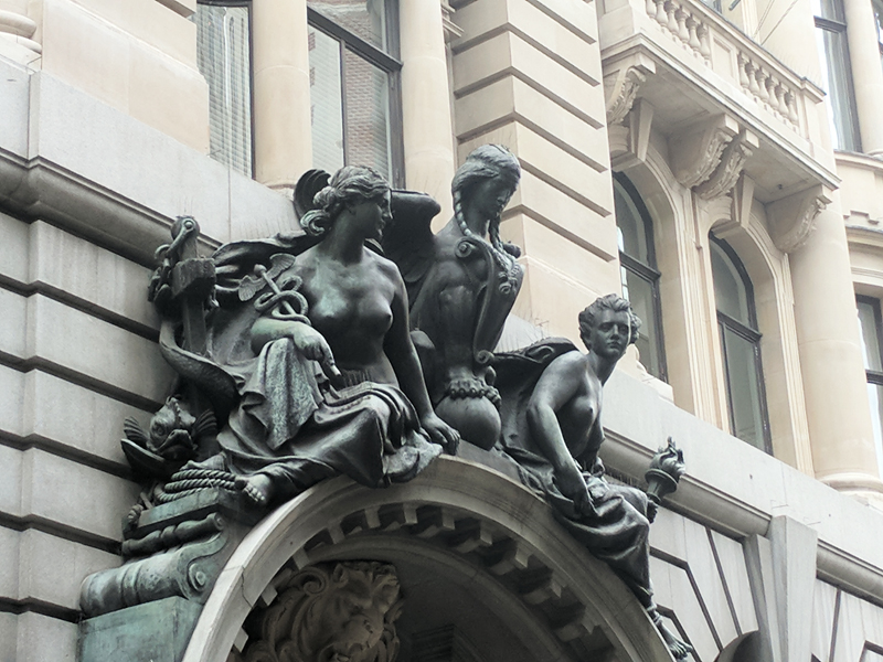
At the ends of the viaduct there are four winged lions, each with its left paw resting on a small globe. These were created by Farmer & Brindley, as were the two female statues on the north side, representing Science and Fine Arts. The figures on the south side, representing Commerce and Agriculture, are by Henry Bursill. The distinctive rich red cast-iron work of the arches and railings presages the ornate qualities of the Art Nouveau movement still decades away.

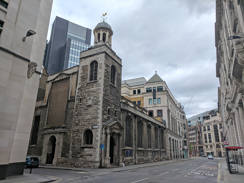
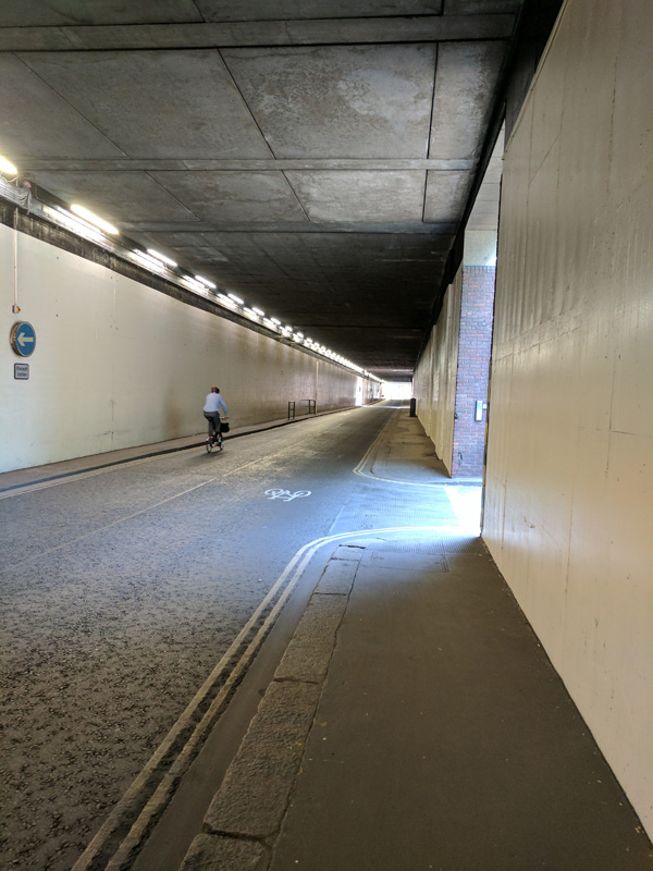
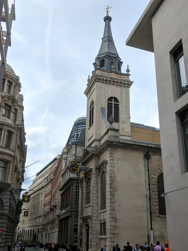
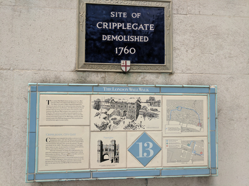
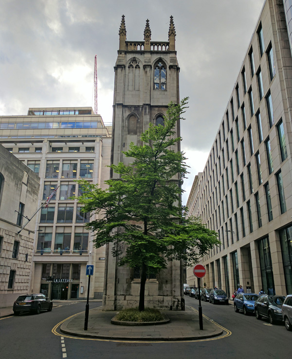
We descend the steps down to the east side of Farringdon Street and then proceed south towards Ludgate Circus, ducking in and out of Newcastle Court, Bear Alley and Old Fleet Lane en route. Just before the Circus we turn left down Old Seacoal Lane which leads into Limeburner Lane. Keep left here and then circle round Fleet Place, Fleet Passage and Bishop’s Court to return to Old Bailey. Next we drop all the way back down Limeburner Lane to Ludgate Hill. A short way up the hill going east is the church of St Martin’s-within-Ludgate, another one which has followed the Medieval foundation, Great Fire destruction, Christopher Wren rebuilding trajectory. Opposite the church was the site of the Ludgate, the westernmost gate of London Wall which, like all the others, was demolished in 1760.

This slideshow requires JavaScript.

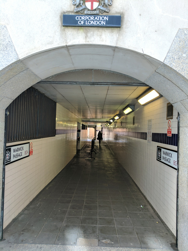
Turning back up Old Bailey for the final time we then nip through Warwick Passage (where the entrance to the public galleries for the majority of the 18 courts can be found) to Warwick Lane.

IMG_20170614_113533

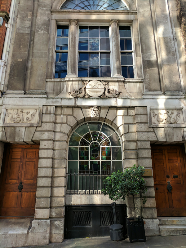
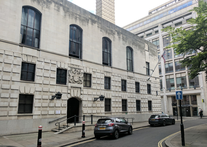
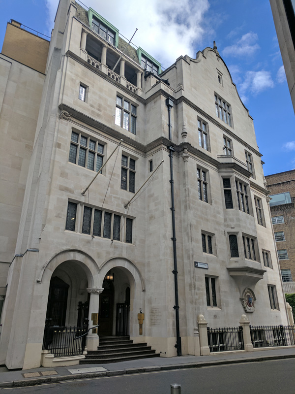
Turning the corner we find the first of three more Livery Company Halls to be encountered on today’s route. This one belongs to the Worshipful Company of Cutlers, craftsmen originally involved in the production of knives, swords and other implements with a cutting edge. Over the course of time the trade evolved away from instruments of war towards more domestic wares such as razors and scissors. The Cutlers received their first Royal Charter from Henry V in 1416 and they sit at no.18 in the Order of Precedence. The current hall dates from 1888 and the terracotta frieze on the outside wall, depicting cutlers working at their craft, is by the Sheffield sculptor Benjamin Cresswick (1853 – 1946).

IMG_20170614_113721

Turning south we pass Amen Court which  was once home to the scribes and minor canons of St Paul’s cathedral, but is more famous now for a reputation as one of the most haunted parts of the Square Mile. A large wall on the site is one of the only remnants of Newgate prison and behind that wall is the narrow passage known as Deadman’s Walk, along which condemned prisoners were taken to their executions.

IMG_20170614_113836

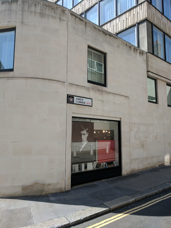
A few steps further on and as Warwick Lane mysteriously transforms into Ave Maria Lane we reach Amen Corner. Sadly this was not the inspiration for the naming of the popular 1960’s beat combo.

IMG_20170614_113923

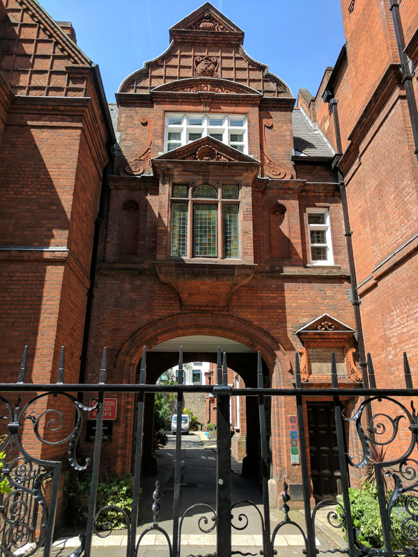
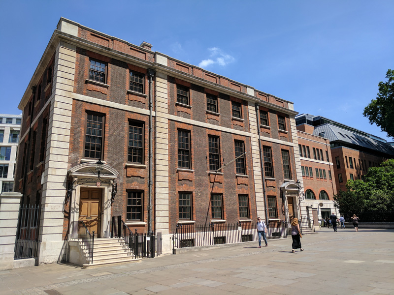
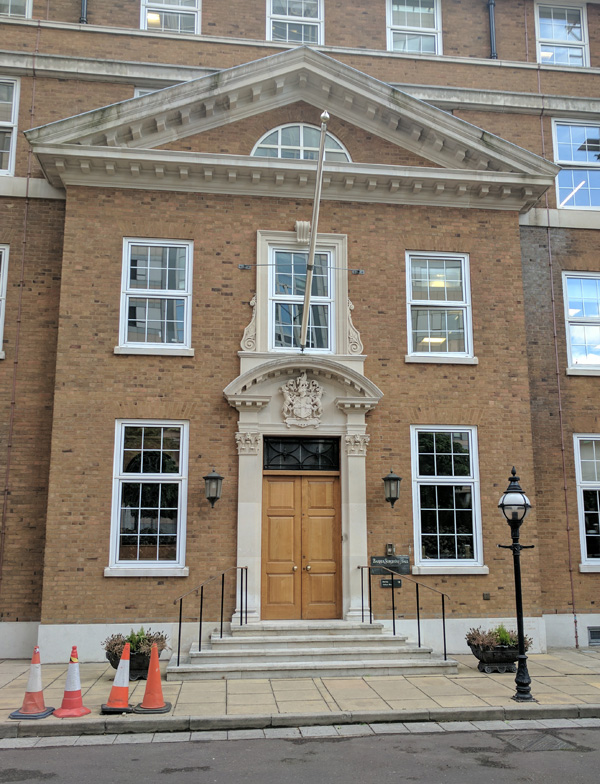
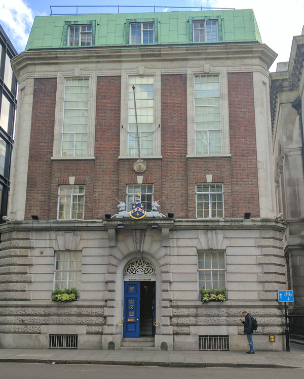
On the other side of the Sassoon hair salon we enter Stationers’ Court which is where we find the second Livery Company Hall, that of the Worshipful Company of Stationers and Newspaper Makers whose current 900 members  work in the paper, print, publishing, packaging, office products and newspaper industries.  At the outset of the 15th century London’s formerly itinerant manuscript writers and illustrators decided to set up stalls or ‘stations’ around St Paul’s Cathedral and because of this they were given the nickname ‘Stationers’ which in turn became the name for the guild they established in 1403. The hall itself was completed in 1673 and it’s one of the few Livery Halls rebuilt just after the Great Fire that have survived into the present. Both the hall and its accompanying garden do a roaring trade in corporate and private entertaining. Only number 47 in the OOP however.

Come back out onto Ludgate Hill and turn east, proceeding past the north side of St Paul’s along Paternoster Row. In times past, on the feastday of Corpus Christi, monks would say prayers in a procession round the Cathedral. They would set off from Paternoster Row chanting the Lord’s Prayer (Pater noster… being the opening line in Latin) and they would reach the final ‘amen’ as they turned the corner in Ave Maria Lane; hence Amen Corner. Immediately opposite the north flank of the cathedral is the Grade II listed Chapter House which was designed and built by Sir Christopher Wren and his son in 1715.

IMG_20170614_115109

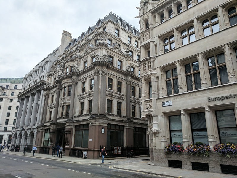
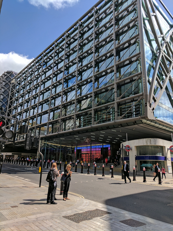
At the end of Paternoster Row we circle up past St Paul’s tube station and then duck in and out of Panyer Alley, Queen’s Head Passage and Rose Street to arrive in Paternoster Square, where I spent the last 12 years of my working life. This area was more or less completely obliterated during the Blitz and the initial reconstruction undertaken in the 1960’s was widely regarded as disastrous; a “monstrous carbuncle” sited embarrassingly close to one of the capital’s primary tourist attractions. A new redevelopment plan was finally agreed in 1996 and work completed 7 years later. While not to everyone’s taste, the architecture is at least more sympathetic to its historical context (and Prince Charles was happy with it). The main monument on the square is the 75ft tall Paternoster Square Column ( less prosaically also known as the Flaming Orb monument), a Corinthian column of Portland stone topped by a gold-leaf covered flaming copper urn illuminated by fibre-optic lighting at night. The square’s most famous resident is the London Stock Exchange though to some it is better known for the Paternoster Chop House, the restaurant used by Channel 4 as the meeting place in its First Dates programme.

This slideshow requires JavaScript.

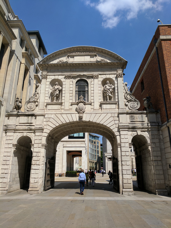
We leave via the southern entrance to the square beneath the Temple Bar. This was returned to the capital and erected here in 2004 having languished for 125 years in a clearing on the Hertfordshire estate of the brewer Henry Meux. As we learnt a few posts ago, it originally stood where Fleet Street meets the Strand, near to the Temple Church. That was in the 14th to 16th centuries. It was then rebuilt after the Great Fire under commission from King Charles II. The work is attributed to that man Sir Christopher Wren again (how did he ever find the time to sleep). The statues of Anne of Denmark, James l, Charles I, and Charles II, in niches in the upper floor were carved by John Bushnell. However, by the late 19th century it had become a serious impediment to the flow of horse and cart traffic in the city and the City of London Corporation had it dismantled (whereafter it was bought by the aforementioned Henry Meux).

IMG_20170614_115018

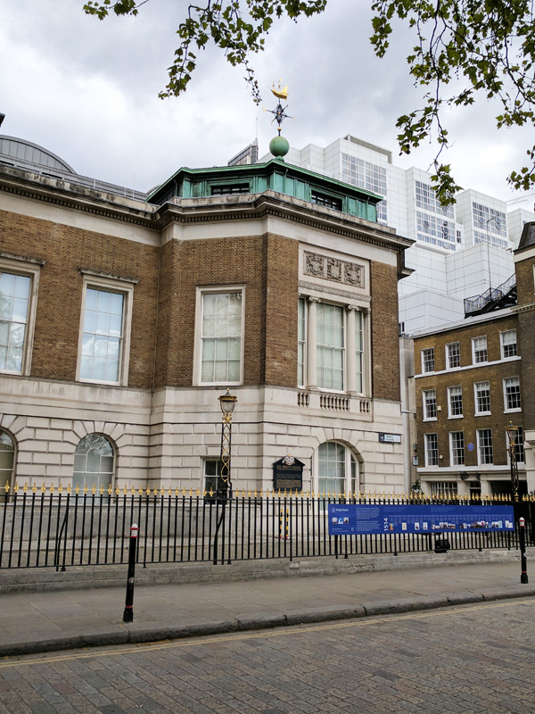
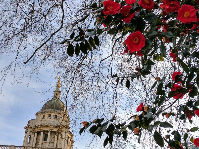
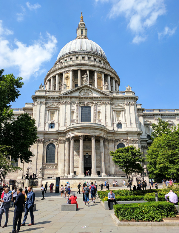
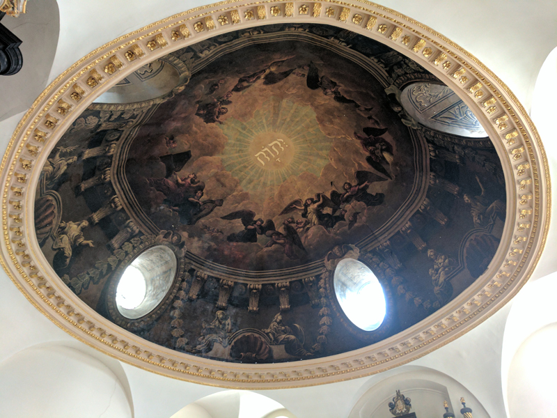
And so, after much preamble, to St Paul’s Cathedral itself. I could write about Wren’s masterpiece almost ad infinitum of course but I’ll keep it fairly brief and just encourage you to visit yourself, especially if you never have. Clutching my £16 online ticket, I join the line of tourists outside the west entrance. (If you do gift aid this ticket actually allows you to visit as many times as you want over the next 12 months). According to my 1930’s guidebook back then it cost 6d (2.5p) for admission that took you as far as the Stone Gallery and then 1s (5p) to get to the Golden Gallery. In those days you could also go right up to the Golden Ball on top of the dome for a further shilling. Today’s entry price includes all areas that are open and an audio-guide.

The present cathedral is at least the third to occupy this site and is actually somewhat smaller than its immediate predecessor which was burnt down in the Great Fire. Two years after the fire Christopher Wren was commissioned to design the replacement but it wasn’t until 1697 that the first service was held in the new cathedral. Incidentally, you’re not supposed to take photographs inside St Paul’s but it took me a while to cotton on to that.

This slideshow requires JavaScript.

Once you’ve explored the Nave, looked up into the Dome and watched the Bill Viola video installations at the end of the two Quire Aisles it’s 257 steps up to the Whispering Gallery where you can hear a myriad of foreign tongues echoing round the perimeter. Another 119 steps will take you up to the Stone Gallery (at the base of the Dome). Unfortunately, you can’t do a full circuit here at the moment because of renovation work but you do still have good views to west and the south and the east. Because I’m rubbish with heights and pretty knackered already I wimp out of climbing the additional 152 steps to the Golden Gallery (which runs round the top of the dome).

This slideshow requires JavaScript.

Once you’ve made your way back down the exit is via the Crypt which contains the tombs of Christopher Wren (naturally), Lord Nelson and the Duke of Wellington as well as memorials to William Blake and Florence Nightingale amongst others.

Once outside again, we swing east through the churchyard past the column mounted with a gilded statue of St Paul which commemorates the public preaching of the Christian gospel in this location.

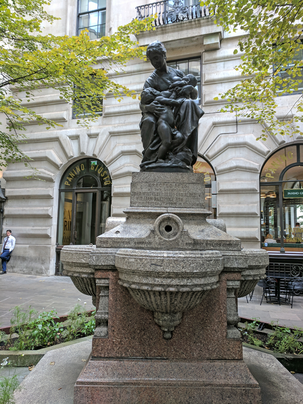
Then we move round to the gardens on the south side of the cathedral, a popular spot for wedding photographs and, appropriately, home to George Ehrlich’s sculpture The Young Lovers.

Next we turn south away from St Paul’s heading towards the Millennium Bridge down Sermon Lane/Peter’s Hill, looking back for one final shot of the cathedral.

IMG_20170614_145439

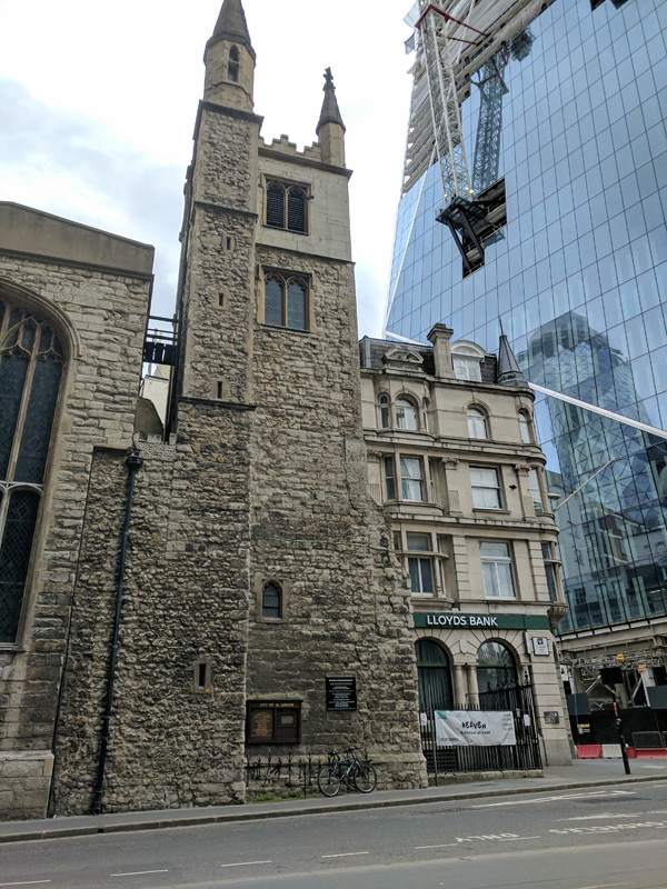
Turn toward the east along Distaff Lane then loop round into Queen Victoria Street and back to Peter’s Hill. Continue south skirting the ramp up to the bridge and at the river’s edge turn left along Paul’s Walk. Very quickly head away from the Thames via Trig Lane, Broken Wharf and High Timber Street, with nods to Gardeners Lane and Stew Lane (both dead ends with no access to the river). Then we have to cross the two-lane high way that is Upper Thames Street, effected via Fyefoot Lane, a name wasted on what is essentially just a footbridge. From the other side we cut through to Queen Victoria Street turn westward and then roll back down Lambeth Hill at the bottom of which sits Saint Mary Somerset Tower. This is another one of the 51 churches rebuilt by you-know-who but the tower is all that remains now, the body of the church having been demolished in 1871. Before the Second World War the tower was used as a women’s rest room. Today there is talk of it being refurbished and extended to create a private residence but I saw little evidence of this.

Turn west next into Castle Baynard Street which these days is basically a cycle route that runs parallel with Upper Thames Street. Baynard’s Castle was originally a Norman fortification sited near the river here and then in the 15th century reconstructed on adjacent land. According to Shakespeare’s Richard III the infamous usurper assumed the title of King at Castle Baynard.

IMG_20170614_151439

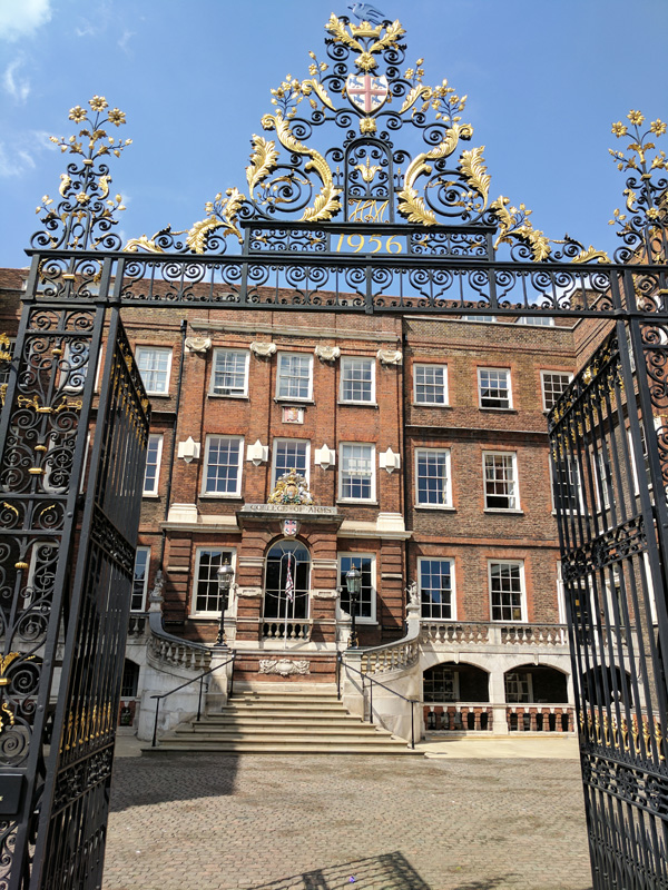
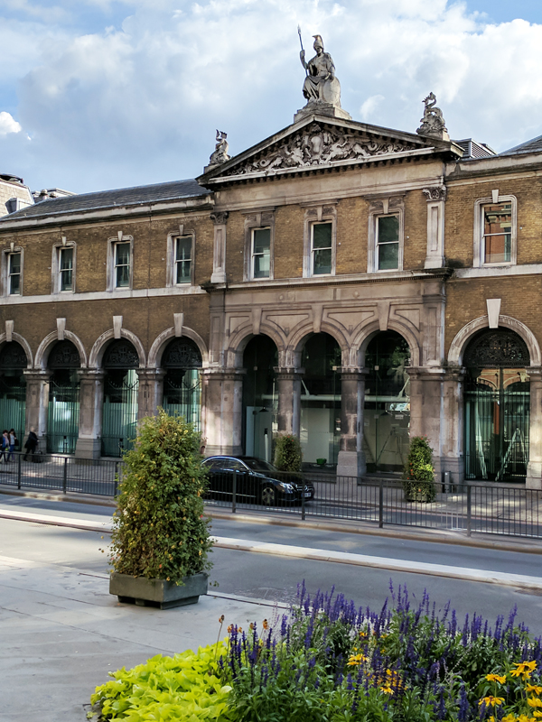
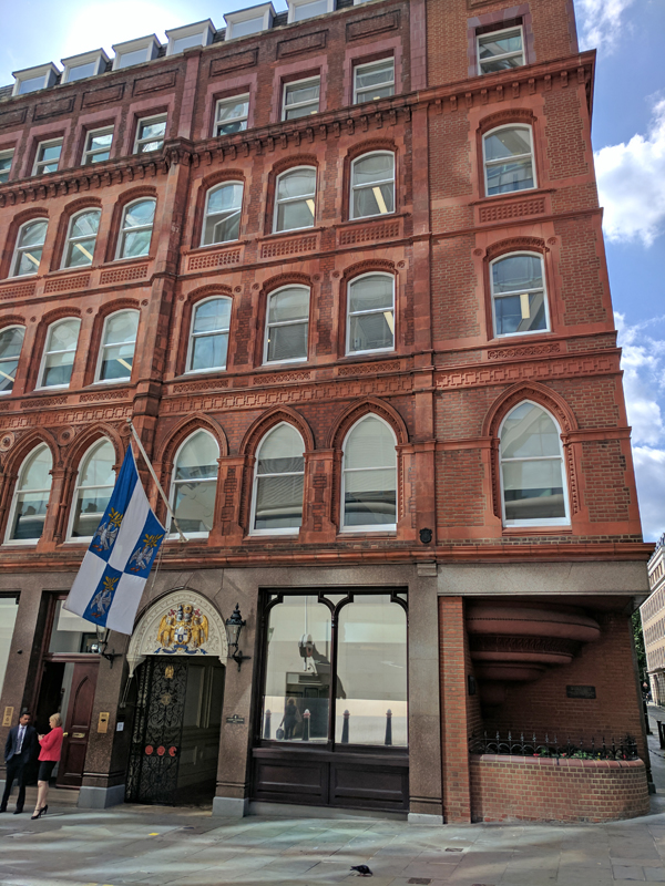
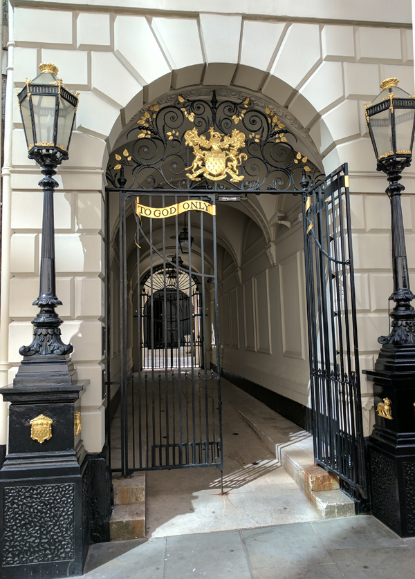
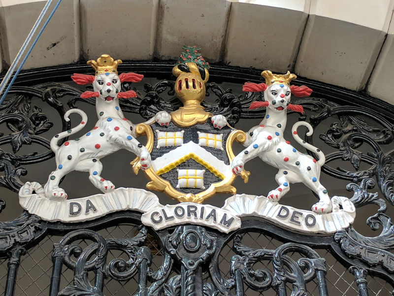
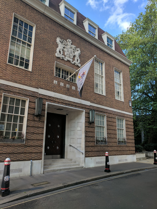
At the end of the underpass turn north up Bennet’s Hill past the City of London School and St Benets Metropolitan Welsh Church onto Queen Victoria Street again. On the north side of the street is the College of Arms, the official heraldic authority for England, Wales, Northern Ireland and much of the Commonwealth founded in 1484. So this is the place you need to apply to if you’re looking to create your own coat-of-arms; unless you’re in Scotland, which has a separate heraldic executive, where you’d need to approach someone called the Lord Lyon King of Arms. The Officers of Arms who make up the College of Arms are all classified as Heralds in Ordinary but are titled as either Kings of Arms, Heralds or Pursuivants. All Heralds in Ordinary are members of the Royal Household and appointed either directly by the Sovereign or on the recommendation of the Duke of Norfolk. They receive yearly salaries from the Crown – Garter King of Arms £49.07, the two provincial Kings of Arms £20.25, the six heralds £17.80, and the four pursuivants £13.95. At the present time the posts of Rouge Dragon Pursuivant and Bluemantle Pursuivant are both vacant. If her majesty is reading this I’d be happy enough to be either of those for nowt.

The college building dates from the 1670s.

IMG_20170614_151803

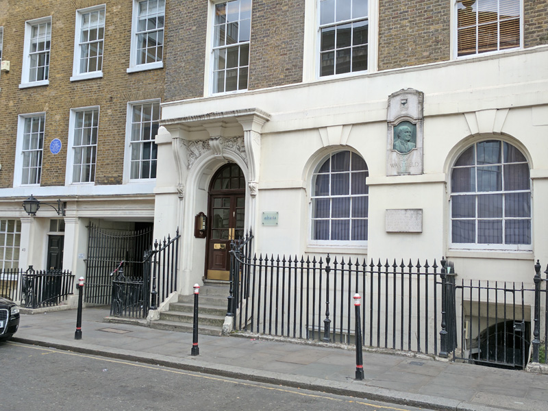
Proceed northwards next up Godliman Street then cut a right into Knightrider Street, nothing to do with the cult 1980’s TV show though, anecdotally, David Hasselhoff has claimed that the Centre Page pub here is his favourite hostelry. Circle round Sermon Lane, Carter Lane back into the top part of Godliman Street then a bit more of St Paul’s Churchyard before dropping down Dean’s Court to the main stretch of Carter Lane. On the corner here is what must be the most heavily over-subscribed Youth Hostel in the UK. The building was formerly the St Paul’s Choir School, built in 1875 to a design of F.C Penrose. The YHA took it over in the early seventies and have retained most of the original features including the Latin wall paintings on the exterior and original choirboy graffiti in a wood-panelled classroom.

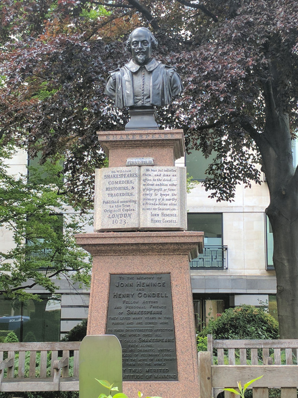
Do another loop starting east on Carter Lane and back via Godliman Street, Knightrider Street and New Bell Yard then turn south down Addle Hill before slipping westward through Wardrobe Terrace to the Church of St Andrew by the Wardrobe, Wren’s final city church. The name derives from the time when King Edward III moved his royal robes and other effects to a large building nearby that became known as the Great Wardrobe. The church has a connection with Shakespeare in that the playwright worked for 15 years with the local Blackfriars Theatre and also bought a house in the parish.

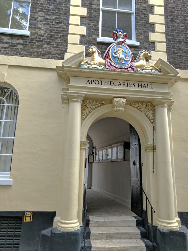
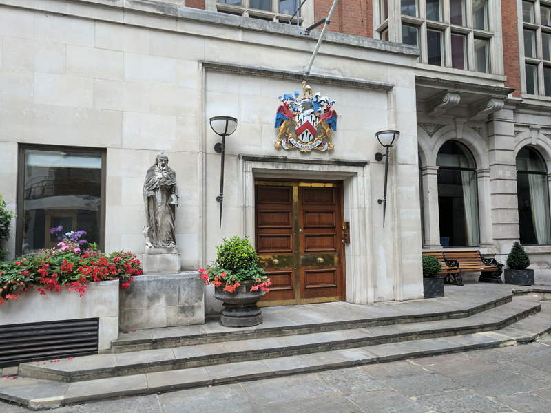
Emerge out on Queen Victoria Street on the other side of the church then head back up St Andrew’s Hill. Take a quick look at Wardobe Place which commemorates the aforementioned Great Wardobe before crossing between Carter Lane and the Ireland Yard (where Shakespeare bought that house) via Burgon Street, Friar Street and Church Entry respectively. Across Carter Lane from the latter is Cobb’s Court which doglegs onto Ludgate Broadway from where we return to Ludgate Hill via Pilgrim Street. Turn west here then back south down Pageantmaster Court, Ludgate Broadway again and then Blackfriars Lane. A short way down here on the left is the last of today’s three Livery Halls, belonging to the Worshipful Society of Apothecaries.

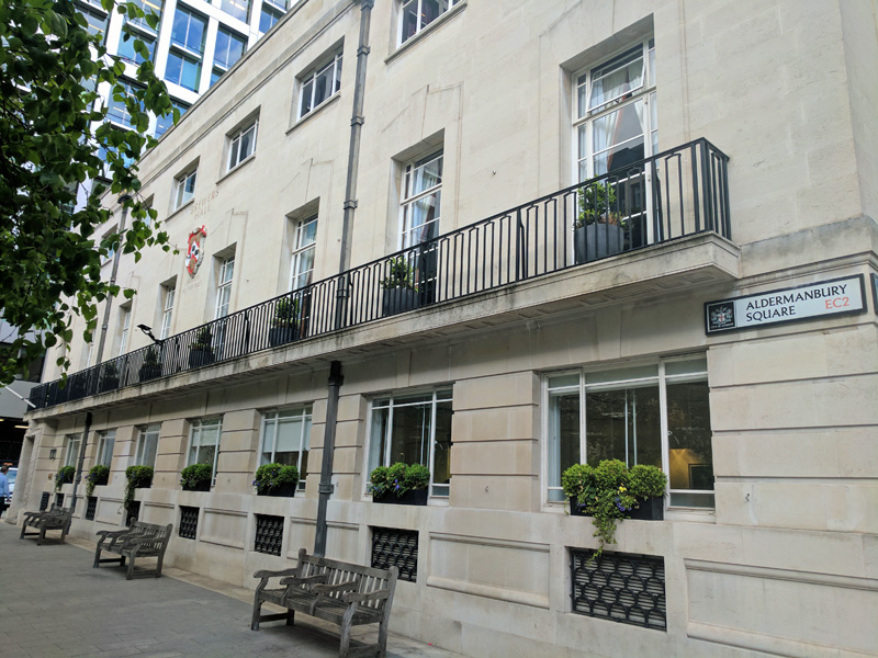
The word ‘apothecary’ is derived from apotheca, meaning a place where wine, spices and herbs were stored. During the thirteenth century it came into use in this country to describe a person who kept a stock of these commodities, which he sold from his shop or street stall. The Apothecaries were granted their royal charter by King James I in 1617 and they occupy 58th position in the Order of Precedence. The hall has been around since 1672 when it was rebuilt here after the Great Fire. The year following the Society founded the Chelsea Physic Garden which it had under management until 1899.

IMG_20170614_154259

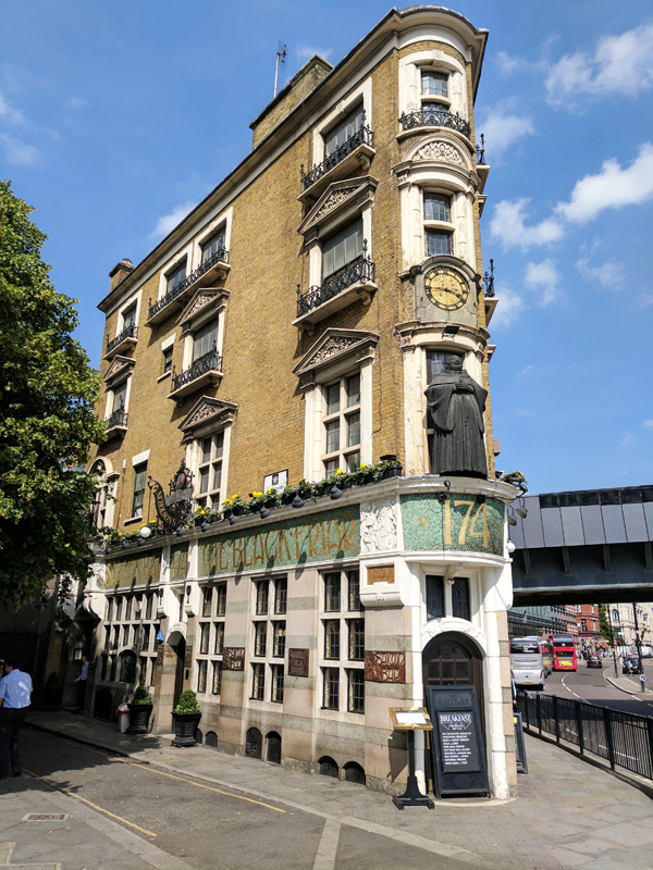
After a brief diversion into Playhouse Yard (that Shakespeare connection again) we continue down to the bottom of Blackfriars Lane and turn right to where the Blackfriar pub sits on the junction of Queen Victoria Street and New Bridge Street. This historic Art Nouveau Grade II masterpiece of a pub was built in 1875 on the site of a Dominican friary, designed by architect H. Fuller-Clark and artist Henry Poole, both committed to the free-thinking of the Arts and Crafts Movement. Jolly friars appear everywhere in the pub in sculptures, mosaics and reliefs. That the pub survived the quite horrendous post-war redevelopment of the immediate area is down to a campaign against demolition led by Sir John Betjeman.

IMG_20170614_154552

And that you will be relieved to know is finally it for this time. If you made it this far then please feel free to claim a pint off me if and when we ever run into each other.


Day 41 – London Wall – Cheapside – Guildhall

Today’s journey starts with a visit to the Museum of London and then weaves it way between London Wall and Cheapside before finishing (more or less) at the City of London Guildhall. It’s an area full of historical resonance (to which the scurrying office workers are blithely indifferent) despite almost wholesale reconstruction after WWII. It also has the highest concentration of Livery Company Halls in the City though they maintain a discreetly low profile .

Day 41 Route

Although today’s walk properly begins at the Museum of London I take time out beforehand to revive the tradition of the pub of the day. In this case that involves a visit to the Hand and Shears on Middle Street which is pretty much where we closed proceedings two posts ago. This is a proper unreconstructed old boys’ boozer and none the worse for it; though it does mean it’s not exactly heaving for a Friday lunchtime.

IMG_20170512_142520

Anyway back to the Museum which sits in the south-western corner of the Barbican complex. There are vague plans afoot to turn this site into a new concert hall and relocate the museum elsewhere locally but in the current climate I won’t be holding my breath for that. I won’t dwell too much on the collections in the museum;  if you haven’t been I can recommend it – and it’s still free entry as we speak. Here are some of my personal highlights though.

This slideshow requires JavaScript.

The sandwich board in the final slide was worn by one Stanley Owen Green (1915 – 1993) who strolled up and down Oxford Street wearing it for 25 years from 1968 until his death. I remember him well from my younger days though I was never really sure how less sitting was supposed to dampen the libido.

On leaving the museum we head east along what remains of the Bastion Highwalk, taking its name from the 21 bastions built along wall by the Emperor Hadrian in AD 122. In short order descend the steps onto London Wall and then veer off-road to check out the remnants of the wall in this the north-west corner, the Aldersgate section, diametrically opposite the bit we looked at in the previous post (by Tower Hill for those with short memory). These remains include St Giles Cripplegate Tower which was one of the towers added when the wall was comprehensively rebuilt in the early 13th century. What’s left standing today represents about 2/3 of the original height. The Roman fort at Cripplegate was a bit further east as we shall shortly see.

This slideshow requires JavaScript.

In the final slide (again) you can see the Barber’s Physic Garden which is on the site of the 13th of Hadrian’s bastions and showcases a selection of plants which have been used in medical and surgical practice throughout the ages. Barber-Surgeons Hall, the HQ of The Worshipful Company of Barbers, 17th out of 110 in order of precedence and 700 years old in 2008, is round the corner in Monkwell Square. The Company first included surgeons amongst its number in 1312. Barbers and surgeons had overlapped in their duties for many years, largely because in the 13th century Pope Honorarius III had prohibited all persons in holy orders from practising medicine. Barbers in the monasteries therefore began to add minor surgical skills to their repertoire, which in due course were passed on to barbers elsewhere.

IMG_20170512_160041

Across Wood Street from Monkwell Square is the former site of Cripplegate that I referred to above. This entrance to fortified London was rebuilt at least twice after its original construction in c. AD 120 and was finally demolished in 1760.

IMG_20170512_160242

To the east of here is St Alphage Gardens which, hemmed in by the massive ongoing redevelopment of this area, currently leads to nowhere. This former churchyard derives its name from St Alfege, the 29th Archbishop of Canterbury, who was killed by the Vikings in 1012. The garden is bordered by another chunk of the Roman city wall.

There are more wall remains back on the south side of London Wall at the top of Noble Street. It was actually the destruction of this area by the German bombing raids in WW2 which allowed the remains of the old City Wall to see the light of day again.

At the junction of Noble Street and Gresham Street sits St Anne & St Agnes Church which typically can trace its history back to Norman times. It was rebuilt to a design of Christopher Wren’s in 1680 then largely destroyed in the Blitz. Its restoration was largely paid for by the worldwide Lutheran church in order for it to be used by the exiled Estonian and Latvian communities. When that congregation moved on in 2013 the building became the secular Gresham Centre and home to the music-based charity, VCM.

IMG_20170512_161526

Heading a little way back up Noble Street we turn eastward next, down Oat Lane. On the corner with Staining Lane we find the hall of the Worshipful Company of Pewterers. These guys were granted their charter by Edward IV in 1473 and they sit at number 16 in the Livery Company charts. The use of pewter as an everyday production material had effectively died out by the end of the 17th century but the trade survives as a decorative art.

IMG_20170512_161807

Back on Gresham Street, opposite the bottom end of Staining Lane, is Wax Chandlers Hall, the sixth incarnation of the home of that particular Livery Company. Wax Chandlers were in the business of making products out of beeswax; before the Reformation acts of devotion to speed souls through Purgatory required vast quantities of beeswax for candles, tapers and images. These days I think its safe to assume that Wax Chandlers are even thinner on the ground than Pewterers, though there is apparently a European Wax Federation based in Brussels. Uniquely, their charter was granted by Richard III (I guess he wasn’t around long enough to do any more). In the Order of Precedence they rank a few places lower than the Pewterers at no.20.

IMG_20170512_161952

From here we turn north again up Wood Street. On an island in the middle of the street sits the 92ft tower which is all that remained of the Church of St Alban after WWII bombs destroyed the rest of Christopher Wren’s post-Great Fire handiwork. These days the tower is used as a private residence.

IMG_20170512_162404

Adjacent to the tower is Wood Street police station which was built in the mid-1960’s to the neoclassical design of architect Donald McMorran and has been Grade II listed since 1998.

IMG_20170512_162343

Just north of the Police Station we cut through between the buildings to get to Aldermanbury Square. This is the location of Brewers’ Hall, home of the Brewers’ Company, which as you might have worked out has a somewhat more extensive membership than its fellow Livery Companies we have encountered thus far. This lot got their charter from Henry VI (who completes the triumvirate of monarchs associated with the Wars of the Roses) in 1438. The current hall is the third on the site and was constructed in 1960 (I’m sure by now I don’t need to explain what happened to the previous two). Apparently there was something of a feud between the Brewers and Mayor Dick Whittington which blew up because the Brewers had fat swans at their feast on the morrow of St Martin and the Mayor didn’t. Whittington’s revenge was to make the Brewers sell their ale at 1d per gallon all the following day. The Brewers are at position 14 in the O.O.P. (between the Dyers and the Leathersellers).

IMG_20170512_162614

Nipping up Brewers’ Hall Gardens we emerge back on London Wall and then sortie eastward towards Moorgate. Although it’s not strictly on today’s route I just wanted to mention Electra House which stands at no.84 Moorgate, as it’s kind of fallen in between the cracks. This was completed in 1903 and was the headquarters of the Eastern telegraph and Allied Companies. The rather resplendent bronze sculpture atop the dome was created by F.W Pomeroy (1856 – 1924) and depicts a group of four cherubs holding aloft a globe within a wire structure showing the signs of the zodiac (why is anyone’s guess).

IMG_20170512_163016

Anyway, back on track we head south on Coleman Street before turning west along Basinghall Avenue which brings us to the home of the Worshipful Company of Girdlers (girdle makers). Unsurprisingly, this is one of the smaller Livery Companies with only around 80 active members and is no longer allied with an extant trade. Girdles, as in a kind of belt used to fasten a cassock rather than the elasticated figure-enhancing garment produced by Playtex in the 20th century, began to go out of fashion in the 16th century. Even in its heyday, the Company overlapped with other crafts concerned with metal or leather and was at various times associated with the Pinners, the Cordwainers and the Gold and Silver Wyre Drawers. Today the Girdlers’ Company no longer practises its craft, with the single proud exception that it has the privilege of presenting the sword belt for the Sword of State and stole for each Sovereign’s coronation. Oh, no.23 since you ask.

At the end of Basinghall Avenue we turn south into Aldermanbury Street where we find the Institute of Chartered Insurers which incorporates the Worshipful Company of Insurers (but I reckon we’re Livery Company’ed out for the moment and we know what these guys do and besides they’re only placed at a lowly no.92).

IMG_20170512_163515

In St Mary Aldermanbury Garden at the corner with Love Lane is a memorial to John Heminge and Henry Condell, members of the King’s Men actors’ company, who in 1623 published the “First Folio”of Shakespeare’s collected plays.

IMG_20170512_163655

I took this photo of One Love Lane because I was going to make a weak joke about this having nothing to do with Bob Marley, but I don’t think I’ll bother.

IMG_20170512_163610

So Love Lane takes us back to the St Alban Tower on Wood Street from where we go south back to Gresham Street then turn left for a short way before continuing south on Gutter Lane. From her we turn west along Carey Street which joins with Foster Lane. Foster Lane is the site of Goldsmiths’ Hall, the very grandiose home of the Goldsmiths’ Company (no.5 with a bullet !). The current hall is the third of its kind and was built in the early 1830’s to a design of Philip Hardwick, the Company’s Surveyor. the grand opening in 1835 was attended by the Duke of Wellington. In 1941 a bomb exploded in the south-west corner but as you can see in the picture below the hall (unlike most of the surrounding buildings) survived relatively unscathed. Goldsmith has always referred to someone who works in both gold and silver and today encompasses those who work in platinum and palladium as well. In 1300 King Edward I passed a statute requiring gold and silver to be of a defined standard and requiring ‘les Gardeins du Mester’ (Guardians of the Craft) to test it and mark it with the leopard’s head. This was supposedly taken from the royal arms and later known as the King’s mark. This is the first legal recognition of the Company, and the beginning of hallmarking in Britain. If you look closely you can see the leopards’ heads on the coat of arms sculpted on the exterior of the building.

This slideshow requires JavaScript.

Turn back south down Foster Lane then make a round trip of Rose Crown Court and Priests Court before visiting the Church of St Vedast. Same old story here I’m afraid; originated in the 12th century, burnt down in the Great Fire, rebuilt by Christopher Wren, burnt out in the Blitz and restored after the war.  St Vedast is a fairly obscure French saint from the 6th century. His name in England has been corrupted from St Vaast, by way of Vastes, Fastes, Faster, Fauster and Forster to Foster, hence the name of the lane, and the reason that the official designation of the church is St Vedast-alias-Foster.

We return to Gutter Lane via Cheapside and find ourselves at Saddlers’ Hall which is where I was stationed as a volunteer for the Dominoes event commemorating the 350th anniversary of the Great Fire in 2016.  The Worshipful Company of Saddlers occupies 25th place on the list despite being one of the oldest companies, having received its first Royal Charter in 1395 courtesy of Richard II. The Saddlers attribute their relatively lowly placing to the fact that by the time the order of precedence was established in 1515 the economic balance of power in the City of London had shifted from the craft guilds to the merchant companies.

That’s the last mention of Livery Companies you’ll have to put up with for today you’ll be relieved to hear. So, moving swiftly on, we head east next down Goldsmiths’ Street then across Wood Street again and continue through Compter Passage to Milk Street. Crossing over again we enter Russia Row which in a brilliant twist of up-to-the-minute irony segues directly into Trump Street.

Swiftly leaving Trump Street behind we turn north up Lawrence Lane which takes us back up on to Gresham Street and the church of St Lawrence Jewry which is so-called because the original 12th century church was in an area occupied at the time by the Jewish community. Since then it’s been a familiar tale of Great Fire, Wren-designed rebuild, WWII destruction (as a result of action by the King’s enemies according to the plaque outside) and post-war restoration, in 1957 in this case. St Lawrence is now the official church of the Corporation of London. St Lawrence met a particularly grisly end at the hands of the Romans. You can follow the link to get the full details but suffice to say his symbol is a gridiron, a representation of which forms part of the weather vane on the church.

This slideshow requires JavaScript.

St Lawrence occupies the south side of the square on the opposite of which stands the Guildhall. The Guildhall was built between 1411 and 1440 and was designed to reflect the power and prestige of the Lord Mayor and the ruling merchant class. It is the only non-ecclesiastical stone building from that era to have survived (at least in part) until the present day. The Great Hall lost its roof in both 1666 and 1940 but the walls stood firm. The second replacement roof, erected in 1954, was designed by our old friend Sir Giles Gilbert Scott. The giants, Gog and Magog, are associated with Guildhall. Legend has it that the two giants were defeated by Brutus and chained to the gates of his palace on the site of Guildhall. Carvings of Gog and Magog are kept in Guildhall and 7-foot high wicker effigies of them donated by the Worshipful Company of Basketmakers in 2007 lead the procession in the annual Lord Mayor’s Show. The Guildhall hosts the annual Lord Mayor’s Banquet which marks the change from one Lord Mayor to the next and includes a speech on world affairs by the incumbent Prime Minister.

This slideshow requires JavaScript.

On the east side of the square you can find the Guildhall art gallery. Having visited this before I felt no compunction to repeat the experience, though you can see the (somewhat scant) remains of London’s Roman Amphitheatre in the basement.

Leave the square via Guildhall Buildings and turn right up Basinghall Street. The part of the Guildhall that faces onto this street was built as its library by Sir Horace Jones (architect of Tower Bridge) in 1870. Three niches that Jones incorporated into the building were later filled by statues of Queens Elizabeth I, Anne and Victoria. These were created by J.W. Searle of Lambeth and were representative rather than strictly realistic. (In real life, Anne was supposedly so short and stocky she was buried in a square coffin).

IMG_20170512_171338

Basinghall Street turns into Basinghall Avenue which sweeps east to Coleman Street. Head south here and after a quick poke around White Horse Yard continue down to Masons Avenue and cut through back to Basinghall Street. It’s gone 5pm by now so as it’s also Friday the Old Doctor Butler’s Head pub already has quite a congregation outside it. This is named after the court physician to King James I, Doctor William Butler who as well as setting up a number of taverns in the City also invented a medicinal ale for which he claimed rejuvenating properties. Since he lived to be 83 he may have been onto something.

IMG_20170512_172054

As I could do with some of that ale myself I’m racing through to the end of today’s trip; crossing back over Gresham Street into Old Jewry before threading my way westward between Cheapside and Gresham Street via St Olaves Court, Frederick’s Place, Ironmonger Lane, Prudent Passage and King Street before concluding at St Pauls’ station.

IMG_20170512_172715
If you ask me it’d be more prudent to take the long way round


Day 40 – Aldgate – Tower Hill – Fenchurch Street

Shifting slightly further to the east for this excursion which starts out where we left off a couple of months back on Aldgate High Street then heads south down to Tower Hill, stopping short of the Tower itself, before snaking west and north through the City. Because this walk took place on Easter Sunday the area was atypically quiet apart from the inevitable tourist throng near the Tower and, less obviously, in the vicinity of the Gherkin.

Day 40 Route

So we set out on Aldgate High Street  opposite Aldgate tube station and proceed south down Little Somerset Street. Looking behind us gives a background glimpse of what’s to come later.

IMG_20170416_112536

Reaching Mansell Street we continue south turn right along Haydon Street and then when this adjoins onto the Minories head northward to return to Aldgate High Street opposite the church of St Botolph without Aldgate. This is the second time we’ve encountered St Botolph; he was “without Bishopsgate” a few posts back. In fact there were four medieval churches built in London in honour of this particular saint, all of which stood by one of the gates of the London Wall (more of that later). Aldersgate is the other one of those that survives while the church at Billingsgate wasn’t rebuilt after the Great Fire. St Botolph’s was often referred to as the “Church of Prostitutes” in the late Victorian period. To escape arrest by the police the local ladies of the night would parade around the island in a sea of roadways on which the church stands.

IMG_20170416_113557

Turn south again, this time down Jewry Street which is the site of the Sir John Cass Foundation. John Cass (1661 – 1718) was both a Sheriff and Alderman of the City of London and in 1710 set up a school for 50 boys and 40 girls which originally occupied buildings in the churchyard.  After his death, despite his will being incomplete and contested, his wish to leave the majority of his estate to the school was upheld though it took thirty years. So the Foundation came into being in 1748 and in 1899 a Technical Institute was created alongside the school and this moved into the new-build premises on Jewry Street, becoming the Sir John Cass College in 1950.

After nipping briefly into Saracens Head Yard we take the next right turn, Carlisle Avenue, which takes us into Northumberland Alley which meets its end at the wonderfully-named Crutched Friars. Crutched Friars is one of the alternative names of the Roman Catholic order Fratres Cruciferi (Cross-bearing brethren). Crutched refers to the crucifix-surmounted staff which they carried about with them. Next up, turning north again, is Rangoon Street, which is barely more than an alcove, before we switch eastward down India Street. Turn right next down Vine Street (not the one which forms part of the Orange set of properties in Monopoly – that’s over near Piccadilly) then veer off to the left, down Crosswall which takes us into Portsoken Street. This latter skirts one side of a charming small park wedged in amongst some less than charming buildings.

IMG_20170416_114946

At the end of Portsoken Street we swing round Mansell Street and Goodman’s Yard to loop back onto Minories and then turn south under the railway bridge and past Tower Gateway station, one of the two western termini of the DLR.

IMG_20170416_115538

So we’re now onto Tower Hill and moving west parallel to the north side of the Tower of London. Here there is one of the most substantial surviving sections of the London Wall built around the city  by the Romans in around 200 AD. In total the wall was about 4km long enclosing some 330 acres and including the four city gates (mentioned previously) with a further entrance to the legionary fortress at Cripplegate.

Turn north into Cooper’s Row and head up past Trinity Square Gardens back to Crosswall (whose name now makes perfect sense). Duck through American Square onto the southern section of Vine Street which seems to lead nowhere but then suddenly and bizarrely emerges into a crescent of replica Georgian houses (some rebuilt immediately post WW2 others as part of a 1980s redevelopment) called, simply and literally, Crescent.

IMG_20170416_120510

Double back and cut through a series of alleyways leading out onto Cooper’s Row again. Cross over and proceed west along Pepys Street before turning south down Savage Gardens. This returns us to Trinity Square, to No. 10 Trinity Square in fact, which links neatly back to the previous post for this is the first permanent HQ of the Port of London Authority. It was built in the Beaux Arts style by John Mowlem & Co to a design of Sir Edwin Cooper and was opened by then Prime Minister, David Lloyd-George, in 1922. The façade of the building is interspersed with Corinthian columns and high above the front entrance is a sculpture of Old Father Thames, holding his trident and pointing east in homage to the trade between nations. In 1946 the General Assembly of the United Nations held its inaugural reception here, in what is now known as the UN ballroom. In the 1970’s the PLA moved out to Tilbury and no. 10 was renovated; becoming the home of insurance broker Willis Faber until 2008. Two years after they left a Chinese Investment company bought the Grade II-listed building and after a six year multi-million pound renovation it was brought back to life as a Four Seasons Hotel. In the interim it had a walk-on part in the James Bond Skyfall film as a location for a meeting between M (Dame Judi Dench) and Gareth Mallory (Ralph Fiennes).

This slideshow requires JavaScript.

Moving on clockwise round the square we come first to Trinity House which is the home of the organisation that began life as The Corporation of Trinity House (or to give it its full name The Master Wardens and Assistants of the Guild Fraternity or Brotherhood of the Most Glorious and Undivided Trinity and of Saint Clement in the Parish of Deptford Strond in the County of Kent), under Royal Charter of 1514 with a remit to regulate pilotage on the River Thames and provide for aged mariners. Today Trinity House is the UK’s largest maritime charity dedicated to safeguarding shipping and seafarers as well as incorporating the General Lighthouse Authority (GLA) for England & Wales. The GLA is responsible for a range of aids to navigation from lighthouses to radar beacons but, confusingly, is separate from HM Coastguard (which looks after all aspects of search and rescue).

The building itself dates to 1796 and was designed by architect Samuel Wyatt.

IMG_20170416_121211

On the east of the square at no.43 is a blue plaque commemorating Reverend Philip “Tubby” Clayton (1885 – 1972), founder of the international Christian movement Toc H. And next door at no.41 is a memorial to Viscount Wakefield of Hythe (1859 – 1941) who founded the Castrol lubricants company and was a Lord Mayor of London and also Tubby’s mate.

IMG_20170416_121349

We now take a stroll through Trinity Square Gardens which is dominated by the Merchant Navy Memorial. The original, post WW1, section was designed by Sir Edwin Lutyens with sculpture by Sir William Reid-Dick and was unveiled by Queen Mary on 12 December 1928.  It commemorates almost 12,000 Mercantile Marine casualties who have no grave but the sea, including almost 1,200 lost when the Lusitania was sunk in 1915. The WW2 extension, which commemorates almost 24,000 casualties, was designed by Sir Edward Maufe, with sculpture by Charles Wheeler and was unveiled by Queen Elizabeth II on 5 November 1955.

This slideshow requires JavaScript.

Leaving the gardens on the west side we find ourselves back outside Ten Trinity Square, which as I mentioned is now a Four Seasons hotel having opened a mere three months back in January 2017. On impulse born of curiosity I decide to head inside for a lunchtime cocktail at the Rotunda bar. I have the place to myself pretty much and the very amiable bartender rustles me up a concoction called (appropriately) a Shivering Timbers which will set me back £15 plus service. Still it’s just about worth it to take in the elaborately refurbished interior (and make a luxurious and desperately need toilet stop). As well as the hotel the building incorporates 41 private residences and a private members’ club. At the time of speaking £440 a night for the cheapest room doesn’t include access to the spa and swimming pool as these won’t be open for a few more weeks.

This slideshow requires JavaScript.

Leaving the hotel, head west along Muscovy Street and then turn north up Seething Lane before returning eastward along Pepys Street and via another section of Savage Gardens find ourselves back on Crutched Friars. From here we continue north up Lloyds Avenue most of the buildings on which were built under a redevelopment of derelict East India Company warehouses at the turn of the 20th century. Coronation House at no. 4, built in 1904,  eventually became absorbed into the Lloyd’s Register building which stood on the corner with Fenchurch Street.

IMG_20170416_131130

Lloyd’s Register (not to be confused with Lloyds of London) began life in 1760 in a London coffee house as a marine classification society. Nowadays it operates as a global provider of risk assessment and technical consultancy services across numerous industrial sectors but is still wholly owned by the charitable Lloyd’s Register Foundation.

It moved into the premises at 71 Fenchurch Street, designed by Thomas Colcutt, in 1901. Almost 100 years later it moved again – just a few yards further along Fenchurch Street – to a glass, steel and concrete skyscraper designed by the Richard Rogers Partnership (who of course had previously been responsible for the much better known Lloyd’s of London building – of which we shall hear more another time).

We’re going east again now on Fenchurch Street and at the junction with Leadenhall Street where it turns into Aldgate High Street we find the Aldgate Pump. This historic water pump, which has stood on this spot since 1876, marks the start of the A11 road that eventually leads to Norwich. It’s also considered by many to be the symbolic start of the East End. The wolf’s head is supposed to commemorate the last wolf shot in the City of London though there appears to be no record of when that might have been.

IMG_20170416_131442

Moving on we make a sharp left into Mitre Street and then cut through St James’s Passage to join Dukes Place. Turn the corner and we’re on to Houndsditch. Head up here as far as Creechurch Lane which we follow back across Dukes Place as far as the junction with Heanage Lane which we take back up to Bevis Marks (which Dukes Place merges into and which gets several mentions in Dickens’s Old Curiosity Shop). From here we take the next right, going north, Goring Street to return to Houndsditch. Turn left then left again down the top section of St Mary Axe to revisit Bevis Marks. Turn south this time and then loop round Bury Street past Cunard Place and back onto the lower stretch of Creechurch Lane. Here on the corner with Leadenhall Street stands the actual Cree Church, the Church of St Katharine Cree to be precise. The church was founded in 1280 and the present building dates from around 1630. It is the only remaining Jacobean church in London having survived both the Great Fire and the Blitz practically unscathed.

IMG_20170416_133106

Crossing over Leadenhall Street we squeeze through the alley known as Fenchurch Buildings and having traversed Fenchurch Street again navigate a couple more alleys in the form of St Katharine’s Row and French Ordinary Court which take us round the back of Fenchurch Street Station and onto Hart Street. Turning west we reach another medieval church that eluded the clutches of the Great Fire, St Olaves. This one dates all the way back to 1450 in its present form (more or less – it wasn’t so lucky in the Blitz and had to be extensively restored after the war). The fabulously macabre entrance to the churchyard was a 1658 addition. The church is dedicated to the patron saint of Norway, King Olaf II and the Norwegian connection continued during and after WW2 when King Haakon VII of Norway worshipped here in exile and then in 1954 presided over the rededication ceremony. Samuel Pepys was buried here in 1703 and it is also, weirdly, recorded as the last resting place of the pantomime character Mother Goose (?). Her internment apparently took place in 1586 according to the parish registers and the event is commemorated by a plaque on the outside of the church.

This slideshow requires JavaScript.

Leaving St Olaves behind we move northward again next, up New London Street into London Street (both doing less than nothing to deserve such names) and round Fenchurch Place to the front of Fenchurch Street Station, gateway to Essex. The station opened in 1841 initially to serve the London and Blackwall Railway but was reconstructed after just 13 years when the London, Tilbury and Southend Railway began operations. It’s one of the smallest termini in London and uniquely has no interchange with the underground.

IMG_20170416_134003

Back on Fenchurch Street we continue west for a bit and then proceed north up Billeter Street resurfacing on Leadenhall Street. Keep the westerly trajectory before turning north again up the bottom-most section of St Mary Axe. On the right here is yet another of the City churches that survived the double whammy of the Great Fire and the Blitz. The present St Andrew Undershaft was built in 1532 in the Perpendicular style (a subdivision of Gothic, so-called because of its fondness for vertical lines). The church’s name derived from the shaft of the maypole that was set up opposite the church – though only until 1547 when it was seized by a mob and destroyed as a “pagan idol” (now that’s a show I’d like to see).

IMG_20170416_134926

Continuing north we arrive at the foot of St Mary Axe’s most famous resident, no. 30 more commonly known as “The Gherkin”.  The Gherkin, designed and engineered by Norman Foster and Partners and the Arup Group respectively, was completed in December 2003 and opened in April 2004. 41 storeys and 180 metres tall, it stands on the site of the former Baltic Exchange which was irretrievably damaged by the IRA bomb of 1992. It has a floor area of just over half a million square feet including a restaurant on the 39th floor. In November 2014 the building was bought by the Safra Group, controlled by the Brazilian billionaire Joseph Safra, for £700m (£150m than the price originally anticipated). The sculpted head you can see below is another work in the Sculpture in the City 2016 series; “Laura” by Jaume Plensa.

This slideshow requires JavaScript.

After a circuit round the base of the Gherkin we meander off to the west again down the dead end that is Undershaft. Doubling back and then turning left down Great St Helens we pass in front of St Helen’s Bishopsgate which, you’ve guessed it, also survived the Great Fire and the Blitz (it’s almost like there was some kind of divine providence at work here). Wasn’t so fortunate when it came to that IRA bomb in 1992 however; that took the roof off and also destroyed one of the City’s largest medieval stained glass windows. The church started out as a priory for Benedictine nuns in the early 13th century and was Shakespeare’s parish church when he lived in the area in the 1590s. The artwork on display outside the church, Shan Hur’s “Broken Pillar #12” has been left in place from the 2015 Sculpture in the City collection.

This slideshow requires JavaScript.

At the end of Great St Helens we emerge onto Bishopsgate and head north towards Liverpool Street station. Final point of interest on today’s journey stands at no.110 bounded on its other three sides by Camomile Street, Outwich Street and Houndsditch. Completed in 2011 the building was originally known as the Heron Tower after its owners Heron International but in 2014 its primary tenant pressed for the name to be changed to the pitifully naff Salesforce Tower. The City of London eventually ruled that it should officially be called simply 110 Bishopsgate. Whatever its name the building stands 230 metres tall (including the 28 metre mast) with 46 floors. It currently holds the record as the City of London’s tallest structure, having eclipsed Tower 42 when construction reached the 44th floor.

Situated on floors 38 and 39, Sushi Samba restaurant is one of the top restaurant destinations for the young, aspiring (and easily impressed) denizens of the Home Counties and for those without a head for heights, the lobby contains a 70,000 litre aquarium.

IMG_20170416_134711

And I think that’s us finally done for this time around (and I really expected this one would reverse the trend for longer and longer posts).