Day 75 – King’s Road – Flood Street – Royal Hospital Chelsea

Continuing where we left off last time, today’s journey takes us west and south from Sloane Square into the area tucked in between the King’s Road and the Chelsea Embankment. A good proportion of this is taken up by the Royal Hospital Chelsea and its grounds, a visit to which concludes this outing. Before then we’ve got plenty else to cover including Chelsea Old Town Hall, Chelsea Physic Garden and a wealth of literary connections.

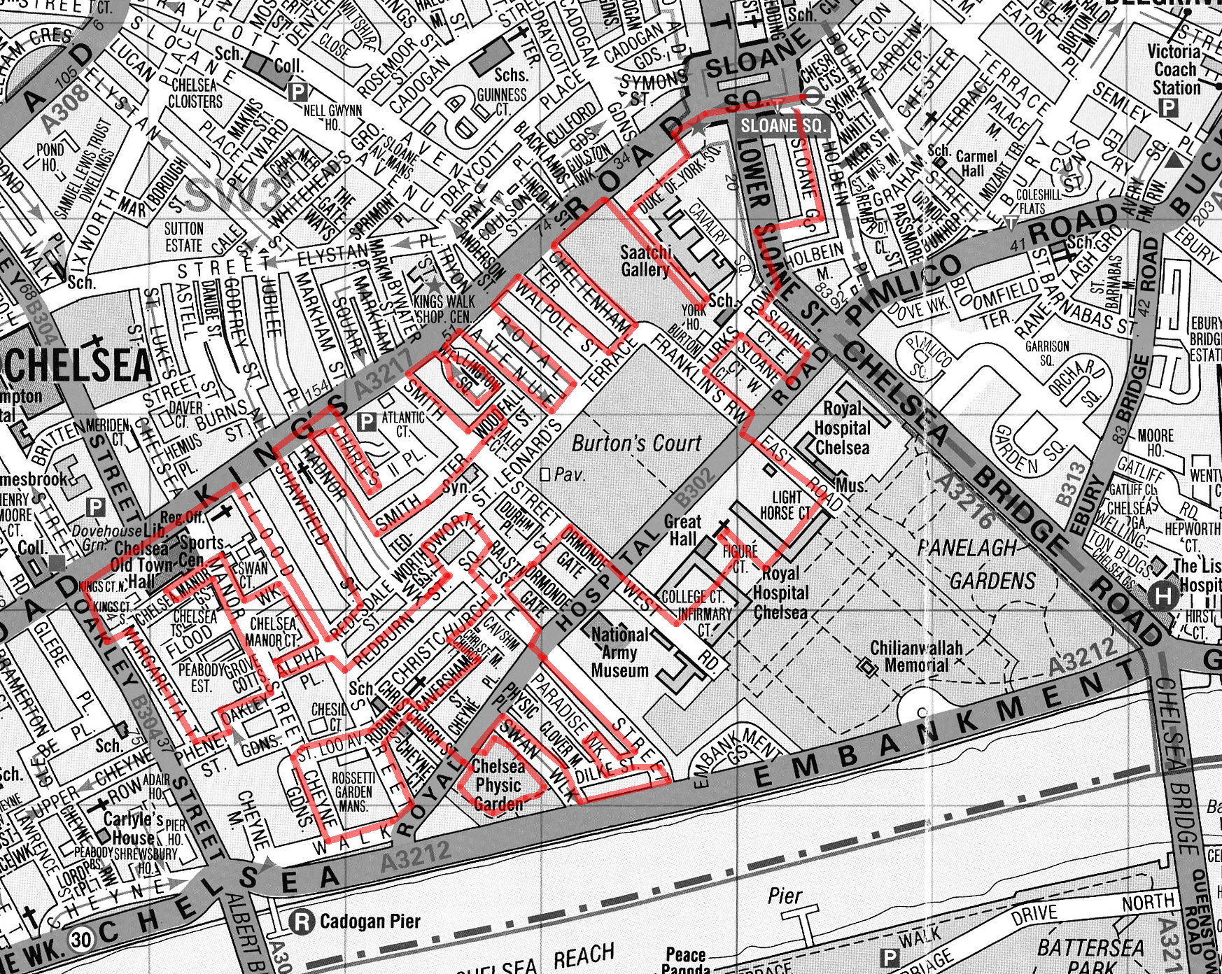
We start out from Sloane Square tube station again and head westward through the square and onto King’s Road. King’s Road derives its name from its function as a private road used by King Charles II to travel to Kew. It remained a private royal road until 1830. In the 1960’s it became synonymous with Mod culture and Swinging London and although its glory days are behind it now it remains one of the capital’s most fashionable shopping areas.

Immediately to the south is Duke of York Square, a retail quarter developed by Cadogan Estates after purchasing the site from the MOD in 1998. It includes one of the largest European stores of fashion retailer, Zara amongst its 33 outlets.

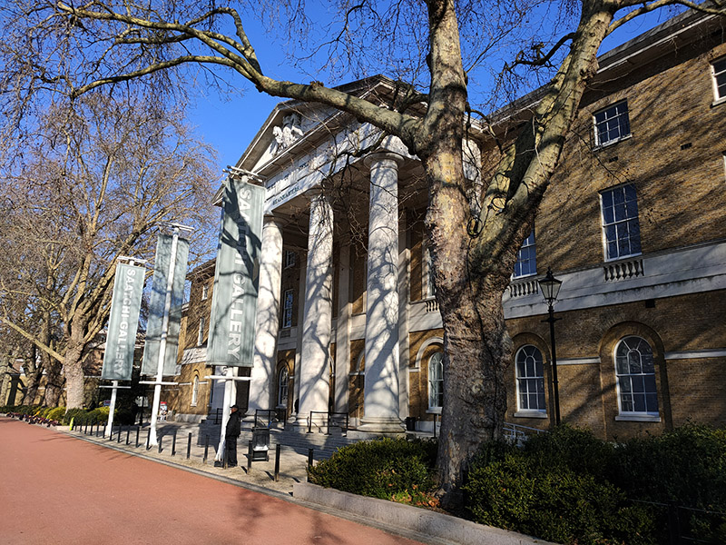
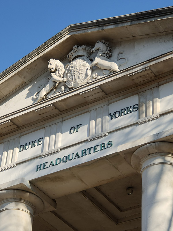
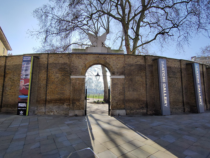
Beyond the square, the building known as the Duke of York’s Headquarters is now home to the Saatchi Gallery. The building was completed in 1801 to the designs of John Sanders, who also designed the Royal Military Academy Sandhurst. It was originally called the Royal Military Asylum and was a school for the children of soldiers’ widows. In 1892 it was renamed the Duke of York’s Royal Military School. In 1909, the school moved to new premises in Dover, and the Asylum building was taken over by the Territorial Army and renamed the Duke of York’s Barracks. The Duke of York in question being Frederick, second son of George III, the so-called “Grand Old Duke of York” and Asylum used in its archaic sense of “sanctuary or refuge”. Saatchi moved his gallery here in 2008 having leased the building from Cadogan Estates. It’s probably the only major Art Gallery in London I’ve never visited, having no wish to patronise a vanity project of Charles Saatchi, a man who will have one or two things to answer for come judgement day. And as it’s currently between exhibitions I have an excuse for not rectifying the omission.

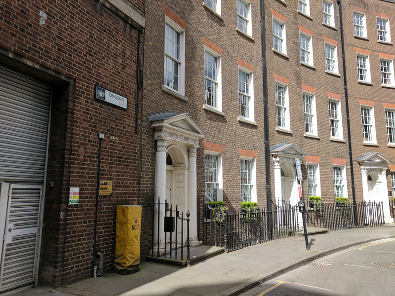
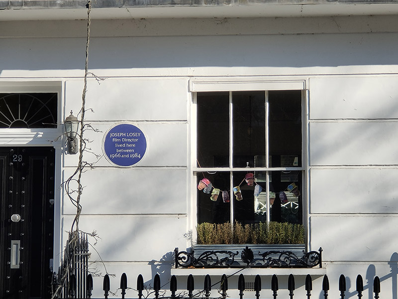
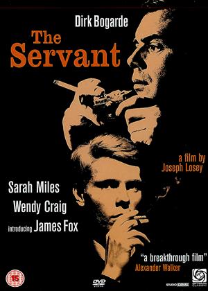
Having returned to King’s Road we take the next left, Cheltenham Terrace which runs down to Leonard’s Terrace and then head back up on Walpole Street. Next up on the south side is the grand and leafy Royal Avenue, an open-ended square with a clear view of Chelsea Hospital in the distance. No.29 was once home to the American theatre and film director Joseph Losey (1909 – 1984) who relocated to the UK in 1953 having been blacklisted by Hollywood. Unlike many of the victims of the McCarthyism, Losey had actually been a member of the American Communist Party. His number was up once RKO pictures, where he has under contract, was bought by Howard Hughes. Once in the UK, Losey worked on everything from crime features to melodrama to horror before achieving major critical and commercial success with a trio of films scripted by Harold Pinter, The Servant (1963), Accident (1967) and The Go-Between (1971). He died here in 1984, four weeks after completing his final film.

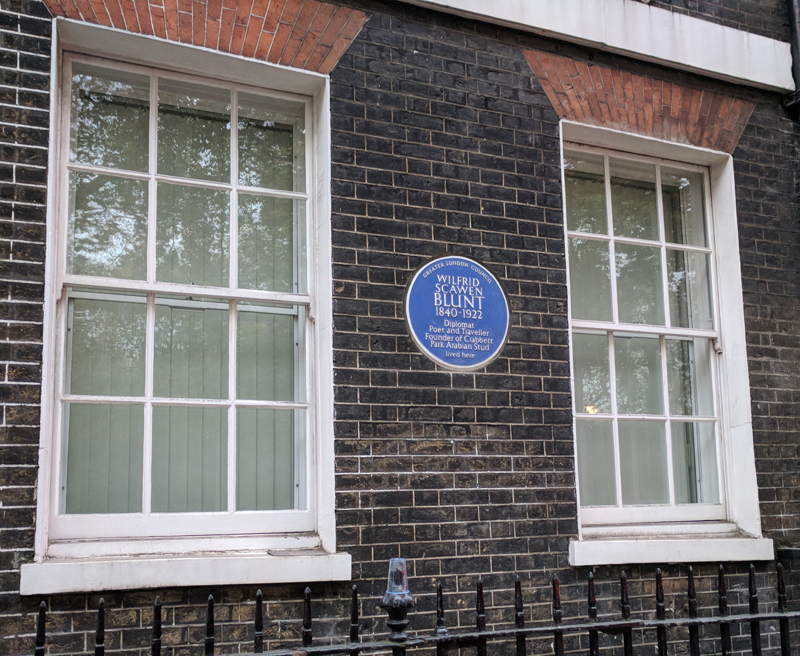
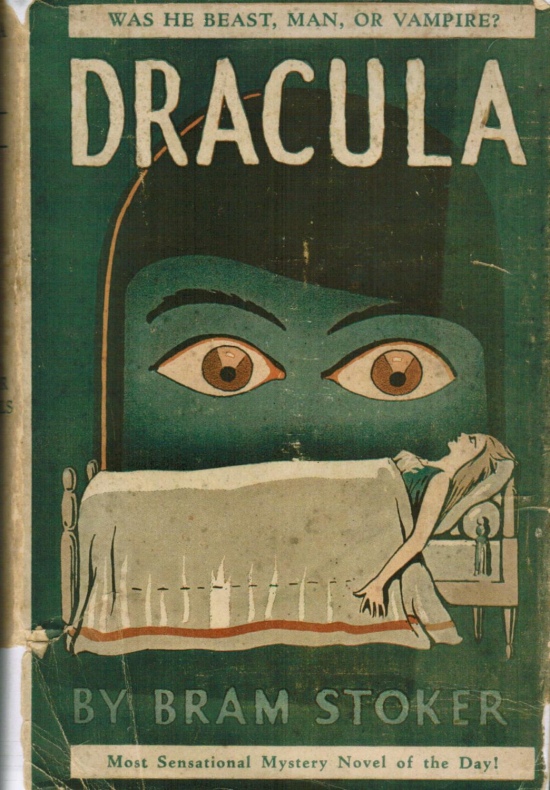
Back on St Leonard’s Terrace at no.18 is a Blue Plaque commemorating the first of the literary icons we’ll be encountering today, Abraham “Bram” Stoker (1847 – 1912). Stoker’s fame largely rests upon his authorship of the classic gothic horror tale Dracula which was published in 1897. I would imagine, like me, you’d be hard pushed to name any of his other novels. Born in Dublin, Stoker moved to London following his marriage in 1878 and for 27 years worked as business manager of the Lyceum Theatre which was in the charge of the most famous actor of the day, Henry Irving. The precise sources of inspiration for Dracula are still subject to debate but prior to writing the novel he had spent several years researching Eastern European folklore and mythology though he never actually visited that part of the world.

Returning to the King’s Road and continuing west we arrive at Wellington Square which despite an absence of plaques also has a number of literary ghosts. A. A. Milne, creator of Winnie-the-Pooh, lived there in the early 1900s as well as the notorious occultist Aleister Crowley in the 1920s. It is also considered to be the location Ian Fleming had in mind when he described his creation, James Bond, as living “in a ground floor flat in a square lined with plane trees in Chelsea off the King’s Road”.

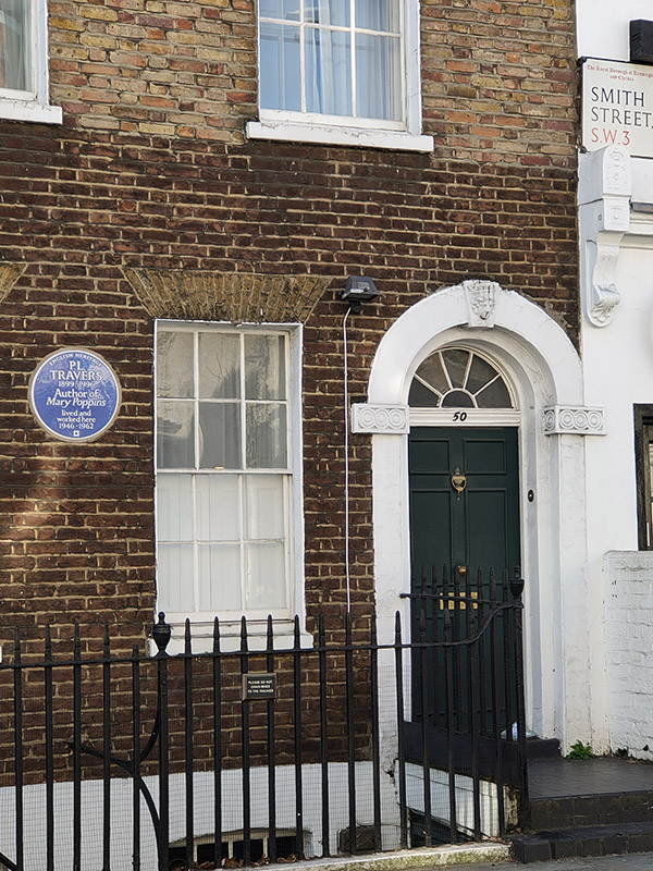
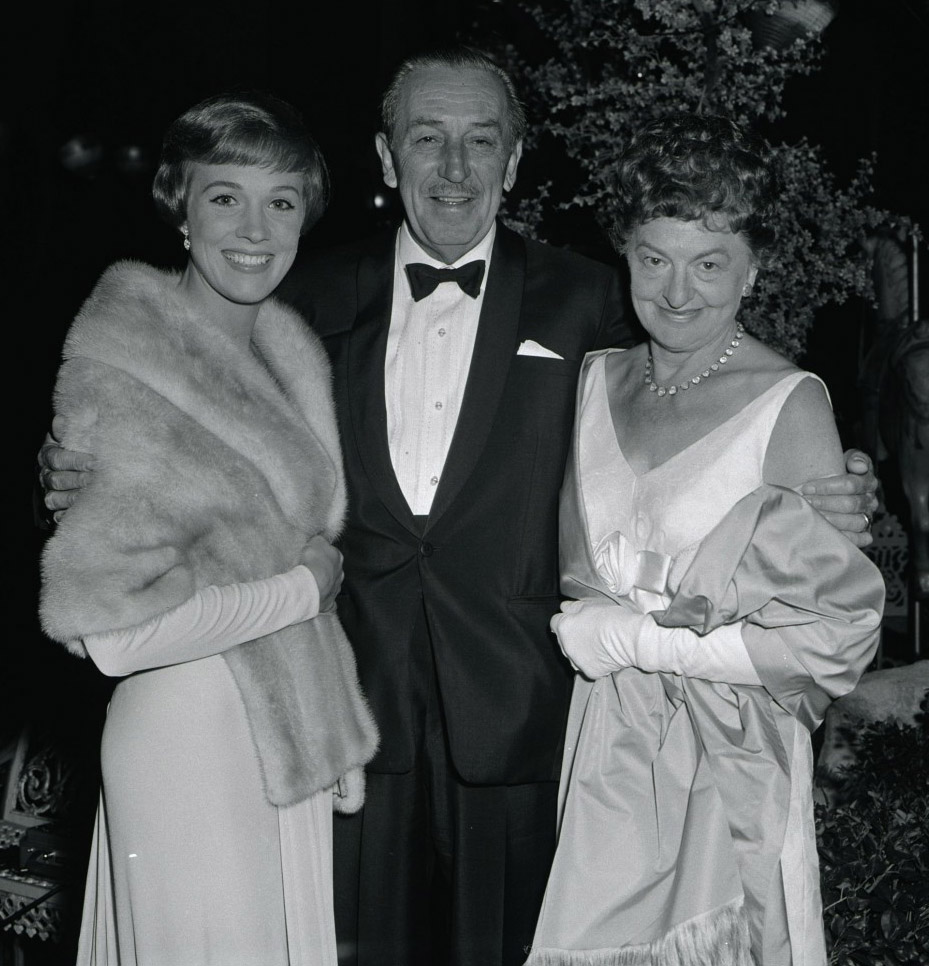
Next southward turning is Smith Street with yet another figure honoured at no.50. P. L. Travers (1899-1996) lived here for seventeen years and the house inspired the depiction of the Banks’s family home in the Disney film of her most famous creation, Mary Poppins. Travers was born as Helen Lyndon Goff in Queensland, Australia. She took the stage name Pamela Travers when she started an acting career in her late teens. After a few years, she gave up acting for journalism and moved to England in 1924. Ten years later she wrote Mary Poppins, the first in a series of eight books featuring the eponymous “supernanny”; the last of which she wrote in 1988 at the age of 1989. Under financial duress, Travers eventually ceded to years of pressure and sold the film rights to Disney. She famously disapproved of the musical which was released in 1964, particularly the animated sequences. The relationship between Travers and Walt Disney was itself given a cinematic treatment in 2013’s Saving Mr Banks.

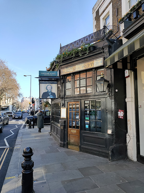
From Smith Street we cut along Smith Terrace to Radnor Walk and head back to King’s Road again. Just around the corner is the Chelsea Potter Pub which dates from 1842 and was reputedly a regular haunt of Jimi Hendrix and The Rolling Stones in the late sixties. It has added resonance since the appointment of Graham Potter as manager of Chelsea F.C of course, and the beard gives the connection added flavour. Though by the time this is published…

Beyond the pub we turn left again down Shawfield Street then west along Redesdale Street emerging on Flood Street opposite the Hall of Remembrance which is attached to Christ Church (which we will come to in due course).

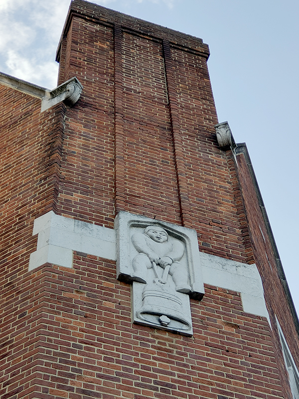
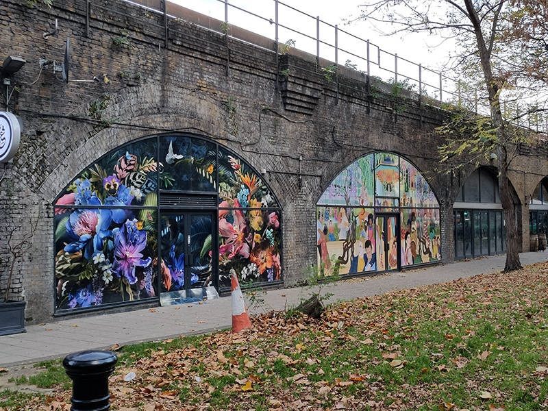
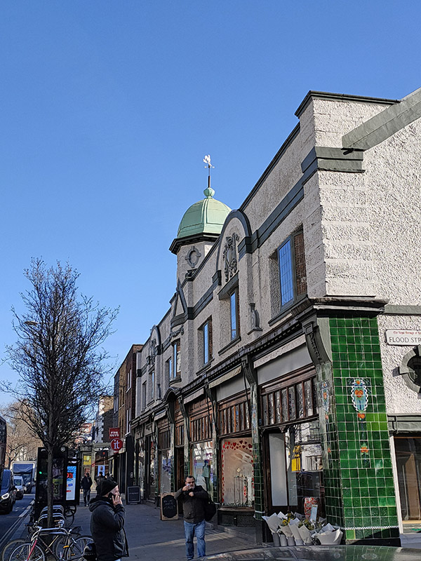
From here we head north back to the King’s Road for just about the final time today. I took the photo below left on account of the splendid tiling. Today this building houses an antique centre but back in the sixties it was home to the Top Gear fashion boutique.

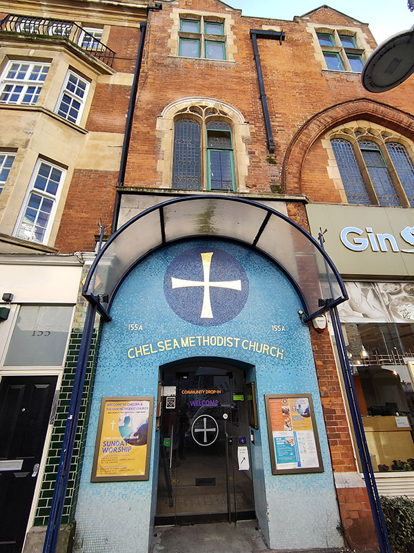
On the other side of the northern end of Flood Street is the Chelsea Methodist Church, the only church with an entrance on King’s Road. The original 1903 building was badly damaged in a 1941 bombing raid; the present church formed part of a 1983 redevelopment and was opened by Cardinal Hume the following year.

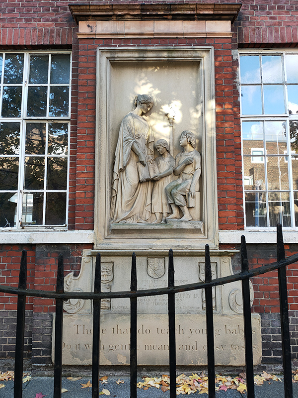
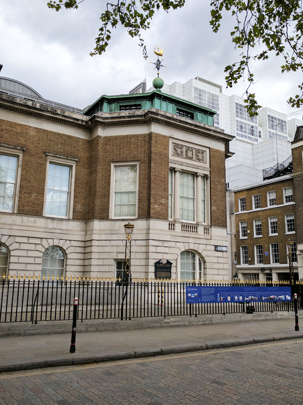
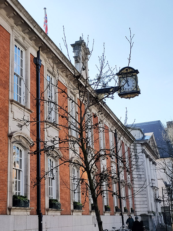
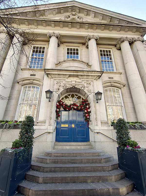
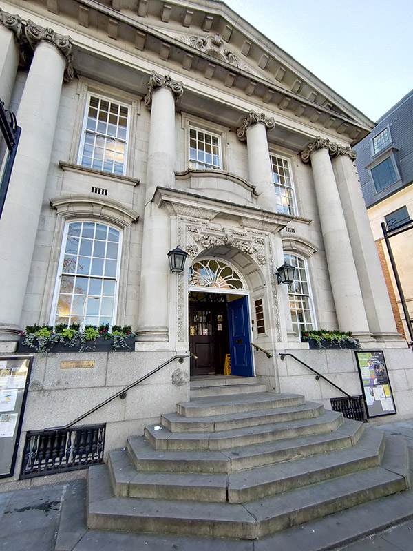
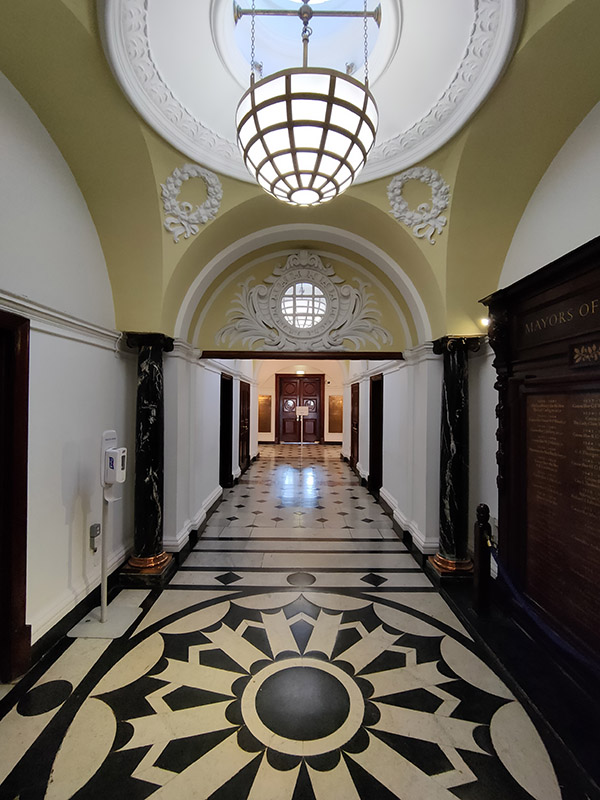
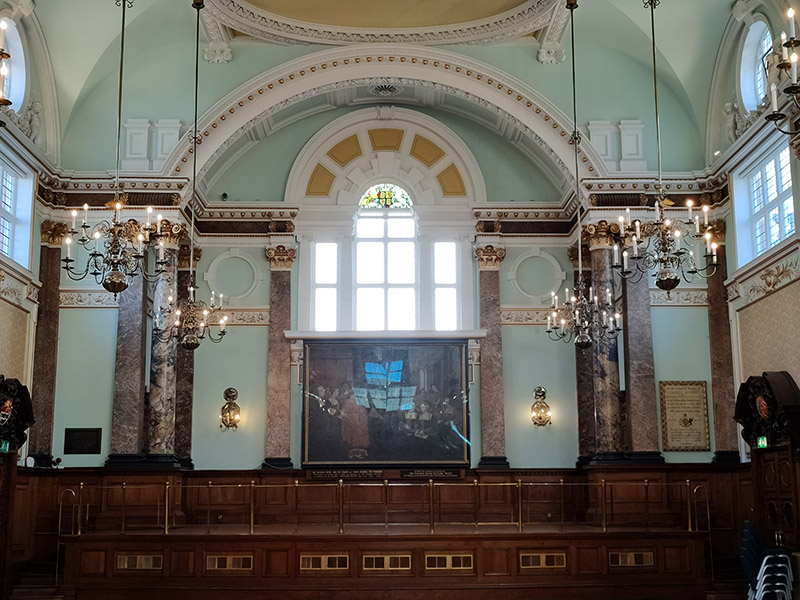
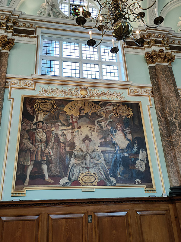
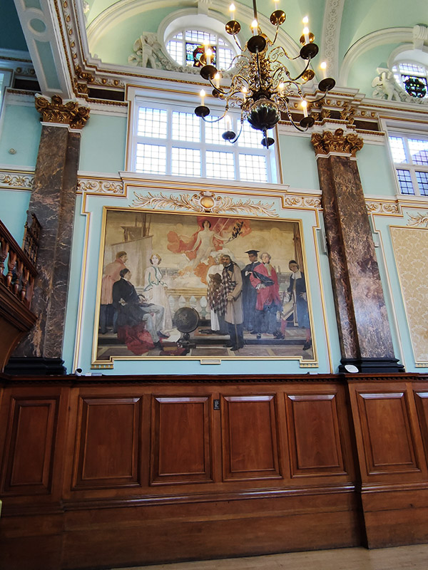
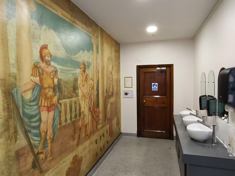
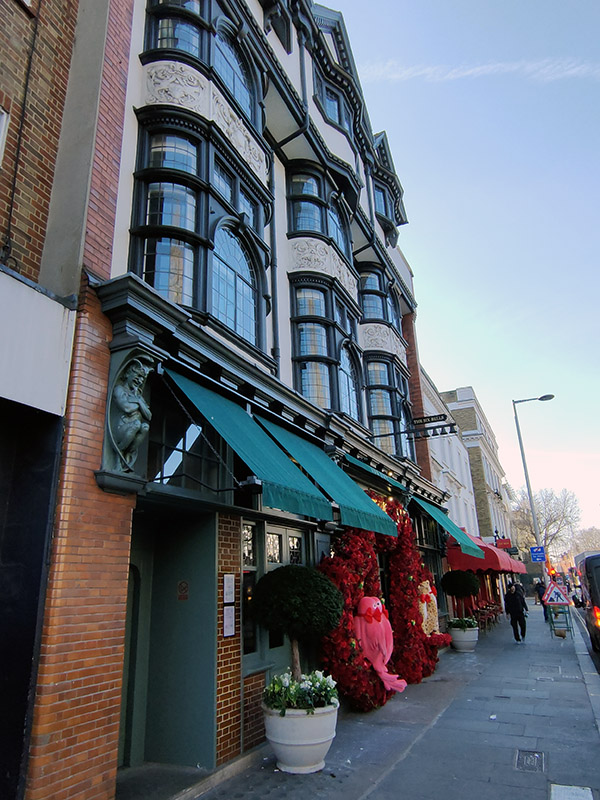
Almost the last stop on King’s Road is Chelsea Old Town Hall which it was a real treat to visit. So many of these old municipal buildings are inaccessible to the public these days. Surprisingly, there seems to be a dearth of information about the buildings despite their Grade II listed status. The oldest part of the complex is the Vestry Hall to the rear which was designed by J.M Brydon in 1886. The north elevations that front onto King’s Road are part of the 1906-08 extension by Leonard Stokes constructed in a neo-classical style. The building ceased to be a seat of local government in 1965 when the boroughs of Chelsea and Kensington merged. The Brydon building houses the Kensington and Chelsea Register Office which has hosted the weddings of, amongst others, Marc Bolan and June Child (1970), Judy Garland and Mickey Deans (1969), Roman Polanski and Sharon Tate (1968) and James Joyce and Nora Barnacle (1933). One section of the Stokes building is taken up by Chelsea Library. Many of the other rooms are hired out for functions and events, including the splendid main hall with its original Victorian wall paintings depicting representations of Art, Science, History and Literature. Unfortunately, I haven’t been able to discover who was responsible for creating these. Even if you don’t need to (and are qualified to do so) it’s also worth visiting the Gents’ toilet (see picture).

Just beyond the Town Hall is a building which dates back to 1722 and was originally the Six Bells pub (as evidenced by the eponymous sign that remains on the outside) which backed on to the bowling green of the local bowls club. Both pub and bowling green have now been consumed by the Ivy Chelsea restaurant which has gotten itself a little too excited about the upcoming Valentine’s Day.

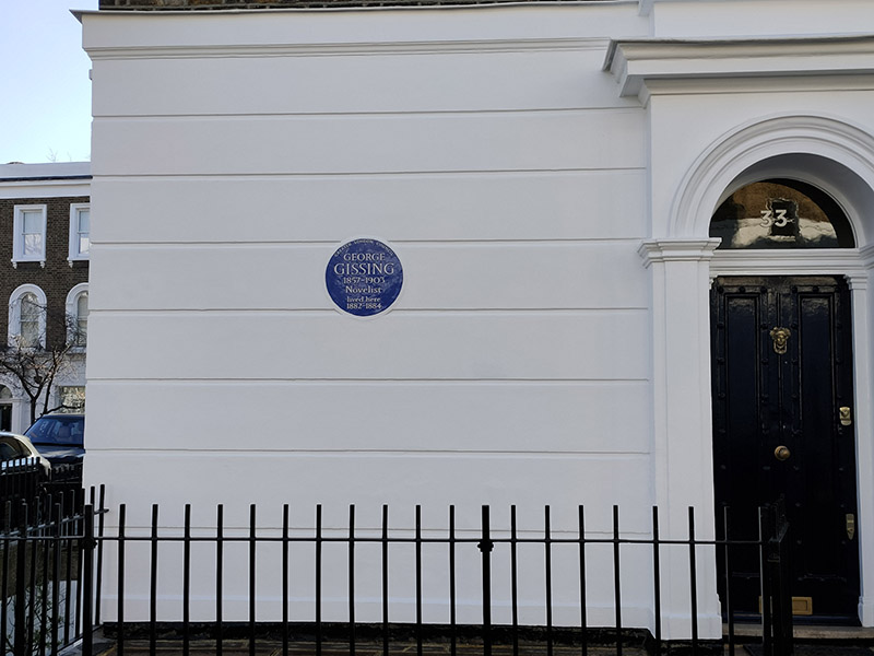
We finally say goodbye (for now) to the King’s Road via Oakley Street then veer left down Margaretta Terrace to reach Phene Street which runs east into Oakley Gardens. At no.33 Oakley Gardens there’s another literary commemoration, somewhat more obscure this time. George Gissing (1857 – 1903) wrote 23 novels in all the most highly regarded of which are Demos, New Grub Street and The Odd Women. Gissing’s relationships with women don’t seem to bear much scrutiny. He parted from his first wife Nell on account of her chronic ill-health then, subsequent to her death in 1888, he married Edith who he also separated from, nine years later, blaming her uncontrolled violent rages. Five years further on, Edith was certified insane and confined to an asylum. Before then, Gissing had met Gabrielle Fleury, a Frenchwoman with whom he lived until his death. Gabrielle eventually outlived him by fifty years.

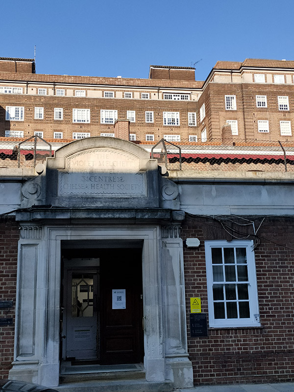
Exiting Oakley Gardens onto Chelsea Manor Street we return northward past the NHS Day Clinic in what was formerly the Violet Melchett Infant Welfare Centre named after Violet Mond, Baroness Melchett (1867 – 1945) and financed by her husband, politician and businessman, Sir Alfred Mond.

Further up the street we make a quick detour onto Chelsea Manor Gardens for a view of the facade of the Vestry Hall before turning back south.

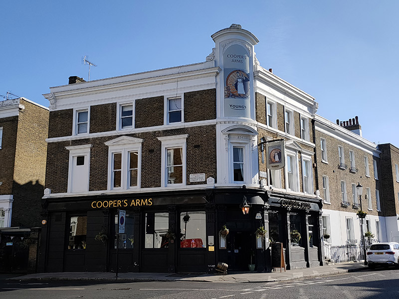
Flood Walk takes us back to Flood Street and after dropping in on Alpha Place we head east on Redburn Street. Unfortunately there’s no time to take in a pub of the day today as there a fair number of fine looking hostelries in the area such as The Cooper’s Arms on the corner of Flood Street and Redburn Street.

Redburn Street leads into Tedworth Gardens and the adjacent Tedworth Square. Our next literary icon was a one-time resident at no.23 in the latter. Mark Twain (1835 – 1910) was the pen name of Samuel Langhorne Clemens described in his New York Times obituary as “the greatest humorist the United States has produced” and by William Faulkner as “the father of American literature”. Twain is best known, of course, for The Adventures of Tom Sawyer (1876) and The Adventures of Huckleberry Finn (1884) which he wrote at his family home in Hartford, Connecticut. The two years he spent in England came after the conclusion of a year long around-the-world lecture tour which he undertook in 1895 as a means to pay off creditors, having lost most of the money earned through his writing by unsuccessfully investing in new inventions and technology, particularly the Paige typesetting machine

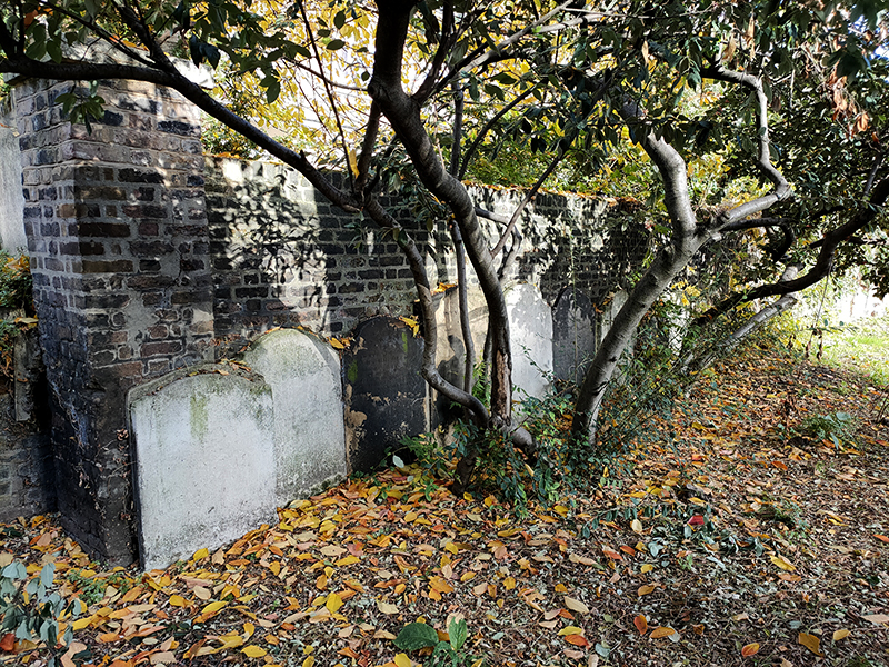
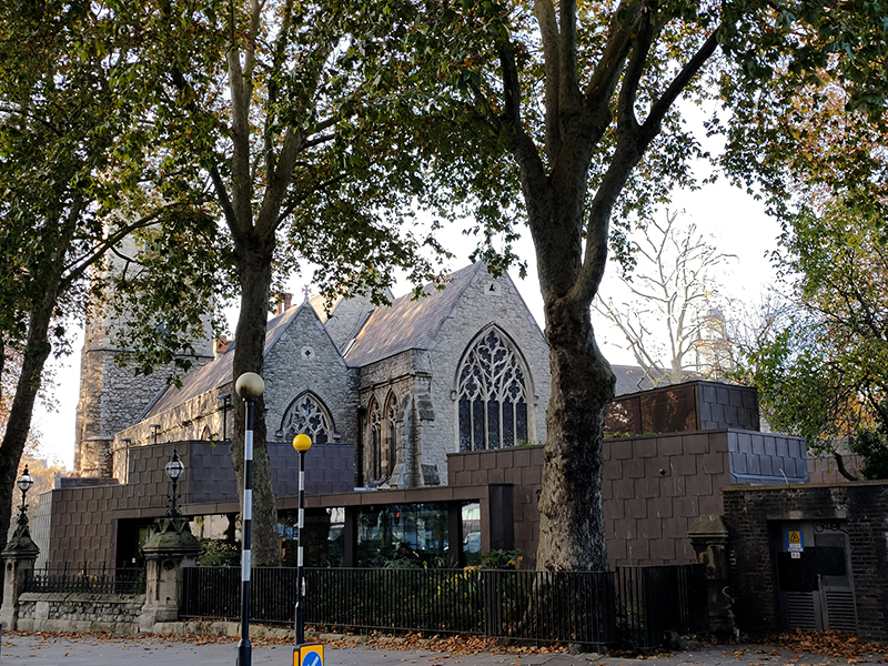
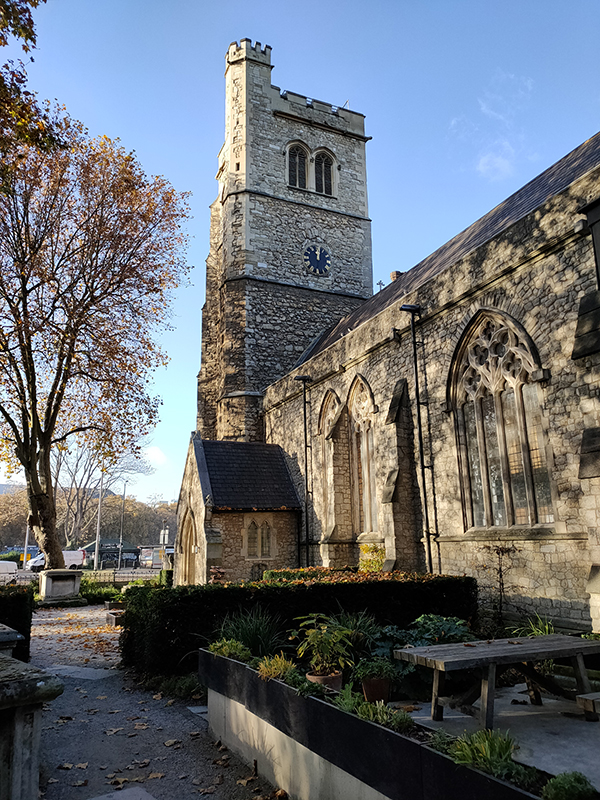
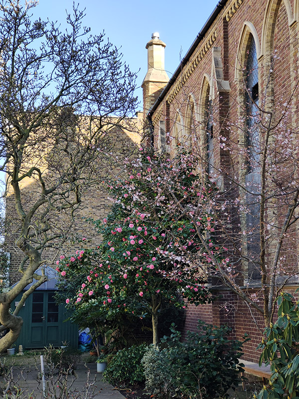
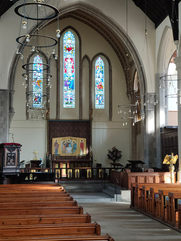
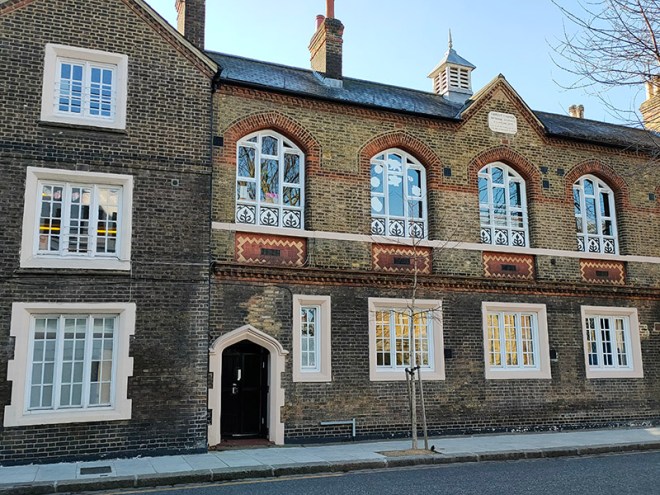
Next we make our way back west to the actual Christ Church following Ralston Street, Tite Street, Christchurch Street, Christchurch Terrace and Caversham Street. The church was consecrated in 1839 having been built to a design by Edward Blore (1789-1879). It was intended as a church for the many servants and tradesmen who worked in and for the grand houses of Belgravia and as such was designed to accommodate the maximum number of people at minimum cost. The construction cost was just over £4,000, paid for by the Hydman Trust, the Hydman family having originally made their money from sugar plantations in the West Indies. Philanthropy really does begin at home.  In 1843, a new school was built on land donated by Lord Cadogan, directly opposite the church. The school still exists as a Church of England Primary School.

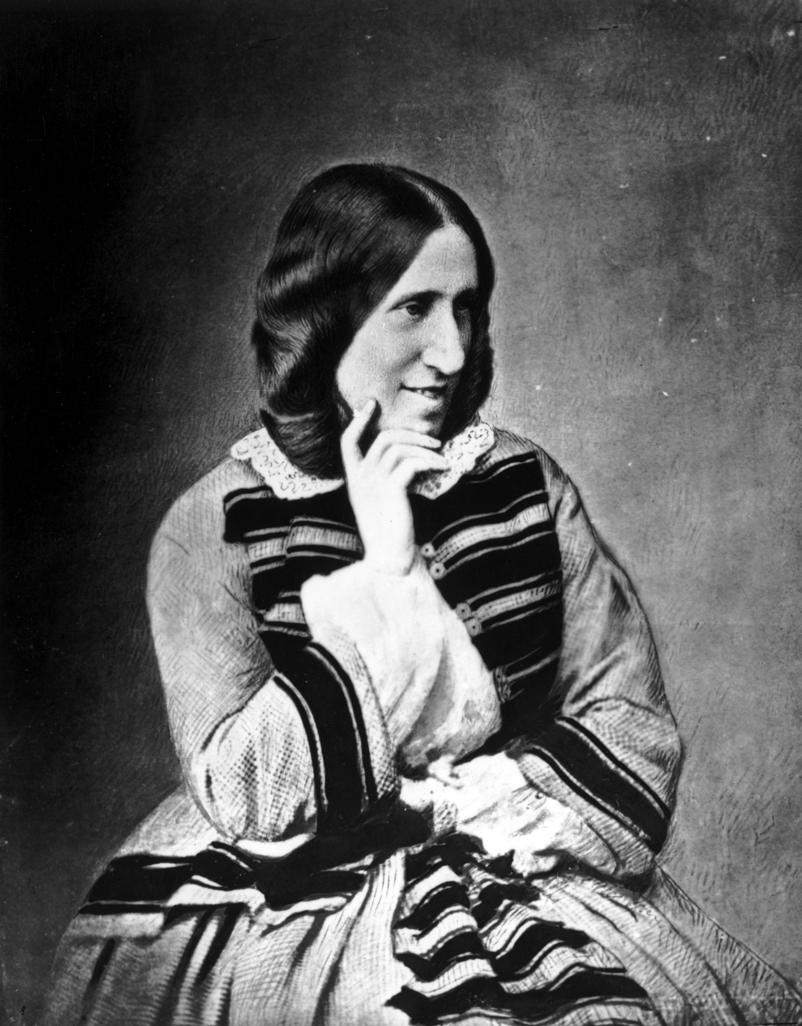
From the church we make a full circuit of St Loo Avenue, Cheyne Gardens, Cheyne Walk and the southernmost section of Flood Street. The literary connections continue unabated with a blue plaque commemoration the death of novelist George Eliot (1819 – 1880) at no.4 Cheyne Walk. George Eliot was the pen name employed by Mary Ann Evans, born the third child of a West Midlands’ mill owner and his wife. Of the seven novels she wrote, The Mill on the Floss (1860), Silas Marner (1861) and Middlemarch (1871–72) are probably the most celebrated (or at least the most studied by English Lit. undergraduates).  Following the success of her first complete novel, Adam Bede, public curiosity as to the author’s identity and the emergence of a pretender to the authorship, one Joseph Liggins, led Mary Ann to acknowledge that she stood behind the pseudonym George Eliot. She continue to publish her novels under the pen name nonetheless. From 1854 to 1878 Mary Ann lived with the philosopher and critic George Henry Lewes (1817–78). Although Mary considered that she and Lewes were effectively husband and wife, he was in fact already married to Agnes Jervis, although in an “open relationship”. In addition to the three children they had together, Agnes also had four children by Thornton Leigh Hunt, the first editor of the Daily Telegraph. It was her association with Lewes, in addition to her denial of the Christian faith, that led to her burial in Highgate Cemetery rather than Westminster Abbey.

No.72 Flood Street, The Rossetti Studios, is a Grade II listed building containing artist studios which was built in the Queen Anne Revival style in 1894 to a design of Edward Holland. The studios were named after pre-raphaelite artist, Dante Gabriel Rossetti whose own studio was based nearby.

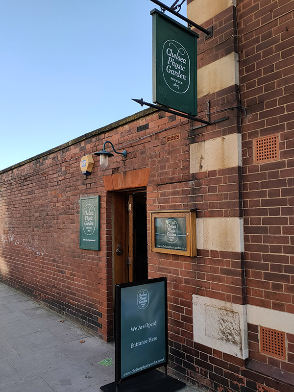
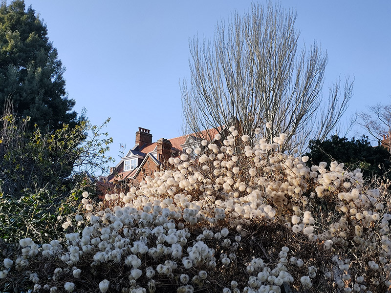
After returning to Christ Church we head down Christchurch Street to Royal Hospital Road for a visit to Chelsea Physic Garden. The garden occupies four acres beside the Thames and was established in 1673 by the Worshipful Society of Apothecaries as a base for conducting plant finding expeditions in surrounding areas and teaching their apprentices to identify plants, both those that might cure and those that might kill. The river access allowed plants arriving from around the world to be introduced to the British Isles via the Garden and its international reputation was quickly established through a global seed exchange scheme, known as Index Seminum, which it initiated in the 1700s and continues to this day. The Garden’s unique microclimate and location has facilitated the cultivation of plants not typically found outside in the UK. Early February is obviously not the best time to visit but there was still plenty of green stuff on show.

Beyond the garden we turn right onto Swan Walk which runs down to Chelsea Embankment. Round the corner at no.9 Chelsea Embankment is a rare non-literary related blue plaque. This one is for George Robinson, Marquess of Ripon (1827 – 1909), politician and Viceroy of India. Robinson was actually born at 10 Downing Street, the second son of F. J. Robinson, 1st Viscount Goderich who was Prime Minister at the time (though his premiership only lasted 144 days; I studied that period of history at A level and have no recollection of his tenure. Still, compared with Liz Truss it’s quite a stellar effort). Robinson junior’s political career was an extensive one; he served as a member of every Liberal cabinet between 1861 and 1908. In between administrations he managed to fit in a four year stint as Viceroy of India (1880 -84) during which time he did at least attempt to get progressive legislation to improve the rights of native Indians passed.

Turning off the Embankment onto Tite Street we immediately double back along Dilke Street for a short glimpse of the ill-named Paradise Walk. My partner, artist Susan Eyre, featured this in an ongoing art project based around unlikely places which include Paradise in their name.

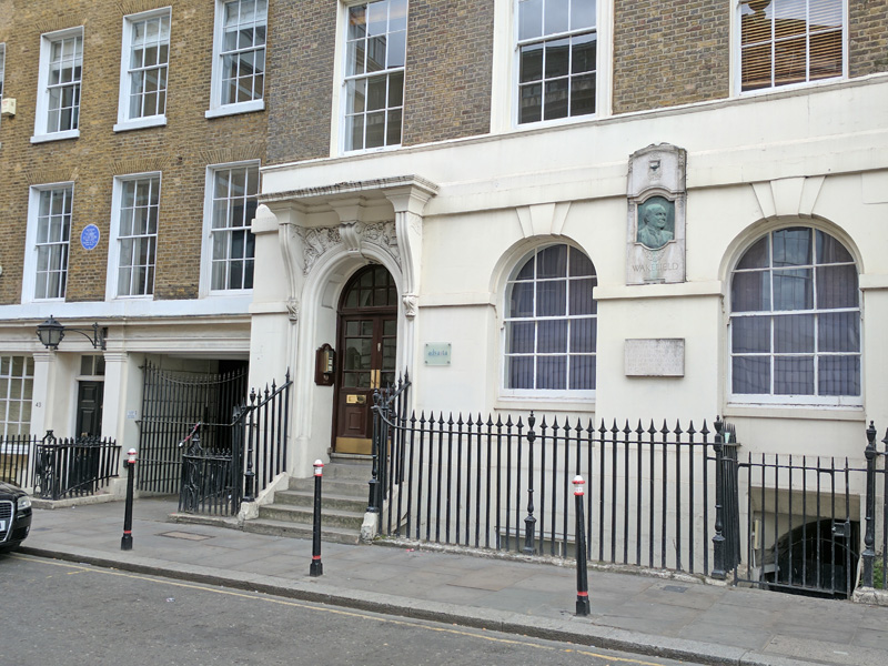
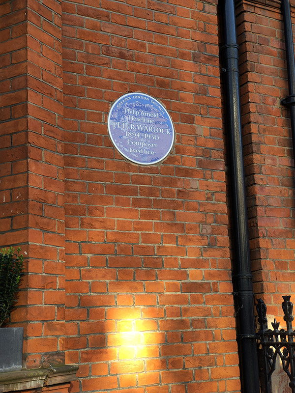
We return to Tite Street to take us back to Royal Hospital Road. The imposing red brick terrace on the west side of the street is home to three more blue plaques more or less adjacent to each other. At no. 38 we have Lord Hayden-Guest (1877 – 1960), author, journalist, Labour politician and physician; at no.34 Oscar Wilde (1854 – 1900) dramatist and celebrated wit; and at no.30 composer, Philip Arnold Heseltine a.k.a Peter Warlock (1894 – 1930). We’ve had an overload of blue plaques today so just a few words about each of these three. Haden-Guest was once described by Bertrand Russell as “a theosophist with a fiery temper and a considerable libido”. Oscar Wilde wrote both The Picture of Dorian Gray and The Importance of Being Earnest while living at no.34 and it was from here he left to serve his jail term for ‘gross indecency’ in 1895. Peter Warlock died here from coal gas poisoning; the inquest returning an open verdict. Previous to this he had penned the following words as his own epitaph :

Here lies Warlock the composer
        Who lived next door to Munn the grocer.
    He died of drink and copulation,
        A sad discredit to the nation.

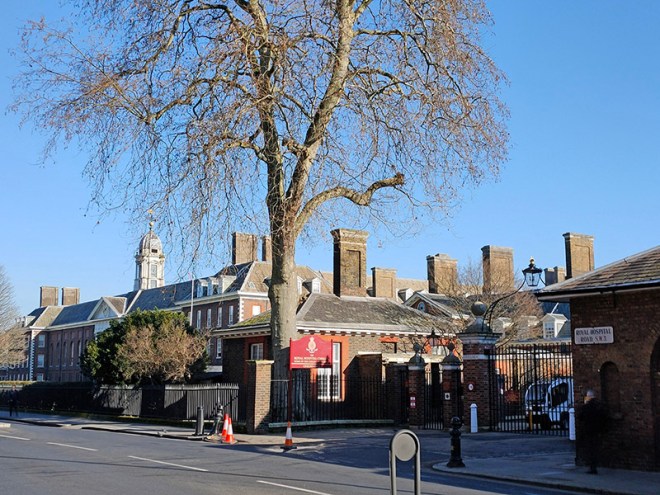
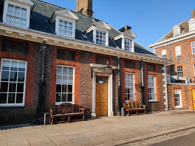
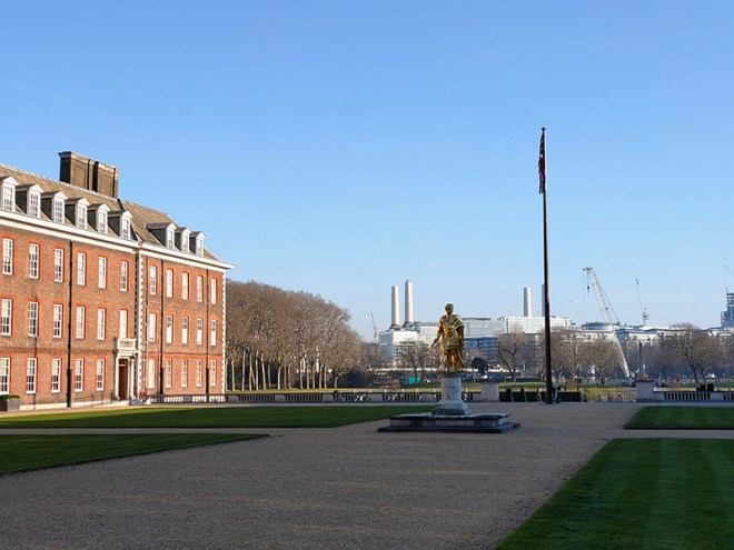
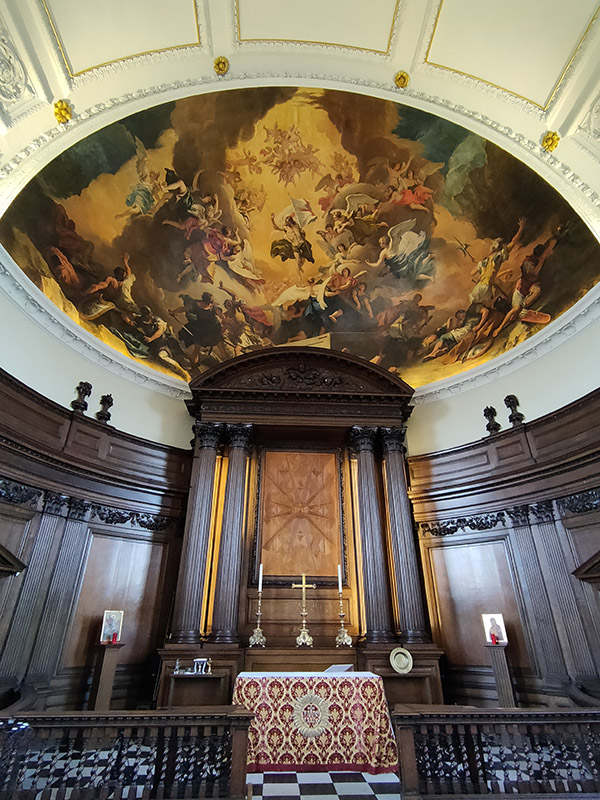
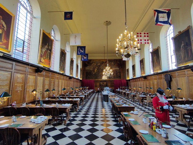
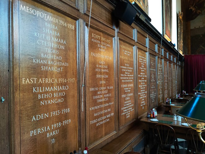
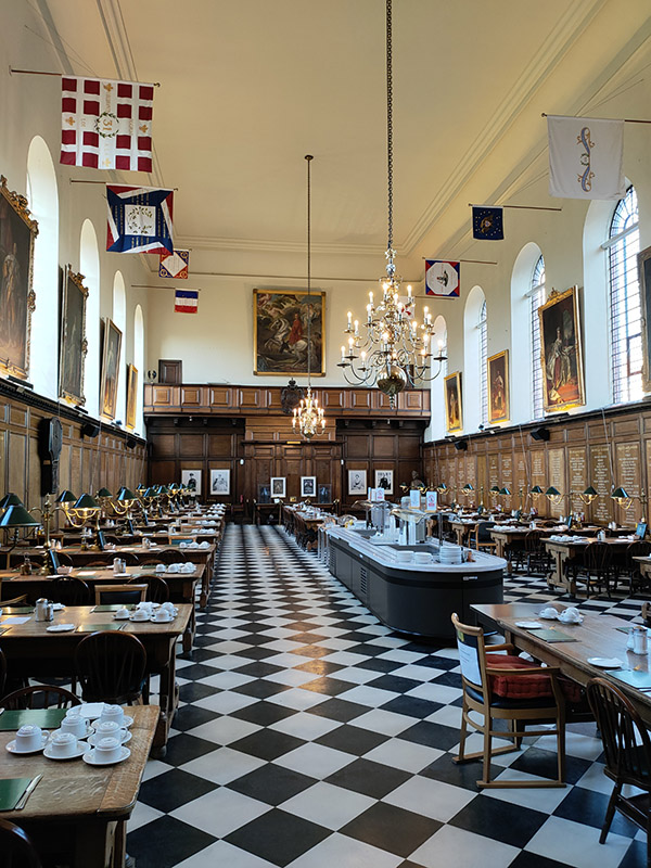
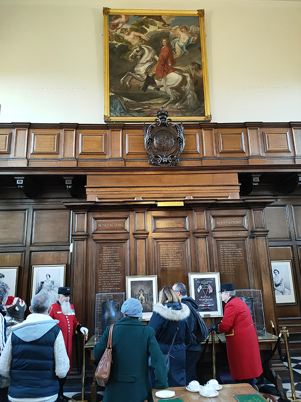
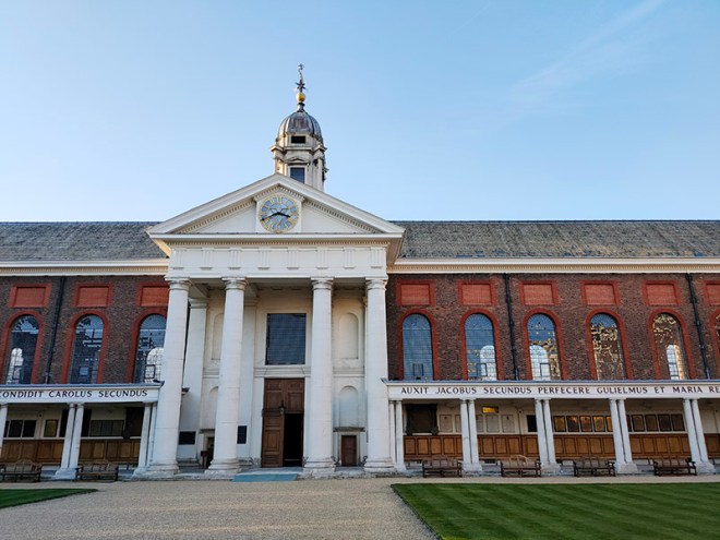
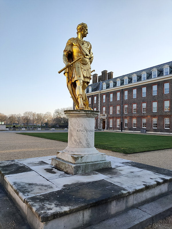
We cross over Royal Hospital Road and loop round the two sections of Ormonde Gate and we arrive at the West Road entrance to Royal Hospital Chelsea ready for our tour conducted by a Chelsea Pensioner. Guide, John, definitely looks the part with his grey whiskers and multi-bemedalled red tunic. He also knows his stuff as he regales us with facts and stories for at least half an hour longer than the scheduled 90 minutes. To deal with the history first: in 1681 Charles II issued a royal warrant for the building of the Hospital to provide for elderly and injured soldiers, Sir Christopher Wren was commissioned to design and erect the building and Sir Stephen Fox was charged with securing the necessary funds.  In 1692 work was finally completed and the first batch of Chelsea Pensioners, 476 in total, were in residence by March of that year. By the time of completion, Charles II had died (in 1685) and his successor James II had been deposed in “the glorious revolution” of 1688. This is why the Latin inscription on the exterior of the main building, composed by Wren himself, translates as ‘For the succour and relief of men broken by age and war, started by Charles II, extended by James II and completed by William and Mary, King and Queen 1692’.

Upgrades to the accommodation, the ‘berths’ – were enlarged in 1954-55 and again in 1991 to resize them from 6ft square to 9ft square, mean that the modern day capacity is only 300 pensioners. Due to an annual death rate of around 10% there are always slightly fewer than that; currently 278 of which 16 are women. To be eligible for admission as a Chelsea Pensioner you must be a former non-commissioned officer or soldier of the British Army who is over 66 years of age, “unencumbered by spouse” and “of good character”.

Since 1913 the Royal Horticultural Society’s Chelsea Flower Show has been held annually on the South Grounds, between Figure Court and the Chelsea Embankment.

Tour over, we leave the RCH via Light Horse Court and the East Road entrance. Crossing Royal Hospital Road, we make a circuit of Franklin’s Row, Turks Row and Sloane Court West emerging back on Royal Hospital Road opposite the Margaret Thatcher Infirmary, a state of the art care home and hospice for Chelsea Pensioners, designed by Sir Quinlan Terry and opened in 2009.

From here it only remains to work our way back to Sloane Square tube station via Sloan Court East, Lower Sloane Street and Sloane Gardens.

Day 70 Part 2 – Black Prince Road – Lambeth Road – Albert Embankment

On to the second leg of this excursion and this time we’re knocking off the triangle of streets bounded by Black Prince Road, Kennington Road and Lambeth Road then heading back down the Albert Embankment to Vauxhall station.

We start on the Albert Embankment at White Hart Dock. The origins of a dock and slipway at this site can be traced back to the 14th century. The present structure was built c.1868 as a parish dock when the Albert Embankment was constructed by the Metropolitan Board of Works to improve flood defences. Several other inland docks were built to enable continued access to the river for firms such as the Doulton Pottery (see below) but now only White Hart Dock remains. It was used to hold an Emergency Water Supply during the Second World War and the faded EWS logo can still be seen on the brickwork of the western wall. In 1960 the Borough of Lambeth sought to close White Hart Dock as it had “not been used by commercial craft for very many years” but the proposal wasn’t implemented and the Dock just fell dormant and largely unnoticed. Then in 2009, the Dock was cleaned and refurbished and Handspring Design were commissioned by Lambeth BC to create the timber sculpture now seen in and around it. Made in Sheffield from sustainably sourced English Oak, the arches and boats celebrate the meeting of land and river and remind us of the site’s long history.

There is also a plaque here (possibly the wordiest you’ll find in the whole of London) commemorating the victims of the mid-nineteenth century Lambeth Cholera Epidemic. During 1848 and 1849 at least 1,600 nearby residents (who took their water directly from the river) died of cholera and were buried in unmarked graves. It was by studying this tragedy and the 1854 outbreak in Soho (which we covered many moons ago) that Dr John Snow (1813 – 1858) was able to conclude that cholera was a waterborne disease rather than one transmitted through the air.

Heading away from the river on Black Prince Road named as you will recall (if you were paying attention last time) after Edward of Woodstock, the eldest son of Edward III. Edward junior never made it onto the regnal throne as he died of dysentery at the age of 46. Instead, on the death of Edward III, succession passed to the Black Prince’s 10 year old younger son, Richard (II). At the junction with Lambeth High Street stands the formidable Southbank House which is the only surviving part of the Doulton Pottery complex that dominated this area from the early Victorian era until the mid 1950’s. This Grade II listed gothic extravaganza with its striking pink and sandy-coloured terracotta ornamentation was built in 1876-78, probably to a design of architect, Robert Stark Wilkinson. The building housed the pottery’s museum and art school as well as serving as company HQ. During WW2 the pottery’s industrial buildings presented an easy target for German bombers and the resulting destruction hastened the process of transferring production facilities to Stoke-On-Trent which had begun in the the 1930’s. New clean air regulations finally sounded the death knell for the Lambeth factory in 1956 and demolition of all the buildings apart from the HQ followed shortly thereafter.

Beyond Southbank House and after passing under the railway we turn left into Newport Street. Adjacent to the railway, the Beaconsfield Contemporary Art Gallery occupies the southern (girls) wing and only remaining part of the former Lambeth Ragged School. This was built 1849-1851 by Henry Beaufoy, whose family wealth came from the vinegar trade, in memory of his late wife, Eliza. Originally the plot had been owned by South-Western Railway and in 1903 the decision was made to sell the site back to them. One year later most of the school was knocked down when the railway was widened. Network Rail still own the freehold for the site. Beaconsfield took over the lease from the London Fire Brigade in 1994 and worked with LKM Architects to restore the building and transform it into a contemporary art space. 

We turn left after the gallery, back under the railway, along Whitgift Street, named after John Whitgift who was Archbishop of Canterbury from 1583 to 1604. At the end we turn right into Lambeth High Street past the Windmill pub, renowned for its extensive selection of rums apparently.

The building behind the pub was formerly the headquarters of the London Fire Brigade and looking back down Lambeth Hight Street towards the rear of Southbank House there is some vestigial evidence of this.

To the east of Lambeth High Street at its top end lie the Old Paradise Gardens. These public gardens were opened in 1884 on the site of what had been the burial ground for St Mary’s Church from 1703 to 1853. The old gravestones can still be seen around the perimeter of the gardens, the walls of which are Grade II listed. Originally known as Lambeth High Street Recreation Ground the gardens were renamed in 2013 following refurbishment.

Just beyond the gardens is Old Paradise Street which takes us east to the top end of Newport Street home to the eponymous gallery, created through the conversion of three listed buildings, which were purpose-built in 1913 to serve as scenery painting studios for the booming Victorian theatre industry in London’s West End. With the addition of two new buildings, the gallery now spans half the length of the street. It opened in 2015 for the purpose of displaying works from Damien Hirst’s private art collection to the public free of charge. The current exhibition, which runs until 12 December 2021, features the hyper-realistic paintings of Richard Estes, a mixture of vignettes of American urban life and panoramic landscapes.

The railway arches on the other side of the street are all part of the Pimlico Plumbers empire.

Beyond these, heading south again, we’re back on Black Prince Road and moving eastward into what was one of the largest conglomerations of social housing in the capital. Or at least it was when the various apartment blocks and towers where originally constructed in the late sixties and early seventies. These days there is a significant interspersal of private ownership. We make an immediate loop of Lambeth Walk, Lollard Street and Gibson Road (and we’ll come on to the cultural resonance of the former later on) to start with. Then further east on Black Prince Road, Marylee Way provides the main route into the Ethelred Estate. In 2012 the residences in Ethelred and its sister estates, Thorlands and Magdalen, still owned by Lambeth Council (around 1,300 leaseholds and tenancies) were transferred to Housing Association, WATMOS. This was after a ballot of tenants in which 51.1% voted in favour. Hopefully it’s working out better than Brexit.

The estates are to the north of Black Prince Road. Of note on the south side is the Beaufoy Institute, built in 1907 by Henry’s nephew, Mark Hanbury Beaufoy, as a technical school for boys and also to replace his uncle’s Ragged School which had been torn down three years earlier. The Beaufoy vinegar-making dynasty began in 1741 when the family switched from the distilling of gin, apparently horrified by the damage it caused and its toxic ingredients. Their malt vinegar was used on ships as a ‘fumigator, antiseptic and preservative’ and the Beaufoys acquired a lucrative Navy contract. They also produced ‘sweets’ or ‘mimicked’ wines from raisins with added sugar and by 1872 were advertising cordials and non-alcoholic drinks as well. The Beaufoy vinegar works were bombed in 1941, and the Institute was requisitioned for use by women manufacturing munitions. It returned to use as a school after the war, before being eventually acquired by Lambeth Council. It was bought by the London Diamond Way Buddhist Centre in 2012.

At the eastern end of the street named after him the Black Prince is also commemorated with a pub on the corner with Hotspur Street.

We turn north up Kennington Road then dip into the estates and back out again via Lollard Street, Distin Street and Fitzalan Street. Further up Kennington Road we veer off along Walnut Tree Walk which returns us to Lambeth Walk. En route we encounter Hornbeam Close and Bedlam Mews, which some local vandals have decided merits some retrospective nominative determinism.

Lambeth Walk is, of course, best known for being the title of one of the songs in the 1937 musical Me and My Girl. The contemporaneous musical, with music by Noel Gay and original book and lyrics by Douglas Furber and L. Arthur Rose, tells the story of an unapologetically unrefined cockney gentleman named Bill Snibson, who learns that he is the 14th heir to the Earl of Hareford. It was revived several times in the 1940’s and made a triumphant return to the West End in 1984 in a version revised by Stephen Fry and starring Robert Lindsay and Emma Thompson.

I have to say that if the song didn’t already exist I doubt anyone would be inspired to write it by the present-day Lambeth Walk.

It does however boast Pelham Hall which was built as Lambeth Mission Hall in about 1910 and is distinguished with an exterior pulpit.  The building is now home to the the sculpture department of Morley College.

On the wall of the adjacent Chandler Hall Community Centre is a stone plaque dedicated to Charlie Chaplin who lived in the area in his youth and whose uncle ran the (long since departed) Queens Head pub in Black Prince Road. No. 5 Lambeth Walk, on the junction with China Walk, was built in 1958 to replace the Victorian municipal swimming baths which a V2 bomb had destroyed in 1945. The new building had no pool but provided slipper baths and laundry facilities for the local community. In the early 1990’s it was reconfigured for use as a GP practice.

Lambeth Walk doglegs into Lambeth Road where he turn left and head down towards Lambeth Bridge. At 109 Lambeth Road is the building that houses the Metropolitan Police’s Forensic Science Laboratory. It also hosts the Met’s 24 hour emergency call centre and its Lost Property office (inter alia). And it does more than nearly any other building of its era to give Brutalist architecture a bad name (not that it’s not intrinsically a bad name to start with).

Across the road, in stark contrast, is the former Holy Trinity Primary School (1880) now part of Fairley House School (for children with learning difficulties).

Back on the same side of the road as the Met and just beyond it stands the Bell Building which is a poster child for the sympathetic redevelopment of former public houses into residential space. Crucially the emblematic exterior sculpture of a man lifting a heavy bell has been retained.

Crossing the road again we’re in front of the former St Mary’s Church which was saved from demolition in 1977 by Rosemary and John Nicholson who turned it into The Garden Museum. The church is the burial place of John Tradescant The Elder (c1570 – 1638), the first great gardener and plant-hunter in British history. Tradescant was gardener to Robert Cecil, 1st Earl of Salisbury then to George Villiers, 1st Duke of Buckingham (remember him) and finally to Charles I, after Buckingham’s assassination. His son, John Tradescant The Younger (1608 – 1662), followed in his footsteps as royal head gardener and is buried beside him. The first church on this site predates the Norman Conquest and is mentioned in the Domesday Book. The present church was originally built in 1337 and the bell tower still largely retains its 14th century form. The rest of the building was substantially rebuilt in the Victorian era.

Turn to the right beyond St Mary’s and you’re face to face with Lambeth Palace or, more specifically, Morton’s Tower. You can’t go beyond this gateway as a rule since, as it rather pompously states on the website, this is “a working palace and a family home” and therefore not open to the public except on rare special occasions. The Tower was built by John Morton, Archbishop of Canterbury in 1486–1501 and is one of the few surviving examples of the early Tudor style of brick building. From the time of its completion onward the “Lambeth Dole” of bread, broth and money (which originated in the 13th century) was dispensed to beggars at the gate. In his 1785 History of Lambeth Palace archivist Andrew Ducarel writes that in his day it was regularized and consisted of a weekly allowance of 15 quartern loaves, 9 stone of beef and 5s., which were divided amongst around 30 poor parishioners and distributed three times a week. The practice was discontinued after 1842 and replaced with direct pecuniary grants to the poor.

After negotiating the roundabout at the nexus of Lambeth Road and Lambeth Bridge we set off on the final stage of today’s journey, southward along the Albert Embankment to Vauxhall Station. Almost immediately on the left is the headquarters of the International Maritime Organization and just beyond that the former HQ of the London Fire Brigade (as referenced earlier). Commissioned by the London County Council, the building was designed by EP Wheeler, architect to the LCC, with sculpture work by Gilbert Bayes, Stanley Nicholas Babb and FP Morton. It was opened by King George VI in 1937. Despite not being one of the prime examples of 1930’s architecture in the capital it has acquired a Grade II listing. In 2020 a plan to redevelop the building into a new home for the LFB Museum and erect two towers of over 20 storeys each immediately behind creating over 400 flats and a 200 bedroom hotel was submitted to public inquiry. Although the scheme had the support of the London Fire Commissioner and Lambeth Council it was vetoed by the Secretary of State for Housing in the summer of 2021. (The main objection being, I think, that it would spoil the views from the Palace of Westminster).

Time for the pub of the day finally, and in the face of plenty of stiff competition, the sunny skies tipped the balance in favour of the Tamesis Dock, a converted 1930’s Dutch barge, permanently moored on the river opposite the Millbank Tower.

These floating bars tend to charge over the odds but this one was pretty reasonable and thanks to the mild weather (for mid- November) I was able to enjoy a glass of wine and some baked goats cheese up on the deck, in glorious isolation and with a great view of the Houses of Parliament. Until I drew the attention of the local gulls that is.

Lambeth Council actually designated the Albert Embankment riverfront an Area of Conservation in 2001 but as noted earlier this hasn’t stopped them approving plans for redevelopment. The Corniche Building, designed by Foster & Partners, was completed in spring 2020 and along with the adjacent Dumont and Merano residential blocks has created 472 new luxury apartments close to the river.

As we approach Vauxhall Bridge the railway converges with the Albert Embankment and the river moves away.

The space between the road at the river here at Vauxhall Cross is famously occupied by the MI6 Headquarters. Officially the organisation that operates out of these premises is called the Special Intelligence Service (SIS). The MI6 pseudonym was used extensively during WW2 especially if an organisational link needed to be made with MI5 (the Security Service) but it is no longer applied by the secret services themselves. Of course it’s still the go-to appellation as far as the media and popular culture are concerned. SIS moved to Vauxhall Cross in 1994 from its previous home, Century House, on Westminster Bridge Road (see Day 55). Architect Terry Farrell won the competition to design the new HQ and he took his inspiration from 1930s architecture such as Battersea and Bankside power stations, as well as Mayan and Aztec temples. The building has 60 different roof areas and six perimeter and internal atria, and also incorporates specially designed doors and 25 different types of glass to meet the Service’s specific needs. Vauxhall Cross has, of course, featured in many of the films in the James Bond franchise made since it was opened. The building was first featured in GoldenEye in 1995 and is depicted as coming under attack in The World Is Not Enough (1999) and Skyfall (2012). In fact in the latter the front of the building is completely destroyed in an explosion. A 15 metre high model of the building was constructed at Pinewood Studios to create this illusion which was cheered by MI6 staff at a special screening of Skyfall at Vauxhall Cross. Filming for the 24th film in the series, Spectre, took place on the Thames near Vauxhall Cross in May 2015, with the fictional controlled demolition of the building playing a key role in the finale sequence of the film.

The light is beginning to fade as we head up onto platform 8 of Vauxhall Station and before the train arrives to take us back to the suburbs there’s just time to contemplate how very different this view would have looked just a couple of years ago.

Day 48 – Victoria Street – Buckingham Gate – Broadway

A relatively short walk this one, especially since the first part of it actually took place at the end of Day 47. That took us from Victoria Station back up to the southern side of Buckingham Palace then down Buckingham Gate and a westward loop ending up on Palace Street. Day 48 proper takes us east from that point covering most of the area around St James’ Park tube station between Birdcage Walk and Victoria Street.

Day 48 Route

Just outside the perimeter of the small triangular garden across Buckingham Palace Road from Victoria Station stands a statue of Marshal Ferdinand Foch (1851 – 1929) the French general who led his country’s forces in World War One and was appointed as Allied Commander-In-Chief in March 1918. Foch was an advocate of imposing the most draconian of peace terms on the defeated Germans; far more so than those eventually agreed in the Treaty of Versailles. As the treaty was being signed he declared “This is not a peace. It is an armistice for twenty years”. Although those words proved prophetic historians generally tend towards the view that the rise of National Socialism can be in large part attributable to the armistice terms being overly harsh rather than too lenient as Foch believed. Foch was made a British Field Marshal 1919.

IMG_20171102_161255

Heading north up Buckingham Palace Road we cross over Victoria Street and then turn left down Eaton Lane. On reaching Beeston Place we turn right then right again to arrive at Victoria Square. The small garden at the heart of this contains a statue of the eponymous monarch, depicting her in her younger days. This was commissioned from the artist Catherine Anne Laugel and installed in 2007. Former residents of the square include Ian Fleming, Michael Portillo and Mike Oldfield. Casino Royale, the first of Fleming’s Bond novels, was published shortly after he took up residence.

On the other side of Victoria Square we cross over Buckingham Palace Road again and enter one of the many new retail and leisure developments that have sprung up in this area in recent times. This one is constructed around Sir Simon Milton Square, named after the one-time leader of the Tory-run Westminster City Council. The artwork below is Places for Nova by Saad Qureshi and was installed in 2017.

IMG_20171102_162214

At the north end of the square we emerge onto Bressenden Place and, having done an eastward circuit of this, continue north into Warwick Row. An alleyway at the end leads into Palace Place which links to Palace Street. Here we turn right and then left up Stafford Place and then another alleyway brings us back onto Buckingham Palace Road. Turn right up to the south eastern corner of Buck House and then right again down Buckingham Gate. At no.15 is a blue plaque commemorating the Diplomat, Poet, Traveller and Founder of the Crabbett Park Stud, Wilfrid Scawen Blunt (1840 – 1922). Blunt was married to Lady Anne Noel, the daughter of Ada Lovelace and, therefore, granddaughter of Lord Byron, until his unabashed philandering led to their legal separation in 1906. The Stud which they had founded together in 1878 was stocked with the first Arabian horses to be brought to England.

IMG_20171102_163023

A little way further down is the High Commission of Swaziland which occupies a late 19th century building designed by Reginald Blomfield and featuring sculpture-work by Henry Pegram.

IMG_20171102_163102

We next make a left-turn into Wilfred Street then make a figure of eight involving that along with Catherine Place, Palace Street and Buckingham Place. We end up back on Palace Street just north of Westminster City School.

IMG_20171212_143827

We head back east from here along Castle Lane. The tenement blocks on either side of the street were originally built in 1882 to provide accommodation at the nearby Watney’s Stag Brewery (demolished in 1959). In more recent times the properties had been used as a homeless shelter but have stood empty since their purchase in 2010 by Land Securities. The original proposal to refurbish the blocks to provide 63 affordable homes as a quid-pro-quo for receiving planning permission for the conversion of a nearby office building into luxury flats has now been shelved and it looks likely that the Castle Lane properties will now be developed into upscale townhouses instead.

IMG_20171212_143949

At the eastern end of Castle Lane, on the corner with Buckingham Gate, stands Westminster Chapel. The chapel was opened in 1865 as a Congregational church with seating capacity for 1,500. It was designed by William Ford Poulton (1822 – 1901) in a Lombard Romanesque Revival style. The auditorium is almost oval-shaped with two tiers of galleries. The church is now part of the evangelical Commission family of churches which means, as explained to me by the young man who kindly let me into the building for a look around, that they follow the text of the Bible very closely and have a far less liberal approach to matters such as the role of women than moral capitulators like the Baptists. This statement of one of their key values will give you an idea of what lies behind the happy-clappy outward persona “A church where Biblical family life is highly valued, where husband and wife embrace male servant leadership and joyful female submission, where godly parenting is taught and practised, and where the special value of singleness and its unique opportunities are affirmed.”

This slideshow requires JavaScript.

Continuing down Buckingham Gate we reach the St James’ Court hotel, the work of Victorian architect C.J Chirney Pawley, which first opened its doors in 1902. In 1982 the hotel was acquired by the Indian Hotels Company Ltd (now Taj Hotels Resorts and Palaces) owned by the Tata family who established the Taj Mahal Palace Hotel in Bombay (also at the turn of the 20th century) and who are best known in this country for acquirng both the remnants of British Steel and the Tetley tea company.

This slideshow requires JavaScript.

Beyond the hotel we make a right turn down Spencer Street and then, blocked off by another construction site, take Seaforth Place down on to Victoria Street. Head west initially as far as the junction with Palace Street and then double back to the bottom of Buckingham Gate. On the corner here stands the Grade II listed pub, The Albert, built in 1862 by the Artillery Brewery and still in possession of its original Victorian façade. It was built on the site of an earlier pub named The Blue Coat Boy after the nearby charity school (which we shall come to very shortly).

IMG_20171212_150521

The Bluecoat (or Blewcoat) School was founded in 1688 by voluntary subscription as a charity for the education of the male offspring of the poor. It moved into purpose-built premises in the apex of Brewer’s Green, Caxton Street and Buckingham Gate in 1709 and from five years after this date also began to teach girls. It remained in use as a school until 1926 and was purchased by the National Trust in 1954. In 2013 fashion designer Ian Stuart was granted permission to refurbish the interior to house his bridal and evening gown collections.

Having circumnavigated the old school building we continue to retrace our steps up Buckingham Gate before shifting east into Petty France. The name is thought to derive from the settlement of French Huguenot refugees in the area in the 17th century (Petty being a corruption of Petit). From the second half of the 18th century until 1925, when the earlier name was restored, the street was called York Street after the son of George II (the Duke of York). On the north side is the exceptionally unattractive rear side of the Wellington Barracks (though not altogether out of keeping with some of the other buildings nearby).

IMG_20171212_150952

Once past the barracks we turn south down Vandon Passage which leads into Vandon Street which in turn curves round back to Caxton Street. From here we head east as far as Palmer Street then turn north back to Petty France, emerging opposite the equally unlovely building that houses the Ministry of Justice and Crown Prosecution Service.

IMG_20171212_151601

We carry on going east to the roundabout from where Petty France turns into Broadway and where St James’ Park tube station sits beneath the monolithic 55 Broadway. This imposing and, frankly, totalitarian-looking product of the late 1920’s was designed by Charles Holden (1875 – 1960) and won him the RIBA London Architecture Medal in 1931. It was built as a new HQ for the Underground Electric Railways Company (UERL) of London the forerunner of London Underground which still occupies the building today (they were due to move to new premises in the Olympic Park in 2015 but this still hasn’t happened at the time of writing). When it was completed the building was the tallest office block in the city. The sculptural artwork on the building’s exterior includes works by Eric Gill and Jacob Epstein (1880 – 1959). At the time it was the latter’s prominently sited figures, Day and Night, which provoked public opprobrium and a newspaper campaign that almost cost the UERL managing director, Frank Pick, his job. In the end the naked figure on the Day sculpture had 1.5 inches taken off his little chap and the outcry eventually died down. Ironically, these days it is Gill’s work that causes consternation in the light of posthumous revelations about his public life. 55 Broadway was originally Grade II listed in 1970 and upgraded to Grade I in 2011.

This slideshow requires JavaScript.

We cut through the building and emerge the other side on St Ermin’s Hill which leads out onto the north-south running stretch of Broadway (about as far removed from its New York namesake as you can imagine). Turning right back onto Caxton Street we pass the St Ermin’s Hotel, nicely done out for Christmas.

IMG_20171212_152320

And a short way further on come to the Caxton Hall which was designed in 1878 by William Lee and F.J Smith and built using red brick and pink sandstone. It was originally the Westminster Town Hall on opening in 1883 and has since hosted a variety of political and artistic events. It was also the registry office of choice for high society and celebrity civil weddings from the end of WWII up to 1979. Those who married there during that period included Elizabeth Taylor (to husband no.2 Michael Wilding), Donald Campbell (twice), Diana Dors (twice), Peter Sellers (to Miranda Quarry), Orson Welles, Roger Moore, Joan Collins, a couple of Beegees and Anthony Eden (to Winston Churchill’s niece). Going back to the political events these ran the full gamut from the first Pan-African Conference in 1900 and the hosting of the Suffragette Movement’s “Women’s Parliament” to the founding of the National Front in 1967. In light of all this it seems a bit feeble that the green plaque outside merely refers to the fact that Churchill made a few speeches here during the war. The building was redeveloped as apartments and offices in 2006.

This slideshow requires JavaScript.

Take the bottom section of Palmer Street down to Victoria Street with a brief detour into Butler Place which is where the branch of Lloyds that holds my account is even though all the correspondence comes from Chelmsford. Heading east again on Victoria Street there is another massive ongoing development; this time if the former site of New Scotland Yard. The Met took up shop here in 1967 and bought the freehold of the building in 2008. Then in 2013 they announced that 10 Broadway would be sold and the force’s HQ would relocate to the Victoria Embankment where it had been situated from 1890 to the late sixties. The 10 Broadway site was bought by an Abu Dhabi investment group for £370m in 2014.

We circle round the site via Dean Farrar Street and Dacre Street before heading back up Broadway to where it merges into Tothill Street. Then we return south down Dean Farrar Street and resume going east on Victoria Street. As Westminster Abbey comes into view on our right we turn left into Storey’s Gate and nip into Central Hall Westminster for a very brief shuftie. CHW can lay claim to being the world’s first purpose-built meetings facility. It was constructed on the site of the former Royal Aquarium to a design of Lancester and Rickards opened in 1912. Funding came from the Wesleyan Methodist Church’s 20th century Fund set up to mark the 1891 centenary of John Wesley’s death. £250,000  was allocated to the building of a ‘monumental Memorial Hall’ that would not only house a worshipping congregation and the new Methodist headquarters  but would also be a meeting place for all people, regardless of religious persuasion. The Suffragettes met here in 1914, Mahatma Ghandi spoke in the Lecture Hall in 1932 and De Gaulle founded the Free French movement here in the 1940’s. Most famously it was the venue for the very first General Assembly of the United Nations in 1946 attended by representatives of 51 countries. Slightly less auspiciously it was where I sat a number of professional examinations back in the nineties.

This slideshow requires JavaScript.

We circle round the CHW via Matthew Parker Street and end up back on Tothill Street where we take a westward turn past the Department of Work and Pensions.

IMG_20171212_154453

It’s starting to get dark now so we quickly turn north up Dartmouth Street and then east down the alley that is Lewisham Street to finish for the day back on Storey’s Gate. And that’s it for 2017 !


Day 40 – Aldgate – Tower Hill – Fenchurch Street

Shifting slightly further to the east for this excursion which starts out where we left off a couple of months back on Aldgate High Street then heads south down to Tower Hill, stopping short of the Tower itself, before snaking west and north through the City. Because this walk took place on Easter Sunday the area was atypically quiet apart from the inevitable tourist throng near the Tower and, less obviously, in the vicinity of the Gherkin.

Day 40 Route

So we set out on Aldgate High Street  opposite Aldgate tube station and proceed south down Little Somerset Street. Looking behind us gives a background glimpse of what’s to come later.

IMG_20170416_112536

Reaching Mansell Street we continue south turn right along Haydon Street and then when this adjoins onto the Minories head northward to return to Aldgate High Street opposite the church of St Botolph without Aldgate. This is the second time we’ve encountered St Botolph; he was “without Bishopsgate” a few posts back. In fact there were four medieval churches built in London in honour of this particular saint, all of which stood by one of the gates of the London Wall (more of that later). Aldersgate is the other one of those that survives while the church at Billingsgate wasn’t rebuilt after the Great Fire. St Botolph’s was often referred to as the “Church of Prostitutes” in the late Victorian period. To escape arrest by the police the local ladies of the night would parade around the island in a sea of roadways on which the church stands.

IMG_20170416_113557

Turn south again, this time down Jewry Street which is the site of the Sir John Cass Foundation. John Cass (1661 – 1718) was both a Sheriff and Alderman of the City of London and in 1710 set up a school for 50 boys and 40 girls which originally occupied buildings in the churchyard.  After his death, despite his will being incomplete and contested, his wish to leave the majority of his estate to the school was upheld though it took thirty years. So the Foundation came into being in 1748 and in 1899 a Technical Institute was created alongside the school and this moved into the new-build premises on Jewry Street, becoming the Sir John Cass College in 1950.

After nipping briefly into Saracens Head Yard we take the next right turn, Carlisle Avenue, which takes us into Northumberland Alley which meets its end at the wonderfully-named Crutched Friars. Crutched Friars is one of the alternative names of the Roman Catholic order Fratres Cruciferi (Cross-bearing brethren). Crutched refers to the crucifix-surmounted staff which they carried about with them. Next up, turning north again, is Rangoon Street, which is barely more than an alcove, before we switch eastward down India Street. Turn right next down Vine Street (not the one which forms part of the Orange set of properties in Monopoly – that’s over near Piccadilly) then veer off to the left, down Crosswall which takes us into Portsoken Street. This latter skirts one side of a charming small park wedged in amongst some less than charming buildings.

IMG_20170416_114946

At the end of Portsoken Street we swing round Mansell Street and Goodman’s Yard to loop back onto Minories and then turn south under the railway bridge and past Tower Gateway station, one of the two western termini of the DLR.

IMG_20170416_115538

So we’re now onto Tower Hill and moving west parallel to the north side of the Tower of London. Here there is one of the most substantial surviving sections of the London Wall built around the city  by the Romans in around 200 AD. In total the wall was about 4km long enclosing some 330 acres and including the four city gates (mentioned previously) with a further entrance to the legionary fortress at Cripplegate.

Turn north into Cooper’s Row and head up past Trinity Square Gardens back to Crosswall (whose name now makes perfect sense). Duck through American Square onto the southern section of Vine Street which seems to lead nowhere but then suddenly and bizarrely emerges into a crescent of replica Georgian houses (some rebuilt immediately post WW2 others as part of a 1980s redevelopment) called, simply and literally, Crescent.

IMG_20170416_120510

Double back and cut through a series of alleyways leading out onto Cooper’s Row again. Cross over and proceed west along Pepys Street before turning south down Savage Gardens. This returns us to Trinity Square, to No. 10 Trinity Square in fact, which links neatly back to the previous post for this is the first permanent HQ of the Port of London Authority. It was built in the Beaux Arts style by John Mowlem & Co to a design of Sir Edwin Cooper and was opened by then Prime Minister, David Lloyd-George, in 1922. The façade of the building is interspersed with Corinthian columns and high above the front entrance is a sculpture of Old Father Thames, holding his trident and pointing east in homage to the trade between nations. In 1946 the General Assembly of the United Nations held its inaugural reception here, in what is now known as the UN ballroom. In the 1970’s the PLA moved out to Tilbury and no. 10 was renovated; becoming the home of insurance broker Willis Faber until 2008. Two years after they left a Chinese Investment company bought the Grade II-listed building and after a six year multi-million pound renovation it was brought back to life as a Four Seasons Hotel. In the interim it had a walk-on part in the James Bond Skyfall film as a location for a meeting between M (Dame Judi Dench) and Gareth Mallory (Ralph Fiennes).

This slideshow requires JavaScript.

Moving on clockwise round the square we come first to Trinity House which is the home of the organisation that began life as The Corporation of Trinity House (or to give it its full name The Master Wardens and Assistants of the Guild Fraternity or Brotherhood of the Most Glorious and Undivided Trinity and of Saint Clement in the Parish of Deptford Strond in the County of Kent), under Royal Charter of 1514 with a remit to regulate pilotage on the River Thames and provide for aged mariners. Today Trinity House is the UK’s largest maritime charity dedicated to safeguarding shipping and seafarers as well as incorporating the General Lighthouse Authority (GLA) for England & Wales. The GLA is responsible for a range of aids to navigation from lighthouses to radar beacons but, confusingly, is separate from HM Coastguard (which looks after all aspects of search and rescue).

The building itself dates to 1796 and was designed by architect Samuel Wyatt.

IMG_20170416_121211

On the east of the square at no.43 is a blue plaque commemorating Reverend Philip “Tubby” Clayton (1885 – 1972), founder of the international Christian movement Toc H. And next door at no.41 is a memorial to Viscount Wakefield of Hythe (1859 – 1941) who founded the Castrol lubricants company and was a Lord Mayor of London and also Tubby’s mate.

IMG_20170416_121349

We now take a stroll through Trinity Square Gardens which is dominated by the Merchant Navy Memorial. The original, post WW1, section was designed by Sir Edwin Lutyens with sculpture by Sir William Reid-Dick and was unveiled by Queen Mary on 12 December 1928.  It commemorates almost 12,000 Mercantile Marine casualties who have no grave but the sea, including almost 1,200 lost when the Lusitania was sunk in 1915. The WW2 extension, which commemorates almost 24,000 casualties, was designed by Sir Edward Maufe, with sculpture by Charles Wheeler and was unveiled by Queen Elizabeth II on 5 November 1955.

This slideshow requires JavaScript.

Leaving the gardens on the west side we find ourselves back outside Ten Trinity Square, which as I mentioned is now a Four Seasons hotel having opened a mere three months back in January 2017. On impulse born of curiosity I decide to head inside for a lunchtime cocktail at the Rotunda bar. I have the place to myself pretty much and the very amiable bartender rustles me up a concoction called (appropriately) a Shivering Timbers which will set me back £15 plus service. Still it’s just about worth it to take in the elaborately refurbished interior (and make a luxurious and desperately need toilet stop). As well as the hotel the building incorporates 41 private residences and a private members’ club. At the time of speaking £440 a night for the cheapest room doesn’t include access to the spa and swimming pool as these won’t be open for a few more weeks.

This slideshow requires JavaScript.

Leaving the hotel, head west along Muscovy Street and then turn north up Seething Lane before returning eastward along Pepys Street and via another section of Savage Gardens find ourselves back on Crutched Friars. From here we continue north up Lloyds Avenue most of the buildings on which were built under a redevelopment of derelict East India Company warehouses at the turn of the 20th century. Coronation House at no. 4, built in 1904,  eventually became absorbed into the Lloyd’s Register building which stood on the corner with Fenchurch Street.

IMG_20170416_131130

Lloyd’s Register (not to be confused with Lloyds of London) began life in 1760 in a London coffee house as a marine classification society. Nowadays it operates as a global provider of risk assessment and technical consultancy services across numerous industrial sectors but is still wholly owned by the charitable Lloyd’s Register Foundation.

It moved into the premises at 71 Fenchurch Street, designed by Thomas Colcutt, in 1901. Almost 100 years later it moved again – just a few yards further along Fenchurch Street – to a glass, steel and concrete skyscraper designed by the Richard Rogers Partnership (who of course had previously been responsible for the much better known Lloyd’s of London building – of which we shall hear more another time).

We’re going east again now on Fenchurch Street and at the junction with Leadenhall Street where it turns into Aldgate High Street we find the Aldgate Pump. This historic water pump, which has stood on this spot since 1876, marks the start of the A11 road that eventually leads to Norwich. It’s also considered by many to be the symbolic start of the East End. The wolf’s head is supposed to commemorate the last wolf shot in the City of London though there appears to be no record of when that might have been.

IMG_20170416_131442

Moving on we make a sharp left into Mitre Street and then cut through St James’s Passage to join Dukes Place. Turn the corner and we’re on to Houndsditch. Head up here as far as Creechurch Lane which we follow back across Dukes Place as far as the junction with Heanage Lane which we take back up to Bevis Marks (which Dukes Place merges into and which gets several mentions in Dickens’s Old Curiosity Shop). From here we take the next right, going north, Goring Street to return to Houndsditch. Turn left then left again down the top section of St Mary Axe to revisit Bevis Marks. Turn south this time and then loop round Bury Street past Cunard Place and back onto the lower stretch of Creechurch Lane. Here on the corner with Leadenhall Street stands the actual Cree Church, the Church of St Katharine Cree to be precise. The church was founded in 1280 and the present building dates from around 1630. It is the only remaining Jacobean church in London having survived both the Great Fire and the Blitz practically unscathed.

IMG_20170416_133106

Crossing over Leadenhall Street we squeeze through the alley known as Fenchurch Buildings and having traversed Fenchurch Street again navigate a couple more alleys in the form of St Katharine’s Row and French Ordinary Court which take us round the back of Fenchurch Street Station and onto Hart Street. Turning west we reach another medieval church that eluded the clutches of the Great Fire, St Olaves. This one dates all the way back to 1450 in its present form (more or less – it wasn’t so lucky in the Blitz and had to be extensively restored after the war). The fabulously macabre entrance to the churchyard was a 1658 addition. The church is dedicated to the patron saint of Norway, King Olaf II and the Norwegian connection continued during and after WW2 when King Haakon VII of Norway worshipped here in exile and then in 1954 presided over the rededication ceremony. Samuel Pepys was buried here in 1703 and it is also, weirdly, recorded as the last resting place of the pantomime character Mother Goose (?). Her internment apparently took place in 1586 according to the parish registers and the event is commemorated by a plaque on the outside of the church.

This slideshow requires JavaScript.

Leaving St Olaves behind we move northward again next, up New London Street into London Street (both doing less than nothing to deserve such names) and round Fenchurch Place to the front of Fenchurch Street Station, gateway to Essex. The station opened in 1841 initially to serve the London and Blackwall Railway but was reconstructed after just 13 years when the London, Tilbury and Southend Railway began operations. It’s one of the smallest termini in London and uniquely has no interchange with the underground.

IMG_20170416_134003

Back on Fenchurch Street we continue west for a bit and then proceed north up Billeter Street resurfacing on Leadenhall Street. Keep the westerly trajectory before turning north again up the bottom-most section of St Mary Axe. On the right here is yet another of the City churches that survived the double whammy of the Great Fire and the Blitz. The present St Andrew Undershaft was built in 1532 in the Perpendicular style (a subdivision of Gothic, so-called because of its fondness for vertical lines). The church’s name derived from the shaft of the maypole that was set up opposite the church – though only until 1547 when it was seized by a mob and destroyed as a “pagan idol” (now that’s a show I’d like to see).

IMG_20170416_134926

Continuing north we arrive at the foot of St Mary Axe’s most famous resident, no. 30 more commonly known as “The Gherkin”.  The Gherkin, designed and engineered by Norman Foster and Partners and the Arup Group respectively, was completed in December 2003 and opened in April 2004. 41 storeys and 180 metres tall, it stands on the site of the former Baltic Exchange which was irretrievably damaged by the IRA bomb of 1992. It has a floor area of just over half a million square feet including a restaurant on the 39th floor. In November 2014 the building was bought by the Safra Group, controlled by the Brazilian billionaire Joseph Safra, for £700m (£150m than the price originally anticipated). The sculpted head you can see below is another work in the Sculpture in the City 2016 series; “Laura” by Jaume Plensa.

This slideshow requires JavaScript.

After a circuit round the base of the Gherkin we meander off to the west again down the dead end that is Undershaft. Doubling back and then turning left down Great St Helens we pass in front of St Helen’s Bishopsgate which, you’ve guessed it, also survived the Great Fire and the Blitz (it’s almost like there was some kind of divine providence at work here). Wasn’t so fortunate when it came to that IRA bomb in 1992 however; that took the roof off and also destroyed one of the City’s largest medieval stained glass windows. The church started out as a priory for Benedictine nuns in the early 13th century and was Shakespeare’s parish church when he lived in the area in the 1590s. The artwork on display outside the church, Shan Hur’s “Broken Pillar #12” has been left in place from the 2015 Sculpture in the City collection.

This slideshow requires JavaScript.

At the end of Great St Helens we emerge onto Bishopsgate and head north towards Liverpool Street station. Final point of interest on today’s journey stands at no.110 bounded on its other three sides by Camomile Street, Outwich Street and Houndsditch. Completed in 2011 the building was originally known as the Heron Tower after its owners Heron International but in 2014 its primary tenant pressed for the name to be changed to the pitifully naff Salesforce Tower. The City of London eventually ruled that it should officially be called simply 110 Bishopsgate. Whatever its name the building stands 230 metres tall (including the 28 metre mast) with 46 floors. It currently holds the record as the City of London’s tallest structure, having eclipsed Tower 42 when construction reached the 44th floor.

Situated on floors 38 and 39, Sushi Samba restaurant is one of the top restaurant destinations for the young, aspiring (and easily impressed) denizens of the Home Counties and for those without a head for heights, the lobby contains a 70,000 litre aquarium.

IMG_20170416_134711

And I think that’s us finally done for this time around (and I really expected this one would reverse the trend for longer and longer posts).