Day 72 – Sussex Gardens – Praed Street – Paddington Basin

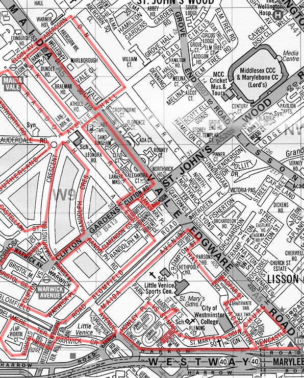
After another lengthy hiatus we’re finally back on the beat and for this trip we’ve moved south from where we finished last time, across the Westway into the area between Paddington Station and the Edgware Road.

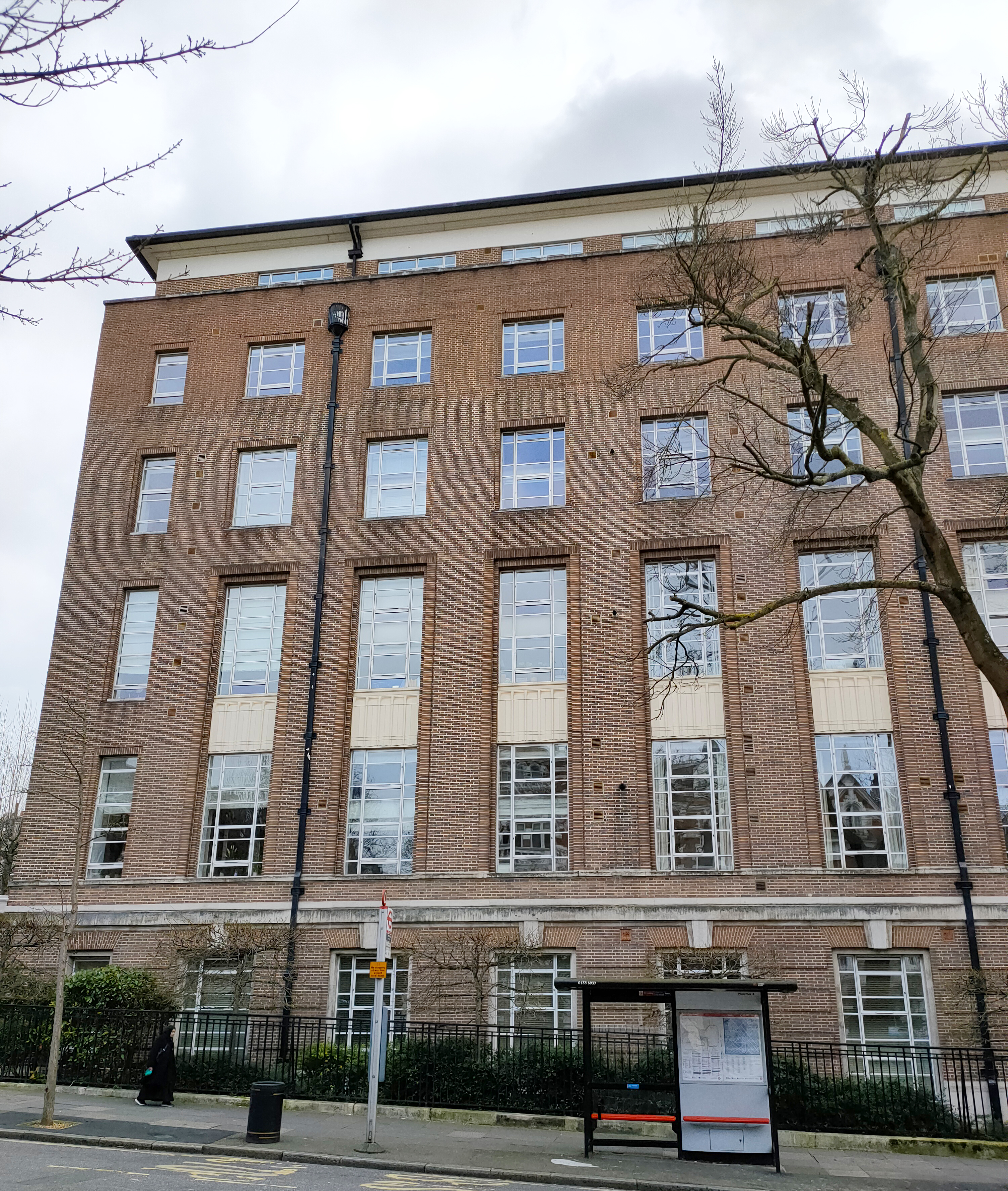
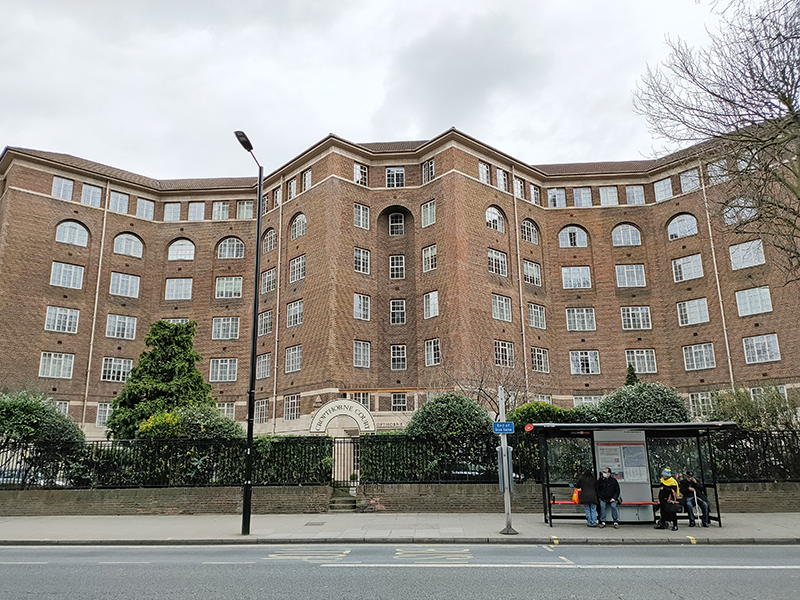
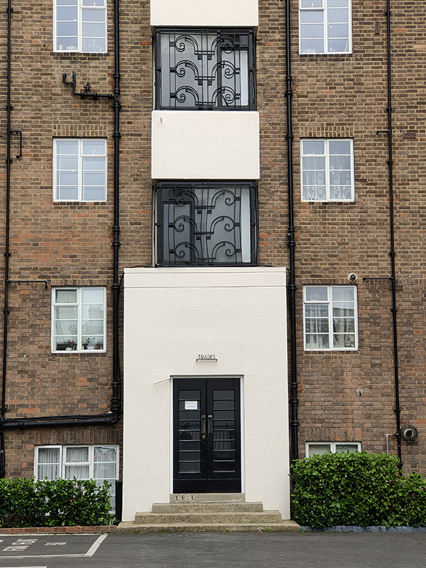
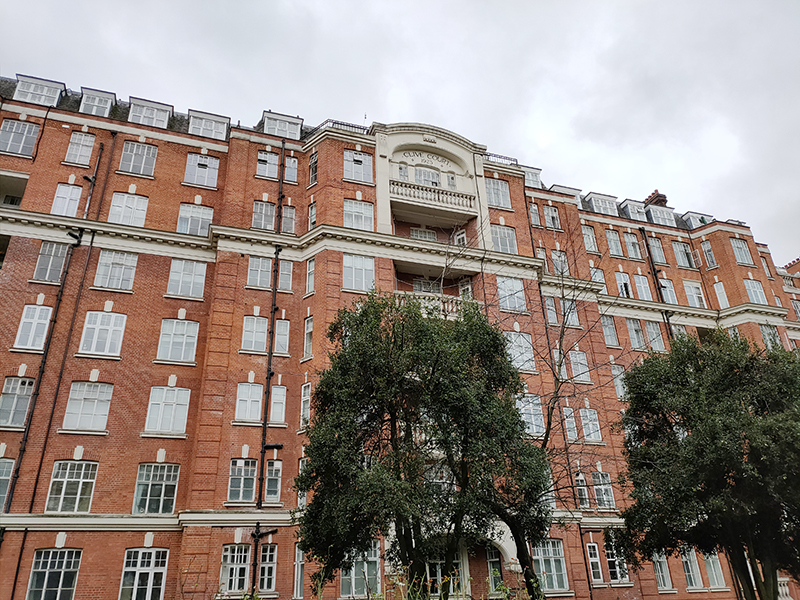
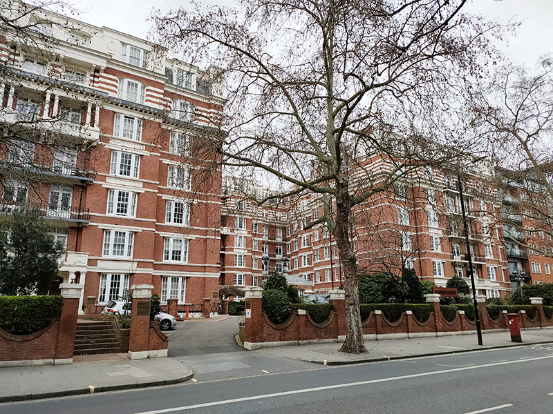
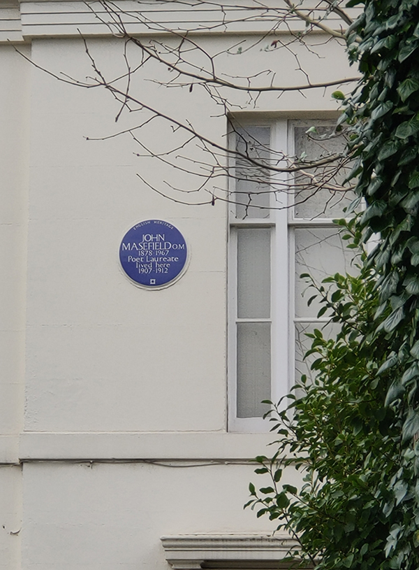
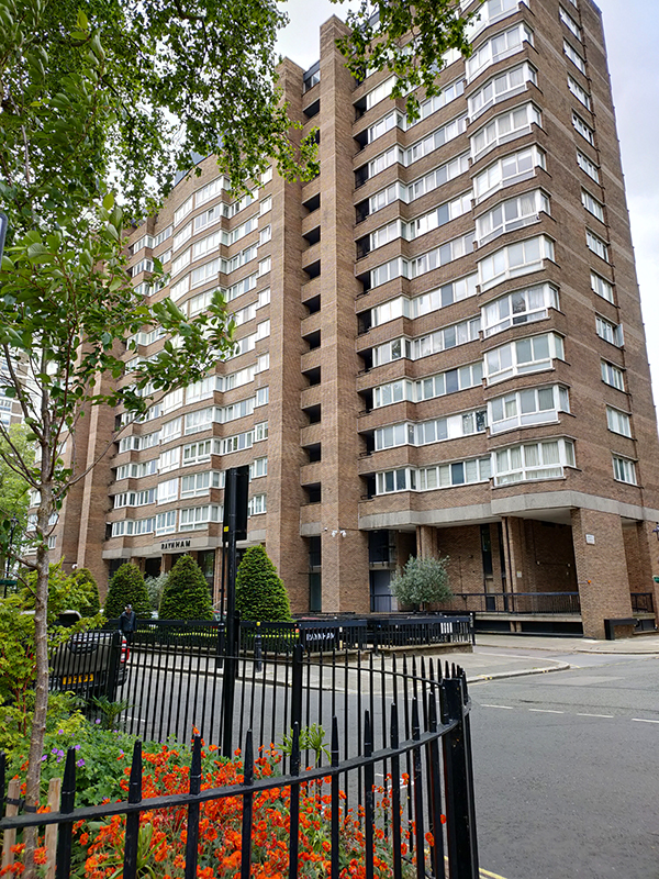
We start out on Bayswater Road and head north up Hyde Park Street into the heart of the Hyde Park Estate. This residential district was originally developed in the early 19th century on land owned by the Bishop of London. In 1836 ownership of the freeholds passed to the Ecclesiastical Commissioners (who became the Church Commissioners in 1948). A series of redevelopments from the 1950’s through to the 1970’s saw a number of high density blocks of flats rise up amongst the remaining Victorian villas.

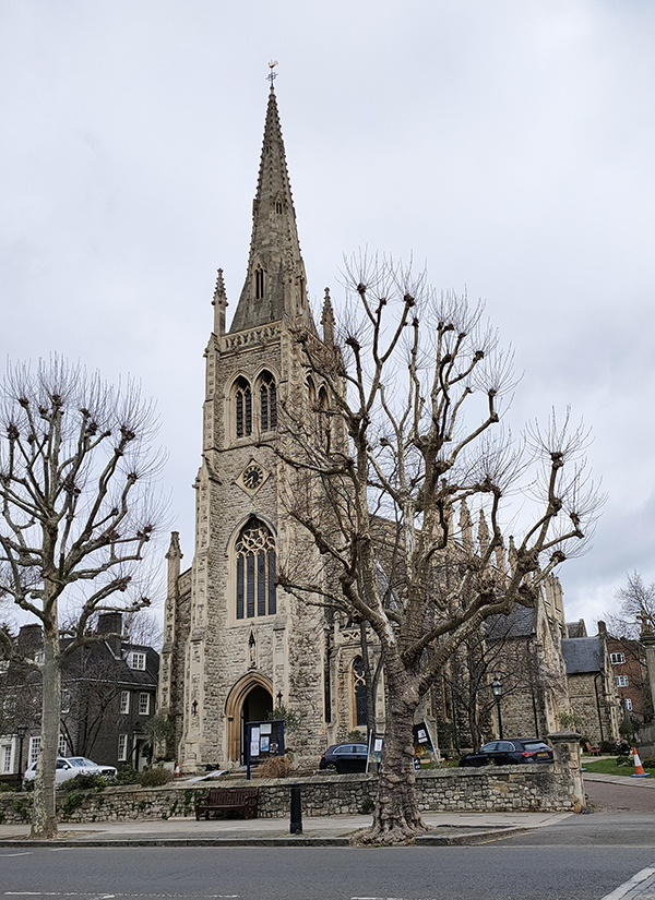
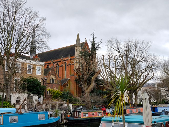
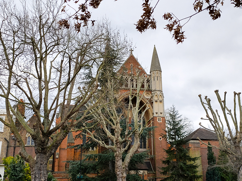
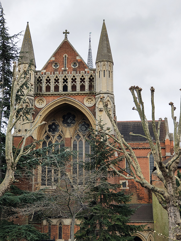
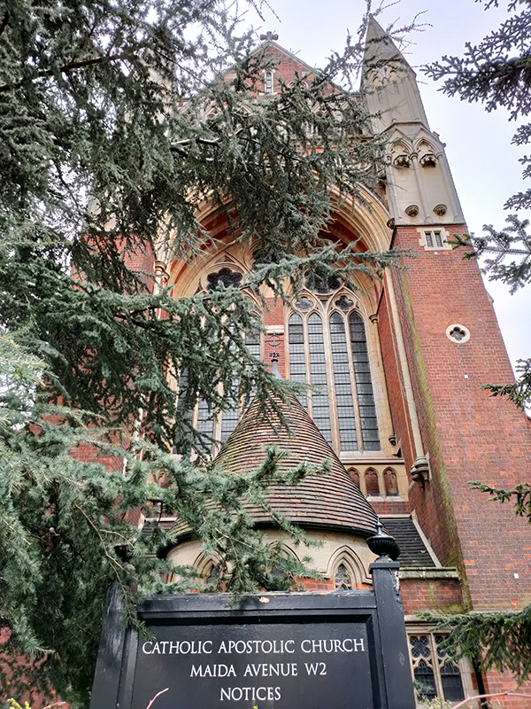
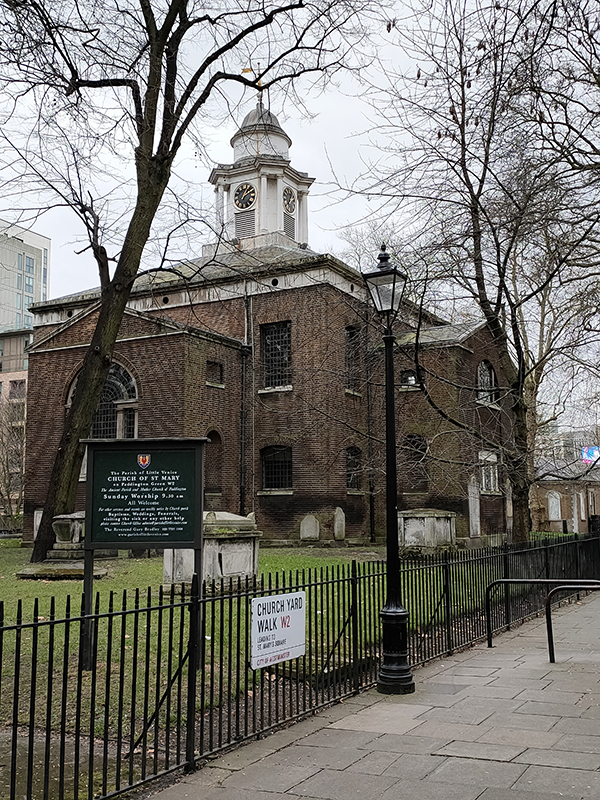
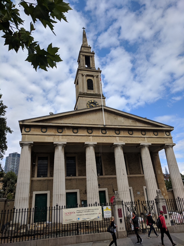
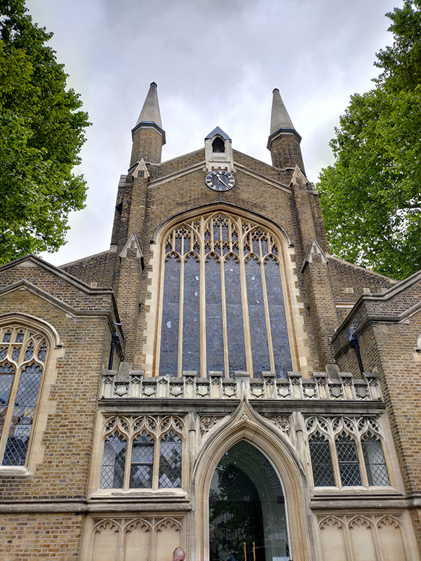
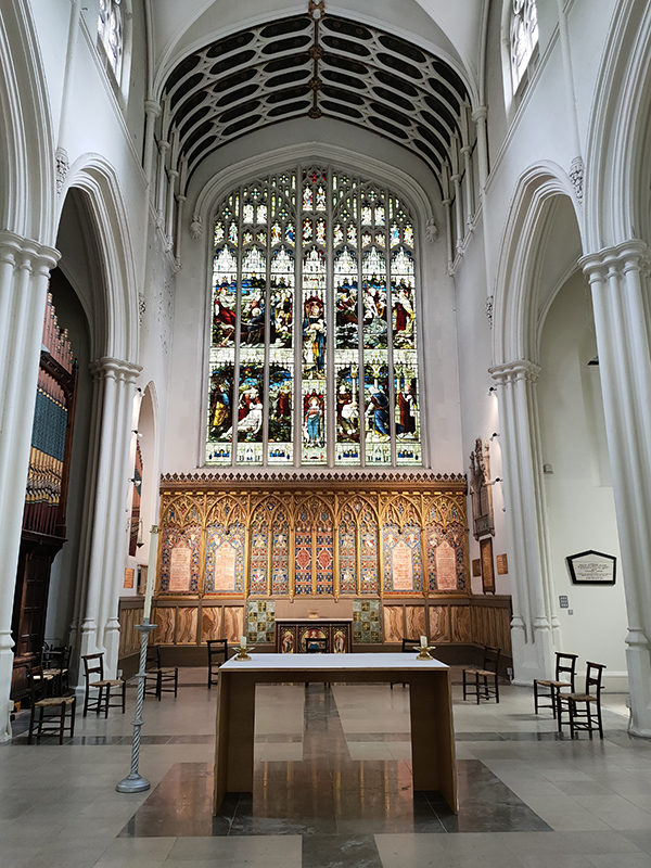
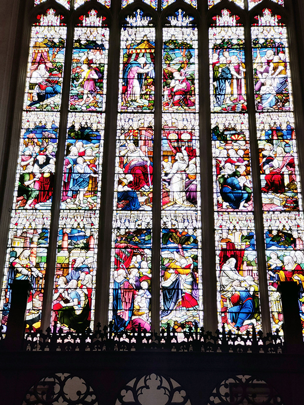
Having circled east on Norfolk Crescent we double back via Oxford Square to reach St John’s Church on Hyde Park Crescent. The church was designed by Charles Fowler (of Covent Garden Market fame) in a 13th century Gothic style and was consecrated in 1832. It has a long history of musical associations and in the 1960’s Beatles’ producer George Martin was invited to sort out the acoustics.

Having circumnavigated Cambridge Square we proceed northward on Southwick Street past a solitary representative of the “Dolphin” lamp posts familiar from the Thames Embankment. Unusually, in this case, the “dolphins” are white rather than black.

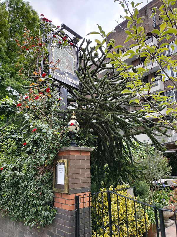
Taking a right turn onto Sussex Gardens we pass the Monkey Puzzle Pub. It’s pretty rare to see an example of Araucaria araucana these days so this one was a welcome sight. Also had a sudden memory flash as I recalled meeting an old school friend here for a drink many, many years ago despite this being an area that I have never had any familiarity with.

We resume a northward trajectory on Sale Place, passing Junction Mews, on the corner of which stands a house bearing the sign “Boatmen’s Institution”. In 1828, an organisation known as the ‘Paddington Society for Promoting Christian Knowledge among Canal Boatmen and Others’, purchased a stable and coach house with a view to creating a place of worship for the boatmen who transported goods along the Grand Union canal and their families. As Victorian Society generally looked askance at such families, partly because the boatmen worked on the Sabbath, it was difficult for them to gain acceptance in existing church congregations.

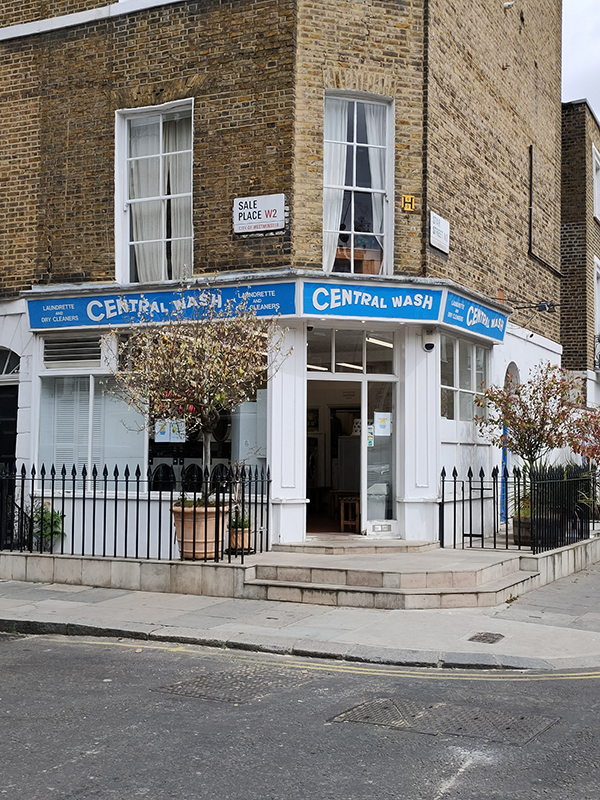
Sale Place is also home to this excursion’s launderette/laundrette of the day. Another example of the latter (mis)spelling.

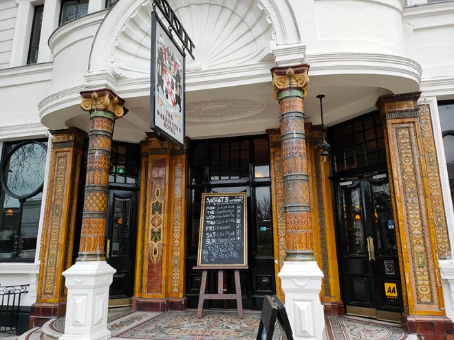
We make a brief visit to the Edgware Road via Star Street before returning to Sale Place along part of St Michael’s Street. Then we continue north up on to Praed Street where we turn right again just as far as Harbet Road. On the corner here is another pub conversion that gives a flavour of the changing tenor of this part of London.

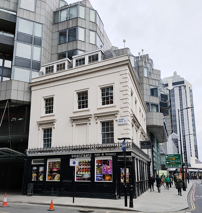
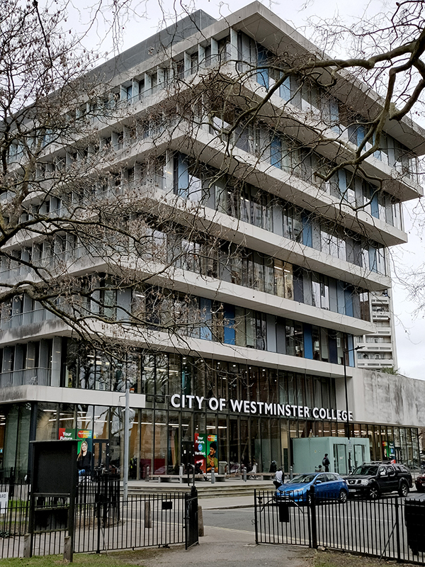
Harbet Road affords access into Merchant Square, a development built around the eastern end of the Paddington Basin. The first of the six buildings for which planning permission was granted was completed in 2013 and three others have been completed since. The remaining two, including 1 Merchant Square which, at 42 storeys, will be the tallest building in the City of Westminster, are still under construction.

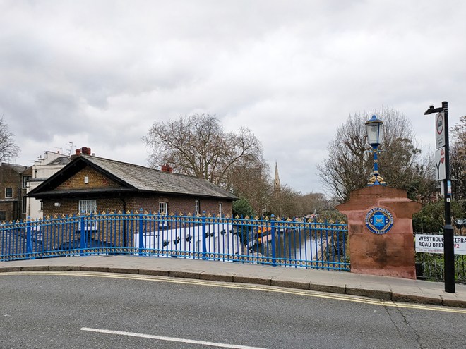
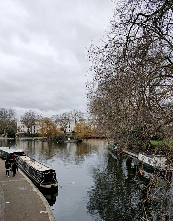
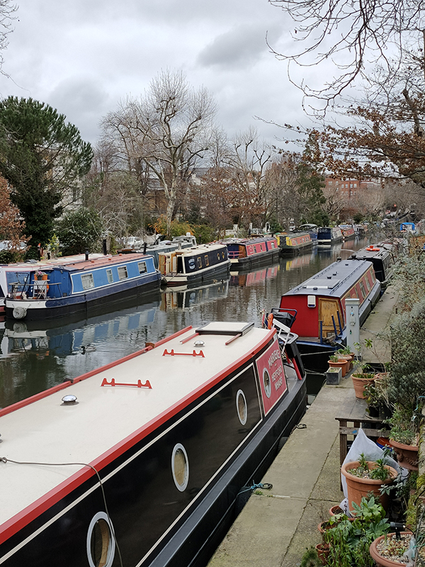
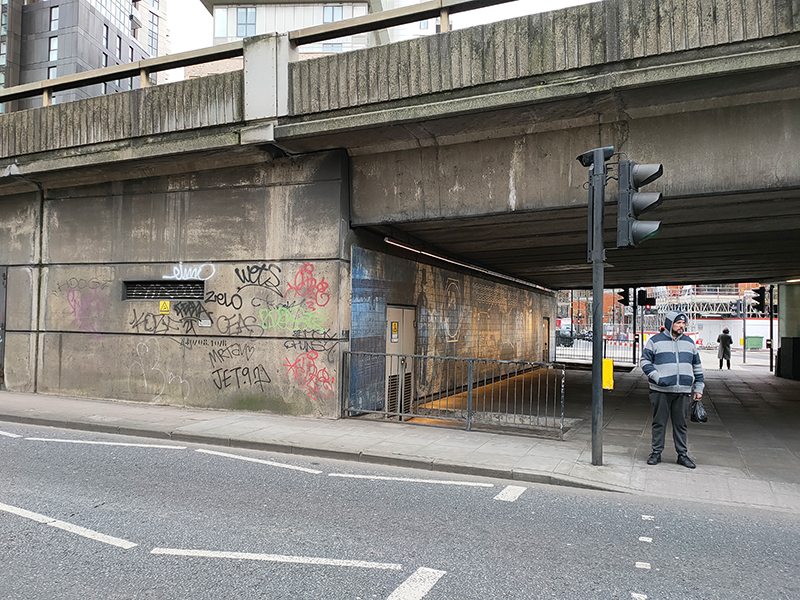
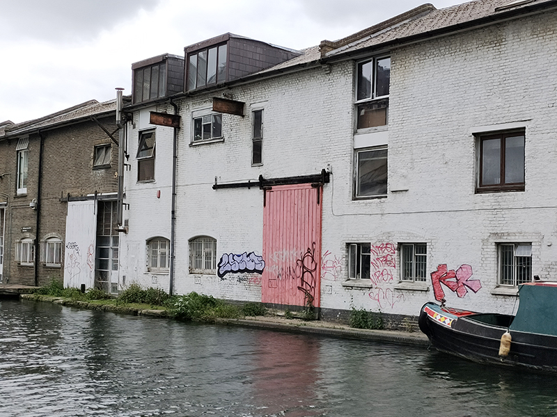
Cutting back on to Harbet Road we swing up to Harrow Road in the shadow of the Marylebone Flyover. We skirt the latter as far as North Wharf Road then follow this as far as Hermitage Street which takes us up to the eastern end of Bishop’s Bridge Road. The bridge itself crosses over the final stretch of the Paddington Arm of the Grand Union Canal which runs from Little Venice down into the Paddington Basin. The Paddington Canal was opened in 1801, with the Basin chosen for its strong onward transportation links. Large furniture depositories arose around the Paddington Basin and its wharves were soon handling huge quantities of building materials, coal, hay, pottery and for the return journey, manure for agriculture and household rubbish to fuel brickyard kilns. However, its heyday was short-lived; within twenty years the Regents Canal had been built allowing goods to be transported from the Grand Union through to the River Thames and the Port of London rendering the Paddington Basin largely redundant.

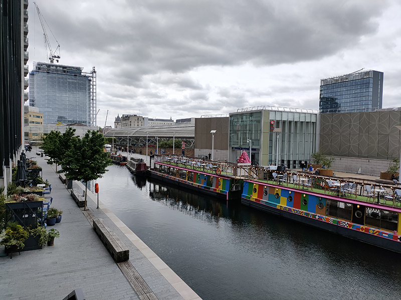
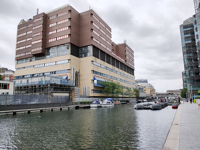
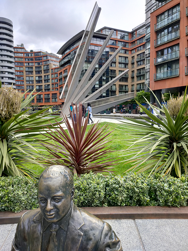
We drop down from the bridge onto Canalside Walk with its array of modern eateries then nip across into North Wharf Road again following this round to the western end of the Paddington Basin which was redeveloped earlier in the 21st century. On the way back to Merchant Square we pass the Fan Bridge and a statue of Sir Simon Milton, who as Deputy Mayor for Policy and Planning during Boris Johnson’s Mayoral administration, was largely responsible for overseeing the regeneration of the Basin.

Exiting Merchant Square onto Praed Street we turn back west as far as the junction with South Wharf Road. Here stands the one-time Grand Junction Arms, a splendid representative of the former estate of the Truman, Hanbury, Buxton brewing company (1666-ish to 1988). If you look closely you can just about make out the gargoyles. These days it operates as the Fantasia Grill House.

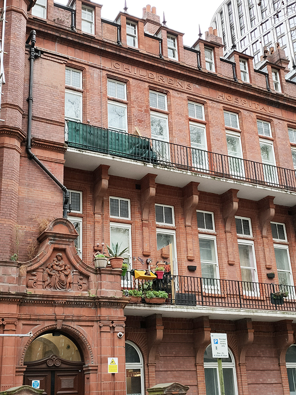
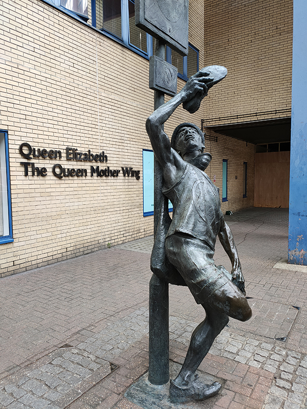
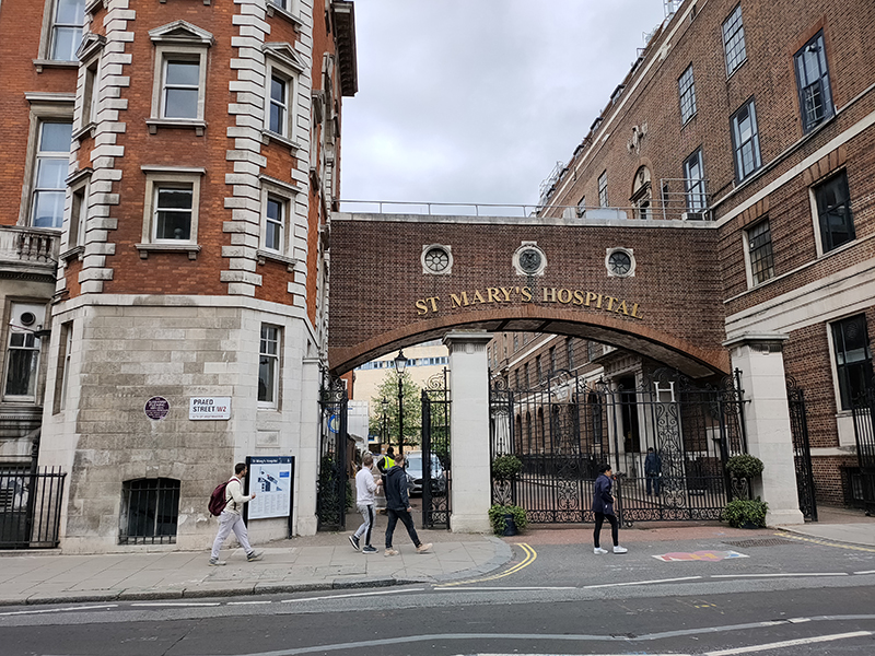
South Wharf Road runs through the middle of St Mary’s Hospital. To the north, abutting the Paddington Basin stands the modern Queen Mother Wing which was opened in 1987 and subsumed the services of Paddington General Hospital.

The Messenger, by Allan Sly

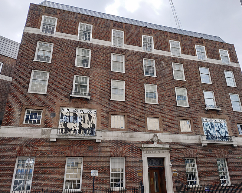
Across the road is the private Lindo Wing which opened in November 1937, having been financed by businessman and hospital board member Frank Charles Lindo, and has witnessed numerous royal and celebrity births. Amongst these being Princes William and Harry, musicians Elvis Costello and Seal and actor Kiefer Sutherland. The artworks on the windows were created as part of a 2012 exhibition by Julian Opie, perhaps best known for the cover of Blur’s “Best of” compilation in 2000.

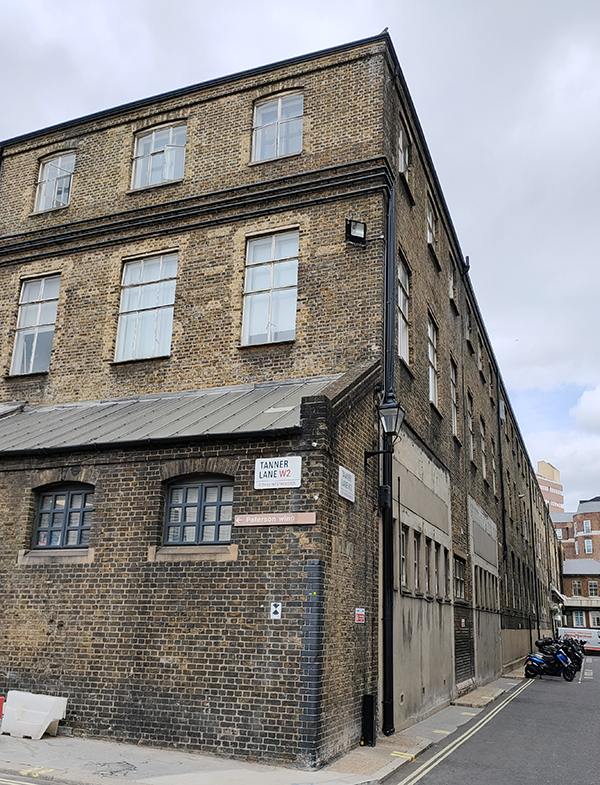
At the western end of South Wharf Road we turn left, where, because of the Paddington Square redevelopment on the east side of Paddington Station, the street configuration is different from that shown on either my printed map or Google maps. Since July 2020 a new road called Tanner Lane has fomed the connection with Praed Street and Winsland Street. It’s named after Sir Henry Tanner (1849–1935) the architect who designed the former Royal Mail sorting office on London Street which was demolished in 2018 to accommodate the Renzo Piano designed new development. During its period of vacancy from 2010 the Sorting Office moonlighted as a culture venue, hosting Punchdrunk’s 2013, A Drowned Man, and acting as a staging post for the 2012 Olympic Games. One small silver lining to its destruction is the view temporarily afforded of Paddington Station’s majestic Tournament House (1935).

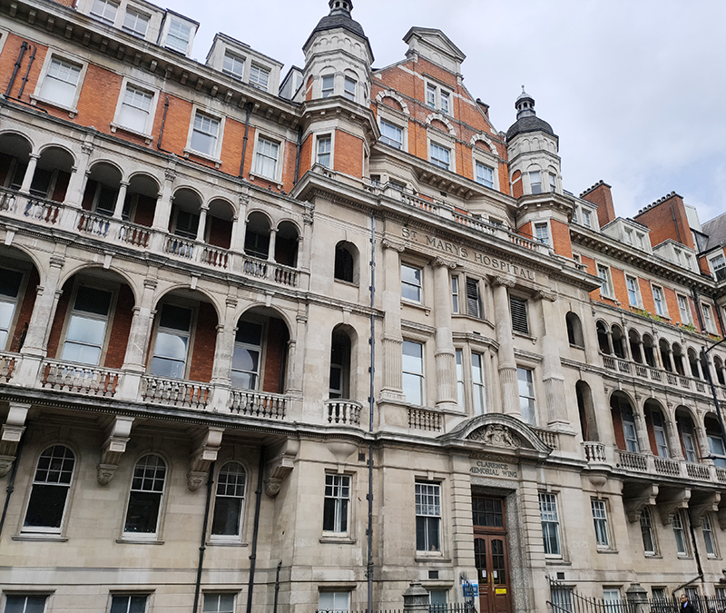
Moving back east along Praed Street we approach the The Clarence Memorial Wing, of St Mary’s Hospital which was designed by Sir William Emerson and opened in 1904.

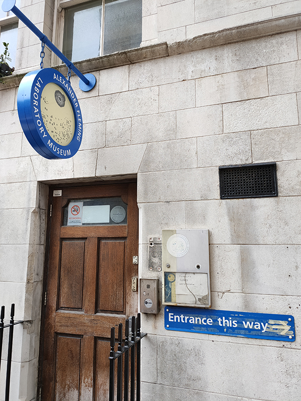
It was here that Alexander Fleming (1881 – 1955) discovered penicillin by happy accident in 1928. On 3 September that year he returned to his laboratory having spent a holiday with his family at Suffolk. Before leaving for his holiday, he had inoculated staphylococci on culture plates and left them on a bench in a corner of his laboratory. On his return, he noticed that one culture was contaminated with a fungus, and that the colonies of staphylococci immediately surrounding the fungus had been destroyed, whereas other staphylococci colonies farther away were normal, famously remarking “That’s funny”. He was able to identify the mould as belonging to the genus Penicillium. Fleming’s laboratory has been restored and incorporated into a museum about the discovery and his life and work, however the museum has not as yet re-opened post-pandemic.

On the other side of Norfolk Mews is the original incarnation of St Mary’s Hospital in Norfolk Place which was designed by Thomas Hopper in a classical style. It first opened its doors to patients in 1851, the last of the great voluntary hospitals to be founded. Among St Mary’s founders was the surgeon Isaac Baker Brown, a controversial figure who performed numerous clitoridectomies at the London Surgical Home, his hospital for women. Since 2008, St Mary’s has been operated by Imperial College Healthcare NHS Trust and the Norfolk Place site now forms one of the campuses of Imperial College’s Faculty of Medicine.

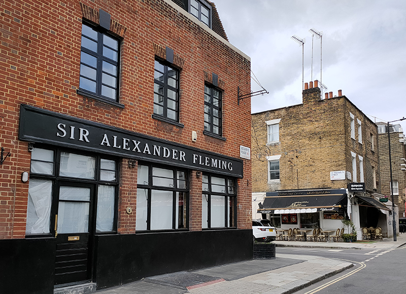
Beyond St Mary’s we turn south off Praed Street into Junction Place then swiftly make a right into another section of St Michaels Street. At the junction with Bouverie Place the pub named after Alexander Fleming sits as inactive as the museum. The Iraqi restaurant opposite appears to be flourishing on the other hand.

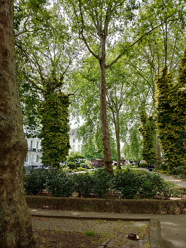
A combination of Star Street, Rainsford Street, Southwick Mews and Norfolk Place return us to Praed Street where we head west as far as Paddington Station before turning south again on London Street and almost immediately veering off into Norfolk Square. This is one of the few squares in the vicinity accessible to the public, which might be connected to the fact that the majority of the mid nineteenth century stuccoed terrace houses that surround it are now mid-range hotels (though that might be a slightly generous description). In any event nos. 2 to 22 have a Grade II listing.

After a circuit of the square, London Street drops us down onto Sussex Gardens. The section from here east as far as Radnor Place is equally well endowed with, well let’s call them budget plus, hotels.

Just off Radnor Place, Radnor Mews is a rare example of a mews with vehicle access at either end. There was a certain amount of rebuilding following WWII bomb damage but a number of original buildings survive nearer to the Sussex Place entrance.

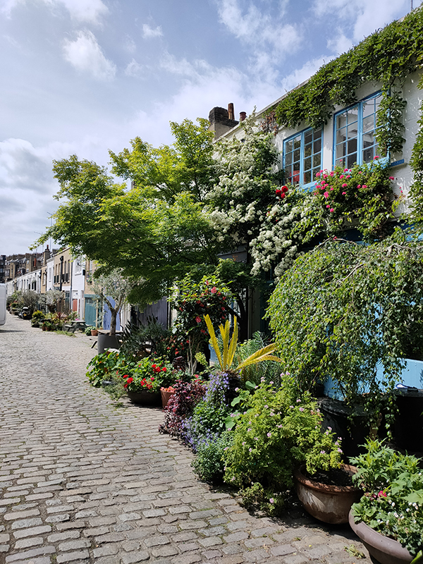
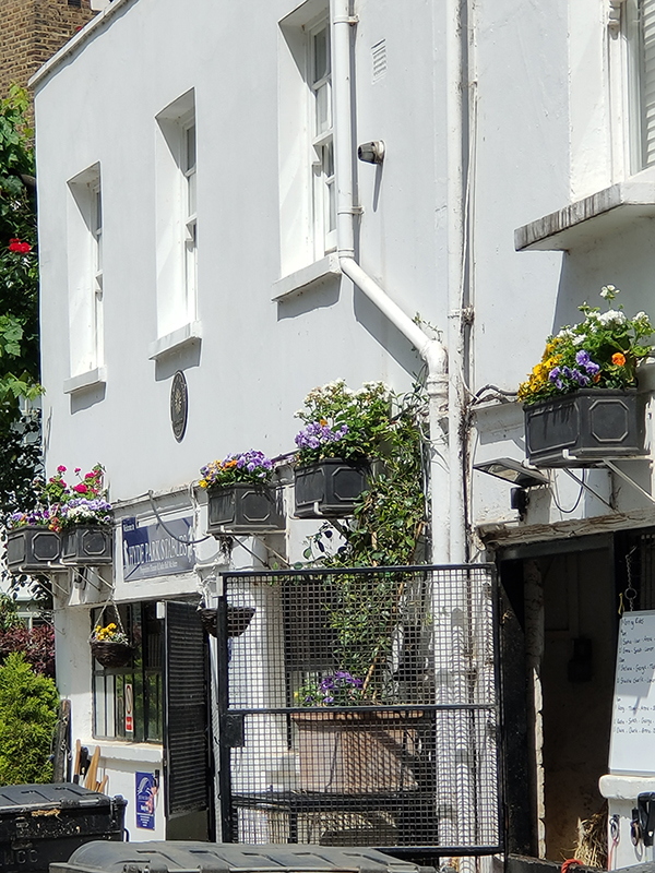
On the other side of Sussex Place is Bathurst Mews which like Radnor Mews originally provided stables for the larger properties in Gloucester Square and Sussex Gardens. However, unlike Radnor and, indeed, any other mews in London, Bathurst is still home to working stables. Hyde Park Stables and Ross Nye Stables are both at the western end of the Mews from where they offer horseback excursions into Hyde Park. As you can see below left, some of the residents at the eastern end have excelled themselves on the horticultural front.

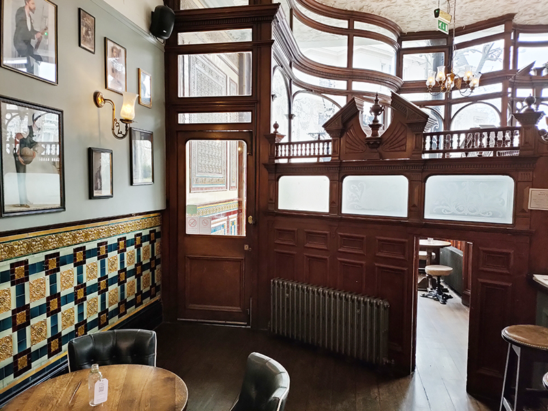
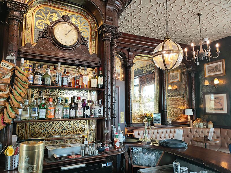
We exit Bathurst Mews onto Bathurst Street the proceed east through Sussex Square, Clifton Place, Gloucester Square and Somerset Crescent all the way back to Hyde Park Crescent and St John’s Church. Then we wend our way back west via Southwick Place, Hyde Park Square and Strathearn Place to arrive at today’s pub of the day, The Victoria on the corner with Sussex Place. A beautiful Victorian pub, dating from around 1864, The Victoria is a Grade II listed building with an interior than retains its original counter with panelled bays divided by fluted pilasters and a regency-style fireplace. The Theatre Bar, upstairs, has ornate fittings imported from the Gaiety Theatre about 1958. It was Fuller’s pub of the year in both 2007 and 2009 and does a mean club sandwich.

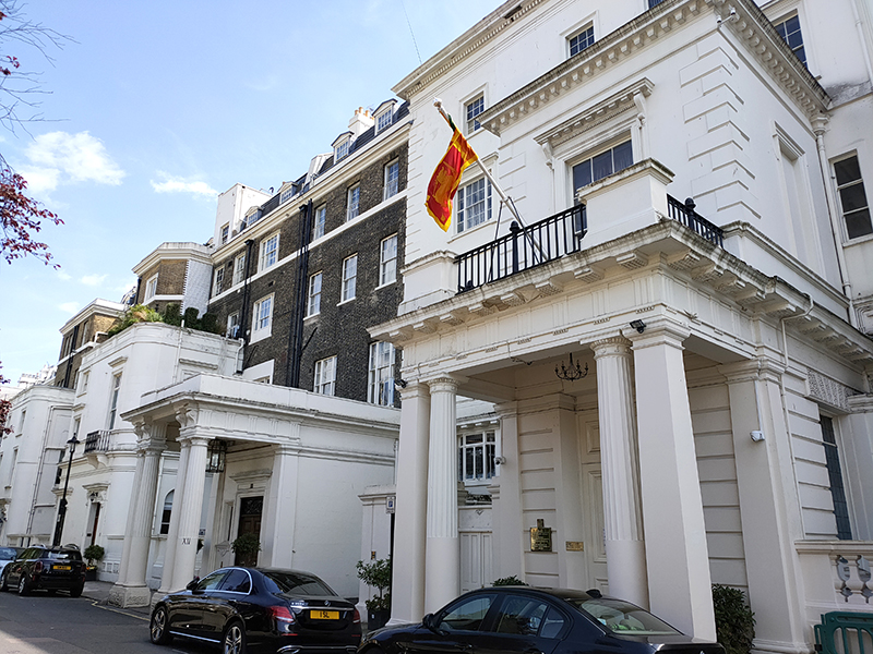
Suitably refreshed, we crack on with the last leg of today’s journey, joining Hyde Park Garden Mews from Sussex Place then swinging round into Hyde Park Gardens via Brook Street. Hyde Park Gardens is home to the Sri Lankan consulate which takes up several buildings.

Beyond the consulate we turn right into Clarendon Place which drops us onto the Bayswater Road. On the way we pass Chester House designed and lived in (from 1926 to 1960) by, our old friend, Sir Giles Gilbert Scott (1880 – 1960). GGS is, of course, the man who brought us the red telephone box and both Battersea and Bankside Power Stations (the latter now Tate Modern).

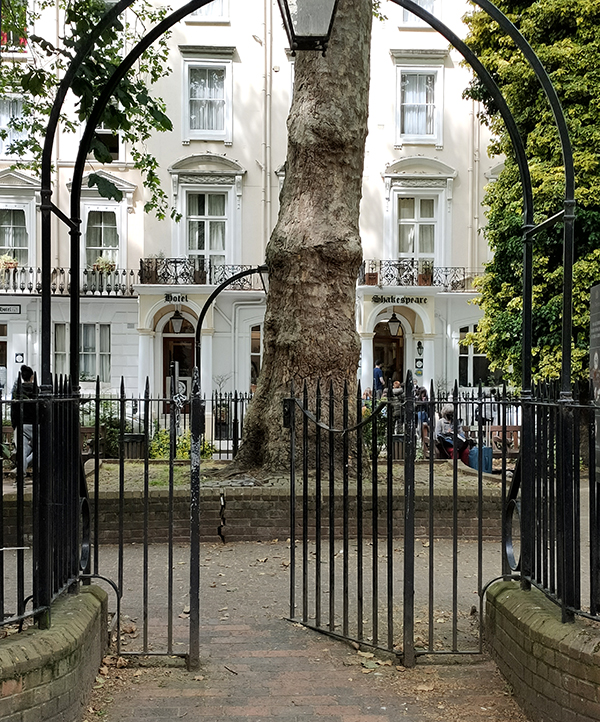
We follow Bayswater Road west as far as Westbourne Street from where detour off to loop round Stanhope Terrace, Sussex Square and Bathurst Street before continuing up to the western end of Sussex Gardens. Turning east we circumnavigate Talbot Square, another one with rare public access to its gardens, before making our way back to Praed Street via Spring Street and Conduit Place.

We end today’s excursion opposite Paddington Station, which has seen enormous changes in recent times due to its participation on the Elizabeth Line. But we’ll delve into that next time.

Day 71 – Maida Vale – Little Venice

Switching our attention back to the north west for this excursion which, roughly speaking, covers the triangular area formed by Maida Vale, Warwick Avenue and Edgware Road tube stations. The name Maida Vale apparently derives from a pub called The Maida which formerly stood on Edgware Road near the Regent’s Canal. The pub was named in recognition of General Sir John Stuart, who was made Count of Maida, a town in Calabria, by King Ferdinand IV of Naples, after victory at the Battle of Maida in 1806. In contrast, the somewhat over-ambitious soubriquet, Little Venice, only became popularised in the latter half of the 20th century.

Starting point today is Maida Vale tube station which opened in June 1915 and consequently was the first station to be staffed entirely by women.

We turn right into Elgin Avenue which merges into Abercorn Place and then proceed as far as the junction with Hamilton Terrace. Here stands St Mark’s Church, consecrated in 1847 when this area was on the fringes of urban London. In 1870, Canon Robinson Duckworth became parson. Duckworth’s main claim to fame is that he introduced Alice Liddell, the daughter of his friend, Charles Liddell, to the Reverend Charles Dodgson, aka Lewis Carroll, on a boating trip. Duckworth himself appears in the foreword of an early edition of the Wonderland as ‘The Duck’ and Alice Through the Looking Glass is thought to have been written in the his vicarage.

Like neighbouring, and equally affluent, St John’s Wood, Maida Vale is home to an architecturally diverse array of grand residential mansion blocks. The ones here generally predate those in the former, being mainly of late Victorian and Edwardian vintage.

You don’t employ common or garden removal men round here – you need Master Removers.

From St Mark’s we head south down Hamilton Terrace as far as Hall Road where we turn back west. On the corner of Hall Road and Maida Vale (A5) is the massive Cropthorne Court apartment block, built 1928-30 (one of the few from that era in this locale) and designed by (our old friend) Sir Giles Gilbert Scott (1880 – 1960). Flats here were originally let out for between £375 and £425 per annum. The building was Grade II listed in 2003 and, fittingly, it has its own telephone box.

We turn up Maida Vale back towards Elgin Avenue and at no. 32 find a blue plaque commemorating the actor and music hall star, Lupino Lane (1892 – 1959). Born in Hackney, Lane, whose cousin was the screenwriter/director/actress Ida Lupino, started out as a child performer known as ‘Little Nipper’ and went on to make numerous appearances in theatre, film and variety. He moved to America in the 1920’s and forged a successful career in screen comedies before returning to England in 1929. In a rather neat segue from the last post, he is perhaps best known for playing Bill Snibson in the play and film Me and My Girl, which popularized “The Lambeth Walk”.

Also on Maida Vale is the gated Vale Close with its mock tudor pretensions and throwback attempts to keep the riff-raff at bay.

Going back to my point about the diversity of architectural styles there is a distinct Italianate feel to the brick-built parade on Elgin Avenue.

And on Lanark Road, which we follow next there’s another reminder of the social hierarchy that still feels implicit in these parts.

Sutherland Avenue is home to the Maida Vale Everyman Cinema which was purpose built in 2011.

Randolph Avenue takes us back to Maida Vale tube station where we turn left on to Elgin Avenue this time, proceeding as far as Ashworth Avenue which runs down Lauderdale Road. On the corner here sits the Lauderdale Road Synagogue which is one of the main centres for London’s Sephardi Jewish community. The Sephardi Jews first arrived in England in the 18th century fleeing the inquisitions taking place in Spain and Portugal. Originally, they congregated in the East End but by the late 19th century many wealthier members of the community had moved across to the new north-west suburbs. As a consequence, Lauderdale Road Synagogue was opened in 1896, constructed in the Byzantine style by architects Davis & Emanuel.  From 1887 to 1917 the Sephardi community was led from here by Haham Rabbi Moses Gaster who played a major role in the promotion of Zionism in the British Jewish community and at whose home the first meeting to plan the Balfour Declaration was held. As with the synagogue near Lord’s which we encountered a couple of posts back there was security on site to encourage me to move on, though I think my explanation for my interest just about convinced them.

Turning left, we are soon at five-way roundabout from where we take the first exit anti-clockwise and revisit Sutherland Avenue heading west. This is probably a good point to note just how wide some of the streets are round here (compared to nearly everywhere else in London). Many of them have parking on both sides (and sometimes in the middle) and still plenty of space for two-way traffic flow.

We drop south on Castellain Road then cut through Formosa Street to Warrington Crescent. On the way we call in at the Grade II listed Prince Alfred pub which was built in 1856 and is justifiably on the Campaign for Real Ale’s National Inventory of Historic Pub Interiors. Inside it retains its original “snob screens”, a Victorian invention comprised of an etched glass pane in a movable wooden frame which was intended to allow middle class drinkers to see working class drinkers in an adjacent bar but not to be seen in return. The Prince Alfred was also featured in David Bowie’s Grammy Award-winning short film “Jazzin’ for Blue Jean” (1984).

Warrington Crescent adds to the architectural mosaic with its Regency-style white painted stucco terraced town houses reminiscent of those we saw in Belgravia and Pimlico.

At no.75 there’s a blue plaque in honour of David Ben Gurion (1886 – 1973), the first Prime Minister of the state of Israel.  Ben-Gurion rose to become the preeminent leader of the Jewish community in British-ruled Mandatory Palestine from 1935 until the establishment of the State of Israel in 1948. He served as Prime Minister up to 1963 save for a short break in 1954–55. He led military operations during the first Arab-Israeli war which took place almost immediately following the declaration of independence and was instrumental in arranging for the extraction of Adolf Eichmann from Argentina by Mossad in 1960.

Back on the roundabout at the top of Warrington Crescent stands another impressive Grade II listed Victorian pub, the Warrington Hotel, built just a year later than its near neighbour. The Warrington has also retained its colourful original features including mosaic floors, stained glass windows, pillared porticos and art nouveau friezes.

On the other side of the hotel we turn southward again first on Randolph Avenue then on Randolph Crescent. At the end of the latter we turn right on Clifton Gardens and follow this back to the lower end of Warrington Crescent before taking Warrington Gardens to cross behind St Saviour’s church (which we’ll come to in a minute). Now we’re back on Formosa Street which links into Bristol Gardens. The houses on the right side of the latter have a distinctly Moorish feel to them. I came across a picture of these same houses from the early 1970’s that illustrate just how far up in the world this area has come in the last fifty years.

Next we follow Clifton Gardens, Blomfield Street and Warwick Place round to Warwick Avenue and head north up to the eponymous tube station. Also dating from 1915, Warwick Avenue has no surface building, the station being accessed by two sets of steps to a sub-surface ticket hall. It was one of the first London Underground stations built specifically to use escalators rather than lifts. 

As you can see. the Catholic Church of St Saviour stands beyond the station. The current church was built in 1976 replacing a gothic structure dating from 1855 which was demolished in 1972. The original church was deemed too large for its 1960’s congregation and so the site was redeveloped to incorporate a block of flats behind a new brick church building designed by architects Biscoe and Stanton. Local interest groups had lobbied to retain the original tower, as it was felt a vertical feature was desperately needed in the area as Warwick Avenue is one of the broadest streets in London. However, the proposal was ignored in favour of the fiberglass spire we see today.

We retrace our steps eastward on Clifton Gardens then swing round Randolph Road and Clarendon Gardens back onto the southern section of Lanark Road and follow this back up to Sutherland Avenue. Then we return past Cropthorne Court on another stretch of Maida Vale that incorporates two more enormous mansion blocks, Clive Court and Rodney Court, the former dating from 1923 and the latter built in 1915.

Clive Court (1923)
Rodney Court (1915)

We run down as far as Clifton Road which has a suitably upmarket parade of shops including a Village Butcher’s. There’s also yet another red phone box here. This area must have the highest density of them in London.

From Clifton Road we take a peek at Lanark Place and Clarendon Terrace and then work our way down to the Regent’s Canal via Randolph Avenue. Blomfield Road runs along the north side of the Canal through so-called Little Venice. As noted in a previous post the 8.6 mile long Regent’s Canal links the Paddington arm of the Grand Union canal in the west with Limehouse Basin in the east. Construction of the canal formed part of architect John Nash’s grand redevelopment of central north London for George IV (conceived when the latter was still Prince Regent). The first section from Paddington to Camden Town, which includes where we are today, opened in 1816 and included a 274 yard long tunnel under Maida Hill.

We follow Blomfield Road alongside the canal as far as Westbourne Terrace Road just beyond the triangular basin where the Puppet Theatre Barge is moored. The Puppet Theatre Barge began life as a marionette theatre touring company called Movingstage, founded by Juliet Rogers and Gren Middleton in 1978. Several years later, the company acquired a 72ft-long Thames lighter and converted it into a permanent puppet theatre. The stage was specially designed to put on shows using string marionettes, and the seating raked to ensure a good view from every seat. Initially, the Barge was based in Camden Lock and toured the Grand Union Canal in the summer. Then in 1986, it moved its winter base to Little Venice and each summer went up the River Thames, sometimes as far as Oxford.

In the middle of the Basin sits Browning’s Island, named for the poet Robert Browning (1812 – 1889) who lived on Warwick Crescent for most of the latter part of his life. Browning is also credited with being the first person to coin the name Little Venice though there are those who maintain that Lord Byron beat him to it by several years. The island is popular with waterfowl including cormorants, swans, Egyptian Geese and various species of duck.

Westbourne Terrace Road starts with a bridge across the canal which we use to get to Delamere Terrace which runs west parallel to the southern canalside. On the corner here is the Canal Cafe Theatre which holds the dubious privilege of being the only venue to have staged a piece of work written by myself – albeit just a sketch in a 2016 comedy revue. Operating here since the 1970s, the theatre is better known for hosting Newsrevue, the world’s longest running live comedy show (Guinness Book of Records certified) which in March 2020 was forced to close for the first time in over 40 years by the Covid pandemic.

A westward circuit comprised of Chichester Road, Bourne Terrace, Blomfield Villas and Delamere Street takes us through the least salubrious section of today’s walk and deposits us back on Westbourne Terrace Road where we turn back north and then follow Warwick Crescent east beside the south side of the basin. At the end of Warwick Crescent we switch briefly onto the Harrow Road (A404) before turning up Warwick Avenue again. This section of Warwick Avenue skirts Rembrandt Gardens which abut the third side of the basin triangle. A shout out here to Westminster Council for maintaining in the gardens an example of that sorely endangered species, the Public Convenience. Running east from the bridge south of the canal is Maida Avenue which at no. 30 boasts a blue plaque in commemoration of the one-time Poet Laureate, John Masefield (1878 – 1967). Masefield lived here from 1907 to 1912 during which time his wife Constance, who was his senior by 12 years, gave birth to their second child and he wrote his first narrative poem, Everlasting Mercy.

Also on Maida Avenue is the imposing Victorian Gothic-styled Catholic Apostilic Church. This was built in 1891-93 to a design of architect John Loughborough Pearson (1817 – 1897) who worked on around 200 ecclesiastical buildings during a fifty plus year career. The Catholic Apostilic Church, confusingly, was actually a Protestant Christian sect which originated in Scotland around 1831 and later spread to Germany and the United States. Its founder, Edward Irving, was still a minister of the Church of Scotland at the time but was subsequently expelled. Despite his death within four years of its establishment the CAC continued as a going concern until the early part of the 20th century with 200,000 members at its peak. Since then it has been in gradual decline. According to sources, this building, which was Grade I listed in 1970 was home to the last active British congregation as of 2014; though on the day I visited it was completely locked-up with no signs of life.

Maida Avenue runs right up to the Edgware Road (and the canal tunnel I mentioned earlier). We don’t spend long on Edgware Road, turning right almost immediately into Compton Street then following Hall Place, Cuthbert Street and Adpar Street south to Paddington Green. Here we head west past City of Westminster College (originally founded as Paddington Technical Institute in 1904) and St Mary’s Church. The college building was designed by Danish architects, Schmidt Hammer Lassen. The church, the third on this site, was built in 1791 by John Plaw and sits within its own extensive graveyard which contains fine monuments (by renowned sculptors such as Physick, Derby and Blore) to local luminaries including Peter Mark Roget (the Thesaurus man) and Sarah Siddons, actress.

From St Mary’s Square we turn north and make a loop of St Mary’s Terrace, Park Place Villas, Howley Place and Venice Walk before returning past the church on the Harrow Road, in the shadow of the Westway.

Paddington Green is home to a statue of the aforementioned Sarah Siddons (1755 -1831) who was acclaimed for her many performances in the role of Lady Macbeth and who, reputedly, fainted at the sight of the Elgin Marbles. She also played Hamlet on several occasions, illustrating that gender-blind casting is far from a purely 21st century phenomenon.

On the east side of the Green stands the Grade II Listed former Paddington Green Children’s Hospital which is now a residential apartment block. And in its south-east corner, reached via a circuit of Church Street, Edgware Road and Newcastle Place, two more red phone boxes make it at least ten in total for today.

Just behind where that right hand photo was taken lies Paddington Green Police Station, as was. Built in 1971 it became infamous as a location where high-profile terrorist suspects were brought for interrogation. In 1992 a phone box outside the station was blown up by the IRA (not one of the ones above obviously). In 2007, a joint parliamentary human rights committee stated that the station was “plainly inadequate” to hold such high-risk prisoners and despite subsequent major refurbishment its days were numbered. It closed permanently in 2018 and then in February 2020 was occupied by anarchist group the Green Anti-Capitalist Front, who said they intended to turn the space into a community centre. They also discovered that since its closure the station had been used for firearms training for police and special forces.

From here it’s just a few steps to Edgware Road tube station and we’re done for this time.

Day 56 – Elephant & Castle to Tate Modern

Does what it says on the tin this one, so it’s a long south to north and narrow east to west. So much so that I’ve had to divide the route map in two; starting off with this one which takes us from the Elephant & Castle as far as Mint Street Park which lies about halfway along Southwark Bridge Road.

Day 56 Route 1

Our journey north from the E & C begins along Newington Causeway then takes a right into Rockingham Street before continuing north up Tiverton Street as far as Newington Gardens. This small park sits on the site of the former Horsemonger Lane Gaol which closed in 1878. The poet and reformer, Leigh Hunt, had been one of the “guests” of the gaol, detained for writing disrespectfully of George IV. In 1849, Charles Dickens (of whom much more later), came here to witness a public execution and was so appalled he wrote to The Times in favour of their abolition.

Avonmouth Street takes us away from the park back to Newington Causeway where we turn back southward briefly before cutting sharply north again down Newington Court which runs alongside the railway arches.  On the way we pass the Institute of Optometry which started life in 1922 as the London Refraction Hospital – refraction in this context basically just meaning eye test – the world’s first specialist eye clinic. The current name was only adopted in 1988. On the other side of the road is the Southwark Playhouse which has been one of London’s leading studio theatres for the last 25 years.

Newington Court houses the entrance to the Ministry of Sound nightclub which took over the disused bus garage behind the arches back in 1991. One of the first of the so-called superclubs of the nineties and one of the few remaining, MoS still attracts around 300,000 clubbers a year to its three weekly sessions and has fought off several threats of closure due to the development of the surrounding area.

At the far end of the arches we emerge onto Borough Road and turn east. On our right we pass the home of the London School of Musical Theatre, a faux-Gothic style building dating from 1906. The LSMT moved here in 2000 having previously been at the Old Vic then Her Majesty’s Theatre. Like the MoS they have also had to ride out local redevelopment plans.

IMG_20180927_113538

At the junction of Borough Road and Newington Causeway is a sadly crumbling example of a classic 1960’s petrol station forecourt canopy….

IMG_20180927_113805

… right opposite the Inner London Crown Court located in the Sessions House opened in 1917.
IMG_20180927_113836

Crossing onto the north side of Borough Road we take Stone’s End Street up to Great Suffolk Street then turn west as far as Southwark Bridge Road where we dip back southward in order to check off Collinson Street and Scovell Road. We resume the northward trajectory from Great Suffolk Street up Sudrey Street which is blessed with one of the four rows of cottages in this area built around 1887 at the instigation of social reformer Octavia Hill (1838 – 1912). Octavia, who later went on to co-found the National Trust in 1895, arranged for the cottages to be built on land owned by the Ecclesiastical Commissioners following her appointment to manage their portfolio of inner city properties.

IMG_20180927_115154

At the end of Sudrey Street we turn right onto Lant Street then right again round Bittern Street. A 1904 warehouse on the corner here is now home to the Listening Books charity
IMG_20180927_115410

And round the next corner, heading north again on Touliman Street, stands the Charles Dickens primary school, appropriately bordered on one side by Pickwick Street.

IMG_20180927_115544

Next we turn back along Lant Street before taking the dog-leg Trundle Street round to Weller Street. Then a combination of Mint Street and Caleb Street drops us onto Marshalsea Road. An obvious further Dickens connection here though the debtors’ prison that held his father was actually sited on what is now Borough High Street. Circling round Mint Street Park we arrive at another Dickens’ reminder in the form of Quilp StreetQuilp being the vicious and stunted villain from The Old Curiosity Shop.

IMG_20180927_120408

Before we get to the second leg of today’s journey there’s a previously unvisited stretch of Southwark Bridge Road to go up and down. This includes the old Southwark Fire Station a Grade II listed Gothic Revival building of 1878 (further developed in 1911).

IMG_20180927_120627

And adjacent to the north, Winchester House, originally built as a workhouse in the late 18th century and later converted into a hat factory and private residences. At the same time as the fire station was being built next door this was acquired by the Metropolitan Fire Brigade to serve as its HQ, which it did up until the 1930’s. In 2018 planning approval was granted for a redevelopment to create a new secondary school that would incorporate both the Fire Station and Winchester House buildings.

IMG_20180927_120733


Stage 2 kicks off on the other side of the Borough Welsh Congregational Chapel where Doyce Street makes a short run into Great Guilford Street.

IMG_20180927_120813

Day 56 Route 2

Once on Great Guilford Street you’re greeted with this warning (nicely juxtaposed with the Anarchist symbol I thought) which is supposedly an Edwardian injunction against public urination.

IMG_20180927_120903

We follow Great Guildford Street down to Union Street which then takes us west as far as Pepper Street which runs back south to Copperfield Street (Dickens again of course). On the south side of the street are some more of Octavia Hill’s cottages, Winchester Cottages, with a pleasingly Dickensian aspect to them.

IMG_20180927_121342

And on the north side is All Hallows Church originally erected in 1879-80 in the Victorian Gothic style as interpreted by George Gilbert Scott Junior (1839 – 1897) but almost completely destroyed in the Blitz. Fragments of the building remain, including two stone archways and a chapel, all incorporated into a rebuilding of the north aisle of the church in 1957. This was closed in 1971. The remainder of the bombsite rubble was restored to create an award-winning walled garden with lawns, flower beds and shrubbery.

We take the next turn on the left as you go west which is Sawyer Street. This connects us with Loman Street on which we continue west back to Great Suffolk Street and are pleased to discover en route a Victorian warehouse yet to succumb to demolition or redevelopment. The warehouse is a grade II listed building and dates from the 1850s or 1860s. It has had many occupants over the decades, including Spicer Bros paper merchants in the late 19th century and more recently a group of squatters.

IMG_20180927_122802

From here we loop back to Union Street via the western section of Copperfield Street and Risborough Street. Heading back east we stop off briefly at the Jerwood Space. The Jerwood which opened in 1998 was the first major capital project of the Jerwood Foundation. The Jerwood Foundation was established in 1977 for the international businessman and philanthropist John Jerwood (1918 – 1991). Jerwood moved to Japan after the Second World War and established what became one of the largest cultured pearl dealerships in the world. The Jerwood is an important dance and theatre rehearsal space and includes a gallery which hosts the prestigious annual Jerwood drawing prize. It also has a pretty good café.
IMG_20180927_123136

At the eastern end of Union Street we rejoin Great Guildford Street and resume our northward trajectory. Before reaching Southwark Street we call in on America Street and Wardens Grove. The latter runs along the side of the Metal Box Factory which is a development of office and studio spaces in the building where the tins for Peek Freans biscuits were once made (and was nothing to do with the Metal Box Company as I originally assumed).

From Southwark Street, going west, we branch off down Lavington Street then take a left into Ewer Street which starts out running southward then turns west alongside the railway. The final arch before you get back onto Great Suffolk Street is the current home of The Ring boxing club which as we noted in the last post started life in a twelve-sided  former chapel of prayer that stood on the site now occupied by Southwark tube station.

We continue to the west on another stretch of Union Street then make a circuit of Nelson Square before going north on Gambe Street. Scoresby Street takes us west again onto Blackfriars Road from where we switch back east via Dolben Street, Brinton Walk, Nicholson Street and Chancel Street. At the end of all this we arrive at no.45 Dolben Street which hosts a blue plaque marking this as the site of one of the London homes of Mary Wollstonecraft (1759 – 1797). Wollstonecraft is best known for the proto-feminist treatise A Vindication of the Rights of Woman (1792) but she was author of many other works including a history of the French Revolution. She was born in Spitalfields but led a peripatetic life before returning to London in 1788 to reside here in Southwark. Her other claim to fame is of course as the mother of Mary Godwin, the creator of Frankenstein. It was a fame she was destined never to experience herself as she died of septicaemia just ten days after giving birth to the future wife of the romantic poet, Percy Bysse Shelley.

IMG_20180927_130623

From Dolben Street we take a left into Bear Lane then cut through Treveris Street back to Chancel Street which is where the Philarmonia Orchestra are based. The Philharmonia was founded in 1945 by EMI producer Walter Legge but has been self governing since 1964. Finnish conductor and composer Esa-Pekka Salonen has been Principal Conductor & Artistic Advisor of the Orchestra, which has 80 player-members, since 2008.

IMG_20180927_131212

At the northern end of Chancel Street we initially turn left onto Burrell Street but then double-back under the railway.  At the end of Burrell Street we turn back onto Bear Lane and after a few paces southward switch east down Price’s Street which runs along the rear side of the Kirkaldy Testing Museum. David Kirkaldy (1820 – 1897) set up the Testing Works at 99 Southwark Street in 1874 to house the hydraulic tensile test machine which he had patented ten years earlier and had built at his own expense by the Leeds firm of Greenwood & Batley. The machine is 47 feet 7 inches (14.50 m) long and weighs some 116 tons and could theoretically test the strength of metal parts up to 450 tons in weight. The museum, which was established in 1983, is only open on the first Sunday of each month. The building (including the machine) has a Grade II listing.

IMG_20180927_132231

The eastern end of Price’s Street emerges onto yet another section of Great Suffolk Street. Turning south we call in on Farnham Place before revisiting Lavington Street which deposits us back on Southwark Street. As we head all the way back to Blackfriars Road we pass the Blue Fin building, completed in 2008 and so-named because its façade incorporates 2,000 vertical fins of varying blue colours to provide solar shading for the offices inside. It has been included in a Daily Telegraph list of London’s ugliest buildings but then that’s the Telegraph for you. I have visited the roof terrace in the past but it’s not generally accessible to the public. In any event its views have been largely rendered redundant by the Tate Modern extension (see below).

IMG_20180927_132344

Once on Blackfriars Road we head down to the river and along the Thames Path under Blackfriars Railway Bridge before leaving the riverside to take Hopton Street back to Southwark Street.

Hopton Street is home on its west side to what is genuinely one of London’s ugliest buildings. Sampson House was built in the late Seventies as a processing centre for Lloyds Bank but is currently leased to IBM who use it as a data centre. That lease (rent of £8m a year) has a mutual break clause exercisable in June 2018 and as a result its (no doubt slow) deconstruction to pave the way for new apartment blocks has already begun. Whether those blocks will be less of a blight on the skyline remains to be seen (though Sampson House does actually look quite fetching in this photo).

IMG_20180927_142743

By way of complete contrast, on the other side of Hopton Street are a collection of Grade II listed almshouses built in the 1740’s as homes for poor men of Southwark of good character.

IMG_20180927_142828

So for the final stretch of today’s tour we head back east on Southwark Street then negotiate Sumner Street and Holland Street to takes us to the entrance to Tate Modern. As pretty much everyone knows, Tate Modern was created out of a redevelopment of the Bankside Power Station which was built here across the river from St Paul’s Cathedral in two phases between 1947 and 1963. The power station was designed by, our old friend, Sir Giles Gilbert Scott and consisted of a stunning turbine hall, 35 metres high and 152 metres long, with the boiler house alongside it and a single central chimney. However by 1981 the facility was no longer in service apart from a single London Electricity sub-station and in 1994 the Tate trustees selected this as their preferred site for a separate new gallery focusing on modern and contemporary art. Swiss architects, Herzog and De Meuron were appointed to oversee the conversion of the building.

This slideshow requires JavaScript.

Since it opened in May 2000 Tate Modern has become one of the UK’s top three tourist attractions and welcomed more than 40 million visitors. That electricity substation (now under the control of EDF Energy) continued to occupy the southern third of the building but the western half of this holding was released to the Tate in 2006 and plans were put in place to build a tower extension over the old oil storage tanks. The ten-storey 65m high Switch Tower was opened to the public in June 2016.  The design, again by Herzog & de Meuron, has been controversial. It was originally designed with a glass stepped pyramid, but this was amended to incorporate a sloping façade in brick latticework (to match the original power-station building) despite planning consent to the original design having been previously granted by the supervising authority. In May 2017 the Switch House was formally renamed the Blavatnik Building, after Anglo-Ukrainian billionaire Sir Leonard Blavatnik, in recognition of his “substantial contribution” towards the £260m cost of the extension.

This slideshow requires JavaScript.

For once the timing of my visit was fortuitous as the museum is currently playing host to one of my favourite ever things, Christian Marclay’s epic work The Clock.  24-hours long, the installation is a montage of thousands of film and television images of clocks, edited together so they show the actual time. During several years of rigorous and painstaking research and production, Marclay collected together excerpts from well-known and lesser-known films including thrillers, westerns and science fiction which he then edited so that they flow in real time. If you’ve never seen any of it I would urge you to do so; you have until 20 January 2019.


Day 54 – South Bank – Waterloo Bridge – Blackfriars Bridge – Stamford Street

Today’s perambulations are mainly about the riverfronts either side of the Thames between Waterloo Bridge and Blackfriars Bridge with a particular focus on the South Bank though, as you can see, we do venture a bit further south of the river in the latter stages. It’s an area I’m mostly more than familiar with as, when I could be arsed to walk, I passed through here on my way from Waterloo to an office near St Pauls for many years.

Day 54 Route

Before we kick off however here’s a bit of bonus material relating to the previous post in which we featured the London Eye. As coincidence would have it, just a couple of weeks after that walk I found myself actually aboard the Eye (for the first time in many years)courtesy of a family visit – and here are the pics from on high.

This slideshow requires JavaScript.

Right, back to the business in hand. We start out this time from Waterloo Station once again and having crossed York Road make our way along Concert Hall Approach towards the Royal Festival Hall. The RFH was built in 1951 as part of that year’s Festival of Britain. As London’s new main concert hall it would be the only permanent structure amongst the temporary pavilions and constructions on the Festival’s south bank site. The architects were Sir Robert Matthew and Dr Leslie Martin and the hall took 18 months to build at a cost of £2 million. Initially it was run by the LCC and then its successor the GLC but on the demise of the latter in 1986 responsibility was devolved to the Arts Council. Two years later the building was granted Grade 1 listed status.

Following a public appeal for assistance with the recovery of lost artworks, Peter Laszlo Peri’s Sunbathers sculpture, which was originally installed outside Waterloo underground station during the Festival, was retrieved from the garden of the Clarendon Hotel in Blackheath, restored and re-hung in the foyer of the RFH. That was in 2017 and it was originally only intended to stay there for one summer – but, as you can see, it’s still in situ. The bust of Nelson Mandela outside the western entrance to the hall was commissioned by Ken Livingstone’s GLC, sculpted by Ian Walters and initially unveiled in 1985 by the then ANC leader Oliver Tambo. Unfortunately, following what was described at the time as “politically-motivated vandalism” the sculpture had to be re-cast and was re-installed in 1988.

This slideshow requires JavaScript.

The “brutalist” Queen Elizabeth Hall and Purcell Room were added to the South Bank site in 1967 adjacent to the RFH. These smaller venues were designed to play host to chamber orchestras and other smaller musical ensembles. Then in 1968 the Hayward Gallery, named after the late Sir Isaac Hayward, the then leader of the London County Council, was opened. The gallery’s first exhibition was a major retrospective of the paintings of Henri Matisse. All three venues were re-opened in 2018 after a two year refurbishment programme. The slideshow below includes shots of the Lee Bul exhibition that was showing at the Hayward when this walk took place.

This slideshow requires JavaScript.

The area beneath the concrete walkway joining the RFH with the QE Hall (known as the Undercroft) has, for decades now, been used as a semi-officially sanctioned skateboard and BMX park. After fending off the latest threat to close and redevelop the site the users of the Undercroft have recently won a £700,000 grant from City Hall to enable the park to be extended and improved.

IMG_20180813_121535

From the Hayward Gallery we ascend the steps up on to Waterloo Bridge. The current bridge, built to a design of Sir Giles Gilbert Scott (the creator of the red telephone box if you remember), was “officially opened” in 1942. Not great timing as you can imagine and somewhat ironically this was the only bridge across the Thames to suffer damage from the German bombing campaign. As a consequence it was only fully completed in 1945. The bridge is sometimes referred to colloquially as the Ladies Bridge due to the fact that when the Irish labourers who had been working on its construction went back to Ireland at the outbreak of WW2 they were largely replaced by women.

IMG_20180813_133738

Having crossed the bridge we head east along the Victoria Embankment towards Blackfriars Bridge. In the previous post we noted that the benches on the Albert Embankment use a swan motif in their metalwork supports while their counterparts on the Victoria Embankment incorporate camels and sphinxes into their design. And here’s the evidence.

About half way along this stretch of the Embankment is HQS (formerly HMS) Wellington which acts as the Livery Hall for the Honourable Company of Master Mariners (Merchant Seamen in other words). The vessel is open for boarding at the moment due to an ongoing exhibition on the role of mercantile shipping in WW1; which was fortunate because as soon as I’d got below decks the heavens opened. HMS Wellington is the last surviving convoy escort ship from the Second World War. She was built at Devonport Dockyard in 1934 and initially served in the Pacific mainly on station in New Zealand and China. When war broke out she was fitted with anti-aircraft guns and loaded with depth charges for use against submarines and went on to conduct convoy escort duties in the North Atlantic. She shared in the destruction of one enemy U boat and was involved in Operation Dynamo, the evacuation of troops from Dunkirk. The Master Mariners, who had been given their Royal Charter in 1926, acquired the Wellington in 1947.

This slideshow requires JavaScript.

A short way further on is the monument erected in 1935 to celebrate King George V’s silver jubilee which I suspect most people walk past without giving a second glance. Much like…

IMG_20180813_140856

And so on to Blackfriars Bridge which in its present incarnation was opened in November 1869 by Queen Victoria (hence the statue). It was built to a design of Joseph Cubitt and is comprised of five wrought iron arches. On the piers of the bridge are stone carvings of water birds by sculptor John Birnie Philip and the ends of the bridge are shaped like a pulpit in a reference to Black Friars.It is owned and maintained by the Bridge House Estates, a charitable trust overseen by the City of London Corporation. Blackfriars Bridge became internationally notorious in June 1982, when the body of Roberto Calvi, a former chairman of Italy’s largest private bank, was found hanging from one of its arches with five bricks and around $14,000 in three different currencies in his pockets. Calvi’s death was initially treated as suicide, but he was on the run from Italy accused of embezzlement and in 2002 forensic experts concluded that he had been murdered by the Mafia, to whom he was indebted.

IMG_20180813_141841
IMG_20180813_153143

As you walk south across the bridge the view is dominated by No.1 Blackfriars a 52 storey tower comprising 274 private flats that was completed in 2018. The site was formerly occupied by the headquarters of Sainsbury’s but had lain empty at least throughout all those years I walked past it. Then no sooner had I retired than construction started.

IMG_20180813_142021

Having reached the southern end of the bridge we turn right past the Doggett’s Coat and Badge pub. Named after the world’s oldest rowing race, contested between apprentice Thames watermen since 1715, Doggett’s is one of only a handful of riverside hostelries in central London and, as such, does very well for itself.

We proceed along the river passing in front of Sea Containers House and the Oxo Tower. The latter was originally constructed as a power station to supply electricity to the Royal Mail post office towards the end of the 19th century. In the 1920’s it was acquired by the Liebig Extract of Meat Company, manufacturers of Oxo cubes, for conversion into a cold store. The building was largely rebuilt to an Art Deco design by company architect Albert Moore between 1928 and 1929. Much of the original power station was demolished, but the river facing facade was retained and extended. Liebig wanted to include a tower featuring illuminated signs advertising the name of their product. When permission for the advertisements was refused, the tower was built with four sets of three vertically-aligned windows, which “coincidentally” happened to be in the sequential shapes of a circle, a cross and another circle.

IMG_20180813_140957

Continuing west we pass by Bernie Spain Gardens (named after Bernadette Spain, a local housing campaigner in the 1980’s), Gabriel’s Wharf and the rear of the IBM and ITV HQ buildings before arriving at the National Theatre. After many years of debate and lobbying the NT was founded in 1963 and was based at the Old Vic until its new purpose-built home was opened in 1976. This latest addition to the South Bank’s modernist skyline, designed by architects Sir Denys Lasdun and Peter Softley and structural engineers Flint & Neill, divided opinion; Sir John Betjeman was an unlikely fan but, less surprisingly, Prince Charles referred to it as “a clever way of building a nuclear power station in the middle of London without anyone objecting”.  That was in 1988, the year that Sir Peter Hall relinquished the post of Artistic Director having succeeded Sir Laurence Olivier in that role in 1973. The building houses three separate theatre spaces, the Olivier Theatre, the Lyttleton Theatre and the Dorfman Theatre (formerly the Cottesloe). It’s been Grade II listed since 1994 and regularly appears simultaneously on publicly-surveyed lists of London most-loved and most-hated buildings.

The sculpture above is London Pride by Frank Dobson (1886 – 1963). This was originally exhibited in plaster cast form at the Festival of Britain but after Dobson’s death was re-cast in bronze and in 1987 donated by his wife Mary to be exhibited in front of the National Theatre. Just to the west of this is the statue of Laurence Olivier (as Hamlet) that was unveiled in 2007.

IMG_20180813_143437

Adjacent to the NT and effectively right underneath Waterloo Bridge is the BFI Southbank (previously known as the National Film Theatre – its cinemas are still called NFT1, 2 & 3). The BFI (British Film Institute) was founded in 1933 and operates as a charity under Royal Charter. The BFI maintains the world’s largest film archive, containing more than 50,000 fiction films, over 100,000 non-fiction titles, and around 625,000 television programmes. In addition to the Southbank site it also runs the nearby London IMAX and the annual London Film Festival each October. The National Film Theatre was initially opened in a temporary building (the Telekinema) at the Festival of Britain and moved to this present location in 1957. In addition to the main three cinemas the building also incorporates the BFI Reuben Library and the Mediatheque which are both free to access. The upper level includes a gallery space which is currently displaying exhibits tying in with the ongoing Working Class Heroes season.

This slideshow requires JavaScript.

Turning away from the river up past the BFI we arrive at Upper Ground and head back eastward passing, in sequence, the home of the Rambert Ballet Company, the front entrance of the IBM HQ and the ITV London Studios and Tower. The latter were constructed in the early 1970’s, when independent television was still provided by a plethora of separate regional operators, as a new studio complex for London Weekend Television (LWT).  It was originally called The South Bank Television Centre (a name that lasted until the early 1990s) and at the time was the most advanced television centre in Europe. LWT was acquired by Granada in 1994 and a decade later Granada was merged into Carlton Communications to form ITV plc. As well as being the main studios for ITV’s entertainment shows the complex has also been used by the BBC and Channel 4 as well as several independent production companies.  Good Morning Britain, The Graham Norton Show, Ant & Dec’s Saturday Night Takeaway and The Jonathan Ross Show are amongst the shows it has to bear some of the responsibility for. In April 2018 ITV closed the site for 5 years of large-scale redevelopment that will result in the loss of most of the studios space.

Doubling back a bit we head south next down Cornwall Road then turn right to take a trip up and down Doon Street which runs along the back of the Franklin-Wilkins building (named after Maurice Wilkins and Rosalind Franklin two of the pioneers who contributed to the discovery of the structure of DNA). This is now part of King’s College’s Waterloo Campus but it was built between 1912 and 1915 as a reinforced-concrete headquarters, known as Cornwall House, for Her Majesty’s Stationary Office. However before HMSO could move in the building was requisitioned for use as a military hospital during WW1. As the King George Military Hospital it accommodated, at its height, some 1800 patients on 63 wards.  Cornwall House had been built with underground tunnels connecting it to Waterloo Station and these tunnels were used by the hospital to transfer wounded soldiers arriving by train from the Front.

IMG_20180813_145717

At the junction with Stamford Street we turn left and then take another left up Coin Street back to Upper Ground. Resuming eastward we stop for lunch at the slightly insalubrious but generously-priced House of Crepes at the top of the Gabriel’s Wharf marketplace of “independent eateries and boutiques”.  The actual Gabriel’s Wharf building (in the background below) was formerly used as a scenery store by ITV.

IMG_20180813_150437

We return to Stamford Street via Duchy Street and then take the next left turning, Broadwall, back to Upper Ground. We continue east as far as Bargehouse Street which loops round the back of the actual Bargehouse, a 4-storey former factory building, which is now an exhibition and event space forming part of the OXO Tower Wharf development.

IMG_20180813_152839

After a quick look at the northern section of Hatfields we end up back by the river courtesy of another stretch of Upper Ground and Marigold Alley. Turning right we revisit the steps up to Doggett’s and then it’s a few paces along Blackfriars Road before the final bit of Upper Ground and Rennie Street return us to Stamford Street. We switch westward briefly before turning south down Paris Gardens and then cutting east through the churchyard of Christ Church Southwark. The first church on this site was built in 1670 bit that sank into the Lambeth Marshes after about seventy years and had to be demolished. Its replacement lasted a bit longer but failed to survive the 1941 bombing. The current building dates from 1959 and has an interesting (and secular) selection of stained glass windows depicting local trades and history.

On the other side of the church we revisit Blackfriars Road and drop south as far as Meymott Street where we take a westerly turn and look in on Colombo Street before using the longer stretch of Hatfields to return to Stamford Street. This building on Meymott Street always caught my eye on those journeys to work on account of its modest art deco stylings but I’ve been unable to find anything out about its history or current situation. Incidentally, Hatfields derives its name from the fact that this area was once used for drying animal skins that were made into hats.

IMG_20180813_154842

Just around the corner as we turn left onto Stamford Street is the London Nautical School, founded in 1915 as a consequence of the official report into the loss of the Titanic (according to their website though it doesn’t elaborate). Let’s assume it was something to do with the creation of the “nautical ethos” which they still promote to this day.

IMG_20180813_155316

Another section of Duchy Street is the next turning to the south and this is then linked to the southern section of Coin Street by Aquinas Street. The north side of Aquinas Street consists of a very nice three storey Victorian terrace. If you fancied living here though even a one bedroom flat is listed at more than £550k.

IMG_20180813_155637

After a final visit to Stamford Street we take the southern section of Cornwall Street down to Theed Street where we make an eastward circuit also involving Whittlesey StreetThen a further block south down Cornwall Street we turn east again along Roupell Street home to today’s pub of the day, the Kings Arms. After a quick pint of cider we carry on down to the end of Roupell Street then double back and cut through Windmill Walk by the side of the pub to reach Brad Street. Turn west here and we’re back to Cornwall Street and duck left through the railway arch to Sandell Street. This is the first of a series of streets that cross between Cornwall Street and Waterloo Road, the others being Alaska Street, Exton Street and Secker Street. The last two of these combine to circle round St John’s Church. The church was originally built to the designs of the architect Francis Octavius Bedford in 1824. It was struck by a bomb in 1940, when the roof and much of the interior was destroyed. The building stood open for ten years until it was restored and remodelled internally by Thomas Ford in 1950. In 1951 the Church was rededicated as the Festival of Britain Church. The interior isn’t much to write home about but the church is imbued with a very strong community spirit and has an extremely cosmopolitan congregation. It’s also home to the Southbank Sinfonia an orchestra formed anew each year through the 33 annual fellowships granted by its charitable foundation. The orchestra performs a series of Free Rush Hour (6pm – 7pm) concerts at St John’s throughout the year and I can testify as to the excellence of these.

IMG_20180813_165131

Just across from the church in the roundabout at the nexus of Waterloo Road, Stamford Street, Waterloo Bridge and York Road stands the BFI IMAX (as mentioned earlier).  Built in 1999, this houses the largest cinema screen in Britain (20m high and 26m wide). It has a seating capacity of just under 500 and a 12,000 Watt digital surround sound system. Since 2012 Odeon Cinemas have operated the IMAX under licence.

IMG_20180813_165210

It just remains to cross over at these lights to Tenison Way and from there take the escalator up to Waterloo Station and that’s one more out of the way.