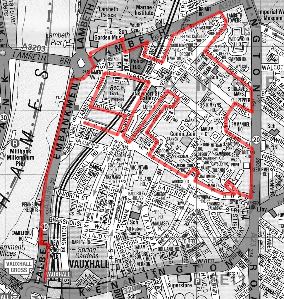
Day 70 Part 2 – Black Prince Road – Lambeth Road – Albert Embankment

On to the second leg of this excursion and this time we’re knocking off the triangle of streets bounded by Black Prince Road, Kennington Road and Lambeth Road then heading back down the Albert Embankment to Vauxhall station.

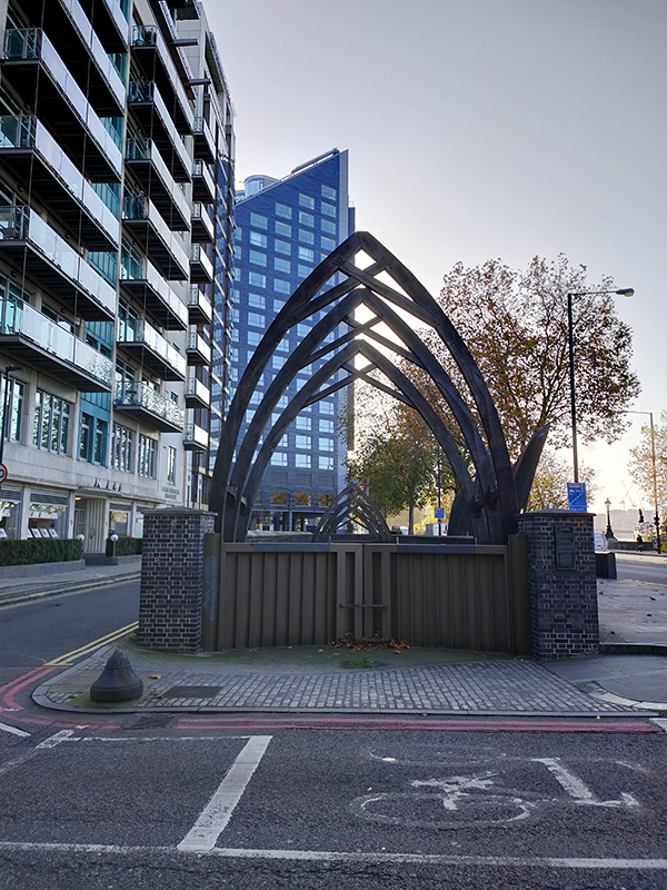
We start on the Albert Embankment at White Hart Dock. The origins of a dock and slipway at this site can be traced back to the 14th century. The present structure was built c.1868 as a parish dock when the Albert Embankment was constructed by the Metropolitan Board of Works to improve flood defences. Several other inland docks were built to enable continued access to the river for firms such as the Doulton Pottery (see below) but now only White Hart Dock remains. It was used to hold an Emergency Water Supply during the Second World War and the faded EWS logo can still be seen on the brickwork of the western wall. In 1960 the Borough of Lambeth sought to close White Hart Dock as it had “not been used by commercial craft for very many years” but the proposal wasn’t implemented and the Dock just fell dormant and largely unnoticed. Then in 2009, the Dock was cleaned and refurbished and Handspring Design were commissioned by Lambeth BC to create the timber sculpture now seen in and around it. Made in Sheffield from sustainably sourced English Oak, the arches and boats celebrate the meeting of land and river and remind us of the site’s long history.

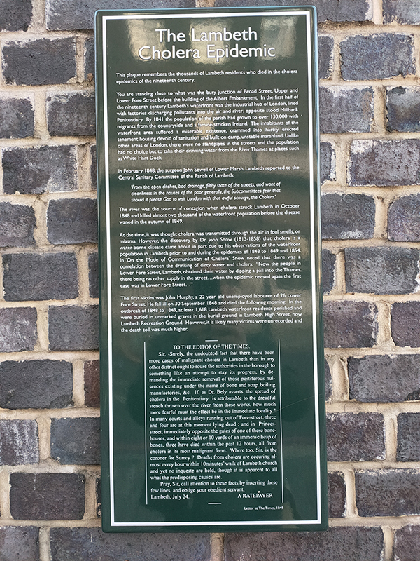
There is also a plaque here (possibly the wordiest you’ll find in the whole of London) commemorating the victims of the mid-nineteenth century Lambeth Cholera Epidemic. During 1848 and 1849 at least 1,600 nearby residents (who took their water directly from the river) died of cholera and were buried in unmarked graves. It was by studying this tragedy and the 1854 outbreak in Soho (which we covered many moons ago) that Dr John Snow (1813 – 1858) was able to conclude that cholera was a waterborne disease rather than one transmitted through the air.

Heading away from the river on Black Prince Road named as you will recall (if you were paying attention last time) after Edward of Woodstock, the eldest son of Edward III. Edward junior never made it onto the regnal throne as he died of dysentery at the age of 46. Instead, on the death of Edward III, succession passed to the Black Prince’s 10 year old younger son, Richard (II). At the junction with Lambeth High Street stands the formidable Southbank House which is the only surviving part of the Doulton Pottery complex that dominated this area from the early Victorian era until the mid 1950’s. This Grade II listed gothic extravaganza with its striking pink and sandy-coloured terracotta ornamentation was built in 1876-78, probably to a design of architect, Robert Stark Wilkinson. The building housed the pottery’s museum and art school as well as serving as company HQ. During WW2 the pottery’s industrial buildings presented an easy target for German bombers and the resulting destruction hastened the process of transferring production facilities to Stoke-On-Trent which had begun in the the 1930’s. New clean air regulations finally sounded the death knell for the Lambeth factory in 1956 and demolition of all the buildings apart from the HQ followed shortly thereafter.

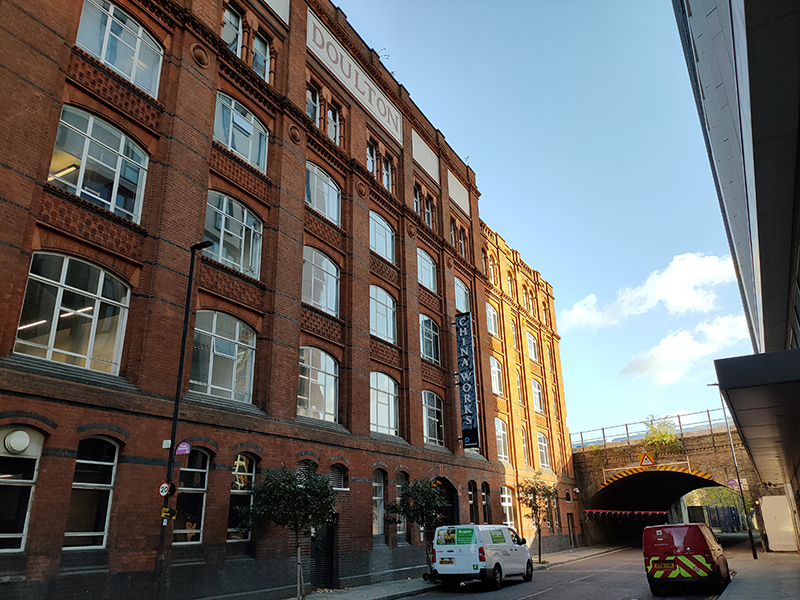
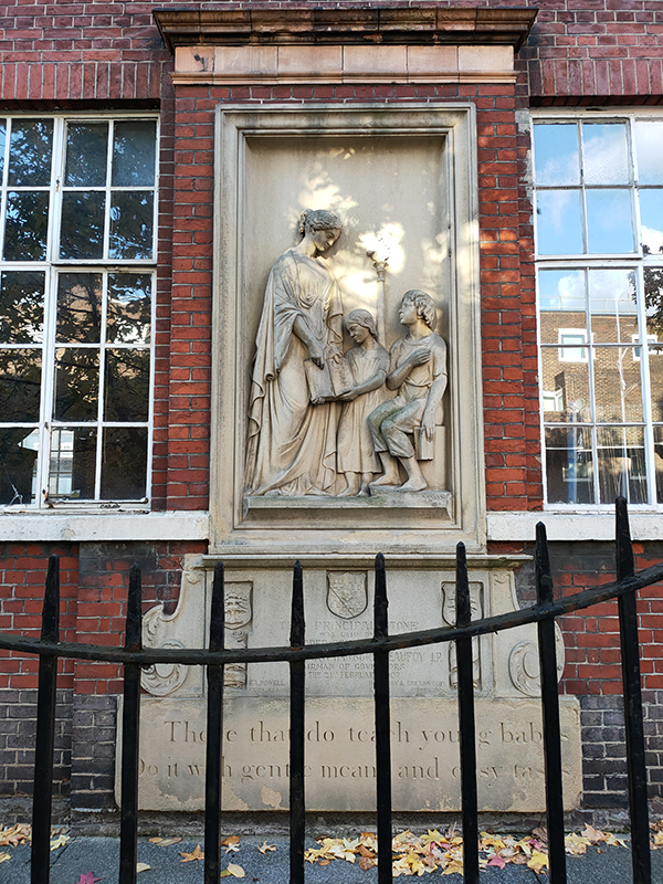
Beyond Southbank House and after passing under the railway we turn left into Newport Street. Adjacent to the railway, the Beaconsfield Contemporary Art Gallery occupies the southern (girls) wing and only remaining part of the former Lambeth Ragged School. This was built 1849-1851 by Henry Beaufoy, whose family wealth came from the vinegar trade, in memory of his late wife, Eliza. Originally the plot had been owned by South-Western Railway and in 1903 the decision was made to sell the site back to them. One year later most of the school was knocked down when the railway was widened. Network Rail still own the freehold for the site. Beaconsfield took over the lease from the London Fire Brigade in 1994 and worked with LKM Architects to restore the building and transform it into a contemporary art space. 

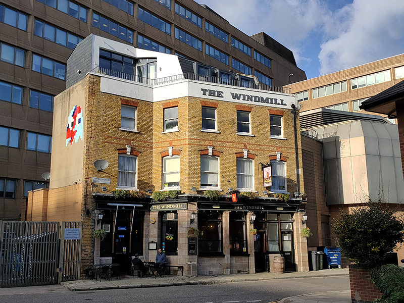
We turn left after the gallery, back under the railway, along Whitgift Street, named after John Whitgift who was Archbishop of Canterbury from 1583 to 1604. At the end we turn right into Lambeth High Street past the Windmill pub, renowned for its extensive selection of rums apparently.

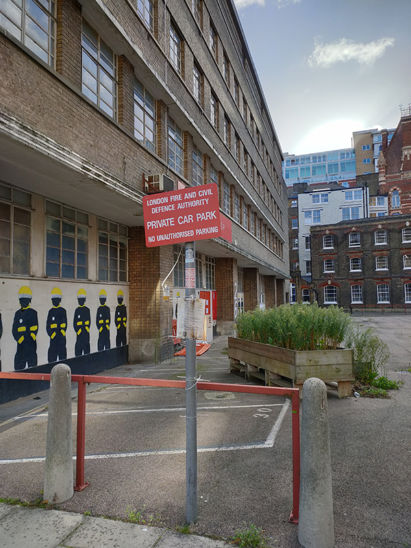
The building behind the pub was formerly the headquarters of the London Fire Brigade and looking back down Lambeth Hight Street towards the rear of Southbank House there is some vestigial evidence of this.

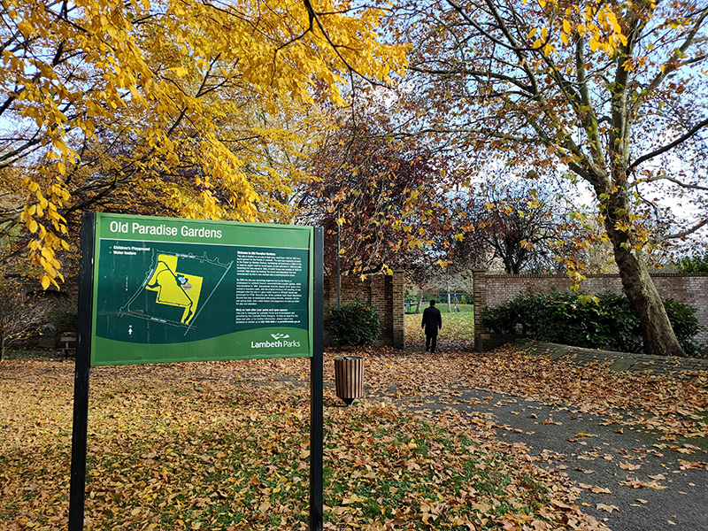
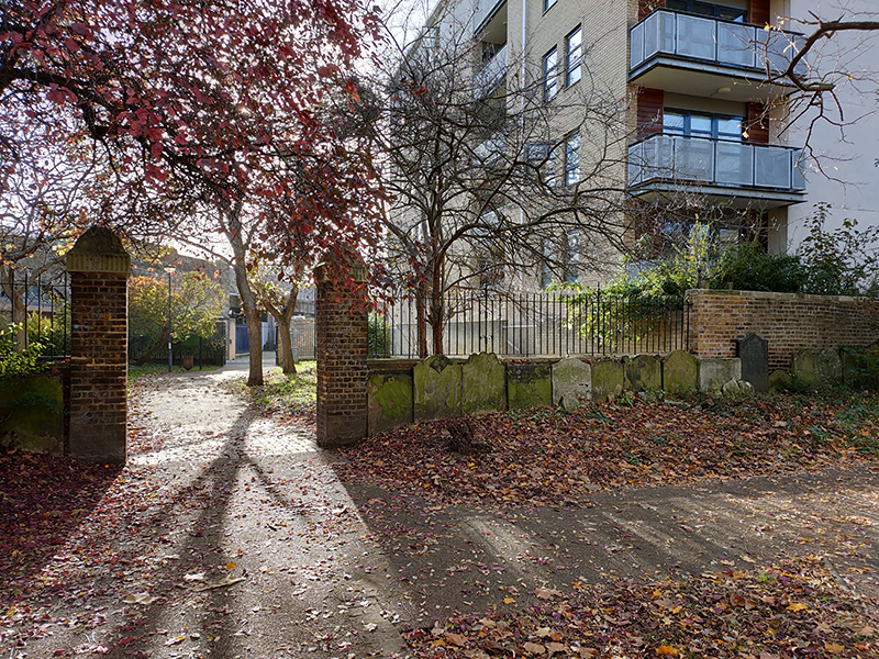
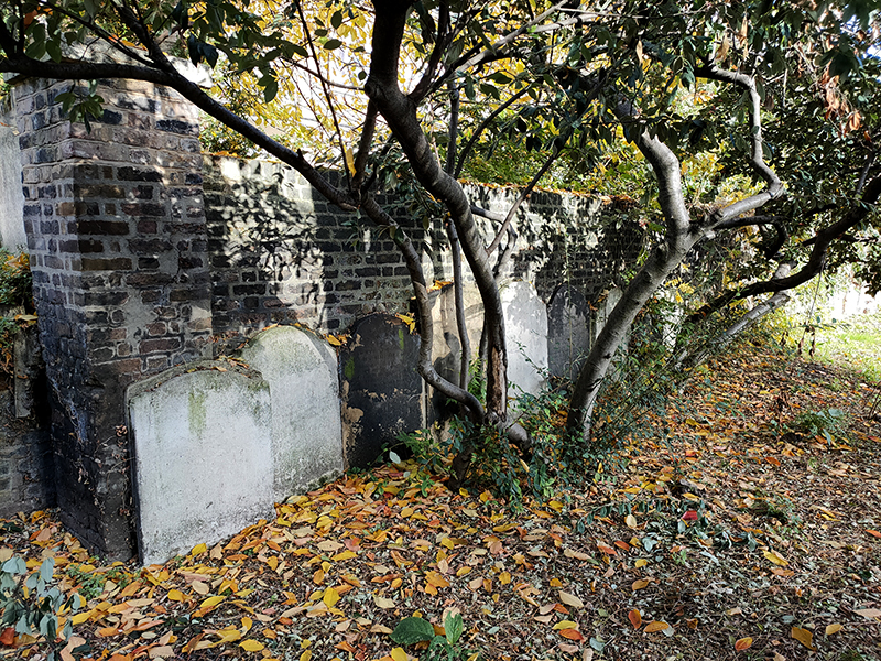
To the east of Lambeth High Street at its top end lie the Old Paradise Gardens. These public gardens were opened in 1884 on the site of what had been the burial ground for St Mary’s Church from 1703 to 1853. The old gravestones can still be seen around the perimeter of the gardens, the walls of which are Grade II listed. Originally known as Lambeth High Street Recreation Ground the gardens were renamed in 2013 following refurbishment.

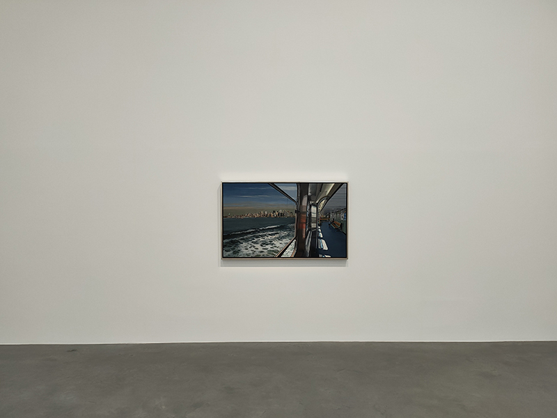
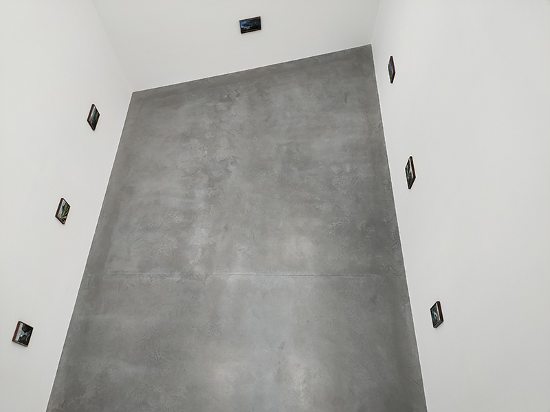
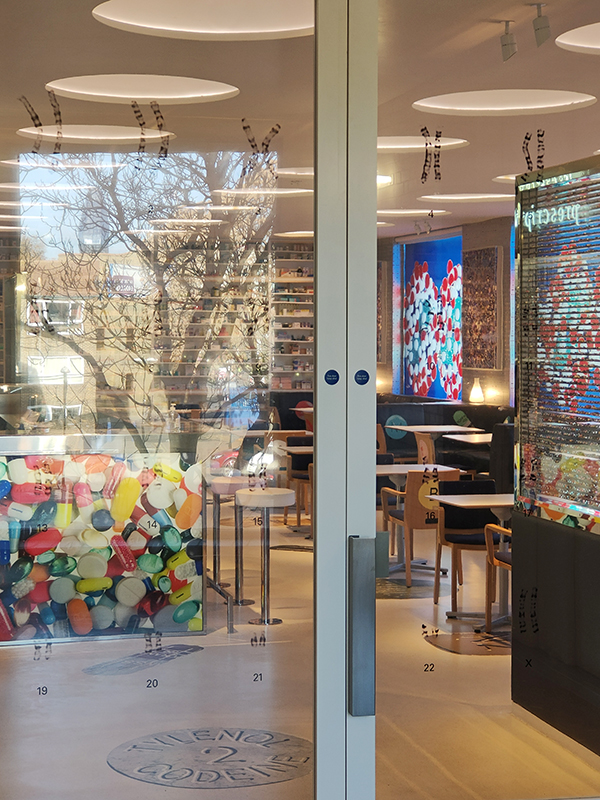
Just beyond the gardens is Old Paradise Street which takes us east to the top end of Newport Street home to the eponymous gallery, created through the conversion of three listed buildings, which were purpose-built in 1913 to serve as scenery painting studios for the booming Victorian theatre industry in London’s West End. With the addition of two new buildings, the gallery now spans half the length of the street. It opened in 2015 for the purpose of displaying works from Damien Hirst’s private art collection to the public free of charge. The current exhibition, which runs until 12 December 2021, features the hyper-realistic paintings of Richard Estes, a mixture of vignettes of American urban life and panoramic landscapes.

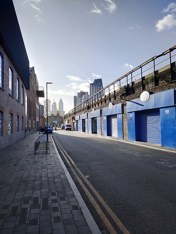
The railway arches on the other side of the street are all part of the Pimlico Plumbers empire.

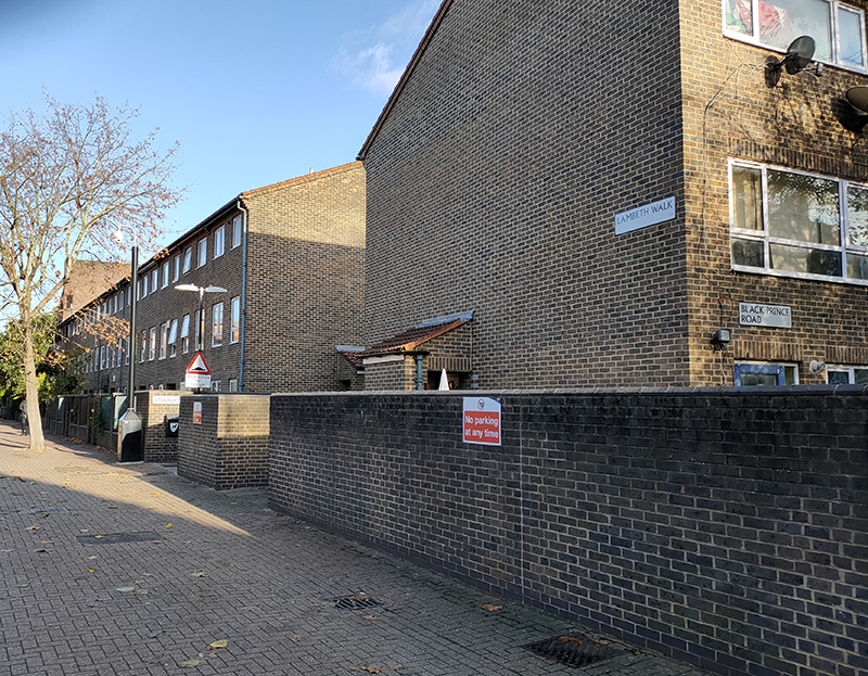
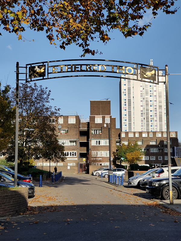
Beyond these, heading south again, we’re back on Black Prince Road and moving eastward into what was one of the largest conglomerations of social housing in the capital. Or at least it was when the various apartment blocks and towers where originally constructed in the late sixties and early seventies. These days there is a significant interspersal of private ownership. We make an immediate loop of Lambeth Walk, Lollard Street and Gibson Road (and we’ll come on to the cultural resonance of the former later on) to start with. Then further east on Black Prince Road, Marylee Way provides the main route into the Ethelred Estate. In 2012 the residences in Ethelred and its sister estates, Thorlands and Magdalen, still owned by Lambeth Council (around 1,300 leaseholds and tenancies) were transferred to Housing Association, WATMOS. This was after a ballot of tenants in which 51.1% voted in favour. Hopefully it’s working out better than Brexit.

The estates are to the north of Black Prince Road. Of note on the south side is the Beaufoy Institute, built in 1907 by Henry’s nephew, Mark Hanbury Beaufoy, as a technical school for boys and also to replace his uncle’s Ragged School which had been torn down three years earlier. The Beaufoy vinegar-making dynasty began in 1741 when the family switched from the distilling of gin, apparently horrified by the damage it caused and its toxic ingredients. Their malt vinegar was used on ships as a ‘fumigator, antiseptic and preservative’ and the Beaufoys acquired a lucrative Navy contract. They also produced ‘sweets’ or ‘mimicked’ wines from raisins with added sugar and by 1872 were advertising cordials and non-alcoholic drinks as well. The Beaufoy vinegar works were bombed in 1941, and the Institute was requisitioned for use by women manufacturing munitions. It returned to use as a school after the war, before being eventually acquired by Lambeth Council. It was bought by the London Diamond Way Buddhist Centre in 2012.

At the eastern end of the street named after him the Black Prince is also commemorated with a pub on the corner with Hotspur Street.

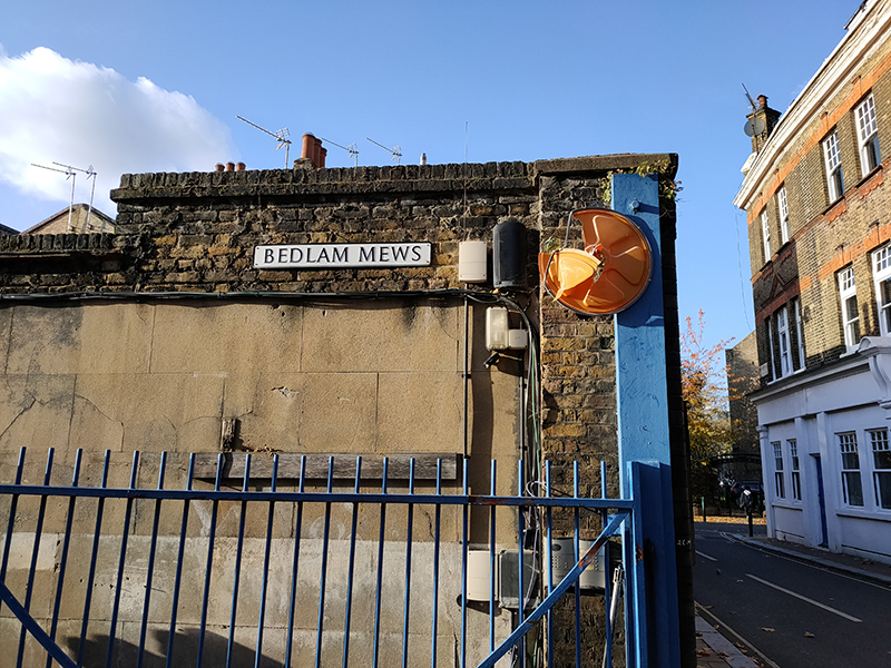
We turn north up Kennington Road then dip into the estates and back out again via Lollard Street, Distin Street and Fitzalan Street. Further up Kennington Road we veer off along Walnut Tree Walk which returns us to Lambeth Walk. En route we encounter Hornbeam Close and Bedlam Mews, which some local vandals have decided merits some retrospective nominative determinism.

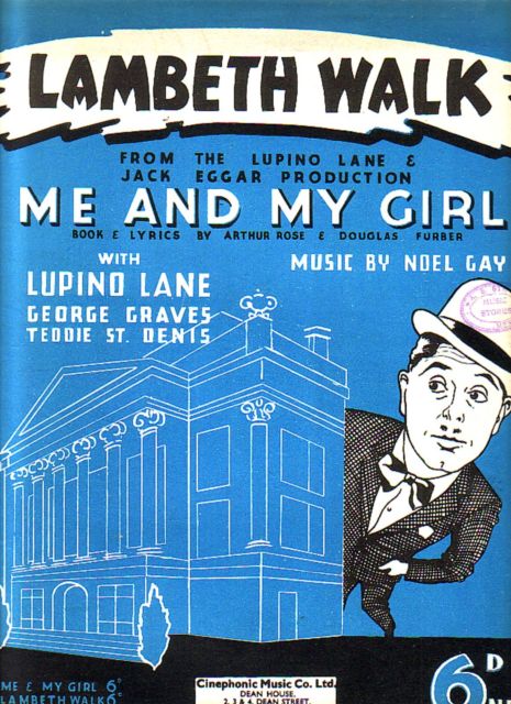
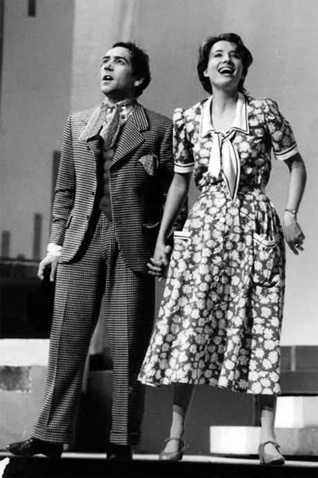
Lambeth Walk is, of course, best known for being the title of one of the songs in the 1937 musical Me and My Girl. The contemporaneous musical, with music by Noel Gay and original book and lyrics by Douglas Furber and L. Arthur Rose, tells the story of an unapologetically unrefined cockney gentleman named Bill Snibson, who learns that he is the 14th heir to the Earl of Hareford. It was revived several times in the 1940’s and made a triumphant return to the West End in 1984 in a version revised by Stephen Fry and starring Robert Lindsay and Emma Thompson.
I have to say that if the song didn’t already exist I doubt anyone would be inspired to write it by the present-day Lambeth Walk.

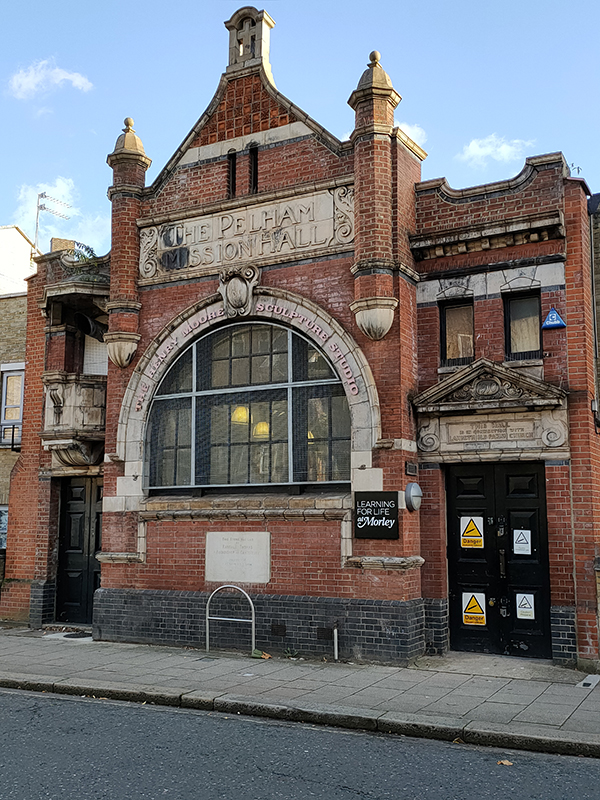
It does however boast Pelham Hall which was built as Lambeth Mission Hall in about 1910 and is distinguished with an exterior pulpit.  The building is now home to the the sculpture department of Morley College.

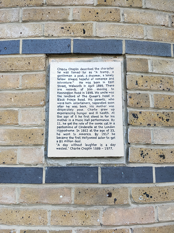
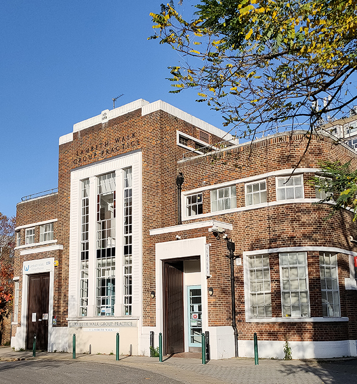
On the wall of the adjacent Chandler Hall Community Centre is a stone plaque dedicated to Charlie Chaplin who lived in the area in his youth and whose uncle ran the (long since departed) Queens Head pub in Black Prince Road. No. 5 Lambeth Walk, on the junction with China Walk, was built in 1958 to replace the Victorian municipal swimming baths which a V2 bomb had destroyed in 1945. The new building had no pool but provided slipper baths and laundry facilities for the local community. In the early 1990’s it was reconfigured for use as a GP practice.
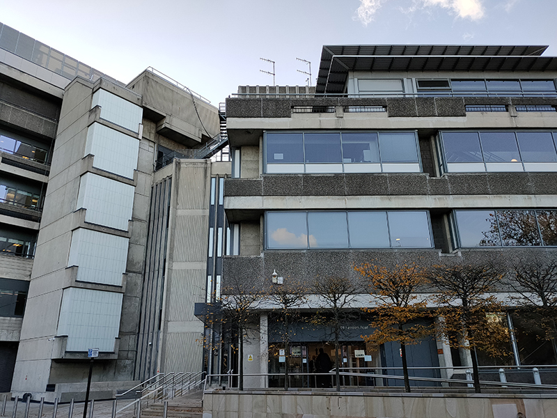
Lambeth Walk doglegs into Lambeth Road where he turn left and head down towards Lambeth Bridge. At 109 Lambeth Road is the building that houses the Metropolitan Police’s Forensic Science Laboratory. It also hosts the Met’s 24 hour emergency call centre and its Lost Property office (inter alia). And it does more than nearly any other building of its era to give Brutalist architecture a bad name (not that it’s not intrinsically a bad name to start with).
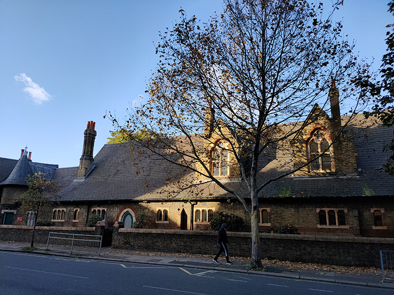
Across the road, in stark contrast, is the former Holy Trinity Primary School (1880) now part of Fairley House School (for children with learning difficulties).

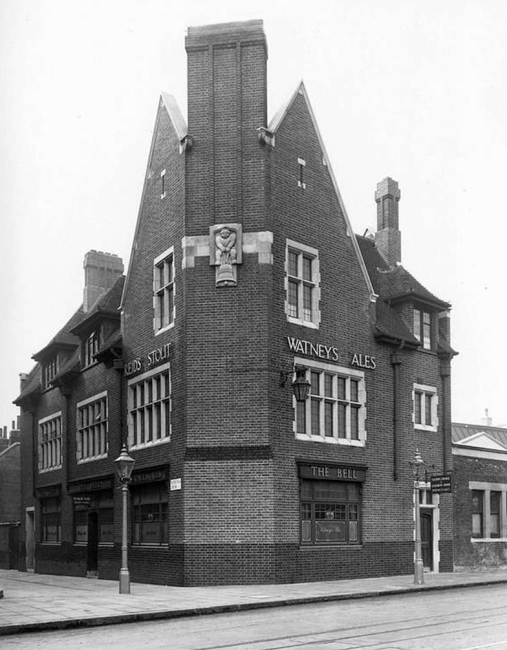
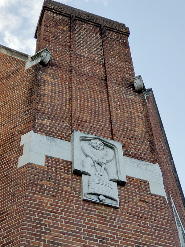
Back on the same side of the road as the Met and just beyond it stands the Bell Building which is a poster child for the sympathetic redevelopment of former public houses into residential space. Crucially the emblematic exterior sculpture of a man lifting a heavy bell has been retained.
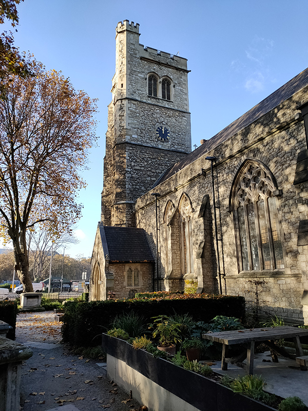
Crossing the road again we’re in front of the former St Mary’s Church which was saved from demolition in 1977 by Rosemary and John Nicholson who turned it into The Garden Museum. The church is the burial place of John Tradescant The Elder (c1570 – 1638), the first great gardener and plant-hunter in British history. Tradescant was gardener to Robert Cecil, 1st Earl of Salisbury then to George Villiers, 1st Duke of Buckingham (remember him) and finally to Charles I, after Buckingham’s assassination. His son, John Tradescant The Younger (1608 – 1662), followed in his footsteps as royal head gardener and is buried beside him. The first church on this site predates the Norman Conquest and is mentioned in the Domesday Book. The present church was originally built in 1337 and the bell tower still largely retains its 14th century form. The rest of the building was substantially rebuilt in the Victorian era.

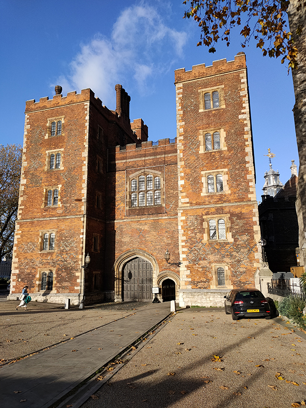
Turn to the right beyond St Mary’s and you’re face to face with Lambeth Palace or, more specifically, Morton’s Tower. You can’t go beyond this gateway as a rule since, as it rather pompously states on the website, this is “a working palace and a family home” and therefore not open to the public except on rare special occasions. The Tower was built by John Morton, Archbishop of Canterbury in 1486–1501 and is one of the few surviving examples of the early Tudor style of brick building. From the time of its completion onward the “Lambeth Dole” of bread, broth and money (which originated in the 13th century) was dispensed to beggars at the gate. In his 1785 History of Lambeth Palace archivist Andrew Ducarel writes that in his day it was regularized and consisted of a weekly allowance of 15 quartern loaves, 9 stone of beef and 5s., which were divided amongst around 30 poor parishioners and distributed three times a week. The practice was discontinued after 1842 and replaced with direct pecuniary grants to the poor.

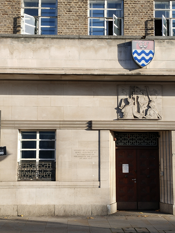
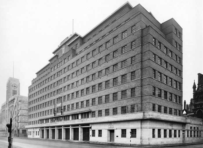
After negotiating the roundabout at the nexus of Lambeth Road and Lambeth Bridge we set off on the final stage of today’s journey, southward along the Albert Embankment to Vauxhall Station. Almost immediately on the left is the headquarters of the International Maritime Organization and just beyond that the former HQ of the London Fire Brigade (as referenced earlier). Commissioned by the London County Council, the building was designed by EP Wheeler, architect to the LCC, with sculpture work by Gilbert Bayes, Stanley Nicholas Babb and FP Morton. It was opened by King George VI in 1937. Despite not being one of the prime examples of 1930’s architecture in the capital it has acquired a Grade II listing. In 2020 a plan to redevelop the building into a new home for the LFB Museum and erect two towers of over 20 storeys each immediately behind creating over 400 flats and a 200 bedroom hotel was submitted to public inquiry. Although the scheme had the support of the London Fire Commissioner and Lambeth Council it was vetoed by the Secretary of State for Housing in the summer of 2021. (The main objection being, I think, that it would spoil the views from the Palace of Westminster).
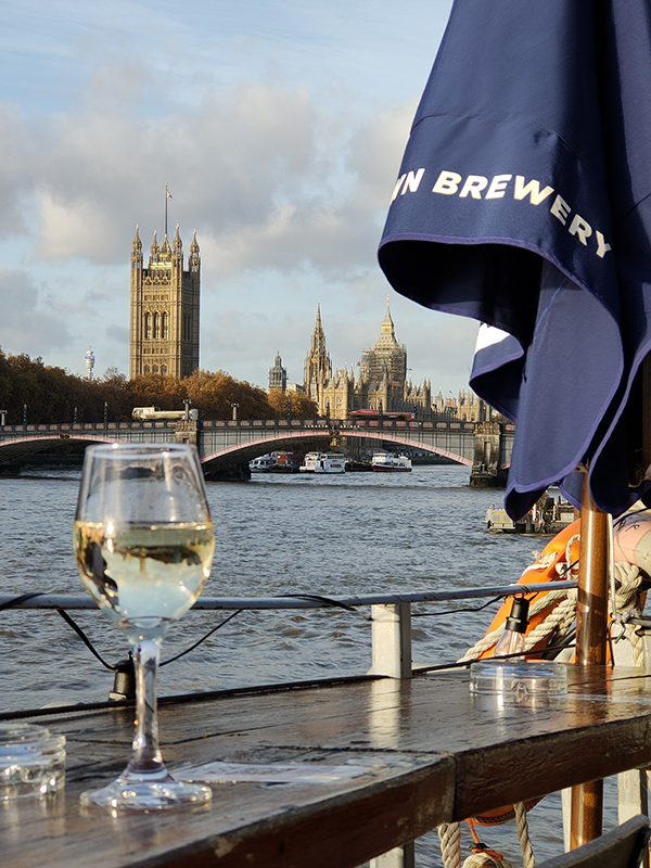
Time for the pub of the day finally, and in the face of plenty of stiff competition, the sunny skies tipped the balance in favour of the Tamesis Dock, a converted 1930’s Dutch barge, permanently moored on the river opposite the Millbank Tower.

These floating bars tend to charge over the odds but this one was pretty reasonable and thanks to the mild weather (for mid- November) I was able to enjoy a glass of wine and some baked goats cheese up on the deck, in glorious isolation and with a great view of the Houses of Parliament. Until I drew the attention of the local gulls that is.

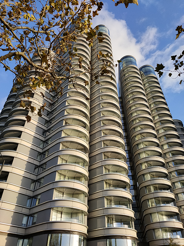
Lambeth Council actually designated the Albert Embankment riverfront an Area of Conservation in 2001 but as noted earlier this hasn’t stopped them approving plans for redevelopment. The Corniche Building, designed by Foster & Partners, was completed in spring 2020 and along with the adjacent Dumont and Merano residential blocks has created 472 new luxury apartments close to the river.

As we approach Vauxhall Bridge the railway converges with the Albert Embankment and the river moves away.
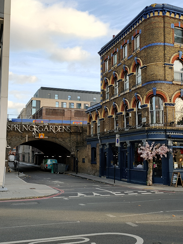
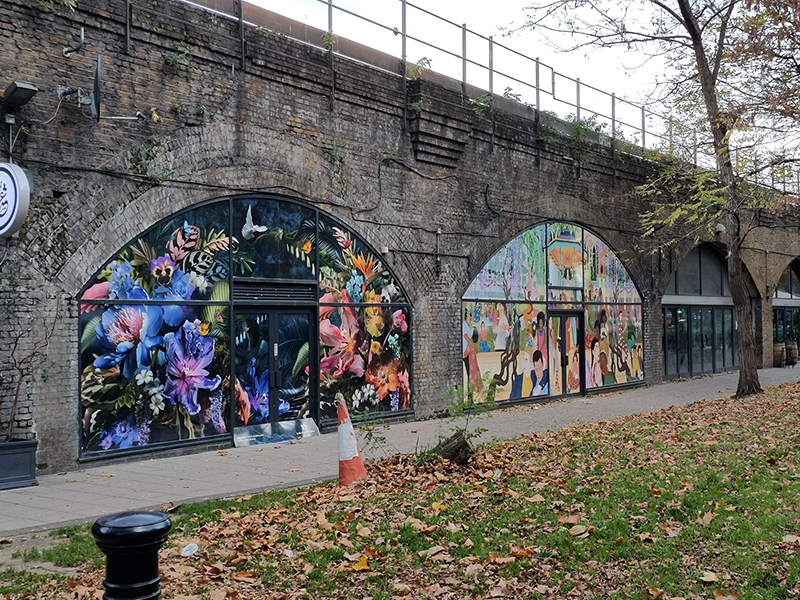
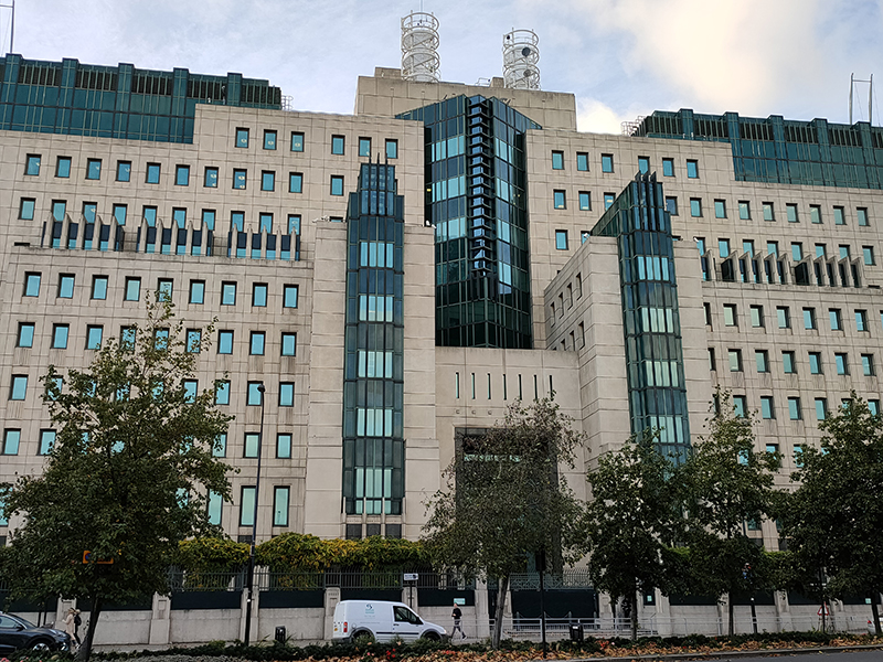
The space between the road at the river here at Vauxhall Cross is famously occupied by the MI6 Headquarters. Officially the organisation that operates out of these premises is called the Special Intelligence Service (SIS). The MI6 pseudonym was used extensively during WW2 especially if an organisational link needed to be made with MI5 (the Security Service) but it is no longer applied by the secret services themselves. Of course it’s still the go-to appellation as far as the media and popular culture are concerned. SIS moved to Vauxhall Cross in 1994 from its previous home, Century House, on Westminster Bridge Road (see Day 55). Architect Terry Farrell won the competition to design the new HQ and he took his inspiration from 1930s architecture such as Battersea and Bankside power stations, as well as Mayan and Aztec temples. The building has 60 different roof areas and six perimeter and internal atria, and also incorporates specially designed doors and 25 different types of glass to meet the Service’s specific needs. Vauxhall Cross has, of course, featured in many of the films in the James Bond franchise made since it was opened. The building was first featured in GoldenEye in 1995 and is depicted as coming under attack in The World Is Not Enough (1999) and Skyfall (2012). In fact in the latter the front of the building is completely destroyed in an explosion. A 15 metre high model of the building was constructed at Pinewood Studios to create this illusion which was cheered by MI6 staff at a special screening of Skyfall at Vauxhall Cross. Filming for the 24th film in the series, Spectre, took place on the Thames near Vauxhall Cross in May 2015, with the fictional controlled demolition of the building playing a key role in the finale sequence of the film.

The light is beginning to fade as we head up onto platform 8 of Vauxhall Station and before the train arrives to take us back to the suburbs there’s just time to contemplate how very different this view would have looked just a couple of years ago.

Day 55 – The Cut – St George’s Circus – London Road – Borough Road – Blackfriars Road

I think it’s fair to say that just about everywhere I’ve visited so far during this project is a places I’ve been to at least once before during the thirty odd years I’ve been resident in the London Metropolitan Area. Today’s foray however took me to some locations that I had genuinely never set eyes on before (and to be honest am unlikely to ever again). We’re taking about the area to the south and east of Waterloo stretching almost as far from the river as the wilds of the Elephant & Castle.

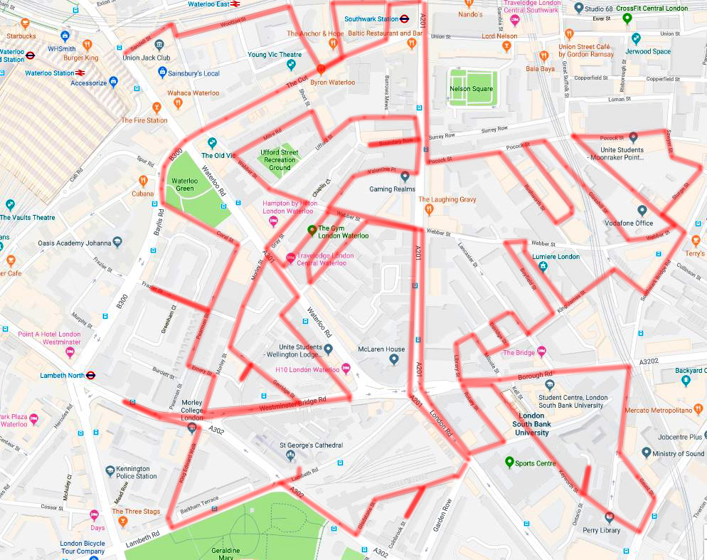
Day 55 Route

For the third and final time we set out from Waterloo Station, taking Sandell Street to the east then hopping over Cornwall Road into Wootton Street. At the end of this we turn right on Greet Street and pay a brief first visit to The Cut before turning left down Hatfields. On reaching the railway track we follow leafy Isabella Street east in front of the parade of restaurants that now occupy the railway arches.

At the far end Joan Street dog legs left past the lumpen monstrosity that is Colombo House, a 1969-built outpost of the BT empire. We follow Joan Street back to Hatfields and then take Meymott Street east onto Blackfriars Road. The building below, 209-215, was refurbished as recently as 2011 but is apparently under threat of demolition as part of Southwark Council’s plans to turn the Blackfriars area into an extension of the City.

IMG_20180830_132047
IMG_20180830_132217
Just before the railway bridge we cut down an alleyway (unofficially known as Falafel Alley due to its being home to a number of Turkish foodstalls) and utilise this and the top section of Joan Street to circumvent Southwark Tube Station in returning to The Cut which we then follow west all the way back to Waterloo Station. First point of interest en route is the Anchor and Hope pub, rebuilt here in 1936. The name, Anchor and Hope, and also its reverse which is more frequently encountered supposedly have a biblical origin, being a reference to a quotation from the Letter to the Hebrews (6: 19), “We have this as a sure and steadfast anchor of the soul, a hope”.

IMG_20180830_132619

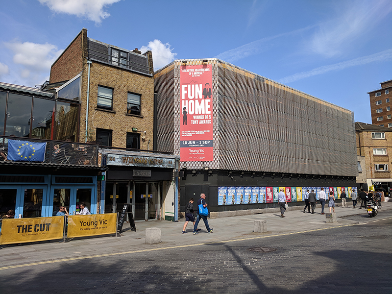
A short way further up on the same side of the street is the Young Vic theatre. The Young Vic Theatre Company was formed as an offshoot of the Old Vic (in the days when that was the home of the National Theatre) with a remit to produce classic plays for young audiences and also develop more experimental work. Its first Director, Frank Dunlop, oversaw the construction of the theatre building in 1970, taking over a butcher’s shop and extending onto a bomb-site where 54 people sheltering in a bakery had died in WW2. It was intended to last for five years, but has become a permanent venue.
The Young Vic primarily performs classic plays, but often in innovative productions. Many well-known actors have worked here including Ian Charleson, Vanessa Redgrave, Helen Mirren, Judi Dench, Timothy Dalton, Robert Lindsay, Willard White, John Malkovich, Michael Sheen and Arthur Lowe.
The Who performed free weekly concerts at the Young Vic in early 1971 in order to rehearse their  album, Who’s Next. One of these shows was released on the Deluxe edition of the album. Between 2004 and 2006 the old breeze-block building was rebuilt, though the main auditorium was left intact and the butcher’s shop was retained as the main entrance and the box office.

IMG_20180830_132813

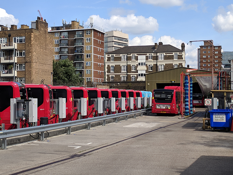
Just before we get to the end of The Cut we take a quick detour off to the right down the southern-most section of Cornwall Road. Down here are the sleeping quarters for the single-decker 521 and 507 buses which link Waterloo Station with its mainline counterparts at London Bridge and Victoria respectively.

IMG_20180830_133134

Back up on The Cut we come to the Old Vic theatre, standing on the corner with Waterloo Road. A theatre was first established here in 1818 and known as the Royal Coburg Theatre. In 1833 it was renamed the Royal Victoria Theatre and in 1871 was rebuilt and reopened as the Royal Victoria Palace. It was then taken over by the philanthropist Emma Cons (1838 – 1912) in 1880 and formally named the Royal Victoria Hall, although by this time it was already known as the “Old Vic”. In 1898, a niece of Cons, Lilian Baylis (1874 – 1937), the force behind Sadler’s Wells, assumed management and began a series of Shakespeare productions from 1914 onward. The building was damaged in 1940 during air raids and it became a Grade II listed building in 1951 after it reopened. As noted in the last post, the Old Vic was the first home of the National Theatre from 1963 up until 1976. In 1982 the theatre was put up for sale through a sealed bid. Canadian entrepreneur Ed Mirvish outbid Andrew Lloyd Webber and spent £2.5 million restoring the building. The facade of the building was based on an 1830 engraving while the auditorium was modelled on the designs of 1871. In 1998 the Mirvish family put the theatre on the market. Suggestions for changing it into a themed pub, a bingo hall or a lap-dancing club provoked widespread outrage and protests, in response to which, it was acquired by The Old Vic Theatre Trust 2000, a registered charity. In 2003 it was announce that the theatre would recommence in-house production (rather than just being a home for visiting productions) with Kevin Spacey appointed as the first Artistic Director of the newly created Old Vic Theatre Company. Spacey’s tenure ended in 2015 and we all know what’s happened subsequently. Following an initial allegation of sexual misconduct against Spacey by actor Anthony Rapp up to 20 employees of the Old Vic have come forward with similar complaints of unwanted advances. To put it mildly, not exactly what the Old Vic would have wanted as it celebrates its 200th anniversary in 2018.

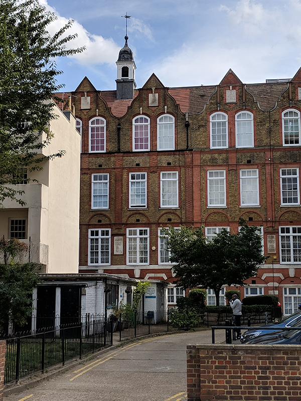
Passing the theatre we cross Waterloo Road into Baylis Road, named after Lilian, and then on the other side of Waterloo Green turn south down Coral Street. At the end we take a right into Pearman Street and, after a quick dip into Frazier Street, follow this down as far as Emery Street which links through to the parallel running Morley Street emerging opposite the former Webber Row School which was built in 1877 at the height of the Victorian era. Grade II listed since 1988 it’s now the Chandlery Business Centre.

IMG_20180830_134329

We follow Morley Street into Westminster Bridge Road and turn east as far as Gerridge Street which reconnects with Morley Street via Dibdin Row. Morley Street then takes us back to Waterloo Road from where we close the loop courtesy of Webber Row and Dodson Street.  Having arrived back on Westminster Bridge Road we strike north until we get to the Perspective Building at no. 100 then double back. In its former guise as Century House this was the home of the Secret Intelligence Service (SIS) aka MI6 from 1964 to 1994.  The Secret Service’s occupation of the building was supposedly classified information but according to the Daily Telegraph it was “London’s worst-kept secret, known only to every taxi driver, tourist guide and KGB agent”. Century House was described as “irredeemably insecure” in a 1985 National Audit Office (NAO) report with security concerns raised in a survey i.e. the building was made largely of glass, and had a petrol station at its base. MI6 moved to Vauxhall Cross in 1994 (if you’ve seen Skyfall you know what an upgrade in security that was).  Century House was refurbished and converted into the residential Perspective Building by Assael Architecture in 2001.
IMG_20180830_135743

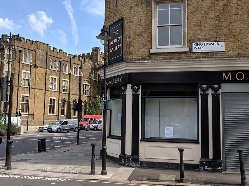
Returning southward along Westminster Bridge Road we arrive at Morley College, currently under redevelopment. Morley College is one of the main adult education centres in London; it was founded it the 1880’s and currently serves around 11,000 students. The college’s origins lie in the series of “penny lectures” introduced by the aforementioned Emma Cons as part of the programme of the Royal Victoria Hall when she took that over. The success of these led to the founding of the College thanks to an endowment from the MP, Samuel Morley. The College has been long renowned for its Music Department; Gustav Holst was Music Director from 1907 to 1924 and Michael Tippett held the same post from 1940 to 1951.

IMG_20180830_140003

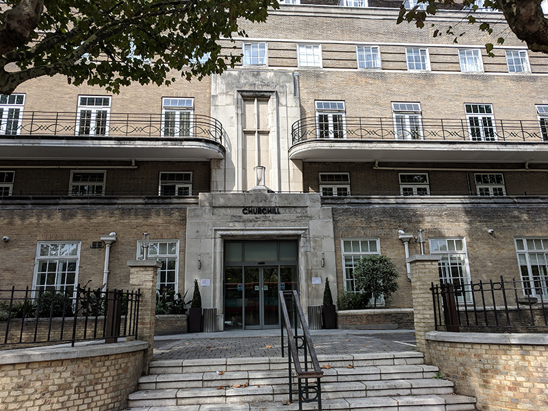
Turning the corner by the College we head down King Edward Walk until we reach Lambeth Road and turn left here, continuing on the opposite side of the road from the  grounds of the Imperial War Museum. Inset off the road here is Barkham Terrace which is mainly comprised of the building which now houses the Cambian Churchill mental health rehabilitation hospital. You wouldn’t know this from the outside though – I assumed it was just another residential conversion. The building dates from 1940 when it was opened as the Catholic Hospital of Our Lady of Consolation in Southwark. At the time the Catholic Herald described it as “ a splendid six-storey hospital whose creamy facade brightens the drabness of Lambeth Road”.

IMG_20180830_140237

At the junction of Lambeth Road and St George’s Road stands the Roman Catholic St George’s Cathedral, Southwark. St George’s was built in 1848 prompted by the swelling of the local congregation thanks to the influx of Irish immigrants into the area. Four years later it became one of the first four Catholic churches in England and Wales (and the first in London) to be raised to cathedral status since the English Reformation.  It was designed by Augustus Pugin (1812 – 1852), famous for his work with Charles Barry on the design of the rebuilt Houses of Parliament. Pugin was the first person to be married in the church, to his third wife Jane. The Cathedral was extensively damaged by an incendiary bomb during WW2. After the war (the fabulously named) Romilly Craze was commissioned to take charge of the rebuilding and the restored Cathedral was opened in 1958. Since then it has resumed its role as a focal point in the local community and has played host to many notable visitors, including the Dalai Lama (1998) and Pope John Paul II (1982), the latter being depicted in one of the Cathedral’s many fine stained-glass windows.

This slideshow requires JavaScript.

After our visit to the church we head south on St George’s Road towards Elephant & Castle. Having passed Notre Dame High School for Girls, founded by the Sisters of Notre Dame de Namur in 1855, we turn off to the left down Gladstone Street.

Gladstone Street and its offshoot, Colnbrook Street, are the epitome of the gentrification of this part of south London with their smartly done-up early Victorian terrace properties.
IMG_20180830_142543

This is reinforced by today’s pub of the day, the Albert Arms, which sits on the corner of Gladstone Street and Garden Row just across from the converted Ice Cream Factory. The gastro-pub menu isn’t really conducive to light lunchtime eating but it was gone 2.30pm and I was starving so I felt compelled to stump up £6.50 for three very small pulled-pork croquettes. In the Gents they’ve put up a framed poster of that lady tennis player scratching her bare bottom – I assume this is hipster irony.

IMG_20180830_142951

Having finished the aforementioned croquettes (and half a lager) I venture out onto London Road and take a northward turn, past several far more suitable eating spots, up to St George’s Circus. This nexus of five main arterial roads was created in 1771 as the first purpose-built traffic junction in London. Initially the middle of the roundabout was adorned by an obelisk with four oil lamps affixed to it but in 1905 this was relocated to in front of the Imperial War Museum and was replaced by a new clocktower. However by the 1930’s the clocktower was deemed a “nuisance to traffic” and was demolished. It took until the late 1990s before the obelisk was returned to its original location, now without the oil lamps. At the base of the obelisk is the inscription Erected in XI year of the reign of King George MDCCLXXI, with the inscriptions on the other three sides reflecting the obelisk’s one-mile distance from Palace Yard, London Bridge and Fleet Street.

This slideshow requires JavaScript.

Crossing over the Circus we continue north up Blackfriars Road for some distance before turning off west along Webber Street which is on the far side of another of the Peabody Estates we’ve become familiar with.

IMG_20180830_150521

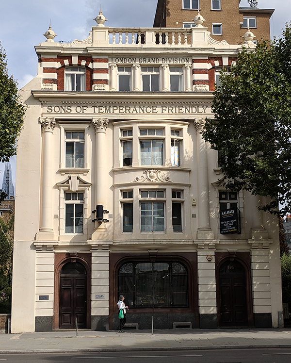
We’re heading back down towards the Old Vic now, criss-crossing between Webber Street and Waterloo Road by way of Webber Row, Baron’s Place and Gray Street. Just before we reach the theatre we take a sharp right onto Mitre Street and then navigate our way back to Blackfriars Road via Short Street and Ufford Street. At no.176 Blackfriars Road is the rather splendid (former) Sons of Temperance Friendly Society Building. The Order of the Sons of Temperance (SOT) was established in New York in 1842 as a teetotalist friendly society, with the dual aim of sustaining its members in a teetotal way of life, and of providing them with a modicum of financial security in case of ill-health, and their families with an insurance payment in the event of their death. The organisation, conceived on Masonic principles with lodges, insignia and rituals, overseen by a Supreme Patriarch, soon spread to other US states and to several Canadian provinces, and had amassed 100,000 members by 1847. The first UK lodges were established in Liverpool and other northern cities in the late 1840s, and in 1853 a National Division of Great Britain was formed. Within this were numerous Grand Divisions, the largest of which, based in London but with branches as far afield as Ipswich and Reading, commissioned the building of 176, Blackfriars Road as its headquarters in 1909-10 with Arthur Charles Russell as architect. The SOT only moved out in 2011 two years after which the building, now occupied by an architect’s practice, was Grade II listed.

IMG_20180830_152502

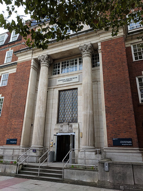
From here on there’s still a lot of streets to cover though not much to detain us en route so we’ll crack on. First off we work our way back to St George’s Circus passing through Boundary Row, Chaplin Close, Valentine Place and Webber Street then retracing our steps up Blackfriars Road. We then return to London Road and head off to the east side starting with Thomas Doyle Street, named after the founder of St George’s Cathedral (check the earlier slideshow for his memorial). This is the first of the streets that fall within the triangle created by London Road, Southwark Bridge Road and Borough Road, the others being Rotary Street, Keyworth Street, Ontario Street and Kell Street. Once we’ve tramped round that lot we end up on Borough Street by the entrance to London South Bank University, an institution which started life as the Borough Polytechnic Institute in 1892.

IMG_20180830_155227

On the other side of the road is another of the public libraries funded by the Victorian philanthropist (word of the day that) John Passmore Edwards. Most of these were built in the East End (we came across the one in Pitfield Street, Hoxton way back in Day 24). This one dates from 1899 and is currently unoccupied save for the presence of  “guardians” installed by the Camelot vacant property services company so its future is uncertain.

Traversing the area between Borough Road and the eastern stretch of Webber Street to the north takes us, in turn, through Library Street, Milcot Street, King James Street, Lancaster Street, Boyfield Street, Silex Street and Belvedere Buildings. The only thing to draw the eye amongst all that lot is this building, the Peabody Gateway Centre, and even that isn’t interesting enough for anyone to have recorded any information about it.

IMG_20180830_155826

Anyway, after all that we find ourselves back on Southwark Bridge Road from where we’re crossing between Webber Street to the south and Pocock Street to the north taking in Great Suffolk Street, Surge Street, Sawyer Street, Glasshill Street, King’s Bench Street and Rushworth Street. Final picture of the day is of Blackfriars Crown Court on Pocock Street which, earlier this year (2108), the Ministry of Justice announced plans to close and sell off. The site is valued at £32m on the Government’s National Asset Register.

IMG_20180830_161026

And so the very final leg of today’s marathon takes us from Pocock Street back onto Blackfriars Road and up to Southwark Tube Station. The tube station stands on the site of the Blackfriars Ring boxing arena that was bombed out of existence in 1940. The Ring arena was originally called the Surrey Chapel, built in 1783, until the strange shaped building was bought by former British Lightweight champion Dick Burge in 1910. Together with his wife Bella they staged many boxing matches including well known fighters such as Len Johnson, Jack Drummond, Alf Mancini, Jack Hood and the legendary Ted ‘Kid’ Lewis. This is all commemorated by the Ring public house that stands opposite the station on the other corner of The Cut and Blackfriars Road.