Day 70 Part 2 – Black Prince Road – Lambeth Road – Albert Embankment

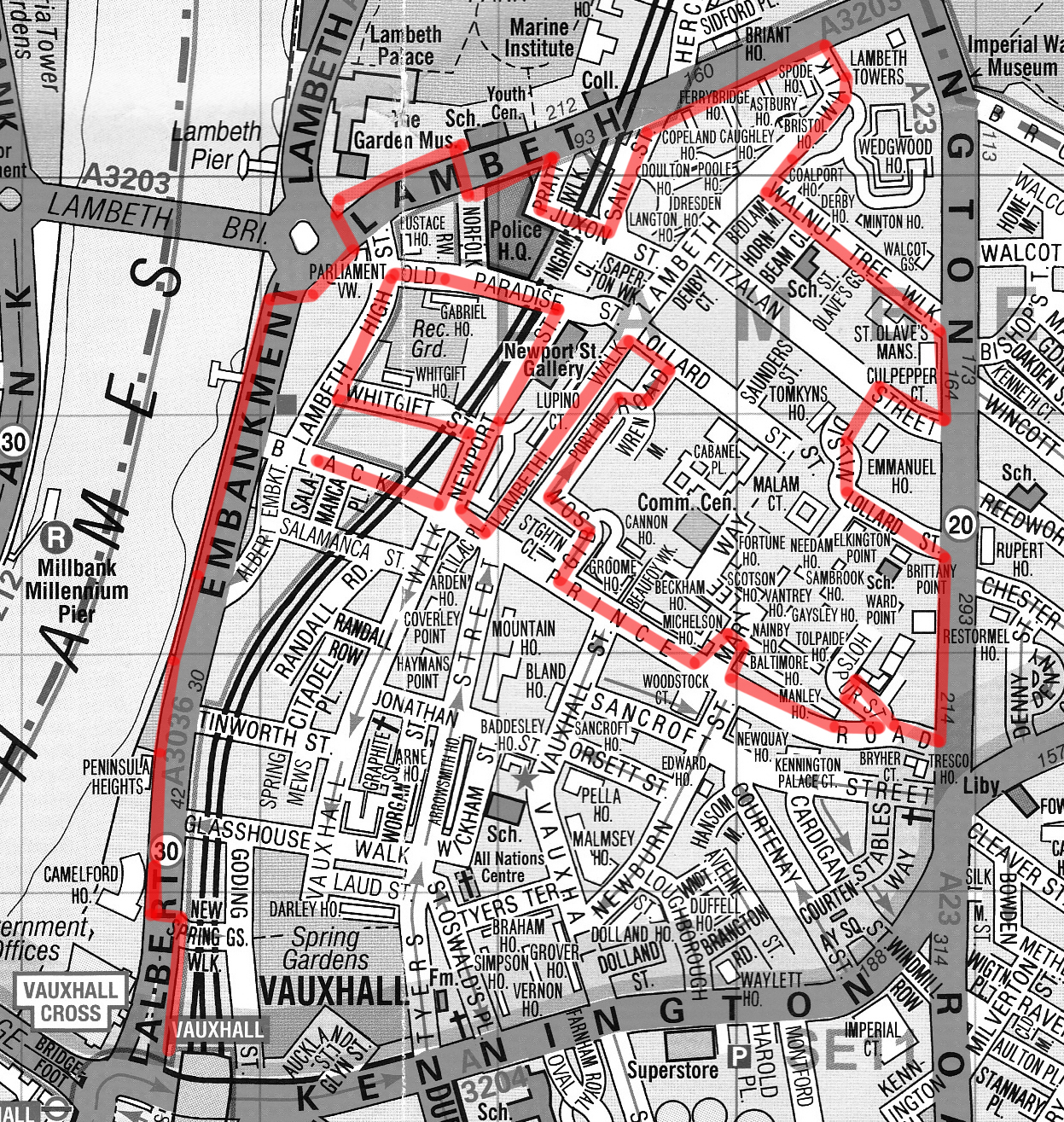
On to the second leg of this excursion and this time we’re knocking off the triangle of streets bounded by Black Prince Road, Kennington Road and Lambeth Road then heading back down the Albert Embankment to Vauxhall station.

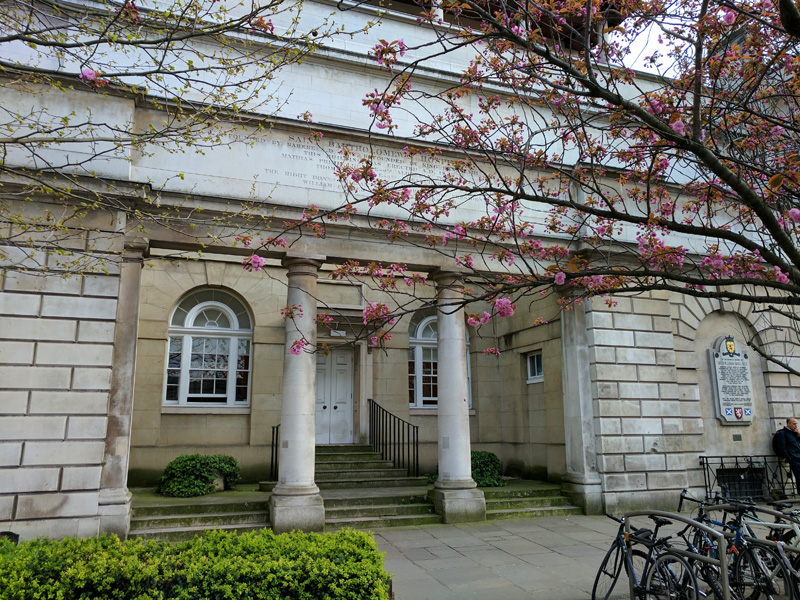
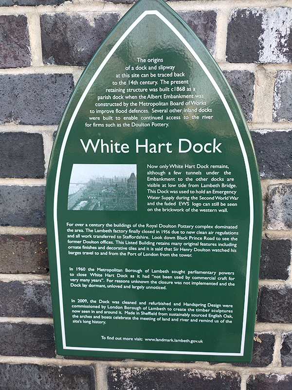
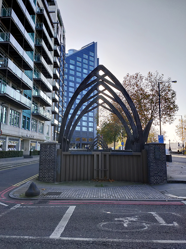
We start on the Albert Embankment at White Hart Dock. The origins of a dock and slipway at this site can be traced back to the 14th century. The present structure was built c.1868 as a parish dock when the Albert Embankment was constructed by the Metropolitan Board of Works to improve flood defences. Several other inland docks were built to enable continued access to the river for firms such as the Doulton Pottery (see below) but now only White Hart Dock remains. It was used to hold an Emergency Water Supply during the Second World War and the faded EWS logo can still be seen on the brickwork of the western wall. In 1960 the Borough of Lambeth sought to close White Hart Dock as it had “not been used by commercial craft for very many years” but the proposal wasn’t implemented and the Dock just fell dormant and largely unnoticed. Then in 2009, the Dock was cleaned and refurbished and Handspring Design were commissioned by Lambeth BC to create the timber sculpture now seen in and around it. Made in Sheffield from sustainably sourced English Oak, the arches and boats celebrate the meeting of land and river and remind us of the site’s long history.

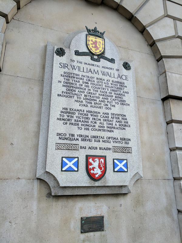
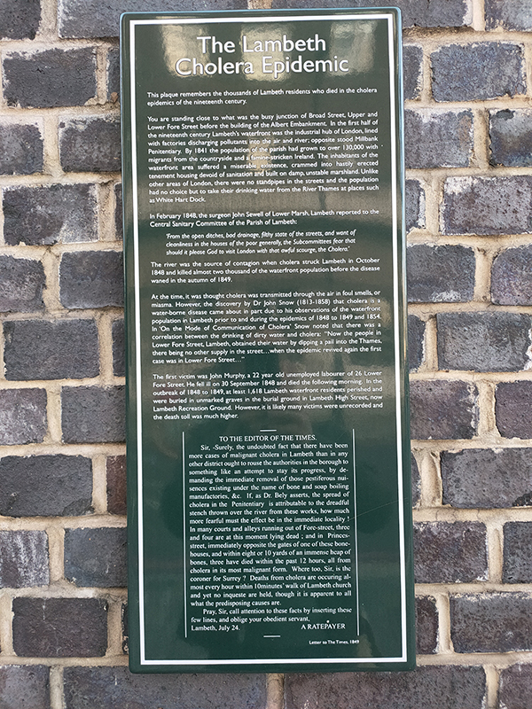
There is also a plaque here (possibly the wordiest you’ll find in the whole of London) commemorating the victims of the mid-nineteenth century Lambeth Cholera Epidemic. During 1848 and 1849 at least 1,600 nearby residents (who took their water directly from the river) died of cholera and were buried in unmarked graves. It was by studying this tragedy and the 1854 outbreak in Soho (which we covered many moons ago) that Dr John Snow (1813 – 1858) was able to conclude that cholera was a waterborne disease rather than one transmitted through the air.

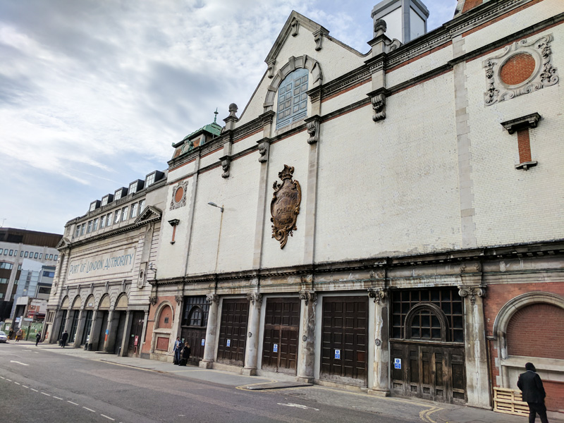
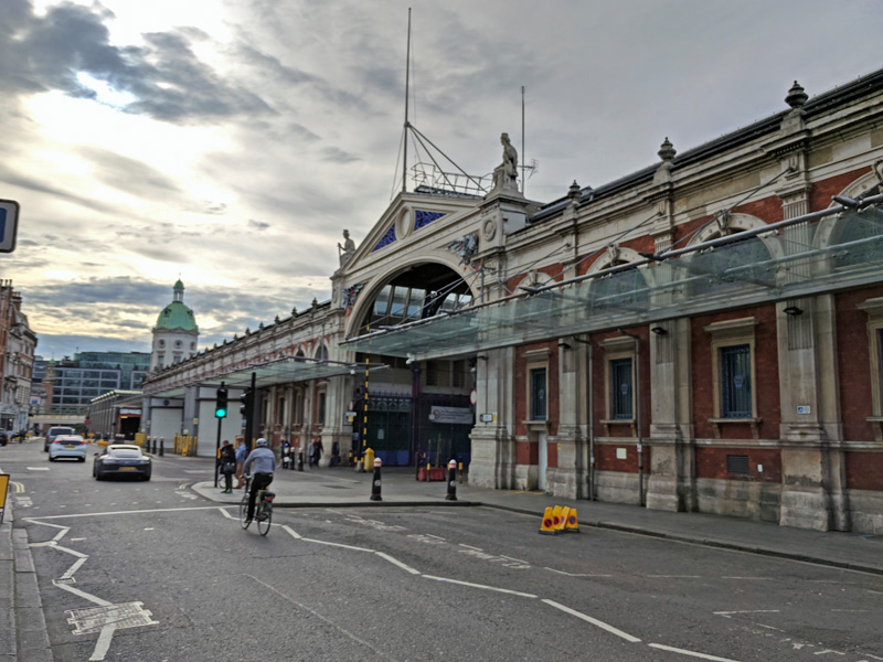
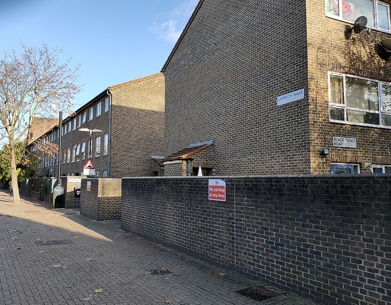
Heading away from the river on Black Prince Road named as you will recall (if you were paying attention last time) after Edward of Woodstock, the eldest son of Edward III. Edward junior never made it onto the regnal throne as he died of dysentery at the age of 46. Instead, on the death of Edward III, succession passed to the Black Prince’s 10 year old younger son, Richard (II). At the junction with Lambeth High Street stands the formidable Southbank House which is the only surviving part of the Doulton Pottery complex that dominated this area from the early Victorian era until the mid 1950’s. This Grade II listed gothic extravaganza with its striking pink and sandy-coloured terracotta ornamentation was built in 1876-78, probably to a design of architect, Robert Stark Wilkinson. The building housed the pottery’s museum and art school as well as serving as company HQ. During WW2 the pottery’s industrial buildings presented an easy target for German bombers and the resulting destruction hastened the process of transferring production facilities to Stoke-On-Trent which had begun in the the 1930’s. New clean air regulations finally sounded the death knell for the Lambeth factory in 1956 and demolition of all the buildings apart from the HQ followed shortly thereafter.

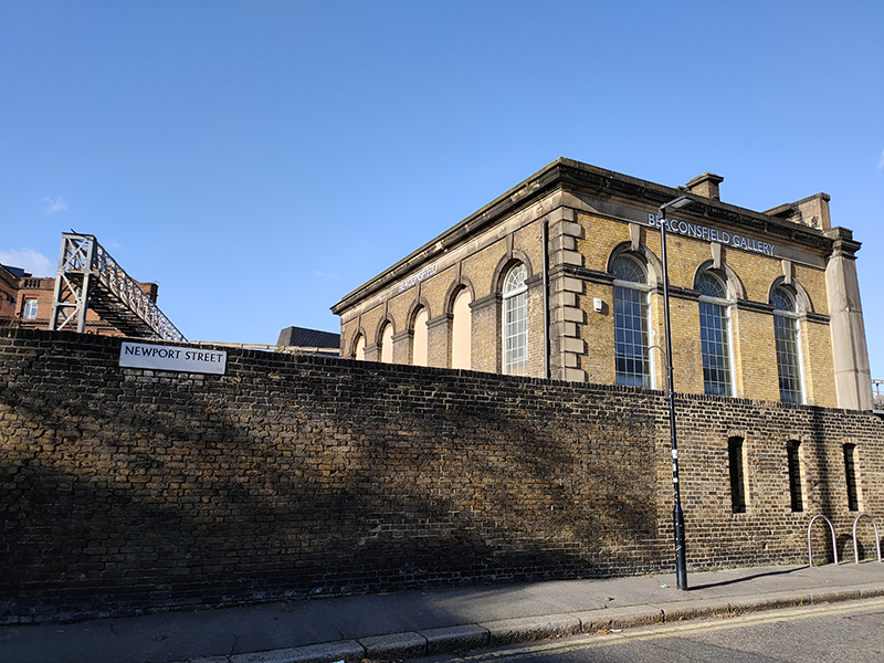
Beyond Southbank House and after passing under the railway we turn left into Newport Street. Adjacent to the railway, the Beaconsfield Contemporary Art Gallery occupies the southern (girls) wing and only remaining part of the former Lambeth Ragged School. This was built 1849-1851 by Henry Beaufoy, whose family wealth came from the vinegar trade, in memory of his late wife, Eliza. Originally the plot had been owned by South-Western Railway and in 1903 the decision was made to sell the site back to them. One year later most of the school was knocked down when the railway was widened. Network Rail still own the freehold for the site. Beaconsfield took over the lease from the London Fire Brigade in 1994 and worked with LKM Architects to restore the building and transform it into a contemporary art space. 

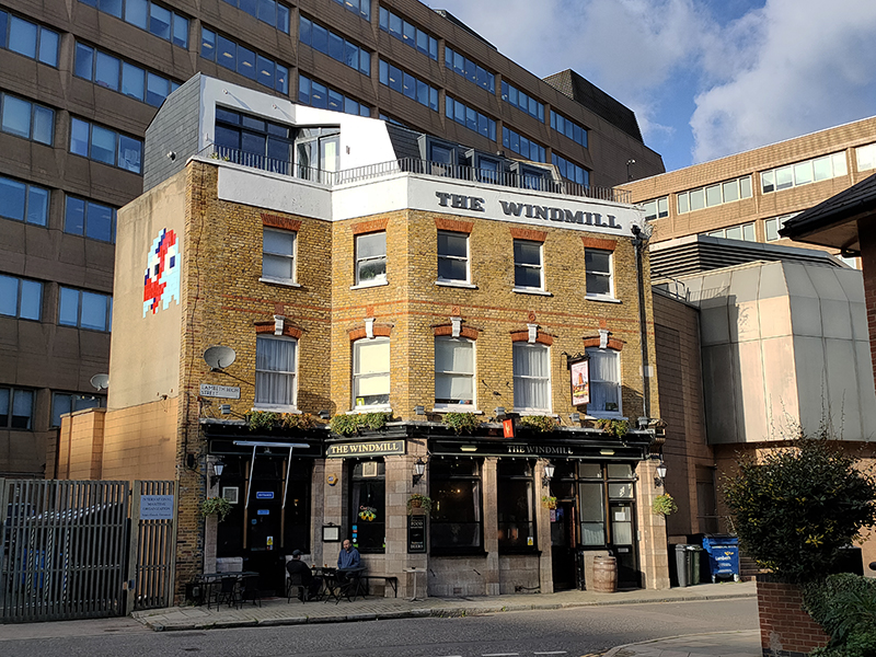
We turn left after the gallery, back under the railway, along Whitgift Street, named after John Whitgift who was Archbishop of Canterbury from 1583 to 1604. At the end we turn right into Lambeth High Street past the Windmill pub, renowned for its extensive selection of rums apparently.

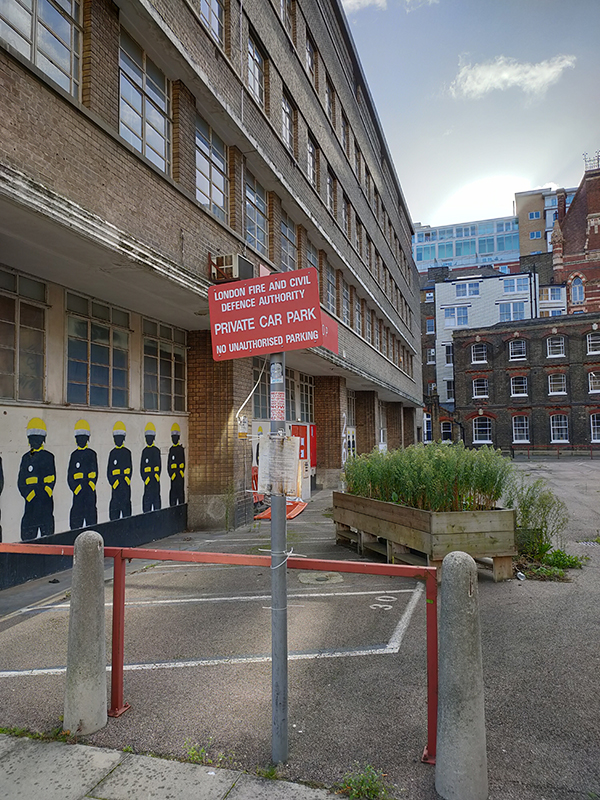
The building behind the pub was formerly the headquarters of the London Fire Brigade and looking back down Lambeth Hight Street towards the rear of Southbank House there is some vestigial evidence of this.

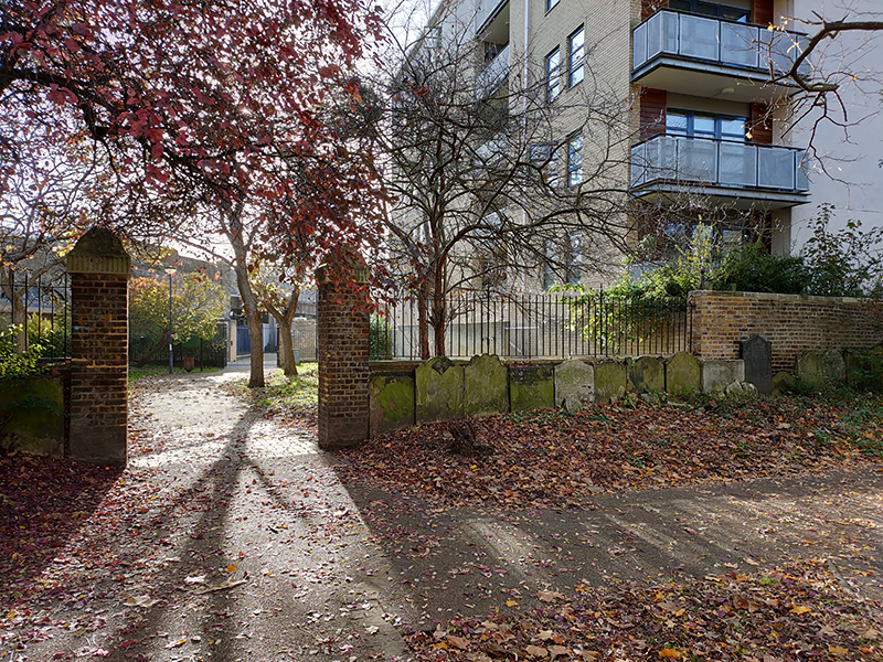
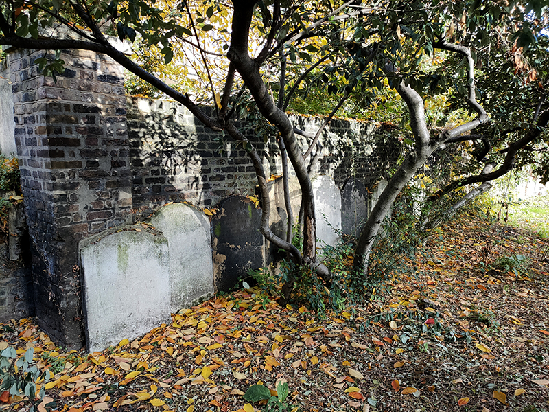
To the east of Lambeth High Street at its top end lie the Old Paradise Gardens. These public gardens were opened in 1884 on the site of what had been the burial ground for St Mary’s Church from 1703 to 1853. The old gravestones can still be seen around the perimeter of the gardens, the walls of which are Grade II listed. Originally known as Lambeth High Street Recreation Ground the gardens were renamed in 2013 following refurbishment.

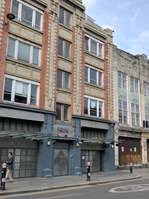
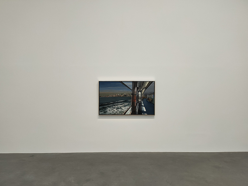
Just beyond the gardens is Old Paradise Street which takes us east to the top end of Newport Street home to the eponymous gallery, created through the conversion of three listed buildings, which were purpose-built in 1913 to serve as scenery painting studios for the booming Victorian theatre industry in London’s West End. With the addition of two new buildings, the gallery now spans half the length of the street. It opened in 2015 for the purpose of displaying works from Damien Hirst’s private art collection to the public free of charge. The current exhibition, which runs until 12 December 2021, features the hyper-realistic paintings of Richard Estes, a mixture of vignettes of American urban life and panoramic landscapes.

The railway arches on the other side of the street are all part of the Pimlico Plumbers empire.

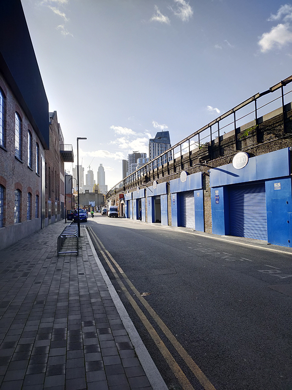
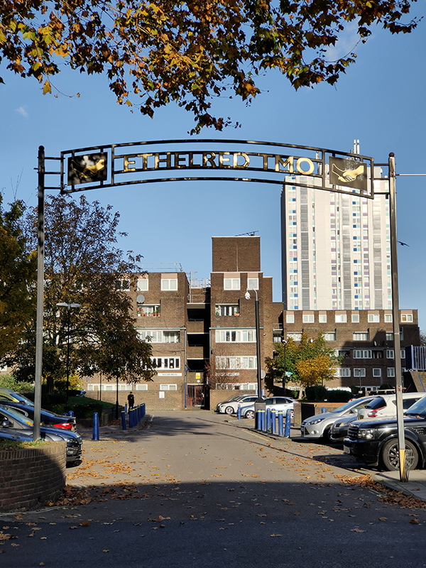
Beyond these, heading south again, we’re back on Black Prince Road and moving eastward into what was one of the largest conglomerations of social housing in the capital. Or at least it was when the various apartment blocks and towers where originally constructed in the late sixties and early seventies. These days there is a significant interspersal of private ownership. We make an immediate loop of Lambeth Walk, Lollard Street and Gibson Road (and we’ll come on to the cultural resonance of the former later on) to start with. Then further east on Black Prince Road, Marylee Way provides the main route into the Ethelred Estate. In 2012 the residences in Ethelred and its sister estates, Thorlands and Magdalen, still owned by Lambeth Council (around 1,300 leaseholds and tenancies) were transferred to Housing Association, WATMOS. This was after a ballot of tenants in which 51.1% voted in favour. Hopefully it’s working out better than Brexit.

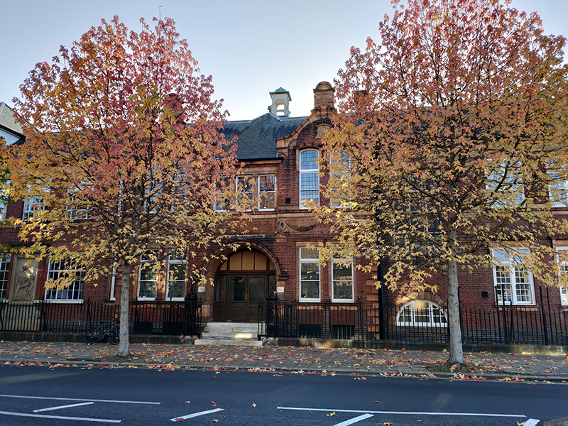
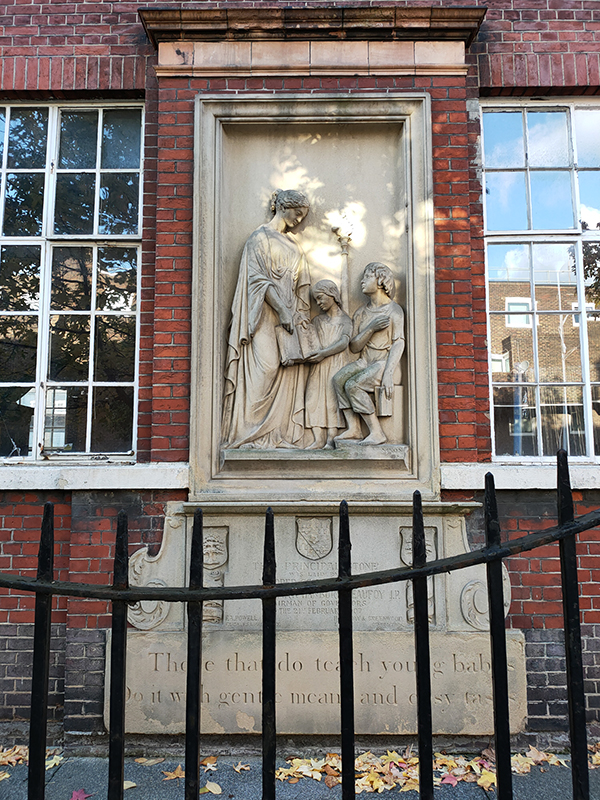
The estates are to the north of Black Prince Road. Of note on the south side is the Beaufoy Institute, built in 1907 by Henry’s nephew, Mark Hanbury Beaufoy, as a technical school for boys and also to replace his uncle’s Ragged School which had been torn down three years earlier. The Beaufoy vinegar-making dynasty began in 1741 when the family switched from the distilling of gin, apparently horrified by the damage it caused and its toxic ingredients. Their malt vinegar was used on ships as a ‘fumigator, antiseptic and preservative’ and the Beaufoys acquired a lucrative Navy contract. They also produced ‘sweets’ or ‘mimicked’ wines from raisins with added sugar and by 1872 were advertising cordials and non-alcoholic drinks as well. The Beaufoy vinegar works were bombed in 1941, and the Institute was requisitioned for use by women manufacturing munitions. It returned to use as a school after the war, before being eventually acquired by Lambeth Council. It was bought by the London Diamond Way Buddhist Centre in 2012.

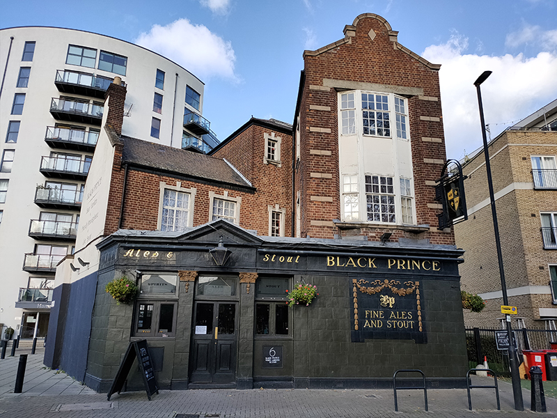
At the eastern end of the street named after him the Black Prince is also commemorated with a pub on the corner with Hotspur Street.

We turn north up Kennington Road then dip into the estates and back out again via Lollard Street, Distin Street and Fitzalan Street. Further up Kennington Road we veer off along Walnut Tree Walk which returns us to Lambeth Walk. En route we encounter Hornbeam Close and Bedlam Mews, which some local vandals have decided merits some retrospective nominative determinism.

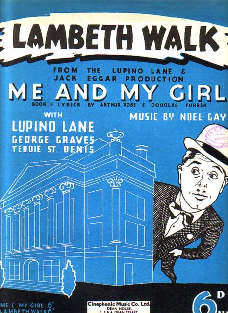
Lambeth Walk is, of course, best known for being the title of one of the songs in the 1937 musical Me and My Girl. The contemporaneous musical, with music by Noel Gay and original book and lyrics by Douglas Furber and L. Arthur Rose, tells the story of an unapologetically unrefined cockney gentleman named Bill Snibson, who learns that he is the 14th heir to the Earl of Hareford. It was revived several times in the 1940’s and made a triumphant return to the West End in 1984 in a version revised by Stephen Fry and starring Robert Lindsay and Emma Thompson.

I have to say that if the song didn’t already exist I doubt anyone would be inspired to write it by the present-day Lambeth Walk.

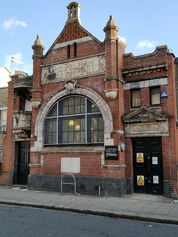
It does however boast Pelham Hall which was built as Lambeth Mission Hall in about 1910 and is distinguished with an exterior pulpit.  The building is now home to the the sculpture department of Morley College.

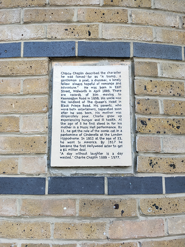
On the wall of the adjacent Chandler Hall Community Centre is a stone plaque dedicated to Charlie Chaplin who lived in the area in his youth and whose uncle ran the (long since departed) Queens Head pub in Black Prince Road. No. 5 Lambeth Walk, on the junction with China Walk, was built in 1958 to replace the Victorian municipal swimming baths which a V2 bomb had destroyed in 1945. The new building had no pool but provided slipper baths and laundry facilities for the local community. In the early 1990’s it was reconfigured for use as a GP practice.

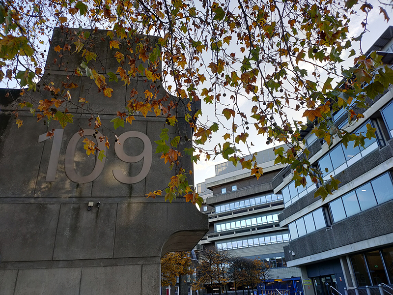
Lambeth Walk doglegs into Lambeth Road where he turn left and head down towards Lambeth Bridge. At 109 Lambeth Road is the building that houses the Metropolitan Police’s Forensic Science Laboratory. It also hosts the Met’s 24 hour emergency call centre and its Lost Property office (inter alia). And it does more than nearly any other building of its era to give Brutalist architecture a bad name (not that it’s not intrinsically a bad name to start with).

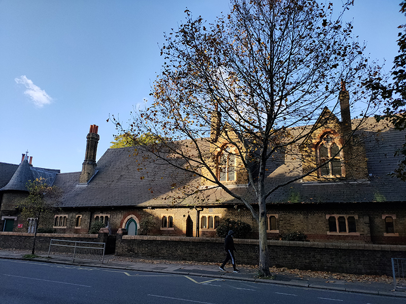
Across the road, in stark contrast, is the former Holy Trinity Primary School (1880) now part of Fairley House School (for children with learning difficulties).

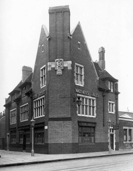
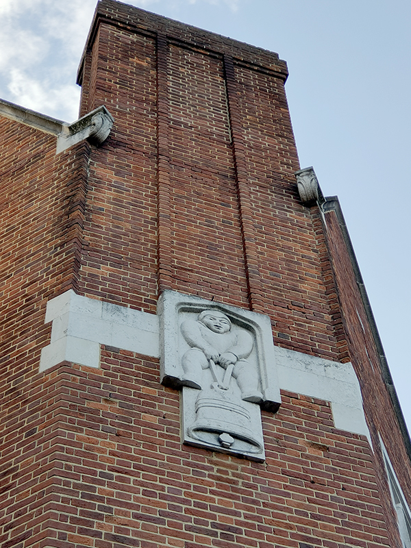
Back on the same side of the road as the Met and just beyond it stands the Bell Building which is a poster child for the sympathetic redevelopment of former public houses into residential space. Crucially the emblematic exterior sculpture of a man lifting a heavy bell has been retained.

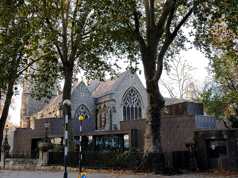
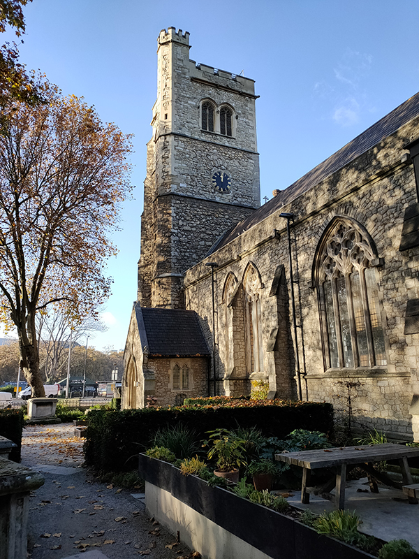
Crossing the road again we’re in front of the former St Mary’s Church which was saved from demolition in 1977 by Rosemary and John Nicholson who turned it into The Garden Museum. The church is the burial place of John Tradescant The Elder (c1570 – 1638), the first great gardener and plant-hunter in British history. Tradescant was gardener to Robert Cecil, 1st Earl of Salisbury then to George Villiers, 1st Duke of Buckingham (remember him) and finally to Charles I, after Buckingham’s assassination. His son, John Tradescant The Younger (1608 – 1662), followed in his footsteps as royal head gardener and is buried beside him. The first church on this site predates the Norman Conquest and is mentioned in the Domesday Book. The present church was originally built in 1337 and the bell tower still largely retains its 14th century form. The rest of the building was substantially rebuilt in the Victorian era.

Turn to the right beyond St Mary’s and you’re face to face with Lambeth Palace or, more specifically, Morton’s Tower. You can’t go beyond this gateway as a rule since, as it rather pompously states on the website, this is “a working palace and a family home” and therefore not open to the public except on rare special occasions. The Tower was built by John Morton, Archbishop of Canterbury in 1486–1501 and is one of the few surviving examples of the early Tudor style of brick building. From the time of its completion onward the “Lambeth Dole” of bread, broth and money (which originated in the 13th century) was dispensed to beggars at the gate. In his 1785 History of Lambeth Palace archivist Andrew Ducarel writes that in his day it was regularized and consisted of a weekly allowance of 15 quartern loaves, 9 stone of beef and 5s., which were divided amongst around 30 poor parishioners and distributed three times a week. The practice was discontinued after 1842 and replaced with direct pecuniary grants to the poor.

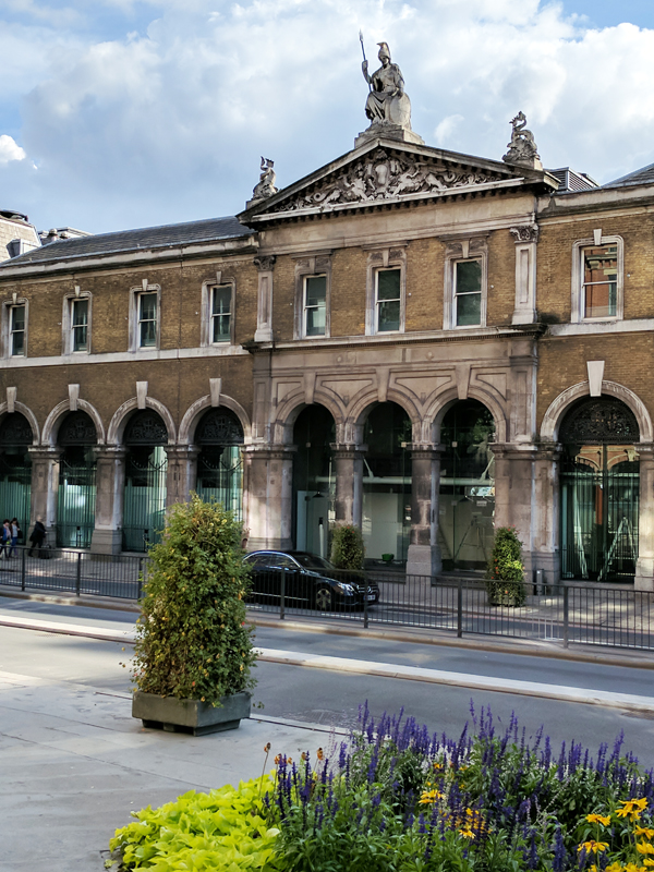
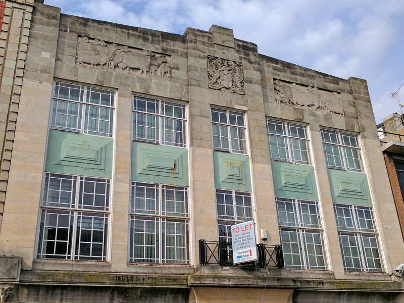
After negotiating the roundabout at the nexus of Lambeth Road and Lambeth Bridge we set off on the final stage of today’s journey, southward along the Albert Embankment to Vauxhall Station. Almost immediately on the left is the headquarters of the International Maritime Organization and just beyond that the former HQ of the London Fire Brigade (as referenced earlier). Commissioned by the London County Council, the building was designed by EP Wheeler, architect to the LCC, with sculpture work by Gilbert Bayes, Stanley Nicholas Babb and FP Morton. It was opened by King George VI in 1937. Despite not being one of the prime examples of 1930’s architecture in the capital it has acquired a Grade II listing. In 2020 a plan to redevelop the building into a new home for the LFB Museum and erect two towers of over 20 storeys each immediately behind creating over 400 flats and a 200 bedroom hotel was submitted to public inquiry. Although the scheme had the support of the London Fire Commissioner and Lambeth Council it was vetoed by the Secretary of State for Housing in the summer of 2021. (The main objection being, I think, that it would spoil the views from the Palace of Westminster).

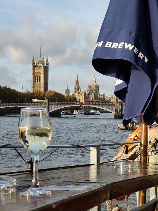
Time for the pub of the day finally, and in the face of plenty of stiff competition, the sunny skies tipped the balance in favour of the Tamesis Dock, a converted 1930’s Dutch barge, permanently moored on the river opposite the Millbank Tower.

These floating bars tend to charge over the odds but this one was pretty reasonable and thanks to the mild weather (for mid- November) I was able to enjoy a glass of wine and some baked goats cheese up on the deck, in glorious isolation and with a great view of the Houses of Parliament. Until I drew the attention of the local gulls that is.

Lambeth Council actually designated the Albert Embankment riverfront an Area of Conservation in 2001 but as noted earlier this hasn’t stopped them approving plans for redevelopment. The Corniche Building, designed by Foster & Partners, was completed in spring 2020 and along with the adjacent Dumont and Merano residential blocks has created 472 new luxury apartments close to the river.

As we approach Vauxhall Bridge the railway converges with the Albert Embankment and the river moves away.

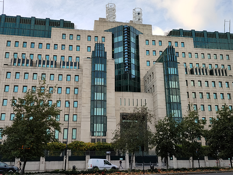
The space between the road at the river here at Vauxhall Cross is famously occupied by the MI6 Headquarters. Officially the organisation that operates out of these premises is called the Special Intelligence Service (SIS). The MI6 pseudonym was used extensively during WW2 especially if an organisational link needed to be made with MI5 (the Security Service) but it is no longer applied by the secret services themselves. Of course it’s still the go-to appellation as far as the media and popular culture are concerned. SIS moved to Vauxhall Cross in 1994 from its previous home, Century House, on Westminster Bridge Road (see Day 55). Architect Terry Farrell won the competition to design the new HQ and he took his inspiration from 1930s architecture such as Battersea and Bankside power stations, as well as Mayan and Aztec temples. The building has 60 different roof areas and six perimeter and internal atria, and also incorporates specially designed doors and 25 different types of glass to meet the Service’s specific needs. Vauxhall Cross has, of course, featured in many of the films in the James Bond franchise made since it was opened. The building was first featured in GoldenEye in 1995 and is depicted as coming under attack in The World Is Not Enough (1999) and Skyfall (2012). In fact in the latter the front of the building is completely destroyed in an explosion. A 15 metre high model of the building was constructed at Pinewood Studios to create this illusion which was cheered by MI6 staff at a special screening of Skyfall at Vauxhall Cross. Filming for the 24th film in the series, Spectre, took place on the Thames near Vauxhall Cross in May 2015, with the fictional controlled demolition of the building playing a key role in the finale sequence of the film.

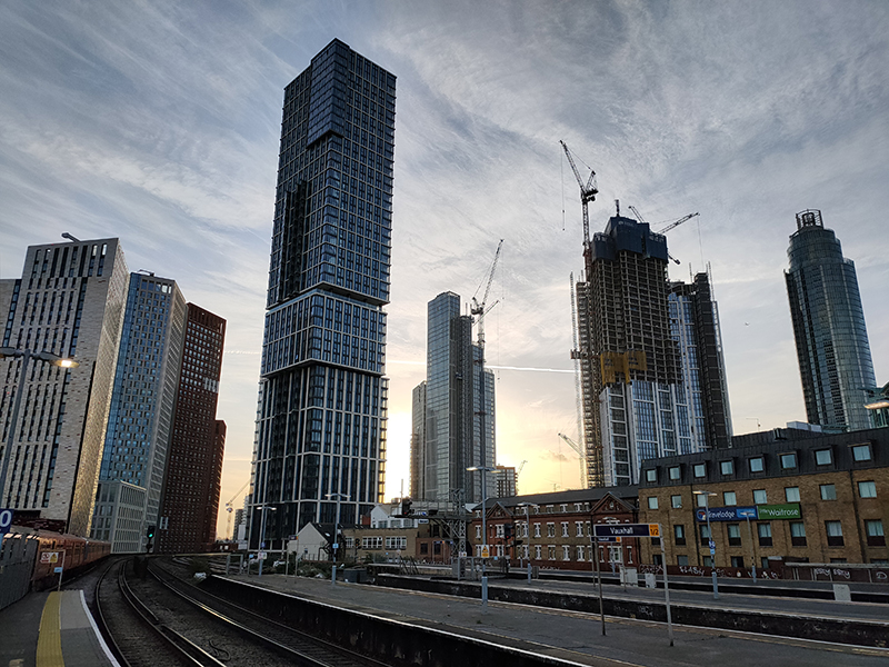
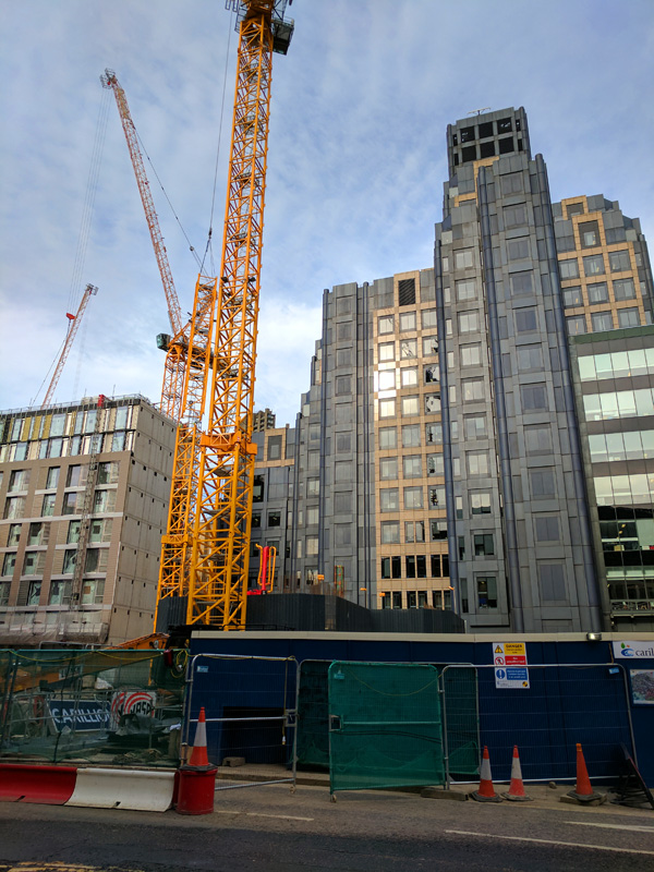
The light is beginning to fade as we head up onto platform 8 of Vauxhall Station and before the train arrives to take us back to the suburbs there’s just time to contemplate how very different this view would have looked just a couple of years ago.

Day 45 – Bishopsgate – Leadenhall Market – Lime Street – Monument

Today’s journey’s a little bit different from the usual in that it coincided with the Sunday of this year’s Open House Weekend so I was afforded the possibility of seeing inside a few places en route that would normally be off limits. Case in point is the Drapers’ Hall which we encountered towards the end of Day 44 so we’re going to rewind a bit and kick off with that again this time. From there we’re going to head north up to London Wall then drop south on Bishopsgate to Leadenhall Market before wending our way east and south to finish up at the Monument.

Day 45 Route

As noted, today’s starting point is the Drapers’ Hall on Throgmorton Street. We already covered the history of the Drapers’ Company and the external architectural features last time out so I’m just going to let the images of the interior pretty much speak for themselves (aside from the commentary I’ve added to the individual slides that is). Suffice to say, I had expected something pretty grandiose as befitting third place on the Order of Precedence but I wasn’t prepared for something quite this opulent (and on such a scale).

This slideshow requires JavaScript.

You will have noted that the Victorian artist, Herbert James Draper (1863 – 1920) had quite a prominent role in in the decoration of the Hall. Whether he got the commission on account of his name or because the guiding lights of the company appreciated his somewhat risqué interpretations of mythological and Shakespearean themes is not recorded (so far as I can tell). The thinking behind the tapestries and ceiling painting depicting scenes from the Legend of Jason and the Golden Fleece is rather easier to discern.

After leaving the hall we repeat the walk up Throgmorton Avenue to Austin Friars which leads east to the Dutch Church. Originally this was the site of a 13th century Augustinian priory (Austin Friars) before, in 1550, what is regarded as the oldest Dutch-language Protestant church in the world church was founded here. That first building survived right up until the Blitz destroyed it; the present church was built in the early 1950’s. Perkin Walbeck, the pretender to the English crown (he claimed to be the younger son of Edward IV, one of the Princes in the Tower murdered by Richard III), was buried in the original church following his execution by Henry VII. Today the church still acts as a focal point for the Dutch community in London.

Opposite the church is the Furniture Makers’ Hall – which is the one that I could claim entry to by virtue of ancestry. Typical ! If only my Grand-dads had been drapers instead of chairmakers.

IMG_20170823_163832

Looping round the rest of Austin Friars we emerge onto Old Broad Street opposite the City of London Club, the oldest Gentlemen’s club in, well, the City of London. This was founded in 1832 by a group of prominent bankers, merchants and ship owners and held its first meetings at the George and Vulture pub (see last post). The original membership numbered 600 and included the Duke of Wellington and Sir Robert Peel. If you should want to join then you need to make the acquaintance and get the support of at least six people who are already members (and ladies are equally welcome these days apparently).

IMG_20170823_164020

As you can see, these days the City of London Club, sits in the shadow of Tower 42, which until 1990 and the construction of One Canada Square at Canary Wharf was the tallest building in the UK. Nowadays it’s only the third highest skyscraper in the City of London having been eclipsed in recent years by the Heron Tower (we’ll stick with that name thank you) and 122 Leadenhall Street (a.k.a “the Cheesegrater”). Tower 42, of course, started life as the NatWest Tower (seen from above the shape of the building echoes the NatWest logo). It was designed by Richard Seifert (1910 – 20011) and built by John Mowlem & Co between 1971 and 1980 at a cost of £72m. At 183m the tower dwarfed everything around it at the time of construction and was extremely controversial. It was built around a massive central concrete core from which the floors are cantilevered (anchored at just one end) making it exceptionally strong but reducing the amount of office space that could have been available with an alternative structure. On a note with contemporary resonance; at the time of design, fire sprinkler systems were not mandatory in the UK and so weren’t installed. It was this omission, coupled with a fire in the tower during a 1996 refurbishment, that prompted the GLC to amend its fire regulations and require sprinkler installations in all buildings. Today the building is multi-tenanted with a high-end restaurant on the 24th floor and a champagne and seafood bar on the 42nd.

Moving on we duck into Pinners Alley (by the side of Pinners Hall where I worked from 1996 to 2004) heading west briefly before turning north up Austin Friars Passage – which I always though should’ve been the name of a second division 1970’s pro-rock band.

IMG_20170823_164254

At the other end is Great Winchester Street which is home to Deutsche Bank’s London HQ. Among the artworks in their lobby is one of Damien Hirst’s multi-coloured dot efforts (more of him later).

IMG_20170917_115458

Turning left we end up back on London Wall which as we head east morphs into Wormwood Street. At the junction with Bishopsgate (a.k.a the A10) we switch southward and drop all the way down to Leadenhall Market. On the way we pass a NatWest building of a different vintage altogether; this one built in the 1860’s to a design of the architect John Gibson (1817 – 1892) when the bank was known as the National Provincial Bank of England.

At Leadenhall Market I was able to tag along with a tour that had just started (courtesy of Open House again). I wish I had made a note of the guide’s name so I could give a well deserved shout-out as she was excellent. Anyway, Leadenhall Market dates back to the 14th century and stands on a site that was once the heart of Roman London. As early as 1321 it was a meeting place of the Poulterers while the Cheesemongers (I think we must have missed them on our travels) sold their wares here from 1397. In 1411 the Corporation of London acquired the freehold of the site and it became an established market for fish, meat, poultry and corn. The present wrought iron and glass roofed structure was designed by City Architect, Horace Jones (1819 – 1887) and erected in 1881. The Market has been used as a location in a number of films, most notably Harry Potter and the Philosopher’s Stone where it represented Diagon Alley and the Leaky Cauldron pub.

This slideshow requires JavaScript.

We leave the market via Whittington Avenue and, turning right on Leadenhall Street, pass the Lloyds of London building (not to be confused with the Lloyds Register building which we encountered previously). This iconic, Richard Rogers designed edifice, caused even more of a stir when it was put up (between 1978 and 1986) than the NatWest Tower had. In spite of this, 25 years after its completion it became the youngest structure ever to be granted Grade-I listed status. Lloyds is a leading example of what has been dubbed Bowellism, the practice of putting service areas of a building on its exterior so as to maximise space in the interior (c.f. Paris’s Pompidou Centre). The building consists of three main towers and three service towers around a central, rectangular space. Its core is the large Underwriting Room on the ground floor, which houses the Lutine Bell within the Rostrum. (It wasn’t taking part in Open House this year but the queues are normally prohibitive anyway).

The Lloyd’s building is at no.1 Lime Street; opposite at no.52 construction is underway of yet another skyscraper, The Scalpel. This time that’s an official designation, the developers yielding to the “if you can’t beat ’em join ’em” maxim. This one will top out at 38 storeys and be the new European HQ for insurers W.R Berkley (no me neither).

IMG_20170917_123428

Turn south down Lime Street and then return to the Market along Leadenhall Place. Take a left into Lime Street Passage and then traverse the Market a couple more times via Beehive Passage, Bull’s Head Passage and Ship Tavern Passage. This finds us back on Lime Street which we follow southward to Fenchurch Street. From here we go west back to Gracechurch Street then continue south before cutting round Talbot Court down onto Eastcheap. Turn east as far as Philpot Lane and use this to return northward, poking our noses into Brabant Court on the west side before arriving back on Fenchurch Street. This route takes us around no.20 Fenchurch Street, better known to you, me and everyone else as the “Walkie-Talkie” and the 2015 winner of Building Design Magazine’s Carbuncle Cup for the worst building in the UK. It is notorious of course because its concave shape makes it reflect sunlight into a concentrated beam that on reaching street level has been known to melt the bodywork of parked cars and facilitate the frying of eggs on the pavement. Those incidents took place in 2013, since when the glass exterior has been covered with a non-reflective film. In an interview with The Guardian the building’s architect, Rafael Vinoly, blamed the problem on global warming “When I first came to London years ago, it wasn’t like this … Now you have all these sunny days”.  The ‘sky garden’ at the top of the building was claimed to be London’s highest public park, but since opening there have been debates about whether it can be described as a ‘park’, and whether it is truly ‘public’ given the access restrictions. On the day there was a queue of about eighty or so people waiting to be allowed up.

IMG_20170917_124732

This time we strike eastward until we reach Cullum Street which curves back onto Lime Street. At the junction here that man Damien Hirst makes a second appearance in today’s post, lowering the tone of the neighbourhood with one of his giant anatomical models as part of Sculpture in the City.

IMG_20170917_123920

This time we make an easterly retreat from Lime Street along Fenchurch Avenue and after a short distance cut back to Fenchurch Street via Fen Court. There is a small garden here in what was once the churchyard of St Gabriel Fenchurch, lost in the Great Fire. The sculpture “The Gilt of Cain” by Michael Vissochi was unveiled by Archbishop Desmond Tutu in 2008 and commemorates the 200th anniversary of the abolition of the transatlantic slave trade. It takes its name from a poem of Lemn Sissay which is inscribed on the sculpture and combines Old Testament text with the language of the Stock Exchange.

You’re probably wondering by now where all the churches had got to but don’t worry, there are one or two on the menu today – though fewer than you’ve had to put up with in the last few posts. First up is All Hallows Staining which we reach by taking Star Alley south from Fenchurch Street through to Mark Lane. Mind you, all that remains of this one is its tower which was built around 1320 AD. The rest was demolished c.1870 when All Hallows merged with nearby St Olave Hart Street (see Day 40). The latter was badly damaged in WW2 so a prefab church was erected next to the tower and named St Olave Mark Lane (as you see the sign in the photo confusingly still refers to St Olave). The tower is maintained by the Worshipful Company of Clothworkers, whose hall sits in nearby Mincing Lane.

IMG_20170917_132720

Next we follow Mark Lane down to Great Tower Street which at its eastern extremity adjoins with Byward Street which as it heads west turns into Lower Thames Street. At the juncture here sits The Hung Drawn & Quartered pub which acts as a reminder of the public executions which once took place on nearby Tower Hill, including those of Thomases More and Cromwell.

IMG_20170917_133151

We leave Lower Thames Street almost immediately and wend our way through Bakers Hall Court, Harp Lane and Cross Lane to St Dunstan’s Hill where lie the ruins of the church of St Dunstan in the East, now set within a public garden that was laid out in 1967. St Dunstan’s wasn’t completely destroyed in the Great Fire so it was patched up in the immediate aftermath and then a Wren-designed tower and steeple were added at the end of the 17th century. Apart from a couple of walls this tower was all that remained intact after the WW2 bombing and it was decided not to rebuild again. Personally I like it as it is now – as do the birds.

This slideshow requires JavaScript.

Dropping back down onto Lower Thames Street it’s time for another Open House visit – to the Billingsgate Roman House and Baths (or rather the very partial remains thereof) located beneath a drab 1980’s office block. Discovered in 1848 during the construction of the Coal Exchange building (more of that in a while) these are the only remains of a Roman house accessible in London. It is believed that the house was originally built around the late 2nd century AD and the baths added in the following century. The latest theory is that at the time the baths were constructed the building had become a resting-place for travellers, essentially a Roman version of a hotel. I have to again commend the guides who were exceptionally informative and engaging. Visits to the site are restricted but you can book a tour through the Museum of London outside of Open House weekend.

Opposite here, straddling the area between Lower Thames Street and the river is another Open House destination, Custom House. An English Customs service on an ad hoc basis has existed since at least the middle of the 8th century and was formalised by King Edward I in 1275 as a means of beefing up the royal finances. The current Custom House is thought to be the fifth such to have been built on this site, chosen because beyond this point London Bridge has historically prevented ships from going further upriver. The present building was put up between 1813 and 1817 and initially designed by David Laing (1774 – 1856), Surveyor to the Customs. However within a few years of completion the ceiling of the Long Room had partially collapsed and the floor completely given way. The latter event occurred just a day after Sir Robert Smirke (1780 – 1867) had concluded an inspection of the premises and advised staff to evacuate. Smirke was then engaged to oversee the rebuilding and Laing’s career suffered the same fate as the floor. The Custom House now comprises a west wing built by Laing, a central block built by Smirke and an east wing dating from 1962-66. The southern façade, made of Portland stone, is much more aesthetically-pleasing than the northern face of yellow stock brick; this is because the building was designed to be seen from the river and impress shipfarers from overseas.

This slideshow requires JavaScript.

The Great Long Room was an innovation of Christopher Wren (prolific doesn’t even begin to do the man justice) for his version of the Custom House, built in 1671. This was to be the public room where all import and export business was to be transacted. Because of this room, the public rooms in Custom Houses around the world have become known as ‘Long Rooms’ irrespective of their shape or size. The current Long Room is the work of the aforementioned Sir Robert Smirke, it is 190 feet long and 63 feet wide and has one of the largest unsupported wooden ceilings in Europe.

IMG_20170917_151631
The Long Room

The Coal Exchange which I mentioned earlier was one of the glories of Victorian Architecture, built in 1847-49 to the designs of City architect, James Bunstone Bunning (1802 – 1863) and opened to great fanfare by Queen Vic herself. The interior was one of the earliest and most remarkable examples of cast-iron construction in the world, several years before the Crystal Palace. However that didn’t cut any ice with the town planners of the 1960’s who had little regard for Victorian extravagance. Despite the objections of the Victorian Society and Sir John Betjeman (naturally) the building was demolished in 1962 in preparation for a road-widening scheme that didn’t actually take place until the 1980s. Why do I mention this ? Because the alternative would have been to shave off that unlovely north face of the Custom House, an option which from a 21st century perspective appears immeasurably more appealing.

Coal Exchange

James Bunning was also responsible for the original Billingsgate Fish Market built just to west of the Custom House in 1850 but rendered obsolete by increased levels of trade within 25 years. Work on a new market building, designed by Horace Jones in the Italianate style, began in 1874 and was completed three years later. In 1982 the fish market was relocated to the Isle of Dogs and the building on Lower Thames Street was refurbished under the guidance of Richard Rogers (he gets about a bit as well). The Grade II listed building is now used as an events venue.

IMG_20170917_153833

Time we got moving again I think. Head up Idol Lane which runs to the west of St Dunstan’s and turn right on Great Tower Street before proceeding north (with a manly stride) up Mincing Lane. Next move is west along Plantation Lane which leads into Rood Lane. Venture northward first before doubling back towards Eastcheap. On the corner here stands the Guild church of St Margaret Pattens (unlike Parish churches Guild churches hold regular weekday services rather than serving a Sunday congregation). The church’s exterior is notable for its 200-ft high spire, Wren’s third highest and the only one that he designed in a medieval style. The name of the church derives from pattens, wooden-soled overshoes which historically enabled Londoners to walk about the city without sinking too deep into the mud and effluent which covered the streets. The church still has an affiliation with the Worshipful Company of Pattenmakers.

IMG_20170917_153041

Cross over Eastcheap and drop down St Mary at Hill back towards the river. At no.18 we find the Watermen’s Hall, home to the Company of Watermen and Lightermen (in a riverfaring context the Watermen were the equivalent of taxi-drivers and the Lightermen the truckers). The hall was built in 1780 by William Blackburn and is the only remaining Georgian hall in the City of London. The Watermen are not a Livery Company as such, hence no Worshipful before the name. This is because the Waterman are governed by statutes and Royal Charters that extend beyond the boundaries of the City of London. So unlike the Pattenmakers (no.70) they don’t appear in the Order of Precedence.IMG_20170917_153709

So we’re almost at our final stop and to get there we have to negotiate as follows: north up Lovat Lane, left turn into Botolph Alley, north up Botolph Lane, west along Eastcheap, south down Pudding Lane, left along St George’s Lane back to Botolph Lane, south this time and then west into Monument Street. Which, as you might have guessed, brings us to The Monument itself. As I’m sure you’re aware, this was erected in commemoration of the Great Fire of 1666 and the subsequent rebuilding of the City and was completed in 1677. The fire was alleged to have begun in a baker’s shop on Pudding Lane and the height of The Monument is equal to its distance from that starting point, 202 feet. The designers of the memorial were Sir Christopher Wren (goes without saying really) and his friend Dr Robert Hooke (1635 – 1703). They came up with the idea of a classic Doric column with 311 steps up to a viewing platform and a summit topped with a drum and copper urn from which flames emerge. A total of seven people died falling from the viewing gallery (six suicides and one who accidentally fell after leaning over the balcony to look at a live eagle kept in a cage) before it was enclosed in an iron cage in 1842. It costs £5 (cash only) if you want to ascend up to the platform.

Keeping my five pounds in my pocket I walk on by and finish today’s epic with a stroll up and down Fish Street Hill.

And that’s us finally just about done with the City of London. Next time we’ll be heading back west over to Hyde Park for a complete change of scene.


Day 39 – Smithfield – St Bartholomew’s Hospital – Newgate Street

Today’s trip covers the triangle formed by Charterhouse Street to the North, Holborn Viaduct/Newgate Street (A40) to the South and Aldersgate Street (A1) to the West, encompassing both Smithfield Market and St Bart’s Hospital. Another compact area but once again one that’s teeming with historical echoes of the likes of William Wallace, Wat Tyler and Henry VIII (of course).

Day 39 Route

We start out from Holborn Circus and head east along Charterhouse Street, almost immediately taking a detour into Ely Place, apparently the last privately-owned street in London. This is the site of the first of several churches we’re going to cover this time out, St Ethelreda’s RC. It might not look that impressive from the outside but St Ethelreda’s is the oldest Catholic church in England and one of only two remaining buildings in London from the reign of Edward I. It was the town chapel of the Bishops of Ely from about 1250 to 1570 (hence Ely Place). Ethelreda, daughter of King Anna, ruler of the Kingdom of East Anglia, was born in 630. She wanted to be a nun but agreed to a political marriage with a neighbouring King, Egfrith, on condition that she could remain a virgin. When the King tried to break the agreement she fled back to Ely where she built a magnificent church on the ruins of one founded by St Augustine. For reasons more obvious than is generally the case with such designations she is the Patron Saint of Chastity.

Continuing along Charterhouse Street we cross Farringdon Street and enter the surrounds of Smithfield Market. This area was originally known as Smoothfield, meaning a flat plain, from the Saxon word smeth, eventually corrupted again to become Smith. In the 12th Century it was used as a vast recreational area where jousts and tournaments took place and by the late Middle Ages had become the most famous livestock market in the country. It was also the location of Bartholomew Fair – three days of merrymaking, dancing, trading and music which over the centuries became the most debauched and drunken holiday in the calendar. This went on for almost 700 years before it was eventually closed in 1855.

Before we get to the actual market though there are a couple of buildings on Charterhouse Street to take stock of. First up is the Port of London Authority (PLA) building. The PLA is the self-funding public trust that governs the Port of London and has responsibility the maintenance and supervision of navigation on the tidal stretch of the Thames from the estuary upstream to Teddington. Built in 1914, this only lasted five years as the main HQ of the PLA before being superseded by a grandiose monolith adjacent to the Tower of London.  The motto at the top of the building “floreat imperii portus” translates as “let the imperial port flourish” (curse of the commentator as it turned out of course).

IMG_20170330_150916

Right next door is the Central Cold Store (constructed in 1899 for the Dutch margarine manufacturers, Van Den Bergh). In 1992 the two buildings were gutted and behind their facades a power station was installed; the Citigen CHP (combined heat and power) plant which supplies 31 MW of electricity to the London Electricity network and provides heat and cooling through a system of heating and chilled water pipes to a variety of buildings in central London.

IMG_20170330_152316
In total contrast, just a few steps further along is the recently-reprieved, world famous nightclub, Fabric.
IMG_20170330_152436

The building just to the right of Fabric at 79-83 dates from 1930 and was home to the Corporation of London Meat Inspectors. 

IMG_20170330_152504
Following the relocation of Covent Garden and Billingsgate, Smithfield is the last of London’s three big food & produce markets still operating from its original home. Just to rub this in it also goes by the alternative name of London Central Markets and, not surprisingly, its the largest and oldest wholesale meat market in the country. It came into being when the livestock market was re-sited north of Islington in 1852 and plans were drawn up to create a new market in the area which would specialise in cut meat. Built to a design of Sir Horace Jones, the cathedral-like structure of ornamental cast iron, stone, Welsh slate and glass was completed in 1868. It consisted of two main buildings linked under a great roof and separated by a central arcade, the Grand Avenue and also included an underground area where fresh meat delivered from all over the country by the new railways could be unloaded in specially constructed sidings.
IMG_20170330_164724

IMG_20170330_165427

Within in a few years four more buildings had been added including the Poultry Market, opened in 1875, which is the only one still in use today.  The original building however was destroyed by a major fire in 1958. A new building was commissioned, at a cost of £2 million, and was completed in 1963. While unremarkable from the outside, inside it is a feat of engineering: at the time its domed roof was, at 225 feet, the largest clear spanning dome roof in Europe. The appositely named West Poultry Avenue and East Poultry Avenue run beneath the arches either side and taking the former we emerge onto West Smithfield.


This slideshow requires JavaScript.

Head west from here then take a sharp right down Snow Hill before returning to the market via Smithfield Street. Nip up East Poultry Avenue, turn right and then duck into the aforementioned Grand Avenue. The market opens for business at 2 a.m. and is pretty much done for the day by 7 a.m. Some of the local pubs have adjusted opening hours to cater for this, and they no doubt pick up a bit of extra business when Fabric chucks out.

Opposite the southern end of the Grand Avenue is where the underground railway used to terminate. Nowadays it’s a car park and is topped by the West Smithfield Rotunda Garden which features a bronze statue of Peace courtesy of John Birnie Philip (1824-1875), echoing the statue of Lady Justice atop the Old Bailey which you can see in the distance below. 

IMG_20170330_164802

Circling round to the other side of the garden/car park we reach the west gate of St Bartholomew’s Hospital (or just Barts Hospital as it is generally known).  Barts and the adjacent priory of St Bartholomew the Great (of which more later) were established it 1123 by the priest/monk Rahere, a favourite courtier of King Henry I. It was refounded by Henry VIII in 1546 on the signing of an agreement granting the hospital to the Corporation of London which endowed it with properties and income entitlements that replaced the support from the priory taken away by the Dissolution of the Monasteries. Barts is the oldest hospital in Britain still providing all medical services and which occupies the site it was originally built on. The west gate continues to be the main public entrance; and the statue of Henry VIII above it is the only remaining statue of him in London.

Passing through the gate we arrive almost straight away at the church of St Bartholomew-the-Less St Bartholomew-the-Less. The church’s tower and west façade date from 15th century, with two of its three bells dating from 1380 and 1420 respectively. These hang within an original medieval bell frame, believed to be the oldest in the City of London.

The North Wing of the hospital contains the Barts Museum which tells the story of this renowned institution and showcases historical medical and surgical equipment as well as displaying a facsimile of that agreement between Henry VIII and the City of London.

This slideshow requires JavaScript.

The museum overlooks the main square which was designed by James Gibbs (1682 – 1754) and built in the 1730’s. The fountain in the centre dates from 1859.
IMG_20170330_154644
IMG_20170330_154704
After a circuit of the square we exit the grounds of St Barts onto Giltspur Street, almost immediately crossing over and proceeding west along Hosier Street. This takes us back to Smithfield Street where we turn south to reach the lower section of Snow Hill. The police station here has a plaque commemorating it as the site of the Saracen’s Head Inn (demolished 1868) which merited several mentions in Samuel Pepys’ Diary and one in Dicken’s Nicholas Nickleby. The station also has a bit of an homage to yours truly painted on the street in front.

The quaint No.1 Snow Hill Court was formerly a parish schoolhouse but these days is a suite of consulting rooms for hire. Next port of call, Cock Lane, is closed off for building work so we have to trek all the way back round Hosier Street to get to the eastern end.

Once we get there we’re in the presence of the Golden Boy of Pye Corner. This small wooden statue covered in gold marks the reputed spot where the Great Fire of 1666 was brought to a halt. The inscription immediately beneath the (pretty surly looking) boy reads This Boy is in Memmory Put up for the late FIRE of LONDON Occasion’d by the Sin of Gluttony. Presumably that’s a reference to the fire having started in the baker’s on Pudding Lane. I won’t repeat the full inscription positioned at eye level but it’s worth clicking the link to see that. Suffice to say that papists get equal billing with gluttony here when it comes to the causality of the fire.

At the southern end of Giltspur Street where it joins Holborn Viaduct as it turns into Newgate Street is the Church of St Sepulchre without Newgate. As seems to often be the case, a church has existed on this site since Saxon times. It was rebuilt after being destroyed in the Great Fire (a few yards further up the street and it might have made it) and extensively restored in Victorian times. Today it is the largest parish church in the City. The bells of Old Bailey in the nursery rhyme Oranges and Lemons refer to those of St Sepulchre which were tolled on execution days as the condemned were led to the gallows of Tyburn.  For hangings at the even nearer-by Newgate, between the 17th and 19th centuries, a handbell was rung outside the condemned man’s cell by the clerk of St Sepulchre’s. This handbell had been acquired for the parish in 1605 at a cost of £50 by London merchant tailor Mr. John Dowe for this express purpose. It now resides in a glass case to the south of the nave.

IMG_20170330_161528

The church has been the official musicians’ church for many years and is associated with many famous musicians. Its north aisle is dedicated as the Musicians’ Chapel, with four windows commemorating John Ireland, the singer Dame Nellie Melba, Walter Carroll and the conductor Sir Henry Wood respectively. Wood, who “at the age of fourteen, learned to play the organ” at this church and later became its organist, also has his ashes buried in this church. The south aisle of the church holds the regimental chapel of the Royal Fusiliers (City of London Regiment)  and its gardens are a memorial garden to that regiment.

This slideshow requires JavaScript.

Proceed eastward next along Newgate Street then cut through Christchurch Greyfriars Garden to King Edward Street. The site of the Franciscan church of Greyfriars was established in 1225.  Four queens were buried in the medieval church, which was destroyed in the Great Fire of 1666, including Margeurite, 2nd wife of Edward I, Isabella, widow of Edward II and Eleanor of Provence, wife of Henry III (though in her case it was only her heart that was interred here) . A new church, designed by Wren, was completed in 1704 and survived until incendiary bombs destroyed the main body of it in 1940. Only the west tower now stands.


A short way up King Edward Street is a statue to Sir Rowland Hill (1795 – 1879) the inventor and social reformer generally credited with the concept of the postage stamp.

IMG_20170330_162943

Continue east along Angel Street as far as St Martin Le Grand and follow this north as it turns into Aldersgate Street. Here there is one of the few remaining (though no longer used) Police “Call Posts” which from 1888 to 1969 provided bobbies on the beat and the general public with the means to make emergency calls to the local Old Bill station. The larger variant of these, the Police Call Box, was of course the inspiration for Dr Who’s TARDIS.

IMG_20170330_163351

Turn west again through Postman’s Park which contains a real oddity in the form of G.F Watts’s Memorial to Heroic Self Sacrifice. Conceived and created by the Victorian Artist George Frederic Watts (1817 – 1904) this wooden pavilion contains an array of 120 tile plaques commemorating individuals who lost their lives trying to save others.

Double back to Aldersgate Street via Little Britain (and no I’m not going to mention that TV series – doh !). Then proceed clockwise round the Museum of London roundabout to Montague Street and take this back to the northerly section of Little Britain which runs along the back of St Barts. On the eastern side more major development work is taking place.

IMG_20170330_164136

(I just liked the colours of the crane). Anyway we’re back now at the north face of St Barts where there are separate memorials to the two historical figures I mentioned right back at the start of the post (I know it seems at eternity ago), Wat Tyler and William Wallace.

IMG_20170330_164421

Taking these chronologically we’ll deal with William Wallace (c.1270 – 1305) first. Wallace led a Scottish rebellion against Edward I. Having won a famous victory at the battle of Stirling Bridge in 1297 Wallace was defeated by a much larger English force at Falkirk a year later. He fled to France and in his absence Robert the Bruce negotiated a truce with Edward that he was excluded from. A large reward was posted on him and 2 years after his 1303 return to Scotland he was captured and brought to London where he was hung, drawn and quartered at Smithfield having been dragged there behind a horse. (Again I shall say nothing about that Mel Gibson film – doh!)

IMG_20170330_164444

The main trigger for the Peasants’ Revolt of 1381 was the levying of new taxes to finance wars in France. A group of rebels from Kent and Essex marched on London under the leadership of Wat Tyler, Jack Straw and John Ball. After they had burnt and ransacked part of the city and supporters had murdered the Archbishop of Canterbury they were met at Mile End by the 14-year old King Richard II. After he had heard their grievances and made certain promises some of the mob dispersed and the rest set up camp at Smithfield. When the King returned to see them accompanied by a number of loyal soldiers and William Walworth, the Mayor of London an altercation broke out which led to Walworth stabbing Wat Tyler who was dragged into the church of St Bartholomew the Great. Troops then surrounded the rebels who effectively surrendered. Tyler was beheaded and his head placed on London Bridge. The memorial below commemorating the Great Rising of 1381 (alternative title) was unveiled in 2015.

IMG_20170330_164516

This brings us on to the aforementioned Priory Church of St Bartholomew the Great which is more than worth a visit despite an entrance fee of £5 (keeps the rabble out). As noted earlier this was founded as an Augustinian Monastery by the monk cum priest, Rahere, in 1123 making it the oldest church in London. During the dissolution of the monasteries (1539 remember) the nave of the Church was demolished and one Sir Richard Rich (seriously), Lord Chancellor from 1547-51, took possession of the remaining buildings. During the religious rollercoaster of the reigns of Queens Mary and Elizabeth I a number of Protestant and Catholic Martyrs were burnt at the stake outside the west gate of St Bartholomews. The Tudor timber frontage of the gate that remains intact today was erected by Lord Rich.

IMG_20170330_164540

The Lady Chapel at the eastern end was used for secular purposes from the 16th century until the 1880’s including as a printing works where Benjamin Franklin was employed and a lace and fringe factory. In the latter years of the 19th century it was restored along with the rest of the church.

The church today contains a number of works by notable contemporary artists; some permanent fixtures, others on temporary loan (details in the slide show below). It has also featured extensively as a location for many recent films including Four Weddings and a Funeral (the fourth wedding), Shakespeare in Love and (somewhat incongruously) Avengers:Age of Ultron.

This slideshow requires JavaScript.

The church also has a resident squirrel who must be the tamest one in London.

Leave the grounds of the church via steps down into Cloth Fair which connects with Long Lane via the alleyways of Barley Mow Passage, Cloth Court and Rising Sun Court.

IMG_20170330_165522

There are several pubs in this small area including the Hand & Shears on Cloth Fair which claims to have been established in 1532. The name of the pub derives from the prevalence of cloth merchants trading in the area in Tudor times (as does teh name of the street self-evidently). Apparently St Bartholomew’s Fair (see above) was for many years officially opened by the Lord Mayor from the doorway of the inn.

IMG_20170405_151622

The pub is on the corner with Kinghorn Street which we turn down as far as Bartholomew Court which is a dead end due to the building works. So we zig-zag west to east courtesy of Newbury Street, Middle Street and East Passage which all intersect with Cloth Street. Long Lane then sends us back to Aldersgate Street across the way from the Barbican Complex and turning south we finish up at the steps leading to the Museum of London – which you will be relieved to hear can wait for another day.