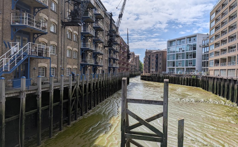
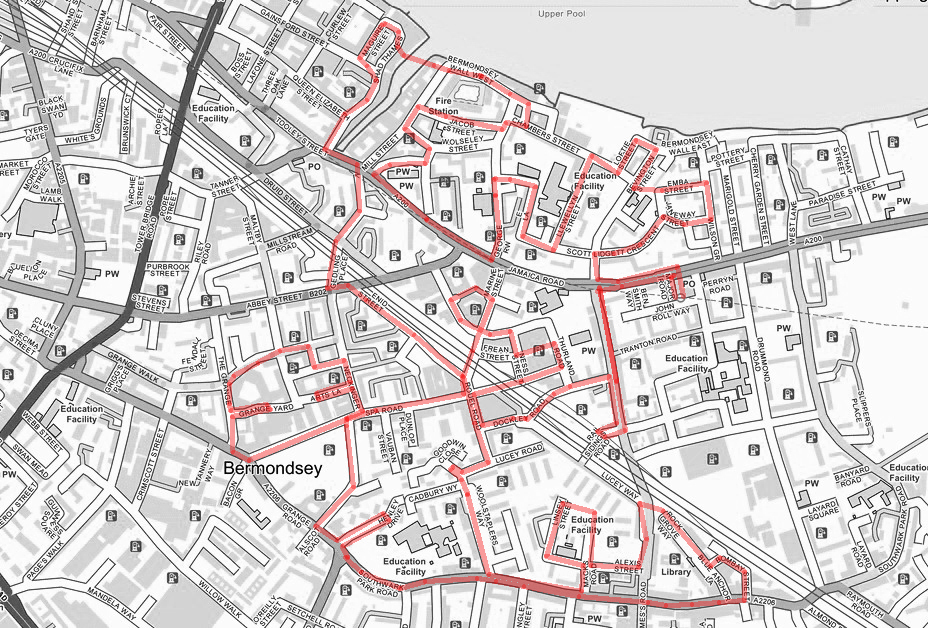
South of the river once more for today’s outing, but only just. We’re east of Tower Bridge in Bermondsey, exploring the highs and lows of the area between Southwark Park Road and the Thames; an area intersected by both the Jamaica Road and the Kent-bound rail lines out of London Bridge. In common with the other parts of South London visited recently this locale is heavy on public housing estates but unlike them it still has a wide selection of functioning pubs. The weather was warmer than I had dressed for and I had added to the usual navigational challenge by employing a map that was at least 15 years out of date. (The one below is not much better but at least handy if you need to know where the EV charging points are).
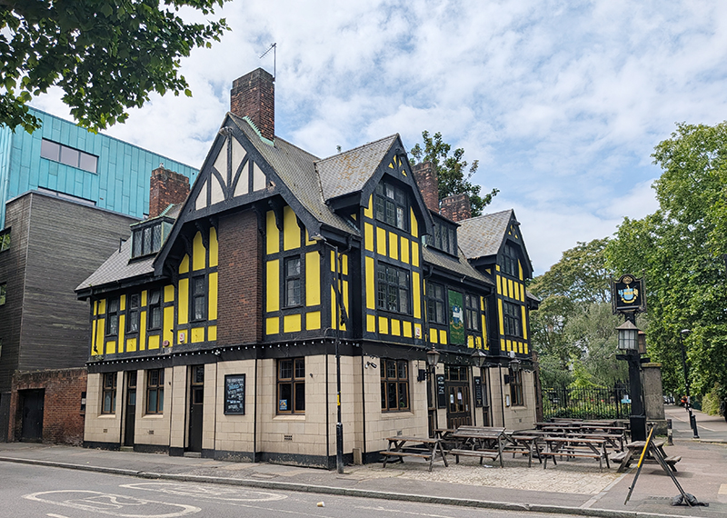
We kick things off by heading west on Jamaica Road from Bermondsey Tube Station past Major Road (which seriously belies its name) and Ben Smith Way. As we turn south onto St James’s Road we pass the first of those pubs I mentioned, the inter-war mock-Tudor style Gregorian.
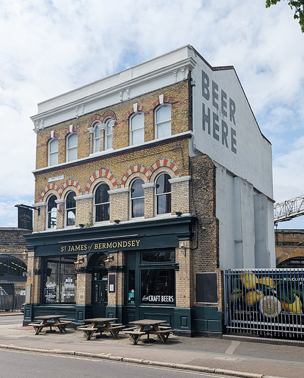
Further up the road just before we reach the railway is the St James of Bermondsey which dates back to around 1870. This one-time Watneys pub was done up and renamed (from the St James Tavern) in 2014. It’s changed hands a couple of times since then including a brief ownership by one of the breweries on the so-called Bermondsey Beer Mile. That informal collection of microbreweries and taprooms alongside the railway viaduct roughly covers the distance from Tower Bridge Road to St James’s Road.
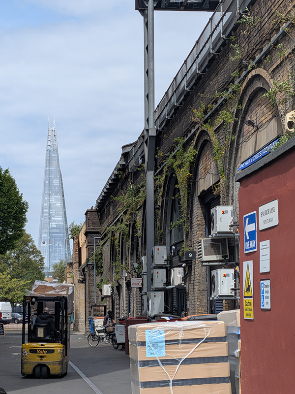
Railway Sidings Road is the first of many routes under the viaduct taken during the course of today. This viaduct is one of a series of nineteen brick railway viaducts between London Bridge station and Deptford Creek, which together make a single structure 3.45 miles in length. The structure carries the former London and Greenwich Railway (L&GR) line and consists of 851 semi-circular arches, the longest run of arches in Britain.
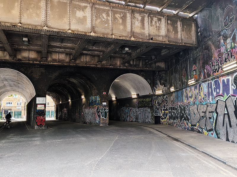
We don’t carry on having reached the other side however. Instead we double back and follow Dockley Road beneath the rails.
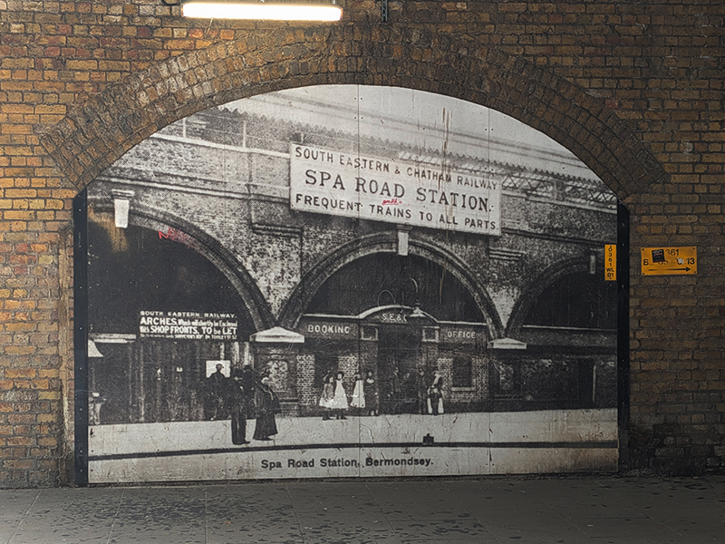
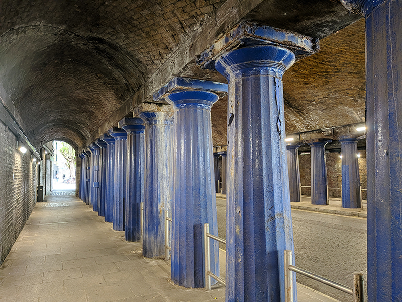
On Rouel Road we turn right down to Spa Road and make a return visit under the viaduct. As attested by the blown-up photograph mural beneath the bridge, this was once the site of Spa Road station the original terminus of the L&GR, the capital’s first railway. Opened in 1836, the station underwent several ownership changes, was rebuilt, changed its name, and relocated before closing in 1915 due to cost-saving measures during World War I. The tunnel is still supported by the original blue painted cast iron columns that line either side of the roadway.
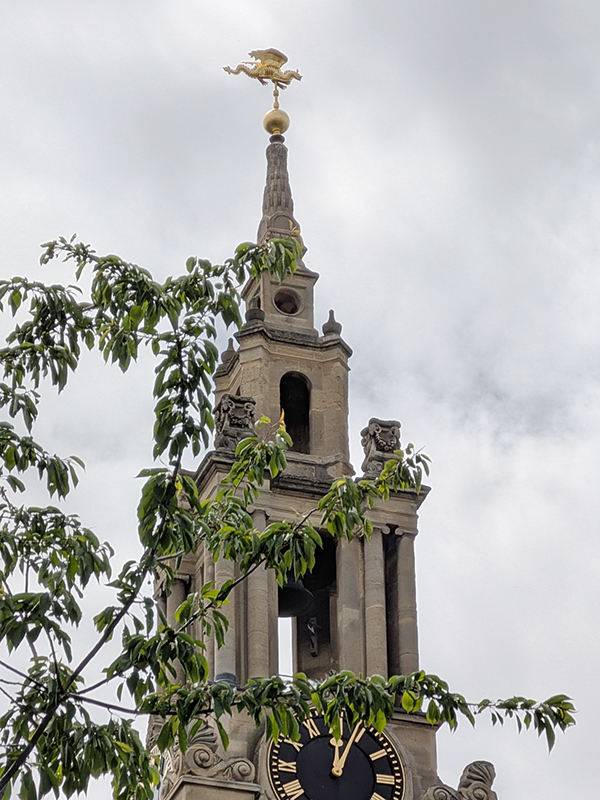
We look in on Ness Street then continue east to Thurland Road off of which stands St James Anglican Church. After the Battle of Waterloo a Commission was set up to build churches as a means of giving thanks and commemorating the victory. A sum of £1m was initially granted for their construction, in Acts of 1818 and 1824. South London secured seven of these so-called Waterloo Churches and group of Bermondsey churchmen successfully lobbied for a grant to build one of those seven having acquired the land on which St James was built. James Savage, the architect, modelled the church on the style of Greek Temples with galleries round three sides and the organ in the west. The bells were cast by the famous foundry of Mears of Whitechapel, from cannon left behind by Napoleon at Waterloo and a four-faced striking clock, costing £160, was put in the tower. The church was consecrated in 1829.
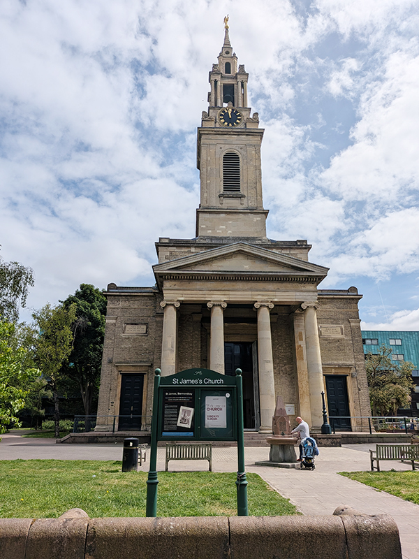
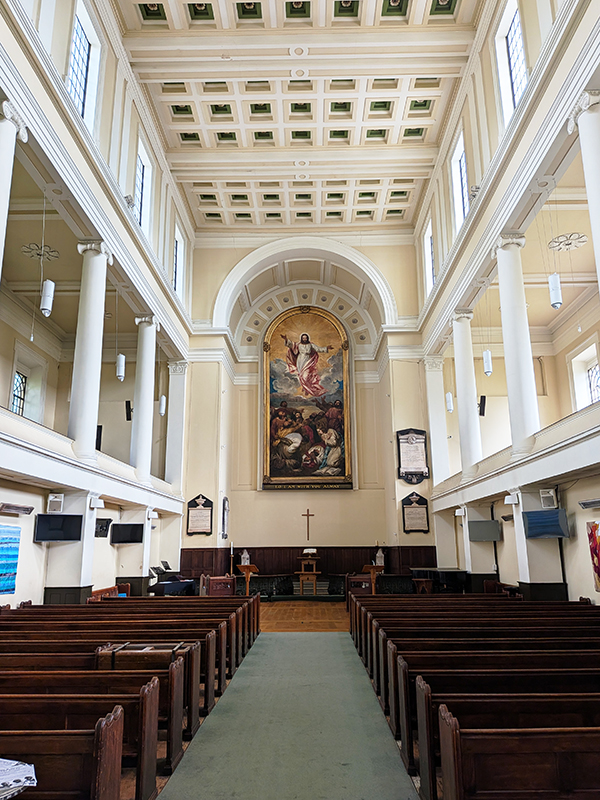
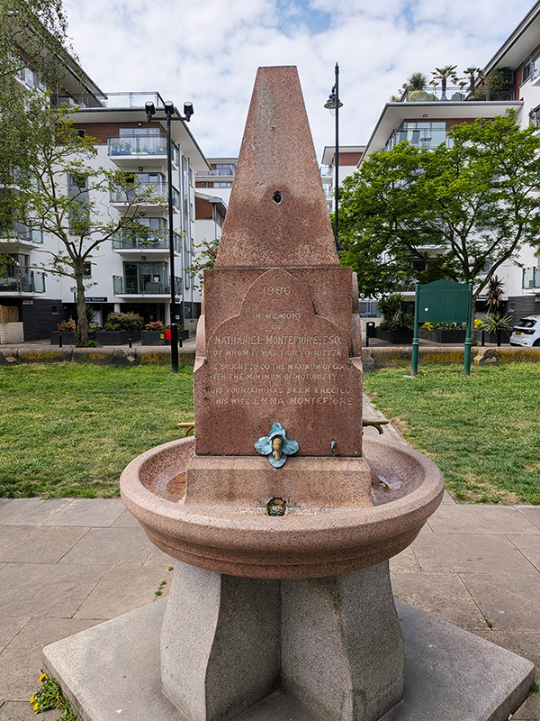
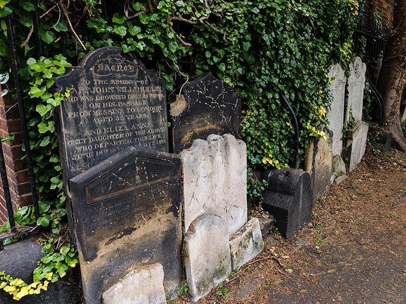
Sadly, I have been unable to find any further information about the death by drowning of a Captain John Hullin on Christmas Eve 1846, as recorded on one of the gravestones piled up at the back of the churchyard. There is no record of a shipwreck on that date although the straits of Messina (between Sicily and the Italian mainland) are known for their jeopardy. The Nathaniel Montefiore (1`819 – 1883), commemorated by the drinking fountain was a surgeon and philanthropist who practised at Guy’s Hospital. He died of a cold caught while attending a funeral in Berlin ( I suspect that wasn’t the inspiration for the Len Deighton novel).
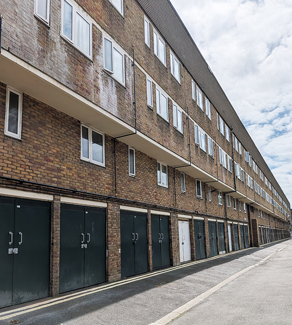
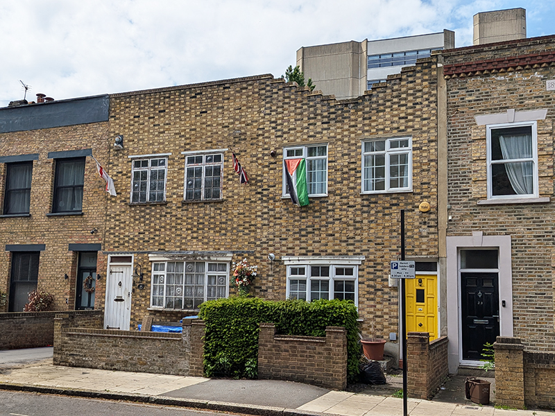
After leaving the grounds of the church we follow Frean Street (named for the Peak Frean biscuit factory that once existed nearby), Sun Passage, Old Jamaica Road and Marine Street back under the railway to Rouel Road. Heading south via Lucey Road and Yalding Road takes us past part of the Rouel Road Estate which is a particularly unlovely example of post-war public housing. In fact most of the housing estates in this area suffer in comparison with those encountered elsewhere in South London (so far at any rate). More England flags round here than I’ve been used to seeing as well; including this unlikely juxtaposition.
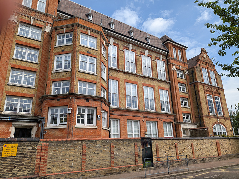
Arriving on Southwark Park Road we make our way east as far as Linsey Street which runs north into Alexis Street where we find the original school building of St James CofE Primary. This was constructed in 1877 as a London School Board facility and designed by the renowned architect E.R. Robson as part of the LSB’s massive push to educate inner-London children. Known affectionately as a “three-decker,” its classic Victorian layout stacked infants on the ground floor, junior girls on the first floor, and junior boys on the second. Nowadays, the building supplements the school’s main campus which is off Old Jamaica Road.
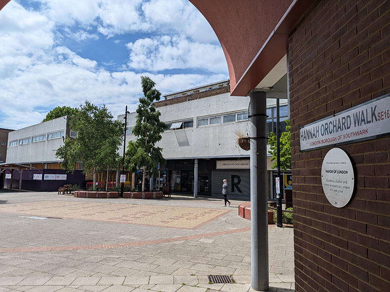
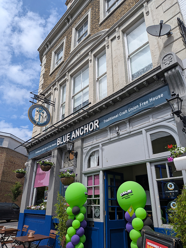
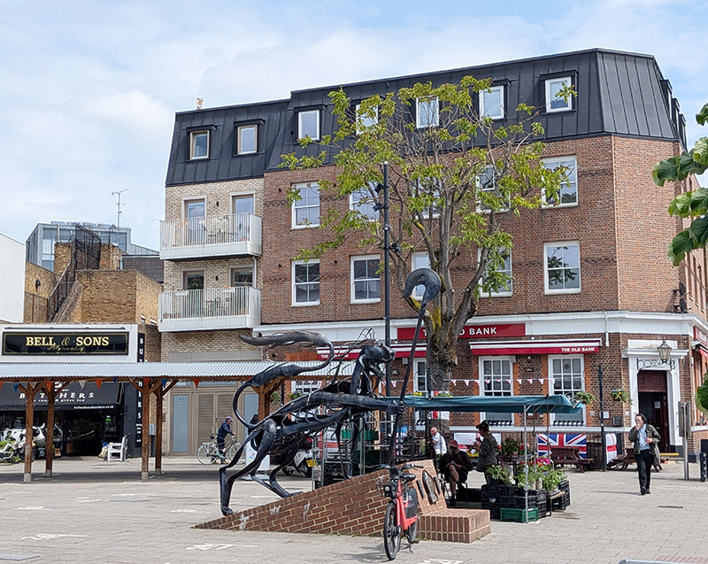
We round the corner into Macks Road then cut across the Rouel Road community garden to the top end of St James’s Road from here we make our way back to Southwark Park Road via Blue Anchor Lane and Bombay Street. As we make the return journey east we pass the Blue Anchor pub, the current incarnation of which has stood here since 1878. Prior to that the site was host to a “Blew Anchor” tavern as far back as at least 1695. Just beyond The Blue Anchor lies the Blue Market which has existed here for well over a hundred and fifty years; originally lining Southwark Park Road but moved to this purpose built square in 1976. Following regeneration in 2011 one of the access points, Hannah Orchard Walk, was named after a lady who worked in the market for more than eight decades starting in 1921. Despite the plaque proclaiming that the funding from the Mayor of London is “promoting a better and more prosperous London” reality doesn’t really bear that out. The market has room for 24 stallholders but there are reportedly only around 10 here on a regular basis and on this Thursday “Mr Fish Sole of Bermondsey” is holding the fort on his own. The pub on the square, The Old Bank, which is festooned with rather more flags of St George than warranted by the impending World Cup, is apparently popular with Millwall supporters (coincidence I’m sure). The statue, a representation of the Bermondsey Lion was created by Kevin Boys for Southwark Council and in 2011.
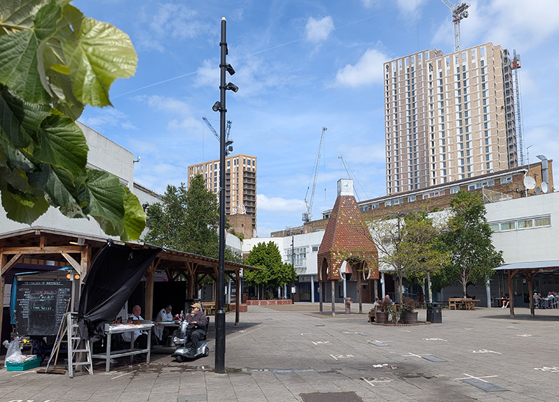
Back in the day it was was said that you could buy anything ‘Down the Blue’ and by fair means or foul, goods bound for the local factories found their way to the Blue Market, drawing legions of eager shoppers to the area. To a rather lesser extent the first part of that could be said to still hold true today.
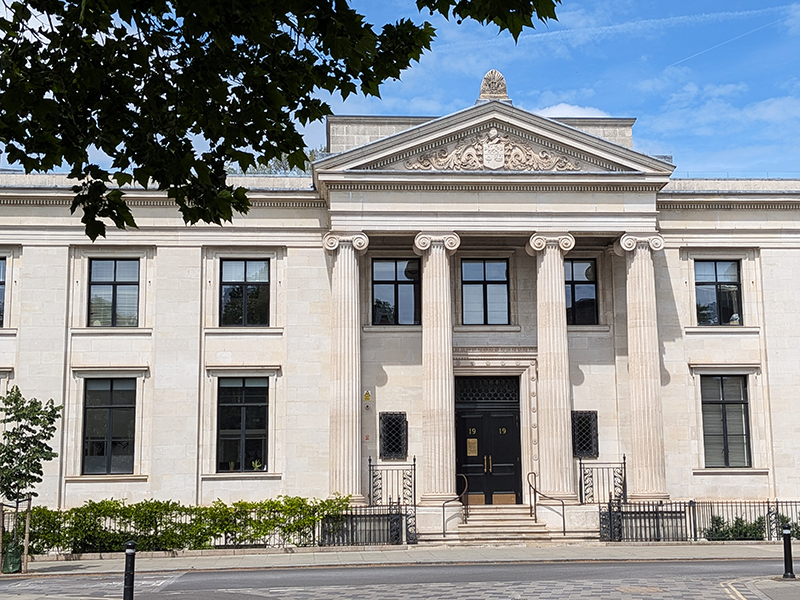
It’s a bit of a trek back along Southwark Park Road before, notwithstanding a detour into Henley Drive, we finally turn north again on Alscot Road which runs alongside Bermondsey Spa Gardens before hitting Spa Road opposite the former Bermondsey Town Hall. Built on the site previously occupied by Bermondsey Public Baths. The building was designed by Henry Tansley in the Greek Revival style and completed in 1930. The design involved a symmetrical main frontage with nine bays; the central section including a large three-bay, full-height, tetrastyle Ionic order portico. Internally, the main atrium on the ground floor featured a grand staircase and Doric order marble columns which supported an elliptical landing on the first floor and an elliptical domed ceiling above. The new building took over the role of headquarters of the Metropolitan Borough of Bermondsey during WWII but ceased to be the local seat of government when the enlarged London Borough of Southwark was formed in 1965. The Grade II listed building continued to be used as additional workspace by Southwark Council until 2010 before being converted into a block of apartments known as “Bath House Lofts” in 2014.
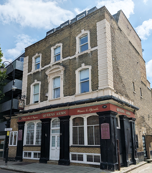
According to CAMRA, The Queens Arms, a short way to the east on Spa Road was converted into flats in 2016. If so, nothing has been done to disguise its pubbiness, which dates back to the early 19th century.
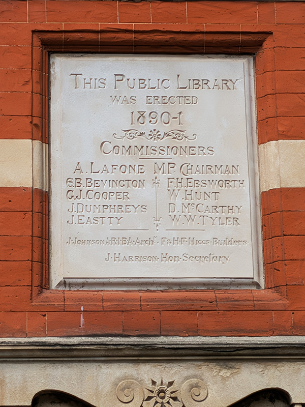
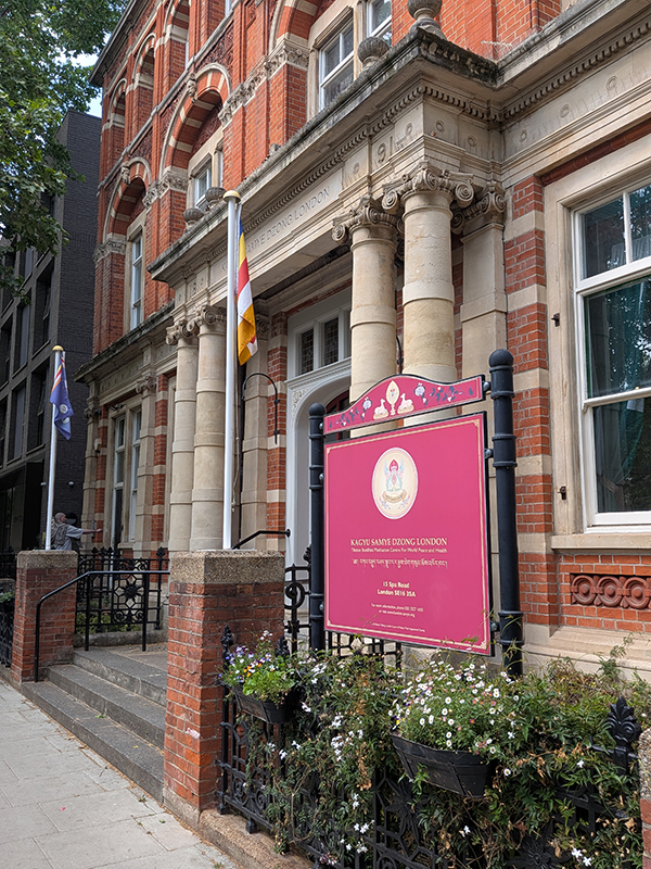
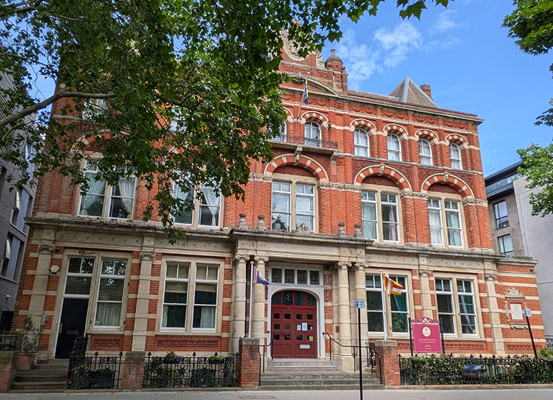
From here we make a circuit westward involving Neckinger, Grange Walk and The Grange to bring us back to Spa Road at its western end. En route we also take in several streets threaded through a development more recent than the map I was working from – Arts Lane, Limasol Street, Bakery Street and Woodmill Street. Just up from the old Town Hall is the original Bermondsey Public Library, also Grade II listed. This was built 1890-91 and was the work of John Johnson, architect and F and H Higgs, builders. It is in Flemish bond (a traditional bricklaying pattern created by alternating headers – the short end of the brick and stretchers – the long side within the same course) with terracotta and stone trim. This was one of the first free public libraries in London and remained operational as such until the 1980s after which it was used as office space by London Borough of Southwark. In 2009 it was sold to the Kagyu Samze Dzong London Buddhist community to be used as a Tibetan Buddhist Meditation Centre for World Peace & Health.
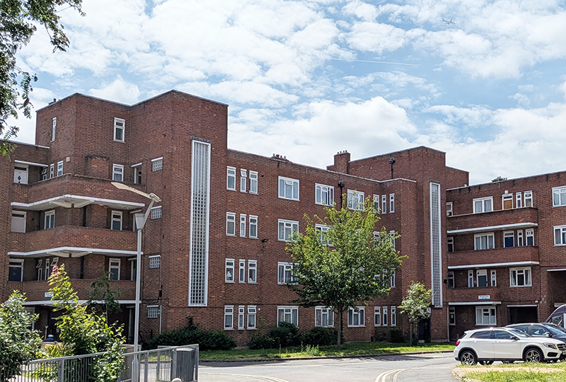
Having covered the full extent of Spa Road we follow Enid Street southwest alongside the railway viaduct again, a stretch that is one of the main components of the Bermondsey Beer Mile. On the other side of the street lies the Neckinger Estate. The estate was built in 1938 by the Bermondsey Borough Council to provide affordable housing for local workers and occupies the site of historic tanneries and the 18th-century Neckinger Mills. It gets its name from the River Neckinger, a tidal tributary of the Thames, the remains of which are subterranean apart from the final few hundred metres that flow into St Saviours Dock (see further on).
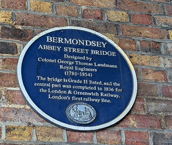
At the end of Enid Street we emerge onto Abbey Street at the southern entrance to the tunnel underneath the Abbey Street Bridge, another of those that were built in 1836 to carry the London and Greenwich Railway.
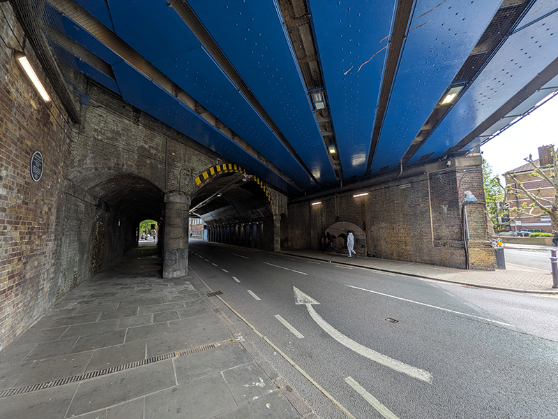
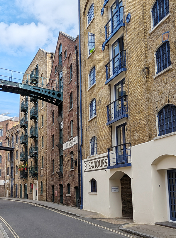
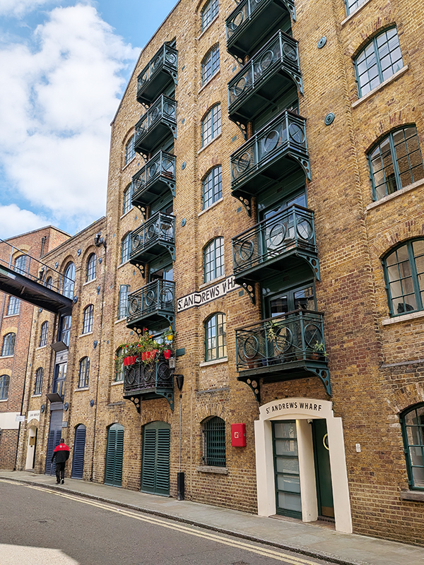
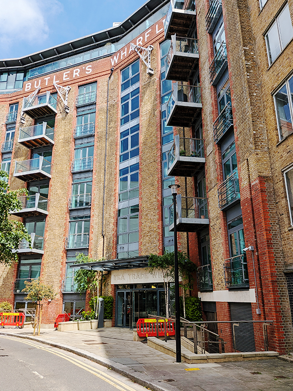
We don’t cross under the bridge however; we turn left instead and then immediately right into Gedling Place which takes us under the railway to Druid Street where we continue into Sweeney Crescent and make our way down to Jamaica Road. After a short westward stint on Jamaica Road we turn north and follow Shad Thames down to the river. In the 19th century, this street and its neighbour, Maguire Street, were home to the largest warehouse complex in London. From the mid-1980’s onward, as with Wapping on the other side of the river, the wharves have been converted to house upmarket apartments and associated restaurants and leisure facilities. Originally built in 1873, the warehouses here stored huge quantities of tea, coffee, spices and other commodities, which were unloaded and loaded onto river boats. For this reason, the area became known as the ‘larder of London’. During the 20th century, the area went into decline as congestion and containerization forced shipping to unload goods further east, and the last warehouses closed in 1972. In 1989, the Design Museum, brainchild of Terence Conran, opened its doors in a converted banana warehouse in Shad Thames. In 2016, however, it moved to a new location in Kensington. Among the most striking features of Shad Thames are the walkways which criss-cross the street high overhead. Most of them now connect the Butlers Wharf building and the Cardamom Building and were originally used as bridges to roll barrels and the like between warehouses.
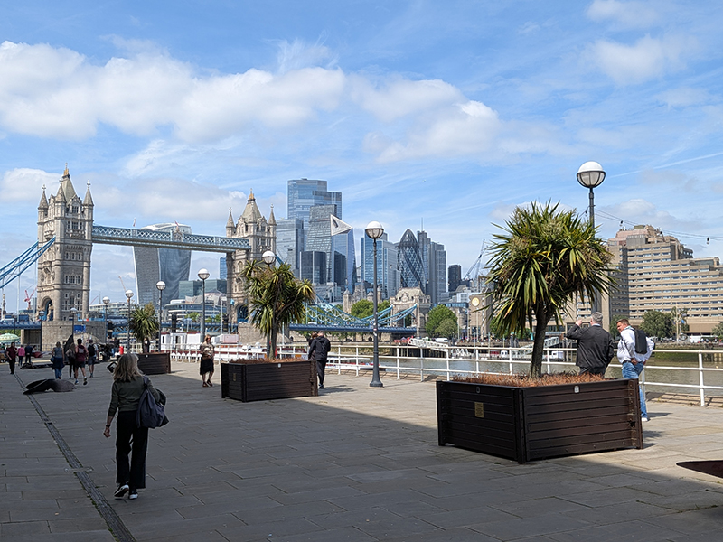
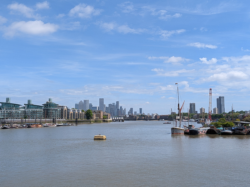
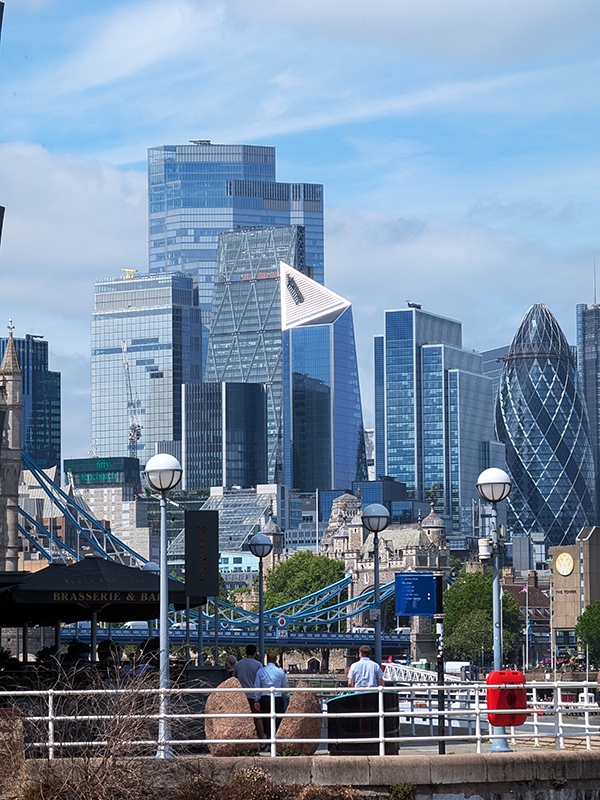
Having reached the river we are afforded panoramic views of Tower Bridge and the City to the west and Canary Wharf to the east.
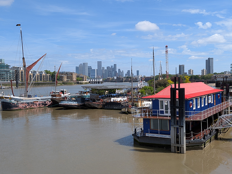
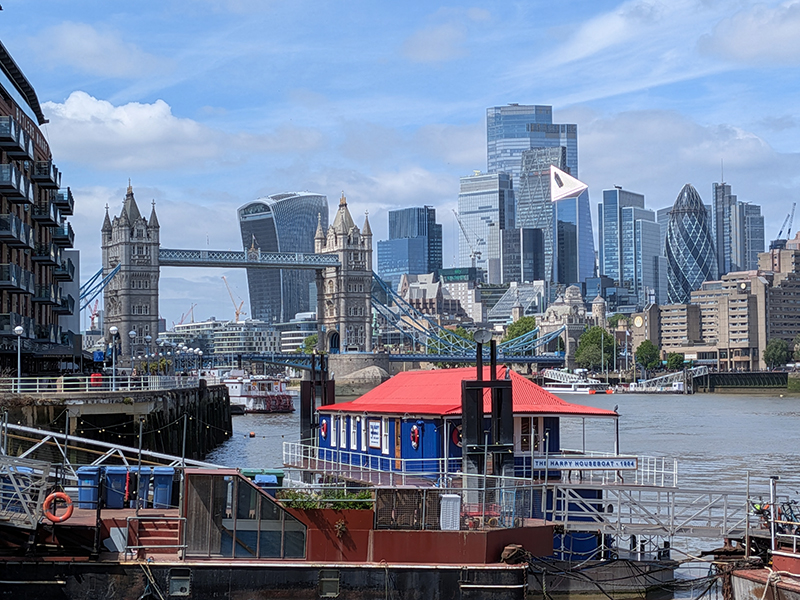
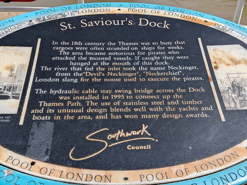
A few paces further downstream we arrive at St Saviours Dock where what is left of the River Neckinger dribbles out into the Thames. The river’s name translates to “Devil’s Neckerchief” or hangman’s noose, likely referencing the gibbets where pirates were executed. In 1995 a hydraulic cable stay bridge was installed across the dock to connect up the Thames Path, and we duly take advantage of that today.
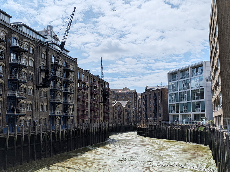
As we proceed parallel to the river along Bermondsey Wall West we pass St Saviours House, a former factory that was also, inevitably, converted into apartments. What was once manufactured in this building is seemingly unascertainable but the area was once a real hub of industry, in particular the production of biscuits.
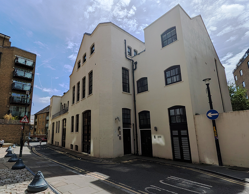
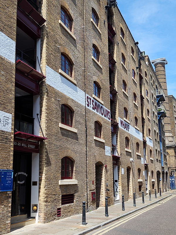
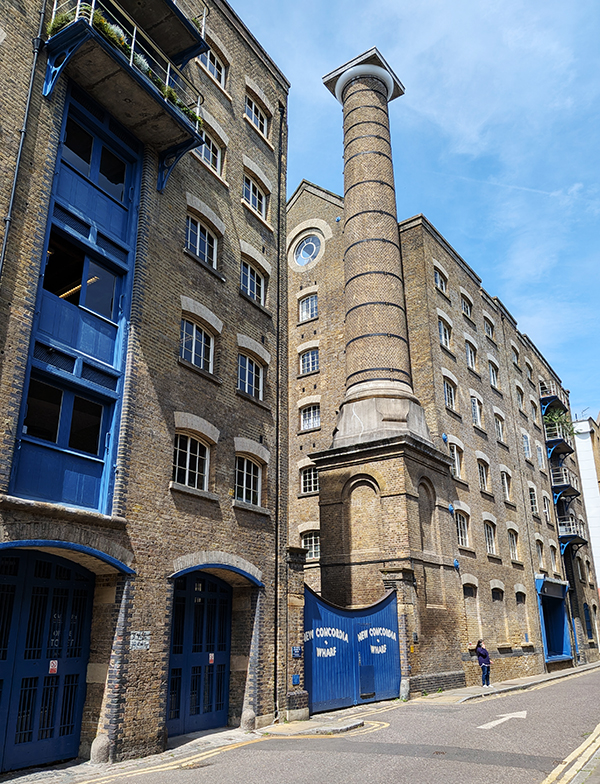
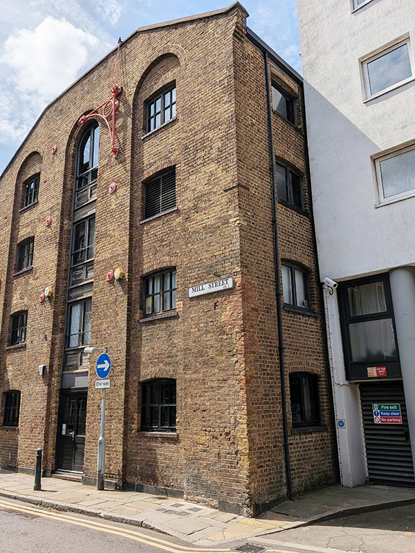
By way of Flockton Street, Chamber Street and Jacob Street, which was once home the Spillers dog biscuit factory, we double back to Mill Street which runs along the back of St Saviours Wharf and New Concordia Wharf on the eastern bank of St Saviours Dock. Both these warehouses are Grade II listed; the former was built around 1860, the latter, constructed c.1882, also included a cornmill (hence the water tower and chimney). Conversion of both buildings occurred in the early 1980’s. The area to the east of Mill Street was once known as Jacob’s Island and was a notorious slum in the first half of 19th century. Charles Dickens used Jacob’s Island as the setting for Bill Sikes’ lair where the Oliver Twist villain is cornered and meets his demise at the end of the novel.
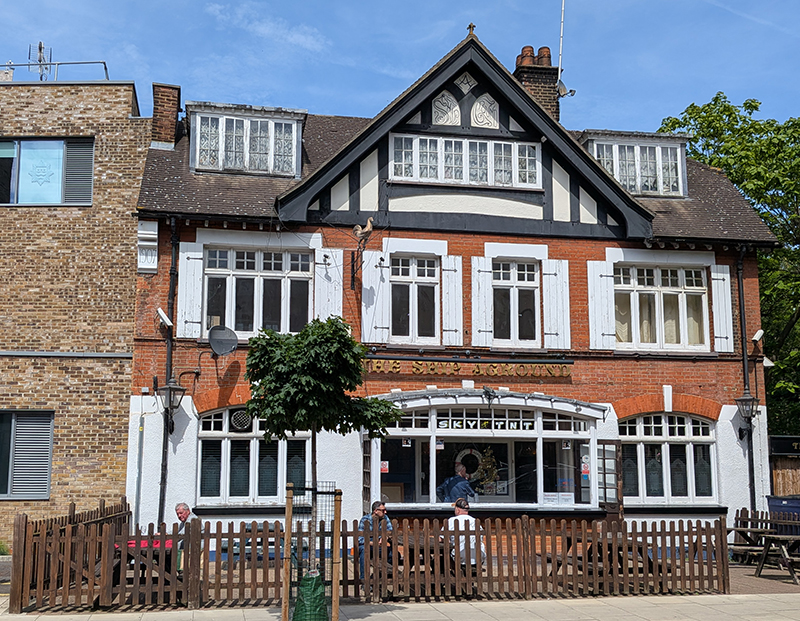
Leaving Mill Street via Wolseley Street we finally reach our pub of the day, the unassuming The Ship Aground. This former Courage house is situated next to Bermondsey Fire Station and featured in the 90’s TV series London’s Burning. They don’t do food so I had to make do with crisps to accompany my half a cider. The staff were very friendly (though it’s always a bit disconcerting to be referred to as my lovely by someone half your age) and the toilet was pretty smart too.
Having finished my drink I head back up to Jamaica Road on Parkers Row and Dockhead (careful with the typing there). W.R Jacobs, the (originally Irish) company responsible for the eponymous crackers, Club biscuits and Twiglets, had a factory that occupied the site between Dockhead and Wolseley Street. This site closed down in 1989 but the company, which is now part of United Biscuits, itself owned by a Turkish-based conglomerate, still produces 55,000 tons of snacks and biscuits annually from its factory in Aintree, Liverpool.
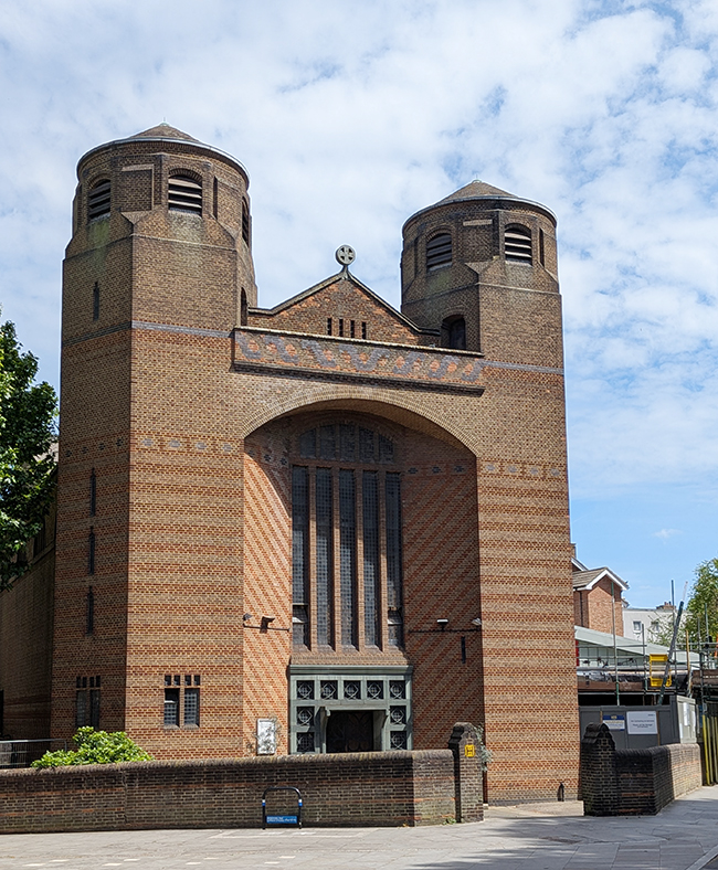
In between Dockhead and Jamaica Road lies the Roman Catholic, Most Holy Trinity Church. The original Catholic chapel here, the Dockhead Mission, was built in 1773 but only lasted seven years before being demolished in the Gordon Riots. More than 50 years later, in 1837, a replacement was built in the Early English Gothic style. That church was then destroyed by a German V-bomb in 1945. The present church, another Grade II listing, was the final work of architect Harry Stuart Goodhart-Rendel (1887-1959), a prolific designer of Roman Catholic churches. Construction began in 1957 but the church wasn’t consecrated until 1960 by which time Goodhart-Rendel had passed on. The church, with its yellow and red brick polychrome patterns, was completed by the successor practice of F.G. Broadbent and Partners.
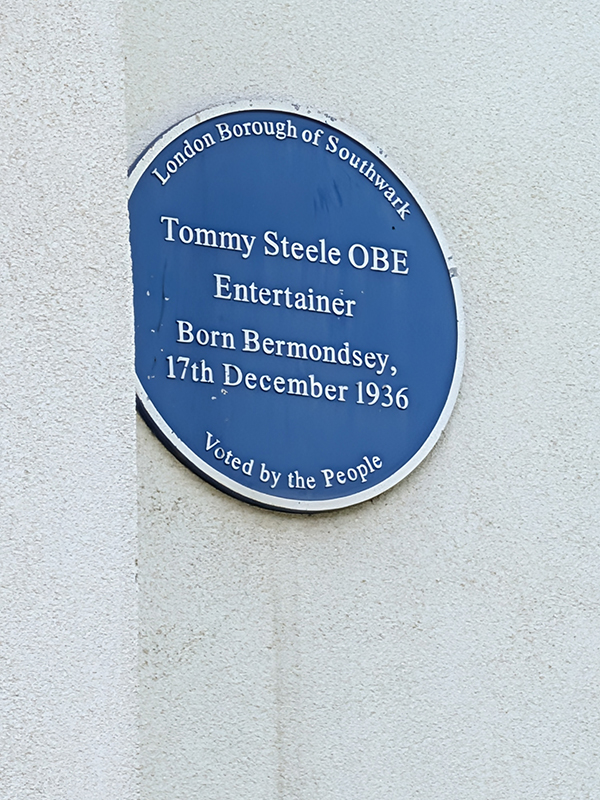
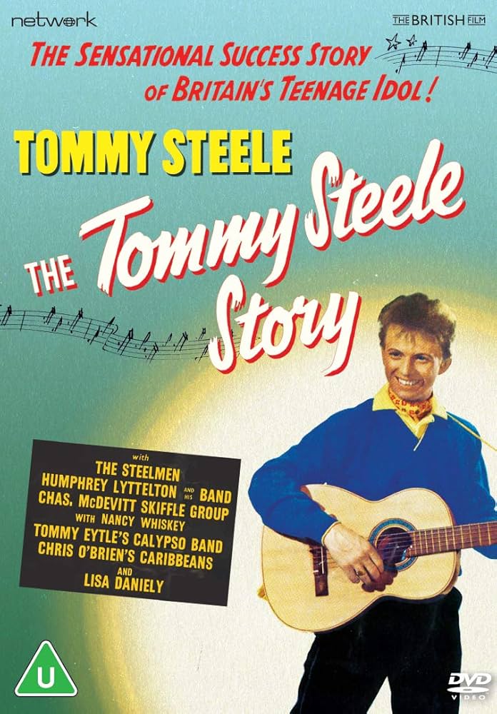
About 200 metres east on Jamaica Road we turn north again on George Row. On the side of Nickleby House is a Southwark Council blue plaque marking the fact that the all-round entertainer (Sir) Tommy Steele (1936 – ) was born in Bermondsey (though nobody seems to be sure where exactly). He was born as Thomas Hicks but by the time he had his first hit record, “Rock With The Caveman” in 1956, he had adopted the stage name. A series of chart smashes followed in quick succession as Steele became Britain’s first teen idol and bona-fide rock n’ roll star (notwithstanding the tameness of his material). So rapid was his rise to fame that as early as 1957 a biographical film documenting it, “The Tommy Steele Story”, was produced. Steele shifted away from rock and roll in the 1960s, becoming an all-round entertainer. He originated the part of Kipps in Half a Sixpence in the West End and on Broadway, reprising his role in the 1967 film version. As an actor, he went on to appear in the films The Happiest Millionaire (1967) and Finian’s Rainbow (1968) and as the lead in several West End productions of Singin’ in the Rain.
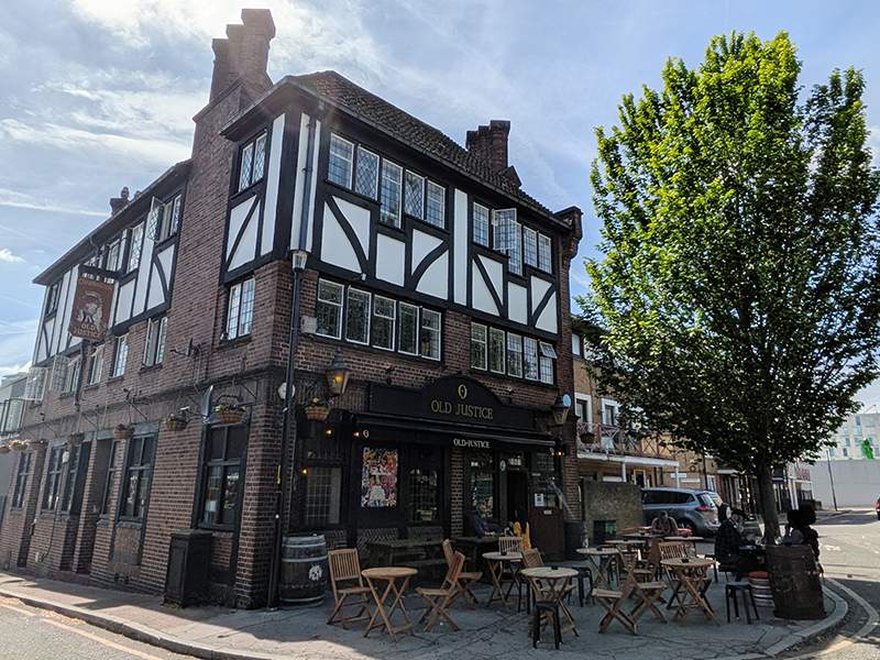
We work our way further east via Sugar Lane, East Lane, Scott Lidgett Crescent, Lewellyn Street, Chamber Street (once more) and Loftie Street before alighting on Bevington Street. Just round the corner on Bermondsey Wall East is one final pub, The Old Justice, another of those 1930s neo-Tudor style jobs. The architect was Sidney C Clark, regarded as one of the most accomplished inter-war pub architects. In 2017 planning permission was refused for the conversion of the pub to flats and it was Grade II-listed shortly after. Subsequently the building owner began unlawfully ripping out the historic interior but following enforcement action by Southwark Council, listed building consent was granted in 2021 for reinstatement of the interior. After a five year hiatus the pub reopened in 2023. It was famously used as a backdrop for Paul McCartney’s music video for No More Lonely Nights, a fact commemorated by the plaque which is just about visible in the photo below (next to the lamp on the right – squint !)
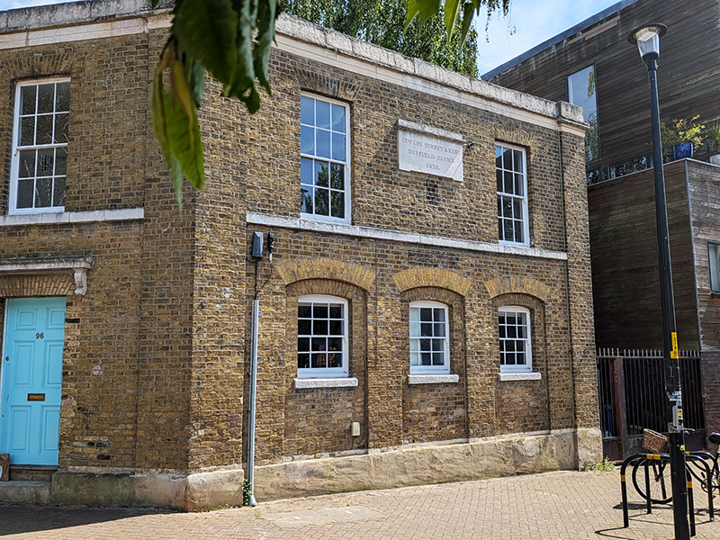
Opposite the pub is a former office block that is all that remains of a sewer pumping station constructed by the Surrey and Kent Commission of Sewers in 1822. At the time, this part of London was still part of Surrey, and this particular commission can be dated to 1554, as its Letters Patent were granted by Queen Mary following a series of “gret wyndes and fluddes”. Sewers at the time were more about draining water to prevent flooding in low lying areas than the removal of human waste. Land Registry documents relating to a sale of the building in 1992 indicate that the sewers remain under the building and are still used by Thames Water.
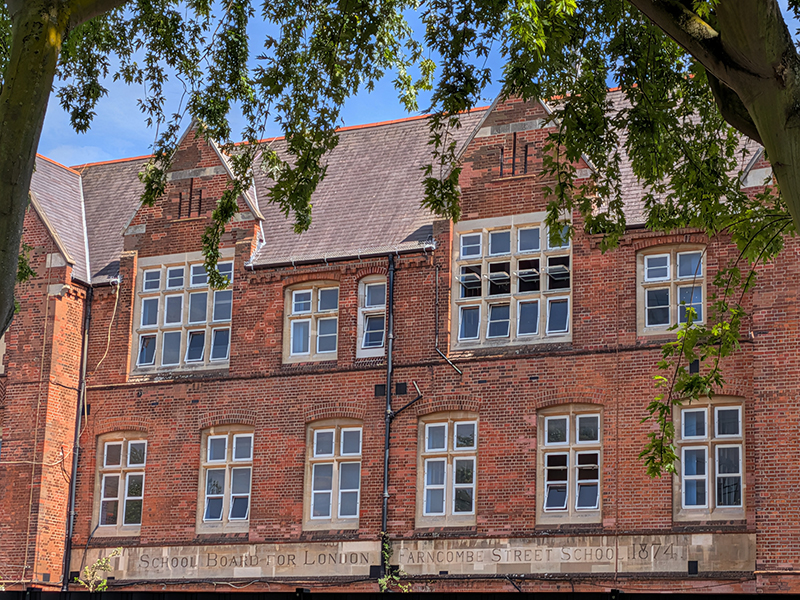
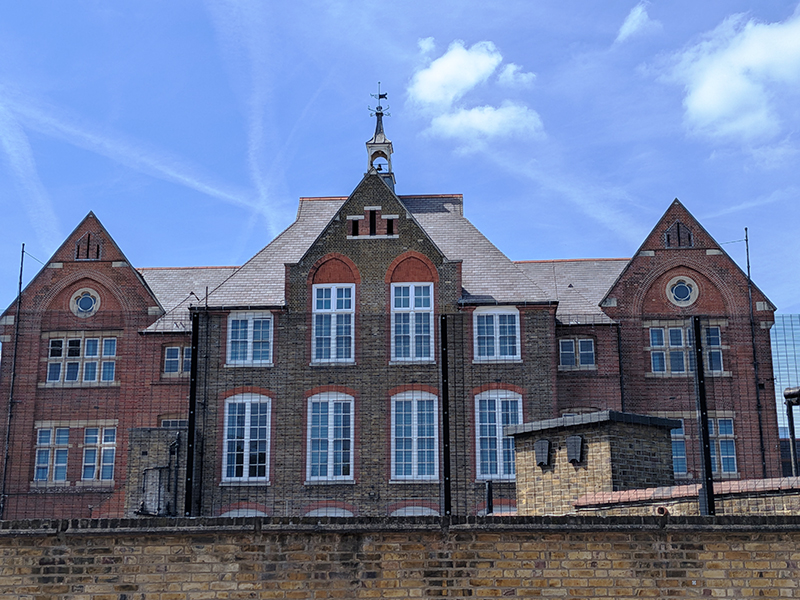
Farncombe Street leads up to another primary school dating back to the Victorian era that is still used for that purpose today. Farncombe Street Board School was built in 1874 by the London School Board in the ecclesiastical Gothic Revival style popular at the time and is yet another Grade II Listing because of this. The steeply pitched outer gable ends have stone quatrefoils with three light slits above, while the whole building is capped with a cupola containing the school bell, itself capped with a weather vane. Today the school has around 250 pupils with a more or less 50/50 gender split. Almost half the children don’t speak English as a first language notwithstanding which the proportion of them deemed to meet the expected standard for reading and writing is significantly above the national average.
For the last leg of today’s journey we move from Farncombe Street into Emba Street then on to Wilson Grove and back to Jamaica Road via Janeway Street and repeat visits to Scott Lidgett Crescent and Bevington Street. 100 metres to the east and we’re back at Bermondsey Tube Station.

