
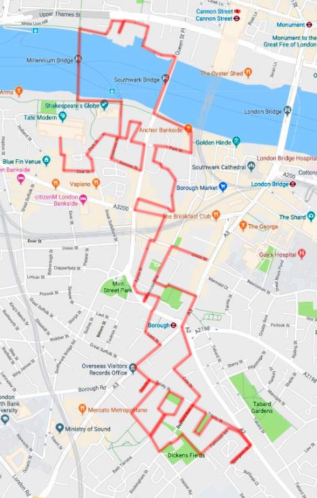
This is a bit of a meandering one, starting out on Bankside then crossing the river twice before heading down through Borough to Trinity Square and hallway back again. On the way we’ll cross paths with Shakespeare, Dickens, Alfred the Great and Catherine of Aragon.
So we begin where we left off last time, at Tate Modern, exiting from the Blavatnik Building onto Sumner Street. Then we cut down Canvey Street as far as Zoar Street turning east for a short while before nipping between the buildings up onto Southwark Street.
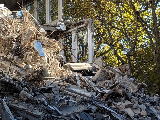
On Southwark Street we turn east and when we get to the next left, the by-now familiar Great Guildford Street head back towards the river. Crossing over Sumner Street we reach the western end of the long and winding Park Street. Before we get to Emmerson Street which return us to another section of Sumner Street there’s a nice new demolition site to stop and admire.
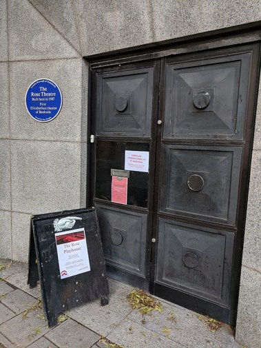
Sumner Street takes us up onto Southwark Bridge Road where we turn northward briefly before taking some steps which deposit us back on Park Street on the doorstep of the Rose Playhouse. The Rose became the fifth purpose-built theatre in London when it was created in 1587 pre-dating the Globe (of which more later) on Bankside by 14 years. It represented something of a cultural step-up for an area known for its brothels, gaming dens and bear-baiting pits. The Rose’s repertoire included Marlowe’s Doctor Faustus, Jew of Malta and Tamburlaine the Great, Kyd’s Spanish Tragedy and Shakespeare’s Henry VI part I and Titus Andronicus. Its star faded fairly swiftly in the shadow of the success of the Globe however and by the very early years of the 17th century it had fallen out of use. Its archaeological remains were discovered in 1989 during excavations for the re-development of an office block. The Rose Theatre Trust was formed in response to fears that the new building proposed for the site would bring about the destruction of the remains. A campaign to ‘Save The Rose’ was launched with enthusiastic support from the public, scholars and actors, including the dying Lord Olivier who gave his last public speech in May 1989 on behalf of The Rose. The Trust managed to secure government funds to delay construction and to bring about a re-design of the proposed new building so that only a small amount of the fabric of The Rose was lost, and a permanent enclosure of this fragile site was created. If you want to check it out public viewings take place most Saturdays.
From Park Street we duck in and out of Rose Alley and Bear Gardens before New Globe Walk takes us up to Bankside and, naturally enough, the new Globe Theatre. The new incarnation of the Globe is located several hundred metres away from where the original was sited so we’ll deal with the latter in a while. The project to rebuild Shakespeare’s Globe was the brainchild of the American actor, director and producer Sam Wanamaker. Twenty one years after his first visit to London, in 1949, he founded what was to become the Shakespeare Globe Trust, dedicated to the reconstruction of the theatre and the creation of an education centre and permanent exhibition. After another 23 years spent tirelessly fundraising and planning the reconstruction with the Trust’s architect Theo Crosby, Sam Wanamaker died in 1993. He lived long enough to see the site secured and a few timber bays of the theatre in place. It was another three and a half years before the theatre was completed. Other than concessions to comply with modern day fire regulations such as additional exits, illuminated signage, fire retardant materials and some modern backstage machinery, the Globe is as accurate a reconstruction of the 1599 Globe as was possible with the available evidence.
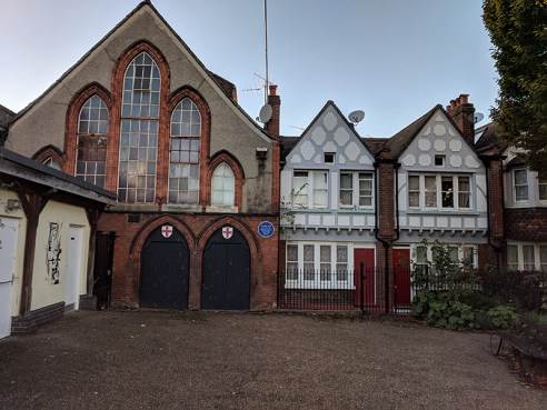
Sandwiched in between the Globe and Tate Modern is a row of 18th century houses the most striking of which is the three-storey cream coloured building bearing the name Cardinal’s Wharf. Its façade also bears a ceramic plaque engraved with the words Here lived Sir Christopher Wren during the building of St Paul’s Cathedral. Here also, in 1502, Catherine Infanta of Castile and Aragon, afterwards first queen of Henry VIII, took shelter on her first landing in London. Sadly, both of these claims were debunked in a 2006 book by writer and historian Gillian Tindall. Since the house was built in 1710, the year St Paul’s was completed, Wren couldn’t have lived here during its construction. He did however live in a house nearby so it’s probable the plaque was rescued from that property at the time of its demolition and cheekily redisplayed. As for Catherine of Aragon, that’s dismissed as pure fantasy. The adjacent redbrick house is known as the Provost’s Lodging, a name adopted when it was acquired by Southwark Cathedral from Bankside Power Station in 1957. In 2011, following the death of the then Dean of Southwark (the title of provost was done away with in 2000) the property was put on the market for £6m. Which is a lot of money to spend if you’re going to have tens of thousands of people traipsing past each day within spitting distance of your front door.


And so it’s time to head briefly back across the river and tick off a couple more bridges. First up, of course, is the ill-fated (in terms of its name) Millennium Bridge, built to link St Paul’s Cathedral with the new Tate Modern as part of the Millennium celebrations. Unfortunately, as I’m sure we all recall, when it opened in June 2000 it only stayed accessible for two days before being closed for two years to allow for modifications to rectify the swaying motion (or resonant structural response) that led to the nickname “Wobbly Bridge”. The design of the bridge, which was subject to a competition, was a collaboration between Arup Group, Foster and Partners and Sir Anthony Caro. Due to height restrictions, and to improve the view, the suspension design had the supporting cables below the deck level, giving a very shallow profile. The eight suspension cables are tensioned to pull with a force of 2,000 tons against the piers set into each bank—enough to support a working load of 5,000 people on the bridge at one time. Though not enough to save it from the Death Eaters in Harry Potter and the Half-Blood Prince.
Once across the bridge we turn east along the Thames Path though not for very long as you soon have to divert away from the river up Broken Wharf and along High Timber Street (calling in on the dead end Stew Lane if you wish) before rejoining via Queenhithe. Beside and below the street of the same name is the only surviving inlet along the City waterfront which was once a thriving Saxon and Medieval Dock. The harbour is reputed to have been established in AD 899 shortly after King Alfred the Great had turfed the Vikings out of London. Originally named ‘Ethelred’s Hythe’ it became known as ‘Queenhithe’ when Queen Matilda, wife of Henry I, was granted the dues from the dock in the early 12th century (a right inherited by successive English queens). In the 15th century the dock’s fortunes waned as larger vessels struggled to navigate past London Bridge and opted to unload further east at Billingsgate. The dock did however remain in service up to Victorian times and remnants of that period of usage are still visible at low tide.


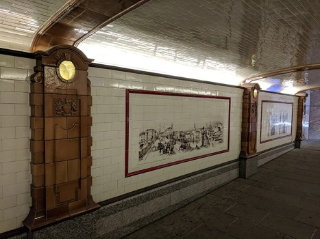
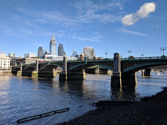
From Queenhithe it’s just a hop and a skip to Southwark Bridge. Before we get up onto the bridge itself though we can pop through the northside underpass, known as Fruiterers’ Passage after the Worshipful Company of Fruiterers whose warehouses once stood nearby. The passage is tiled on both sides incorporating scanned historic images of the bridge and its immediate surroundings.
The bridge itself, something of a Cinderella as far as central London crossings of the Thames are concerned, dates from 1921 in its current form. The bridge was designed and engineered by Ernest George and Basil Mott respectively, the latter also partly responsible for the Mersey Tunnel. And there’s not really much else to say about it to be honest.
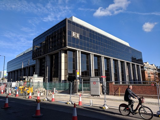
At the southern end of the bridge sits the current HQ of the Financial Times. I say current because at the time of writing the FT’s owners Nikkei (who acquired from Pearson in 2015) have just announced plans to sell the building ahead of a move back to the FT’s previous offices at Bracken House near St Paul’s in 2019. One Southwark Bridge has been the FT’s home since 1989.
We drop down from the bridge onto Bankside and head east as far as the Anchor pub. The pub started life as the ‘brewery tap room’ for the Anchor Brewery which was established in 1616 on land adjacent to the original Globe Theatre and by the early nineteenth century was the largest brewery in the world. After being destroyed in the Great Fire the pub was rebuilt in 1676 and largely reconstructed again in the 19th century. The brewery was taken on by the newly founded Barclay Perkins & Co. in 1781 and Barclays survived as an independent brand (including their famous Russian Imperial Stout) up until 1955 and a merger with Courage. Brewing continued on the site under Courage but last orders were called in the early 1970’s and the buildings were demolished in 1981.


Beyond the pub we turn away from the river up Bank End which soon forms a junction with two more parts of Park Street. We take the section heading back west which runs through where the Anchor Brewery stood (a plaque on the south side commemorates this) and arrive at the site of the original Globe Theatre just to the east of the Southwark Bridge Road flyover and less than a hundred metres from the Rose Theatre. The precise location of the Tudor Globe was only determined in 1989 when part of the foundations were discovered beneath the car park of Anchor Terrace a building of 1834 which originally housed senior employees of the brewery. As this is itself a listed building further excavations have not been possible. The Elizabethan Globe Theatre was built in 1599 on land leased by Richard Burbage and his brother Cuthbert along with Shakespeare and four other members of the Chamberlain’s Men company. It was partially constructed re-using timbers from “The Theatre” in Shoreditch; London’s first theatre which had been built in 1576 by the Burbage brothers’ father, James. As noted above, the theatre was enormously successful in its early years but in 1613, during a performance of Henry VIII, wadding from a stage cannon ignited the thatched roof and the theatre burned to the ground. It was hastily rebuilt, with a tiled roof, and continued as a playhouse until 1642 when the Cromwell’s Puritan administration forced its closure. It was demolished to make way for tenements two years later.


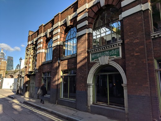
Doubling back along Park Street we turn south next down Porter Street then work our way though Gatehouse Square, Perkins Square and Maiden Lane back to the final, most easterly stretch of Park Street. From here we link back to Southwark Street via Redcross Way where the façade of the old W.H. Willcox & Co. engineering company building still clings on. Lord knows where you have to go these days to get your crank-pin lubricators.
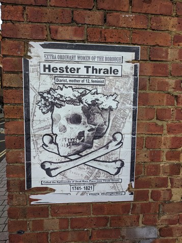
We turn west for a bit along Southwark Street then fork right down Thrale Street, named after Henry Thrale the eighteenth century politician who was a friend of Samuel Johnson and who inherited the Anchor Brewery from his father (it then being sold to Messrs Barclay and Perkins upon his death). His wife, Hester, bore him 12 children and outlived him by forty years. Hester Thrale was a formidable woman; in addition to her procreational achievements she was a noted diarist, author and patron of the arts. She also rescued her husband from probable bankruptcy by raising the money to clear his debts of £130,000 that resulted from a failed scheme to brew beer without malt or hops.
At the end of Thrale Street we turn left onto Southwark Bridge Road then right onto Southwark Street again. This takes us past the Menier Chocolate Factory building built by the French company, Chocolat Menier, in the 1870s. Menier eventually became part of the Rowntree Macintosh group which was in turn swallowed up by Nestle. Confectionery production had ceased here by the 1980s and the building was derelict until it was resurrected as an arts and theatre space in 2004. The Menier Chocolate Factory theatre has an impressive list of productions under its belt, including some particularly lauded musical revivals such as A Little Night Music and La Cage Aux Folles which both transferred to Broadway in 2010.
Beyond the Chocolate Factory we turn south down Omeara Street where we find the dramatically-named Roman Catholic Church of the Most Precious Blood. The Parish was founded in 1891 and the church was designed by Frederick Arthur Walters who was also the architect for Buckfast Abbey.


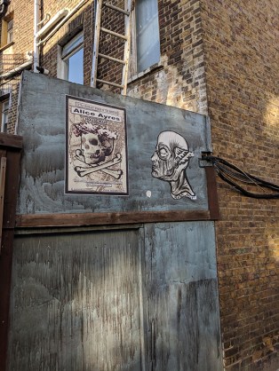
At the end of Omeara Street we cross over Union Street and continue south on Ayres Street. The street used to be known as White Cross Street but was renamed in 1936 by the then Labour-led LCC in honour of Alice Ayres, a nursemaid who attained a form of secular canonisation in the Victorian era after she died rescuing the three young children in her care (the daughters of her elder sister, Mary Ann) from a house fire. Such was the public interest in the story that Alice’s funeral was attended by 10,000 mourners and a memorial fund set up raised £100 for the erection of a granite obelisk monument above her grave in Isleworth cemetery.
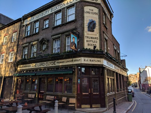
On the corner of Ayres Street and Clennam Street stands the Lord Clyde pub, one of the all-too-few remaining classic style Trumans Beer alehouses. Named after Field Marshal Sir Colin Campbell, 1st Baron Clyde, GCB, KSI, who commanded the Highland Brigade in the Crimean War and led the troops who quelled the Indian Mutiny of 1857, the pub has remained unchanged since it was built in 1913 and has been run by the same family, the Fitzpatricks, for over 60 years.
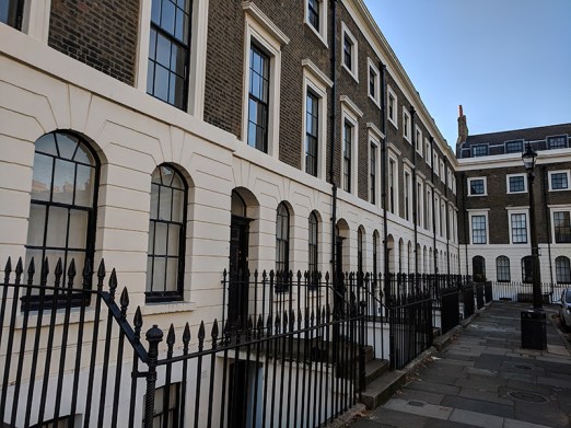
We turn left onto Marshalsea Road then almost immediately left down Quilp Street (the other section of which we visited last time). Off of Quilp Street is Dorrit Street which is basically a twenty-yard cul-de-sac and therefore crying out to be prefaced by the word Little; so one can only assume it was left off out of embarrassed deference towards Dickens’ titular heroine. Quilp Street disgorges into Redcross Way which we hop over into Disney Street then dog-leg round Disney Place back onto Marshalsea Road. Cross over into Sanctuary Street which we follow south as far as Lant Street where we turn left down onto Borough High Street. Continue south down to Trinity Street where we turn east past Trio Place then head south along Swan Street to Harper Road. Turning left onto Harper Road and then left again down Brockham Street brings us into Trinity Church Square, comprised of immaculately maintained Georgian terrace houses such as are the go-to residences for characters of any social station in London-set Hollywood films.
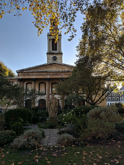
The eponymous church in the middle of the square was built in 1824 and designed by architect Francis Bedford. In 1968 it was declared redundant and in the 1970s was converted into an orchestral rehearsal studio for the London Philharmonic and London Symphony Orchestras and named after the conductor, Sir Henry Wood. On the north side of the church there is a statue reputed to be of King Alfred the Great. It’s suggested that it could be one of eight medieval statues from the north end towers of Westminster Hall (c. late 14th century) or, alternatively, one of a pair representing Alfred and Edward, the Black Prince, made for the garden of Carlton House in the 18th century.
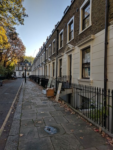
Having completed a circuit of the square we return up Brockham Street to Harper Road then take the next left into Dickens Square before cutting through Dickens Fields to Falmouth Road. We take Falmouth Road down to Great Dover Street (A2) and turn right briefly for a contractual look at Sturgeon Street before heading back west along Trinity Street. A diversion round Merrick Square gives us a chance to admire some more of those Georgian terraces.
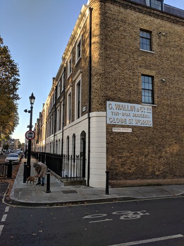
On the corner with Globe Street the bloke in the picture below taps me for £2 (to buy food for the dog) after spotting my remembrance poppy by claiming to have spent 6 years in the RAF before being discharged with a fractured skull that still troubles him. He then went on to bemoan the fact that “everyone else round here is foreign and doesn’t speak English”. Unfortunately I’d already parted with the cash by then.
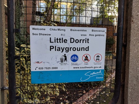
So we cut down Globe Street into Cole Street which runs down to Swan Street where we take a right back to Great Dover Street. From here we head down to the four-way junction by Borough Tube Station and take Borough High Street southward for about a hundred metres before turning left into Little Dorrit Court. A little bit more respectful to the fictional Amy and she has a playground named after her too.
Little Dorrit Court returns us to Redcross Way across the street from Redcross Garden which along with the six cottages which flank it in one side was created by the social reformer, Octavia Hill (who we covered in detail in the last post).
We follow Redcross Way back to the corner with Union Street and the last port of call for today which is the Crossbones Graveyard a disused post-medieval burial ground in which up to 15,000 people are believed to have been buried. Cross Bones is thought to have been established originally as an unconsecrated graveyard for prostitutes, or “single women”, who were known locally as “Winchester Geese” because they were licensed by the Bishop of Winchester to work within the Liberty of the Clink which lay outside the legal scope of the City of London. It was closed in 1853. Today the iron gates surrounding the graveyard are festooned with ribbons, feathers, beads and other tokens commemorating the “Outcast Dead” buried here. In 2007, Transport for London, which now owns the site, gave playwright John Constable access inside the gates, where he and other volunteers have created a wild garden. An informal group known as the Friends of Cross Bones is working to ensure that a planned redevelopment of the site preserves the garden as a more permanent place of reflection and remembrance.


