
As George McCrae sang, aeons ago now, It’s Been So Long. But we’re back finally and with a double header no less. In returning south of the river and working my way through the (roughly) rectangular area bounded by Kennington Lane, Kennington Road, Lambeth Road and the Albert Embankment I bit off more than can be chewed over in a single post. So for this initial instalment we’re sticking to the southern half of the quadrilateral; let’s call it Vauxhall.
Starting point for today is Vauxhall overground station, from where we head east along Kennington Lane. By the river and further west, Vauxhall these days is redevelopment central with new high-rise apartment blocks sprouting like knotweed but we’re saving all that for another time.
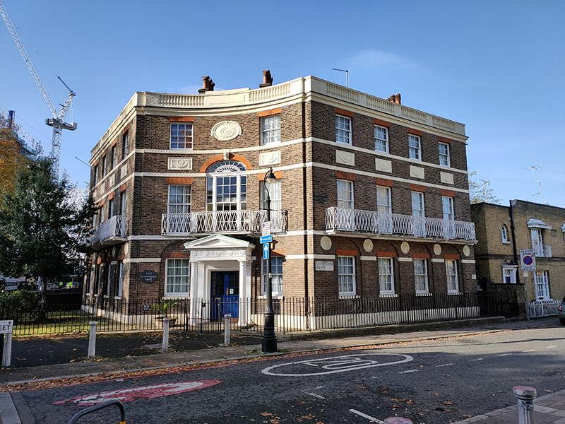
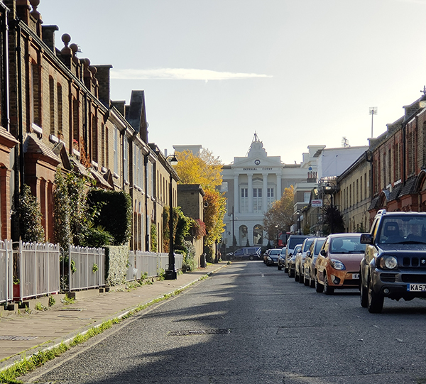
The grandiose Imperial Court, like so many large former commercial or public buildings, is now a community of private apartments. However, its origins lie in the creation in 1794 of the Friendly Society of Licensed Victuallers which was established to educate the children of publicans affected by long term illness, incapacity, or poverty. The original school was demolished in 1835 and the current neo-classical building was erected the following year after a design by H & E Rose. In 1921 the school moved to Slough and Imperial Court became the HQ of the Navy, Army, and Air Forces Institutes, or ‘NAAFI’ which was formed to provide catering services and recreational activities for the British Armed Forces and their families posted overseas. In 1980 the building became Grade II listed and in 1992 the NAAFI moved out and the inevitable happened.

The area between Cardigan Street and Sancroft Street, to the east of Kennington Lane, is strongly held to be the site of Kennington Palace, built by the eldest son of Edward III, Edward of Woodstock aka the first Duke of Cornwall aka The Black Prince (1330 – 1376). Edward junior built his palace here during the 1340s and 1350s at the end of which its main structures were a large Hall orientated east-west and measuring approximately 88 feet long by 53 feet wide and the so-called ‘Prince’s Chamber’, of a similar size but two or three storeys high. In 1531 the Palace was largely demolished by Henry VIII to provide materials for his own Palace at Whitehall.

This plaque is on the exterior of Edinburgh House which stands on the site of the Palace’s stable block. Originally a 1960’s office block, Edinburgh House, has been reconfigured to provide separate office space and studio units.

The land on which the palace stood was within the Manor of Kennington which formed part of The Duchy of Cornwall, a private estate (largely comprised of land in Cornwall) established under charter by Edward III in 1337 in favour of Prince Edward and every future Duke of Cornwall (i.e. the eldest surviving son of the Monarch and heir to the throne). The current Duke of Cornwall, Prince Charles, is the longest serving Duke in history. The houses which now occupy the area north of Edinburgh House, were built at the turn of the 20th century and are mostly subject to preservation orders. The majority were sold to a housing association in 1990 but the Duchy still directly owns 23 houses and 16 flats. Our route through the so-called (by estate agents at least) Kennington Triangle is a circuit of Courtenay Street, Courtenay Square, Stables Street, Sancroft Street and Cardigan Street.

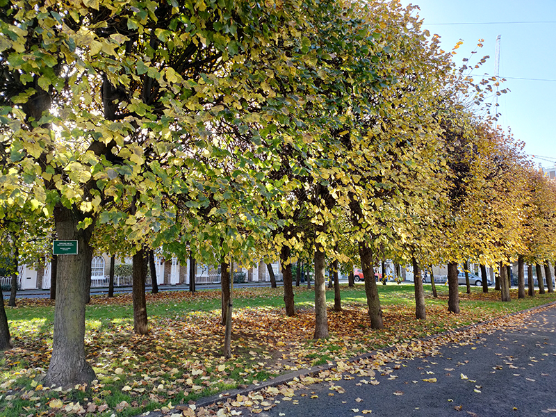

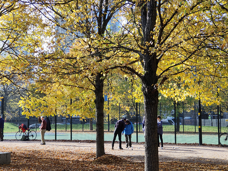
At the top end of Courtenay Street, after a quick look in on Hansom Mews, a sequence of Aveline Street, Brangton Road, Loughborough Street and Newburn Street brings us out onto Vauxhall Street and back within touching distance of Kennington Lane. We make the rapid acquaintance of Dolland Street before heading east along Vauxhall Street then completing a circuit of Orsett Street, and some more of both Newburn Street and Sancroft Street. I should have noted at the beginning what a beautiful day for a walk this was; uniformly blue skies and sunlit autumn leaves.

We turn a short way back down Vauxhall Street as far as the laund(e)rette of the day and then make a right into Jonathan Street.
Almost immediately we turn left down Wickham Street at the end of which the Hope Church is making its message loud and clear.

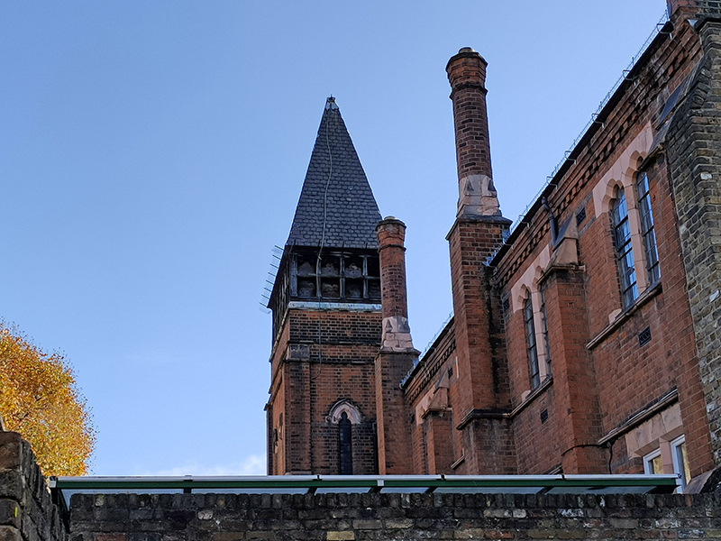
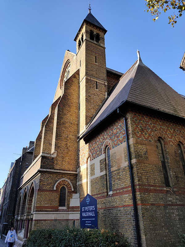
Next, St Oswalds Place (with a diversion into Tyers Terrace) takes us back onto Kennington Lane and St Peter’s Church. The church was erected in 1863-4 (on the site of the Vauxhall Pleasure Gardens’ Neptune Fountain) by the notable Victorian gothic revival architect John Loughborough Pearson (1817-1897). The driving force behind the church was the (long-lived) Reverend Robert Gregory (1819 -1911) and it was built adjacent to a new school he had established just a couple of years previously, also on land reclaimed from the Vauxhall Gardens. The school was designed in what was called a thirteenth-century Gothic style and consisted of separate boys’ and girls’ schoolrooms, a headmaster’s house, and an art school. The foundation stone was laid in 1860, by the Prince of Wales, later Edward VII. Gregory’s art school achieved great renown. The two major employers in the area, Maudslay’s engineering works and Doulton’s pottery factory, needed, respectively, skilled draughtsmen and designers and artists and the school set out to train its pupils accordingly.


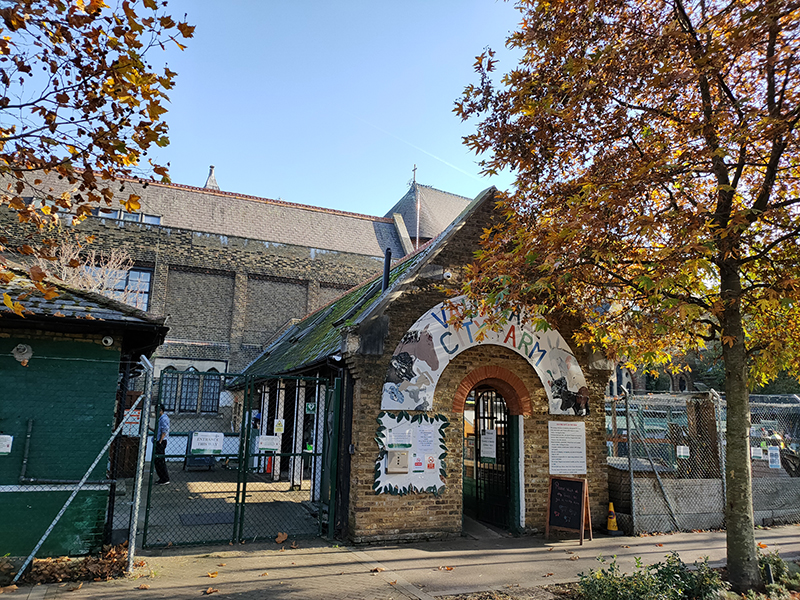
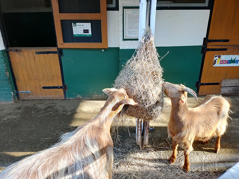
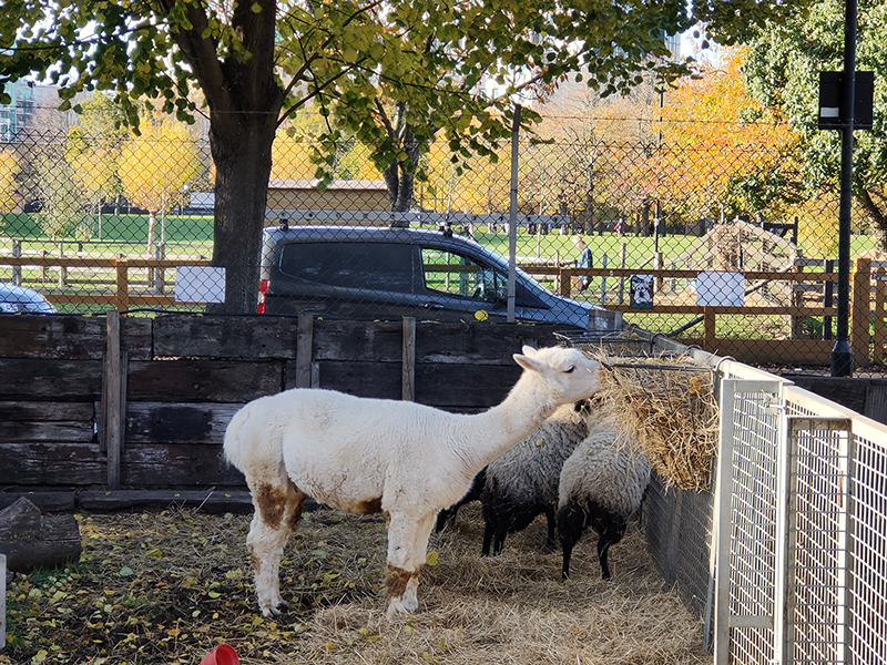
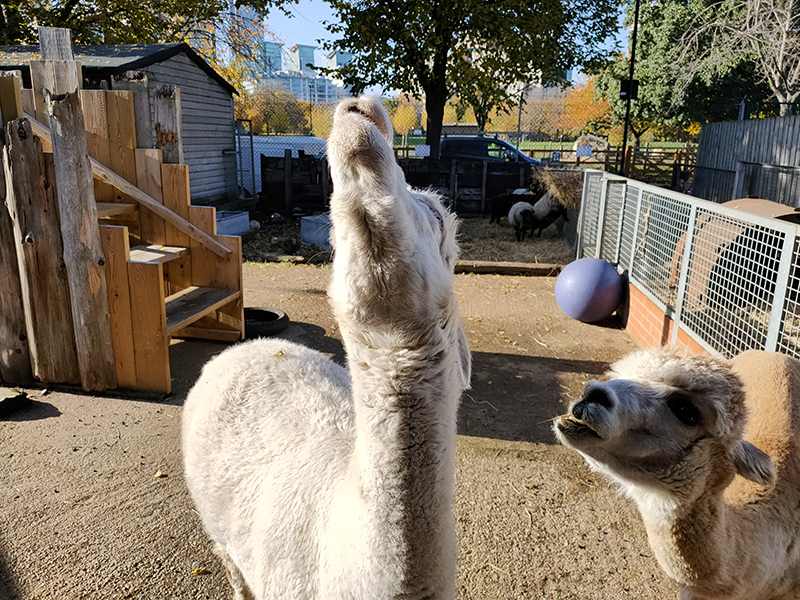
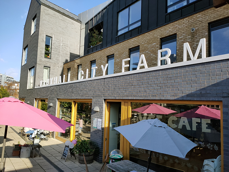
To the west of the church, on Tyers Street, we find the Vauxhall City Farm. The farm began life as Jubilee City Farm in 1976, instigated by a group of architects squatting in nearby St Oswalds Place. Together with local residents they commandeered a plot of land cleared as part of a spate of demolitions in the early 1970s’ and used it for growing vegetables and keeping livestock. A year later the operation was registered as a charity under its present name. Today, the farm is home to over 100 animals, a riding centre, education and youth projects, and a cafe. And it is still run solely by volunteers. I ventured inside for a quick look around (and to make a donation) feeling more than a little self-conscious. I was given a bag of Grass Nuts to feed to the alpacas but made a bit of a hash of that and most of them ended up on the floor (though they were still eaten). Lovely place; though probably best to visit with kids (if you have them).
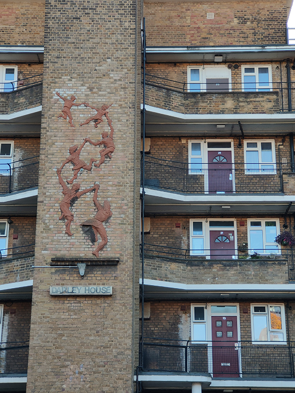
After leaving the farm we make a loop to the left off of Tyers Street, taking in Laud Street, Vauxhall Walk and Glasshouse Walk. The former runs past the back of Darley House, a post-war 1940’s built public housing block. The central column is adorned with a sculpture by artist Peter Peri entitled Following The Leader. The work was intended as a memorial to children killed in the Blitz, which hit this area quite hard.
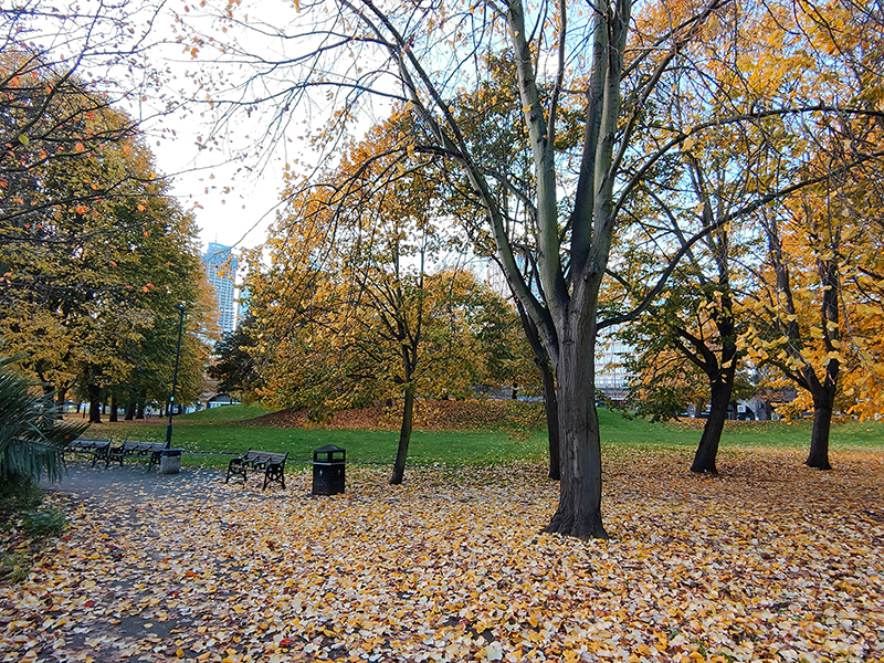
We turn left at the top of Tyers Street and left again to head south on Vauxhall Walk and Worgan Street until we reach Vauxhall Pleasure Gardens (formerly Spring Gardens). The original Spring Gardens were established here after the Restoration of 1660 (covering a wider area than the present day gardens). At that time Vauxhall was still quite a rural environment and a boat-trip was required to visit the gardens where impromptu live entertainers joined the many purveyors of food and drink. In the evenings the resident nightingales competed for airtime with the sounds of amorous liaisons, as noted by regular visitor Samuel Pepys. In 1729, ‘Vauxhall Spring-Gardens’, was sub-let to a new tenant, the entrepreneurial Jonathan Tyers (1702-1767), who saw an opportunity to provide a new type of paid entertainment for Londoners. He also figured out that charging an admission fee (of one shilling) would discourage the pickpockets and ladies of the night. Thus was created the first and best-known of London’s “Pleasure Gardens”. Over the next 130 years Vauxhall Pleasure Gardens played host to concerts by Handel, firework displays, operas, balloon rides, circus acts and much more besides. Despite Tyers’ wish to create a nexus of wholesome family entertainment, the Gardens remained synonymous with after dark activities of a more salacious nature. All good things come to an end though and in 1859 the Gardens were permanently closed and the site redeveloped into housing.
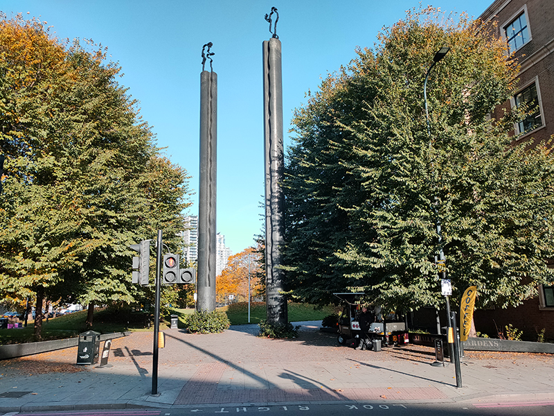
By the 1970s, those houses, badly war-damaged and suffering from long neglect, were demolished as part of the so-called slum-clearances. A dozen or so acres of the cleared site were grassed over by the new owner, the London Borough of Lambeth, and the resulting park, first opened to the public on 9 October 1976, was originally called Spring Gardens. Then in 2012, after a campaign by local supporters, was re-named Vauxhall Pleasure Gardens, and a new monumental entrance to the park was created by local architects DSDHA near the site of the old Coach Entrance to the gardens on Kennington Lane.


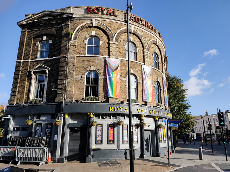
At the southern end of the gardens an apex of Auckland Street and Glyn Street interrupt the alignment with Kennington Lane and it the the south-western corner sits the renowned Royal Vauxhall Tavern. The RVT actually opened the year after the Pleasure Gardens closed, in 1860. Its close association with London’s gay community dates back to the 1940’s while its iconic drag shows were first staged in the 1970’s. In 2014 the pub became the first building to be listed in recognition of its significant role in LGBTQ history.
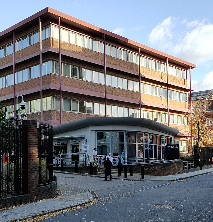
From here we proceed north up Goding Street then duck under the railway via Glasshouse Walk to the Albert Embankment before heading back under the railway courtesy of Tinworth Street. Here we find the headquarters of the National Crime Agency (“NCA”). The NCA was formed in 2013 to replace the Serious Organised Crime Agency (“SOCA”). In addition to organised crime its remit covers trafficking (of the human, weapons and drugs kind), cybercrime and economic crime with cross-border implications. It has around 1,800 active officers and an annual budget approaching £460m (which is a 43% reduction on the combined budgets of the various agencies whose responsibilities it assumed).
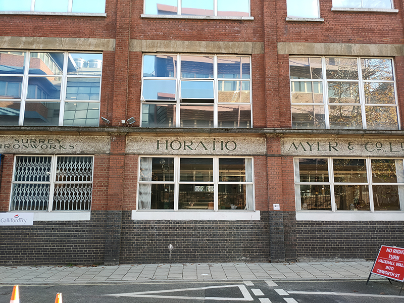
Beyond the NCA, back on Vauxhall Street, stands the building that from 1877 to 1982 produced iron bedsteads for Horatio Myer & Co. Ltd.
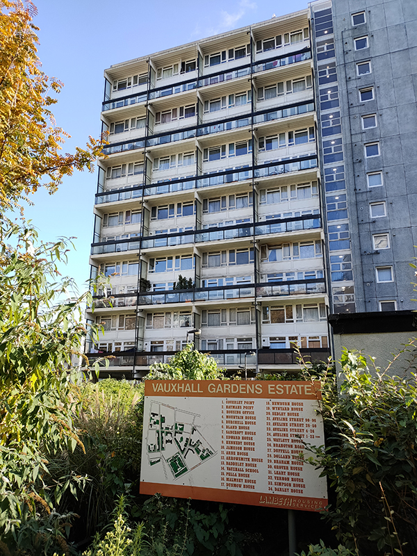
On the east side of Vauxhall Walk, a bit further north, is the 1960’s section of the Vauxhall Gardens Estate which also includes Darley House and a number of 1930’s blocks that stretch down to Kennington Lane.
In conclusion of this Part 1 we make a Z shaped return to the Albert Embankment formed by Randall Row, Randall Road and Salamanca Street.
