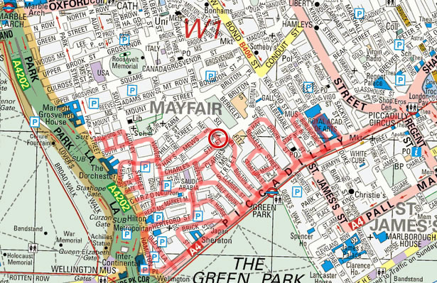
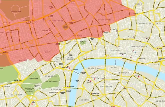
So here’s the second instalment of this particular walk. As a reminder we finished last time on South Street; in the top left hand corner of the marked out area below. From here we’re going to crisscross between Park Lane and Piccadilly and spiral in to finish in Shepherd’s Market.
First up a circuit of Aldford Street, Balfour Mews, Rex Place and Park Street which brings us back onto South Street and past the Egyptian Embassy.

Also on South Street, at no.25. is this elaborate art deco doorway. The mansion it adorns was built in 1932-33 for Sir Bernard Eckstein to designs by E.B Musman. The iron and glass porch by W. Turner Lord Company arrived a bit later, in 1936. The somewhat risqué relief bearing the house number is reputedly (and perhaps appositely) the work of Scottish sculptor Sir William Reid Dick (1879 – 1961). At no.10 there is a blue plaque honouring the fact that Florence Nightingale (1820 – 1910) lived and died in a house that previously occupied the site and at no.15 (on the corner with Rex Place) is one which commemorates a woman perhaps diametrically opposite Florence on the spectrum of female achievement, Catherine Walters aka “Skittles” (1839 – 1920), proclaimed as the last great courtesan of Victorian London. The nickname is thought to derive from her time working at a bowling alley in nearby Chesterfield Street.


Turn right down South Audley Street where at no.72 is another blue plaque (this post is awash with them) commemorating the fact that Charles X (1757 – 1836), the last Bourbon king of France, lived in exile there during the reign of Napoleon. Charles was a younger brother of the executed Louis XVI and of Louis XIII who was crowned king following the 1814 restoration (briefly interrupted by Naploeon’s 100 day comeback). Charles himself acceded to the throne in 1824 but was overthrown by the July Revolution of 1830.

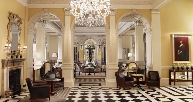
Next, Deanery Street takes us down to the Dorchester Hotel on Park Lane. The hotel opened in 1931 and swiftly established itself as one of the most prestigious in London. Over the years it has had myriad associations with the world’s rich and famous. General Eisenhower set up his HQ here in 1944 as the D-Day landing plans were being formulated. Prince Philip held his stag night here on the eve of his wedding to Princess Elizabeth (as she was then). Elizabeth Taylor and Alfred Hitchcock were among the regular guests in the fifties and sixties, the former sometimes with Richard Burton, sometimes not. Roman Abramovich and Ken Bates are reported to have sealed the deal for the sale of Chelsea F.C at a meeting here in 2003. Since the mid-Eighties the hotel has effectively been owned by the Sultanate of Brunei and its celebrity appeal has faded somewhat since the introduction of Sharia law in Brunei in 2014. (Biographical detail – some years ago I attended a corporate awards ceremony here and won a case of champagne for bagging most chips at the pop-up Casino tables).

Middle Eastern connections abound in this part of town so it’s no surprise on returning to South Audley Street via Tilney Street and Stanhope Gate to come across the Qatari Embassy.

Continuing south we reach the western end of Curzon Street and head east, stopping off at Chesterfield Gardens before turning left onto the aforementioned Chesterfield Street. Not sign of that bowling alley but at no.4 we have a rare double blue plaque scenario. Once the home of Regency dandy George “Beau” Brummell (1778 – 1840), a man who allegedly took five hours to get dressed every day, this was also a residence of Anthony Eden (1897 – 1977) the Prime Minister from 1955-57 and forever associated with the ignominy of the Suez Crisis.


And at no.6, not contemporaneously with either of those two, lived William Somerset Maugham (1874 – 1965). This was between 1911 and 1919 at the height of his fame and when Of Human Bondage was written. During this period he also married Sylvie Wellcome, former spouse of Henry Wellcome (of Wellcome Trust fame and who we covered in Day 7). Maugham was cited as co-respondent in the divorce suit having fallen into a relationship with Sylvie despite being at least ambivalent in his sexual proclivities. Needless to say the marriage was not a happy one.


Not quite finished with Chesterfield Street as we have the High Commission of the Bahamas at no.10 (breaking up the Middle Eastern hegemony).

At the top turn right on Charles Street passing no.20 which was the birthplace of Archibald Primrose, 5th Earl of Rosebery (1847 – 1929) who managed 14 months as Prime Minister following Gladstone’s final stint. This and many of the adjacent properties are Grade II listed.

Another resident of Charles Street, albeit briefly, was the Duke of Clarence (later King William IV) (1765 – 1837) the third son of George III and Queen Charlotte. The Sailor King tag is a result of his career in the Royal Navy which he began at age 13 and ended with him becoming Admiral of the fleet in 1811. As he never expected to accede to the throne he merrily went ahead and sired ten children with his mistress, the actress Dorothy Jordan. But then, also in 1811, he married Princess Adelaide of Saxe-Meiningen and following the deaths of his two elder brothers, the eldest being George IV the Prince Regent, neither of whom had living heirs he was crowned in 1830. His reign was a mere ten years and on his death he was succeeded by his niece Victoria (daughter of one of his younger brothers). The ten illegitimate children, surnamed Fitzclarence, all appear to have done fairly well for themselves though their mother ended up dying in poverty in France in 1816.

Final thing to note on Charles Street is this bust of the Emperor Nero, who is perhaps not the most obvious figure to choose to memorialise above your front door.

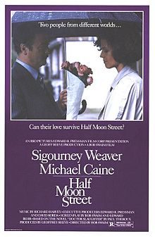
Next we turn briefly south on Queen Street before veering left into Clarges Mews which leads in turn to Clarges Street which takes us all the way back down to Piccadilly. From here the next street heading north is Half Moon Street which you may vaguely recall as the title of a 1986 erotic thriller starring Sigourney Weaver and Michael Caine.
Opposite the top end, on Curzon Street again, is the Third Church of Christ Scientist which was built between 1910 and 1913 but pretty much all of it apart from the façade you see below was demolished in 1980.

Just along from this G.F. Trumper’s gentleman’s barber and perfumer which has occupied no.9 Curzon Street since the late 19th century.

Next door at no. 10 is where Nancy Mitford (1904 – 1973) worked (i.e. wrote) during the war years. Nancy, best known for Love In A Cold Climate, was the eldest and most talented of the six infamous Mitford sisters. She was also less politically controversial than at least three of her siblings though she did briefly flirt with Mosley’s Blackshirt movement before becoming a vociferous opponent of fascism.


Head down the alleyway opposite to arrive at Shepherd’s Market for the first time leaving again swiftly via White Horse Street where Mayfair Cobblers makes a decent fist of trying to look like its been around longer than a couple of decades.

Then we’re back on Piccadilly and turning west pass by no. 100 which was developed into private apartments in 1984. It’s a grand address to have but the listed façade is looking pretty dingy these days.

Right next door is the Embassy of Japan, currently hosting a Manga exhibition which I popped in to take a look at. This required the presentation of ID and a security scanner check.
So we’re now on to Brick Street pausing briefly at Yarmouth Place before reaching Down Street which is home to another of London’s phantom tube stations. The station was opened in 1907 but when the Piccadilly Line was extended in the late 1920’s its proximity to both Green Park and Hyde Park Corner made it effectively redundant and it closed in 1932. During WWII it was used as a bunker by Churchill and his war cabinet prior to the creation of the Cabinet War Rooms. Back at the tail end of the eighties I went on a tour of the station and its hidden depths and I’m sure I recall them getting a train to stop at the disused platform to allow our orange-suited party to board. TFL are currently touting for ideas for a new permanent use for the space.

Back on Piccadilly we pass by both the Cavalry & Guards Club and the Royal Air Force Club. You can see their respective flags in the picture below along with the sign for some restaurant or other.

So next we’re going north up Old Park Lane then cut through Hamilton Mews to Hamilton Place and continue north on to Pitt’s Head Mews. As we swoop round this one take a quick look at Derby Street before making a dog-leg left into Market Mews. At the end of this we double back along Shepherd Street and emerge into Stanhope Row via an archway in what is now a boutique hotel. The green plaque above the archway reads : On this site, until destroyed by bombing during the winter of 1940, stood an archway and Mayfair’s oldest house. ‘The Cottage 1618 A.D.’ from where a shepherd tended his flock whilst Tyburn
idled nearby.

Now we’re heading west on Hertford Street where yet another blue plaque is affixed to no.20 in honour of Sir George Cayley (1773 – 1857). I was going to let this one pass but the combination of “pioneer of aviation” and “died 1857” piqued my interest. As early as 1799 he set forth the concept of the modern aeroplane as a fixed-wing flying machine. He also designed the first glider to carry a human being aloft and he discovered and identified the four aerodynamic forces of flight, which act on any flying vehicle: weight, lift, drag and thrust.

Moving swiftly on we loop round further sections of Old Park Lane, Brick Street and Down Street (passing the Playboy Club of London en route) before heading back into Shepherd’s Market via the eastern stretches of Hertford Street and Shepherd Street. Incidentally, Shepherd’s Market doesn’t take its name from that shepherd referenced earlier but from Edward Shepherd, an architect and builder, who established a produce market here in 1735 on part of the site of the old May Fair.

Where Hertford Street joins Shepherd Street is today’s pub of the day, the Shepherd Tavern, chosen not for the excellence of its victuals but because of the penultimate blue plaque on this route which commemorates the fact that the actress Wendy Richard (1943 – 2009) lived above the pub as a child.


After a couple of drinks circumnavigate Shepherds Market, calling at Carrington Street and Trebeck Street, before returning onto Curzon Street opposite the back of the Saudi Arabian Embassy which occupies Crewe House on Charles Street (designed by the aforementioned Edward Shepherd).

On the other side of the street and along a bit is the Curzon Cinema which has been operating on this site since 1934.

And that’s nearly it. Just time for one final blue plaque on the way back to the tube which is at no.94 Piccadilly(aka Cambridge House), the one-time residence of Henry John Temple (1784 – 1865) better known as Lord Palmerston. Palmerston lived here during his two stints as Prime Minister – 1855-58 and 1859 until his death in 1865. He had previously served as Foreign Secretary under three separate PMs and it is in connection with matters of British foreign policy that he is best remembered. Despite often being an advocate (and possibly the originator) of gunboat diplomacy this was generally in the cause of so-called liberal interventionism. The most notable exception to this being the forcing of China to open up to free trade, in particular the importation of opium.


")