Day 77 Part 1 – Cable Street – The Highway – Wapping Wall

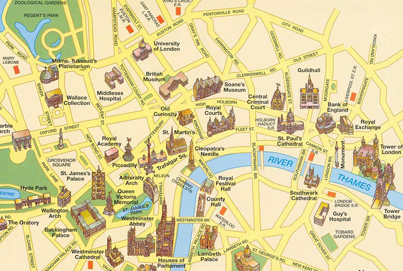
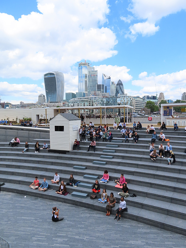
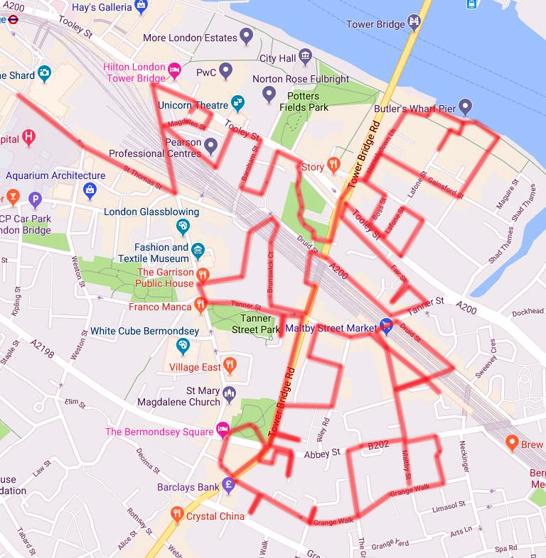
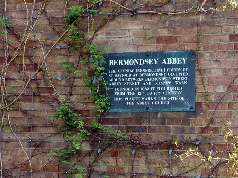
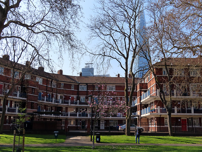
It’s been a lengthy lay-off but the weather was good, the trains were running and the diary was free so there were no longer any excuses. After several excursions round the exclusive environs of Kensington and Chelsea it was time for a change though; so this return to the fray sees us heading out east to sample the contrasting delights of Shadwell and Wapping. Specifically, we’re talking the area between Cable Street and the north bank of the Thames between Shadwell Basin and St Katharine’s Dock adjacent to Tower Bridge. Out with the blue plaques therefore and in with the pubs, both live and demised, and the converted warehouses. Over four hours walking so a lot to cram in, which means this walk will be covered over two posts.

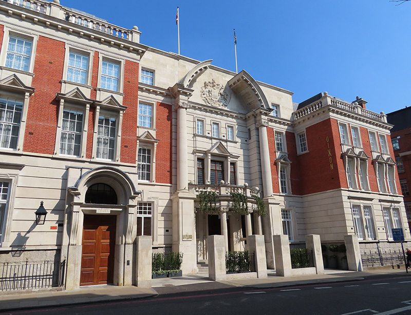
We start out from Tower Hill tube station and head east along Shorter Street which swiftly merges in Royal Mint Street. The Royal Mint was, of course, once situated within the Tower of London. It moved to the site between Royal Mint Street and East Smithfield, which became known as Royal Mint Court, in 1809 and resided here until 1967 when production was transferred to Llantrisant in Wales. We’ll return to Royal Mint Court at the end of today’s post but for now we’ll just note the presence of the Wapping Telephone Exchange at the north side of the site. I hadn’t realised that telephone exchanges still existed in the modern world but it appears that some of them will remain in active use for a few more years at least. That being the case, this building falls outside the scope of the redevelopment plans to be revealed later.

A bit further along the street stands the Artful Dodger pub. This was formerly part of the Ind Coope estate and originally called the Crown & Seven Stars. It dates from 1904 and is Grade II listed. The change of name occurred in 1985. Unpretentious, traditional and friendly according to reviews though one Twitter post from 5 years ago referred to “people selling fags out of carrier bags and a menacing atmosphere” then awarded it 10/10.

After the pub we turn south down Cartwright Street then cut through Crofts Street into Blue Anchor Yard and back up to Royal Mint Street. A few steps further east John Fisher Street runs down to The Highway (aka the A1203) with a brief detour into Flank Street. We then switch back north via Dock Street. On the east side of Dock Street stands the former St Paul’s Church for Seamen which was consecrated in 1847 and lasted as a place of worship until 1990. Since 2002 it has been home to a private nursery. Apparently, the west window which depicts scenes of Jesus in relation to the Sea of Galilee was installed in memory of Captain Sir John Franklin who led the ill-fated expeditionary voyage of the Erebus and the Terror (as realised in the TV series of the latter name). Almost directly opposite the church is the Sir Sydney Smith pub, named after the British Admiral of the Napoleonic Wars who is the only person known to have been present at both the Battle of Trafalgar and the Battle of Waterloo. The pub has been serving thirsty Eastenders since 1809.

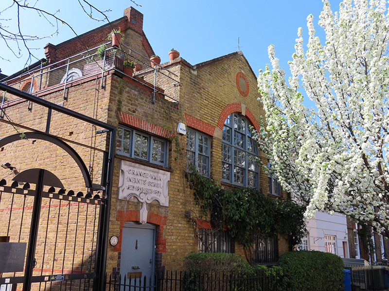
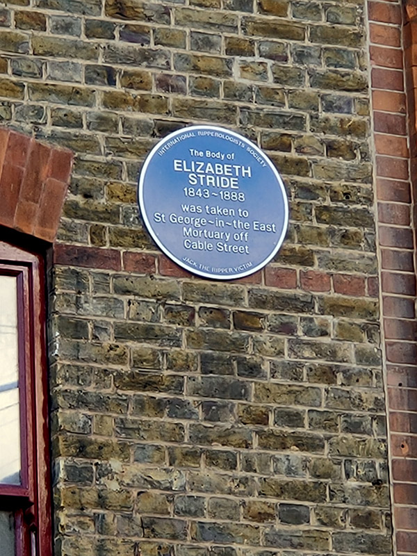
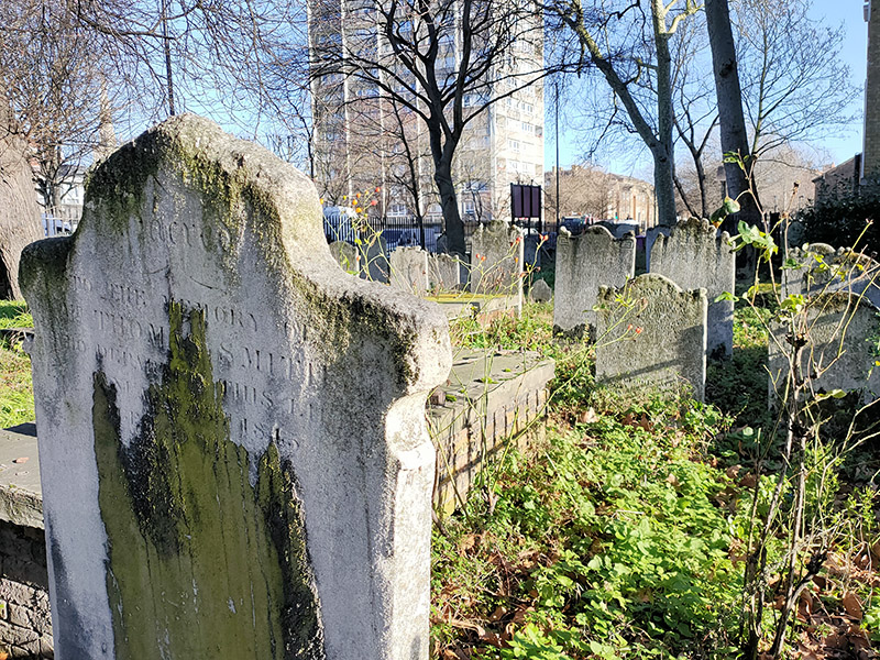
At the top of Dock Street, at the western end of Cable Street is the Jack the Ripper Museum. Since I find the whole Jack the Ripper industry pretty unsavoury, I didn’t venture into the museum and I’m not going to dwell on the man himself here. I will however offer a few words about Elizabeth Stride (1843 – 1888), the Ripper’s third victim, who is remembered in a blue plaque (the only one today) on the front of the museum. She was born as Elizabeth Gustafsdotter in rural Sweden and moved to London in her early twenties. In 1869 she married John Thomas Stride, a ship’s carpenter who was 22 years her senior. Within five years the marriage had hit the rocks although they continued to live together on and off until 1881. For the last three years of her life while living in various common lodging houses she was involved with a dock labourer named Michael Kidney. They separated for the final time, following an argument, just days before her murder in Berner Street (now Henriques Street) which is a few hundred yards north of the museum. Due to the tempestuous nature of his relationship with Stride and inconsistencies between her murder and those of the Ripper’s other victims, suspicion originally fell on Kidney. In the end, though, the inquest verdict was “Wilful murder by some person or persons unknown.”

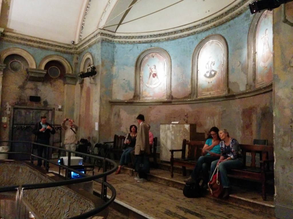
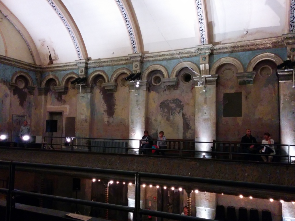
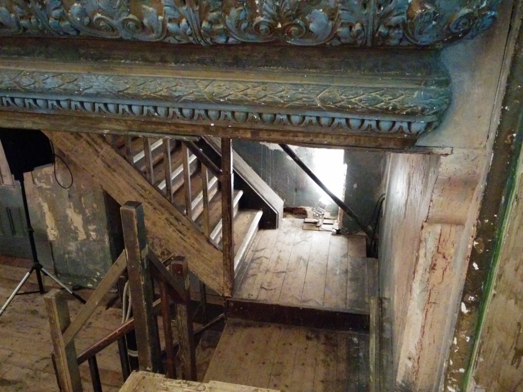
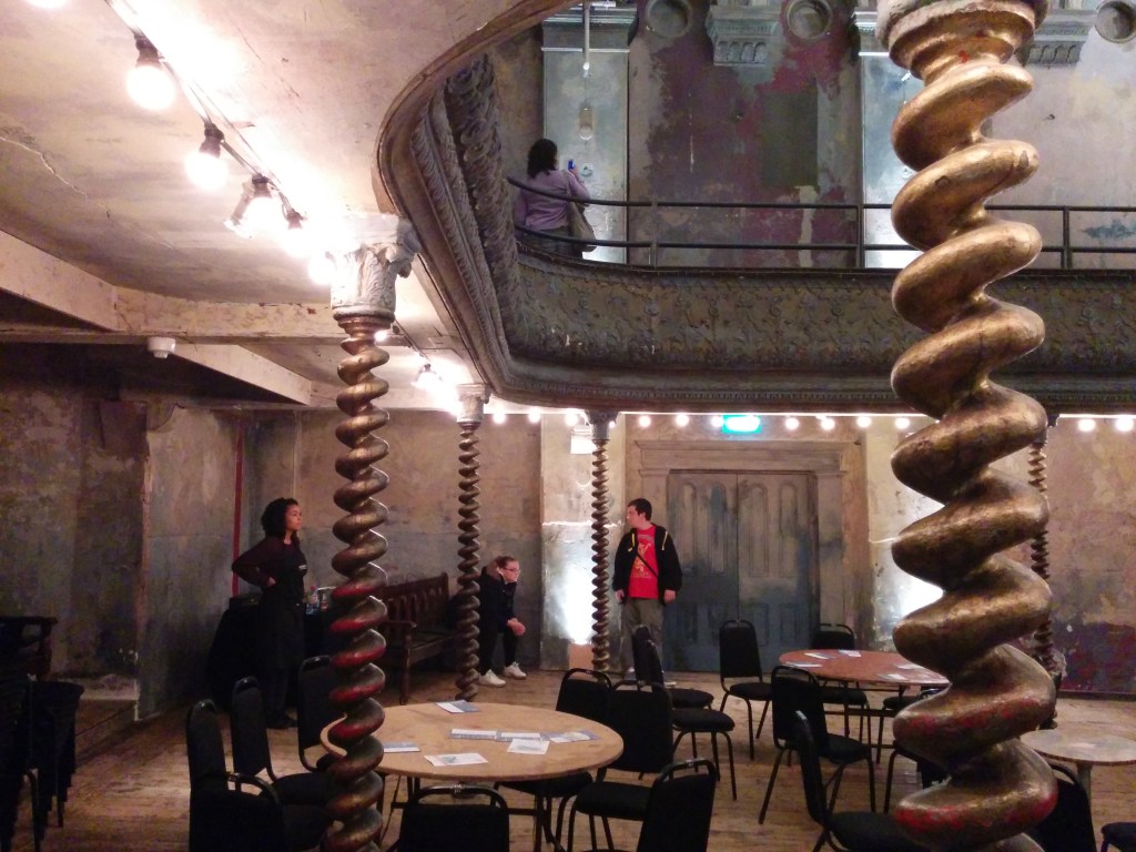
Just off Ensign Street, which is next right after the museum, is Graces Alley where you will find the famous Wilton’s Music Hall. Wilton’s began life as five individual houses built in the 1690’s. The largest house (1 Graces Alley) became an ale house in the early 18th century, serving the Scandinavian sea captains and wealthy merchants who lived in the area. In 1839 a concert room was built behind the pub and soon after it was was licensed for a short time to legally stage full-length plays under the name of the Albion Saloon. John Wilton bought the business around 1850 and by 1859 had created his ‘Magnificent New Music Hall’ with mirrors, chandeliers, decorative paintwork and the finest heating, lighting and ventilation systems of the day. The entertainment comprised of madrigals and excerpts from opera along with the latest attractions from the West End and circus, ballet and fairground acts. However, Wilton sold up in 1868 and after a serious fire in 1877 the Music Hall closed its doors within four years despite having been faithfully rebuilt. In 1888 the building was bought by the East London Methodist Mission who renamed it ‘The Mahogany Bar Mission’ (reflecting one of its incarnations as an alehouse). The Mission survived until 1956 when the building became a rag sorting warehouse for a few years. Then in the early 1960s the London County Council drew up plans for demolition and redevelopment of the whole area between Cable Street and the Highway including Wilton’s. A campaign was launched to save the building led by theatre historian John Earl who persuaded the poet John Betjeman and the newly formed British Music Hall Society to back the campaign. Eventually, The Greater London Council (successor to the LCC) bought the building and agreed to leave it standing. The building was grade 2* listed in 1971 and a year later John Earl, together with Peter Honri, an actor and music hall historian, founded the first trust to raise funds to buy the lease. A successor charitable trust acquired the freehold in 1986. For the next almost twenty years the building remained in a state of dereliction whilst still playing host to sporadic theatrical productions and video shoots. Only in late 2004 did The Wilton’s Music Hall Trust fully open the building to the public, secure its ownership and present a wider arts programme. Finally, between 2013 and 2015, with the support of the Heritage Lottery Fund a full restoration project was undertaken which enabled Wilton’s to became structurally sound for the first time since the renovations of the 19th century. (The interior shots in the slideshow below were taken during an Open House visit in 2014 before the restoration was fully complete).

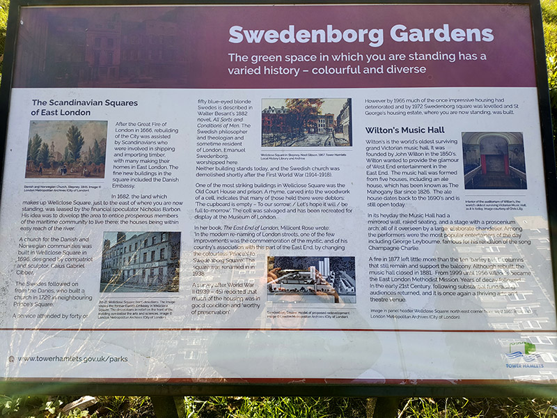
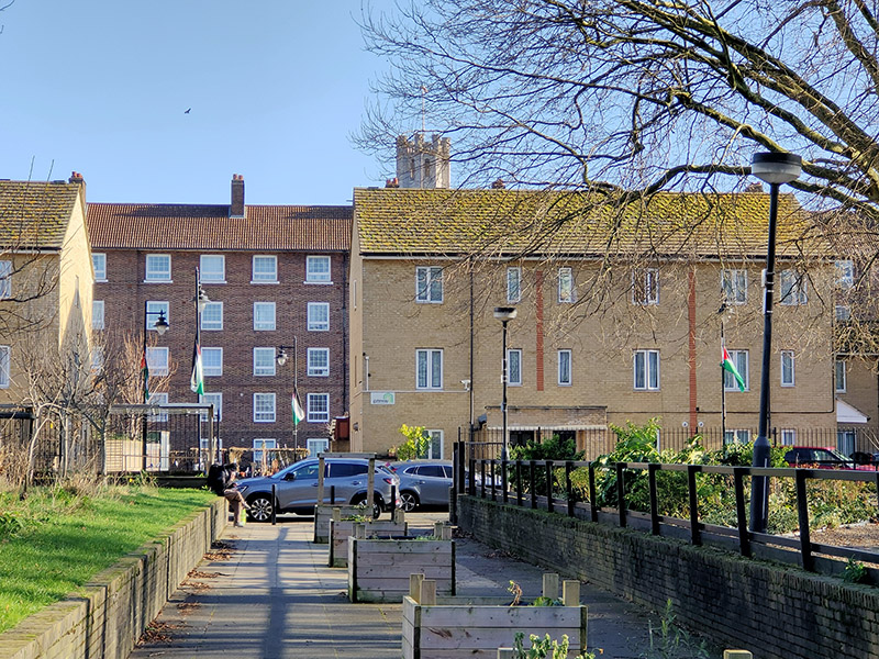
After a brief diversion into Fletcher Street, we double back onto Ensign Street and follow this down to The Highway before making our way to Swedenborg Gardens via Wellclose Street and Wellclose Square. The gardens are named after Emanuel Swedenborg (1688 – 1772) a Swedish inventor, thinker, scientist and theologian, best known for his book on the afterlife, Heaven and Hell . Swedenborg travelled widely in western Europe and spent time in London living in this area which was then known as ‘Prince’s Square’. When he died he was buried in the churchyard of the Swedish Church in the square. In the 1960’s the square (by then known as Swedenborg Square) was demolished to make way for the St George’s public housing estate which incorporates the gardens. A hundred years ago this part of the East End was largely populated by Jewish immigrants so there is a certain poignancy in seeing Palestinian flags flying from the lampposts in what is now a predominantly Bangladeshi Muslim.

On the other side of the estate we head back to The Highway on Crowder Street then return to Cable Street via Cannon Street Road. A hundred metres or so further east we arrive at the Grade II listed St George’s Town Hall which is where the inquest into the death of Elizabeth Stride was held. At that time it was still functioning as the Vestry Hall for the Church of St George In The East (more of which later) having been built for that purpose in 1860. In 1900 it was co-opted as Stepney Town Hall. The building ceased to function as the local seat of government when the enlarged London Borough of Tower Hamlets was formed in 1965. It was renovated fairly recently and is now principally used as a wedding venue. On the side of the building is a mural, dating from the 1980’s, which commemorates the so-called Battle of Cable Street. This catch-all term refers to a series of clashes which took place on Sunday 4 October 1936 between the Metropolitan Police, who had been sent to protect a march by members of Oswald Mosley‘s British Union of Fascists, and a consortium of anti-fascist demonstrators, including local trade unionists, communists, anarchists, British Jews, supported in particular by Irish workers, and socialist groups. Sources at the time estimated that the fascist rally attracted around 2,000 to 3,000 participants while the counter-demonstrators numbered anywhere from 100,000 to 250,000. Around 7,000 police officers were in attendance including the whole of the Met’s mounted police division. About 150 demonstrators were arrested, with the majority of them being anti-fascists, although some escaped with the help of other demonstrators. Around 175 people were injured including police, women and children. Following the battle, the Public Order Act 1936, which outlawed the wearing of political uniforms and forced organisers of large meetings and demonstrations to obtain police permission, was put on the statute. The events of that day are generally seen as sounding the beginning of the end for Mosley and his blackshirts though ironically the BUF experienced an brief increase in membership in the immediate aftermath.

We continue along Cable Street as far as Shadwell Tube Station which in its original incarnation, which opened in 1876, was one of the earliest London Underground stations. It was part of the East London Line up until 2007 when that line was carved out of the Underground system and subsumed into the new London Overground network which became operational in 2010.

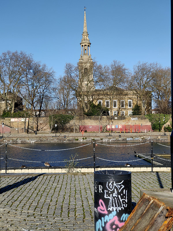
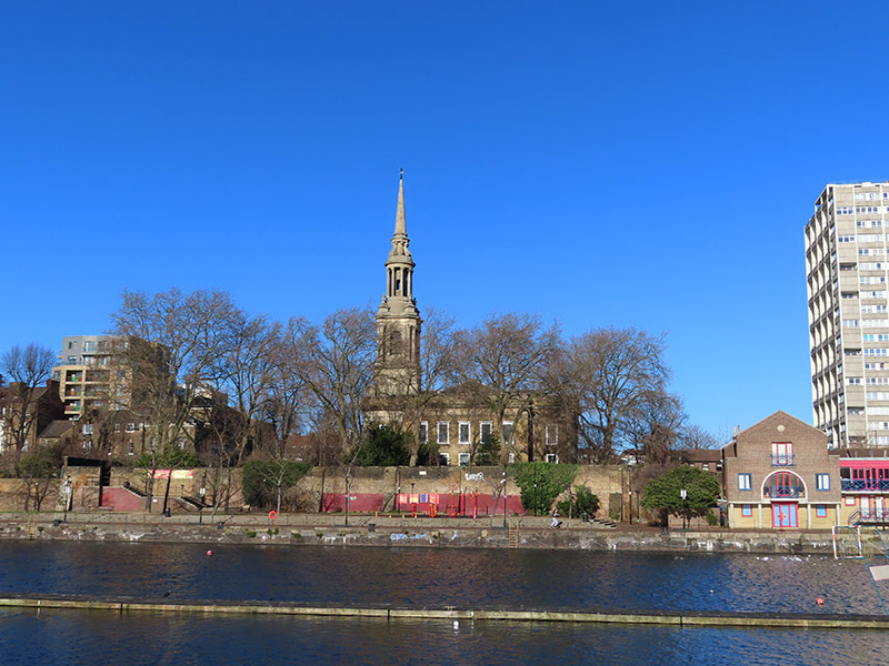
We make a loop of Dellow Street and Bewley Street and call in on Sage Street before saying farewell to Cable Street via the south-heading King David Street. We make a final foray eastward along Juniper Street and Redcastle Close then take Glamis Road down to The Highway once more. Here we make a brief detour to the west to take a look at St Pauls’ Shadwell Church before continuing down towards the river on Glamis Road. A church has stood on this site since 1656. In 1670 it was renamed after St Paul’s Cathedral. Captain James Cook was a member of the congregation and his eldest son was baptised here in 1763. Also baptised at St Paul’s was Jane Randolph, mother of Thomas Jefferson. The original church was demolished in 1817 and the present building, a Waterloo church designed by John Walters, was erected in 1821. It was Grade II listed in 1950. The church stands in the charismatic and evangelical Anglican traditions so the interior is nothing to write home about.

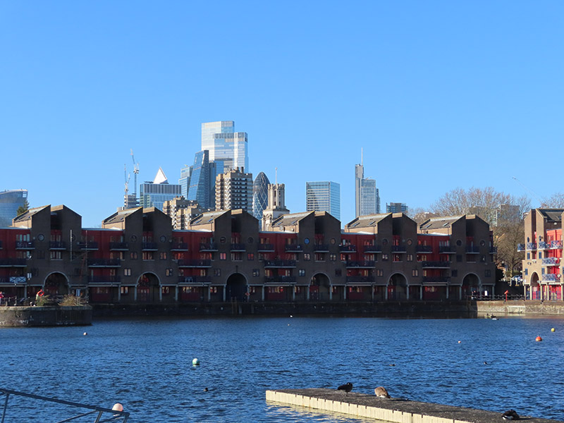
As I said, we’re heading down towards the river now but before we get there we’ve got Shadwell Basin to take a look around. Shadwell Basin was originally constructed between 1828 and 1832 as part of the eastward expansion of the London docks. The new docks were granted access to the river via entrances at both Shadwell and Wapping. By the 1850s, the London Dock Company had recognised that the entrances at both Wapping and Shadwell were too small to accommodate the newer and larger ships coming into service so the company built a new larger entrance and a new basin at Shadwell. Regardless of this, The London Docks had outlived their usefulness by the early 20th century. New steam-powered ships were built too large to fit into them, so cargoes were unloaded downriver and then ferried by barge to warehouses in Wapping. This uneconomic and inefficient system was one of the main reasons that The London Docks complex closed to shipping in 1969. Purchased by the London Borough of Tower Hamlets, Shadwell Basin and the western part of the London Docks fell into a derelict state, mostly a large open tract of land and water. The site was acquired in 1981 by the London Docklands Development Corporation (LDDC) and redevelopment of Shadwell Basin took place in 1987 resulting in 169 houses and flats being built around the retained historic dock. Today Shadwell Basin is a maritime square of 2.8 hectares used for recreational purposes (including sailing, canoeing and fishing) and surrounded on three sides by a waterside housing development of four and five storey residential buildings. The development was added to the National Heritage List for England by Historic England as Grade II listed in 2018, part of a listing of postmodern buildings.

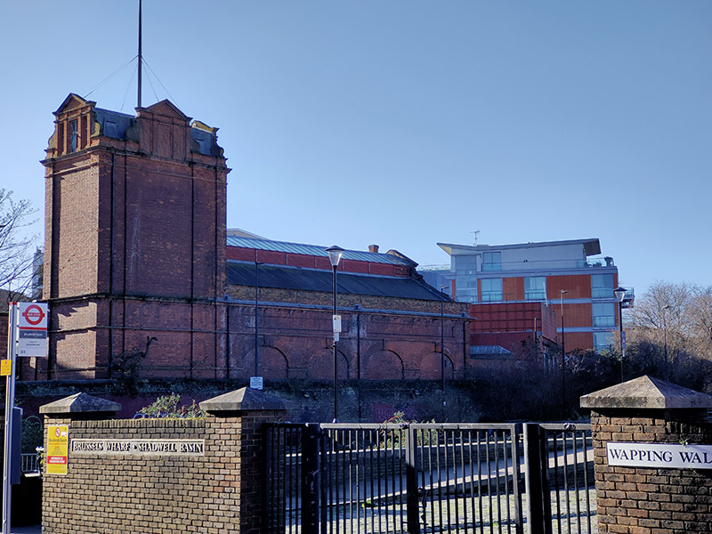
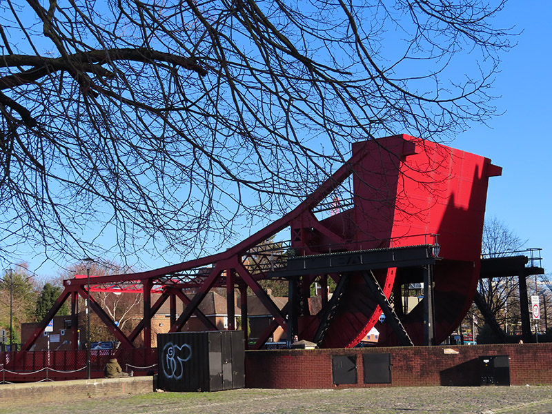
Once across the Bascule Bridge (see slideshow) Glamis Road morphs into Wapping Wall with Wapping Hydraulic Power Station to the west. This was built in 1890, originally operating using steam but later converted to use electricity. Before the adoption of electricity, hydraulic power was London’s main power system, generating everything from bridges to private households in Kensington and Mayfair. In the heyday of hydraulic power, more than 33 million gallons of water a week were pumped beneath the streets of London. It was transmitted along 186 miles of underground, cast iron piping. The Power Station closed in 1977 and after a certain amount of conversion eventually reopened as an arts centre and restaurant. In 2013 the building was sold to new owners who are still awaiting planning permission for redevelopment. In the meantime, at least part of its upkeep is funded by the that old stand-by, location-hire for film and video. For a view of the interior check out this.

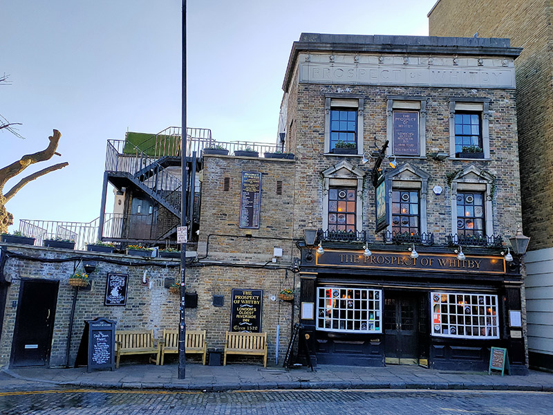
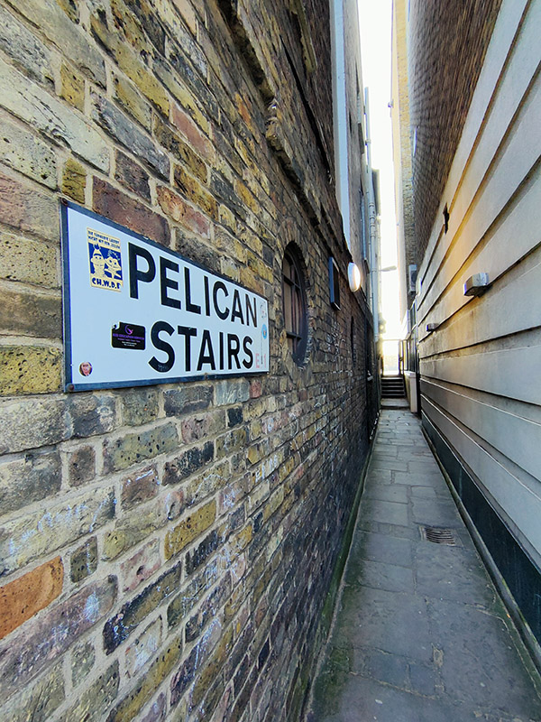
Where Wapping Wall reaches the River Thames lies the Prospect of Whitby Inn, reputedly London’s oldest riverside tavern, dating back to 1520. It was formerly known as The Pelican and later as the Devil’s Tavern, on account of its dubious reputation. All that remains from the building’s earliest period is the 400-year-old stone floor, and the pub features eighteenth century panelling and has a nineteenth century facade. In its early years it was a meeting place for sailors, smugglers and cut-throats and according to the 16th century antiquarian, John Stow, “The usual place for hanging of pirates and sea-rovers, at the low-water mark, and there to remain till three tides had overflowed them”. Charmingly, the pub still displays a noose overhanging the river’s edge. (Although it is widely accepted that the actual execution site was further along the river). Following a fire in the early 19th century, the tavern was rebuilt and renamed The Prospect of Whitby, after a Tyne collier that used to berth next to the pub and transported sea coal from Newcastle upon Tyne to London.

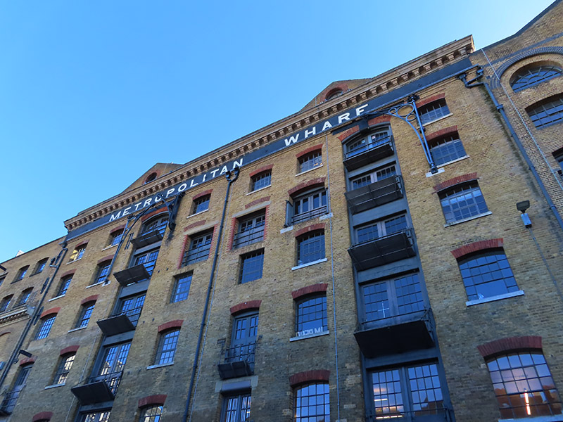
To the west of the PoW are a series of Victorian Wharf buildings, the various warehouses comprising which were built between the 1860’s and 1890’s. The first of these we encounter, Metropolitan Wharf was one of the last to be converted into luxury penthouse apartments and contemporary office space. Its riverside dock is credited as being the “real” execution site used by the Admiralty to hang pirates for over 400 years up until 1830.

The adjacent New Crane Wharf was built in in 1873 then rebuilt 12 years later after a fire. Like its neighbour its buildings are Grade II listed and these were converted for retail and commercial use in 1989-90.

After a quick circuit of Monza Street and Milk Yard we leave Wapping Wall (and the wharves for the time being) behind and head back north up Garnet Street, calling in on Riverside Road and Benson Quay before we reach The Highway once more. And that’s where we’re going to sign off for this post. We’ll be back shortly with the lowdown on the rest of today’s excursion including the story of the “Battle of Wapping”.

To be continued.

Day 62 – Tower Bridge – Queen’s Walk – Hay’s Wharf

Well it’s taken nearly four years, which is about three and a half more than originally planned, but after 62 days and god knows how many miles every street covered by the central section of the London A-Z has finally been walked. Of course, give it a few more years and no-one will have a clue what that means as they’ll only ever have used Google maps to get around but, just as a reminder, this is roughly the area we’re talking about :

Covered so far May 2016

or to put it another way :

london_tourist_map

And (having just counted them up) that’s roughly 2,028 streets, roads, lanes, walks, passages, avenues, mews(es) and rents altogether. Though I probably shouldn’t count Downing Street as it wasn’t actually possible to set foot there.

Anyway back to today’s valedictory lap which is mercifully short – just across Tower Bridge and west along the river to London Bridge.

Day 63 Route

Tower Bridge was built between 1886 and 1894 and is a combined bascule (the bit that raises and lowers – from the French for “see-saw”) and suspension bridge. It has a total length of 244m and the two towers are 65m high. Over 50 designs had been submitted for the new river crossing and the successful proposal for a bascule bridge was a collaboration between Horace Jones, the City Architect, and engineer, John Wolfe Barry. The incorporation of twin towers with connecting walkways was intended to allow pedestrians to be able to continue to cross the river when the bridge was raised. However, in 1910 the walkways were closed due to lack of use – the general public preferred to wait for the bascules to close rather than clamber up the two hundred-odd stairs and (allegedly) run a gauntlet of pickpockets and prostitutes once they got to the top. Only in 1982 with the creation of the Tower Bridge exhibition were the Walkways re-opened and covered over. Two massive piers were sunk into the river bed to support the construction and over 11,000 tons of steel provided the framework for the Towers and Walkways. This framework was clad in Cornish granite and Portland stone to protect the underlying steelwork and to give the Bridge a more pleasing appearance.

This slideshow requires JavaScript.

Compared to many London attractions entry to the Tower Bridge exhibition is relatively reasonably priced at just under a tenner. This gets you up to the walkways, 42m above the river, and also includes access to the engine rooms. I chose to climb up the 200-plus steps inside the north tower rather than take the lift. Those that go for the latter option miss out on half the exhibition (including the “dad-dancing diver – you’ll see what I mean). Each walkway now includes a short glass-floored section which is not great for those that lack a head for heights. If these had only been configured “à la bascule” then the world would be able to rid itself of a bevy of annoying teenagers on regular basis.

This slideshow requires JavaScript.

To get to the Engine Rooms, which are situated underneath the southern end of the bridge, you follow a blue line from the base of the south tower. The bascules are operated by hydraulics, originally using steam to power the enormous pumping engines. The energy created was stored in six massive accumulators so that, as soon as power was required to lift the bridge, it was always readily available. The accumulators fed the driving engines, which drove the bascules up and down. Despite the complexity of the system, the bascules only took about a minute to raise to their maximum angle of 86 degrees. Today, the bascules are still operated by hydraulic power, but since 1976 they have been driven by oil and electricity rather than steam. The original pumping engines, accumulators and boilers are now exhibits within the Engine Rooms.

We descend from the west side Tower Bridge Road down onto Queen’s Walk and then turn left immediately and follow Duchess Walk past a line of upscale eateries to Queen Elizabeth Street. On the triangular island bordered by this, Tooley Street and TBR stands a statue of Samuel Bourne Bevington (1832 – 1907) who was Bermondsey’s first mayor and came from a Quaker family who made their fortune in the local leather trade.  The sculptor was Sydney March (1876 – 1968) who was something of a go-to guy at the start of the 20th century if you wanted a monument to a major figure of Empire or a WW1 memorial. Beyond this statue (and you can only just see the plinth in the photo below) is a bust of the far more significant figure of Ernest Bevin (1881 – 1951) who was co-founder of the Transport and General Workers’ Union and served as Foreign Secretary in the 1945-51 Labour Government.
IMG_1033

At the junction of Queen Elizabeth Street and Tooley Street sits the building that was built in 1893 as a new permanent home for St Olaves’ Grammar School. The school was founded in the late 16th century following a legacy of £8 a year granted in the will of Southwark brewer, Henry Leeke. The building on QE Street was designed by Edward William Mountford, the architect of the Old Bailey. The school upped and decamped to suburban Orpington in 1968 and the building was acquired for use as an annexe by South London College. That tenure lasted until 2004 after which the listed building lay idle for ten years until it was bought by the Lalit Group as the latest addition to their chain of luxury boutique hotels, opening in 2017.

We turn right past the west side of the hotel down Potters Fields which runs into its eponymous park where a lunchtime session of Bikram yoga is in full swing.

IMG_1039

On the north side of the park, heading back towards Tower Bridge is London’s newest major theatre, the Bridge, founded by former National Theatre luminaries, Nicholas Hytner and Nick Starr, and opened in 2017.  Diagonally opposite across the park stands City Hall the headquarters of the Greater London Authority (GLA) a combination of the Mayor of London’s office and the London Assembly. The building was designed by Norman Foster and opened for business in 2002, two years after the creation of the GLA. The unusual shape of the building was supposedly intended to minimise surface area and thus improve energy efficiency but the exclusive use of glass for the exterior has more than offset any benefit this confers. In a singular display of unity, former Mayors, Ken Livingstone and Boris Johnson, have both likened the form of the building to a particular element of the male anatomy; the former dubbing it “the Glass Testicle” and the latter “the Glass Gonad”.

City Hall forms part of a larger riverside development, called More London, with the usual mix of offices, shops and restaurants, which covers the area once filled with wharves and warehouses forming part of the so-called Upper Pool of London. Adjacent to City Hall is a sunken amphitheatre called The Scoop which hosts open-air music performances and film screenings during the summer months (and more lunchtime yoga as you can see below).

IMG_1046

In order to arrive at The Scoop we cross Potters Fields Park back to Tooley Street and return via Weaver’s Lane and More London Riverside. En route we pass through a herbaceous garden, of forty different perennial species, designed by the man responsible for the highline garden in New York, Piet Oudolf.

The thoroughfare known as More London Riverside continues beyond The Scoop, veering away from the river in between new HQ’s for accountancy firms Ernst & Young and PWC and lawyers, Norton Rose.

IMG_1048

On arriving at More London Place we head back down to river along Morgan’s Lane, which joins Queen’s Walk by the mooring of HMS Belfast. Although I have been aboard HMS Belfast before that was about 45 years ago I reckon so I was sorely tempted to repeat the experience but time was against me so I spurned the opportunity.

Built by Messrs Harland & Wolff in 1936, HMS Belfast was launched by Anne Chamberlain, wife of the then Prime Minister Neville Chamberlain, on St Patrick’s Day in 1938. A year later she was commissioned into the Royal Navy under the command of Captain G A Scott (the ship that is, not Mrs Chamberlain). The Belfast was immediately called into service patrolling northern waters in an effort to impose a maritime blockade on Germany. However, disaster struck after only two months at sea when she hit a magnetic mine. There were few casualties but the damage to her hull was so severe she was out of action for three years. On rejoining the fleet in 1942 the Belfast played a key role in protecting arctic convoys en route to the USSR. She then went on to spend five weeks supporting the 1944 D-Day landings. She retired from service in 1963 and a few years later a trust was formed under the auspices of the Imperial War Museum to preserve her. After a successful campaign HMS Belfast was opened to the public in 1971, the last remaining vessel of her type – one of the largest and most powerful light cruisers ever built.

Bang in front of HMS Belfast on the riverfront, and taking up valuable real estate that could be otherwise utilised for even more bars and restaurants, is the enduring loveliness that is Southwark Crown Court. Opened in 1983 its 15 courtrooms make it the fourth largest centre for criminal sentencing in the country. It specialises in serious fraud cases. High profile cases in 2019 include the founder of Extinction Rebellion and another activist being cleared of all charges relating to protests in which they entered Kings College London and spray painted “Divest from oil and gas” on the walls and Julian Assange being convicted for breaching bail conditions by taking refuge in the Ecuadorean embassy. (Who says judges are out of touch ?).
IMG_1051

The front entrance to the court building is away from the river on English Grounds which is off Battle Bridge Lane. Surrounded by the latter, Counter Street and Hay’s Lane is Hay’s Galleria. In 1651 merchant, Alexander Hay took over the lease of a brewhouse beside London Bridge which included a small wharf. By 1710 his family company owned most of the warehouses along the river between London Bridge and the future southern end of Tower Bridge and the expanded wharf officially became known as Hay’s Wharf. By 1838 the company had fallen under the control of John Humphrey Jnr, an Alderman of the City of London. He commissioned architect William Cubitt to design and build a new wharf with an enclosed dock which work was completed in 1857. Unfortunately, just four years later, the Great Fire of Southwark destroyed the warehouses surrounding the new wharf. The buildings that form Hay’s Galleria are some of those arose from the ashes of that fire. Within a few years Hay’s Wharf was handling nearly 80% of the dry produce coming into the capital earning it the soubriquet of “London’s Larder”. The area suffered terrible bombing during WW2 but the Hay’s Wharf company recovered and by 1960, was handling 2m tons of foodstuffs and had 11 cold and cool air stores. However, over the course of the following decade, the explosion in the use of container ships led to the shipping industry moving out to the deep water ports of Tilbury and Felixstowe. Quite rapidly the London docks began to close and in 1969 The Hay’s Wharf Company ceased operations. In the 1980’s the site was acquired for redevelopment by St Martin’s Property Corporation, the real estate arm of the State of Kuwait’s sovereign wealth fund. Hay’s Wharf, renamed Hay’s Galleria, was filled in and paved over and a glass barrel vault installed to join the two warehouse buildings at roof level to create an atrium like area with shops and stalls on ground level with offices in the upper levels. The adjoining wharf to the east, Wilson’s Wharf, was levelled to make way for the Crown Courts and the wharf buildings to the west, Chamberlain’s Wharf together with St Olaf House, were taken over by London Bridge Hospital (see below).

On leaving Hay’s Galleria we continue west along the river as far as London Bridge, passing the aforementioned eponymous hospital. On ascending up to bridge level we turn south and take the walkway that curves round to London Bridge Station then take the stairway down from Duke Street Hill to Tooley Street emerging opposite another part of London Bridge Hospital, a private hospital opened in 1986. St Olaf House, which houses the hospital’s Consulting rooms and Cardiology Department, was built as the Headquarters for Hay’s Wharf in 1931. This outstanding example of an Art Deco building was designed by the famous architect, H.S. Goodhart-Rendel, and is one of his best known works. It is a listed building, with its well-known river facade and its Doulton faience panels by Frank Dobson, showing dock life and the unloading of goods – ‘Capital, Labour and Commerce’.

IMG_0915

The building on Tooley Street is somewhat less impressive and so perhaps not the most fitting way to close this project. But then again this has not just been about venerable and grandiose old buildings and the ports of call for the open-top bus tours. It’s been about poking into every corner of the heart of this great city and circulating round each and every one of its arteries from the grandest boulevard to the grimiest cul-de-sac. In that spirit therefore, please salute these former shipping offices which first saw the light of day in 1860.
IMG_1055

And so it’s goodbye from me…..for now.


Day 60 – Tower Bridge Road – Tanner Street – Tooley Street

If all goes to plan this will be the penultimate post documenting this project. Recording a journey through the streets in the far south-eastern corner of the designated target area, this one covers the part of the capital stretching roughly from Bermondsey Square to Butlers Wharf going south to north and intersected by Tower Bridge Road. The walk took place on another glorious spring day with the sun beaming down and the cherry blossom out in full force. It was also the day the UK was supposed to be cutting itself adrift from the European Union, notwithstanding the postponement of which the hordes of Mordor still descended on Parliament Square. But let’s return swiftly to the sunlit and verdant streets of SE1.

Day 60 Route

We begin on the east side of Tower Bridge Road with Grange Walk. The south side of the street is home to a number of listed houses dating from the late 17th century and, on the corner with Grigg’s Place, the former Bermondsey United Charity School for Girls built in the 1830’s.

IMG_0850

A short way further along is another converted schoolhouse, the Grange Walk Infants School of late Victorian vintage.

IMG_0851

The north side of the street marks the southern end of the massive St Saviours Estate which we dip into briefly by way of Fendall Street before continuing east on Grange Walk as far as Bridewain Street.

IMG_0852

Bridewain Walk connects Grange Walk with Abbey Street as do, moving back westward, Maltby Street and The Grange. From the northern end of the latter we return along Abbey Street to the former and continue on its northern section down to Millstream Road which after a brief diversion into Stanworth Street takes us under the railway arches and into Druid Street.

IMG_0853

The plaque you see in the photograph above commemorates the WW2 bombing of the railway here which took seven lives.  We head back under the railway via Tanner Street and wander up Rope Walk which runs alongside the arches on the west side. A timely celebration of London’s international diversity here.

IMG_0854

We loop back to Tanner Street taking the final stretch of Maltby Street and turn west which takes us past Ugly Duck a for-hire venue for creative projects housed in a former Victorian warehouse and polythene bag factory. (bit of a cheat here – some of the photos in the sequence below were taken in 2017 when I was helping out with an installation for an exhibition).

This slideshow requires JavaScript.

From here we snake round Pope Street, Riley Road and Purbrook Street to get back on Tower Bridge Road just north of where we started out from. Just beyond Stevens Street on the corner with Abbey Street a plaque fixed to the side of the end house of a row of council properties marks the site of the 11th century Cluniac priory that evolved and expanded to become Bermondsey Abbey. The priory and then the abbey played host to a number of notable royal occasions until the dissolution of the monasteries under Henry VIII (yes that again) instigated its eventual break up. The newly crowned King Henry II and his Queen, Eleanor of Aquitaine, held court here at Christmas in 1154 shortly before the birth of their second son. Elizabeth Woodville, the widow of Edward IV and the mother of the young princes murdered in the Tower at the behest of Richard III, registered as a boarder at the Abbey in 1487, after retiring from the court of Henry VII (who had defeated Richard and also married her daughter, Elizabeth of York). She died there on 8 June 1492. Today all that remains of the Abbey is a small section of the medieval gatehouse which forms part of the structure of some of those 17th century houses on Grange Walk.

IMG_0858

Just beyond the junction with Abbey Street we cut back through Bermondsey Square, where the weekly antiques market is underway, to the eastern end of Long Lane.

Across the road is the churchyard of St Mary Magdalen Bermondsey. The church itself we discussed in the last post. The churchyard, which stands on part of the site of Bermondsey Abbey, is now an open space having been largely cleared of gravestones after closing as a burial ground in the mid 19th century. A few large chest tombs remain along with an obelisk which commemorates the granting of the space to the vestry of Bermondsey in the 1880’s. There is also a typically Victorian (though it dates from 1902) shrine-type fountain, a gift of one Colonel Bevington.

This slideshow requires JavaScript.

After crossing the churchyard we head briefly south again to the waggishly named Long Walk which dog-legs between Tower Bridge Road and Abbey Street and must be all of 50 metres from one end to the other. Final stop off on Abbey Street is Radcliffe Road and then it’s back to Tower Bridge Road and a good leg stretch north back to Tanner Street.

IMG_0860

So we head west on Tanner Street (with a short diversion to take in Archie Street) and find ourselves briefly on Bermondsey Street from where we make a circuit of Whites Grounds and Brunswick Court before ending up back on Tower Bridge Road. Continuing north there are some splendid examples of the cherry blossom, we referred to at the outset, leading up to Roper Lane which runs once again beneath the railway.

IMG_0866

At the end we turn right on Druid Street and follow this east across TBR and alongside another set of railway arches that are largely occupied by specialist motor vehicle service providers (car mechanics to you guv’).

IMG_0867

We make a left next onto Coxson Way and at the end of this follow Fair Street back to TBR. A few paces further north and we arrive at Tooley Street which takes us eastward again. Almost straight away we pass the Dixon Hotel which has made its home in the 1906 edifice that formerly served as the Tower Bridge Magistrates Court. The hotel takes its name from John Dixon Butler who was the architect of the Grade II listed Edwardian building.

IMG_0869

We continue east as far as Three Oak Lane and then use this, Lafone Street and Boss Street to weave our way back west between Tooley Street and Queen Elizabeth Street. Horselydown Lane then takes us further north as far as Gainsford Street where we switch east again before taking a left on Curlew Street which carries us down to Shad Thames, Butler’s Wharf and the river. Butler’s Wharf was built between 1865 and 1873 as a shipping wharf and warehouse complex dealing in commodities such as grain, sugar, cloves, cinnamon, rubber, tapioca and tea. The warehouse used for the latter was reputedly the largest of its kind in the world. The buildings gradually fell into disuse during the 20th century and their original commercial purpose was finally redundant when the Port of London closed in 1972.

In the 1970’s artists such as David Hockney, Andrew Logan and Derek Jarman used the empty buildings as a space for the creation of video and performance art. Then in 1981 Terence Conran led a consortium that bid successfully to redevelop the Grade II listed site for mixed use. The renovation of Butler’s Wharf was a 20 year project that involved renovating and developing six buildings: the Butlers Wharf building itself, and the renamed Cardamom, Clove, Cinnamon, Nutmeg and Coriander warehouses. Conran’s pet project the Design Museum was included alongside the residential, retail and restaurant developments (though it has recently moved to a new building in Kensington).

IMG_0873
Looking east from Butler’s Wharf

IMG_0872
Looking west from Butler’s Wharf

In an earlier post we talked about the Barclay Perkins Brewery on Bankside which was also known as the Anchor Brewery. Well they obviously had trouble coming up with original names back in the 18th century because when John Courage founded his eponymous brewery in 1787 he gave it the exact same alternative monicker. At first his brewery consisted of just a small building on the foreshore, adjacent to what would be the southern end of Tower Bridge when that was built in 1886, but he and his son (after his death) rapidly built up the surrounding site. Some of the land had to be surrendered when the bridge was constructed and then in 1891 a spark in the malt mills caused a fire that razed the brewery to the ground. It was rebuilt to what were at the time state-of-the art specifications and was soon producing 300,000 barrels a year. The Courage family were still in full control of the business at this time even though it had floated on the stock market in 1889. By 1955 however it was forced to merge with the Barclay Perkins Brewery and in 1972 the combined entity was acquired by Imperial Tobacco. The writing was probably already on the wall by then and it 1981 both the Anchor Breweries were closed down. The Bankside site was demolished completely but in the case of the Courage Brewery the riverside frontage was retained (including the chimney which you can see in the picture above) while the buildings to the rear were torn down for redevelopment. As of 2017 the Courage brand is in the possession of Marston’s Brewery.

It’s fitting then that today’s pub of the day is the Anchor Tap on Horselydown Lane which was the Courage Brewery’s Tap (though it claims to originate from 1761 a couple of decades and some before John Courage set up). It’s now part of the Sam Smith’s estate and provided me with a very decent pint of cider and an excellent B.L.T.

IMG_0879

On leaving the pub we go back down Tower Bridge Road as far as St John’s Church park on the west side. Cutting through this brings us back onto Fair Street and then Tooley Street again.

IMG_0880

Continuing west we visit a sequence of streets that run off Tooley Street to the south – an orphan section of Druid Street, Banham Street and Shand Street. At the end of the latter we turn onto Holyrood Street, another that skirts the rail lines out of London Bridge.

IMG_0881

We double sharply back down Magdalen Street to return to Tooley Street, dipping into Gibbon’s Rent and Bursar Street en route. Then it’s west on Tooley Street as far as Bermondsey Street where we negotiate its northernmost section that includes the long tunnel under the railtrack and finishes at the junction with St Thomas St. We’ve visited St Thomas Street before of course but on that previous occasion I overlooked the London Science Gallery which is sited on part of the Kings College campus by Guy’s Hospital and only opened last September (2018) with a mission to connect art, science and healthcare. The photos below are from a video work that forms part of the current (until 12 May 2019) exhibition Spare Parts which explores the art and science of organ transplantation and tissue regeneration.

The other reason for trekking all the way along St Thomas Street for a second time is that although it has loomed large in the background of many of the photographs in this and previous posts we haven’t yet dealt properly with the elephant in the city that is the Shard. So here, in no particular order, are the facts. It’s the tallest building in the UK and the European Union (which at the time of writing are still one and the same thing). Construction began in 2009 and it topped out three years later at 309.7 metres. It is 95 storeys tall with 72 habitable floors the uppermost of which at 244 metres incudes the UK’s highest viewing gallery. Floors 53 to 65 are taken up with residential apartments while the Shangri-La Hotel occupies floors 34 to 52 and the rest is mainly offices. These floors are served by a total of 36 lifts which can travel at speeds up to 6 metres a second. Its exterior is covered by 11,000 glass panels – equivalent in area to eight football pitches or two and a half Trafalgar Squares. The lead architect was the Italian, Renzo Piano who also designed the Pompidou Centre in Paris. Towards the end of construction a fox was found up on the 72nd floor; nicknamed Romeo by staff, the fox is believed to have survived on food left by construction workers.

IMG_0882

And finally, in a nod to the opening comments above I should mention that some people like to refer to The Shard as the Tower of Mordor.